The development of an integrated theory of subsurface drainage based on hydrology and hydrogeology concepts is presented.The historical context, the main hypothesis derived from the Boussinesq equation and the validation of the model predictions are discussed.Theoretical developments of this equation demonstrate that a single parameter (σ)-a combination of soil and drainage system properties-is sufficient for predicting the dynamics of subsurface drain flow rates.We also demonstrate that these drain flow rates are a function of the level of water replenishment in the system (classically the water table elevation), of the recharge intensity of the aquifer and of a buffer function related to the swelling or deflation of the water table shape during recharge events.For values of σ > 1, the buffer role of the water table is negligible.In that case approx.13% of the water table recharge contributes to the flow rate, which is shown to explain the observed disconnection between water table elevations and peak flow rates at the outlet of classic agricultural drainage systems and to predict these peak flow rates accurately.A modelling approach based on this theory and validated experimentally (SIDRA model) allowed us to test the quality of the peak flow prediction.The SIDRA model also includes a surface runoff module and has been coupled to different modelling tools and used to analyse the impacts of subsurface drainage on water quality.The approach contributed towards the development of tools that helped to connect better the drainage systems to the hydrological functioning of watersheds.
Debut 2013, les auteurs de cet article ont ete conjointement sollicites par l’Etat pour donner un avis sur la methode de compensation des atteintes aux zones humides proposees pour le projet d’aeroport du Grand Ouest a Notre-Dame-des-Landes en Loire-Atlantique. Cet article fait etat des reflexions consecutives a ce travail qui, au-dela du cas aborde, portent sur les methodes a utiliser pour compenser les atteintes aux zones humides alterees, degradees ou detruites par un amenagement. Il presente tout d’abord le cadre juridique actuel de la compensation ; puis l’experience internationale acquise principalement aux Etats-Unis, peu de cas similaires existant en France. Enfin, il propose des recommandations sur les modalites d’evaluation du besoin et de la reponse de compensation des atteintes aux zones humides, en insistant notamment sur l’utilite d’y integrer le facteur temporel, le risque d’echec, l’ecologie du paysage et la valeur patrimoniale de ces milieux. En conclusion, l’attention est portee sur les questions que soulevent la disponibilite et l’usage des terres de compensation, l’incertitude associee aux methodes de genie ecologique et la difficulte de prevoir les trajectoires de ces ecosystemes restaures/recrees.
Aging in humans is complex and ultimately results in reproductive failure. As human lifespan increases, the basic chronology of reproductive aging remains constant, even as postreproductive lifespan increases. Reproductive aging in both genders includes functional changes, with a precipitous loss of fertility in women and a gradual decline in males, both detectable by the third decade of life. This article discusses endocrine and neuroendocrine hallmarks of reproductive aging in humans as well as underlying mechanisms, behavioral correlates, calcium signaling, and inflammatory correlates, with a particular focus on males. Human reproductive aging is compared with other vertebrates and studies of key animal models are considered.
This year the Working Group on Drainage of the International Commission on Irrigation and Drainage (ICID) celebrates its 25th anniversary. This paper reviews the development of drainage for three different agro-climatic zones, i.e. the temperate (humid), the arid/semi-arid and the humid/semi-humid zones. Drainage is referred to as crop-season drainage, off-season drainage, intermediate drainage and salt drainage. Its specific properties, requirements, socio-economic functions and environmental implications are considered. Global statistics on the areas with and without irrigation and drainage are presented as well as the outlook of anticipated drainage developments in the future. The role of drainage in global food production is illustrated. Drainage design criteria over these last 25 years have evolved from the dual objectives of draining waterlogged agricultural lands and controlling soil salinity, to multi-criteria objectives that include the original criteria, satisfying more stringent environmental and water quality criteria, involve multi-stakeholder participation and social benefits, and satisfy economic criteria. Interaction with urban drainage and flood protection has also become an essential part in design considerations. Most importantly the designs need to be sustainable. This article briefly describes the evolution of these various aspects over the last 25 years. Copyright (C) 2007 John Wiley & Sons, Ltd.
Abstract I. Einleitung Der Europäische Gerichtshof hat mit seiner Entscheidungstrias Centros/Überseering/Inspire Art eine in Europa zuvor nicht gekannte Wanderungsbewegung ausgelöst: Gesellschaftsgründer – vornehmlich aus Deutschland – bewegen sich in andere Mitgliedstaaten – in erster Linie Großbritannien –, um dort eine Kapitalgesellschaft in einer ihnen genehmen Rechtsform zu errichten. Diese „Wanderung“ muss nicht in einem physischen Sinne erfolgen: Gesellschaftsgründungen können – insbesondere in Großbritannien – „online“ erfolgen. Die viel gepriesenen Vorzüge der englischen Limited Company – namentlich das Fehlen eines gesetzlichen Mindest-Stammkapitals und die Einfachheit ihrer Gründung – haben dazu geführt, dass heute offenbar einige -zigtausend (Schätzungen gehen von einer Zahl von 30.000–40.000 aus) Limited Companies in Deutschland existieren. Mit dieser – unscharfen – Kennzeichnung sind Sachverhalte bezeichnet, bei denen tatsächliche Verknüpfungen wie die Ansässigkeit der die Geschicke der Gesellschaft lenkenden Gesellschafter sowie Beziehungen zu Geschäftspartnern der Gesellschaft in erster Linie in der Bundesrepublik Deutschland und nicht im Gründungsstaat Großbritannien bestehen: In vielen Fällen existiert in Deutschland eine als Niederlassung zu qualifizierende selbständige organisatorische Einheit; allerdings ist davon auszugehen, dass die Pflicht zur Anmeldung einer solchen Niederlassung zum inländischen Handelsregister (§§ 13dff HGB) in einer Vielzahl von Fällen nicht erfüllt wird.
The paper studies non-thermal dielectric barrier discharges (DBD) operated in a parallel plate reactor (6 cm width and 16 cm long) under atmospheric pressure in Ar/HMDSO and Ar/HMDSO/O-2 mixtures at different O-2 to HMDSO ratio and different power. Emission spectroscopy and FT-IR absorption spectroscopy were applied to get information on the reaction products in the DBD. The spectroscopic analysis was performed at three residence time. The properties of the polymer films deposited on silicon wafer were measured by FT-IR absorption spectroscopy, AFM and XPS analysis. Surface tension was obtained from contact angle measurements with water and CJ(2)H(2). The correlation between properties of plasma and the results of thin film diagnostics has been investigated.
Water scarcity in the Bojili irrigation District, which is located in the Shandong province in China, affects the management of the irrigation system and has led to the development of water storage functions inside the system. In particular, the irrigation and drainage scheme is used for short-term water storage whereas groundwater is used for long-term storage which is replenished during the monsoon season and drawn from when crop water requirements are not satisfied by surface irrigation.
Soil salinity is present in most of the large irrigation schemes over the world under the conjunctive effect of low quality irrigation water, aridity and lack of natural drainage ofsoils and aquifers. The trends in water management and soil salinity are assessed through studies in China, Mali, Pakistan and Uzbekistan. In China, the upper valley of the yellow river (Huinong irrigation district) is characterized by aridity, good water availability and over-irrigation. Despite large amount of drainage water returned to the river, excess in water supplied a shallow water table, accumulated in depression and resulted in soil salinity. Remote sensing showed that downstream areas are more affected by salinity and displayed lower cropping intensity. The lower valley (Bojili Irrigation District) is faced with shortage of irrigation water. Drainage water of low quality is re-used to assist leaching and get round salinity hazard.In Mali (Office du Niger), the soils are affected by an alkalinization process due to irrigation water quality. A previous reclamation of irrigation and drainage systems has modified agricultural practices and water management, and altered the trend of soil alkalinity. The improvement of surface drainage of flooded rice cropping season has decreased soil pH in clayey basins. Concomitantly the improvement of irrigation has allowed cropping during the dry season. Nowadays water stands in irrigation canal all year long and supplies a shallow water table. The recharge is high on permeable material and soil pH increases on sandy levees. In Pakistan (Chistian sub-division) shortage of irrigation surface water has lead to a significant increase in conjunctive use of groundwater of low quality. Consequently the water table and soil salinity decreased while soil sodicity increased even if leaching is improved. Whereas farmers got used to control salinity, the sodification hazard is more difficult to grasp and manage. To assess the extension of soil degradation, remote sensing can only provide accurate information through assimilation of additional information. In Uzbekistan (Fargana valley), a deep drainage system has been set up in order to reduce waterlogging and control soil salinity. The discharge of salt by drainage is more than twice the salt amount provided by irrigation due to the mobilization primary aquifer salinity. This operation is technically successful but environmentally dreadful. Too many water is diverted from Syr-Daria and Amou-Daria rivers and Aral Sea declined dramatically. The salinity of downstream plains increased. Salinization is the consequence of various complex processes of salt redistribution which depends on natural conditions, system features, agricultural practices and irrigation and drainage management. These evolutions result from alteration induced by agricultural water management within contexts of limited drainage, increasing conjunctive use of low quality drainage or groundwater, or the release of drainage water downstream. Salinity management requires an appropriate methodology in order to understand the involved process and to assess decisions for management and planning according to the current and expected impact on the system. Spatial distribution of salt can be characterized at specific dates through remote sensing at small scales and soil survey at higher scales. It requires additional information for pertinent analysis of the origin of this distribution. In a first stage, trends can be assessed by the estimation of water and salt balance at various scales within the irrigated area. Later stage consists in the implementation of a perennial complementary device including groundwater and soil monitoring, and also the analysis of agricultural water management for the assessment of both performances and sustainability of irrigation. It allows further development of decision-making tools and accompanying methods for the control of salinity. (Resume d'auteur)
Sap flow measurements based on the heat balance method offers the opportunity to evaluate directly and quite easily the mass flow rate of water in plants. However, extrapolation of measurements of water use by individual stems to that for a canopy is tricky. In the present study, 14 sugarcane stems, out of a canopy of nearly 200 000, were equipped with Dynamax sap flow gauge. We extrapolated these individual measurements to determine the transpiration of the canopy and compare this transpiration to the crop evapotranspiration calculated on the basis of the Penman–Monteith method. The method used for the extrapolation assumes that the transpiration of a sugarcane plant is proportional to its leaf area. Transpiration of the canopy determined by this method was overestimated by more 35% as compared to the reference evapotranspiration results. Different sources of possible errors were examined and lead to suppose that it is very difficult to determine the transpiration of a heterogeneous canopy in growth by using the sap flow measurement technique.
La salinite des sols est presente dans la plupart des grands systemes d'irrigation a travers le monde sous l'effet conjugue d'une mauvaise qualite des eaux d'irrigation, de l'aridite et d'un drainage insuffisant du sol et des aquiferes. Les tendances evolutives dans la gestion de l'eau et la salinite des sols sont evaluees a travers differents travaux realises en Chine, au Mali, en Ouzbekistan et au Pakistan. La salinisation apparait comme la consequence de divers processus complexes de redistribution des sels lies au fonctionnement hydrologique du milieu sous l'influence de l'irrigation et du drainage. Ces evolutions resultent de modifications induites par la gestion agricole de l'eau dans differents contextes lies a un drainage insuffisant, a une utilisation accrue d'eaux souterraines ou de drainage de mauvaise qualite en situation de penurie, ou encore au rejet des eaux de drainage en aval des amenagements. La gestion de la salinite necessite une methode appropriee permettant a la fois de comprendre les processus impliques et d'evaluer les decisions a adopter en matiere de gestion et de planification en fonction de la situation actuelle et des evolutions attendues. La distribution spatiale de la salinite peut etre caracterisee a des dates specifiques par teledetection aux petites echelles et par cartographie des sols au plus grandes echelles. Des donnees supplementaires sont generalement necessaires pour une analyse pertinente de l'origine de cette repartition. Dans une premiere etape, les tendances evolutives peuvent etre evaluees par une estimation des bilans en eau et en sels aux differentes echelles de l'amenagement. La derniere etape consiste a mettre en oeuvre un dispositif perenne complementaire pour l'analyse des performances des usagers et gestionnaires de l'eau, et un suivi de la nappe et des sols. Un tel dispositif permet alors d'envisager le developpement de nouveaux outils d'aide a la decision et methodes d'accompagnement des evolutions. (Resume d'auteur)
The generic crop model STICS was modified to take into account shallow water-table fluctuations and subsurface drainage in the context of French waterlogged soils. This was accomplished by incorporating a subsurface drainage component into STICS code. The SIDRA (Simulation du Drainage) model was adapted to a daily time-step. For the dimensional aspect, the passage from two-dimensional drainage functioning to STICS one-dimensional conceptualization is done by taking an average water elevation between drain and mid-drain spacing. Simulation performances of the new STICS were evaluated by comparing its predictions with six years (1979-1983 and 1985-1986) of measured data from the field experiment of Arrou, located in northern France. Comparisons of STICS predictions with the measurements of drain-flow rates, total drained volumes and depths to water table for different crops and drain spacings were satisfactory. Nevertheless, the performances were better for drain spacings of less than 20 m and for winter crops or covers.
Semianalytical transient equations describing the behavior of water tables in subsurface drained soils when drains rest on a sloping impervious barrier have been derived previously and represent the bases of the SIDRA model. To validate (SIDRA), water table elevations and drainflow rates have been monitored for six years in the French Alps on fields with a slope of 8%. The predicted drain flow rates and water table shapes compare reasonably well with data of a drainage experiment site but the improvement provided by taking the slope into consideration was limited. Running the model with different slopes confirmed that high water table elevations and peak flows were not significantly changed with a slope of 8%. As could be predicted from the analysis in steady state, low water table elevations were the most affected by slope. With the soil parameters of the field experiment and from an analysis in tail recession conditions, it was shown that there is a clear threshold of 12% slope below which the slope has no significant influence and can be neglected in drainage design.
The most common sugarcane variety in the Gharb plain of Morocco (CP 66-345 variety) was grown in a lysimeter in the laboratory. It developed during 6 months with a water-table at 0.7m below the soil surface. The water-table was then successively maintained with a Mariotte bottle at 0.45, 0.2 and 0.05m from the soil surface for 21, 31 and 24 days, respectively. Transpiration was measured by Dynamax sap flow sensors. Soil water pressure heads were measured at six different depths; soil hydraulic properties and root density profile were also determined. No transpiration reduction was observed with soil waterlogging. Two different models were used to predict the pattern of root water uptake (RWU) with water-table at 0.45m below the soil surface. These two models are based on a RWU function used as sink term in the Richards equation. The first model, HYDRUS-2D (Simunek et al., 1996), is based on the α-model RWU (Feddes et al., 1978a) which depends on a reduction function varying according to the soil water pressure head and on the root density. The second model, SIC (Breitkopf and Touzot, 1992) is based on the hr-model RWU (Whisler and Millington, 1968, Feddes et al., 1974). It is proportional to the difference between soil and root pressure heads, to unsaturated hydraulic conductivity and to root density. Calculated soil water flows from pressure head measurements are compared to predicted pressure heads by the two models. These predictions compare well with the measured values and show that sugarcane roots mainly absorbed water in the water-table. However, while goods predictions were obtained using the actual root density profile with the hr-model, it was necessary to modify this profile to obtain proper results using the α-model.
The Gharb perimeter is the most important irrigated area in Morocco with more than 100 000 ha equipped from 250 000 ha planed. The development of this plain is, however, hampered by many problems linked to agricultural drainage. Thus, the Gharb perimeter suffer form soils waterlogging due to rain water excess, from the low soil hydraulic conductivity, from the presence of a shallow and saline watertable and from the lack of natural drainage. To remedy these problems, more than 80 000 ha were equipped by subsurface drainage. However, many dysfunctions of tile drains network were observed. In other to enable the Gharb perimeter to have his own references on agricultural drainage, a pilot experiment station was put up in the Souk Tlet region. The experiment studies have shown the importance of surface drainage in water excess evacuation. For best understanding of drainage functioning in the Gharb perimeter, a tow-dimensional coupled model was developed for simultaneously simulation of surface and subsurface flow. The groundwater model solve tow-dimensional Laplace equation. Surface flow toward ditches is represented by a one reservoir conceptual model applied to finite
The Gharb plain in Morocco faces both problems of excesswinter rainfall and salinity hazards due to a shallow,permanent and saline groundwater. A large area of 80.000 hahas been equipped with subsurface drains out of a totalplanned area of 200.000 ha. This system has been designedwithout any local references and has encountered severalmaintenance problems mainly caused by high drain depths.
 S. Bouarfa合作论文数Cemagref, 361 rue Jean-François Breton, BP 5095, 34196 Montpellier Cedex 5, France15
 B. Lesaffre合作论文数6
 Cyril Kao合作论文数Groupement Antony, DEAN6bernard vincent合作论文数5
 Jingwei Wu (伍靖伟)合作论文数School of Water Resources and Hydropower Engineering, Wuhan University4
 Ali Hammani合作论文数4R Chabot合作论文数3
 Taky Abdelilah合作论文数3
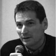 Marcel Kuper合作论文数CIRAD, France3
 Julien Tournebize合作论文数CEMAGREF3A. Debbarh合作论文数3C. Chaumont合作论文数3
 Yves Nedelec合作论文数Cemagref, UR HBAN3Mp Arlot合作论文数2Cedric Chaumont合作论文数2J. Yang合作论文数2Etienne Frejefond合作论文数2
 Alain Vidal合作论文数Centre de Recherches sur la Physico-Chimie des Surfaces Solides, 24, Avenue du Président Kennedy, 68200-Mulhouse, France2
 Tarik Hartani合作论文数2
 Serge Marlet合作论文数UMR Gestion de l'Eau;Acteurs et Usages;UMR Gestion de l'Eau2Michel Lagoutte合作论文数2Christoph Naendrup合作论文数2Pierre Vaquié合作论文数2Benoît Lesaffre合作论文数2M Aslam合作论文数1a musy合作论文数1Geneviève Barnaud合作论文数1Abdelhafid Debbarh合作论文数1pierre strosser合作论文数1Willem F. Vlotman合作论文数1J. -B. Faure合作论文数1christian leveque合作论文数1Frederik Hendrickx合作论文数1Josette Garnier合作论文数1F. Giraud合作论文数1
 Bart Schultz合作论文数Institute for Water Education1
 Mary Ann Ottinger合作论文数Department of Biology and Biochemistry, College of Natural Sciences and Mathematics, University of Houston1
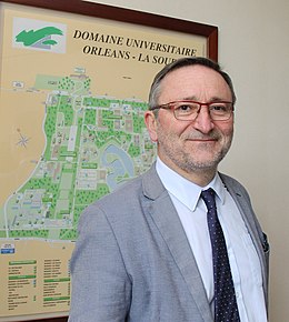 Ary Bruand合作论文数universite d'Orleans1M. K. N'Diaye合作论文数1Nenad Nikolic合作论文数1K. Belabbes合作论文数1
 François Birgand合作论文数Cemagref de Rennes, 17 avenue de Cucillé, CS 64427, 35044 Rennes Cedex, France1J.-C. Lefeuvre合作论文数1Igor Vinogradov合作论文数1Marc Benoit合作论文数1
 Pierre Renault合作论文数United ' Ecologie et de Physiologie du Systeme Digestif;Institut National de la Recherche Agronomique;Service de Gastroentérologie;Service de Gastroentérologie, Institut National de la Recherche Agronomique1Jean Claude Mailhol合作论文数1R Wayne Skaggs合作论文数1




