Even when radio frequency interference (RFI) is detected, very little is known about the sources of the interference. More information about the sources would facilitate the design of systems to deal with the interference. Reporting of interference by the RFI teams for SMAP and SMOS through international channels has resulted in a decrease in RFI and identification of several sources. Two such cases that have been identified in the USA and are reported here.
Wide bandwidth radiometer systems that make measurements at multiple frequencies in the range from 300 MHz to 2 GHz have been proposed to address parameters important for understanding issues in the cryosphere associated with climate change such as ice sheet thickness and temperature. It is also possible with such a system to retrieve sea surface salinity (SSS), which is important for understanding the impact of climate change on ocean circulation at high latitude. In contemporary sensors for retrieving SSS, such as on Soil Moisture and Ocean Salinity (SMOS) and Soil Moisture Active Passive (SMAP), sea surface temperature (SST), another parameter important for understanding ocean circulation and necessary in the retrieval of salinity, is treated as an ancillary parameter obtained from an independent source. However, both SSS and SST have peaks in sensitivity below 1 GHz; and it has been shown that measurements at multiple frequencies in this portion of the spectrum can take advantage of this peak in sensitivity to improve the accuracy of the retrieval of SSS. In this manuscript, it will be shown that there is also the potential to retrieve SST and, in cold water, the possibility for improved accuracy over existing retrievals.
The Soil Moisture Active Passive (SMAP) mission was launched on 31 st January 2015 in a 6 AM/6 PM sun-synchronous orbit at 685 km altitude to measure soil moisture and free/thaw globally [1]. A radar (active) and a radiometer (passive) are onboard, and they share a single feedhorn and mesh reflector. The antenna pointing was calibrated by the radar and the result is applied to the radiometer. Because the two instruments work at different frequencies, the antenna pointing for the two instruments are slightly different. Calibration of the radiometer antenna pointing is necessary for improving the water-body correction used in the soil moisture retrieval and improving the ocean surface incidence accuracy needed in the retrieval of sea surface salinity (SSS). The calibration activity has been performed and the result will be presented.
The Soil Moisture Active/Passive Mission was launched in 2015 to provide estimates of global surface soil moisture from its L-Band radiometer measurements. The digital backend included in SMAP's radiometer enables radio frequency interference (RFI) to be detected and filtered in real time. The six-year record of SMAP's RFI data available now allows global monitoring of the RFI environment and its changes over time. An automatic tool has been developed for this purpose that generates a table listing the most persistent and strongest sources. This paper provides an analysis of these tables to examine the evolution of the RFI environment over time. The use of the tables generated for reporting RFI sources to national authorities is also discussed.
The Soil Moisture Active Passive (SMAP) mission was launched on 31st January 2015 in a 6 AM/ 6 PM sun-synchronous orbit at 685 km altitude to measure soil moisture and free/thaw globally [1]. The passive instrument of SMAP is a fully polarimetric L-band radiometer (1.4GHz) operating with a bandwidth of 24MHz. The radiometer uses a combination of noise-diodes and Dicke-loads for internal calibration with a design similar to that used by the Aquarius or Jason series radiometers [2], [3]. Pre-launch calibration activities had been performed since 2012 on the engineering model of the radiometer. Post-launch calibration activities have been performed to fine-tune and validate the results from the pre-launch calibration. The major calibration activities and lessons learned in the past 8 years will be described in the following sessions.
The soil moisture active passive (SMAP) microwave radiometer is a fully-polarimetric L -band radiometer flown on the SMAP satellite in a 6 AM /6 PM sun-synchronous orbit at 685-km altitude. After the SMAP L1B_TB data product version 4 was released in 2018, the radiometer has undergone further calibration and validation. The goal is to reduce the difference between antenna temperature of ascending and descending orbits during the eclipse, and to reduce the dips in the calibration drift over the cold sky (CS) during the eclipse seasons in 2017 and 2018. The postlaunch calibration algorithm has been revisited by retrieving all of the calibration parameters simultaneously with two different options for the hot calibration source (the global ocean, or the radiometer internal reference load). The performance of the two options are compared here. The option with the radiometer internal reference load has been chosen by the SMAP science team for data release version 5. In addition, a correction offset is applied to the input signal to account for offsets during the early-mission stages with the SMAP synthetic aperture radar transmitter operating alongside the radiometer.
Modern microwave radiometers have demonstrated the feasibility of monitoring surface salinity from space and also the need for better accuracy in cold water. Accuracy could be improved by adding measurements at lower frequencies (lower than the measurement at 1.4 GHz currently used) and closer to the peak in sensitivity of brightness temperature to changes in salinity. Proposals to accomplish this have focused on wide bandwidth receivers which include at the low end frequencies close to the peak in sensitivity. This strategy involves trade-offs, some obvious such as radio frequency interference (RFI) when operating outside the protected band at 1.4 GHz and the loss of spatial resolution at lower frequencies. Others stemming from the interdependence of the retrieval of salinity on water temperature and surface roughness are more subtle. The objective of this manuscript is to examine this interdependence and its implications to future wide bandwidth instruments for remote sensing of salinity from space.
The radiometer on the NASA SMAP (Soil Moisture Active/Passive) mission is fully polarimetric and operates at L-band in the spectrum window at 1413 MHz protected for passive use only. A unique feature of the radiometer is the fully digital back-end which permits direct computation of the third and fourth Stokes parameters (i.e., real and imaginary part of the correlation of signal at horizontal and vertical polarizations). The SMAP conical scanning geometry has provided the opportunity to look at the global distribution of the fourth Stokes parameter at constant incidence angle (40 degrees at the surface). A striking feature of these maps is the existence of a strong (± 10 K peak-to-peak) spurious signal at coastlines. There is also a weak coupling to Faraday rotation. This paper reports research to explain the existence of these spurious signals.
The SMAP L-band microwave radiometer is in its extended mission of measuring soil moisture and freeze/thaw state globally for quantifying the water and carbon cycles. Instrument behavior has been stable over the past 4 years and 9 months. With the concurrent calibration of the internal calibration parameters and the antenna gain after estimating reflector emissivity, the SMAP radiometer measurements exhibit 0.1 K (rms) stability and nearly zero biases over the averaged global ocean and monthly Cold Sky views. The data (version 4) were released to the public in 2018 for various science activities. Now the radiometer data are under revisit to improve the absolute radiometric calibration and reduce calibration drift. Several approaches are investigated to obtain the optimal solution. In addition, the correction to the radiometer measurement when the SMAP radar transmitter was operational will also be revisited for the next data release. The performances of the calibration revisit and Radio-Frequency Interference (RFI) trends will be presented as well.
The dielectric constant of seawater at L-band is determined by a resonant cavity technique. Based on the measurement data, an accurate dielectric model function has been developed and employed to retrieve the ocean surface salinity from the satellite data. The retrieved salinities indicate that the accuracy of the dielectric model needs to be improved to resolve the bias correlated with sea surface temperature. This paper reports the new measurements that have been recently made for the development of a more accurate model function. These new measurements are made using 20, 34 and 36 psu seawater samples from 10°-30° C with a 5° C interval. An improved model function is developed based on the new measurements and on the previous measurements. The salinity retrieval results using the new model function will be presented at the meeting.
Soil Moisture, Sea Surface Salinity and Sea Ice Extent/Age are important global geophysical parameters which are most effectively measured from space-borne instruments. We discuss an effort to outline an instrument that will extend the data timeline and improve the sensitivity of the measurements and present a new feed antenna that could enable such instrument to achieve wide spectral coverage.
Aquarius final product V5.0 has been released. The dataset includes close to four years of global radiometric measurements at L-band. The mission's objective was to monitor sea surface salinity, but other applications of its data over land and the cryosphere have been developed. For this reason, it is important to have accurate calibration over the full range of antenna temperatures from natural targets. It is also needed in order to combine Aquarius measurements with other L-band sensors. Aquarius calibration is strongly focused on the ocean. We present a research product which is part of the final release and aims at producing an accurate calibration from the low end (celestial sky) to the high end (land and ice) of the brightness temperature scale. We calibrate the Aquarius radiometers using measurements over the Sky and oceans and assess the new calibration using measurements over land.
In recent years, several L-band microwave instruments have been launched into Earth's orbit to measure soil moisture and ocean salinity (e.g., Soil Moisture and Ocean Salinity [SMOS], Aquarius, and Soil Moisture Active/Passive [SMAP]). As the microwave signal travels through the ionosphere, the polarization vector rotates (Faraday rotation) and it is possible to estimate the total electron content (TEC) along the path by measuring this change. A comparison is presented of the TEC retrieved from Aquarius and SMAP over the ocean with the values provided by the IGS (International Global Navigation Satellite System Service (GNSS)). The TEC retrieved from Aquarius and SMAP measurements show good agreement with each other and, on a global scale, are in agreement with the TEC provided by the IGS. However, there are cases in which the TEC from the two satellite sensors are in good agreement with each other but differ significantly from the IGS TEC. The comparison suggests that the L-band instruments are a reliable source of TEC over the ocean and could be a valuable supplementary source of TEC values that could be assimilated in the IGS models, especially over the ocean, where GNSS ground stations are sparse.
Faraday rotation can be significant at L-band and needs to be considered in remote sensing from space using the spectrum window at 1.413 GHz protected for passive observations. This is especially so for a conical scanner such as SMAP because the variation of the rotation angle with position around the scan is of the same order of magnitude as the change with geographic position as the sensor travels in its orbit around the globe. Furthermore, the angle retrieved in situ by the radiometer is particularly noisy over land raising additional issues for remote sensing of soil moisture. Research is reported here assessing the magnitude of the problem and suggesting an approach for treating Faraday rotation in the context of remote sensing of soil moisture with a conical scanner like SMAP.
The Soil Moisture Active/Passive (SMAP) satellite mission measures Earth's radiation in the protected portion of the spectrum at 1.413 GHz (L-band) to retrieve geophysical quantities of the surface, such as soil moisture and the frozen/thawed state of the soil. The presence of radio-frequency interference (RFI) in this band is significant and impacts the quality of SMAP measurements. Knowing the location of the sources of RFI is important, because it can help to identify the source itself and also be used to develop strategies to mitigate its impact of the RFI on the data. This paper presents an algorithm that takes advantage of the viewing geometry of SMAP to locate sources of RFI. The results are validated using known locations of RFI sources and by comparison with the measurements of Soil Moisture and Ocean Salinity (SMOS) and Aquarius, two other satellite missions with L-band microwave radiometers operating in the protected band. Comparison with RFI of known location suggests that the algorithm is accurate to 1-2 km. The median distance between the locations reported by SMOS and this algorithm is 2.27 km. A study of the relationship between the localization error and the number of observations of RFI sources shows that the median localization error is about 2 km with 12 observations and about 1 km with 30 observations.
Current performance and existing problems in SMAP radiometer L1B_TB version 3 data product are described. The post-launch calibration algorithm has been updated by calibrating the three calibration parameters (the equivalent noise temperature of the noise diode, the offset of the reference load, and the antenna gain) jointly by using the global ocean and CS with both 110o and 180o pitch maneuvers after the reflector emissivity is calibrated. The results show that both calibration drift during eclipse season and bias over CS are removed. The RMSDs of the calibration drift over both the global ocean and CS are less than 0.1 K, and the goals of the calibration algorithm upgrade are achieved for coming L1B_TB version 4 data release.
The land emissivity model used in the Aquarius data processing has been updated for the latest data release (V5.0). In order to improve the estimates of the brightness temperatures of frozen regions, the new model uses values of surface emissivity that have been estimated from the Aquarius measurements averaged over the entire duration of the mission. The retrieved emissivities depend on the geographic location, but they depend only marginally on time, temperature and snow cover.
The next World Radio Conference (WRC) will be held in November 2019 in Geneva, Switzerland. This paper discusses WRC-19 agenda items that could impact scientific uses in Earth satellite remote sensing and radio astronomy.
Ocean salinity and soil moisture are key parameters for understanding the global water cycle, weather, and climate. These parameters are being measured with spaceborne radiometers operating in the L-band window at 1400-1427 MHz. Although man-made activity in this band is prohibited, radio frequency interference (RFI) is still a problem over significant portions of the earth. This paper reports a comparison of the RFI environment in this window as observed by two L-band radiometer systems, Aquarius and Soil Moisture and Ocean Salinity. The observed RFI environment depends on the sources and also on the characteristics of the instrument. Comparing the observations provides insight into the extent of the problem (actual sources), the influence of the instrument on the observation of RFI, and on potential ways of mitigating the effects. As this report shows, the global distribution of RFI is largely consistent between the two instruments, but the details, especially at low levels of RFI, depend on the characteristics of the instrument.
Faraday rotation is an important issue for remote sensing of parameters such as soil moisture and ocean salinity, which are best done at low microwave frequency (e.g., L-band). Modern instruments such as the radiometer on the Soil Moisture and Ocean Salinity (SMOS) satellite and the Aquarius radiometers include polarimetric radiometer channels specifically to implement a correction for Faraday rotation. This works well over ocean, but it is known that over inhomogeneous scenes, such as a land/water mixture, significant errors can occur. This is a particularly important issue for the newest L-band sensor in space, the radiometer on the Soil Moisture Active Passive (SMAP) satellite, where the goal is remote sensing over land (soil moisture) and where the conical scan induces rapid variation in Faraday rotation. Analysis is presented here of the issues associated with retrieving Faraday rotation using the SMAP geometry and antenna pattern. It is shown that, in addition to scenes with a mixture of land and water, scenes with significant vegetation canopy are also associated with large errors in the retrieved Faraday rotation. Examples from the SMAP radiometer support the analysis.
 Emmanuel Philippe Dinnat合作论文数17
 Jeffrey R. Piepmeier合作论文数Instrument Systems and Technology Division, NASA’s Goddard Space Flight Center9
 Paolo De Matthaeis合作论文数7
 Priscilla N. Mohammed合作论文数6
 Simon Yueh合作论文数Jet Propulsion Laboratory, California Institute of Technology6
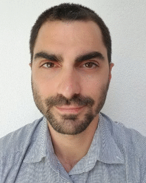 Yan Soldo合作论文数5
 Sidharth Misra合作论文数University of Michigan5
 Saji Abraham合作论文数5
 Jinzheng Peng合作论文数5
 Giovanni De Amici合作论文数4
 Gary Lagerloef合作论文数Earth & Space Research, A Non-Profit Research Institute4
 Thomas Meissner合作论文数4
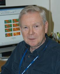 Thomas Jackson合作论文数Hydrology and Remote Sensing Laboratory, Beltsville Agricultural Research Center, Agricultural Research Service, United States Department of Agriculture3
 F. R. Colomb合作论文数Instituto Argentino de Radioastronom ´ õa3
 Roger H. Lang合作论文数Department of Electrical Engineering and Computer Science, George Washington University3
 I. Nollmann合作论文数2alan b tanner合作论文数2
 R. Scott Dunbar合作论文数2
 Joel T. Johnson合作论文数Department of Electrical and Computer Engineering, Ohio State University2
 Alexandra Bringer合作论文数2Calvin T. Swift合作论文数2Derek Hudson合作论文数Biosearch Technologies Inc2
 Fernando A. Pellerano合作论文数2Shannon T. Brown合作论文数1r colomb合作论文数1Yi Chao合作论文数1S. Chan合作论文数1
 Frank Wentz合作论文数Microwave Climate Data Center, Remote Sensing Systems1Griffis, A.合作论文数1
 Liang Hong (洪亮)合作论文数School of Artificial Intelligence, Wuhan University;Data Science and Intelligent Application Laboratory, Wuhan University1
 William J. Blackwell合作论文数The Applied Space Systems Group, MIT Lincoln Laboratory1
 Scott Ransom合作论文数National Radio Astronomy Observatory;Department of Astronomy, University of Virginia1Xiaobin Yin (殷晓斌)合作论文数Beijing Piesat Information Technology Co,Ltd.1
 Yiwen Zhou合作论文数1
 Rajat Bindlish合作论文数Hydrol & Remote Sensing Lab, USDA ARS1
 Gabriel Rebeiz合作论文数Department of Electrical and Computer Engineering, Jacobs School of Engineering, University of California, San Diego;Center for Wireless Communications, Jacobs School of Engineering, University of California, San Diego1
 James M. Moran合作论文数Department of Astronomy, Faculty of Arts and Sciences, Harvard University1
 Daniel Jacob合作论文数John A. Paulson School of Engineering and Applied Sciences, Harvard University;Department of Earth & Planetary Sciences, Harvard University1
 Salem El-Nimri合作论文数1Amy J. Lovell合作论文数1Vincent P. Idone合作论文数1
 David D. Chen合作论文数1
 Paul Siqueira合作论文数1
 Jasmeet Judge合作论文数Center for Remote Sensing, Agricultural and Biological Engineering Department, The University of Florida1
 Sandra Cruz-Pol合作论文数Department of Computer and Electrical Engineering, University of Puerto Rico1
 Steven Tsz K. Chan合作论文数Jet Propulsion Laboratory, California Institute of Technology1
 Todd Gaier合作论文数Division of Physics, Math and Astronomy, California Institute of Technology;Jet Propulsion Laboratory, California Institute of Technology1
 Michael Haken合作论文数1
 Edward J. Kim合作论文数1




