Autonomous underwater vehicles (AUVs) are enabling the collection of unique oceanographic data sets and are playing an increasingly important role in the exploration and monitoring of the global ocean. However, AUV operations inherently involve significant risk due to the complexity of the vehicles, the limited opportunities for operator intervention, as well as the dynamic and often poorly characterized environments in which they take place. To improve operational reliability, we present a practical approach for integrating high-fidelity simulation into the operational risk management workflow of long-range AUV campaigns. Using Autosub Long Range, an ultra-long-endurance AUV designed for over-the-horizon operations, we demonstrate how high-fidelity physics-informed simulation can be systematically employed to support mission rehearsal, software validation, navigation assessment, and contingency evaluation both before and during field operations. The approach is applied across three complex real-world campaigns: extended unaccompanied operations in the Southwest Approaches, low-altitude surveys near decommissioned oil and gas infrastructure in the North Sea, and multiday under-ice operations in the Amundsen Sea. The results indicate that high-fidelity simulation can play a significant role in reducing operational risk, improving mission preparedness, and increasing confidence in autonomous system behavior.
Observations of Antarctic waters are largely limited to the Austral summer as they are largely inaccessible due the prevalence of sea ice for the rest of the year. Measurements in the Amundsen Sea are of particular value due to the significant contribution to sea level rise from the melting of the West Antarctic glaciers that terminate there. Development of new tools to make year round measurements are critical to address this observational gap. Autonomous Underwater Vehicles (AUVs) are a key tool in many areas of ocean observing yet they are typically designed for hours or days of operation. In this paper we describe ongoing work to adapt the Autosub Long Range AUV to enable it to operate for a year under sea ice in the Amundsen Sea. To achieve this we focus on four challenge areas: managing the energy budget by intermittently anchoring the AUV to the seabed to reduce power draw, ensuring navigational accuracy for long term GPS denied operation, managing corrosion and biofouling, and developing the required onboard decision making to enable the AUV to operate during nominal and fault conditions given the constraints of the ice above. The final deployment date is subject to Research Vessel scheduling but is loosely planned for January 2027 to January 2028.
This paper discusses the deployment of Autosub Long Range (ALR), the long-endurance and low-power Autonomous Underwater Vehicle (AUV) of the National Oceanography Centre (NOC), under the Dotson Ice Shelf in West Antarctica. From the perspective of the engineers of NOC, the paper follows the preparation of the deployment from the initial discussions with scientists, through to the identification, implementation, and the testing of the required developments, to the final deployment, with the vehicle successfully completing several missions in the Amundsen Sea, the longest including 86 km under the ice over more than 40 hours of autonomous navigation.
Over the last decade, there has been a proliferation of marine robots such as Unmanned Surface Vehicles (USVs), Autonomous Underwater Vehicles (AUVs) and underwater gliders. The variety of vehicles’ capabilities and styles has led to numerous strategies to address the Guidance, Navigation and Control (GNC) tasks. In particular, a recent trend in the advancements of GNC systems is to develop modular, multi-platform solutions. This paper illustrates the approach followed in the development of the GNC system for the different types of AUV of the Autosub family. The presented system is decomposed into several interconnected components, each implemented as a standalone software module. Each component is highly-reconfigurable and easily extensible, and the interactions between the modules rely on generic-purpose interfaces. Such a design enables the execution of a broad range of autonomous missions, as well as the integration and deployment of the system on marine platforms with very diverse characteristics, not limited to the vehicles of the Autosub class. Experimental results obtained in real-time during in water campaigns are provided to demonstrate the effectiveness of the proposed system and its versatility on a wide range of platforms and missions.
Closed-loop stability of control systems can be undermined by actuator faults. Redundant actuator sets and Fault-Tolerant Control (FTC) strategies can be exploited to enhance system resiliency to loss of actuator efficiency, complete failures or jamming. Passive FTC methods entail designing a fixed-gain control law that can preserve the stability of the closed-loop system when faults occur, by compromising on the performance of the faultless system. The use of Passive FTC methods is of particular interest in the case of underwater autonomous platforms, where the use of extensive sensoring to monitor the status of the actuator is limited by strict space and energy constraints. In this work, a machine learning-based method is formulated to systematically synthesise control laws for systems affected by actuator faults, encompassing partial and total loss of actuator efficiency and control surfaces jamming. Differently from other methods in this category, the closed-loop stability is formally certified. The learning architecture encompasses two Artificial Neural Networks, one representing the control law, and the other resembling a Control Lyapunov Function (CLF). Periodically, a Satisfiability Modulo Theory solver is employed to verify that the synthesised CLF formally satisfies the theoretical Lyapunov conditions associated to both the nominal and faulty dynamics. The method is applied to three marine test cases: first, an Autonomous Underwater Vehicle performing planar motion and subjected to full loss of actuator efficiency is investigated. Next, a study is conducted on a hybrid Underwater Glider with a pair of independent twin stern planes jamming at a fixed position. Finally, partial loss of effectiveness is considered. In all three scenarios, the system is able to synthesise stabilising control laws with performance degradation prescribed by the user. Unlike other machine-learning based techniques, this method offers formal stability certificates and relies on limited computational resources rendering it possible to be run on unassuming office laptops.
Continued improvements in Autonomous Underwater Vehicle (AUV) navigation is required to enable long term deployments. Attempts to address GPS-denied underwater operation have lead to a wide variety of navigation techniques whose suitability for a specific mission is highly dependent on the environment, concept of operations and sensor payload. In this paper we introduce a robust navigation system, able to fuse a wide range of sensors and aiding sources, allowing the vehicle to precisely ascertain its position and navigate the complexities of the surrounding environment. The modular multi-platform architecture proposed in this paper, based on two main inter-connected components, individually implemented as standalone software module, allows to define sensor-agnostic interfaces used to interact with the rest of the system. Preliminary experimental results obtained in real-time during in water campaigns, validate the effectiveness of the proposed approach.
Performance and closed-loop stability of control systems can be jeopardised by actuator faults. Actuator redundancy in combination with appropriate control laws can increase the resiliency of a system to both loss of efficiency or jamming. Passive Fault-Tolerant Control (FTC) systems aim at designing a unique control law with guaranteed stability in both nominal and faulty scenarios. In this work, a novel machine learning-based method is devised to systematically synthesise control laws for systems affected by actuator faults, whilst formally certifying the closed-loop stability. The learning architecture trains two Artificial Neural Networks, one representing the control law, and the other resembling a Control Lyapunov Function (CLF). In parallel, a Satisfiability Modulo Theory solver is employed to certify that the obtained CLF formally guarantees the Lyapunov conditions. The method is showcased for two scenarios, one encompassing the stabilisation of an inverted pendulum with redundant actuators, whilst the other covers the control of an Autonomous Underwater Vehicle. The framework is shown capable of synthesising both linear and nonlinear control laws with minimal hyperparameter tuning and within limited computational resources.
Fleets of Marine Autonomous Systems are increasingly utilised for ocean surveying and monitoring, since they provide both spatial and temporal coverage at a significantly lower cost than conventional methods. Facilitating this mode of operation requires further developments in the field of heterogeneous fleet mission planning, control system interoperability and acoustic networking infrastructure. The Squads of Adaptive Robots project is tackling these challenges to bring together a fleet consisting of light weight microAUVs, a high-powered mapping AUV and an Uncrewed Surface Vehicle to efficiently, by utilising a fleet-level intelligent mission planning system, triage and map areas of the seabed. This paper provides an overview of the aspirations and design of the solution.
Long Range Autonomous Underwater Vehicles (LRAUVs) offer the potential to monitor the ocean at higher spatial and temporal resolutions compared to conventional ship-based techniques. The multi-week to multi-month endurance of LRAUVs enables them to operate independently of a support vessel, creating novel opportunities for ocean observation. The National Oceanography Centre's Autosub Long Range is one of a small number of vehicles designed for a multi-month endurance. The latest iteration, Autosub Long Range 1500 (ALR1500), is a 1500 m depth-rated LRAUV developed for ocean science in coastal and shelf seas or in the epipelagic and meteorologic regions of the ocean. This paper presents the design of the ALR1500 and results from a five week continuous deployment from Plymouth, UK, to the continental shelf break and back again, a distance of approximately 2000km which consumed half of the installed energy. The LRAUV was unaccompanied throughout the mission and operated continuously beyond visual line of sight.
The navigation of Autonomous Underwater Vehicles (AUVs) is still an open research problem. This is further exacerbated when vehicles can only carry limited sensors as typically the case with micro-AUVs that need to survey large marine areas that can be characterized by high currents and dynamic environments. To address this problem, this work investigates the usage of ad hoc acoustic networks that can be established by a set of cooperating vehicles. Leveraging the network structure makes it possible to greatly improve the navigation of the vehicles and as a result to enlarge the operational envelope of vehicles with limited capabilities. The paper details the design and implementation of the network, and specific details of localization and navigation services made available to the vehicles by the network stack. Results are provided from a sea-trial undertaken in Croatia in October 2019. Results validate the approach, demonstrating the increased flexibility of the system and the navigational performance obtained: the deployed network was able to support long-range navigation of vehicles with no inertial navigation or Doppler Velocity Log (DVL) during a 9.5 km channel crossing, reducing the navigation error from approximately 7% to 0.27% of the distance traveled.
Autonomous Underwater Vehicles (AUVs) are proving to be a key component in the global observing system, with their ability to provide unique data sets particularly at abyssal depths or under ice. Autosub5 is the latest in a line of large work class AUVs developed by the National Oceanography Centre specifically tailored for oceanographic science applications. This paper describes the work currently being undertaken to transition the vehicle from an engineering prototype through to a science ready platform. The 18 months process saw the AUV assembled in early 2021 and then undertake a series of trials and incremental payload integrations through to a science rehearsal trial planned for summer 2022.
Deploying long‐range autonomous underwater vehicles (AUVs) mid‐water column in the deep ocean is one of the most challenging applications for these submersibles. Without external support and speed over the ground measurements, dead‐reckoning (DR) navigation inevitably experiences an error proportional to the mission range and the speed of the water currents. In response to this problem, a computationally feasible and low‐power terrain‐aided navigation (TAN) system is developed. A Rao‐Blackwellized Particle Filter robust to estimation divergence is designed to estimate the vehicle's position and the speed of water currents. To evaluate performance, field data from multiday AUV deployments in the Southern Ocean are used. These form a unique test case for assessing the TAN performance under extremely challenging conditions. Despite the use of a small number of low‐power sensors and a Doppler velocity log to enable TAN, the algorithm limits the localisation error to within a few hundreds of metres, as opposed to a DR error of 40 km, given a 50 m resolution bathymetric map. To evaluate further the effectiveness of the system under a varying map quality, grids of 100, 200, and 400 m resolution are generated by subsampling the original 50 m resolution map. Despite the high complexity of the navigation problem, the filter exhibits robust and relatively accurate behaviour. Given the current aim of the oceanographic community to develop maps of similar resolution, the results of this study suggest that TAN can enable AUV operations of the order of months using global bathymetric models.
The desire to conduct research in the Arctic on an ever-larger spatiotemporal scale has led to the development of long-range autonomous underwater vehicles (AUVs), such as the Autosub Long-Range 1500 (ALR1500). While these platforms open up a world of new applications, their actual use is limited in GPS-denied environments since self-contained navigation remains yet unavailable. In response, this study evaluates whether terrain-aided navigation (TAN) can enable multimonth deployments using basic navigation sensors and sparse bathymetric maps. To evaluate the potential, ALR1500 undertakes a hypothetical science-driven mission from Svalbard (Norway) to Point Barrow (Alaska, USA) under the sea ice (a mission over 3200 km). Therefore, a simulated environment is developed, which integrates a state-of-the-art model of water circulation, error models for heading estimation at high latitudes, and an Arctic bathymetric map. Recognizing that this map is constructed based on sparse depth measurements and interpolation techniques, a bathymetric uncertainty model is developed. The performance of the TAN algorithm is examined with respect to the type of the heading sensor utilized and a range of vertical map distortions, calculated using the developed bathymetric uncertainty model. Simulations show that unaided navigation experiences an error of hundreds of kilometers, whereas TAN provides acceptable accuracy given a moderate map distortion. By degrading the quality of the map further, it appears that the navigation filter may diverge when traversing large regions subject to interpolation. Therefore, a rapidly-exploring random tree star algorithm is used to design a new path such that the AUV traverses reliable and rich in topographic information areas.
This paper discusses requirements for autonomy and communications in maritime environments through two use cases which are sourced from military scenarios: Mine Counter Measures (MCM) and Anti-Submarine Warfare (ASW). To address these requirements, this work proposes a service-oriented architecture that breaks the typical boundaries between the autonomy and the communications stacks. An initial version of the architecture has been implemented and its deployment during a field trial done in January 2019 is reported. The paper discusses the achieved results in terms of system flexibility and ability to address the MCM and ASW requirements.
Localisation-aware underwater networks are gaining increasing attention in the marine robotics community thanks to their ability of providing navigational services. This can be beneficial in a number of applications, as for instance to support the navigation of Autonomous Underwater Vehicles (AUVs) when traditional aiding systems are impractical or not cost effective. However, the unreliability of the acoustic channel, together with the additional overhead and constraints introduced by the network itself, result in localisation measurements that are intrinsically sporadic. This makes the outlier filtering problem of localisation measurements obtained through networked underwater systems particularly important and challenging. This paper uses experimental data to compare the integration of two different outlier filtering methodologies in an existing network-aided AUV navigation filter. The first method aims at pre-filtering the measurements to identify and discard potential outliers before they are fused in the navigation filter. The second one modifies the correction step of the Kalman filter to integrate measurements in an outlier-robust way. Results show that when the navigation filter is made outlier-robust the navigation performance increases and the system becomes less sensitive to tuning, a key characteristic for fielded systems.
Undertaking world-class ocean science requires data gathering in some of the world's most extreme environments, such as under polar ice, deep benthic habitats and underwater canyons. Autonomous Underwater Vehicles (AUVs) are often employed for these tasks, as these stable, untethered, vehicles are able to access areas not reachable with conventional ship-based sampling methods. It is easy to understand how deployments in such scenarios require the AUV to be equipped with appropriate sensors to perceive obstacles within its environment as well as suitable collision avoidance control schemes to maintain safe operation.The Marine Autonomous and Robotic Systems (MARS) group at the National Oceanography Centre (NOC) develops and operates multiple AUVs suited for missions in a range of extreme environments. Recently, a considerable effort has been made to develop the NOC On-board Control System (OCS) for AUVs, a unified software architecture able to adapt to different platforms and to provide greater flexibility and extensibility in terms of underwater autonomy. Within this framework, a new Obstacle Avoidance System (OAS) is being developed. The goal is to design a flexible and modular system able to work effectively with different vehicles and in different scenarios, and to satisfy diverse science requirements.This paper will describe the OAS and its components, its integration within the OCS, and its interaction with the preexisting on-board autonomy and guidance systems when dealing with collisions and obstacles in the context of autonomous navigation.
This work develops a TAN algorithm that relies on basic motion sensors and bathymetric observations obtained by low-power sonars (e.g. a single-beam sounder or a downward-facing ADCP while in bottom -tracking regime) and is sufficiently robust to deal with low resolution bathymetric maps. The state estimation process is performed by utilising the Rao-Blackwellised particle filter (RBPF). To make the navigation filter computationally feasible while using low-power processing boards with limited computational resources, the filter estimates the 2D vehicle's position and the 2D speed of the local water currents. Therefore, the proposed navigation solution can enable AUV deployments in remote deep oceans of the order of months, rather than hours or days, without the need for external support or regular surfacing.
Complex maritime missions, both above and below the surface, have traditionally been carried out by manned surface ships and submarines equipped with advanced sensor systems. Unmanned Maritime Vehicles (UMVs) are increasingly demonstrating their potential for improving existing naval capabilities due to their rapid deployability, easy scalability, and high reconfigurability, offering a reduction in both operational time and cost. In addition, they mitigate the risk to personnel by leaving the man far-from-the-risk but in-the-loop of decision making. In the long-term, a clear interoperability framework between unmanned systems, human operators, and legacy platforms will be crucial for effective joint operations planning and execution. However, the present multi-vendor multi-protocol solutions in multi-domain UMVs activities are hard to interoperate without common mission control interfaces and communication protocol schemes. Furthermore, the underwater domain presents significant challenges that cannot be satisfied with the solutions developed for terrestrial networks. In this paper, the interoperability topic is discussed blending a review of the technological growth from 2000 onwards with recent authors' in-field experience; finally, important research directions for the future are given. Within the broad framework of interoperability in general, the paper focuses on the aspect of interoperability among UMVs not neglecting the role of the human operator in the loop. The picture emerging from the review demonstrates that interoperability is currently receiving a high level of attention with a great and diverse deal of effort. Besides, the manuscript describes the experience from a sea trial exercise, where interoperability has been demonstrated by integrating heterogeneous autonomous UMVs into the NATO Centre for Maritime Research and Experimentation (CMRE) network, using different robotic middlewares and acoustic modem technologies to implement a multistatic active sonar system. A perspective for the interoperability in marine robotics missions emerges in the paper, through a discussion of current capabilities, in-field experience and future advanced technologies unique to UMVs. Nonetheless, their application spread is slowed down by the lack of human confidence. In fact, an interoperable system-of-systems of autonomous UMVs will require operators involved only at a supervisory level. As trust develops, endorsed by stable and mature interoperability, human monitoring will be diminished to exploit the tremendous potential of fully autonomous UMVs.
The ice covered portions of the world's seas and oceans are some of the most inaccessible areas on the planet, yet hold crucial clues to the behaviour of the world's climate. Largely inaccessible by manned vessels, robotic platforms provide our best opportunities to explore and learn about these regions. Autosub2000 Under Ice (Autosub2KUI) will become the newest iteration of the Autosub family of Autonomous Underwater Vehicles which have played a significant role in under ice exploration over the last two decades. Autosub AUVs have conducted over 30 missions under sea ice and tidewater glaciers in both the Arctic and Antarctic. This paper outlines the design of Autosub2KUI with a focus on the adaptations required for operation under ice.
As the affordability and the diversity of marine robotic platforms grow, the need for standardized software architectures, communication protocols and operating procedures becomes more critical. Going towards this direction, the Marine Autonomous and Robotic Systems (MARS) group of the National Oceanographic Centre Southampton started the development of a new on-board control and autonomy system, with the aim of delivering a modular and easily maintainable software that can be deployed on all the different platforms of the fleet. This paper presents the architectural description of the system, and the details on the implementation choices made to obtain a flexible and unique software ecosystem. As part of this redesign, two critical components have been completely re-designed: the mission executive layer, based on Behaviour Trees (BT), and the vehicle health management and diagnostic system. Details on these two key components are reported. Results from the first experimental campaign conducted in March 2019 in Portland harbour (Dorset, UK) with the newly developed ALR1500 vehicle provide some examples of the functionalities of the new system.
 Andrea Caiti合作论文数Department of Information Engineering, University of Pisa32
 Riccardo Costanzi合作论文数31
 Di Corato, F.合作论文数Dept. of Electr. Syst. & Autom., Univ. of Pisa;c;Dept. of Electr. Syst. & Autom., Univ. of Pisa20
 Alessandro Ridolfi合作论文数19
 Francesco Fanelli合作论文数Department of Industrial Engineering (DIEF), Mechatronics and Dynamic Modelling Laboratory (MDM Lab), University of Florence (UNIFI), Via di Santa Marta 3, 50139, Florence, Italy15
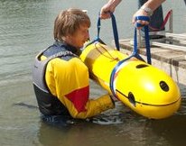 Alexander B. Phillips合作论文数School of Engineering Sciences, University of Southampton15
 Andrea Munafo合作论文数Department of Information Engineering, University of Pisa13
 Niccolo Monni合作论文数11
 Miles Pebody合作论文数9
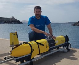 Georgios Salavasidis合作论文数Marine Autonomous and Robotic Systems, National Oceanography Centre8
 Tommaso Fabbri合作论文数8
 Benedetto Allotta合作论文数Scuola Superiore Sant ' Anna8
 Vincenzo Manzari合作论文数Naval Support and Experimentation Centre of the Italian Navy7
 Daniel T. Roper合作论文数6
 Robert Templeton合作论文数5
 Alberto Consensi合作论文数Marine Autonomous Robotic Systems, National Oceanography Centre5
 Jonathan Gelli合作论文数5francesco pacini合作论文数5Simone Grechi合作论文数5
 Filippo Fabiani合作论文数The BioRobotics Institute, Scuola Superiore Sant'Anna5
 Claudio Fantacci合作论文数DSI, Univ. di Firenze;c;DSI, Univ. di Firenze5
 Fabio Bartolini合作论文数Department of Agricultural Economics and Engineering, University of Bologna5
 Luca Pugi合作论文数Dipartimento di Ingegneria Industriale, Universita Degli Studi Firenze5
 Luigi Chisci合作论文数Dipartimento di Sistemi e Informatica, DSI-Universití di Firenze5E. Meli合作论文数4
 Catherine A. Harris合作论文数4Rachel Marlow合作论文数4Manuel Novi合作论文数4Giacomo Paoli合作论文数4
 Enrico Meli合作论文数Department of Energetics, University of Florence4
 Alessandra Tesei合作论文数Undersea Research Centre;Marine Physical Laboratory;Marine Physical Laboratory, Undersea Research Centre4
 Michele Micheli合作论文数4Munafo, A.合作论文数3L. Pugi合作论文数3
 Matthew Kingsland合作论文数3Jeremy Sitbon合作论文数3
 Thomas Prampart合作论文数3Achille Martin合作论文数3Mirko Stifani合作论文数3luca morlando合作论文数3
 Richard Morrison合作论文数3Marco Natalini合作论文数3
 Eric Rogers合作论文数Department of Electronics and Computer Science, University of Southampton3
 Stephen D. Mcphail合作论文数3Shivan Ramdhanie合作论文数2Nick Linton合作论文数2Alexis Johnson合作论文数2Ashley Morris合作论文数2




