Limitations of access have long restricted exploration and investigation of the cavities beneath ice shelves to a small number of drillholes. Studies of sea-ice underwater morphology are limited largely to scientific utilization of submarines. Remotely operated vehicles, tethered to a mother ship by umbilical cable, have been deployed to investigate tidewater-glacier and ice-shelf margins, but their range is often restricted. The development of free-flying autonomous underwater vehicles (AUVs) with ranges of tens to hundreds of kilometres enables extensive missions to take place beneath sea ice and floating ice shelves. Autosub2 is a 3600 kg, 6.7m long AUV, with a 1600m operating depth and range of 400 km, based on the earlier Autosub1 which had a 500m depth limit. A single direct-drive d.c. motor and five-bladed propeller produce speeds of 1–2m s. Rear-mounted rudder and stern-plane control yaw, pitch and depth. The vehicle has three sections. The front and rear sections are freeflooding, built around aluminium extrusion space-frames covered with glass-fibre reinforced plastic panels. The central section has a set of carbon-fibre reinforced plastic pressure vessels. Four tubes contain batteries powering the vehicle. The other three house vehicle-control systems and sensors. The rear section houses subsystems for navigation, control actuation and propulsion and scientific sensors (e.g. digital camera, upward-looking 300 kHz acoustic Doppler current profiler, 200 kHz multibeam receiver). The front section contains forward-looking collision sensor, emergency abort, the homing systems, Argos satellite data and location transmitters and flashing lights for relocation as well as science sensors (e.g. twin conductivity–temperature–depth instruments, multibeam transmitter, subbottom profiler, AquaLab water sampler). Payload restrictions mean that a subset of scientific instruments is actually in place on any given dive. The scientific instruments carried on Autosub are described and examples of observational data collected from each sensor in Arctic or Antarctic waters are given (e.g. of roughness at the underside of floating ice shelves and sea ice).
Filchner-Ronne Ice Shelf (FRIS) is the world's largest ice shelf by volume. It helps regulate Antarctica's contribution to global sea level rise, and water mass transformations within the sub-ice-shelf cavity produce globally important dense water masses. Rates of ice shelf basal melting are relatively low, however, as the production of cold (-1.9 degrees C) and dense High Salinity Shelf Water over the Weddell Sea continental shelf isolates the ice shelf from large-scale inflow of warm water. Nevertheless, a narrow inflow of relatively warm (-1.4 degrees C) Modified Warm Deep Water (MWDW) that hugs the western flank of Berkner Bank is observed to reach Ronne Ice Front, although the processes governing its circulation and fate remain uncertain. Here we present the first observations taken within the ice shelf cavity along this warm water inflow using the Autosub Long Range autonomous underwater vehicle. We observe a core of MWDW with a south-westward velocity of 4 cm s(-1) that reaches at least 18 km into the sub-ice cavity. The hydrographic properties are spatially heterogeneous, giving rise to temporal variability that is driven by tidal advection. The highest rates of turbulent dissipation are associated with the warmest MWDW, with the vertical eddy diffusivity reaching 10(-4) m(2) s(-1) where the water column is fully turbulent. Mixing efficiency is close to the canonical value of 0.2. Modeling studies suggest MWDW may become the dominant water mass beneath FRIS in our changing climate, providing strong motivation to understand more fully the dynamics of this MWDW inflow.
Deploying long‐range autonomous underwater vehicles (AUVs) mid‐water column in the deep ocean is one of the most challenging applications for these submersibles. Without external support and speed over the ground measurements, dead‐reckoning (DR) navigation inevitably experiences an error proportional to the mission range and the speed of the water currents. In response to this problem, a computationally feasible and low‐power terrain‐aided navigation (TAN) system is developed. A Rao‐Blackwellized Particle Filter robust to estimation divergence is designed to estimate the vehicle's position and the speed of water currents. To evaluate performance, field data from multiday AUV deployments in the Southern Ocean are used. These form a unique test case for assessing the TAN performance under extremely challenging conditions. Despite the use of a small number of low‐power sensors and a Doppler velocity log to enable TAN, the algorithm limits the localisation error to within a few hundreds of metres, as opposed to a DR error of 40 km, given a 50 m resolution bathymetric map. To evaluate further the effectiveness of the system under a varying map quality, grids of 100, 200, and 400 m resolution are generated by subsampling the original 50 m resolution map. Despite the high complexity of the navigation problem, the filter exhibits robust and relatively accurate behaviour. Given the current aim of the oceanographic community to develop maps of similar resolution, the results of this study suggest that TAN can enable AUV operations of the order of months using global bathymetric models.
The desire to conduct research in the Arctic on an ever-larger spatiotemporal scale has led to the development of long-range autonomous underwater vehicles (AUVs), such as the Autosub Long-Range 1500 (ALR1500). While these platforms open up a world of new applications, their actual use is limited in GPS-denied environments since self-contained navigation remains yet unavailable. In response, this study evaluates whether terrain-aided navigation (TAN) can enable multimonth deployments using basic navigation sensors and sparse bathymetric maps. To evaluate the potential, ALR1500 undertakes a hypothetical science-driven mission from Svalbard (Norway) to Point Barrow (Alaska, USA) under the sea ice (a mission over 3200 km). Therefore, a simulated environment is developed, which integrates a state-of-the-art model of water circulation, error models for heading estimation at high latitudes, and an Arctic bathymetric map. Recognizing that this map is constructed based on sparse depth measurements and interpolation techniques, a bathymetric uncertainty model is developed. The performance of the TAN algorithm is examined with respect to the type of the heading sensor utilized and a range of vertical map distortions, calculated using the developed bathymetric uncertainty model. Simulations show that unaided navigation experiences an error of hundreds of kilometers, whereas TAN provides acceptable accuracy given a moderate map distortion. By degrading the quality of the map further, it appears that the navigation filter may diverge when traversing large regions subject to interpolation. Therefore, a rapidly-exploring random tree star algorithm is used to design a new path such that the AUV traverses reliable and rich in topographic information areas.
Autosub Long Range 6000 is a 6000-m-rated autonomous underwater vehicle capable of 2- to 3-month-long deployments covering a range of up to 1800 km. This high endurance is achieved through a combination of the use of high energy-density lithium primary cells and energy optimization for all subsystems. This article uses theory and initial trial results to quantify the power consumption of the system and make predictions for ultimate range and endurance. An overview of early science deployments is also presented.
This work develops a TAN algorithm that relies on basic motion sensors and bathymetric observations obtained by low-power sonars (e.g. a single-beam sounder or a downward-facing ADCP while in bottom -tracking regime) and is sufficiently robust to deal with low resolution bathymetric maps. The state estimation process is performed by utilising the Rao-Blackwellised particle filter (RBPF). To make the navigation filter computationally feasible while using low-power processing boards with limited computational resources, the filter estimates the 2D vehicle's position and the 2D speed of the local water currents. Therefore, the proposed navigation solution can enable AUV deployments in remote deep oceans of the order of months, rather than hours or days, without the need for external support or regular surfacing.
In January 2018, in Cape Town, South Africa, two engineers from NOC Southampton and a scientist from BAS. Cambridge, joined the Alfred Wegener Institute icebreaker RV Polarstern. Two months later, after a fascinating and eventful cruise, we docked in Punta Arenas, Chile. The Autosub Long Range AUV had completed two successful missions under the Filchner and Ronne ice shelves (and we had not lost it)! The AUV had run beneath ice for over 3 days in total, penetrating over 25 km under the Filchner and Ronne floating ice shelves, which in places were over 500 m thick. The scientific goals were to quantify and help to understand the controlling factors for the flow of waters (particularly warm, melting water) beneath the ice shelves and to make direct measurements of the ice shelf and sea bed morphology. The AUV carried a microstructure probe, CTD, upward and downward looking ADCPs (for measurement of currents and ranges to the ice and seabed), returning very interesting scientific data. However, the foci of this paper are the engineering challenges and how we overcame them to safely conduct the sub-ice missions. The Autosub Long Range (ALR) AUV is a 3.6 m long, 800 kg displacement AUV with a depth rating of 6000 m. Known by some as "Boaty McBoatface", it is capable of endurances of several months (depending on sensor power drain and speed), and runs at speeds of between 1.8 to 2.9 km hr-1. The AUV navigates using ADCP aided dead-reckoning, relative to either the seabed or the under ice surface. It can be programmed for constant depth or profiling flight, while keeping a safe distance from the seabed and the ice overhead. There were several technical challenges. The AUV navigation needed to be accurate, particularly as (due to sea ice conditions) the AUV could not simply surface at the end its mission (and thence easily relocated using a satellite beacon). Rather, the AUV must circle at depth and await further instructions from the host ship via acoustic telemetry (which has limited range). Achieving this navigation accuracy was encumbered by both high currents in the operating area and the (scientific) requirement for the AUV to make measurements a moderate distance from the sea bed (out of Doppler sea bed lock). Another potential exacerbating factor was the use of a magnetic compass for AUV heading estimation. For cost reasons (the ALR is designed as a relatively low cost AUV), and to minimize power consumption, the ALR carries a magnetic compass for heading estimation (rather than the more expensing and power hungry laser gyro based technologies). This technology would not normally be considered accurate enough for the precise navigation requirements. However, NOC has developed in-situ self-calibration procedures and algorithms, giving very good navigation performance, particularly for missions where the end point is near the start point. Another challenge was to autonomously control the AUV depth trajectory, safely avoiding, in a largely unknown environment, the ice shelf overhead and the seabed below. Not everything went perfectly; a problem which the AUV encountered 25 km under the Filchner ice shelf would have caused us great concern (to say the least) if we had known about what was happening in real-time. Fortunately we were blissfully ignorant until after recovery of the AUV. The paper will describe this near calamity and its possible root cause. Launch and recovery of the AUV was hampered in this environment by rapidly forming and shifting masses of sea ice and very cold temperatures. It was necessary for the ship to break ice and for us to guide the AUV into the ephemeral ice hole overhead via the acoustic telemetry link.
The overturning circulation of the global ocean is critically shaped by deep-ocean mixing, which transforms cold waters sinking at high latitudes into warmer, shallower waters. The effectiveness of mixing in driving this transformation is jointly set by two factors: the intensity of turbulence near topography and the rate at which well-mixed boundary waters are exchanged with the stratified ocean interior. Here, we use innovative observations of a major branch of the overturning circulation-an abyssal boundary current in the Southern Ocean-to identify a previously undocumented mixing mechanism, by which deep-ocean waters are efficiently laundered through intensified near-boundary turbulence and boundary-interior exchange. The linchpin of the mechanism is the generation of submesoscale dynamical instabilities by the flow of deep-ocean waters along a steep topographic boundary. As the conditions conducive to this mode of mixing are common to many abyssal boundary currents, our findings highlight an imperative for its representation in models of oceanic overturning.
Terrain-aided navigation (TAN) is a localisation method which uses bathymetric measurements for bounding the growth in inertial navigation error. The minimisation of navigation errors is of particular importance for long-endurance autonomous underwater vehicles (AUVs). This type of AUV requires simple and effective on-board navigation solutions to undertake long-range missions, operating for months rather than hours or days, without reliance on external support systems. Consequently, a suitable navigation solution has to fulfil two main requirements: (a) bounding the navigation error, and (b) conforming to energy constraints and conserving on-board power. This study proposes a low-complexity particle filter-based TAN algorithm for Autosub Long Range, a long-endurance deep-rated AUV. This is a light and tractable filter that can be implemented on-board in real time. The potential of the algorithm is investigated by evaluating its performance using field data from three deep (up to 3,700 m) and long-range (up to 195 km in 77 hr) missions performed in the Southern Ocean during April 2017. The results obtained using TAN are compared to on-board estimates, computed via dead reckoning, and ultrashort baseline (USBL) measurements, treated as baseline locations, sporadically recorded by a support ship. Results obtained through postprocessing demonstrate that TAN has the potential to prolong underwater missions to a range of hundreds of kilometres without the need for intermittent surfacing to obtain global positioning system fixes. During each of the missions, the system performed 20 Monte Carlo runs. Throughout each run, the algorithm maintained convergence and bounded error, with high estimation repeatability achieved between all runs, despite the limited suite of localisation sensors.
The navigational drift for Autonomous Underwater Vehicles (AUVs) operating in open ocean can be bounded by regular surfacing. However, this is not an option when operating under ice. To operate effectively under ice requires an on-board navigation solution that does not rely on external infrastructure. Moreover, some under-ice missions require long-endurance capabilities, extending the operating time of the AUVs from hours to days, or even weeks and months. This paper proposes a particle filter based terrain-aided navigation algorithm specifically designed to be implementable in real-time on the low-powered Autosub Long Range 1500 (ALR1500) vehicle to perform long-range missions, namely crossing the Artic Ocean. The filter performance is analysed using numerical simulations with respect to various key factors, e.g. of the sea-floor morphology, bathymetric update rate, map noise, etc. Despite very noisy on-board measurements, the simulation results demonstrate that the filter is able to keep the estimation error within the mission requirements, whereas estimates using dead-reckoning techniques experience unbounded error growth. We conclude that terrain-aided navigation has the potential to prolong underwater missions to a range of thousands of kilometres, provided the vehicle crosses areas with sufficient terrain variability and the model includes adequate representation of environmental conditions and motion disturbances.
Coupling Long Range Autonomous Underwater Vehicles (LRAUVs) with Unmanned Surface Vehicles (USVs) addresses two of the key challenges associated with LRAUV missions: lack of real-time communication with the underwater asset and unbounded navigational error growth from dead reckoning. The Autonomous Surface/Subsurface Survey System is coupling the Autosub Long Range (ALR) with unmanned surface vehicles from L3 ASV. Experiments conducted in Loch Ness illustrate the ability of the USV to track the ALR and the enhanced navigational accuracy of the ALR when using acoustic aided navigation. The ability to re-task the ALR while submerged is also demonstrated.
This paper introduces Autosub Long Range 1500, the latest addition to the Autosub family of AUVs, designed built and operated by the National Oceanography Centre, UK. The vehicle is currently in advanced stages of development, with a prototype and sea-trials planned for early 2018. Following the trials, the vehicle will begin a full programme of marine science activities from 2019 onwards. This paper outlines the capabilities and intended usage of this novel game changing vehicle, providing justification for the statement of range and endurance.
This paper investigates the potential of use of Terrain Aided Navigation (TAN) methods to exploit the extended endurance capabilities of an enhanced 1500m depth rated variant of the Autosub Long Range (ALR), the ALR1500 Autonomous Underwater Vehicle (AUV), for operations under the Arctic ice. A simulator for the TAN system using a low resolution Arctic bathymetric map is developed to study the capability to reduce/bound the positioning error growth due to the Dead Reckoning (DR) drift over time. Bathymetric measurements are obtained using a low sample rated single beam echo sounder and a Jittered Bootsrap Particle Filter (JBPF) is used for the multi-sensor data fusion problem. Sensitivity analysis of JBPF has been performed for a range of values of number of particles, jittering variances and measurement frequencies and a discussion over the results is given. Results from the simulation demonstrate that JBPF is capable of providing a robust and accurate solution to the localization problem provided that the AUV follows a trajectory with a sufficiently variant terrain. Finally, a brief discussion regarding the future extension of this work is also provided.
The extent and speed of marine environmental mapping is increasing quickly with technological advances, particularly with optical imaging from autonomous underwater vehicles (AUVs). This contribution describes a new deep‐sea digital still camera system that takes high‐frequency (>1 Hz) color photographs of the seafloor, suitable for detailed biological and habitat assessment, and the means of efficient processing of this mass imagery, to allow assessment across a wide range of spatial scales from that of individual megabenthic organisms to landscape scales (>100 km2). As part of the Autonomous Ecological Surveying of the Abyss (AESA) project, the AUV Autosub6000 obtained > 150,000 seafloor images (~160 km total transect length) to investigate the distribution of megafauna on the Porcupine Abyssal Plain (4850 m; NE Atlantic). An automated workflow for image processing was developed that corrected nonuniform illumination and color, geo‐referenced the photographs, and produced 10‐image mosaics ('tiles,' each representing a continuous strip of 15‐20 m2 of seafloor), with overlap between consecutive images removed. These tiles were then manually annotated to generate biological data. This method was highly advantageous compared with alternative techniques, greatly increasing the rate of image acquisition and providing a 10‐50 fold increase in accuracy in comparison to trawling. The method also offers more precise density and biodiversity estimates [Coefficient of variation (CV) < 10%] than alternative techniques, with a 2‐fold improvement in density estimate precision compared with the WASP towed camera system. Ultimately, this novel system is expected to make valuable contributions to understanding human impact in the deep ocean.
Submarine channel systems transport vast amounts of terrestrial sediment into the deep sea. Understanding the dynamics of the gravity currents that create these systems, and in particular, how these flows interact with and form bends, is fundamental to predicting system architecture and evolution. Bend flow is characterized by a helical structure and in rivers typically comprises inwardly directed near-bed flow and outwardly directed near-surface flow. Following a decade of debate, it is now accepted that helical flow in submarine channel bends can exhibit a variety of structures including being opposed to that observed in rivers. The new challenge is to understand what controls the orientation of helical flow cells within submarine flows and determines the conditions for reversal. We present data from the Black Sea showing, for the first time, the three-dimensional velocity and density structure of an active submarine gravity current. By calculating the forces acting on the flow, we evaluate what controls the orientation of helical flow cells. We demonstrate that radial pressure gradients caused by across-channel stratification of the flow are more important than centrifugal acceleration in controlling the orientation of helical flow. We also demonstrate that nonlocal acceleration of the flow due to topographic forcing and downstream advection of the cross-stream flow are significant terms in the momentum balance. These findings have major implications for conceptual and numerical models of submarine channel dynamics, because they show that three-dimensional models that incorporate across-channel flow stratification are required to accurately represent curvature-induced helical flow in such systems.
For almost half a century, it has been suspected that hydraulic jumps, which consist of a sudden decrease in downstream velocity and increase in flow thickness, are an important feature of submarine density currents such as turbidity currents and debris flows. Hydraulic jumps are implicated in major seafloor processes, including changes from channel erosion to fan deposition, flow transformations from debris flow to turbidity current, and large-scale seafloor scouring. We provide the first direct evidence of hydraulic jumps in a submarine density current and show that the observed hydraulic jumps are in phase with seafloor scours. Our measurements reveal strong vertical velocities across the jumps and smaller than predicted decreases in downstream velocity. Thus, we demonstrate that hydraulic jumps need not cause instantaneous and catastrophic deposition from the flow as previously suspected. Furthermore, our unique data set highlights problems in using depth-averaged velocities to calculate densimetric Froude numbers for gravity currents.
The Mid-Cayman spreading centre is an ultraslow-spreading ridge in the Caribbean Sea. Its extreme depth and geographic isolation from other mid-ocean ridges offer insights into the effects of pressure on hydrothermal venting, and the biogeography of vent fauna. Here we report the discovery of two hydrothermal vent fields on the Mid-Cayman spreading centre. The Von Damm Vent Field is located on the upper slopes of an oceanic core complex at a depth of 2,300 m. High-temperature venting in this off-axis setting suggests that the global incidence of vent fields may be underestimated. At a depth of 4,960 m on the Mid-Cayman spreading centre axis, the Beebe Vent Field emits copper-enriched fluids and a buoyant plume that rises 1,100 m, consistent with >400 °C venting from the world's deepest known hydrothermal system. At both sites, a new morphospecies of alvinocaridid shrimp dominates faunal assemblages, which exhibit similarities to those of Mid-Atlantic vents. The Mid-Cayman Spreading Centre is an ultraslow-spreading mid-ocean ridge in the Caribbean. This study reveals two hydrothermal vent fields on the ridge, including high-temperature vents on an off-axis oceanic core complex where, similar to Mid-Atlantic vents, an alvinocaridid shrimp is common at both vent fields.
This paper introduces the Autosub Long Range Autonomous Underwater Vehicle being developed at the National Oceanography Centre, Southampton. This propeller driven vehicle is designed to have a 6000m depth rating and a 6000km range. This is achieved by reducing the propulsion power by travelling slowly and hotel power by careful component selection and husbanding of resources. The challenges associated with net buoyancy compensation and low Reynolds number phenomena are outlined, and a passive compensation scheme is described. Early field trials are discussed, and the AUV's role in the upcoming FASTNEt science programme is outlined.
There were five main objectives for the trials cruise: The first tests of the Autosub Long Range AUV, testing of the HyBIS video guided grab system, testing of the MYRTLE-X Lander systems, testing of a deep camera system for the Lake Ellsworth probe and test deployments of the PELAGRA neutrally buoyant sediment capture drifters. The working area was about 300 miles south west of the Canary Islands, in international waters, over benthic plains of 4000 m depth, with some tests of the video systems over a isolated sea mount rising to 1200 m depth. Most of the objectives of the cruise where met, with successful diving and control of the Autosub LR, tests of the HyBIS and Ellsworth camera systems, and 3 deployments and recoveries of two PELAGRA floats. Several wire tests of MYRTLE-X systems were carried out, predominantly successful, but concerns over the release system prevented a deployment of the lander.
 n millard合作论文数24P. Stevenson合作论文数20
 James Perrett合作论文数Southampton Oceanography Centre20Miles Pebody合作论文数16
 Gwyn Griffiths合作论文数Ocean Technology Division;Southampton Oceanography Centre;Ocean Technology Division, Southampton Oceanography Centre16
 Maaten Furlong合作论文数10
 Catherine A. Harris合作论文数9
 Georgios Salavasidis合作论文数Marine Autonomous and Robotic Systems, National Oceanography Centre9
 Alexander B. Phillips合作论文数School of Engineering Sciences, University of Southampton9m squires合作论文数8A. T. Webb合作论文数8Peter Stevenson合作论文数8
 Daniel T. Roper合作论文数7
 Paul Fernandes合作论文数Institute of Marine Research;Fisheries Research Services;Marine Laboratory Aberdeen;Marine Laboratory Aberdeen, Institute of Marine Research7
 Andrew S. Brierley合作论文数University of St Andrews7Kate Stansfield合作论文数7
 Robert Templeton合作论文数6
 Eric Rogers合作论文数Department of Electronics and Computer Science, University of Southampton6
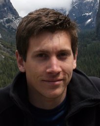 Daniel Jones合作论文数National Oceanography Centre DEEPSEAS Group, George Deacon Division6
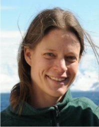 Veerle Huvenne合作论文数National Oceanography Centre6
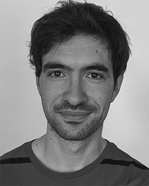 Thomas Prampart合作论文数5
 Andrea Munafo合作论文数Department of Information Engineering, University of Pisa5
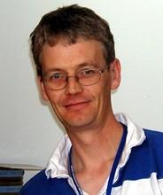 Brian J. Bett合作论文数National Oceanography Centre, University of Southampton5
 Adrian Jenkins合作论文数Geography and Environmental Sciences, Northumbria University4
 Pierre Dutrieux合作论文数School of Ocean and Earth Science and Technology, University of Hawaii4
 Einar Povl Abrahamsen合作论文数British Antarctic Survey4
 Keith W. Nicholls合作论文数Natural Environment Research Council4A Webb合作论文数4Russell B. Wynn合作论文数4
 Davide Fenucci合作论文数3
 Christopher R. German (Chris German)合作论文数Woods Hole Oceanographic Institution3
 Jeff Peakall合作论文数Earth and Biosphere Institute School of Earth and Environment, University of Leeds, Leeds, LS2 9JT, UK3J. P. Wilkinson合作论文数3
 Douglas P Connelly合作论文数National Oceanography Centre, University of Southampton—Waterfront Campus3
 Henry A Ruhl合作论文数3Peter Schultheiss合作论文数3
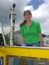 Kirsty J. Morris合作论文数National Oceanography Centre3
 Peter Wadhams合作论文数Department of Applied Mathematics and Theoretical Physics, University of Cambridge3
 P.J. Statham合作论文数3
 David Meldrum合作论文数3MA Brandon合作论文数2EJ SIMMONDS合作论文数2M. R. Price合作论文数2Rob Templeton合作论文数2DG Bone合作论文数2
 Richard Morrison合作论文数2
 David Billett合作论文数National Oceanography Centre;Deep Seas Environmental Solutions Ltd2
 Karen J. Heywood合作论文数School of Environmental Sciences, University of East Anglia2




