The biogeochemistry of seafloor sediments can be significantly altered in response to deoxygenation and eutrophication-driven organic carbon production, resulting in increased benthic fluxes of dissolved nutrients (such as ammonia and phosphate) and metals. The Sea of Marmara, which has also faced large-scale mucilage outbreaks in recent years, is undergoing severe eutrophication and deoxygenation, but the consequences on sediment biogeochemistry and benthic feedback have not been studied so far. This study aims to understand the impacts of deoxygenation and coastal eutrophication on sedimentary biogeochemical processes in the Sea of Marmara, which experiences varying degrees of anthropogenic pressure along with natural inputs from the adjacent Black Sea via Bosphorus surface inflows. Multicore-obtained undisturbed sediment core samples indicate that oxic respiration no longer plays a significant role in Marmara sediments, but denitrification, metal reduction, and sulfate respiration are prevalent as respiratory pathways. The deep-water sediments become more reducing in the Eastern Marmara compared to the Western part of the sea. Cores from & Idot;zmit Bay, the Easternmost region in Marmara, exhibit permanently sulfidic conditions with anaerobic oxidation of methane (AOM) controlling downcore sulfide profiles. Calculated diffusive benthic nutrient fluxes show markedly high phosphate and ammonium fluxes into the near-bottom waters of highly eutrophic areas of the Eastern Marmara, which are expected to enhance primary production in the upper layer during the dry season. On the other hand, these sediments are a net sink for nitrate due to the denitrification. Benthic nutrient dynamics contribute to the accumulation of organic matter as well as shifting N/P ratios and the development of a steep hypoxic zone at halocline boundary depths. Additionally, we show that sediments are already influenced by widespread hypoxia in the Sea of Marmara and benthic-pelagic coupling has enhanced the existing eutrophication problem, analogous to the benthic "vicious cycle" observed in the shallower Baltic Sea. We conclude that the Sea of Marmara is now on a clear path towards being included within the list of famous "dead zones" of the Earth's oceans, such as the Baltic Sea, the Gulf of Mexico, or Chesapeake Bay. For the marine management efforts and ecosystem modeling studies, hypoxia-induced benthic biogeochemical processes and benthic-pelagic coupled cycling of nutrients in the Sea of Marmara should be considered.
The Black Sea is a vital resource with vast potential to boost the societal value of the Blue Economy for its surrounding countries. Improved knowledge and enhanced infrastructure together with better coordination and alignment of research and innovation efforts are critical for the better management of the deteriorated Black Sea ecosystem to help restore and maintain its resilience and enable sustainable use of natural resources. In 2019, the Black Sea Strategic Research and Innovation Agenda (Black Sea SRIA), was developed by the Black Sea experts, in cooperation with European marine institutes and organizations, with the support of the European Commission. Black Sea SRIA presents the priorities and ecosystem-based management options needed for a healthy, sustainable, and resilient Black Sea. Since 2019, efforts focused on developing concrete actions under the Black Sea SRIA Implementation Plan (IP) to contribute to the national blue economy strategies, better structuring of the relevant funding mechanisms for solution-oriented implementation and the international and regional strategies, supporting the co-funding mechanisms. In this study, we present a transnational process that has led to the development of the IP which utilized a bottom-up, co-design and co-creation-based approach. The SRIA and its IP support better governance of the blue economy principles towards sustainable development and conservation of unique Black Sea ecosystems. The Black Sea SRIA and IP address the fundamental research challenges of the region, promote the blue economy, and also build vital support systems and innovative research infrastructure and capacity together with academia, funding organizations, industry, policy, civil society and local communities. The IP is a long-lasting guide to catalyze new ideas and innovations towards and with the Black Sea community with strong implications for other sea basins.
Advection of pelagic fish larvae through ocean currents is a source of dispersal that is known to structure marine populations by directly impacting population success and persistence. To be able to understand fish population dynamics and manage existing fisheries it is therefore of importance to assess the extent of exchange between populations and determine the factors that drive it, which is still a challenge in fisheries research today. In this study, the output of a high-resolution basin-scale circulation model is used to calculate the dispersal probability from spawning areas and the remaining Black Sea for a range of commercially important fish such as anchovy, sprat, turbot, red mullet, and bluefish under different environmental conditions. The common trait of many commercially important species in the Black Sea is that they have pelagic larval stages of different time scales which are simulated by tracking virtual drifters in the simulated surface circulation of the Black Sea. Simulation results show that the dynamic current structure of the Black Sea causes low local retention of larvae. During spring and summer lower offshore transport and higher local retention is observed than in fall and winter, which is directly related to the Rim Current strength. The lowest offshore transport is observed on the northern northwestern shelf, the main spawning area for pelagic fish with still 24-32% of larvae transported offshore. Simulations show that pelagic fish species such as anchovy and sprat adopted different reproductive strategies through their species-specific traits. For the summer spawning species anchovy, timing, and location of spawning together with its short pelagic larval stage is shown to enhance retention on the northwestern shelf. Sprat with its long pelagic larval stage and winter spawning is more adapted to high offshore transport, making it unlikely that sprat is recruited to the same area as where it is spawned. This modeling framework provides a basis for investigating recruitment variability of pelagic fish species in the Black Sea specifically considering the impact of climate variability and provides a useful guide to the potential connectivity of marine populations or the spread of invasive pests in the Black Sea.
Coastal areas are inherently sensitive and dynamic, susceptible to natural forces like waves, winds, currents, and tides. Human activities further accelerate coastal changes, while climate change and global sea level rise add to the challenges. Recognizing and safeguarding these coasts, vital for both socioeconomic and environmental reasons, becomes imperative. The objective of this study is to categorize the coasts of the Mersin and İskenderun bays along the southeastern coast of Türkiye based on their vulnerability to natural forces and human-induced factors using the coastal vulnerability index (CVI) method. The study area encompasses approximately 520 km of coastline. The coastal vulnerability analysis reveals that the coastal zone comprises various levels of vulnerability along the total coastline: 24.7
Abstract Submarine channels are key features for the transport of flow and nutrients into deep water. Previous studies of their morphology and channel evolution have treated these systems as abiotic, and therefore assume that physical processes are solely responsible for morphological development. Here, a unique dataset is utilised that includes spatial measurements around a channel bend that hosts active sediment gravity flows. The data include flow velocity and density, alongside bed grain size and channel‐floor benthic macrofauna. Analysis of these parameters demonstrate that while physical processes control the broadest scale variations in sedimentation around and across the channel, benthic biology plays a critical role in stabilising sediment and trapping fines. This leads to much broader mixed grain sizes than would be expected from purely abiotic sedimentation, and the maintenance of sediment beds in positions where all the sediment should be actively migrating. Given that previous work has also shown that submarine channels can be biological hotspots, then the present study suggests that benthic biology probably plays a key role in channel morphology and evolution, and that these need to be considered both in the modern and when considering examples preserved in the rock record.
ODTÜ Deniz Bilimleri Enstitüsü’nün son 40 yılda R/V Bilim-2 gemisi ile topladığı veriler Marmara Denizi’nin organik madde ve besin tuzları açısından giderek zenginleştiği ve oksijen azlığı (hipoksia) çekmeye başladığını göstermiştir. Marmara Denizi’nin iki tabakalı sistemini oluşturan üst 25-30 metredeki Karadeniz ve altındaki Akdeniz kaynaklı sular, oşinografide haloklin adı verilen keskin bir tuzluluk geçişi ile ayrılmıştır. Haloklin altı sularda özellikle Doğu Marmara›da ciddi hipoksia görülmekte ve artan azot ve fosfor tuzu girdileri ile Marmara Denizi aşırı üretkenlik- ötrofikasyon baskısı çekmektedir. 2021 yılındaki müsilaj patlamasının da temel nedeni Marmara Denizi’nin bu yeni biyojeokimyasal durumu sayılmalıdır. ODTÜ Deniz Bilimleri Enstitüsü koordinasyonunda T.C. Çevre ve Şehircilik Bakanlığı desteği ile yürütülen MARMOD projesi (2017-devam) ile Marmara besin bütçesinde en büyük payın sıra ile yayılı yükler, noktasal deşarjlar ve Karadeniz suyu olduğu sonucuna varılmıştır. MARMOD modelleme sonuçlarına göre karasal girdilerde en az yüzde 40’lık bir azot-fosfor yükü azalımı ile sistem hipoksia eşiğini en az 5-6 yılda aşabilir. Bir başka deyişle, son derece kırılgan bir ekosistem durumuna gelen Marmara Denizi için geriye dönüş mümkündür. Bu nedenle beklenmeden tüm kaynaklarda en güçlü efor ile yük azaltım önlemleri alınmalı ve denize ek besin yükü getirecek her türlü yeni uygulamadan kaçınılmalıdır.
The physical characteristics of water masses in the Cilician Basin were analyzed based on recent, comprehensive in-situ data. Nine seasonal cruises from June 2015 to November 2017 were carried out in an area located in the north-eastern Levantine Basin between the coasts of Turkey and Cyprus. In this little studied area, the structure of the water column, its seasonal variability, and water formation events are investigated. The extensive data set reveals that in summer Modified Atlantic Water (MAW) is observed at about 50 m depth. Saltier and warmer Levantine Intermediate Water (LIW) lies below the MAW between similar to 100 and 250 m. During winter, the water column becomes mixed due to surface cooling and vertical convection, and displays uniform properties from the surface to about 200-300 m depths. The yearly cycle of a vertically uniform water column during winter and the appearance of LIW in the following period suggests that LIW is being formed in this region, which is confirmed through heat and buoyancy flux calculations. It is the first time LIW formation is reported in this area of the north-eastern Levantine Basin and adds to the areas of LIW formation outside Rhodes Gyre. In the 2.5 years of the study, LIW salinity increased by 0.11 psu in 2017, while surface water salinity increased by 0.5 psu over the same period. The presence of meso-scale eddies in the study area is observed throughout the year. The eddies are short-lived, having a time span of a few months, during which they either change location or disappear.
The Mediterranean community represented in this paper is the result of more than 30 years of EU and nationally funded coordination, which has led to key contributions in science concepts and operational initiatives. Together with the establishment of operational services, the community has coordinated with universities, research centers, research infrastructures and private companies to implement advanced multi-platform and integrated observing and forecasting systems that facilitate the advancement of operational services, scientific achievements and mission-oriented innovation. Thus, the community can respond to societal challenges and stakeholders needs, developing a variety of fit-for-purpose services such as the Copernicus Marine Service. The combination of state-of-the-art observations and forecasting provides new opportunities for downstream services in response to the needs of the heavily populated Mediterranean coastal areas and to climate change. The challenge over the next decade is to sustain ocean observations within the research community, to monitor the variability at small scales, e.g., the mesoscale/submesoscale, to resolve the sub-basin/seasonal and inter-annual variability in the circulation, and thus establish the decadal variability, understand and correct the model-associated biases and to enhance model-data integration and ensemble forecasting for uncertainty estimation. Better knowledge and understanding of the level of Mediterranean variability will enable a subsequent evaluation of the impacts and mitigation of the effect of human activities and climate change on the biodiversity and the ecosystem, which will support environmental assessments and decisions. Further challenges include extending the science-based added-value products into societal relevant downstream services and engaging with communities to build initiatives that will contribute to the 2030 Agenda and more specifically to SDG14 and the UN's Decade of Ocean Science for sustainable development, by this contributing to bridge the science-policy gap. The Mediterranean observing and forecasting capacity was built on the basis of community best practices in monitoring and modeling, and can serve as a basis for the development of an integrated global ocean observing system.
Gravity currents are the primary means by which sediments, solutes and heat are transported across the ocean-floor. Existing theory of gravity current flow employs a statistically-stable model of turbulent diffusion that has been extant since the 1960s. Here we present the first set of detailed spatial data from a gravity current over a rough seafloor that demonstrate that this existing paradigm is not universal. Specifically, in contrast to predictions from turbulent diffusion theory, self-sharpened velocity and concentration profiles and a stable barrier to mixing are observed. Our new observations are explained by statistically-unstable mixing and self-sharpening, by boundary-induced internal gravity waves; as predicted by recent advances in fluid dynamics. Self-sharpening helps explain phenomena such as ultra-long runout of gravity currents and restricted growth of bedforms, and highlights increased geohazard risk to marine infrastructure. These processes likely have broader application, for example to wave-turbulence interaction, and mixing processes in environmental flows.
This volume contains the main results of the EC FP7 “The Ocean of Tomorrow” Project CoCoNet, divided in two sections: 1) a set of guidelines to design networks of Marine Protected Areas in the Mediterranean and the Black Seas; 2) a smart wind chart that will allow evaluating the possibility of installing Offshore Wind Farms in both seas. The concept of Cells of Ecosystem Functioning, based on connectivity, is introduced to define natural units of management and conservation. The definition of Good Environmental Status, as defined in the Marine Strategy Framework Directive, is fully embraced to set the objectives of the project, by adopting a holistic approach that integrates a full set of disciplines, ranging from physics to bio-ecology, economics, engineering and many sub-disciplines. The CoCoNet Consortium involved scientist sfrom 22 states, based in Africa, Asia, and Europe, contributing to build a coherent scientific community.
A detailed field investigation of a saline gravity current in the southwest Black Sea has enabled the first complete analysis of three-dimensional flow structure and dynamics of a series of linked hydraulic jumps in stratified, density-driven, flows. These field observations were collected using an acoustic Doppler current profiler mounted on an autonomous underwater vehicle, and reveal that internal mixing processes in hydraulic jumps, including flow expansion and recirculation, provide a previously unrecognised mechanism for grain-size sorting and segregation in stratified density-driven flows. Field observations suggest a newly identified type of hydraulic jump, that is a stratified low Froude number (<1.5–2) subaqueous hydraulic jump, with an enhanced ability to transport sediment downstream of the jump, in comparison to hydraulic jumps in other subaerial and submarine flows. These novel field data underpin a new process-based conceptual model of channel lobe transition zones (CLTZs) that explains the scattered offset nature of scours within such settings, the temporal variations in infill and erosion between adjacent scours, how bed shear stresses are maintained across the CLTZ, and why the locus of deposition is so far downstream of the scour zone.
No detailed information has previously been available on the geological and geophysical characteristics of the sea floor and the underlying strata of Mersin Harbour, Northeastern Mediterranean Sea (Turkey). Continuous resistivity profiling (CRP) and borehole data from Mersin Harbour were used to interpret geoelectric stratigraphy of Neogene-Quaternary sediments in the area. This represents one of few such detailed case studies that have applied these valuable CRP techniques for the purpose of marine stratigraphic imaging. It was found that the Neogene-Quaternary sedimentary succession in the area consists of three geoelectric units (GU1, GU2, and GU3 from base to top). The lowest unit, GU1, has a resistivity value of greater than 20.0 ohm-m and consists of Miocene aged limestone and marl. The middle unit, GU2, is characterized by resistivity values ranging from 3.0 to 20.0 ohm-m. Its thickness is greater than 90 m, with the upper section being composed of stiff clay sequences which are Plio-Pleistocene in age. The uppermost unit, GU3, has resistivity values varying from 1.0 to 3.0 ohm-m. This unit displays a maximum thickness of 15 m, and is composed of Holocene muds together with gravel, sand, silt and clay (sometimes incorporating shells) materials of the Plio-Pleistocene age and their various mixtures, silty/clay limestone, and conglomerate sandstone. Comparisons of the geoelectric units with the depositional sequences interpreted from the available seismic data outwith, but close to, Mersin Harbour reveal that the geoelectric unit GU3 corresponds to the depositional sequences C (mainly Holocene) and B (mainly Plio-Pleistocene). The geoelectric unit GU2 partly correlates with the depositional sequence B which appears to be Plio-Pleistocene in age. The geoelectric unit GU1, which has not been encountered in previous seismic surveys, is a new discovery within Mersin Harbour. Limited correlation between the seismic and resistivity structures in the study area is attributed to differences in the acoustic impedance and resistivity contrasts of sub-bottom layers, as well as the penetration versus resolution performance of the systems.
A specific marine biological data management tool, the Black Sea Mnemiopsis leidyi database system was created within the European Commission 6th framework Black Sea SCENE project for the Black Sea region and is now being supported by the Permanent Secretariat of the Black Sea Commission. The core team of scientists studying M. leidyi in the Black Sea was brought together and all their available M. leidyi data and metadata were loaded into the common database. This works on the Internet and has a simple user interface. It gives Black Sea scientists the option to load all their corresponding data on the database and to use it as an effective tool to work both with M. leidyi and, in future, with other gelatinous organisms' data, including another invasive ctenophore Beroe ovata. All loaded metadata and historical data are available to the entire scientific community. More recent data are available to the team members and with some restrictions - to other scientists.
The Central Basin in the Sea of Marmara is a syntectonic basin related to the evolution of the North Anatolian fault. A well-dated (ca. 15.5-16 ka) homogenite sediment can be used as a marker in three-dimensional depth model calculations, allowing a precise determination of the seafloor subsidence rates during the Holocene. A steady-state model based on the propagation of the rates downward through the basin fill provides a good correlation with the deeper seismic reflection imagery for the past 250 ka but indicates variation of subsidence pattern for older ages. Heat flow measured at the seafloor is affected by sedimentation blanketing effects. Heat flow and subsidence data can only be reconciled if the Central Basin depocenter migrated northward with time. According to that scenario, subsidence and deposition started earlier (ca. 5-3.5 Ma) in the southern subbasin, and an acceleration of subsidence in the northern subbasin occurred at ca. 2.5-1.5 Ma. These results allow us to propose that a southern fault system distinct from the Main Marmara fault is responsible for the southern onset of the subsidence. Changes in the fault network and slip rates are implied during the last 2.5-1.5 Ma despite no apparent change since 250 ka.
The Upper Quaternary seismic stratigraphy and active faults of the Gulf of İzmit were investigated by means of high-resolution shallow seismic profiling data in the source region of 1999 İzmit earthquake. High-resolution seismic reflection data correlated with borehole data indicate that the stratigraphy of İzmit Bay consists of three distinct depositional sequences formed in response to middle Pleistocene-Holocene sea-level changes. Reflector R, separating the pre-Holocene sequences (1 and 2) from the Holocene sequence (3), represents an erosional unconformity produced by the subaerial fluvial erosion of the continental shelves at the time of the last glacial maximum. Occasional, anomalous reflections (acoustic turbidity) observed within the Holocene sequence are interpreted as gas accumulations. The maximum thickness of the Holocene sediments is found to be about 25 m. The isopach map of Holocene sediment implies that the thickness of the Holocene decreases from the east towards the central and western basins of İzmit Bay. Two distinct fault systems are interpreted in İzmit Bay. The main fault system extending roughly in an E-W direction along the Gulf of İzmit is an active right lateral strike slip fault with a normal component. The secondary faults are normal faults striking in different directions and these are identified as being both active and inactive. In addition, prominent compressive features are identified in the seismic cross-sections of some profiles acquired to the east of Hersek Peninsula where the focal mechanisms of the aftershocks of the 1999 İzmit earthquake also reveal predominantly reverse faulting mechanisms, as identified by a local dense seismic network.
 Mustafa Yucel合作论文数7
 Baris Salihoglu合作论文数INSTITUTE OF MARINE SCIENCES;MIDDLE EAST TECHNICAL UNIVERSITY;INSTITUTE OF MARINE SCIENCES, MIDDLE EAST TECHNICAL UNIVERSITY7
 Hasan Orek合作论文数Institute of Marine Sciences, Middle East Technical University6
 Bettina A. Fach合作论文数Center for Coastal Physical Oceanography;Old Dominion University;Center for Coastal Physical Oceanography, Dominion University4
 Ismail Akcay合作论文数Corresponding author.3
 Ozhan Koray合作论文数School of the Coast and Environment, Louisiana State University3
 Jeff Peakall合作论文数Earth and Biosphere Institute School of Earth and Environment, University of Leeds, Leeds, LS2 9JT, UK3
 Mahmut Okyar合作论文数Institute of Marine Sciences, Middle East Technical University3
 Daniel Parsons合作论文数Vice-Chancellor's Office, Loughborough University;Energy and Environment Institute, University of Hull3
 Steve Darby合作论文数Faculty of Environmental and Life Sciences, University of Southampton3
 Esther Sumner合作论文数Southampton Marine and Maritime Institute, Faculty of Engineering and Physical Sciences, University of Southampton3
 Robert Dorrell合作论文数School of Mathematics, University of Bristol3
 Suleyman tugrul合作论文数METU-Institute of Marine Science3
 Emin Ozsoy合作论文数Institute of Marine Sciences, Middle East Technical University3
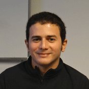 Sinan S. Arkin合作论文数3Russell B. Wynn合作论文数3
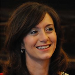 Simona Simoncelli合作论文数Istituto Nazionale di Geofisica e Vulcanologia, Sede di Bologna2
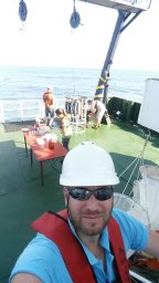 Mantikci Mustafa合作论文数Department of Bioscience, Aarhus University2
 Stanica Adrian合作论文数2Paolo Lazzari合作论文数2
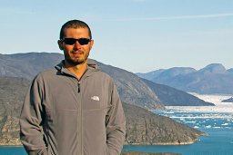 Korhan Ozkan合作论文数Department of Freshwater Ecology, Aarhus University2V. Vladymyrov合作论文数2
 Tamara Shiganova合作论文数Laboratory of Plankton Communities Structure and Dynamics, Shirshov Institute of Oceanology, Russian Academy of Sciences2
 Salud Deudero合作论文数IMEDEA, Univ Balears2
 Levent Bat合作论文数Sackler School of Medicine, Tel-Aviv University2
 Ahmet E. Kideys合作论文数Institute of Marine Sciences, Middle East Technical University2charles smadja合作论文数1Jaime Hernández-Lasheras合作论文数1
 Luminita Buga合作论文数1
 Joaquín Tintoré Subirana合作论文数Sistema de Observación Y Prediccion Costero De Las Illes Balears1
 Nicolae Panin合作论文数National Research - Development Institute for Marine Geology and Geoecology;Romanian Academy;Facultatea de Geologie şi Geofizică, Universitatea din Bucureşti1Z. A. Romanova合作论文数1G. I. Abolmasova合作论文数1Simion Nicolaev合作论文数1inigo losada rodriguez合作论文数1Viorel Malciu合作论文数1Simona Fraschetti合作论文数1Eugen Anton合作论文数1Marc Torner合作论文数1Patrick Farcy合作论文数1Evangelos Papathanassiou合作论文数1Emanuela Voutsinas合作论文数1Miguel Charcos Llorens合作论文数1
 Begona Perez Gomez合作论文数1Enrique Alvarez Fanjul合作论文数1
 Anna Maria Miglietta合作论文数1Volodymyr Myroshnychenko合作论文数1Cristian Munoz Mas合作论文数1Ina Nasto合作论文数1




