Rapid urbanization and land use changes have brought enormous pressure onto the ecological environment. Constructing ecological security patterns (ESPs) contributes to scientifically utilizing ecosystem functions, maintaining biodiversity, and protecting the ecological environment. Thus, this study proposed a regional ESP construction framework, which integrated circuit theory with an ecological security evaluation system composed of a landscape connectivity analysis, an ecosystem service evaluation, and an ecological sensitivity analysis, to generate the ESP of the national-level Chang-Zhu-Tan Metropolitan Area (CZTMA). The results showed that (1) there were 22 ecological sources mainly consisting of woodlands, grasslands, and water bodies and distributed heterogeneously from the eastern to western CZTMA; (2) 48 ecological corridors connected the large-scale ecological patches such as rivers, lakes, wetlands, and woodlands in the CZTMA, and the average distance of the east side was shorter, while the distance of the west side was longer; and (3) 13 ecological pinch nodes and 28 ecological barrier nodes were identified as important nodes. On this basis, this research constructed a multi-level ESP consisting of “one center and multiple cores, one belt and two screens, multiple corridors and multiple nodes” for the CTZMA, which not only guarantees the stability of ecosystems but also maintains their efficiency in providing ecological services and their resistance to the pressure of human activities. Moreover, a series of specific recommendations for the optimization of regional ESPs were provided, including protection of ecological sources and enhancement of their habitat quality, improvement of ecological corridor connectivity, maintenance of pinch nodes, and restoration of barrier nodes. Coordinated mechanisms at the provincial level were proposed. This study could help with ecological conservation and restoration, and strategic planning making in integrated nature–human systems that cross administrative boundaries.
It is of great significance to make overall planning and development based on comprehensive river basin management and strengthen the coordination between river basins and cities and counties.Firstly,from the aspects of logical origin,value resonance and emphasis on action,this paper combs the reality of integrating comprehensive river basin management into territorial space master plan,and reveals that its mode of action is to take water as the main line to systematically govern and repair the elements of land and space,to focus on the control and refinement of land and space protection,to classify and guide and deepen the development of land and space,and to focus on the transmission and control of rigid-elastic combination of base map units.On this basis,starting from the status quo diagnosis,program preparation and program evaluation,a framework for the comprehensive management of the river basin into territorial space master plan is proposed.Among them,the status quo diagnosis stage highlights the resource background;in the stage of plan preparation,spatial coordination is carried out through'control,lead and repair'to promote economic and social development and spatial layout.In the program evaluation stage,the comprehensive effect of program preparation is investigated from two aspects:environmental impact assessment and support capacity assessment.Finally,from the three dimensions of horizontal connection,vertical transmission and policy guarantee,the implementation path and guarantee of the comprehensive management of the river basin into territorial space master plan are put forward.
首先,对"双链"(即产业链和创新链)与生产空间的关系进行辨析,认为生产空间是承载"双链"的场所空间、具有场所属性,而"双链"不仅具有场所属性,还具有功能联系属性,并基于"功能—场所"关系来构建"双链"与生产空间耦合的研究思路.其次,以武汉都市圈为例,采用主导产业的企业点位、用地数据、企业总部—分支机构联系、专利合作等数据来审视成长型都市圈"双链"与生产空间的耦合特征;发现武汉都市圈"双链"与生产空间的场所关系高度耦合、并呈现"强核集聚"的空间格局特征,"功能—场所"关系虽然匹配、但是"双链"与生产空间组织还未从中心城市集聚走向城市区域网络建构.最后,从功能组织、场所组织两个方面出发,分别提出应推进武汉都市圈"双链"网络化功能关系的建构、构建"一核三廊、四新城三组团"的都市圈生产空间格局.
China has achieved success in implementing the rural revitalization strategy and promoting the development of new urbanization. However, there are still many problems in the research and implementation on urban–rural integration development, such as insufficient research at the township level, unclear recognition of development patterns, and disconnection from land-use planning. Therefore, taking Hanchuan city in the Wuhan metropolitan area as a case study, this research constructs a comprehensive evaluation system of urban–rural integration development based on both on the current and potential level of development, and identifies the spatial characteristics and patterns in the study area. This study found that: (1) The comprehensive evaluation result of urban–rural integration development in Hanchuan City shows that a high level of development units are mainly distributed in the northeast and southwest, and gradually decreases from the northeast and southwest, indicating that towns in the central area are relatively weakly driven by the radiation of the surrounding growth poles. (2) Xiannvshan Street, Makou Town, Chenhu Town, and Xinyan Town with the highest comprehensive evaluation values were selected as the centers of urban–rural integration development in four directions. (3) Four typical patterns of urban–rural integration development, which are town gathering, agro-tourism interaction, industry-trade driven, and agricultural service, are derived by the gravity model and classification assignment method according to their respective centers. (4) According to the urban–rural integration development patterns, land-use strategies such as centralization for promoting linkage level of towns, differentiation for arranging various resources and infrastructures, and demonstration for optimization of experience to the whole area are proposed in a targeted manner. This study has important implications for the preparation and implementation of urban–rural integration development and provides effective planning guidance for promoting social equity and accessibility of facilities in the metropolitan area.
Based on the carbon emissions data of 48 districts and counties in the Wuhan city circle from 2008 to 2017, spatial autocorrelation and standard deviation ellipse methods are used to study the spatial-temporal evolution characteristics of carbon emissions from three scales of city circle scale, municipal scale, and county scale. Then, the Tapio decoupling model is used to analyze the relationship between economic development and carbon emissions change at different scales. The results show that:(1) At the city circle scale, the total carbon emissions of the Wuhan city circle continued to increase before 2012, and then gradually stabilized. The decoupling trend between economic growth and carbon emissions of the Wuhan city circle is also generally positive.(2) At the municipal scale, the carbon emissions levels of all cities have stabilized. The carbon emissions levels of Wuhan, Huanggang, and Xiaogan are higher than the average of 9 cities in the Wuhan city circle, and the carbon emissions level of Wuhan is much higher than those of the other 8 cities. The relationship between economic growth and carbon emissions of Tianmen, Xiantao, Xiaogan, and Huanggang has changed from weak to strong decoupling.(3) At the county scale, the carbon emissions of the Wuhan city circle shows significant spatial characteristics of circle distribution. The carbon emissions levels of close circle districts and counties are generally high, while the carbon emissions levels of the core circle and peripheral circle districts and counties are generally relatively low. The circle characteristics of the decoupling state have also appeared, the districts and counties with strong decoupling are mainly located in the core circle and peripheral circle of the Wuhan city circle, and the districts and counties with weak decoupling are mainly located in the close circle. Finally, based on the existing problems of carbon emissions decoupling effect in the Wuhan city circle, the corresponding measures are put forward from the aspects of the circle and polar nucleus, to provide decision-making reference for the high-quality development of the Wuhan city circle and the compilation of relevant planning.
Ecological security is crucial for regional sustainable development; however, as modern urbanization highlights ecological security challenges, major challenges have arisen. In this paper, we take the ecological region around Taihu Lake, China, as a typical research site, extract important ecological sources and key nodes using morphological spatial pattern analysis (MSPA) and circuit theory, and propose a regulatory framework for the ecological security pattern (ESP) of the ecological region based on the spatial characteristics of sources, corridors, and nodes. We obtained the following results: (1) The ESP includes 20 ecological sources, 37 ecological corridors, 36 critical ecological protection nodes, and 24 key ecological restoration nodes. (2) Most ecological sources are large and concentrated in western Zhejiang and west of Taihu Lake, which are both important ecological sources and ecological resistance surfaces. (3) The ecological corridors spread east, west, and south from Taihu Lake, with high network connectivity. (4) Shanghai serves as the central node, with the Su-Xi-Chang town cluster and the Qiantang River town cluster serving as the extension axes for the ecological resistance hot-spot area. The center of the elliptical ecological resistance surface (standard deviation) lies in Suzhou City, located on the east shore of Taihu Lake. (5) Ecological nodes were mostly located in ecological corridors or junctions. A "four zones and one belt" pattern is suggested in order to make the land around Taihu Lake more connected and stable ecologically. This study can be used as a guide for building and improving an ecological safety network.
官方和学术界并未对都市圈的概念内涵形成统一的认识,且在范围划定方面具有较大争议.都市圈起源于美国并从日本传入到我国,概念内涵经历多番演变,对于都市圈范围划定目前主要集中在"1小时交通圈"还是"1小时通勤圈"的讨论.提出将城市群等同于都市圈,将我国的都市圈理解为西方的都市区(圈),将通勤圈(率)作为都市圈范围划定的基本依据以及将都市圈空间范围认作一个固定的政策区域是当前都市圈内涵及范围划定存在的四个误区.数据证明,现阶段我国处于大城市已从中心城、都市区发展向都市圈发展阶段转化的新时期,在此背景下提出都市圈是城市区域协同发展的主要空间范畴,是新时期中国城镇化发展的主要空间形式;都市圈是核心城市及其外围次级城市形成的紧密联系区,是城市群形成的基本构成单元;都市圈范围划定应以一小时交通圈作为基础依据,通勤率作为圈内监测指标;范围划定应参考地区特色和资源禀赋特征,空间范围不宜过大四重认知,为都市圈规划实践及深入研究提供参考.
Metropolitan areas in China are not only the core spatial carriers of urbanization development but also the main generators of land use carbon emission (LUCE). However, existing research lacks comparative studies on the differential patterns and impact factors of LUCE in different stages of metropolitan areas. Therefore, this paper deeply analyzes the spatial characteristics of LUCE and the coupling coordination degree (CCD) of the economy contributive coefficient (ECC) and ecological support coefficient (ESC) in three different stages of metropolitan areas in the Yangtze River Economic Belt (YREB), China. Moreover, quantitative modelling of the impact factors of LUCE in these different stages of metropolitan areas is furtherly revealed. Results show that: (1) The more mature stage of the metropolitan area, the higher the amount of LUCE, and the more districts or counties with high carbon emissions levels are clustered. (2) At the metropolitan area scale, the more mature the metropolitan area is and the lower the CCD between ECC and ESC is, while at the finer scale, more developed counties have lower CCD. (3) Resident population, per capita GDP, and urbanization rate have good explanatory effects on carbon emissions in these three metropolitan areas; however, except for the urbanization rate, which has a negative effect on LUCE in Nanchang metropolitan area (NMA), the other two factors have positive effects on LUCE in these three metropolitan areas. This study has important implications for different stages of metropolitan areas to formulate targeted LUCE reduction policies.
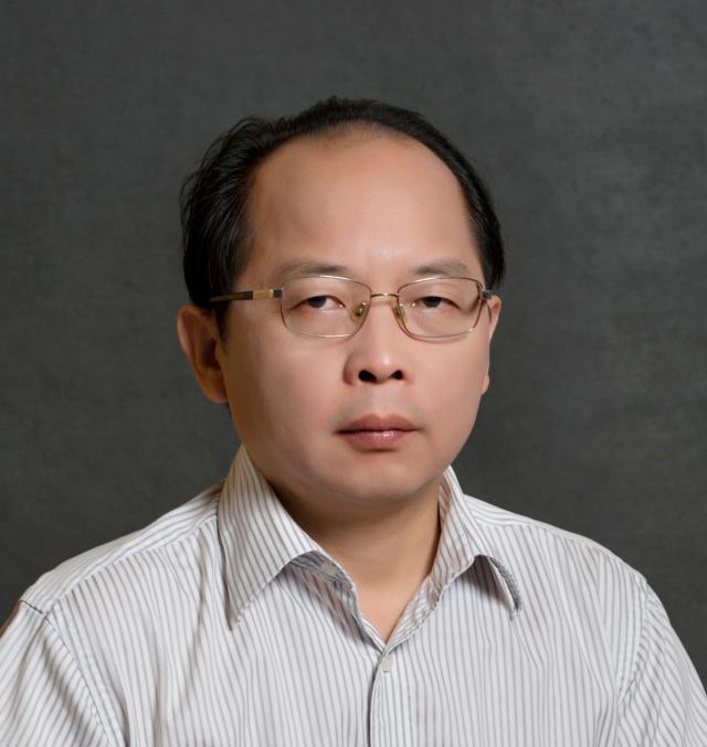 Yaping Huang (黄亚平)合作论文数School of Architecture and Urban Planning, Huazhong University of Science and Technology6
 Shiwei Lu (鲁仕维)合作论文数Department of Urban Planning, School of Architecture and Urban Planning, Huazhong University of Science and Technology5
 ZHU Leizhou (朱雷洲)合作论文数3LaiRong Xie (谢来荣)合作论文数3
 Chunguang Hu合作论文数2Jiawei Zheng (郑加伟)合作论文数2Gaoliu Huang合作论文数1Zhiyong Wang合作论文数1Meng-jie ZHANG (张梦洁)合作论文数1
 Chong Peng (彭翀)合作论文数School of Architecture and Urban Planning, Huazhong University of Science and Technology;College of Design and Engineering, National University of Singapore1




