Laser-ranging provides some of the most precise tests of gravity in the weak-field regime, enabling experimental probes of Einstein's general theory of relativity using the Earth as a laboratory1. A central test of general relativity is the amplitude of frame-dragging, that is, the dragging of spacetime by a rotating mass2-5. Owing to its optimized orbit, a very low surface-to-mass ratio and a highly uniform retroreflector distribution, we show that the recently launched Laser Relativity Satellite 2 (LARES-2)6-together with its predecessor LAGEOS and the GRACE satellites-enables a measurement of terrestrial frame-dragging with a relative uncertainty at the one-part-in-a-thousand level, representing an order-of-magnitude improvement over previous Solar System determinations. This result provides a stringent confirmation of general relativity in the near-Earth environment and places strong constraints on alternative gravitational models that predict deviations specifically in frame-dragging, including scalar-tensor extensions such as Chern-Simons gravity7,8. Beyond tests of fundamental physics, the combined analysis of LARES-2 and LAGEOS also improves the determination of Earth's lunisolar tides, illustrating the broader geophysical impact of high-precision relativistic satellite experiments.
In this paper we treat some aspects of the LARES 2 space experiment to test the general relativistic phenomenon of dragging of inertial frames, or frame-dragging, in particular we discuss some aspects of its relative accuracy which can approach one part in a thousand. We then, once again respond to the criticisms of the author of a recent paper about the accuracy in the measurement of frame-dragging with LARES 2. The claims of such a paper are not reproducible in any independent analyses. Indeed, it claims that the accuracy in the test of frame-dragging, which can be reached by the LARES 2 space experiment, is several orders of magnitude larger than previously estimated in a number of papers. Here we show that such a paper is based on a number of significant misunderstandings and conceptual mistakes. Furthermore, it is puzzling to observe that previous papers by the same author contained completely opposite statements about the accuracy which can be reached using two satellites with supplementary inclinations, such as in the LARES 2 space experiment, and in general with laser-ranged satellites.
LARES 2, successfully launched on July 13, 2022, is a new generation laser-ranged satellite. LARES is an acronym for LAser RElativity Satellite. The first LARES satellite was successfully launched on February 13, 2012 with the ESA-ASI-AVIO launch vehicle VEGA. LARES 2 was injected with extremely high precision onto a high-altitude orbit at about 5900 km altitude with the new ESA-ASI-AVIO launch vehicle VEGA C. Laser-ranged satellites have many applications, including to test Einstein’s theory of general relativity. The main general relativistic phenomenon that LARES 2 will test with high accuracy is the dragging of inertial frames, or frame-dragging. It will also test other aspects and principles of fundamental physics and general relativity, such as the weak equivalence principle at the foundation of viable gravitational theories. Frame-dragging is the name Einstein himself gave in 1913 to an intriguing phenomenon of general relativity which implies that a current of mass-energy, such as the rotation of a body, will generate spacetime curvature. Frame-dragging has a key role in high energy astrophysics, e.g., in the generation of gravitational waves by the collision of two black holes to form a rotating black hole. Frame-dragging by the rotating Earth was measured to a few percent accuracy by combining the data of the satellites LARES, LAGEOS and LAGEOS 2 (Ciufolini et al. in Eur Phys J C 79:872, 2019). LARES 2, thanks to its extremely high injection precision, is projected to improve the test of frame-dragging by at least an order of magnitude. LARES 2 has also relevant applications in space geodesy and geodynamics, e.g., in the study of the shape of the Earth and in the determination of the International Terrestrial Reference Frame (ITRF) by improving the determination of the Earth center of mass and by contributing to a better determination of its rotation axis.
The ILRS contribution to ITRF2020 is a time series of weekly/bi-weekly SINEXs with station position estimates and EOP, from 7-day arcs (1993.0 – 2021.0) and 15-day arcs over 1983.0- 1993.0. Each solution was obtained as the combination of loosely constrained individual solutions from the seven ILRS Analysis Centers: ASI, BKG, DGFI, ESA, GFZ, JCET and NSGF. Everyone followed strict standards agreed within the ILRS Analysis Standing Committee (ASC) and used SLR data from LAGEOS, LAGEOS-2, Etalon-1 and Etalon-2, (LAGEOS-only from 1983 to 1992). The ILRS ASC devised an innovative approach in handling systematic errors in the network, never before utilized. After a 5-year pilot-project documented in Luceri et al., (2019). The Station Systematic Error Monitoring PP (SSEM), delivered a series of long-term mean bias estimates for each station, the time intervals of applicability and their statistics. They were derived from freely adjusted station position and EOP solutions for the period 1993.0 to 2020.5, using the latest satellite CoG model. The simultaneous estimation of the station heights and measurement biases resulted in a self-consistent set of weekly bias estimates for each site. Breaks and “jumps” were used to decne the periods of applicability and to calculate the mean bias and its standard deviation. The mean biases were pre-applied in the re- analysis, limiting the remaining jitter of the bias to negligible level. This approach strengthened the estimation process without a compromise of the cnal results’ accuracy. As a result, the ILRS contribution to ITRF2020 minimized the scale difference between SLR and VLBI to below 2 mm (ITRF2014 ~9 mm). We present an overview of the procedures, models, the improvement over previous ILRS products, focusing especially on the Core ILRS sites, and an overview of how the new model has been implemented in support of the ILRS ogcial products.
The ILRS contributed to the development of ITRF2020 via the combined products submitted to ITRS. The combined products were the result of the combination of individual AC contributions where a new approach in handling systematic errors at the stations was implemented. A set of a priori estimated mean biases was considered for the main period 1993-2020 that includes data from LAGEOS, LAGEOS-2 and the Etalons, whereas an adjusted 15-day average bias at each station for the 1983-1993 period was considered to accommodate systematic and target signature errors, if a priori mean biases were missing. The implementation of ITRF2020/SLRF2020 in SLR operational products required an extended version of the SSEM model, SSEM-X, which led to the finalization of a new DH file. Considering this updated set of long-term mean biases, all ACs produced a solution set based on models used for REPRO2020 and SLRF2020 as input to a combined product intended for the IERS RS/PC at USNO. These EOP series will be used for the calibration of EOP biases prior to the release the final version of the new Bulletin A. The new bias model SSEM-X will be publicly available and maintained current over the coming years.
The LAGEOS 3 (today LARES 2) space experiment was proposed in the eighties by the Physics Department and by the Center of Space Research (CSR) of the University of Texas (UT) at Austin and by the Italian Space Agency (ASI) to test and accurately measure frame-dragging, with the strong support of John Archibald Wheeler, director of the Center for Theoretical Physics of UT Austin. Frame-dragging is an intriguing phenomenon predicted by Einstein’s theory of general relativity which has fundamental implications in high-energy astrophysics and in the generation of gravitational waves by spinning black holes. LAGEOS 3 was reproposed in 2016 to the Italian Space Agency and to the European Space Agency as a technologically much improved version of LAGEOS 3 under the name LARES 2 (LAres RElativity Satellite 2) and then successfully launched in 2022 with the new launch vehicle VEGA C of ASI, ESA and AVIO. Today, after almost 40 years since the original proposal, we report the first results of the LARES 2 space experiment to test general relativity. The results are in complete agreement with the predictions of Einstein’s gravitational theory. Whereas previous results already confirmed the frame-dragging prediction, the conceptual relative simplicity of the LARES 2 experiment with respect to the previous tests with the LARES and LAGEOS satellites provides a significant advance in the field of tests of general relativity.
Geodetic network infrastructure has evolved with increasing pace the past decade with remarkable additions of modern hardware, replacing aging, ‘80s vintage equipment throughout the globe. SLR needs however more than updating the network to deliver the accuracy required today. New and improved design “targets” must also be used that support the required “1-mm accuracy”. LAGEOS was conceived and built in the early ‘70s with a ~5 mm accuracy in mind [Pearlman et al., 2019]. This limitation forced analysts to develop approaches of data analysis to ensure that even with such data one can reach the required 1-mm accuracy [Luceri et al., 2019]. Along with the network updates a parallel effort was thus initiated to modernize the space segment as well. Initially with the design and launch of LARES in 2012 [Pavlis et al., 2015] and following that, the design of LARES-2 [Ciufolini et al., 2017, Paolozzi et al., 2019], which was successfully launched on July 13, 2022 [https://www.nature.com/articles/d41586-022-02034-x]. The new mm-accurate target was quickly acquired first by the Italian station at Matera, only three days after launch and although very early in the mission, the data were of remarkably high quality and insignificant bias. This prompted a quick evaluation and a test inclusion of this target in the limited list of SLR targets supporting the ITRF development. With an orbit nearly identical to LAGEOS (with supplementary inclination), taking full advantage of all the appropriate models designed and applied to LAGEOS, we achieved 7-day orbital fits of 3-5 mm even without a tuned target signature correction. Using the approach described in [Kuzmicz-Cieslak, M. et al., 2022] and along with data from the other geodetic spheres, we have generated preliminary combination products for the development of the ITRF. We will present an overview of this initial analysis of LARES-2 data focusing on comparing these results to contemporaneously taken data from the standard four geodetic spheres only, (LAGEOS 1 & 2 and Etalon 1 & 2).Pearlman et al. J Geod 93, 2181–2194 (2019). https://doi.org/10.1007/s00190-019-01228-yLuceri et al. J Geod 93, 2357–2366 (2019). https://doi.org/10.1007/s00190-019-01319-wPavlis et al. EEEIC (2015), pp. 1989-1994. https://doi.org/10.1109/EEEIC.2015.7165479Paolozzi et al. J Geod 93, 2437–2446 (2019). https://doi.org/10.1007/s00190-019-01316-zCiufolini et al. Eur. Phys. J. Plus 132, 336 (2017). https://doi.org/10.1140/epjp/i2017-11635-1Kuzmicz-Cieslak, M. et al. (2022). https://doi.org/10.22541/essoar.167214343.32185093/v
The member ACs of the ILRS Analysis Standing Committee—ASC, evaluated the preliminary release of ITRF2020—ITRF2020P. For the most part, this evaluation is based on the reanalysis of part or all of the SLR data from geodetic spherical targets in the model; in particular, we focused on the two LAGEOS and two Etalons from 1993 to the end of 2020, extended by one year of data NOT included in the model: all of 2021. The evaluation report was submitted to ITRS for consideration in the finalization of the ITRF2020 model. Some ACs used additional data that do not contribute to ITRF development for testing. The reanalysis used the same improved modeling that was used for the development of the ILRS contribution to ITRF2020. We will focus on the implementation of the new approach in handling systematic errors at the stations and how users will need to adapt their data analysis procedures to benefit the most from the new model. The 2021 ILRS contribution to ITRF2020 minimized the scale difference between SLR and VLBI below 2 mm (ITRF2014 ~9 mm). The reanalysis incorporates an improved “target signature” model (CoG) for better separation of true systematic errors from errors in describing the target’s signature. This model will be periodically updated from now on, so that it represents accurately the state of operations at all sites in the ILRS network of tracking stations. SLR data users should make sure from now on to use each ITRF model with the appropriate (consistent) Data Handling file and “target signature” model. The presentation will provide an overview of the analysis procedures and models, and it will demonstrate the level of improvement with respect to the previous ILRS product series, focusing especially on the Core ILRS sites.
The GGOS Bureau of Networks and Observations works with the IAG Services (IVS, ILRS, IGS, IDS, IGFS, IERS, and PSMSL) to advocate for the expansion and modernization of space geodetic networks for the maintenance and improvement of the reference frame and other applications, as well as for the integration of the techniques. Of particular interest is the integration of gravimetric and tide gauge networks in view of the forthcoming establishment of a new absolute gravity reference frame and of the International Height Reference System/Frame. New sites are being established following the GGOS concept of “core” and co-location sites, and new technologies are being implemented to enhance performance in data yield as well as accuracy. The IAG Committees and Joint Working Groups play an essential role in the Bureau activity. The Standing Committee on Performance Simulations and Architectural Trade-offs (PLATO) uses simulation and analysis techniques to project future network capability and to examine trade-off options. The Committee on Data and Information is working on a strategy for a GGOS metadata system for data products and a more comprehensive long-term plan for an all-inclusive system. The Committee on Satellite Missions is working to enhance communication with the space missions, to advocate for missions that support GGOS goals and to enhance ground systems support. The IERS Working Group on Site Survey and Co-location (also participating in the Bureau) is working to enhance standardization in procedures, outreach and to encourage new survey groups to participate and improve procedures to determine systems’ reference points, a crucial aid in the detection of technique-specific systematic errors. We will give a brief update on the status and projection of the network infrastructure for the next several years, and the progress and plans of the Committees/Working Groups in their critical role in enhancing data product quality and accessibility to the users, scientists and the general community.
The member ACs of the ILRS Analysis Standing Committee—ASC, evaluated the preliminary release of ITRF2020—ITRF2020P. For the most part, this evaluation is based on the reanalysis of part or all of the SLR data from geodetic spherical targets in the model; in particular, we focused on the two LAGEOS and two Etalons from 1993 to the end of 2020, extended by one year of data NOT included in the model: all of 2021. The evaluation report was submitted to ITRS for consideration in the finalization of the ITRF2020 model. Some ACs used additional data that do not contribute to ITRF development for testing. The reanalysis used the same improved modeling that was used for the development of the ILRS contribution to ITRF2020. We will focus on the implementation of the new approach in handling systematic errors at the stations and how users will need to adapt their data analysis procedures to benefit the most from the new model. The 2021 ILRS contribution to ITRF2020 minimized the scale difference between SLR and VLBI below 2 mm (ITRF2014 ~9 mm). The reanalysis incorporates an improved “target signature” model (CoG) for better separation of true systematic errors from errors in describing the target’s signature. This model will be periodically updated from now on, so that it represents accurately the state of operations at all sites in the ILRS network of tracking stations. SLR data users should make sure from now on to use each ITRF model with the appropriate (consistent) Data Handling file and “target signature” model. The presentation will provide an overview of the analysis procedures and models, and it will demonstrate the level of improvement with respect to the previous ILRS product series, focusing especially on the Core ILRS sites.
Geodetic network infrastructure has evolved with increasing pace the past decade with remarkable additions of modern hardware, replacing aging, '80s vintage equipment throughout the globe. The Satellite Laser Ranging-SLR network is the slowest in making changes designed and planned more than a decade ago [Pearlman et al., 2019a]. This is in part due to the voluntary nature of establishing such installations and to a greater part the high cost and limited availability of the one-of-a-kind equipment. NASA, partners and international agencies, embarked on updates with standardization will help in the long term [Merkowitz et al., McGarry et al., Wilkinson, et al., 2019]. SLR needs more than updating the network to deliver the accuracy required today. New "targets" must also be used that support mm-accuracy. LAGEOS was conceived and built in the early '70s with a ~5 mm accuracy in mind [Pearlman et al., 2019b]. This limitation forced analysts to develop approaches of data analysis to ensure that even with such data one can reach the required 1-mm accuracy [Luceri et al., 2019]. Along with the network updates a parallel effort was thus initiated to modernize the space segment as well. Initially with the design and launch of LARES in 2012 [Pavlis et al., 2015] and following that, the design of LARES-2 [Ciufolini et al., 2017, Paolozzi et al., 2019], which was successfully launched on July 13, 2022 [https://www.nature.com/articles/d41586-022-02034-x]. The new mm-accurate target was quickly acquired first by the Matera, Italy station only three days after launch and although very early in the mission, the data were of remarkably high quality and insignificant bias. This prompted a quick evaluation and a test inclusion of this target in the limited list of SLR targets supporting the ITRF development. With an orbit nearly identical to LAGEOS (with supplementary inclination), taking full advantage of all the appropriate models designed and applied to LAGEOS, we achieved 7-day orbital fits of 3-5 mm even without a tuned target signature correction! We will present an overview of the initial analysis of LARES-2 data focusing on comparing them to contemporaneously taken LAGEOS data, we will show results from our initial inclusion of LARES-2 in developing ILRS products for ITRF development and discuss the ILRS plans for its full integration. Ciufolini, Phys. Rev. Lett (1986) Ciufolini, Int. J. of Mod. Phys. A (1989) Pearlman et al., J Geod 93, 2161-2180 (2019a). https://doi.
The International Laser Ranging Service (ILRS) contribution to ITRF2020 has been prepared after the re-analysis of the data from 1993 to 2020, based on an improved modeling of the data and a novel approach that ensures the results are free of systematic errors in the underlying data. This reanalysis incorporates an improved “target signature” model (CoM) that allows better separation of true systematic error of each tracking system from the errors in the model describing the target’s signature. The new approach was developed after the completion of ITRF2014, the ILRS Analysis Standing Committee (ASC) devoting almost entirely its efforts on this task. The robust estimation of persistent systematic errors at the millimeter level permitted the adoption of a consistent set of long-term mean corrections for data collected in past years, which are now applied a priori (information provided by the stations from their own engineering investigations are still taken into consideration). The reanalysis used these corrections, leading to improved results for the TRF attributes, reflected in the resulting new time series of the TRF origin and especially in the scale. Seven official ILRS Analysis Centers computed time series of weekly solutions, according to the guidelines defined by the ILRS ASC. These series were combined by the ILRS Combination Center to obtain the official ILRS product contribution to ITRF2020. The presentation will provide an overview of the analysis procedures and models, and it will demonstrate the level of improvement with respect to the previous ILRS product series; the stability and consistency of the solution are discussed for the individual AC contributions and the combined SLR time series.
The International Laser Ranging Service (ILRS) is improving its services through network expansion and continuous upgrades of its modeling and analysis approaches. New ground stations are being deployed with higher repetition rate systems, more efficient detection, and increased automation; new technologies are also being adopted at some of its legacy stations. In addition, the roster of tracking missions is rapidly expanding. The top priority for the Service continues to be its contribution to the reference frame development, but of increasing importance is also the tracking of GNSS satellites, including the anticipated deployment of the new GPS III constellation over this decade. These requirements are being reflected in new system designs and updates. Stations are also being adapted to accommodate ground and space-time synchronization. A few stations continue with their lunar laser ranging activities while several others have begun testing their ability to do lunar ranging in the future. About a dozen stations are active in space-debris tracking for studies of orbital dynamics and reentry predictions. New tools and procedures have been implemented to improve the quality of SLR data and derived products, and to expedite the resolution of engineering issues. Work also continues on the design and building of improved retroreflector targets to maximize data quality and quantity. This paper will give an overview of activities underway within the Service, paths forward and presently envisioned, and current issues and challenges.
1st International Conference on Complex Information Systems - Volume 1: COMPLEXIS, 131-138, 2016 , Rome, Italy
(1) Harvard-Smithsonian Center for Astrophysics, Cambridge, United States (mpearlman@cfa.harvard.edu), (2) NVI, Inc./NASA Goddard Space Flight Center, Greenbelt MD, United States (dirk.behrend-1@nasa.gov), (3) Jet Propulsion Laboratory/California Institute of Technology, Pasadena, CA, United States (Allison.B.Craddock@jpl.nasa.gov), (4) NASA Goddard Space Flight Center, Greenbelt MD, United States (carey.e.noll@nasa.gov), (5) University of Maryland, Baltimore MD, United States (epavlis@umbc.edu), (6) Institut Géographique National, St. Mande, France (jerome.saunier@ign.fr), (7) PSMSL, National Oceanography Centre, Liverpool, United Kingdom (antt@noc.ac.uk), (8) Politecnico di Milano, Milan, Italy (riccardo.barzaghi@polimi.it), (9) Bundesamt für Kartographie und Geodäsie, Frankfurt, Germany (Daniela.Thaller@bkg.bund.de), (10) GeoForschungsZentrum, Potsdam, Germany (benjamin.maennel@gfz-potsdam.de), (11) Rise Research Institutes of Sweden, Borås, Sweden (sten.bergstrand@ri.se), (12) Institut für Erdmessung, Hannover, Germany (mueller@mbox.ife.uni-hannover.de)
The GGOS Bureau of Networks and Observations works with the IAG Services (IVS, ILRS, IGS, IDS, IGFS, and PSMSL) to advocate for the expansion and upgrade of space geodesy networks for the maintenance and improvement of the reference frame and other applications, as well as for the integration with other techniques, including absolute gravity and sea level measurements from tide gauges. New sites are being established following the GGOS concept of “core” and co-location sites, and new technologies are being implemented to enhance performance in data yield as well as accuracy. The Bureau continues to meet with organizations to discuss possibilities, including partnerships, for new and expanded participation. The GGOS Network continues to grow as new stations join every year. The Bureau holds meetings frequently, providing the opportunity for representatives from the services to meet and share progress and plans, and to discuss issues of common interest. It also monitors the status and projects the evolution of the network based on information from the current and expected future participants. Of particular interest at the moment is the integration of gravity and tide gauge networks and the forthcoming establishment of the new absolute gravity reference frame. The IAG Committees and Joint Working Groups play an essential role in the Bureau activity. The Standing Committee on Performance Simulations and Architectural Trade-offs (PLATO) uses simulation and analysis techniques to project future network capability and to examine trade-off options. The Committee on Data and Information is working on a strategy for a GGOS metadata system for data products and a more comprehensive long-term plan for an all-inclusive system. The Committee on Satellite Missions is working to enhance communication with the space missions, to advocate for missions that support GGOS goals and to enhance ground systems support. The IERS Working Group on Site Survey and Co-location (also participating in the Bureau) is working to enhance standardization in procedures, outreach and to encourage new survey groups to participate and improve procedures to determine systems’ reference points, a crucial aid in the detection of technique-specific systematic errors. We will give a brief update on the status and projection of the network infrastructure of the next several years, and the progress and plans of the Committees/Working Group in their critical role in enhancing data product quality and accessibility to the users.
The International Laser Ranging Service (ILRS) Analysis Standing Committee (ASC) plans to complete the re-analysis of the SLR data since 1983 to end of this year by early 2021. This will ensure that the ILRS contribution to ITRF2020 will be available to ITRS by February 2021, as agreed by all space geodetic techniques answering its call. In preparation for the development of this contribution, the ILRS completed the re-analysis of all data (1983 to present), based on an improved modeling of the data and a novel approach that ensures the results are free of systematic errors in the underlying data. The new approach was developed after the completion of ITRF2014, the ILRS ASC devoting almost entirely its efforts on this task. A Pilot Project initially demonstrated the robust estimation of persistent systematic errors at the millimeter level, leading us to adopt a consistent set of a priori corrections for data collected in past years. The initial reanalysis used these corrections, leading to improved results for the TRF attributes, reflected in the resulting new time series of the TRF origin and scale. The ILRS ASC will now use the new approach in the development of its operational products and as a tool to monitor station performance, extending the history of systematics for each system that will be used in future re-analysis. The new operational products form a seamless extension of the re-analysis series, providing a continuous product based on our best knowledge of the ground system behavior and performance, without any dependence whatsoever on a priori knowledge of systematic errors (although information provided by the stations from their own engineering investigations are always welcome and taken into consideration). The presentation will demonstrate the level of improvement with respect to the previous ILRS product series and give a glimpse of what is to be expected from the development of a preliminary version of the ITRF2020.
 Ignazio Ciufolini合作论文数Department of Engineering for Innovation, Università del Salento61
 Antonio Paolozzi合作论文数Scuola di Ingegneria Aerospaziale, Sapienza Università di Roma44
 Giampiero Sindoni合作论文数Scuola di Ingegneria Aerospaziale, Sapienza Università di Roma31
 J.C. Ries合作论文数28
 Michael R Pearlman合作论文数28
 Claudio Paris合作论文数Universita di Roma28
 Frank Lemoine合作论文数Geodesy & Geophysics Laboratory, Goddard Space Flight Center, National Aeronautics and Space Administration26
 C. Noll合作论文数26Steven M Klosko合作论文数24
 Richard A Matzner合作论文数Department of Physics, College of Natural Sciences, The University of Texas at Austin23
 Magdalena Kuzmicz-Cieslak合作论文数Joint Center for Earth Systems Technology (JCET),, University of Maryland Baltimore County21R. G. Williamson合作论文数19
 Rolf König合作论文数GFZ German Research Centre for Geosciences, Helmholtz Centre Potsdam15
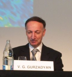 Vahe Gurzadyan合作论文数Yerevan Physics Institute;Yerevan State University13F. J. Lerch合作论文数12b h putney合作论文数11
 Roger Penrose合作论文数Wadham College, University of Oxford;St John's College, University of Cambridge;University College London11
 Stelios P. Mertikas合作论文数11J. W. Robbins合作论文数10V. Luceri合作论文数10Keith Evans合作论文数10
 Lorenzo Iorio合作论文数Ministero dell'Istruzione, dell'Universita e della Ricerca-Istruzione10
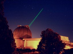 Giuseppe Bianco合作论文数Chirurgia Vascolare d'Urgenza;Cardiologia ed Emodinamica;Cardiologia ed Emodinamica, Chirurgia Vascolare d'Urgenza10Mark H Torrence合作论文数10
 R Steven Nerem合作论文数Ann and H.J. Smead Aerospace Engineering Sciences, College of Engineering & Applied Science, University of Colorado Boulder;Colorado Center for Astrodynamics Research, University of Colorado Boulder10g b patel合作论文数9
 Jerome Saunier合作论文数9Douglas Chinn合作论文数9Ronald Kolenkiewicz合作论文数9PJ DUNN合作论文数8Scott B. Luthcke合作论文数NASA / Goddard Space Flight Center8
 Jan F. Mcgarry合作论文数8Daniela Thaller合作论文数8Stephen M. Merkowitz合作论文数8Zuheir Altamimi合作论文数LAREG/GRGS, Institut Géographique National8M. Kuźmicz-Cieślak合作论文数7
 David Sarrocco合作论文数7Antonio Basoni合作论文数7Despina E. Pavlis合作论文数7Vincenza Luceri合作论文数7
 Daniel Macmillan合作论文数7
 Glynn C. Hulley合作论文数Jet Prop Lab, CALTECH7D. A. Stowers合作论文数6Magda Kuzmicz-Cieslak合作论文数6C. Ma合作论文数6C. M. Cox合作论文数6
 Riccardo Barzaghi合作论文数Politecnico di Milano-DIIAR6Dirk Behrend合作论文数6




