Identification of individuals in complex DNA mixtures remains a challenge for forensic analysts. Recent advances in high throughput sequencing (HTS) are enabling analysis of DNA mixtures with expanded panels of Short Tandem Repeats (STRs) and/or Single Nucleotide Polymorphisms (SNPs). We present the plateau method for direct SNP DNA mixture deconvolution into sub-profiles based on differences in contributors DNA concentrations in the mixtures in the absence of matching reference profiles. The Plateau method can detect profiles of individuals whose contribution is as low as 1/200 in a DNA mixture (patent pending).
Human DNA identification is currently performed by amplifying a small, defined set of short tandem repeat (STR) loci (e.g. CODIS) and analyzing the size of the alleles present at those loci by capillary electrophoresis. High-throughput DNA sequencing (HTS) could enable the simultaneous analysis of many additional STR and single nucleotide polymorphism (SNP) loci, improving accuracy and discrimination. However, it is necessary to demonstrate that HTS can generate accurate data on the CODIS loci to enable backwards compatibility with the FBI NDIS database. Sequencing can also detect novel polymorphisms within alleles that migrate with identical sizes by capillary electrophoresis, improving allele discrimination, and enhancing human identification analysis. All CODIS alleles from an individual can be amplified in a single, multiplex PCR reaction, and combined with additional barcoded samples prior to sequencing. A computational tool for allele identification from multiplexed sequence data has been developed. With longer-read-length platforms, 99.6% allele calling accuracy can be achieved. In the course of STR sequencing protocol development, 12 novel allele sequences have been identified for multiple loci. Sequencing STR loci combined with SNPs will enable new forensic applications.
The ability to predict familial relationships from source DNA in multiple samples has a number of forensic and medical applications. Kinship testing of suspect DNA profiles against relatives in a law enforcement database can provide valuable investigative leads, determination of familial relationships can inform immigration decisions, and remains identification can provide closure to families of missing individuals. The proliferation of High-Throughput Sequencing technologies allows for enhanced capabilities to accurately predict familial relationships to the third degree and beyond. KinLinks, developed by MIT Lincoln Laboratory, is a software tool that predicts pairwise relationships and reconstructs kinship pedigrees for multiple input samples using single-nucleotide polymorphism (SNP) profiles. The software has been trained and evaluated on a set of 175 subjects (30,450 pairwise relationships), consisting of three multi-generational families and 52 geographically diverse subjects. Though a panel of 5396 SNPs was selected for kinship prediction, KinLinks is highly modular, allowing for the substitution of expanded SNP panels and additional training models as sequencing capabilities continue to progress. KinLinks builds on the SNP-calling capabilities of Sherlocks Toolkit, and is fully integrated with the Sherlocks Toolkit pipeline.
DNA sequence analysis has multiple forensic applications. The justice system currently uses sizes of STRs as well as mitochondrial DNA (mtDNA) for DNA evidence. With recent advancements in DNA sequencing technologies, inclusion of additional polymorphic loci, including SNPs, enable new useful analyses while maintaining backwards compatibility with STR sizing. Sherlock's Toolkit, developed by MIT Lincoln Laboratory, is an open source, scalable system for the integration and automation of STR and SNP-based analysis for high-throughput sequence data. The toolkit includes modules for a range of kinship, biogeographic ancestry, replicate, and mixture analyses.
For a forensic identification method to be admissible in international courts, the probability of false match must be quantified. For comparison of individuals against complex mixtures using a panel of single nucleotide polymorphisms (SNPs), the probability of a random man not excluded, P(RMNE) is one admissible standard. While the P(RMNE) of SNP alleles has been previously studied, it remains to be rigorously defined and calculated for experimentally genotyped mixtures. In this report, exact P(RMNE) values were calculated for a range of complex mixtures, verified with Monte Carlo simulations, and compared alongside experimentally determined detection probabilities.
The size and scope of standoff multimodal biometric datasets can be increased through the adoption of a common architecture to collect, describe, archive, and analyze subject traits. The Extendable Multimodal Biometric Evaluation Range (EMBER) system developed by MIT Lincoln Laboratory is a field-ready, easily adaptable architecture to streamline collections requiring multiple biometric devices in environments of interest. Its data architecture includes a fully featured metadata-rich relational database that supports the aggregation of biometric data collected with proliferated systems into a single corpus for analytical use.
This paper discusses selected aspects of an MIT Lincoln Laboratory effort developing information fusion techniques for biodefense decision-support tasks, involving biological standoff (lidar - light detection and ranging) sensors, meteorology, as well as point sensors and potentially other battlespace sensing and contextual information. The Spatiotemporal Coherence (STC) fusion approach developed in this effort combines phenomenology aspects with approximate uncertainty measures to quantify corroboration between the information elements. The results indicate that STC can significantly reduce false alarm rates. Meandering Plume and Background Simulation is one of two techniques developed for ground-truth data generation. Beyond the detection realm, developed techniques include information-fusion based plume mapping and propagation prediction.
This paper discusses some of the techniques developed at MIT Lincoln Laboratory for information fusion of lidar-based biological standoff sensors, meteorology, point sensors, and potentially other information sources, for biodefense applications. The developed Spatiotemporal Coherence (STC) fusion approach includes phenomenology aspects and approximate uncertainty measures for information corroboration quantification. A supervised machine-learning approach was also developed. Computational experiments involved ground-truth data generated from measurements and by simulation techniques that were developed. The fusion results include performance measures that focus explicitly on the fusion algorithms' effectiveness. Both fusion approaches enable significant false-alarm reduction. Their respective advantages and tradeoffs are examined.
Information fusion aims at a synergistic exploitation of multiple information sources, to enable decision-making or to enhance its performance. The sources include sensors of various modalities and characteristics, as well as sources which are not sensors. We discuss the challenges of information fusion, technical directions and approaches that can cope with those challenges, and the opportunities those approaches enable. Several research and development efforts conducted at MIT Lincoln Laboratory over the recent years in the area of information fusion for chemical-biological defense serve as the backdrop for that discussion.
Detection performance of LWIR passive standoff chemical agent sensors is strongly influenced by various scene parameters, such as atmospheric conditions, temperature contrast, concentration-path length product (CL), agent absorption coefficient, and scene spectral variability. Although temperature contrast, CL, and agent absorption coefficient affect the detected signal in a predictable manner, fluctuations in background scene spectral radiance have less intuitive consequences. The spectral nature of the scene is not problematic in and of itself; instead it is spatial and temporal fluctuations in the scene spectral radiance that cannot be entirely corrected for with data processing. In addition, the consequence of such variability is a function of the spectral signature of the agent that is being detected and is thus different for each agent. To bracket the performance of background-limited (low sensor NEDN), passive standoff chemical sensors in the range of relevant conditions, assessment of real scene data is necessary1. Currently, such data is not widely available2. To begin to span the range of relevant scene conditions, we have acquired high fidelity scene spectral radiance measurements with a Telops FTIR imaging spectrometer3. We have acquired data in a variety of indoor and outdoor locations at different times of day and year. Some locations include indoor office environments, airports, urban and suburban scenes, waterways, and forest. We report agent-dependent clutter measurements for three of these backgrounds.
The JPEO-CBD, in conjunction with other members of the defense community, is actively assessing future system architectures for Major Defense Acquisition Programs (MDAPs) such as the Future Combat Systems (FCS). Sensors, networks and information superiority are key elements of FCS, and the JPEO will provide the critical capability that enables complete situational awareness of CB hazards. After a brief overview of the JPEO-CBD program, this paper discusses early insight into how FCS operations and platforms affect CB sensors. Key challenges will be highlighted, such as sensor/platform integration, broad spectrum detection, and sensor performance.
Longwave Infrared (LWIR) data sets collected from airborne platforms provide opportunities for study of atmospheric and surface features in the emissive spectral regime. The transfer of radiation for LWIR scenes can be formulated in a manner that allows recovery of the surface-leaving radiance (a result of atmospheric compensation). Using a forward radiative transfer model, a number of modifications to the atmospheric component of the scene can be made and applied to the surface-leaving radiance to predict sensor radiance that reflects a desired scenario. One such modification is the inclusion of a layer of effluent, the structure of which can be simulated by a plume model. Additionally, a different set of atmospheric conditions can be modeled and used to replace the conditions present in the scene. The resultant scene radiance field can be used to test algorithms for effluent characterization since the composition of the effluent layer and the intervening atmosphere is known. This approach allows for the embedding of a plume layer containing any combination of effluents from a set of over 400 gas spectra, the dispersion of which can be simulated using various plume models. Examples of simulated plume scenes are given, one of which contains an existing plume which is replicated using known emission information. Comparison of the real and simulated plume brightness temperatures yielded differences on the order of 0.2 K.
In order to meet current and emerging needs for remote passive standoff detection of chemical agent threats, MIT Lincoln Laboratory has developed a Wide Area Chemical Sensor (WACS) testbed. A design study helped define the initial concept, guided by current standoff sensor mission requirements. Several variants of this initial design have since been proposed to target other applications within the defense community. The design relies on several enabling technologies required for successful implementation. The primary spectral component is a Wedged Interferometric Spectrometer (WIS) capable of imaging in the LWIR with spectral resolutions as narrow as 4 cm-1. A novel scanning optic will enhance the ability of this sensor to scan over large areas of concern with a compact, rugged design. In this paper, we shall discuss our design, development, and calibration process for this system as well as recent testbed measurements that validate the sensor concept.
We consider the problem of remotely identifying gaseous materials using passive sensing of long-wave infrared (LWIR) spectral features at hyperspectral resolution. Gaseous materials are distinguishable in the LWIR because of their unique spectral fingerprints. A sensor degraded in capability by noise or limited spectral resolution, however, may be unable to positively identify contaminants, especially if they are present in low concentrations or if the spectral library used for comparisons includes materials with similar spectral signatures. This paper will quantify the relative importance of these parameters and express the relationships between them in a functional form which can be used as a rule of thumb in sensor design or in assessing sensor capability for a specific task. This paper describes the simulation of remote sensing datacontaining a gas cloud.In each simulation, the spectra are degraded in spectral resolution and through the addition of noise to simulate spectra collected by sensors of varying design and capability. We form a trade space by systematically varying the number of sensor spectral channels and signal-to-noise ratio over a range of values. For each scenario, we evaluate the capability of the sensor for gas identification by computing the ratio of the F-statistic for the truth gas tothe same statistic computed over the rest of the library.The effect of the scope of the library is investigated as well, by computing statistics on the variability of the identification capability as the library composition is varied randomly.
A systems analysis framework for assessing performance of long wave infra-red (LWIR) hyperspectral chemical imaging sensors (HCIS) is presented. The trade space study includes assessment of HCIS detection sensitivity and deployment impact on meeting specified mission requirements.
The pre-launch ground infrared calibration of the Geostationary Operational Environmental Satellite (GOES) N-Q Imager and Sounder is presented. Ground calibration provides information necessary to the accurate on-orbit calibration of these radiometers. Infrared channels are calibrated in a thermal vacuum environment, under minimum and maximum mission operation temperatures, using a variable-temperature warm target to simulate the Earth scene and a cold target to simulate the space scene. Brightness temperatures derived from observation of the instrument internal calibration target, used for on-orbit calibration, are compared to brightness temperatures of the external calibration target as a check of relative accuracy using these two sources. Changes to the GOES N-Q specification from GOES I-M are highlighted, as well as results of noise, relative calibration accuracy, and spectral response performance to date. For completeness, results of spatial and pointing performance will be presented. Enhancements to test methodology and data processing techniques are highlighted throughout.
The Geostationary Operational Environmental Satellite (GOES) platform carries an infrared atmospheric sounding instrument which is used to obtain vertical profiles of atmospheric temperature and humidity throughout much of the western hemisphere. These profiles are numerically retrieved from measured nadir-viewing spectral radiances. The opacity of clouds to IR radiance makes such instruments functional only in clear-air regions. Because severe weather is associated with clouded regions, it is highly desirable to obtain soundings through holes in the cloud cover and up to the edge of frontal boundaries. There is much difficulty in performing this task with the existing GOES sounder because cloud cover gives rise to radiance errors in adjacent, and more distant, clear-air fields-of-view. A primary cause for this problem is diffraction, which introduces optical crosstalk between fields-of-view, and which is exacerbated by the large radiance contrast between clouds and clear air. This paper describes a novel application of tapered, or apodized, aperture illumination which may be employed in future GOES sounding instruments to mitigate the effects of diffraction. Tapering the aperture illumination at the edges (or applying this taper at accessible pupils, which are images of the aperture stop) reduces the subsidiary rings of the point-spread function. The benefits of pupil apodization are quantified, as are the penalties incurred by effectively making the aperture smaller. The construction of a graded-transmission spatial filter is described, and its optimal location in a sounding instrument based on a Michelson spectrometer is defined. Finally, the results of measurements taken on a fabricated filter are presented.
The process of formulating a remote sensing instrument design from a set of observational requirements involves a series of trade studies during which judgments are made between available design options. The outcome of this process is a system architecture which drives the size, weight, power consumption, cost, and technological risk of the instrument. In this paper, a set of trade studies are described which guided the development of a baseline sensor design to provide vertical profiles (soundings) of atmospheric temperature and humidity from future Geostationary Operational Environmental Satellite (GOES) platforms. Detailed trade studies presented include the choice between an interferometric versus a dispersive spectrometer, the optical design of the IR interferometer and visible imaging channel, the optimization of the instrument spatial response, the selection of detector array materials, operating temperatures, and array size, the thermal design for detector and optics cooling, and the electronics required to process detected interferograms into spectral radiance. The trade study process was validated through simulations of the radiometric performance of the instrument, and through simulated retrievals of vertical profiles of atmospheric temperature and humidity. The flexibility of these system trades is emphasized, highlighting the differing outcomes that occur from this process as system requirements evolve. Observations are made with respect to the reliability and readiness of key technologies. The results of this study were disseminated to industry to assist their interpretation of, and responses to, system requirements provided by the U.S. Government.
 Darrell O. Ricke合作论文数Syngenta, Torrey Mesa Research Institute6Martha S. Petrovick合作论文数5
 Eric Schwoebel合作论文数5
 Johanna Bobrow合作论文数Lincoln Laboratory, Massachusetts Institute of Technology4
 Yan Glina合作论文数3lawrence m candell合作论文数3Jerome J Braun合作论文数3Richard N. Czerwinski合作论文数Lincoln Lab., MIT;c;Lincoln Lab., MIT3Tara Boettcher合作论文数3Shcherbina Anna合作论文数3Timothy J. Dasey合作论文数3
 James Harper合作论文数Alabama Agricultural Experiment Station, Auburn University3Danette P. Ryan-Howard合作论文数3Carolyn A. Upham合作论文数3Juliette A. Seeley合作论文数3Dp Ryan-Howard合作论文数2KELLY MICHAEL W合作论文数2Darryl E. Weidler合作论文数2Hhk Burke合作论文数2monica m coakley合作论文数2
 Karianne J. Bergen合作论文数Department of Computer Science, Brown University2Christina Zook合作论文数2
 Michael Weinreb合作论文数2
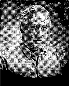 Harry R. Finkle合作论文数2michael k griffin合作论文数2jeanette g baucom合作论文数1
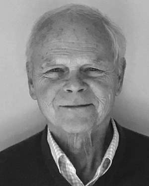 Daniel L. Mooney合作论文数1Nandini Rajan合作论文数1rongrong x johnson合作论文数1joe isaacson合作论文数1Philip Fremont-Smith合作论文数MIT Lincoln Laboratory1James Watkins合作论文数1Strom, D.合作论文数1Pomianowski, P.合作论文数1Joseph Lacirignola合作论文数1Austin R. Hess合作论文数1
 John P. Kerekes合作论文数Lincoln Laboratory;Massachusetts Institute of Technology;Lincoln Laboratory, Massachusetts Institute of Technology1
 Michael I. Jordan (迈克尔·乔丹)合作论文数Department of Electrical Engineering and Computer Sciences, University of California, Berkeley;Department of Statistics, University of California, Berkeley;Department of Industrial Engineering and Operations Research, University of California, Berkeley1
 Curtis Colonero合作论文数1Michael Muldoon合作论文数1Michael Stokely Kelly合作论文数1Roger W. Heymann合作论文数1Su May Hsu合作论文数1Jeanine E. Murphy-Morris合作论文数1
 Alexandre Vallieres合作论文数1G. D. Berthiaume合作论文数1
 Brian Helfer合作论文数MIT Lincoln Laboratory1
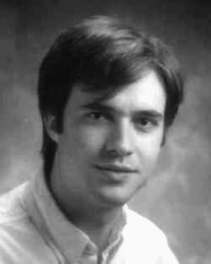 Brian Tyrrell合作论文数1Shen Shey合作论文数1




