Land clearing in the Brazilian Amazon is strongly influenced by the economics of farming at the forest frontier. Here we examine how rising profits from second-season corn, grown after soybeans, may increase pressure on forests in the state of Mato Grosso. We assemble detailed annual data on crop prices, yields, production costs, land values, and forest loss, and construct measures of both per-hectare and regional-level profits from soybean and safrinha corn farming. Using statistical models designed to separate the effects of expected returns from the effects of profit-driven expansion, we show that increases in farm profits raise land prices and are followed by higher levels of forest clearing. These effects persist for several years after a shift in profits. Our results suggest that expanding corn production in frontier regions, by making farming more profitable, fuels land speculation and encourages the clearing of new land.
Sedimentation represents a key risk to the world's artificial reservoirs upon which humans rely to satisfy vital water needs. Improving our understanding of watershed sediment dynamics is crucial in managing water reservoirs, particularly in small, high‐standing tropical islands characterized by high sediment yields. This study addresses such a need by comparing potential contributions from surface erosion on active cropland and rain‐driven shallow landsliding to sediment yields in an artificial reservoir in Puerto Rico for a 60‐year period. The study relied on various data sources including land cover and landslide maps, high‐resolution digital elevation databases, long‐term rainfall data and bathymetric surveys to document the sediment budget of a 43.9 km 2 watershed. Results indicate that sediment delivery associated with landsliding may explain 47–79% of the 1,195 Mg km −2 yr −1 long‐term, watershed‐scale average sediment yield with surface erosion from active cropland capable of sustaining about 20%. Rainfall not directly associated to tropical cyclones appears to be as important as that directly related to named storms in driving landslide mobilization. As cropland cover declined and as the frequency of days with sufficient rainfall to trigger landslides increased through time, the relative importance of landsliding consequently increased and presently appears to be about 85% of sediment yield rates that remain well above background levels. The current high incidence of landsliding in this mostly forested watershed appears to be linked to its abundant rainfall (~1,980 mm yr −1 ; ~0.92 landslide triggering rains per year), high topographic relief (~90% of watershed > 30°) and high road densities (19.4 km km −2 ). Most of the roads are farm access roads and largely represent a legacy of now abandoned agricultural activities, yet they still induce much slope instability that generates significant quantities of sediment.
This Methods article details a survey used to create spatial maps of perceived violence and danger, key indicators of criminal governance, across three Mexican states. This method adds to traditional mapping techniques, which typically only visualize areal data at the municipal level. Criminal governance has been defined as the process by which organized crime groups impose control over territory, population, and resources, often through violence, threats, and bribery. The ability to inflict violence, whether real or imagined, allows groups to establish a persuasive form of communication, solidifying their legitimacy in enforcing rules and claims over territory. The methodology presented here involves conducting surveys to gauge the perceived level of danger in different areas, followed by Geographic Information System (GIS) empirical Bayesian kriging interpolation to generate maps. The study focuses on three Mexican states: Michoacán, Jalisco, and Colima, providing a valuable tool for understanding the relationship between perceived criminal violence reputation and various socio-economic and legal outcomes, especially in the Mexican context. The paper also discusses potential improvements and adaptations of the methodology for broader applicability and acknowledges its limitations.
Climate change and land use change are two main drivers of global biodiversity decline, decreasing the genetic diversity that populations harbour and altering patterns of local adaptation. Landscape genomics allows measuring the effect of these anthropogenic disturbances on the adaptation of populations. However, both factors have rarely been considered simultaneously. Based on a set of 3660 SNPs from which 130 were identified as outliers by a genome-environment association analysis (LFMM), we modelled the spatial turnover of allele frequencies in 19 localities of Pinus leiophylla across the Avocado Belt in Michoacán state, Mexico. Then, we evaluated the effect of climate change and land use change scenarios, in addition to evaluating assisted gene flow strategies and connectivity metrics across the landscape to identify priority conservation areas for the species. We found that localities in the centre-east of the Avocado Belt would be more vulnerable to climate change, while localities in the western area are more threatened by land conversion to avocado orchards. Assisted gene flow actions could aid in mitigating both threats. Connectivity patterns among forest patches will also be modified by future habitat loss, with central and eastern parts of the Avocado Belt maintaining the highest connectivity. These results suggest that areas with the highest priority for conservation are in the eastern part of the Avocado Belt, including the Monarch Butterfly Biosphere Reserve. This work is useful as a framework that incorporates distinct layers of information to provide a more robust representation of the response of tree populations to anthropogenic disturbances.
Water scarcity and competition between water users in Texas have been driven by shifting demands and variable supplies for decades. Despite water scarcity in many parts of the state, the academic literature focuses primarily on the Rio Grande and Edwards Aquifer markets. With urban water demand projected to outpace agriculture for the first time by 2060, this article examines surface water market activity across Texas to better understand where transactions have occurred, the scale of transactions, and the factors driving transactions. We construct an original transactions database of over 2350 individual surface water transactions between 1987 and 2022, spanning 13 major basins and reallocating over 4 million acre-feet (AF) (4.9 billion m3) of water at a total price of $1.3 billion USD. We test the statistical relationships between different types of variables, such as biophysical factors (e.g., drought, precipitation) economic and social factors (e.g., commodity prices, population growth), with water market activity. Results demonstrate that transactional activity has increased over the past decade, and it has also spread across diverse contexts. We illustrate how different basins have different “signatures” of transactions, namely different mixes of drivers and patterns of trade, which have implications for policy. We find that groundwater levels, temperature, and commodity prices for rice and cotton are significant predictors of water transactions. By examining the diverse water market activity in Texas, this study shows how past investments in water market institutions have enabled the establishment of markets tailored to basin characteristics, while also emphasizing the need for institutions and governance arrangements that fit well with local conditions.
The Caribbean has displayed a capacity to fulfill climate change projections associated with tropical cyclone-related rainfall and flooding. This article describes the hydrometeorological characteristics of Hurricane Fiona in Puerto Rico in September 2022 in terms of measured and interpolated rainfall and observed peak flows relative to previous tropical cyclones from 1899 to 2017. Hurricane Fiona ranks third overall in terms of island-wide total rainfall and fourth in terms of daily rainfall. Maximum daily rainfall during Hurricane Fiona exceeded those previously reported (excluding Hurricane María in 2017) in the eastern interior and eastern portions of the island. In terms of peak flows, no value approached the world’s or Puerto Rico’s flood envelope, although 69% of the observations are considered ‘exceptional’. About 26% and 29% of all peak flows were in the 5–10 year and 10–25 year recurrence interval ranges, respectively, yet none matched the 25-year levels. The highest peak flows were concentrated in the central-eastern and southeastern regions. Even though Hurricane María provoked a more extreme hydrometeorological response, some of Hurricane Fiona’s hydro-meteorological characteristics were among the highest ever recorded in Puerto Rico, particularly for the south-central and eastern portions of the island, and it displayed the island’s current level of vulnerability to extreme rainfall.
Brazil is one of the largest suppliers of commodities in the world, partly due to the agricultural expansion in the Brazilian savannas (also known as Cerrado) that began in the 1970s. However, as areas with better soil and climate for agriculture become scarce, farmers have been advancing to the ecotone between the savanna and xeric shrubland, where precipitation is less reliable for rainfed agriculture. The expected increase in temperature will lead to extended drought periods, with negative consequences for surface and groundwater resources. This study explores the hazards associated with making land-use decisions based on current climatology in regions where projected increases in temperature and reductions in water availability are anticipated to pose significant challenges to rainfed agriculture in the Brazilian Cerrado biome. We modeled future farmland expansion and how that matches with future climate change predictions (2016–2046). According to our estimates, at least 129 thousand km2 of cropland and 418 thousand km2 of pastures will be added in places with projected higher annual temperatures ranging from 26–30 °C. This is equivalent to ~60% of the current agricultural areas, and a novel agro-climatology will emerge for the Cerrado biome. Therefore, we discuss the agro-environmental policies that are pushing and pulling farmland expansion in the Cerrado. For instance, payments for environmental services could support the conservation of native vegetation on private land in regions with the highest temperature increases and deforestation risks. Moreover, in areas with expected reduced water yields, such as in the western Cerrado, the protection of riparian vegetation and strict regulation of water use could mitigate future risks to agriculture.
Forest management aimed at the sustainable use of forest resources is an alternative land use to deforestation and can improve forest conservation in tropical regions. The construction of forest infrastructure, including forest roads, skid trails, and log-landings, is a key factor in minimizing the impacts and forest disturbances typically caused by selective logging activities in tropical forests. In this study, we used field and secondary data to assess the planned and implemented forest infrastructure in a study site of 5723 hectares under a forest concession in the Caxiuanã National Forest, located in the state of Pará, Brazilian Amazon. We tested alternative modeling approaches (the Tomlin and Spanning Tree models) by comparing them with the previously planned and implemented logging infrastructure by a concessionaire timber company (CEMAL Ltd.) in the study site. Our results indicate that the Tomlin model was the best approach for allocating forest roads in the study area, as it demonstrated the optimal balance between financial costs and forest disturbances for timber extraction. Additionally, Minimum Spanning Tree modeling achieved the most favorable results in delineating secondary roads and skid trails in the study site, despite slightly higher financial costs compared to the minimum acceptable costs. This alternative approach to modeling forest infrastructure can contribute to reducing forest disturbances and increasing the economic and ecological sustainability of forest management in tropical forests.
In principle, aid from donor organizations to developing countries should be based on need and the likelihood of positive impact, but political biases may intrude into deci-sions about aid allocations. This article elaborates a theory about why a particular form of bias, one based on partisan affiliations, can affect where aid goes and whether the goals of aid are met. Party networks can facilitate coordination of decisions and leverage bureau-cratic capacity, but they can also ensure that resources, such as aid, stay in the control of copartisans to boost reelection goals. The empirical analysis evaluates whether partisan bias is evident in the locations and impact of World Bank agricultural aid to India. The authors analyze georeferenced data on aid projects, election results, and cropland coverage at the levels of state parliamentary electoral constituencies and administrative districts from 1995 to 2008. They find that alignment between local legislators and the political parties that govern state and national governments is associated with a greater number of new aid projects and with anomalous changes in cropland coverage. The evi-dence is consistent with arguments that partisan bias works primarily through patronage to achieve strategic party goals.
Contested Conference Locations:Perspectives on the 2024 AAG and CLAG Meetings Martha G. Bell, Jessica Budds, Gabriela Valdivia, Jörn Seemann, John C. Finn, and Eugenio Arima Both the 2024 american association of Geographers (AAG) and Conference of Latin American Geography (CLAG) meetings will be held on island locations with complicated relationships with the U.S. Government: Hawai'i and Puerto Rico, respectively. The AAG meeting, in particular, has sparked much debate within the geographic community. Concerns about holding the AAG in Hawai'i are varied. The distance from the continental U.S. means that costs are higher, flights are longer, and carbon emissions are increased for many participants, especially those from the mainland U.S. and Europe–although not necessarily for those from Hawai'i, Oceania, or East Asia. Registration and accommodation prices are also higher than usual, complicating access for many members. Still, the most contentious aspects pertain to the colonial context and the history of the relationship between native communities and the U.S. government and "main-lander" visitors, exacerbated by the recent disastrous wildfire that damaged Lahaina. A former chair of the AAG Indigenous People's Specialty Group, Deondre Smiles, even went so far as to tweet that Indigenous Hawaiians (Kānaka Maoli) did not want visitors to come to Hawaiʻi for the AAG (Lave, 2023). The official AAG response, via current president Rebecca Lave (Lave, 2023), is robust and multi-faceted, and has been followed closely by much of the membership. While recognizing that the conference location was selected in 2016, well before her term as president, Lave explained that cancellation fees would severely affect the AAG's resources. She promised additional travel grants as well as a shift to an increasingly hybrid format, which includes remote participation as well as in-person engagement at regional "nodes." These measures would improve accessibility for a range of participants as well as reduce carbon emissions. One of the most interesting parts of the response is the conversation about the relationship between the AAG's annual meetings and the places where these are held. According to Lave, the AAG has undertaken extensive discussion with Hawaiian geographers about how the meeting could be made (more) acceptable to diverse local communities. The AAG will also include much more education about Hawai'i in the lead-up to the meeting, to strengthen the connection between the conference attendees and the local context (AAG, 2023a). The CLAG San Juan meeting was announced at the conclusion of the 2023 [End Page 8] Tucson meeting. While Puerto Rico appeals as a more centrally located meeting point in the Americas, its proximity does not necessarily mean greater accessibility for all. And like Hawai'i, Puerto Rico's historical relationship with the U.S. raises important questions about how to be "good guests" (Lave, 2023), for example, being mindful of our surroundings and educating ourselves about ongoing struggles over sovereignty, self-determination, and environmental change. The conference will be held in historic buildings in the old town, a setting that will provide perspectives on the complex colonial history of the island, and an area that nowadays is more expensive and mainly used for tourism (part of it is a beachfront). Few budget hotels exist, and availability of private accommodation is also limited (exacerbated by the fact that the conference is taking place over a holiday weekend). Attendees on a budget will be encouraged to book cheaper accommodation outside the old town and commute. More information is available via the CLAG website (CLAG, 2023). As of the current date, there have been no public discussions about the choice of location in the context of issues around the U.S.–Puerto Rico relationship. However, unlike the AAG meeting, CLAG is frequently held in Latin American locations, and always organized in close collaboration with, and often at the direct invitation of, local colleagues, so perhaps this choice is less unusual and less likely to be controversial. As is traditional for CLAG, connections with the meeting place will be fostered by the participation of local geographers as well as through multi-day field trips following the conference. Whether cues are taken from the AAG to foster a closer...
The rapid expansion of avocado cultivation in Michoacán, Mexico, is one of the drivers of deforestation. We assessed the degree of fragmentation and functional connectivity of the remaining temperate forest within the Avocado Belt and prioritized patches that contribute the most to connectivity using a network-based approach and modelling different seed and pollen dispersal scenarios, including two types of patch attributes (size and degree of conservation). As landscape transformation in the region is rapid and ongoing, we updated the land-use and land-cover maps through a supervised classification of Sentinel-2 imagery, improving the reliability of our analyses. Temperate forest is highly fragmented within the region: most patches are small (<30 ha), have a reduced core-area (28%), and irregular shapes. The degree of connectivity is very low (0.06), dropping to 0.019 when the degree of conservation of patches was considered. The top 100 ranked patches of forest that support the connectivity of seeds and pollen have different characteristics (i.e., size and topology) that may be considered for implementing conservation and management strategies. Seed dispersal seems to be more threatened by fragmentation than pollen dispersal, and patches that are important for maintaining seed connectivity are embedded in the denser zone of avocado orchards.
Humans place strong pressure on land and have modified around 75% of Earth’s terrestrial surface. In this context, ecoregions and biomes, merely defined on the basis of their biophysical features, are incomplete characterizations of the territory. Land system science requires classification schemes that incorporate both social and biophysical dimensions. In this study, we generated spatially explicit social-ecological land system (SELS) typologies for South America with a hybrid methodology that combined data-driven spatial analysis with a knowledge-based evaluation by an interdisciplinary group of regional specialists. Our approach embraced a holistic consideration of the social-ecological land systems, gathering a dataset of 26 variables spanning across 7 dimensions: physical, biological, land cover, economic, demographic, political, and cultural. We identified 13 SELS nested in 5 larger social-ecological regions (SER). Each SELS was discussed and described by specific groups of specialists. Although 4 environmental and 1 socioeconomic variable explained most of the distribution of the coarse SER classification, a diversity of 15 other variables were shown to be essential for defining several SELS, highlighting specific features that differentiate them. The SELS spatial classification presented is a systematic and operative characterization of South American social-ecological land systems. We propose its use can contribute as a reference framework for a wide range of applications such as analyzing observations within larger contexts, designing system-specific solutions for sustainable development, and structuring hypothesis testing and comparisons across space. Similar efforts could be done elsewhere in the world.
Sediment mobilization by rain-driven landslides tends to be responsible for the relatively high sediment yields of high-standing islands within tropical cyclone corridors where sediments represent a threat to water reservoirs and marine environments such as coral reefs. An opportunity to quantify sediment releases and delivery to streams by shallow landslides emerged as a consequence of the precipitation associated with Hurricane Maria in 2017 within the predominantly metamorphic Rio Loco watershed in western Puerto Rico. Aerial photo interpretation and high-resolution digital elevation models representing conditions before and after the hurricane were used to map and quantify the volume of individual landslide scars. The 642 landslides mapped were estimated to have mobilized 40,640-78,530 Megagrams (Mg) of sediment for an overall denudation of 1.6-3.0 mm, and with -30 % of the sediment being delivered to the stream network. Susceptibility to landslides was controlled by slope, lithological-soil substrate, land cover, and distance to roads. Landslide mobilization during this single rainstorm equaled 10-35 years of sediment production by surface erosion on croplands and 0.8 to 2.3 years of watershed-scale sediment delivery. However, area-normalized mobilization for Rio Loco (1870-3620 Mg km-2) was lower than that on the adjacent Rio Yauco-Lago Lucchetti watershed (5260-9960 Mg km-2), even though the two watersheds share similar topographic relief and had similar precipitation amounts during Hurricane Maria. The difference between the two areas is related to the dominance of serpentinite rocks within Rio Loco (69 % of the watershed), a rock type that weathers into soils that are not apt for the type of coffee and mixed-crop cultivation that is typical of the central-western highlands of Puerto Rico. As a consequence, portions of the Rio Loco watershed underlain by serpentinite are predominantly forested and have a relatively low road density (-7 km km-2) in comparison to actively-cultivated areas that are underlain by intrusive rocks within Rio Loco (22 km km-2) and Rio Yauco-Lago Lucchetti (-21 km km-2). Given the importance of proximity to roads in inducing landsliding, the lower road densities in Rio Loco led to relatively lower watershed-scale sediment mobilization rates than in Rio Yauco-Lago Lucchetti during Hurricane Maria. The results highlight the diversity of geomorphic response to the same rainstorm, in this case driven by lithological substrate controls on past and present land use and road building.
As demand for avocado climbs, avocado production in Michoacán—Mexico’s biggest avocado growing region—expands into new places. We use a spatial probit model to project the geographic distribution of likely future avocado expansion and analyze those results to determine (a) threats to specific forest types and (b) how the distribution of avocado is shifting spatially under current and future climate scenarios. Our results suggest that avocado expansion in Michoacán is strongly driven by distance to existing agriculture, roads, and localities, as well as the dwindling availability of Andosol soils. As future expansion ensues, it presents risk of forest loss across various forest types, with pine-oak forest, mesophilic montane forest, and oyamel fir forest being of particular concern. Moreover, our results suggest that avocado production will occupy wider ranges in terms of temperature, precipitation, slope steepness and soil. The model predicts that climate change will alter the spatial distribution of avocado plantings, expanding into forest types at lower and at higher elevations. Forest loss threatens ecosystem degradation, and a wider avocado crop production footprint could lead to orchard establishment into dwindling forests that host a high diversity of native oaks and charismatic species, including the monarch butterfly.
 Robert Walker合作论文数School of Natural Resources and the Environment, University of Florida;Department of Geography, University of Florida;Nucleo de Meio Ambiente, Federal University of Para36
 Marcellus M. Caldas合作论文数Department of Geography and Geospatial Sciences, College of Arts and Sciences, Kansas State University20
 Stephen Perz合作论文数Department of Sociology and Criminology & Law, College of Liberal Arts and Sciences, University of Florida;Center for Latin American Studies, University of Florida;School of Natural Resources and Environment, University of Florida19
 Cynthia Simmons合作论文数University of Calgary13
 Paulo Barreto合作论文数IMAZON Amazon Institute of People and the Environment12
 Stephen P Aldrich合作论文数Department of Earth and Environmental Systems, Indiana State University11
 Gabriela Valdivia合作论文数9
 Jessica Budds合作论文数Engineering and Development Centre;Loughborough University;Engineering and Development Centre, Loughborough University9
 Martha G. Bell合作论文数9Jörn Seemann合作论文数8John. Finn合作论文数8
 Richards Peter合作论文数Institute for the Study of Environment and Society, Brown University7Ritaumaria Pereira合作论文数7
 Dante Vergara合作论文数Department of Geography;Michigan State University;Department of Geography, Michigan State University7Carlos E. Ramos Scharrón合作论文数6a verissimo合作论文数6
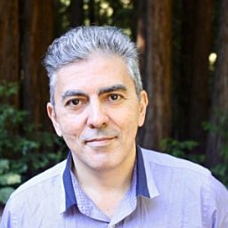 Carlos M. Souza Jr.合作论文数Instituto do Homem e Meio Ambiente da Amazônia (IMAZON), Belém, Pará, Brazil5p barreto合作论文数4
 Alexander Pfaff合作论文数Sanford School of Public Policy, Duke University4
 Eustaquio Reis合作论文数IPEA4Claudio Bohrer合作论文数4j b da veiga合作论文数3
 Isabel Gutierrez- Montes合作论文数3Michael Waylen合作论文数3Britaldo Soares Filho合作论文数3Diana Tung合作论文数3
 Kenneth R. Young合作论文数Department of Geography and the Environment, College of Liberal Arts, University of Texas at Austin3
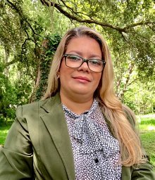 Aghane Antunes合作论文数Dept Geog, Univ Florida3Alan Marcus合作论文数3
 González-Rodríguez Antonio合作论文数Ctr Invest Ecosistemas, Univ Nacl Autonoma Mexico3
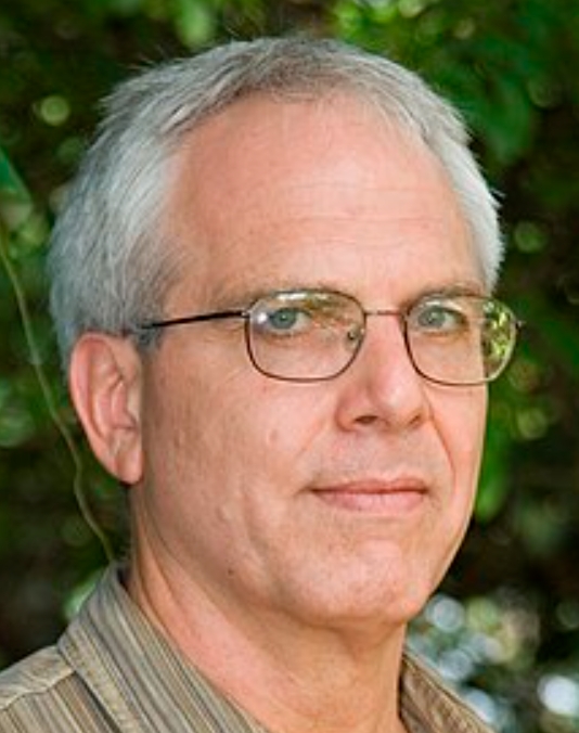 William Laurance合作论文数Centre for Tropical Environmental and Sustainability Science, James Cook University3
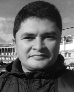 Marcio H. Sales合作论文数3F. Wittmann合作论文数Biogeochemistry Department, Max Planck Institute for Chemistry3
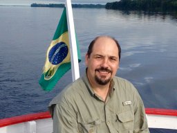 Edgardo M. Latrubesse合作论文数Centro de Investigaciones Geológicas-CIG-LATYR-CONICET;Universidad Nacional de La Plata-FCNyM3
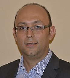 Juan Robalino合作论文数Research Program in Economics and Environment for Development, CATIE3
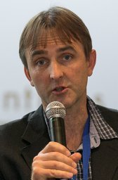 Dietmar Stoian合作论文数Institute of Forest Policy3p g g de matos合作论文数2c m k h de freitas合作论文数2k mayrand合作论文数2x sala i martin合作论文数2g jimenez porras合作论文数2c m v c de almeida合作论文数2g c v da silva合作论文数2a m de brito合作论文数2j a mcneely合作论文数2b louman合作论文数2h d lau合作论文数2g p c azevedo合作论文数2e da cruz cardoso合作论文数2




