Systematic surveys of marine birds from ships were first conducted by the Canadian Wildlife Service (CWS) in Atlantic Canada in 1965, and then expanded to the Canadian Arctic in 1969 under PIROP (Programme intégré de recherches sur les oiseaux pélagiques). PIROP surveys ended in 1992, then resumed in 2006 under the Eastern Canada Seabirds at Sea (ECSAS) program with an updated survey protocol. Surveys under both monitoring programs were conducted from a variety of ship types engaged in scientific, transport, and supply activities, totalling over 120,000 km within sub-Arctic and Arctic Canada waters and over a million marine birds observed, primarily northern fulmar (Fulmarus glacialis), black-legged kittiwake (Rissa tridactyla), thick-billed murre (Uria lomvia), and dovekie (Alle alle). The data collected inform offshore ecological inquiries, environmental impact reviews, mortality estimates from accidental oil releases, and define areas in need of protection. Although surveys were designed to quantify seabird distribution within the waters of eastern Canada, the data also include sightings of non-avian taxa that are made publicly available. Long-term and large-scale monitoring programs will remain essential for assessing the status and health of Canada’s marine birds, including surveys that take place at sea where these species spend most of their time.
Conservation of mobile organisms is difficult in the absence of detailed information about movement and habitat use. While the miniaturization of tracking devices has eased the collection of such information, it remains logistically and financially difficult to track a wide range of species across a large geographic scale. Predictive distribution models can be used to fill this gap by integrating both telemetry and census data to construct distribution maps and inform conservation goals and planning. We used tracking data from 520 individuals of 14 seabird species in Atlantic Canada to first compare foraging range and distance to shorelines among species across colonies, and then developed tree-based machine-learning models to predict foraging distributions for more than 5000 breeding sites distributed along more than 5000 km of shoreline. Despite large variability in foraging ranges among species, tracking data revealed clusters of species using similar foraging habitats (e.g., nearshore vs. offshore foragers), and within species, foraging range was highly colony-specific. Even with this variability, distance from the nesting colony was an important predictor of distribution for nearly all species, while distance from coastlines and bathymetry (slope and ruggedness) were additional important predictors for some species. Overall, we demonstrated the utility of tree-based machine-learning approach when modeling tracking data to predict distributions at un-sampled colonies. Although tracking and colony data have some shortcomings (e.g., fewer data for some species), where results need to be interpreted with care in some cases, applying methods for modeling breeding season distributions of seabirds allows for broader-scale conservation assessment. The modeled distributions can be used in decisions about planning for offshore recreation and commercial activities and to inform conservation planning at regional scales.
Impoundment of hydroelectric reservoirs deeply modifies habitats available for waterfowl because it involves transforming a fast-flowing river, its tributaries and nearby ponds and wetlands into a large body of water. Using a Before-After-Control-Impact design, we evaluated whether the creation of the Peribonka reservoir, a steep-sloped hydroelectric reservoir with low water level fluctuations, affected the abundance and species composition of waterfowl breeding pairs and broods in the area. We used helicopter-based waterfowl survey data covering a period of 2 years before and a period of 10 years after the creation of the reservoir. We also used 9 5x5 km plots and 72 km of river as control sites. Our results show that breeding pair density slightly increased after impoundment, while brood density increased significantly (sixfold), especially for Common Goldeneye (Bucephala clangula). This suggests that there were favorable habitat gains for waterfowl after impoundment, probably due to low water level fluctuations and localized areas of shallow water, and that mitigation measures likely helped to reduce the impact of the project. Because this BACI study ended 10 years after impoundment, it remains difficult to ascertain whether conditions in the Peribonka reservoir have stabilized or are still evolving.
Seabirds in the St. Lawrence Gulf and Estuary are vulnerable to anthropogenic threats such as oil spills and fisheries bycatch. A better understanding of their at-sea distribution is needed to determine occurrence and abundance hotspots where protection and conservation efforts should be concentrated. The goal of this study was to develop an at-sea distribution map of Razorbills (Alca torda) during the breeding period throughout the St. Lawrence to respond efficiently in the event of an environmental emergency. We tracked breeding Razorbills using GPS transmitters (n = 58) in six colonies located in the province of Quebec along the St. Lawrence between 2015 and 2018. Two sets of models and maps (habitat suitability and density) were developed for Razorbills from GPS locations and a set of eight environmental covariates using a machine-learning approach (boosted regression trees). We then predicted at-sea habitat suitability and density around all known and active Razorbill colonies throughout the St. Lawrence (n = 85). The main covariates affecting habitat suitability and density of Razorbills were distance to the colony and distance to shore. Sea surface temperature and chlorophyll -a concentration were also important for habitat suitability. The model allowed generating at-sea maps for the entire targeted area during the breeding period. We identified large areas of high suitability (hotspots) to determine locations where Razorbills are most at risk and where conservation efforts should be focused. This work will be important to assess risk and minimize impacts in the case of an environmental emergency such as oil spills occurring in the St. Lawrence.
We present R2MCDS, an R package that provides tools to call the multiple-covariate distance sampling (MCDS) engine from the Distance 6.2 software in the R environment. We built R2MCDS for the analysis of line transects data collected using distance intervals. Based on the user inputs, the package writes a command file, runs the MCDS engine and re-imports the resulting statistics file as an R object. The package is particularly useful when the user wants to repeat the same distance analysis, as in multi-species surveys. We demonstrate the applicability of the package for multi-species surveys using data from the Eastern Canada Seabirds at Sea (ECSAS) database.
Many populations of seabirds are in decline across the world and one proposed cause is the global collapse of fish stocks. Recently, it has been shown that breeding success starts to decline at some critical threshold (CT) of maximum prey abundance (MPA). Here, we estimated this empirical threshold for a large seabird, the northern gannet Morus bassanus, and discuss its relevance under various conditions. Using a time series starting at the end of the 1970s that included estimated biomass of fish, gannet population and food consumed by gannets, we found a positive and non-linear relationship between fish biomass and breeding success. This correlation was supported by the results of a bio-energetic model indicating that gannets extract a substantial fraction of the available biomass. In addition, distribution and time spent at sea (derived from GPS recordings) increased considerably when food abundance was low. In contrast to the general CT previously proposed (34%), we found that breeding success of gannets started to decline at about 8% of MPA. Moreover, when corrected for the sizes of prey available that may be eaten by the birds and the removal of fish by the fishing industry, the observed threshold was further reduced, indicating that such effects should be included in the context of ecosystem based management. Theoretical considerations are offered to further explain the discrepancy between the results of our study and a previously published meta-analysis, which included the effect of diet on feeding profitability and the effect of population size.
Introduction: Knowledge of seasonal distribution and abundance of species is paramount in identifying key areas. Field data collection and analysis must provide best information concerning seabirds at-sea to optimize conservation efforts. Methods: We tested whether modeling of detection probabilities, and density estimates with their coefficients of variation obtained from the point-transect method provided more robust and precise results than the more commonly used line-transect method. We subdivided our data by species groups (alcids, and aerialist species), and into two behavior categories (flying vs. swimming). We also computed density estimates from the strip-transect and point count methods, to relate differences between transect methods to their counterparts that do not consider a decreasing probability of detection with distance from the observer. We used data collected in the Gulf of St. Lawrence between 2009 and 2010 when observers simultaneously conducted line- and point-transect sampling. Results: Models of detection probability using the line-transect method had a good fit to the observed data, whereas detection probability histograms of point-transect analyses suggested substantial evasive movements within the 0-50 m interval. This resulted in point-transect detection probability models displaying poor goodness of fit. Line transects yielded density estimates 1.2-2.6 times higher than those obtained using the point-transect method. Differences in percent coefficients of variation between line-transect and point-transect density estimates ranged between 0.2 and 5.9. Conclusion: Using 300 m wide line-transects provided the best results, while other methods could lead to biased conclusions regarding species density in the local landscape and the relative composition of seabird communities among species and behavior groups.
Comprehensive understanding of the potential threats faced by seabirds requires information on their distribution and abundance in the marine environment where they spend a significant part of their life cycle. Data collected from shipboard seabird surveys from 2006-2014 were examined to identify high density marine areas in eastern Canada for Herring (Larus argentatus) and Great Black-backed (L. marinus) gulls during the non-breeding season. The relative importance of these offshore areas was also compared to those used by Herring and Great Black-backed gulls in previous decades based on data collected from 1965-1992. Results show that both Herring and Great Black-backed gulls were broadly distributed over shelf waters throughout Atlantic Canada during the non-breeding season, as well as in the southern Gulf of St. Lawrence and the maritime St. Lawrence Estuary. These two species of gulls were also found to use the deeper slope waters, beyond the shelf break. The relative importance of different offshore areas for both species has changed over time, with decreases observed around the island of Newfoundland and on parts of the Scotian Shelf. An assessment of the overall vulnerability of Herring and Great Black-backed gull populations outside the breeding season will require continued monitoring at sea, integration of multiple datasets, and a comprehensive analysis of human activities offshore.
We investigated the abundance and distribution patterns of a range of seabird species in the Lower Estuary and Gulf of St Lawrence in the western North Atlantic Ocean using ship-based surveys during the summers of 2007, 2008 and 2009. This area is known to be of particular importance for several seabird and cetacean species. We analysed distribution and abundance of common seabird species in mid and late summer, and estimated total numbers for the Southern Gulf, which was most intensively surveyed. Northern Gannets Morus bassanus were overall most abundant and widespread. Our at-sea estimate of 150,000 birds for the Southern Gulf constitutes 64% of the North American breeding population, rendering the site one of the most important areas for this species worldwide during this period. Our at-sea estimates suggest that according to the 1% threshold of the Ramsar Convention considerable proportions of the Canadian breeding population of Razorbills Alca torda (5-11%), Common Guillemots Uria aalge (2-3%), Black-legged Kittiwakes Rissa tridactyla (2-4%) and Black Guillemots Cepphus grylle (1-2%) use the Southern Gulf. Relative to their biogeographic populations, at-sea totals were also considerable in American Herring Gulls Larus smithsonianus (3-4%), Great Black-backed Gulls L. marinus (1-4%) and Great Northern Divers Gavia immer (1-4%). Areas of high seabird densities and multispecies aggregations (hotspots) occurred around the Gaspé Peninsula (Northern Gannets, alcids, Black-legged Kittiwakes, Larus gulls), in the Northwestern Gulf, along the Lower North Shore (near St Mary's Islands), along the west coast of Newfoundland (Bay of Islands to St Georges Bay), in Cabot Strait, around Cape Breton Island and the Magdalen Islands, as well as west and east of Prince Edward Island.
Substantial hydrologic changes occurred during the last century in coastal marshes of southwestern Louisiana, which provide vital habitats for wintering waterbirds of North America. As a result, structural marsh management (levees, water control structures and impoundment; SMM) has been widely implemented for conservation purposes. Our previous research on marsh ponds in this area indicated that SMM mostly decreased biomass of small nematoda and secondarily increased that of ostracoda. We also found that invertebrate communities of impounded freshwater (IF), oligohaline (IO), and mesohaline (IM) marshes differed primarily in biomass of oligochaeta. However, the above invertebrate taxa are not likely major prey of waterbirds. Consequently, we predicted that waterbird species that differentiate communities (1) of IM and unimpounded mesohaline (UM) marshes, and (2) of IF, IO, and IM marshes would not be invertebrate-feeding species. We tested these two predictions by comparing waterbird densities among marsh types using multivariate analysis of variance (MANOVA). We computed standardized canonical coefficients from MANOVA to evaluate contributions of waterbird species to differences in communities among marsh types. We used corrected bird densities (Bolduc and Afton 2008) to remove the confounding effects of water level variation among sampling periods and sites on our comparisons. In contrast to our first prediction, several waterbird species that consume invertebrates contributed most to differences in waterbird communities between ponds of IM and UM marshes Present address: Environment Canada, Canadian Wildlife Service, 801-1550 avenue d’Estimauville, Québec City, Québec, G1J 0C3, Canada. Email: francois.bolduc@ec.gc.ca. François Bolduc and Alan D. Afton 110 (American avocets Recurvirostra americana, northern shovelers Anas clypeata, and willets (Catoptrophorus semiplamatus). However, consistent with our second prediction, species that consume vegetation contributed most to differences in waterbird communities among ponds of IF, IO, and IM marsh ponds (common moorhens Gallinula chloropus, American coots Fulica americana, gadwalls A. strepera). Most waterbird species had highest observed densities in IF marshes when water depth was lower than on average, whereas American avocets, northern shovelers, and willets mainly used ponds of UM marshes. We conclude that (1) maintenance of water depths preferred by various waterbirds, (2) promoting hydrological diversity at the landscape level, and (3) the preservation of UM and IF marshes would be most beneficial for the conservation of wintering waterbird populations.
A system was developed for the delineation of distance intervals in front of an observer during seabird surveys. Delineation is based on a coordinates system (x:y) with the vanishing point on the horizon being the origin (0:0), within a vertical plane in front of the observer. Coordinates of parallel interval limits can be calculated using y = H x/d(p) (H = height of the observer's eyes; d(p) = perpendicular distance between transect centerline and interval limit), and coordinates of radial interval limits using y = H root x(2) + omega(2)(p)/d(c) (omega(p) = distance between the observer and the vertical plane in direction of interval limit; d(c) = observer's distance to the interval limit). The use of the delineation system will help reduce observer-induced variation in seabird at-sea surveys. Received 14 September 2010, accepted 5 December 2010.
We studied relationships among sediment variables (carbon content, C:N, hardness, oxygen penetration, silt-clay fraction), hydrologic variables (dissolved oxygen, salinity, temperature, transparency, water depth), sizes and biomass of common invertebrate classes, and densities of 15 common waterbird species in ponds of impounded freshwater, oligohaline, mesohaline, and unimpounded mesohaline marshes during winters 1997-98 to 1999-2000 on Rockefeller State Wildlife Refuge, Louisiana, USA. Canonical correspondence analysis and forward selection was used to analyze the above variables. Water depth and oxygen penetration were the variables that best segregated habitat characteristics that resulted in maximum densities of common waterbird species. Most common waterbird species were associated with specific marsh types, except Green-winged Teal (Anas crecca) and Northern Shoveler (Anas clypeala). We concluded that hydrologic manipulation of marsh ponds is the best way to manage habitats for these birds, if the hydrology can be controlled adequately.
We conducted multiple Common Goldeneye (Bucephala clangula) aerial surveys between I May and 31 July 2004 and 2005 on the Peribonka River, where a new hydroelectric reservoir will be created in 2007. We also conducted single pair and brood surveys on randomly chosen 5 x 5-km plots on the River drainage basin. Objectives were to assess the validity of the impact assessment surveys of 2002, examine the variation in pair and brood numbers, and determine recruitment and habitat characteristics related to productivity. During both years, the number of indicated breeding pairs (IBPs) declined steadily through May, whereas the social index (paired males/lone males) remained stable, declining only when few IBPs were located. However, backdated number of paired and lone males from observed broods suggested that the number of pairs remained maximal and constant during a three-week period centered on the fourth week of May in 2004 and the second week of May in 2005. IBP density (IBPs/10 km of shoreline) was 1.40 on the River and 0.64 in its drainage basin on average in 2005 (no surveys in 2004). When compared to results of the Black Duck Joint Venture (BDJV) surveys, IBP density was higher on the River by 0.69 IBPs in 2002, whereas densities in the two areas differed only by 0.07-0.29 in 2004 and 2005. No difference in brood density was perceived among survey sections and years. Recruitment rate was 0.15 in 2002, but increased to 0.57-0.67 in 2005 and 2004. Variables related to wetland area and distance to wetlands explained most variability in IBP and brood locations. We believe that timing of surveys and weather were the primary factors that affected difference in productivity estimates between 2002 and the 2004-2005 period.
Wetland use by waterbirds is highly dependent on water depth, and depth requirements generally vary among species. Furthermore, water depth within wetlands often varies greatly over time due to unpredictable hydrological events, making comparisons of waterbird abundance among wetlands difficult as effects of habitat variables and water depth are confounded. Species-specific relationships between bird abundance and water depth necessarily are non-linear; thus, we developed a methodology to correct waterbird abundance for variation in water depth, based on the non-parametric regression of these two variables. Accordingly, we used the difference between observed and predicted abundances from non-parametric regression (analogous to parametric residuals) as an estimate of bird abundance at equivalent water depths. We scaled this difference to levels of observed and predicted abundances using the formula: ((observed−predicted abundance)/(observed+predicted abundance))×100. This estimate also corresponds to the observed:predicted abundance ratio, which allows easy interpretation of results. We illustrated this methodology using two hypothetical species that differed in water depth and wetland preferences. Comparisons of wetlands, using both observed and relative corrected abundances, indicated that relative corrected abundance adequately separates the effect of water depth from the effect of wetlands.
Physical characteristics of sediments in coastal marsh ponds (flooded zones of marsh associated with little vegetation) have important ecological consequences because they determine compositions of benthic invertebrate communities, which in turn influence compositions of waterbird communities. Sediments in marsh ponds of the Gulf Coast Chenier Plain potentially are affected by (1) structural marsh management (levees, water control structures and impoundments; SMM), and (2) variation in salinity. Based on available literature concerning effects of SMM on sediments in emergent plant zones (zones of marsh occasionally flooded and associated with dense vegetation) of coastal marshes, we predicted that SMM would increase sediment carbon content and sediment hardness, and decrease oxygen penetration (O 2 depth) and the silt-clay fraction in marsh pond sediments. Assuming that freshwater marshes are more productive than are saline marshes, we also predicted that sediments of impounded freshwater marsh ponds would contain more carbon than those of impounded oligohaline and mesohaline marsh ponds, whereas C:N ratio, sediment hardness, silt-clay fraction, and O 2 depth would be similar among pond types. Accordingly, we measured sediment variables within ponds of impounded and unimpounded marshes on Rockefeller State Wildlife Refuge, near Grand Chenier, Louisiana. To test the above predictions, we compared sediment variables (1) between ponds of impounded (IM) and unimpounded mesohaline marshes (UM), and (2) among ponds of impounded freshwater (IF), oligohaline (IO), and mesohaline (IM) marshes. An a priori multivariate analysis of variance (MANOVA) contrast indicated that sediments differed between IM and UM marsh ponds. As predicted, the silt-clay fraction and O 2 depth were lower and carbon content, C:N ratio, and sediment hardness were higher in IM than in UM marsh ponds. An a priori MANOVA contrast also indicated that sediments differed among IF, IO, and IM marsh ponds. As predicted, carbon content was higher in IF marsh ponds than in ponds of other impounded marsh types. In contrast to our predictions, C:N ratio and sediment hardness were lowest and silt-clay fraction and O 2 depth were highest in IO and IM marsh ponds. Our results indicated that SMM has affected physical properties of sediments in coastal marsh ponds. Moreover, sediments in IF marsh ponds were affected more so than were those in IO and IM marsh ponds. Our results, in conjunction with those of previous studies, indicated that sediments of marsh ponds and emergent plant zones differed greatly. We predict that changes in pond sediments due to SMM will promote greater epifaunal macroinvertebrate biomass, which in turn should attract larger populations of wintering waterbirds. However, waterbirds that filter or probe soft sediments may be negatively affected by SMM because of the expected decrease in infaunal invertebrate biomass.
In the common eider Somateria mollissima as well as in many other bird species, nesting success has been associated with female reproductive characteristics and predator accessibility to the nest site. In this study, we tested the following predictions on nesting common eiders: 1) female and nest-site characteristics are correlated within a colony, where those with the highest ranked reproductive traits nest where the environment provides best protection, 2) females nesting on forested islands generally exhibit better reproductive traits than females nesting on open islets (hereafter habitats) because the former provide the best nest protection, and consequently, 3) colonies located on forested islands have higher nesting success than those on open islets. During the summers of 1995 and 1996, we recorded nesting success at 270 eider nests on two forested islands and four open islets. Simultaneously, we measured several variables describing nest (nest concealment, vegetation height, distance to shore and density of associated nesting gulls) and female (laying date and clutch size) characteristics. Using factor analysis to relate nest-site and female characteristics, we found a correlation between factor scores within four of the six colonies monitored. This correlation indicated that females with largest clutch size and early laying were associated with nest sites of low concealment that were close to shore. However, female score did not differ with habitat. Nesting success did not differ between habitats when controlled for female and nest scores, but was related to female score, and marginally to nest-site score. Because nesting success was principally related to female characteristics rather than to nest site characteristics, we suggest that eiders rely on nest attendance rather than on nest concealment to protect their nests. Nesting close to shore may shorten incubation recesses and improve hatchling survival when leaving the nest.
In Quebec, as throughout North America, the number of vehicles on roads and the daily distances travelled increase continuously. At the same time, populations of moose (Alces alces) and white-tailed deer (Odocoileus virginianus) have reached unprecedented levels in this province. For example, the moose population increased from 60,000 to 100,000 animals in Quebec between 1990 and 2002. Hence, moose-vehicle collisions have increased and caused numerous human injuries and fatalities in recent years in Quebec. The main objective of our study was to identify roadway, habitat, and moose population features that correlated with the reported number of moose-vehicle collisions (MVCs) and propose measures to reduce risks to motorists. Our study was implemented in the context of a planned project to upgrade a two-lane primary artery to a four-lane divided highway, located north of Quebec City that bisects a wide forested area, the Laurentides Wildlife Reserve (LWR). Moose population and habitat variables were obtained from harvest, aerial inventory data, and aerial photos. Other variables were also measured from digital data layers using the ArcView GIS. Habitat suitability was computed using digital layers from ecoforestry maps and ArcView Spatial Analysis. Roadway variables were collected in the field or extracted and computed from digital layers with AutoCad and InRoads software packages. Moose-track surveys were also conducted monthly from June to September 2004 along the major conflict zone. Moose densities varied between 1.0 moose/10 km2 in the center of the 144-km Highway 175 to 8 individuals/10 km2 in its southern and northern portions. We estimated that between 573 and 860 moose were roaming within 5 km on each side of the highway in 2004. A controlled hunt and high quality habitats following forest exploitation and natural perturbations occurring within the LWR are likely to be major contributors to this growing population. Our data analysis using AIC showed that four variables explained most variations in the number of MVCs among 1-km sections. These variables were (1) the slope complexity of the adjacent landscape, (2) the total length of rivers, streams, and brooks located within a 250-m buffer zone on each side, (3) the habitat suitability for forage within a buffer zone of 1 km on both sides, and (4) the proportion of steep (> 3-m high) road cuts. During fall and early winter habitat features were strongly related to the number and location of MVCs, whereas the influence of slope complexity was greater during summer. However, annual and seasonal models explained a limited amount of the variance in the number of MVCs (R2 < 0.288) and could not be used efficiently to identify conflicting sections and set management priority. The longest and the most hazardous section tallied 25 km, which was surrounded by high-quality moose habitat. Track surveys in the summer of 2004 showed frequent movements across the highway, but little clustering. Because we could not find strong relationships between MVCs and road and habitats features, we used the numbers of recorded MVCs to delineate 5-km sections and establish actions to be taken to reduce risks. The top priority hazardous zone, which encompasses 25 km, will be fenced during the upgrading project and combined with two major underpasses.
Aquatic invertebrates are important food resources for wintering waterbirds, and prey selection generally is limited by prey size. Aquatic invertebrate communities are influenced by sediments and hydrologic characteristics of wetlands, which were affected by structural marsh management (levees, water-control structures and impoundments; SMM) and salinity on the Gulf Coast Chenier Plain of North America. Based on previous research, we tested general predictions that SMM reduces biomass of infaunal invertebrates and increases that of epifaunal invertebrates and those that tolerate low levels of dissolved oxygen (O2) and salinity. We also tested the general prediction that invertebrate biomass in freshwater, oligohaline, and mesohaline marshes are similar, except for taxa adapted to specific ranges of salinity. Finally, we investigated relationships among invertebrate biomass and sizes, sediment and hydrologic variables, and marsh types. Accordingly, we measured biomass of common invertebrate by three size classes (63 to 199 μm, 200 to 999 μm, and ≥1000 μm), sediment variables (carbon content, C:N ratio, hardness, particle size, and O2 penetration), and hydrologic variables (salinity, water depth, temperature, O2, and turbidity) in ponds of impounded freshwater (IF), oligohaline (IO), mesohaline (IM), and unimpounded mesohaline (UM) marshes during winters 1997–1998 to 1999–2000 on Rockefeller State Wildlife Refuge, near Grand Chenier, Louisiana, USA. As predicted, ana priori multivariate analysis of variance (MANOVA) contrast indicated that biomass of an infaunal class of invertebrates (Nematoda, 63 to 199 μm) was greater in UM marsh ponds than in those of IM marshes, and biomass of an epifaunal class of invertebrates (Ostracoda, 200 to 999 μm) was greater in IM marsh ponds than in those of UM marshes. The observed reduction in Nematoda due to SMM also was consistent with the prediction that SMM reduces invertebrates that do not tolerate low salinity. Furthermore, as predicted, ana priori MANOVA contrast indicated that biomass of a single invertebrate class adapted to low salinity (Oligochaeta, 200 to 999 μm) was greater in ponds of IF marshes than in those of IO and IM marshes. A canonical correspondence analysis indicated that variation in salinity and O2 penetration best explained differences among sites that maximized biomass of the common invertebrate classes. Salinity was positively correlated with the silt-clay fraction, O2, and O2 penetration, and negatively correlated with water depth, sediment hardness, carbon, and C:N. Nematoda, Foraminifera, and Copepoda generally were associated with UM marsh ponds and high salinity, whereas other invertebrate classes were distributed among impounded marsh ponds and associated with lower salinity. Our results suggest that SMM and salinity have relatively small effects on invertebrate prey of wintering waterbirds in marsh ponds because they affect biomass of Nematoda and Oligochaeta, and few waterbirds consume these invertebrates.
 Alan D. Afton合作论文数5Magella Guillemette合作论文数Départment de Biologie et Géographie, Université du Québec à Rimouski5
 Stefan Garthe合作论文数University of Kiel Research and Technology Centre (FTZ)3
 David A Fifield合作论文数3Carina Gjerdrum合作论文数3Ilona Gruda合作论文数3
 David Lieske合作论文数2
 Mark Mallory合作论文数Department of Biology, Acadia University2
 Jean-Francois Rail合作论文数2
 Nele Markones合作论文数2Stéphane Lapointe合作论文数2donald martel合作论文数1Benoit Gagnon合作论文数1Mathieu Tetreault合作论文数1Jennifer C. Rock合作论文数1Sue Abbott合作论文数1Gabriel Bergeron合作论文数1
 Laura A. McFarlane Tranquilla合作论文数1barbara theriault合作论文数1Katherine R. Shlepr合作论文数1Brad Allen合作论文数1
 Stephanie Symons合作论文数1valerie besner合作论文数1alain caron合作论文数1matthieu beaumont合作论文数Institut des sciences de la forêt tempérée, Université du Québec en Outaouais581patrik garon合作论文数1
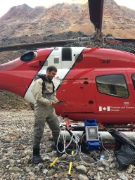 S Duffy合作论文数Fisheries & Oceans Canada1
 Robert A. Mauck合作论文数Biol Dept, Kenyon Coll1
 Robert A Ronconi合作论文数1Isabeau Pratte合作论文数1Dion F合作论文数1Grégoire François合作论文数1
 William Montevecchi合作论文数Department of Psychology, Biology and Ocean Sciences, Faculty of Science, Memorial University of Newfoundland1Rousseu François合作论文数1
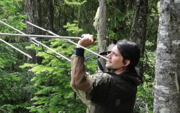 Fabianek François合作论文数1
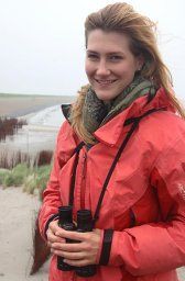 Stephanie Avery-Gomm合作论文数Zoology Department, University of British Columbia1
 Gregory J. Robertson合作论文数Wildlife Research Division, Environment Canada1
 Christian Roy合作论文数1
 David Pelletier合作论文数1
 Gail Davoren合作论文数Departments of Biology and Psychology;Memorial University of Newfoundland1Nils Guse合作论文数1
 Raphael A. Lavoie合作论文数1
 Lucas Savoy合作论文数1
 Sarah N.P. Wong合作论文数1
 April Hedd合作论文数1
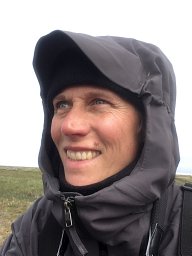 Ingrid Pollet合作论文数British Columbia Cancer Research Center1Julie Mcknight合作论文数1Philip D. Taylor合作论文数Biology Department, Acadia University1Paula Brum合作论文数1




