Efficient integration of subway networks with emerging feeder modes is essential for improving urban accessibility and sustainability. This study explores the growing role of bike sharing as a flexible and eco-friendly first- and last-mile solution, competing with traditional bus connections. We propose a framework that combines machine learning with interpretable analysis to model subway feeder mode choice. By examining factors such as travel attributes, land use, demographics, and station centrality, the framework provides insights into user preferences from spatial and temporal perspectives. Our findings indicate that the built environment and demographic factors around commuters' residences or workplaces have a stronger impact on mode choice than the proximity to subway stations. Housing prices, residential density, and business density notably influence mode selection, with bike sharing particularly favored in urban centers. These insights offer guidance for urban planners seeking to optimize multimodal transport systems and promote sustainable mobility.
With accelerating urbanization, understanding the mechanisms shaping metro station ridership is crucial for optimizing service planning. Metro ridership analysis is challenged by spatial heterogeneity and nonlinear factor interactions. This study integrates Multiscale Geographically Weighted Regression with the Geographical Detector to reveal ridership patterns across station types. A multi-level “station–network” factor system is built by combining station attributes with attraction factors, and K-means++ is used to classify stations into residential, employment, and mixed types. GeoDetector quantifies individual and interaction effects, with the strongest interactions embedded into the MGWR model to uncover how these factors jointly determine ridership variations. Results from Beijing show that attraction factors and their interactions significantly improve model performance. Ridership at residential-dominant stations is mainly influenced by accessibility, employment-intensive stations by land use attributes, and mixed-function stations by multi-level interactions among service, commercial, and population. Findings provide insights for ridership mechanisms and guide metro planning.
Urban Rail Transit (URT) systems are increasingly challenged by operational and management complexities. Artificial intelligence (AI) supports URT operations by learning complex spatiotemporal patterns from multimodal operational data, thereby enabling timely perception, prediction, and decision-making across subsystems. Despite the widespread use of AI for URT operational tasks, a systematic review of this field remains lacking. This review introduces the AI4URT conceptual framework, which categorizes URT operations into three components (passengers, trains, and the operating environment) and three task types (perception, prediction, and decision-making). The review summarizes the applications of traditional machine learning, deep learning, reinforcement learning, and large language models, and clarifies the scope and key challenges of each subtask, including automatic passenger counting, passenger flow prediction, and timetable rescheduling. Additionally, the review identifies data limitations, methodological gaps, and deployment barriers, and outlines future research directions to support the development of intelligent URT operations.
Black carbon (BC) is a refractory form of carbonaceous aerosol generated from fossil fuel and biomass incomplete combustion, which has adverse influence on global warming, air pollution, and human health. However, the relative importance of different sources and meteorology on atmospheric BC evolution was not well understood yet, especially during special periods when series of rigorous emission reduction measures were employed. Here, over one-year observation of BC concentration was conducted in urban of Hangzhou, China from Dec. 2022 to Jan. 2024. The annual mean BC concentration was 1.99 f 1.25 mu g/m3, and displayed strong seasonal and diurnal variability. The BC aerosol in winter (-22.7 f 3.3%o) was 2.3%o enriched in stable carbon isotope (delta 13C) compared to BC in summer, this discrepancy indicated enhanced liquid fossil fuel combustion and C3 plant biomass combustion in cold season. Furthermore, Aethalometer model revealed that BC aerosols in Hangzhou were primarily derived from fossil fuel combustion (73.8 f 9.1%). Specifically, backward trajectory and potential source contribution factor (PSCF) results suggested that the relative high BC concentrations were mainly originated from local sources direct emission in Yangtze River Delta. The BC concentrations during the 19th Asian Games (1.40 f 0.87 mu g/m3) decreased by 41.9% in comparison with that after Asian Games, which was attributed to the vehicle and industrial emissions reduction, and biomass burning prohibition in Hangzhou. These findings highlight the influence of anthropogenic sources emission on temporal variation of BC in urban agglomeration, which was of benefit to further developing effective emission reduction strategies to mitigate climate change and improve air quality.
Accurately predicting metro commuter flows under changing urban conditions is essential for guiding infrastructure investments and service planning. However, existing methods show limited adaptability to evolving urban conditions. To address this, we propose an adaptive graph sharing embedding cascade interaction network (AGSECIN), which establishes a dynamic mapping relationship between changing urban conditions and commuter flows, enabling accurate predictions of metro inflows, outflows, and origin‐destination (OD) flows simultaneously. A graph attention network is built on the long‐term graph to capture the spatiotemporal evolving patterns of urban conditions. Then, an adaptive supply–demand sharing embedding network is designed to model the interaction between origin supply and destination demand. Finally, an adaptive feature interaction layer is developed to uncover the complex high‐order relations among passenger flows and urban conditions. Experimental results on real‐world Beijing datasets demonstrate the superior performance of AGSECIN, compared to contemporary models. Ablation experiments confirm the robustness of our model.
In the realm of mobility services, high-capacity ridesharing such as buspooling holds promise in alleviating the overuse of low-capacity cars and addressing accessibility bottlenecks to public transit systems. However, research on buspooling remains in its fancy stage, requiring dedicated efforts to quantify and enhance its potential benefits. In this paper, we propose car-user-oriented and sustainable operating principles and embody them in a passenger matching model. Furthermore, we employ a solution approach including the spatial-temporal pruning strategies and a heuristic algorithm to guarantee the efficiency of larger-scale computing. Applying this system to the case of Beijing, results demonstrate that buspooling services could yield significant benefits to passengers, operators, and the environment. The consistency observed between the distribution of taxi trips and bus routes suggests that buspooling could effectively enhance subway accessibility, especially for residents in suburban areas. Moreover, findings from a sophisticated analysis can inform the design of a more attractive and eco-friendly system for intermodal transit services in practice.
The impact of two priming exercise protocols using traditional (TS) or cluster-set (CS) arrangements on explosive performance 6 hours later were examined. Sixteen male collegiate athletes performed three testing sessions (one baseline without any prior exercise in the morning and two experimental sessions) separated by 72 hours. Participants completed two morning (9-11 am) priming protocols in a randomized order, either using a TS (no rest between repetitions) or CS (30 seconds of rest between repetitions) configuration. The protocols consisted of 3 sets x 3 repetitions of barbell back squat at 85% of 1 repetition maximum, with 4 minutes of rest between sets. In the afternoon (3-5 pm) of each trial, after a 6-hour rest period, a physical test battery was conducted that replicated baseline testing, including countermovement jump, 20-meter straight-line sprint, and T-test abilities. Across both conditions, participants exhibited increased countermovement jump height, 20-meter sprint time and T-test time compared to baseline (P < 0.05). Improvements in countermovement jump height (+4.4 +/- 5.4%; P = 0.008) and 20-meter sprint time (+1.3 +/- 1.7%; P = 0.022), but not T-test time (+1.1 +/- 3.3%; P = 0.585), were significantly greater for CS than TS. In conclusion, compared to a traditional set arrangement, a morning-based priming protocol using a cluster-set configuration led to superior explosive performance benefits in the afternoon.
It is important to strengthen the research on urban rail transit (URT) existing line renovation strategies. In this paper, we investigate the optimization of bottlenecks that are less attractive but have strong travel demand in existing URT networks. A URT local line optimization model is constructed. The maximum passenger flow and minimum project cost are chosen as the optimization objective for the benefit of both passengers and operators, and several actual constraints are considered in the proposed model, such as the station interval. In order to obtain higher computational efficiency and accuracy, a passenger flow allocation method is embedded in a genetic algorithm with elitist preservation. Taking the local network of the Beijing URT as a case study, the calculation results show that the designed algorithm can quickly and effectively obtain the optimal solution, and the generated local line scheme is able not only to meet the regional travel demand, but also to optimize the connection relationship of the existing URT network. This study can provide a reference method for increasing the attraction of URT and optimization of existing URT networks.
Accurate origin–destination (OD) demand prediction is crucial for the efficient operation and management of urban rail transit (URT) systems, particularly during a pandemic. However, this task faces several limitations, including real-time availability, sparsity, and high-dimensionality issues, and the impact of the pandemic. Consequently, this study proposes a unified framework called the physics-guided adaptive graph spatial–temporal attention network (PAG-STAN) for metro OD demand prediction under pandemic conditions. Specifically, PAG-STAN introduces a real-time OD estimation module to estimate real-time complete OD demand matrices. Subsequently, a novel dynamic OD demand matrix compression module is proposed to generate dense real-time OD demand matrices. Thereafter, PAG-STAN leverages various heterogeneous data to learn the evolutionary trend of future OD ridership during the pandemic. Finally, a masked physics-guided loss function (MPG-loss function) incorporates the physical quantity information between the OD demand and inbound flow into the loss function to enhance model interpretability. PAG-STAN demonstrated favorable performance on two real-world metro OD demand datasets under the pandemic and conventional scenarios, highlighting its robustness and sensitivity for metro OD demand prediction. A series of ablation studies were conducted to verify the indispensability of each module in PAG-STAN.
Objective To effectively reflect the real-time impact of urban rail transit station staff behavior on evacuation, and to solve the problem that the adoption of predefined static path method for evacuation route planning in VR (virtual reality) environment cannot reveal the dynamic response mechanism of passenger evacuation to station staff immediate behavior, a VR simulation modeling method is proposed to model the intervention of station staff behavior on passenger emergency evacuation path choice. Method The environment modeling method that depicts station physical space as an abstract space recognizable by path algorithm is introduced. The passenger intelligent agent model that can perceive external information and make decisions autonomously is defined, and the exit selection rules based on A* algorithm are formulated. On this basis, a dynamic path planning model is constructed by considering the dynamic change of station staff behavior to the environment and integrating the real-time evacuation route length, the evacuation process time, and the density of pedestrians. A VR simulation system is developed to carry out simulation and analysis using a large-scale comprehensive hub station as example. Result & Conclusion Simulation analysis results show that at the beginning of evacuation simulation, the passenger intelligent agent can formulate global routes based on exist selection. During the process, it can autonomously perform real-time local path planning based on dynamic obstacle state changes caused by station staff, and maintain high responsiveness as the number of passengers in the scenario increases. It indicates that the proposed method can effectively and efficiently capture the dynamic changes in virtual environment and reflect them in the process of passenger evacuation, thereby providing technical support for conducting emergency evacuation VR experiments.
The COVID-19 outbreak has led to unprecedented changes in people's lives and travel. Public transportation operators must understand individual mobility during COVID-19. Few studies have focused on the impact of COVID-19 on the travel behaviors of vulnerable older adults. To fill this research gap, this study is conducted using smartcard data from the Xi'an urban rail transit during the time of COVID-19 from February 1, 2020 to April 30, 2020. This study first divides the research objects, that is, passengers, into two groups of young adults and older adults, and periods into three stages: the outbreak, post-pandemic, and recovery. Indicators of travel distance, travel frequency, and activity duration were introduced for the two passenger groups to quantify their travel mobility in different stages. To evaluate the spatiotemporal performance of travel mobility, the travel time distribution of the two groups of passengers in each stage was continuously tracked and the returning passengers were proposed to measure the spatial distribution of station-level ridership. In summary, this study provides not only a deeper understanding of the mobility of older passengers during COVID-19 but also useful insights for urban rail transit managers to make more effective decisions for older adults.
This study aimed to examine differences in the development of spatial knowledge under normal and pressure conditions, as well as differences in the use of signage. To this end, a virtual reality environment of a subway station was developed. We conducted a wayfinding experiment in the environment using a headset device with an eye-tracker. The wayfinding performance and eye-tracking data from 48 participants were recorded and analyzed. The results indicated that spatial knowledge was less grasped under pressure than in normal conditions. Despite the particular diversity across wayfinding conditions, we found a higher reliance on signage among first-time participants. Still, this effect was not significant at landmarks. And the importance of signs near the starting point for route selection was also reported. This study is helpful for understanding the differences in wayfinding and signage use across conditions and provides recommendations for signage design and emergency capacity promotion.
With the rapid development of railway transportation,higher requirements for capacity are increasing and amount of communication,computer and control technologies are applied in train control systems which is the popular method for train control.The application of 3 C brings the enhancement of railway transportation performance.However,the number of internal and external cyber security threats is rising,which could lead to some railway accidents.On the other hand,safety is the core of the design process for railway but security is rarely considered due to the closure of traditional railway systems.As cyber security is threatening the normal operation of industrial control systems and the critical infrastructure,security issues of train control systems should be paid more attention as railway transportation play an important role for society and economy.However,due to the safety-critical characteristics,safety assessment and analysis works have been performed for a long time,but cyber security related works are rarely considered.In the paper,we demonstrate the security situation of train control systems based on the inherent features and the experience of other industrial control systems,where the technical defects and potential threats are summarized.According to the practical engineering experience,the current security protection strategies are illustrated,which shows the popular security protection methods are limited and cannot realize the defense-in-depth.Finally,some research challenges of security issues of train control systems are identified.
There have been many urban rail transit fare change cases in various countries. Evaluating commuters’ responses to fare changes is helpful to the demand management. However, existing studies seldom focus on commuters in particular, rather than the heterogeneity in commuters’ responses using multi-source data. In this regard, this work was devoted to establishing methodologies to reveal the impact of fare changes on different categories of commuters in urban rail transit systems. Firstly, a Hierarchical Dirichlet Processes (HDP) model was developed to identify commuters based on the transit smart card data. Then, a framework was formulated to classify commuters based on their income and responses to fare changes. The model was used to analyze a dramatic fare change of the Beijing metro in late 2014, when a flat fare scheme was replaced by a distance-based one that increased the fare. Long-term commuters and their job-home stations were identified both before and after the event. These commuters were further classified into three categories according to their proxy income. We found that the higher the commuters' income, the closer the home stations were to the city center. In addition, the results suggested that commuters adjusted their job-home locations to balance the commuting time and fares, in response to the fare increase. Commuters with relatively low income were more likely to change job places, whereas high-income commuters had a greater possibility to change the residence places. On average, low-income commuters moved toward city centers after the fare increase, while high-income commuters moved toward to suburban areas. High-income commuters’ commuting distance was shorter than that of the other commuters. The distance-based fare scheme encouraged low-income commuters to reduce the commuting distance, while commuters with middle class or high income increased their commuting distance.
轨道交通网络和常规公交网络作为公共交通系统的主要组成部分,研究乘客在两网复合网络上的方式选择行为有助于提升公共交通系统的协同运营.然而,以往的研究通常只对单个网络出行进行研究,未考虑到出行完整性.针对此不足,基于多源数据融合、轨道与公交网络拓扑融合,提出乘客在公共交通复合网络上的完整出行提取方法;复杂网络中方式选择的本质是路径选择,因此在构建耦合换乘站点的公共交通复合网络基础上,建立5种考虑多种因素组合的多项Logit选择模型,以分析在复合网络中对乘客出行行为影响最显著的因素组合;最后将模型应用于北京市某工作日的公共交通网络及刷卡数据.研究结果表明,基于完整出行的选择模型优于基于出行阶段的选择模型;通勤者在公共交通复合网络上的方式选择行为与考虑在车时间、候车时间、换乘时间、换乘次数的出行总时间及票价因素显著相关,且出行总时间的影响更大;换乘、候车时间对通勤乘客在公共交通复合网络中方式选择的影响较低,通勤者更加偏好出行总时间短的路径.研究结果可为提升轨道与公交的协同程度提供技术支持.
Urban rail transit (URT) system plays a dominating role in many megacities like Beijing and Hong Kong. Due to its important role and complex nature, it is always in great need for public agencies to better understand the performance of the URT system. This paper focuses on an essential and hard problem to estimate the network-wide link travel time and station waiting time using the automatic fare collection (AFC) data in the URT system, which is beneficial to better understanding the system-wide real-time operation state. The emerging data-driven techniques, such as the computational graph (CG) method in the machine learning field, provide a new solution for solving this problem. In this study, we first formulate a data-driven estimation optimization framework to estimate the link travel time and station waiting time. Then, we cast the estimation optimization model into a CG-based framework to solve the optimization problem and obtain the estimation results. The methodology is verified on a synthetic URT network and applied to a real-world URT network using the synthetic and real-world AFC data, respectively. Results show the robustness and effectiveness of the CG-based framework. To the best of our knowledge, this is the first time that the CG is applied to the URT. This study can provide critical insights to better understand the operational state of URT.
构建了考虑乘客异质性的客流分配方法和基于信息熵的均衡度模型.选取北京城市轨道交通2009年、2012年、2015年、2018年等跨度10年的AFC(自动售检票)系统数据,经过客流分配得到全网早高峰时刻断面客流量;利用GIS(地理信息系统)平台将其可视化,并结合城市发展和城市轨道交通新线开通情况,分析北京城市轨道交通近10年的线网客流演变.分析显示:高峰小时进出站客流量、断面客流量均在2009-2012年迅速增长,在2015年略有下降,而在2015-2018年又恢复增长;最大客流量出现的位置基本稳定,仅个别位置发生改变.
Abstract Background: The aim of the study was to compare the delayed potentiation (DLP) effects induced by cluster sets (CS) versus traditional sets (TS) resistance training. Methods: Sixteen male collegiate athletes were recruited for the study in a crossover design. All the subjects performed a CS (30 s interval between reps, 4 minutes interval between sets) and a TS (no rest between reps, 4 minutes interval between sets) resistance training sessions (3 sets of 3 repetitions of barbell back squat at 85% 1RM) in random order separated by 72 hours. Countermovement jump (CMJ), 20-meter sprint and T-test performance were evaluated at baseline and 6 hours after the resistance training sessions. Results: 6 hours after the resistance training sessions, both the CS and TS significantly improved the CMJ height (CS: ES = 0.48, P < 0.001; TS: ES = 0.23, P = 0.006), CMJ take-off velocity (CS: ES = 0.56, P < 0.001; TS: ES = 0.38, P = 0.004), CMJ push-off impulse (CS: ES = 0.38, P < 0.001; TS: ES = 0.26, P = 0.006), 20-meter sprint (CS: ES = 0.85, P < 0.001; TS: ES = 0.58, P = 0.006) and T-test (CS: ES = 0.99, P < 0.001; TS: ES = 0.73, P = 0.003) performance compared with baseline values. Following the CS, CMJ height (ES = 0.25, P = 0.007), CMJ peak power (ES = 0.2, P = 0.034) and 20-meter sprint performance (ES = 0.31, P = 0.019) were significantly better compared with that following TS. Conclusions: Both TS and CS configurations could induce DLP at 6 hours following the training. CS is a better strategy to induce DLP compared with TS training.
The urban road scenario is one of the main scenarios for autonomous driving. The chunking and managing of large 3D point cloud maps in this scenario are essential to solving the memory occupation and memory fluctuation problems caused by map loading in the process of autonomous driving localization, sensing, and planning. This paper proposes a method for chunking large urban road 3D point cloud maps based on Voronoi graph, which achieves uniform and efficient chunking of the maps in this scenario and effectively preserves the semantic integrity of the maps at roads and junctions. At the same time, this paper presents an efficient and applicable map dynamic management method for the autonomous driving localization process, significantly reducing the memory footprint and fluctuations during map loading. We experimented our method extensively on the KITTI dataset. It achieved uniform chunking of the point cloud coverage area and the number of point clouds on a large urban road laser point cloud map covering an area of 3.5km*3.5km, respectively. The memory footprint was reduced by 16% compared to existing map dynamic loading experiment methods.
 Zijia Wang (王子甲)合作论文数School of Civil Engineering, Beijing Jiaotong University50
 Xiaohong Li (李小红)合作论文数School of Civil Engineering, Beijing Jiaotong University15
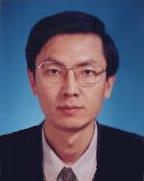 Yuanhua Jia (贾元华)合作论文数School of Traffic and Transportation, Beijing Jiaotong University12
 Jinlei Zhang合作论文数Beijing Jiaotong Univ, Sch Civil Engn, Beijing 100044, Peoples R China10
 Yingyue Hu (胡映月)合作论文数10
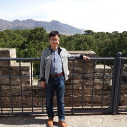 Yadi Zhu合作论文数Beijing Jiaotong Univ, Sch Civil Engn, Beijing 100044, Peoples R China9QiBing Wu (吴奇兵)合作论文数9
 Jiping Fang (方纪平)合作论文数7Yongxin Gao合作论文数6Peiwen Chen (陈培文)合作论文数5Qibing Wu合作论文数5GuChang Ao (敖谷昌)合作论文数5
 Jian Li (李舰)合作论文数School of Civil Engineering, Beijing Jiaotong University4
 Rui Wang合作论文数Luskin Sch Publ Affairs, Univ Calif Los Angeles4Jianpo Wang合作论文数3Bo WANG (王波)合作论文数3Ou-yang LIU (刘欧阳)合作论文数3Na Zhang合作论文数3
 Xiaobing Liu (刘晓冰)合作论文数Sch Traff & Transportat, Beijing Jiaotong Univ3ChengLong Sun (孙成龙)合作论文数3
 Jianling Huang (黄建玲)合作论文数Beijing University of Technology3
 Xi Chen (陈曦)合作论文数School of Civil Engineering, Beijing Jiaotong University3
 Qinghuai Liang (梁青槐)合作论文数School of Civil Engineering, Beijing Jiaotong University3
 Liang Gao (高亮)合作论文数Key Laboratory of Transport Industry of Big Data Application Technologies for Comprehensive Transport, School of Traffic and Transportation, Beijing Jiaotong University3Bing Yan合作论文数2Xiaopeng Shen合作论文数2Huimin Yang合作论文数2Yinan Guo合作论文数2JIA Hui-hui (贾慧慧)合作论文数2
 Shunwei Shi (石顺伟)合作论文数School of Civil Engineering, Beijing Jiaotong University2
 Jingni Song合作论文数2LIU Jian-feng合作论文数2Wen-juan AN (安文娟)合作论文数2
 Yu Li合作论文数2ZhongHai Niu (牛忠海)合作论文数2Yao Huang合作论文数2
 Guowei Hua (华国伟)合作论文数School of Economics and Management, Beijing Jiaotong University;National Academy of Economic Security, Beijing Jiaotong University2Wandi Zhang合作论文数2
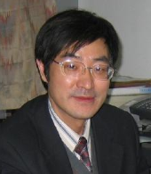 Ziyou Gao (高自友)合作论文数School of Traffic and Transportation, Beijing Jiaotong University2
 Wei Ma (马玮)合作论文数Department of Civil and Environmental Engineering, Faculty of Construction and Environment, Hong Kong Polytechnic University2
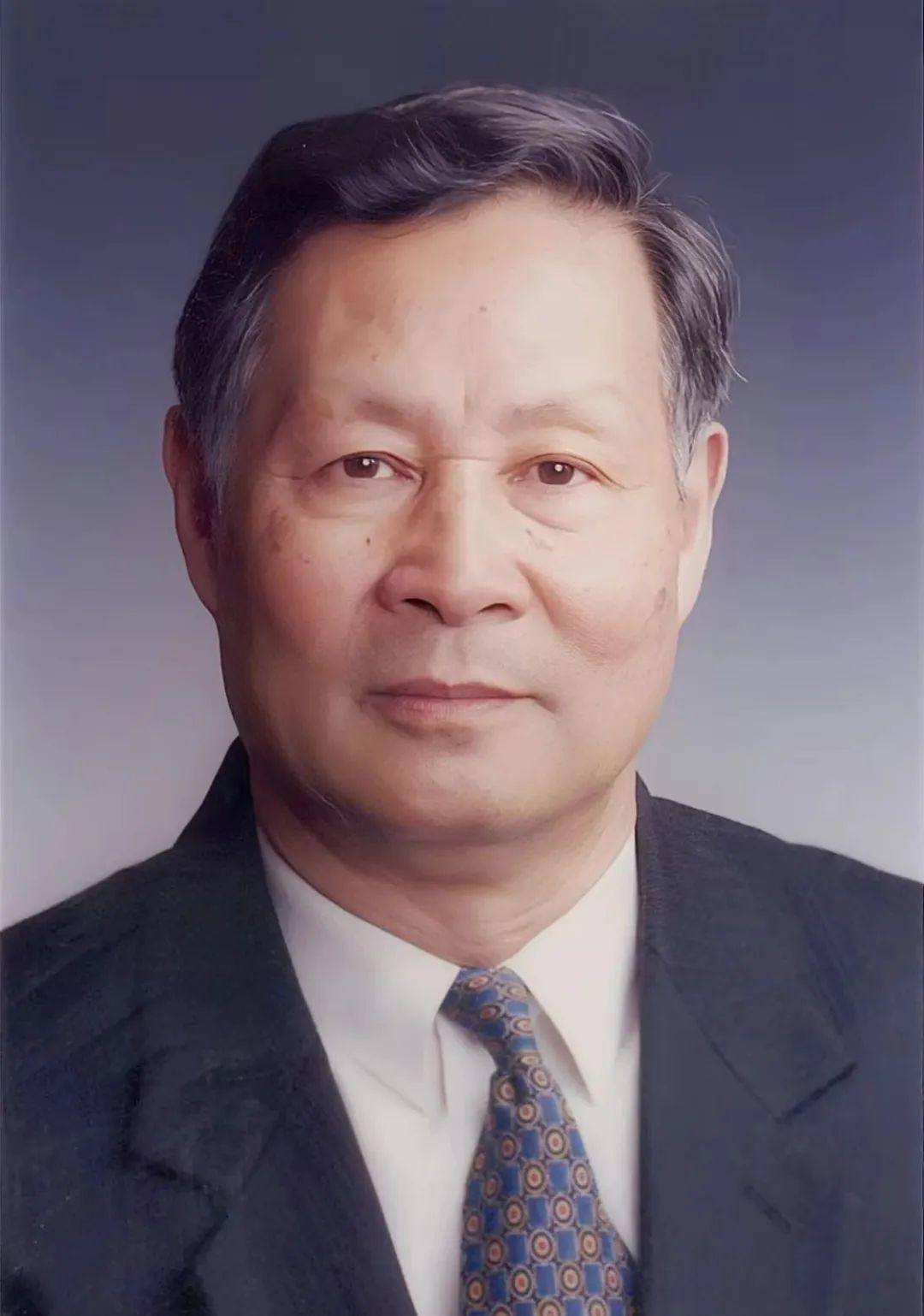 Zhongheng Shi (施仲衡)合作论文数Beijing Jiaotong University2
 Zujun Yu (余祖俊)合作论文数Beijing Jiaotong University2
 Hui Yin (尹辉)合作论文数School of Computer Science & Technology, Beijing Jiaotong University2
 Zhe Wang合作论文数Rapid-Rich Object Search Lab, Nanyang Technological University2
 Lixing Yang (杨立兴)合作论文数School of Systems Science, Beijing Jiaotong University2
 Xiaopei Cai (蔡小培)合作论文数School of Civil Engineering, Beijing Jiaotong University2
 Taku Fujiyama合作论文数Department of Civil, Environmental and Geomatic Engineering, Faculty of Engineering Sciences, University College London2
 Peize Zhao合作论文数1




