Building segmentation in synthetic aperture radar (SAR) imagery is critical for numerous remote sensing applications. Nevertheless, the inherent limitations of SAR imagery, such as speckle noise, complex scattering effects, and geometric distortions, pose significant challenges to accurate segmentation. Existing research introduces auxiliary information or handcrafted priors to improve segmentation performance, but often suffers from increased model complexity and poor generalization. Recently, knowledge distillation has emerged as a promising alternative, as the distillation of optical image semantics provides transferable spatial structural knowledge to enhance SAR segmentation, particularly in complex imaging environments. Nevertheless, conventional distillation methods rely on pixel-wise constraints, failing to accommodate the significant heterogeneity between SAR and optical imagery arising from their distinct imaging mechanisms. To overcome these challenges, we propose adversarial entropy minimization knowledge distillation (AEM-KD), which distills logit-level knowledge via adversarial learning at the prediction layer. By leveraging structural-semantic correlations between heterogeneous modalities, AEM-KD encourages the SAR network to produce confident, low-entropy predictions consistent with those of the optical teacher, while avoiding rigid pixel-wise constraints. To further reduce feature-level discrepancy, a channel-wise knowledge distillation (CW-KD) module is introduced to align intermediate feature distributions along the channel dimension. With the assistance of CW-KD, AEM-KD further aligns high-level feature representations between the SAR and optical networks, thereby alleviating the progressively increasing feature discrepancy across deeper network layers. Experimental results on the multisensor all weather mapping dataset demonstrate that the proposed cross-modality knowledge distillation framework outperforms existing state-of-the-art distillation methods and achieves robust inference using SAR images alone.
For aquatic human activity recognition, mmWave radar is less sensitive to illumination changes, visual occlu sion, and privacy concerns than camera-based sensing. However, water-surface activities introduce additional challenges, includ ing multi-spectrum heterogeneity, coupled temporal-motion and range/cadence structures, and unstable cross-spectrum interactions under lightweight network constraints. To address this challenge, we propose the Adaptive Low-Rank Spatio-Temporal Fusion Net work (ALRST-Net), a lightweight radar-task-driven architecture for water-surface multi-spectrum representations. The network adopts a shared-specialized spectrum encoder to reduce redundant low level extraction while preserving discriminative cues in TR, TD, CVD and CRD.It then reorganizes the multi-spectrum features into a temporal-motion branch and a range/cadence-structural branch, avoiding heavy RNN or Transformer modeling. Finally, an adaptive stable low-rank residual fusion module introduces compact cross spectrum interaction as a controlled residual correction, improving fusion stability and discriminability. Experimental results on the AHAR-I dataset show that ALRST-Net achieves 99.58% recognition accuracy with only 81.5K parameters, 47.8M FLOPs, and 3.20 ms network inference latency. Compared with existing methods, ALRST-Net provides a favorable performance–efficiency trade-off.
The rapid development of drone technology has spurred significant interest in multiunmanned aerial vehicle (UAV) collaborative systems, particularly for complex tasks like cooperative target jamming. However, realizing their full potential is hindered by significant challenges, primarily stemming from uncertain 3-D target positions and operational time constraints. These factors complicate crucial aspects like path planning and efficient task allocation, ultimately jeopardizing jamming mission's success. Furthermore, the specific complexities introduced by uncertain 3-D target positions are often overlooked in existing cooperative jamming strategies. To address these issues, we propose cooperative multi-agent jamming techniques using reinforcement learning (RL) to maximize interference effectiveness against designated targets under target position uncertainty. Our methodology is based on a task framework that unifies the models of target position uncertainty, 3-D probabilistic perception for high-fidelity UAV sensing, and directional antenna interference to achieve optimal jamming. In this framework, we formalize the task as a Markov decision process (MDP) and employ RL to optimize collaborative jamming policies under target positions uncertainty. The proposed RL algorithm, by utilizing both individual and collaborator rewards, adaptively balances exploration and exploitation across different mission stages. This balance is achieved by adjusting the amplitude of noise used for action selection. We conducted simulation experiments with various UAV, target, and no-fly zone configurations to validate the effectiveness of our proposed method, demonstrating its scalability and strong joint task performance in achieving jamming objectives.
This study investigates the impact of image size on deep learning-based concrete crack detection by generating five datasets from a unified image source and systematically evaluating representative object detection models. During the inference stage, a GPU-memory-aware dynamic batch-parallel inference method combined with multi-scale sliding window strategies is proposed to enhance the detection efficiency of large-scale crack images acquired in practical scenarios. Results show that an image size of 320 & times; 320 achieves an optimal balance among dataset scale, detection accuracy, and training efficiency. The proposed inference optimization further reduces inference time across different models and scenarios, achieving reductions of over 90%. Overall, this study not only clarifies the influence of image size and sliding window strategies on crack detection performance, but also proposes practical optimization approaches that balance accuracy with efficiency, thereby providing valuable insights for the engineering application of automated concrete crack detection systems.
Interferometric inverse synthetic aperture radar (InISAR) reconstructs three-dimensional (3-D) target geometry by exploiting the interferometric phase between multi-channel two-dimensional (2-D) images, and plays an important role in space domain awareness (SDA) and maritime surveillance. However, the performance of InISAR is fundamentally constrained by the limited resolution of 2-D images and the difficulty of maintaining inter-channel coherence. Conventional compressed sensing (CS)-based super-resolution methods rely on explicit dictionaries and fragile sparsity priors, which often fail to capture the diverse scattering features of space targets. To overcome these limitations, this paper proposes a novel multi-channel joint super-resolution algorithm of InISAR using gridless Hankel-lift framework. The proposed algorithm dispenses with dictionary design and instead exploits the intrinsic low-rank property of multi-channel Hankel matrices as a higher-order representation, enabling a more general and robust characterization of scattering features. This low-rank prior is embedded into a multi-channel echo extrapolation problem and solved with an iterative re-weighted least squares (IRLS) algorithm. By jointly enhancing resolution and preserving inter-channel coherence, the proposed algorithm produces high-quality 2-D images that retain interferometric phase integrity and lead to accurate, robust, and interpretable 3-D reconstructions. Simulated and measured data experiments demonstrate the improved performance over most of the state-of-the-art CS-based algorithms.
This study presents SAM-SLD, a novel framework for rapid and precise recognition of structural line shapes. Building on the SAM architecture, it integrates specialized modules including point coordinate visualization extraction, image fusion, foreground-based mask extraction, target image extraction, GAN-based super-resolution, a sliding crop strategy, and advanced mask edge contour extraction to enhance automation, robustness, and adaptability. Results show that the SAM-SLD model accurately and reliably identifies and quantifies structural line shapes in complex environments. In concrete beam tests, it achieves an Intersection over Union (IoU) of 0.9931, maintaining high accuracy under low-light and high-noise conditions. Application examples further show that concrete slab monitoring results closely align with measured data, with a maximum mid-span deformation error of 3.02 %. For wave-shaped anchor detection, the maximum error is only 0.18 mm, corresponding to a relative error of 0.83 %. These findings confirm the model's high accuracy, strong robustness, and broad applicability in practical engineering scenarios.
The interferometric inverse synthetic aperture radar (InISAR) is an advanced 3-D imaging sensor that enhances the interpretation and recognition of moving target, such as satellite and aircraft. In the practical multifunctional radar, it often suffers from the data sparse sampling, such as frequency band and sparse aperture (SA), which greatly increases the difficulty of InISAR imaging. In this article, a multichannel structured low-rank Hankel and sparse matrix recovery algorithm is proposed for high-resolution InISAR imaging from compressively sampled data, which can effectively maintain a high coherence between multichannel data with enhanced performance of 3-D target geometry reconstruction. In the scheme, a Hankel matrix formulation is utilized to characterize the intrinsic low-rank property of multichannel data, exploiting the data structure in both temporal and spatial dimensions. Meanwhile, a reweighted approach of joint sparsity constraint on multichannel images is incorporated to construct a unified imaging diagram for the enhanced performance. Then, the Hankel matrix factorization is used to avoid the complicated computation of singular value decomposition and the imaging problem is solved in linearized minimization using an alternating direction method of multipliers approach. Next, the 3-D target geometry is optimized with outlier removing and error reduction while the squinted-angle InISAR is also addressed with modified signal model and accurate coordinate compensation method. Finally, experiments based on both simulated and measured data are conducted to validate the effectiveness of the proposed algorithm, demonstrating its superiority over traditional sparse imaging methods, such as compressive sensing.
Inverse synthetic aperture radar (ISAR) is a powerful tool for space target recognition, benefiting from its capacity for high-resolution imaging at long range. However, ISAR image quality is usually affected by strong scattering point sidelobes, variations in scattering response, defocusing, and blurred target structures, all of which limit the recognition performance of ISAR systems. Moreover, ISAR image deformations caused by varying observation conditions of space targets further increase the recognition difficulty. To tackle these issues, this article proposes an integrated complex-valued network (ICV-Net) for scattering feature enhancement ISAR imaging and high-precision space target recognition. Through a unified complex domain processing chain, ICV-Net preserves phase information and fundamentally avoids the information loss caused by separate processing of imaging and recognition. The ICV-Net consists of two key modules: complex-valued scattering feature enhancement imaging (CV-SFEI) and complex-valued robust multiscale transformer recognition (CV-RMTR). The CV-SFEI module employs an attention-augmented complex-valued encoder-decoder network to reconstruct amplitude and phase. It adaptively focusing on key scattering regions while suppressing defocusing and sidelobes, thereby generating structurally enhanced high-quality ISAR images. Given the continuous observation characteristics of ISAR systems, the CV-RMTR module first performs robust deformation correction on the enhanced image sequence via complex-valued spatial transformation (CV-ST). Subsequently, it employs multiscale transformers to extract complementary inter-frame features, achieving the collaborative optimization of deformation correction and feature extraction. Finally, by adopting a two-stage training strategy based on transfer learning, ICV-Net achieves deep collaboration and integrated optimization between the imaging and recognition modules. Experimental results on satellite target datasets covering multiple imaging parameters and observation angles demonstrate that ICV-Net significantly improves ISAR imaging quality and further enhances target recognition accuracy under various image deformation scenarios.
Reconstructing building models from urban SAR tomography (TomoSAR) point clouds is often constrained by limited resolution, low positioning accuracy in elevation, as well as data incompleteness and artifacts caused by microwave imaging mechanisms. These challenges seriously restrict the extraction of high-accuracy building models with structural details from TomoSAR point clouds. This paper proposes a refined urban building modeling method that effectively utilizes structural priors, including directionality, orthogonality, and potential symmetry. First, a piecewise fitting strategy integrated with density-based segmentation is employed to iteratively estimate the main directions of the buildings and capture finer geometric variations of complex façade footprints than simple-plane approximations. Second, a roof extraction algorithm combining an adaptive Doug-las–Peucker approach with symmetry evaluation and constraints is developed to regularize roof outlines and repair data defects. Crucially, to handle extreme cases where roof data are entirely missing, a novel building width estimation method based on building shadow analysis is proposed. Experiments conducted on the SARMV3D-1.0 and SARMV3D-3.0 point cloud datasets demonstrate that the proposed method significantly enhances reconstruction accuracy and geometric fidelity in urban regions compared to state-of-the-art approaches.
This paper introduces SAM-DN, a methodological approach implemented as an efficient and automated system for monitoring multi-target deformation under varying depths of field. The method integrates visual segmentation, image coordinate acquisition, image fusion, noise removal, automatic target labeling, adaptive target region cropping, and neural network-based deblurring. Following a brief interactive initialization in the first frame, the system performs adaptive updating in subsequent frames, enabling continuous and automated multi-target tracking with minimal human intervention. A parallel computing framework further enhances efficiency in multi-target scenarios. Experimental results under varying levels of blur, tilt, and lighting demonstrate that SAM-DN achieves deformation errors within 0.2 mm and 2-3 % relative error under moderate conditions. Even in severe blur and large tilt angle cases, the adaptive cropping strategy effectively reduces errors. The proposed method demonstrates strong robustness and computational efficiency for dynamic, multi-depth deformation monitoring, enabling automated safety monitoring and management in construction and infrastructure maintenance.
Automotive millimeter-wave (mmWave) synthetic aperture radar (SAR) has emerged as a promising sensing technology for intelligent perception owing to its all-day and all-weather imaging capability. However, existing methods generally treat SAR imaging and vehicle detection as two independent processing stages, preventing the imaging process from being optimized according to downstream perception requirements. To address this limitation, this paper proposes an integrated framework for SAR enhanced imaging and vehicle detection, termed SAR-IEID-Net, which establishes a unified optimization pipeline from raw complex echoes to vehicle detection results. The proposed framework consists of a SAR enhanced imaging network and a lightweight YOLO (LW-YOLO) detection network. By introducing Fourier-prior-guided complex-valued linear layers, the SAR enhanced imaging network transforms conventional fixed SAR imaging process into a learnable network and further enhances the scattering features and structural details of vehicle targets using a feature enhancement network. Furthermore, a two-stage training strategy and a target-background contrast enhancement (TBCE) loss are proposed to achieve task-oriented collaborative optimization between imaging and detection. Through joint training, supervision information provided by the detection task guides the imaging network to generate SAR image representations that are more beneficial for vehicle detection. Experimental results on both the self-collected parking lot dataset and the public ATRNet-STAR dataset demonstrate that the proposed framework consistently improves SAR imaging quality and vehicle detection accuracy while maintaining relatively low computational complexity. Deployment experiments on the embedded platform further validate the deployment potential of the proposed integrated framework in automotive intelligent IoT perception systems.
High-resolution inverse synthetic aperture radar (ISAR) images are essential for space situational awareness, but measured datasets are scarce, and electromagnetic solvers remain computationally costly and nondifferentiable. Although neural radiance field (NeRF)-based methods offer a differentiable alternative, they are bottlenecked by dense ray marching and inefficient implicit field evaluations. To address these limitations, this article proposes a lightweight and efficient ISAR image rendering framework leveraging 3-D Gaussian splatting (3DGS). In particular, we develop a forward rendering pipeline tailored to the ISAR imaging geometry of space targets, in which the target scattering energy distribution is parameterized by 3-D Gaussian primitives and directly rendered onto the radar image plane via radar-specific orthographic projection and linear intensity accumulation. Experiments on a simulated satellite dataset demonstrate high-fidelity novel-view ISAR synthesis, with a PSNR of 31.58 dB and a rendering speed of over 350 FPS.
In passive localization of frequency-hopping (FH) emitters, the unknown carrier frequencies destroy the inter-pulse phase coherence required for synthetic aperture processing. This degrades the accuracy of range parameter estimation and emitter localization. Meanwhile, the carrier frequency and the reference slant range are highly coupled in the azimuth phase history. As a result, a deviation in the carrier frequency is equivalent to an offset in the slant range estimate. The two parameters are difficult to estimate independently, which further limits the ultimate localization accuracy. To address these issues, a bistatic synthetic aperture passive localization method for FH emitters based on full-pulse azimuth accumulation entropy is proposed in this paper. By alternately optimizing the FH carrier frequency sequence and the reference slant range, their coupling in the azimuth phase history is decoupled. The estimation accuracy of the FH carrier frequencies is improved, and high-quality two-dimensional focusing results are obtained. The position and velocity of the emitter are then solved from the bistatic range-history coefficients. The effectiveness of the proposed method is verified through simulation results.
Bridge elastomeric bearings are critical components in bridge structures, yet reliable condition assessment from field inspection images remains challenging because complex inspection scenes often involve diverse defect types, strong background interference, and the coexistence of multiple defects, all of which can lead to inconsistent recognition results. Existing vision-based methods are generally developed in a data-driven manner and seldom integrate engineering knowledge, which limits their ability to convert raw inspection images into structured, semantically consistent, and physically plausible bearing-state information. To address this problem, this study proposes BEB-MDIRNet, a cascaded multi-defect recognition framework integrating elastomeric bearing detection, detector-guided region-of-interest (ROI) extraction, and multi-label defect classification. The framework employs an improved lightweight YOLOv11 detector for rapid detection and accurate localization in complex scenes, while detector-guided ROI cropping and aspect-ratio-preserving resize-and-padding preprocessing are introduced to reduce background interference and preserve bearing geometry. In the classification stage, transfer learning and a hybrid loss function are combined to improve robustness under class imbalance and hard-sample conditions. Mutual-exclusion constraints and physical priors consistent with bearing degradation semantics are further incorporated to suppress conflicting outputs and enhance prediction consistency and interpretability. Experimental results show that, compared with the baseline models, the proposed method improves bearing detection precision by 5.15% and defect classification performance by 14.25%, while reducing missed and false predictions under dust contamination, occlusion, and uneven illumination. These results demonstrate the potential of the proposed framework for engineering informatics and its practical value in bridge inspection, condition assessment, and maintenance decision-making.
Integrated sensing and communication (ISAC) enables simultaneous sensing and data transmission with the assistance of unmanned aerial vehicles (UAVs) in emergency disaster relief and inspects scenarios. However, the impact of sensing uncertainty on communication performance has not been systematically investigated. In this paper, we propose a novel UAV-aided ISAC framework that explicitly accounts for the uncertainty location sensing error (LSE). To characterize LSE more realistically, we derive the Cram & eacute;r-Rao bound (CRB) and use it as the variance parameter for the considered uncertainty LSE models, instead of adopting the conventional unit-variance assumption. Then, we analytically reveal the inherent coupling relationship between LSE and achievable communication rate. Considering three practical LSE distributions, namely, ellipsoidal, Gaussian, and arbitrary distributions, we formulate three robust communication and sensing power allocation problems and develop tractable solutions using the S-Procedure with alternating optimization (S-AO) method, Bernstein-type inequality with successive convex approximation (BI-SCA) method, and conditional value-at-risk (CVaR) with AO (CVaR-AO) method. Simulation results validate the theoretical coupling, demonstrate the robustness of the proposed schemes, and reveal sensing-communication trade-offs, providing valuable insights for robust UAV-aided ISAC system design.
Recently, the radar technology has become increasingly essential for both security and economic purposes. Typically, the ground-based synthetic aperture radar (GB-SAR) is extensively applied in terrain mapping and deformation monitoring, which has the features of noncontact and high-precision sensing at all-time and all-weather conditions. However, the development of the GB-SAR system is usually limited by the large-size, high-power consumption, and low-resolution. To address these issues, a high-integrated chip-cascaded millimeter-wave radar (called CcM-Radar) sensor with a phased-transmitting-digital-receiving array is designed for high-resolution GB-SAR imaging and interferometry. In the scheme, the system architecture of a 1-D phased transmitting array and 2-D digital receiving array is developed using four integrated transceiver (TRX) chips, which can provide higher processing gain in comparison with the conventional multiple-input multiple-output (MIMO) radar. Meanwhile, a novel multichannel enhanced SAR imaging algorithm is proposed by integrating the back-projection (BP) imaging with the multichannel coherent processing, ensuring high-quality imaging and interferometry with an expected long-working-range. Then, the inversion of terrain mapping is investigated using the SAR interferometric technique. Finally, the results of measured data experiments show that the proposed CcM-Radar has long-range and wide-view scanning imaging performance, and the effectiveness of the proposed algorithms for enhanced high-resolution imaging and SAR interferometry is confirmed.
LuTan-1 (LT-1) constellation is an innovative distributed L-band spaceborne synthetic aperture radar (SAR), which can potentially provide tomographic mapping with twin satellites, i.e., tomographic SAR (TomoSAR) imaging. Compressed sensing (CS) techniques are often used in TomoSAR to improve elevation resolution by exploiting the layout sparsity. However, the off-grid effect of discrete dictionary used in traditional CS methods tends to degrade the imaging performance. In this paper, a novel non-convex enhanced matrix completion (NcEMC) algorithm is proposed for gridless super-resolution TomoSAR imaging. Specifically, a Hankel matrix completion model is designed to exploit the latent data structure in an off-grid manner. Benefiting from the enhanced low-rankness of the Hankel form, a refined uniform baseline observation is reconstructed from the original configuration via matrix completion optimization, achieving signal enhancement. To avoid using a regularization term to balance the traditional singular value decomposition solution of Hankel matrix, the proposed algorithm restates the low-rank constraint in a symmetric decomposition manner, which is beneficial to reduce the computation cost. Subsequently, an incoherence condition is introduced as a significant constraint in the Hankel matrix reconstruction process. To this end, a projected gradient descent iteration method is designed to satisfy the incoherence condition, thereby facilitating a more robust and accurate process of data reconstruction. Meanwhile, this paper presents the first large-scale urban 3-D high-resolution results of LT-1 satellites. We use 10 repeat-pass LT-1 monostatic SAR images to demonstrate the full processing workflow in TomoSAR imaging and the superiority of the proposed algorithm.
Existing deep-learning-based methods for synthetic aperture radar (SAR) target recognition typically rely solely on the amplitude images without considering the complex characteristic of SAR images, making it difficult to recognize SAR targets with high visual similarity. To solve this issue, a novel dual-stream manifold multiscale network fused with electromagnetic features, i.e., EFMM-Net, is proposed for target recognition in complex-valued SAR images. In EFMM-Net, the attributed scattering center (ASC) model is first used to reconstruct the complex-valued SAR image, thereby highlighting the electromagnetic scattering features of the target. Subsequently, the reconstructed complex-valued SAR image is combined with the original one to construct the dual-stream input. Second, a scattering-guided manifold multiscale (SGMM) backbone is proposed for parallel extraction of data features and electromagnetic scattering features of the target from the dual-stream input. During feature extraction, the SGMM backbone can effectively leverage the phase information of complex-valued SAR images and inject target scattering information into data features through scattering-guided channelwise feature alignment, thus enhancing the awareness of data features to critical scattering characteristics. Finally, to effective fuse the data features and electromagnetic scattering features, a location awareness feature fusion (LAFF) recognition module is proposed. By exploiting coordinate attention, LAFF uses the target location information captured from electromagnetic scattering features to direct the feature fusion process, thereby increasing the focus of fusion features on the target region. The extensive recognition results of three-class and six-class ship targets in the OpenSARShip 2.0 dataset demonstrate the effectiveness and superiority of the proposed method.
Inverse synthetic aperture radar (ISAR) imaging relies on wideband waveform and viewing angle variation to achieve range and cross-range resolutions, respectively. To enhance the resolutions of 2-D images, sparse signal-processing techniques, such as compressed sensing (CS), have been applied to ISAR imaging using a sparse prior. Despite its efficiency in super-resolution imaging, the performance of CS is constrained due to the mismatch of the discrete dictionary, such as the Fourier transform. To address this issue, we propose a novel off-the-grid super-resolution ISAR imaging algorithm that employs a structured low-rank approach to effectively extrapolate the data bandwidth and aperture. To fully capture the low-rank property of ISAR data, the structured data model is constructed and its low-rank property is deduced to exhibit that the signal is embedded in a limited dimensional subspace. Then, the annihilating filter is derived by constructing a structured data matrix to formulate the proposed structured low-rank method, termed as off-the-grid super-resolution using annihilation constraint (OSAC). Taking into account that super-resolution imaging is highly reliant on the accuracy of the annihilating filter, the optimal annihilating filter is also estimated with the updating of extrapolated ISAR data. Through iterative updates of the annihilating filter and solution of the minimization problem, super-resolution ISAR imaging can be achieved by avoiding the discrete mismatch of the conventional CS method. Due to the effective exploration of structured low-rank property, the proposed OSAC algorithm offers superior precision in scatterer location and structure interpretation of a target. Experimental results using both simulated and real data are presented to verify the enhanced performance of 2-D resolution in ISAR imaging.
For high-resolution squinted airborne synthetic aperture radar (SAR) imaging, both linear range walk correction (LRWC) and motion error introduce significant azimuth spatial-variant (ASV) characteristics in the radar echo, rendering the classical assumption of "azimuth translational invariance" no longer valid. Existing subaperture methods attempt to overcome the ASV characteristics of the signal by performing segmentation processing in the data domain or the image domain. However, grating lobes or image stitching problems inevitably occur in the focused images. Existing full-aperture methods, on the other hand, utilize azimuth resampling or nonlinear chirp scaling (NCS) to address the ASV problem. Nevertheless, the above-mentioned methods basically handle the ASV characteristics introduced by LRWC and motion errors separately, without considering the coupling characteristics between the two. Therefore, this article proposes a high phase-preservation squint airborne SAR autofocus imaging method by modifying the traditional azimuth resampling processing, so that only a single azimuth resampling factor is required to simultaneously solve the ASV problems brought about by LRWC and motion errors. The imaging processing results of airborne squint SAR real data verify its good focusing effect. Meanwhile, the interferometric processing results of multipass cross-track SAR real data also indicate that the proposed algorithm exhibits a high phase-preservation capacity. The images processed by the proposed algorithm and the comparison algorithms, as well as the multipass cross-track SAR complex images after registration, can be downloaded from https://pan.baidu.com/s/1okgAkp18ynK7qzKXe2lceQ?pwd=nquf
 Mengdao Xing (邢孟道)合作论文数School of Electronic Engineering, Xidian University;Academy of Advanced Interdisciplinary Research, Xidian University49
 Wei Hong (洪伟)合作论文数State Key Laboratory of Millimeter Waves, School of Information Science and Engineering, Southeast University24
 Lei Zhang (张磊)合作论文数School of Electronics and Communication Engineering, Sun Yat-Sen University;School of Electronic Engineering, Xidian University16
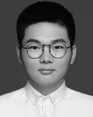 Bangjie Zhang合作论文数15
 Jianlai Chen (陈溅来)合作论文数School of Automation, Central South University15
 Yanyang Liu (刘艳阳)合作论文数14
 Hanwen Yu (于瀚雯)合作论文数School of Resources and Environment, University of Electronic Science and Technology of China12
 Zheng Bao (保铮)合作论文数School of Electronic Engineering, Xidian University11
 Jialian Sheng合作论文数11
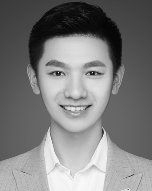 Mengjie Jiang合作论文数8
 Lei Yang合作论文数8
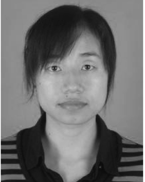 Qianqian Chen合作论文数8
 Qingrui Yue (岳清瑞)合作论文数State Key Laboratory for Advanced Metals and Materials, University of Science and Technology Beijing;Research Institute of Urbanization and Urban Safety, University of Science and Technology Beijing8
 Xiang-Gen Xia (夏香根)合作论文数Department of Electrical and Computer Engineering, University of Delaware8
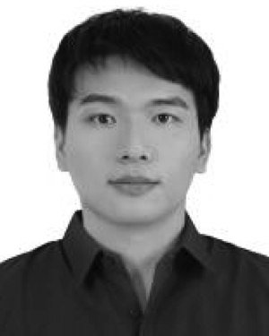 Rui Zhou合作论文数7
 Shuai Ma (马帅)合作论文数中国矿业大学信息与控制工程学院7
 Yachao Li (李亚超)合作论文数Xidian University7
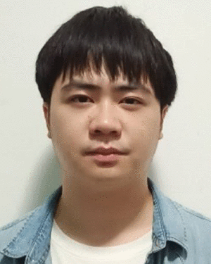 Hao Pei合作论文数6Peishuang Ni合作论文数6
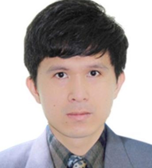 Xianpeng Wang (王咸鹏)合作论文数School of Information and Communication Engineering, Hainan University6
 Shiyin Li (李世银)合作论文数School of Information and Control Engineering, China University of Mining and Technology;Advanced Analysis & Computation Center, China University of Mining and Technology6
 Hui Zhang (张辉)合作论文数Department of Manufacturing & Automation, School of Mechanical Engineering, Southeast University;Jiangsu Key Laboratory of Design and Manufacturing of Micro-Nano Biomedical Instruments, School of Mechanical Engineering, Southeast University6
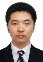 Liangtian Wan (万良田)合作论文数School of Software, Dalian University of Technology5Xiao-Gang Liu合作论文数5
 Yan Huang (黄岩)合作论文数School of Information Science and Engineering, Southeast University;State Key Laboratory of Millimeter Waves, Southeast University5
 Guoan Bi合作论文数School of Electrical and Electronic Engineering, Nanyang Technological University5
 Jie Chen (陈杰)合作论文数School of Geosciences and Info-physics, Central South University4
 Lu Sun (孙璐)合作论文数School of Information Science and Technology, Dalian Maritime University4
 Buge Liang (梁步阁)合作论文数School of Automation, Central South University4Saburo Tsuji合作论文数4
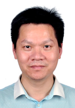 Min Deng (邓敏)合作论文数School of Geosciences and Info-Physics, Central South University4Hongjun Wei合作论文数3Yuxing Hou合作论文数3Lizhong Jiang合作论文数3
 Junli Chen合作论文数Shanghai University(Shanghai University),Shanghai,China3
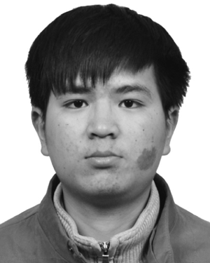 Fangzheng Xu合作论文数3honghao wang (王洪浩)合作论文数3ChuanYong Kang (康传勇)合作论文数3
 Nan Jiang (姜南)合作论文数School of Automation, Central South University3
 Junchao Zhang (张俊超)合作论文数School of Automation, Central South University3
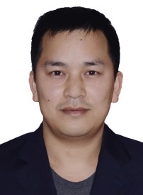 Degui Yang (杨德贵)合作论文数School of Automation, Central South University3
 Shuangxi Zhang (张双喜)合作论文数School of Electronics and Information, Northwestern Polytechnical University3
 Fan Wu (吴凡)合作论文数School of Information Science and Engineering, Southeast University;State Key Laboratory of Millimeter Waves, Southeast University3
 Jixin Chen (陈继新)合作论文数Department of Electromagnetic Field and Microwave Engineering, School of Information Science and Engineering, Southeast University3
 Ruoming Li合作论文数3Yucan Zhu合作论文数2




