In public places,tracking the movement trajectories of key personnel under investigation,and their close contacts tracing is an important task in public health and public security domains.This paper proposes a method for identifying close contact relationships between targets using visual perceptual information.First,based on the spatiotemporal characteristics of target trajectories,15 spatio-temporal topological relationships between dynamic targets and 5 spatio-temporal topological relationships between dynamic and static targets were defined.Next,using the spatio-temporal trajectory information of the moving targets extracted from the video and taking the spatial topological relationship between the targets and their coexistence time as indicators,five pedestrian association states are classified:chance encounter,stay,walking together,close contact and co-occurrence.Finally,experiments conducted in an indoor scenario demonstrate the effectiveness of the proposed method.This research offers a novel solution for personnel tracking in public safety and public health,and plays a significant role in advancing the theory and methods for microscopic-scale crowd dynamics observation.
Change detection is a fundamental yet challenging task in remote sensing, crucial for monitoring urban expansion, land use changes, and environmental dynamics. However, compared with common color images, objects in remote sensing images exhibit minimal interclass variation and significant intraclass variation in the spectral dimension, with obvious scale inconsistency in the spatial dimension. Change detection complexity presents significant challenges, including differentiating similar objects, accounting for scale variations, and identifying pseudo changes. This research introduces a dual fine-grained network with a frequency Transformer (named as FTransDF-Net) to address the above issues. Specifically, for small-scale and approximate spectral ground objects, the network employs an encoder-decoder architecture consisting of dual fine-grained gated (DFG) modules. This enables the extraction and fusion of fine-grained level information in dual dimensions of features, facilitating a comprehensive analysis of their differences and correlations. As a result, a dynamic fusion representation of salient information is achieved. Additionally, we develop a lightweight frequency transformer (LFT) with minimal parameters for detecting large-scale ground objects that undergo significant changes over time. This is achieved by incorporating a frequency attention (FA) module, which utilizes Fourier transform to model long-range dependencies and combines global adaptive attentive features with multi-level fine-grained features. Our comparative experiments across four publicly available datasets demonstrate that FTransDF-Net reaches advanced results. Importantly, it outperforms the leading comparison method by 1.23% and 2.46% regarding IoU metrics concerning CDD and DSIFN, respectively. Furthermore, efficacy for each module is substantiated through ablation experiments. The code is accessible on https://github.com/LeeThrzz/FTrans-DF-Net.
The accurate extraction of traffic signs is of great significance to the digitization of traffic information and the fine management of traffic. This article introduces an innovative approach to address the challenges associated with recognizing and detecting traffic signs, considering their vulnerability to complex backgrounds, variations in illumination, and motion blur. The proposed method utilizes a semi-supervised learning (SSL) strategy, combining convolutional neural networks (CNNs) with a transformer encoder-decoder architecture, to extract traffic sign features from vehicle panoramic images. To enhance feature extraction, a hierarchical sampling method (HSM) is introduced, which facilitates the extraction of multiscale self-attention features in the transformer encoder-decoder structure. Additionally, a network module called local and global information aggregator (LGIA) is designed based on HSM, enabling the incorporation of both local and global context information. Furthermore, a SSL strategy is adopted to simultaneously train our model using both labeled and unlabeled data samples. This strategy aims to improve the extraction of traffic signs by capitalizing on the broader data set available through unlabeled data. Experimental results demonstrate the effectiveness and robustness of the proposed method in improving the detection and recognition of traffic signs. The approach showcases significant improvements in overcoming the challenges posed by complex backgrounds, variations in illumination, and motion blur. Our approach achieved a 0.9% improvement in the F1-score evaluation over the current classical object detection algorithm on the public data set Tsinghua-Tencent 100K and a 1.1% improvement on the SSW data set.
As a forward-looking and proactive policing mode, predictive policing has been a major innovation of modern policing reforms across the USA and European countries since it was proposed in 2008. As it does not involve the use of personal privacy data and can be integrated with police patrolling and precise crime prevention strategies, place-based spatial-temporal crime prediction has been a hot research topic and main component of policing practices. This research presents a systematic review of the progress of spatial-temporal crime prediction across the world since 2013 when the RAND Corporation released its special report on predictive policing. It contributes to the literature with the following five aspects:(1) summarizing the new trends in the field of spatiotemporal crime prediction studies in terms of the number of papers, research topics,leading scholars, and academic journals. The studies on spatial-temporal crime prediction have received extensive attention from various countries in recent years, and the research themes have shown a diversified trend. The most productive scholars are mainly from China and the USA, with the main focus on spatialtemporal crime prediction model development;(2) describing the new dynamics and progress of six basic components involved in the spatial-temporal crime prediction research, which are the prediction target, temporal scale, spatial scale, prediction method, performance evaluation measure, and practical evaluation. The four most widely studied types of crimes are theft, robbery, burglary, and motor vehicle theft. For burglary crime, the typical temporal unit for spatial-temporal prediction is 1-month; For the other three types of crime, the typical temporal unit is 1-day. For these four types of crime, the typical spatial unit is 200-meter grid. The top three models with the best prediction performance are random forest model, spatial-temporal neural network model,and Hawkes process model;(3) introducing several main commercial softwares for spatial-temporal crime prediction and global predictive policing practices;(4) investigating the relevant ethical issues and potential challenges that are embedded in each stage of practical applications, including data & algorithm biases, lack of transparency and countability mechanism;(5) prospecting future research directions in spatial-temporal crime prediction areas. This research provides a brief and panoramic image of the field of spatial-temporal crime prediction and can act as a reference for researchers and practitioners in relevant fields including crime geography, smart policing, and Policing Geographic Information System(PGIS).
The spatiotemporal distribution of crime is closely related to the environment, exhibiting a typical characteristic of “spatiotemporal autocorrelation”. However, most of the existing machine learning-based crime prediction methods have difficulty in simulate the spatiotemporal dependence of crime. In this study, we mitigate the spatiotemporal dependence embedded in crime data by introducing a spatiotemporal lag variable. To verify the feasibility of the proposed methods, four machine learning methods were used to determine whether considering spatiotemporal dependency could improve model prediction accuracy and explore the impact of various factors (i.e., environmental factors and demographical factors) on crime risk intensity in different locations using crime data collected from June 2014 to May 2018 in Dallas. The results indicated the following: (1) incorporating spatiotemporal lag variables can effectively improve the prediction accuracy of machine learning models; (2) variables predicting crime are highly nonlinear over time and space, and tree-based nonlinear models greatly outperform linear models in predicting crime; and (3) interpretable machine learning models can reveal the unique contribution of each variable to researchers and practitioners. These findings contribute to our understanding of the mechanism of crime occurrence and may guide the development of crime prevention strategies.
传统的犯罪地理和犯罪时空预测方法主要是以警务辖区或格网为基本单元,分析结果不利于指导精细化的巡防警力规划部署.基于深度学习的图神经网络方法可以自然地与微观尺度下的路网拓扑结构相结合,实现道路尺度下的精细犯罪预测,但现有方法鲜有考虑道路权重对预测结果的影响.本文通过引入道路通达度和距离衰减因子,构建了一种顾及道路权重的图卷积犯罪时空预测模型(Road Weighted Spatio-Temporal Graph Convolutional Network,RW-STGCN),并利用芝加哥2016-2017年街面盗窃犯罪数据对模型进行评估.结果表明:①与未考虑道路权重的时空图卷积模型相比,RW-STGCN模型命中率在不同的路网覆盖比例下(1%、5%、10%、20%)的提升均在6.5%以上,且随着覆盖比例的下降,模型命中率的提升更为显著,最大提升超过了50%;②模型消融性实验表明,同时考虑2种道路权重的模型比仅考虑距离衰减权重或道路通达度权重单个因子的模型预测性能提升更为明显,命中率最大提升了 12.9%.本研究构建的RW-STGCN模型有助于街面类犯罪预测,可为警务部门基于路网进行科学巡逻防控规划与警力部署提供辅助决策支持,此外还可用于以道路作为分析单元的城市计算问题研究.
针对地理信息系统在公安行业应用中存在多个名称相近及中英文简称混用问题,本文采用文献研究与统计相结合的方法,分析了警用地理信息系统在不同发展阶段名称使用上的变化,厘清了不同名称使用的历史背景和语义环境,论述了概念、内涵与外延,并对其与相关学科的关系进行了探讨.
The application of GIS in the public security industry is generally called “Police Geographic Information System (PGIS)” in Mainland China. Although China’s PGIS play important roles in protecting public safety and smart policing, no publications on this subject are found in English. This paper provides an overview of the four main development stages of PGIS in public security agencies in mainland China: the early exploration stage; the multi-department PGIS system development stage; the centralization stage; and the spread and improvement stage. Successful GIS applications and practices in local police departments are also introduced in this paper. At the end of this paper, three problems and challenges faced in the development of PGIS are introduced, involving the current PGIS application depth; the support of crime mapping and crime analysis theoretical research on policing practices; and the introduction and localization of mature foreign crime analysis and prediction technology. Additionally, we point out that the implementation of smart policing strategies under the context of big data has created favorable conditions for subsequent crime analysis, research, and application, encouraging police departments to more frequently take initiative by cooperating with research institutions in crime analysis and prediction technology research. These new opportunities will inevitably promote the rapid development of PGIS and the geography of crime in China.
Associated traveling becomes new research highlight in the fields of urban planning, traffic traveling, infectious disease prevention and controlling, crime investigation etc. Especially, effectively identifying the related behavior of individuals with subjective intentions (such as meeting and waiting) is considered as a difficult problem in the area of spatio-temporal cognition. In this paper, spatio-temporal trajectory of crime is studied. First, the inadequacy of the previous traveling trajectory description methods is analyzed, which indicating that the detailed point characteristics and the complete line characteristics of the traveling trajectory should be considered, based on that a travel trajectory description model considering the point-line characteristics is proposed. Second, a trajectory discrimination method of associated traveling is proposed based on spatio-temporal topological relationship, which can describe four basic associated traveling trajectory modes including meeting, waiting, coexistence and companion, further distinguishing 19 different associated traveling subtypes. Finally, the effectiveness of the method is validated by an experimental comparison.
The determination of a reasonable spatial analysis unit is an essential step in urban functional zone (UFZ) division, which significantly affects the results. However, most studies on the division of functional zones are based on excessively large spatial units, such as blocks or traffic analysis zones (TAZs), which easily overlook the detailed characteristics of urban regions and introduce bias to the research conclusion. To address this issue, a refined zone segmentation method, namely, the Voronoi diagram for the polygon method, was proposed to generate refined spatial analysis units. Afterward, the functional topics of the spatial analysis unit were classified by a multiclass support vector machine (SVM) to produce the final UFZ map, where the functional topics of each spatial unit were obtained by coupling latent Dirichlet allocation (LDA). To verify the effectiveness of the proposed method, experiments were conducted in Beijing, China. The results indicated that the proposed segmentation method can generate fine-scale spatial units and provide fine-grained and higher accuracy UFZs (overall accuracy = 84%; kappa = 0.82).
In semi-supervised semantic segmentation, the segmentation accuracy of aerial images is mainly improved by using the structure of encoder—master-auxiliary decoder which applies the unlabeled samples to the calculation. However, the loss of shallow detail features which is caused by continuous downsampling in the process of encoding makes the boundary of ground objects incomplete. Therefore, a semi-supervised network combining multi-scale shared encoding is proposed for semantic segmentation of aerial images. The encoder uses ResNet-50 to obtain the shallow features of the image, and links the shallow features by embedding a multi-scale shared coding module at the end of ResNet-50 to build a dense feature pyramid and expand the receptive field, thereby obtaining multi-scale detailed information of the target feature. The effectiveness of the proposed method is verified by compared with UNet, DeepLabv3+, FCN and CCT, XModalNet, VLCNet on the two datasets of LandCover.ai and DroneDeploy, and the result shows that our network has obvious advantages in terms of label number and accuracy. For the LandCover.ai dataset, under the premise of 6000 labeled samples and 6500 unlabeled samples, the overall mIoU increased by 1.15%. For the DroneDeploy dataset, under the premise of 30 labeled samples and 5 unlabeled samples, the overall mIoU increased by 0.94%, while significantly improving the segmentation accuracy of ground objects to obtain a clear and complete ground boundary.
The effectiveness of using changes in environmental conditions to explain the spatiotemporal variability in soil organic carbon (SOC) with digital soil mapping (DSM) requires investigation. In this study, temporal variables representing temporal patterns of climate, vegetation, and land cover factors were explored. Models to predict SOC stocks were developed using a random forest algorithm and data from China during two periods (the 1980s and 2010s). We forecasted and hindcasted the developed models and assessed their temporal projections against temporally independent data. Models were developed for both periods using different sets of variables (with/without temporal variables), and their temporal projections were compared. The important temporal variables were identified by applying the recursive feature elimination algorithm. The results showed that the performances of temporal projections for the 1980s and 2010s were improved by approximately 17% and 47%, respectively, when temporal variables were included in the models. Spatially, the maps of changes in SOC stocks derived from the models that included temporal variables presented stronger associations with temporal changes in climate, vegetation, and land cover than those derived from the models that did not include temporal variables. This work highlights that variation in SOC stocks can be linked to temporal patterns of environmental factors. The findings also provide evidence that the application of temporal patterns of environmental factors to DSM models can be useful for the large-scale prediction of changes in SOC.
针对新疆和田地区大面积果园监测,利用天-空-地一体化监测体系对监测区域从不同尺度获取果园监测数据;利用混合云技术保障数据的安全性,提高数据计算能力;利用Spring Boot框架搭建系统基础架构,实现前后端分离,前端与后端分别部署在公有云和私有云,前端页面部署在公有云,为用户提供访问接口,后端业务逻辑部署在私有云,保障后端程序安全运行.经开发、测试和部署应用后,系统运行稳定,为新疆和田地区的果园管理提供了现代化的果园管理和监测平台.
The prediction of soil organic carbon (SOC) changes in response to environmental change is often limited by a scarcity of revisited temporal data, which constrains scientific understanding and realistic predictions of soil carbon change. The present study improved the potential of nonrevisited temporal data in the prediction of SOC stocks (SOCS) variations. We proposed a method to develop predictions of SOCS change using two independent temporal data sets (pertaining to the 1980s and 2010s) in China based on the digital soil mapping technique. Changes in SOCS over time at the site level were analyzed via the interpolation of missing SOCS values in each data set. Quantitative SOCS change predictions were generated by modeling the relationship between SOCS change and variables that represent changes in climate, vegetation indices, and land cover. The scale-dependent response of SOCS change to these environmental dynamics was assessed. On average, a slight increase was observed from 3.70 kg m-2 in the 1980s to 4.53 kg m-2 in the 2010s. The proposed approach attained moderate accuracy with an R2 value of 0.32 and a root mean squared error (RMSE) of 1.73 kg m-2. We found that changes in climate factors were dominant controls of SOCS change over time at the country scale. At the regional scale, the controlling factors of SOCS change were distinct and variable. Our case study may be of value in the application of independent temporal data sets to analyze soil carbon change on multiple scales. The method may be used to resolve questions of soil carbon change projections and provide an alternative solution to predict likely changes in soil carbon in response to future environmental change when no temporal data are available.
针对大数据时代新技术对我国警用地理信息系统(PGIS)发展所带来的巨大冲击和挑战,该文回顾了我国公安机关20世纪90年代中期以来在PGIS实践探索方面所经历的4个阶段主要发展历程;分析了 当前PGIS发展所面临问题、挑战及与国外的应用差距;提出了 PGIS后续技术优化升级与应用生态体系构建、警务时空大数据关键技术研究、学科建设、国外先进技术引入及本地化优化等相关建议.指出今后PGIS技术研究和应用重点,将从当前以警务地理信息资源共享、可视化管理与空间查询应用为主的阶段,逐步向基于云的警务时空大数据分析与犯罪预测阶段发展过渡.
21世纪的全球化越来越被数据和信息的流动所定义,飙升的跨境数据流动已超越传统的商品贸易,创造出更多的经济价值,并推动全球化进入数字技术驱动的数字全球化新阶段.数字全球化作一种新的社会生产方式,必然带来全球数字技术支撑体系、全球产业链及贸易链格局、全球化问题研究范式、全球数字化治理和规则构建等多方面的变革,并引发对数字全球化相关问题研究的迫切需求.本文尝试借助列斐伏尔空间生产理论,对数字全球化空间生产的内在逻辑和技术体系构建进行初步探讨,认为通过进一步强化新型数字化基础设施建设、强化多学科融合创新研究及多元主体参与意识,将有助于提升数字全球化空间生产能力,拓宽全球化问题创新研究视角和认知空间,促进数字全球化空间正义.
Landmark extraction is a hotspot of spatial cognition and spatial knowledge organization research. Saliency measurement model is a most important method of landmark extraction, of which the principle is the weighted evaluation of the appearance, structure and semantics of objects. Considering the spatial distribution and geometric characteristics of objects, and it is difficult to extract landmarks with more consistent features, making it a complex process. From the viewpoint of composite features in Voronoi domain, a landmark extraction method is proposed to explore the geometric feature reflection of landmark from individual to its neighborhoods, based on the height of Voronoi element, Voronoi k-order neighborhood crevice and Voronoi k-order neighborhood visibility. Comparative experiments show that: (1) Compared with the landmark extracted by the existing methods with the results of traditional saliency measurement model, which verifies the effectiveness of this method; (2) As for the characteristics of ground property, the geometric features contained in Voronoi diagram can effectively represent the landmarks, reducing the complexity for feature selection of landmarks.
运动误差可由位姿变化反映,基于此提出了一种利用同名像点位姿变化建立某型器物量测系统误差补偿新方法.该方法首先在位置1处观测,通过控制器主动做定量位姿变化到位置2,结合位置1处外方位元素与坐标转换原理得到位置2处外方位元素初始值,进而利用条件共线方程解得位置2处标定板角点拟合像素坐标;然后在位置2处观测,并将标定板中同名像点像素坐标作为观测值,与拟合值作差可列出误差方程式,迭代求解误差改正数;最后利用获得的多组误差数据,通过非线性最小二乘拟合获得运动误差补偿模型.实验表明,利用该方法检测运动误差无需测量仪器参与,操作便捷,代价成本低;此外,补偿模型所需参数较少,补偿后误差减小至亚毫米级.
用于变形监测任务的激光雷达扫描仪需要采用运动控制器来变换探头位置以发射/接收光束,通常运动控制器由步进电机与同步带构成.提出了一种基于外方位元素标定的同步带类运动控制器误差模型建立方法,具体步骤为:①恢复运动轴上不同位置处已知控制点坐标与像平面坐标之间的单应关系,得到摄影机的内、外方位元素;②对不同位置处外方位元素中的平移向量进行线性运算后,求解相应的位置关系;③将输入脉冲数对应的距离作为真值,与所求位置关系作差得到多组误差数据,利用拟合对误差建立多项式模型.实验结果表明,利用该方法检测误差所需设备少且操作简单,所建误差模型精度达到亚毫米级,并能有效地对位置控制予以补偿;同步带类运动控制器的主要误差来源于同步带,以其作为基础的相关测绘仪器可分部件进行验校,以节省使用成本.
Based on the technological development in the GIS industry and the GIS application demand in the police departments,the background and the necessity of the construction of Police Geographic Information System(PGIS) Platform in the police information Intranet,the conception and its system architecture,the general idea and progress of the PGIS Platform in China are introduced in this paper.
 Zhenqi Hu (胡振琪)合作论文数School of Environment and Spatial Informatics, China University of Mining and Technology7
 JiaTian Li (李佳田)合作论文数5Yue Deng (邓悦)合作论文数4ZhongYi Wei (魏忠义)合作论文数4JiaLong Li (李家龙)合作论文数4weicheng yi (易伟程)合作论文数3A Xiaohui (阿晓荟)合作论文数3HuaJing Wu (吴华静)合作论文数3PiLong Sun (孙丕龙)合作论文数3
 Changming Zhu合作论文数2LU Yumei (陆宇梅)合作论文数2LI Xinran (李欣然)合作论文数2
 Jianguo Li合作论文数2chuanzhao yan (闫传召)合作论文数2Yiru NIU (牛一如)合作论文数2Li-An Liu合作论文数2Naiqin Gong (龚乃勤)合作论文数安徽省政协人口资源环境委员会2
 Renmin Yang (杨仁敏)合作论文数School of Earth System Science, Tianjin University2Hao ZHANG (张皓)合作论文数2Jian Li (李键)合作论文数2
 Xin Zhang (张新)合作论文数中国科学院遥感与数字地球研究所2Honglu Dong (董红路)合作论文数2Shu Zhang (张舒)合作论文数2
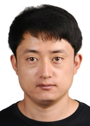 Zhenxin Zhang (张振鑫)合作论文数College of Resources Environment and Tourism, Capital Normal University;College of Geospatial Information Science and Technology, Capital Normal University2
 Liqiang Zhang (张立强)合作论文数Faculty of Geographical Science, Beijing Normal University2
 Z. Q. Zhang合作论文数2Mengbing Xu合作论文数1Hao Ma (马浩)合作论文数1JI Jinliang (季金亮)合作论文数1jitao si (司继涛)合作论文数1
 Shanhe Jiang合作论文数1
 Zhen Li合作论文数1YANG Ruchun (杨汝春)合作论文数1
 Yanji Yao合作论文数1ZHOU Da-liang (周大良)合作论文数1xiang luo (罗翔)合作论文数1jing jiang (姜晶)合作论文数1
 Siyun Chen合作论文数Capital Normal Univ, Coll Resource Environm & Tourism, Beijing 100048, Peoples R China1Haiming Ling (凌海明)合作论文数1ZHANG Wenyu (张文宇)合作论文数1Linyan Bai合作论文数1Chenglin JIA (贾成林)合作论文数1daqi li (李大启)合作论文数1DENG Gang (邓钢)合作论文数1TaiQi Li (李太启)合作论文数1WenJing Zhang (张文靖)合作论文数1JianZhong Feng (冯建中)合作论文数1QingXun Ma (马庆勋)合作论文数1HanLin Li (李汉林)合作论文数1




