Lake Taihu has a history of recurrent harmful cyanobacterial blooms. There is a need to better understand the aquatic ecosystem of Lake Taihu in order to improve methods for controlling the cyanobacterial blooms. Based on the field measurement and satellite remote sensing, we produced and collected a time-series dataset, including the water quality, bio-optics, climate, and anthropogenic data of Lake Taihu (THQBCA), which could provide comprehensive information regarding cyanobacterial blooms. The THQBCA dataset contains 26 variables organized into four categories: water quality, bio-optics, climate, and anthropogenic data. The water quality and climate data are field measured data with sampling frequency from daily to quarterly, and bio-optics and anthropogenic data are satellite-derived annual data. The dataset spans more than 15 years (8 of which cover approximately 35 years, 4 of which cover 20 years), and the spatial resolutions of the satellite-derived data range from 30 m to 500 m. This dataset is expected to advance research on evaluating and predicting cyanobacterial blooms, and support science-based management decisions for sustainable ecological development.
Trophic state index (TSI) serves as a key indicator for quantifying and understanding the lake eutrophication, which has not been fully explored for long-term water quality monitoring, especially for small and medium inland waters. Landsat satellites offer an effective complement to facilitate the temporal and spatial monitoring of multi-scale lakes. Landsat surface reflectance products were utilized to retrieve the annual average TSI for 2693 lakes over 1 km2 in China from 1984 to 2023. Our method first distinguishes lake types by pixels with a decision tree and then derives relationships between trophic state and algal biomass index. Validation with public reports and existing datasets confirmed the good consistency and reliability. The dataset provides reliable annual TSI results and credible trends for lakes under different area scales, which can serve as a reference for further research and provide convenience for lake sustainable management.
Hulun Lake, the largest steppe lake in the high latitude semi-arid region of inland China, holds great significance for grassland production and steppe-lake ecosystem. The absorption coefficient of water constitutes is indicative of the optically active components in water, thus conducive to estimating the optically active substances and other related bio-optical parameters of waters. In this study, we used the quasi-analytical algorithm (QAA), a QAA-750E absorption coefficient inversion algorithm suitable for inland waters. Based on Sentinel-3/OLCI remote sensing reflectance data, we produced a dataset of monthly mean phytoplankton absorption coefficient aph(675)and backscattering coefficient bbp(560) of Hulun Lake during 2016-2020. Validation analysis results show that the model-derived b_bp (560) has an R2 value of 0.59, RMSE of 0.55, and MRD of 0.54 (N = 15), indicating a high level of reliability of the dataset. The dataset is expected to offer data support for water quality monitoring and ecological environment protection of Hulun Lake.
The Trophic state index (TSI) stands as one of the most direct and effective indices for characterizing the trophic state of water bodies, and the long-time TSI series data are important for monitoring the dynamic shifts in water quality in lakes. In this dataset, we used Landsat-5 TM, Landsat-7 ETM+ and Landsat-8 OLI as data sources, and crafted an Algal biomass index (ABI) to investigate its responsiveness to TSI. And through rigorous analysis, we estimated the TSI time series of Hulun Lake for 35 years from 1986 to 2020. Furthermore, we generated spatial maps depicting the mean TSI values in summer. The results revealed a distinctive spatial pattern, characterized by elevated TSI levels in the southwestern region and lower levels in the northeast of Hulun Lake during the summer season. Moreover, there was a noticeable discrepancy between the shoreline and the central area of the lake, with higher TSI values near the shore and lower values in the lake's center. To ensure the reliability and accuracy of the results, we compared the TSI derived from the OLI and the TSI based on measured reflectance ratios, which shows that the root mean square error (RMSE) of less than 2.39, and the mean absolute percentage error (MAPE) of less than 3.53%. The dataset is provided in *.tif format with a spatial resolution of 30 m. Users can leverage professional GIS software to view and edit, or use the relevant python packages or R languages for advanced data processing. The spatial and temporal variation characteristics of TSI reflected in this dataset can provide effective data support for water quality monitoring and ecological protection in Hulun Lake area.
The black soil area in Northeast China plays an important role in food production and ecological security in China. However, over-cultivation practices have led to severe soil erosion, which seriously threatens food security and ecological environment in Northeast China. Accurate simulations of water erosion with high spatio-temporal resolution are important for advancing sustainable development goals, such as promoting sustainable agriculture and monitoring land degradation in Northeast China. This dataset is based on Google Earth Engine (GEE) cloud platform, integrating multi-source remote sensing data, deconstructing RUSLE model, and optimizing algorithm combinations for each factor of the model. We compared and verified the annual sand transport volume and sand transport modulus data from the main hydrological monitoring stations in Northeast China with the soil erosion modulus estimated by the RUSLE model. Then, we selected the optimal factor algorithm combination based on three accuracy metrics (time series correlation, root mean square error and mean absolute error), and obtained the estimation results of soil water erosion modulus with the resolution of 250 m. This dataset can better depict the spatial distribution and temporal changes of soil erosion modulus in Northeast China from 2001 to 2020. It can serve as an effective reference for soil erosion control and assessments in Northeast China.
Suspended particular matter (SPM) concentration is one of the parameters in assessing water quality. The monitoring of the long-term variations of suspended particular matter is of great value for lake management and ecological restoration in lake water. As an important lake in the north of China, Hulun Lake is an important part of the "One Lake, Two Seas" initiative. The monitoring of its water quality changes is of great significance to ensuring the ecological security in Northern China. Through the processing of MODIS Aqua data from 2002 to 2021, and by mitigating the impact of water vapor and ozone absorption as well as Rayleigh scattering, we derived Rayleigh-corrected reflectance (Rrc), and subsequently generated the dataset of monthly and yearly mean suspended particulate matter concentration in Hulun Lake spanning the years from 2002 to 2021. The average percentage error of the model was verified to be 16.5%, which can meet the practical needs of long-term observation of the suspended particulate matter in lakes. This dataset can provide theoretical support and practical reference for the monitoring of ecological changes and environmental management of water quality in Hulun Lake.
Due to global warming and climate change, affected by climate anomalies, Yangtze River basin in China experienced the strongest high-temperature process since the complete meteorological observation records in 1961. This process led to the continuous low water level of Yangtze River tributaries and the rare phenomenon of "anti-depletion of flood season" in Poyang Lake and Dongting Lake, both of which were influenced by this climate event. Lakes are indicators of global climate change, and water area changes in lakes have become one of the sensitive indicators of regional ecological environment and climate change. In this study, we used the GEE cloud computing platform to call Sentienl-1 SAR data to calculate the sentinel-1 dual-polarized water index (SDWI). Then, we determined the optimal threshold value using the OTSU algorithm to obtain the final water change monitoring data at 10m resolution for the main body of Poyang Lake, Dongting Lake and their surrounding areas during extremely high temperatures in 2022. This dataset has been validated to with an overall accuracy of over 96% and a Kappa coefficient of 0.92. The dataset includes spatiotemporal variations in arid water bodies in the middle and lower reaches of the Yangtze River during extremely high temperatures in 2022. The dataset can offer data support and serve as a scientific foundation for sustainable lake water resources during extreme weather events, as well as for research on global climate change and the ecological evolution of lakes.
Water clarity is a significant parameter for evaluating the water quality of lakes. Monitoring the long-term temporal and spatial changes of water clarity of lakes can provides valuable insights for evaluating water quality and eutrophication status of water bodies, as well as guiding lake environmental management and ecological restoration. With MODIS Terra satellite images, we excluded the influence of cloud cover and other interference factors to evaluate the water clarity (i.e. Secchi disk depth), and finally produced a dataset of water clarity of Hulun Lake from 2000 to 2019. It has been validated that the coefficient of determination of the dataset is 0.8, and the root mean squared error is 21.27cm, indicating its accuracy in meeting the monitoring requirements. This data set is expected to serve as a valuable resource for remote sensing-based water quality monitoring and environmental governance of Hulun Lake at a scale of long time series.
The reuse of scientific data can foster the sharing and collaboration of research processes, facilitating a more efficient allocation of data resources. Lake scientific data, as an important fundamental strategic resources, play a crucial role in driving national scientific and technological innovation, fostering economic and social development, and advancing the construction of a national ecological civilization. The sharing of scientific data pertaining to lakes has gradually emerged as an important part of China's national scientific and technological innovation system construction. This research synthesizes the primary channels for lake data production, offering a comprehensive overview of the main data types and formats of lake data from the perspective of lake discipline as an interdisciplinary discipline, and summarizes the current situation of sharing scientific data on lakes both domestically and internationally. Furthermore, this paper also proposed strategies and methodologies for facilitating sharing scientific data related to lakes based on standardized systems, data classification, service platforms, and hierarchical sharing services. In this study, we concluded the institutional measures for lake data sharing, and provided insights for the further development of lake science data sharing under new circumstances. This research is undertaken with the aim of fostering the transformation of lake science data sharing modes under the new paradigm of lake science research.
The presence of cyanobacteria blooms is an intuitive visual indicator of the eutrophication levels in lakes. It is of great importance to precisely assess the extent, coverage, location and other pertinent details of algal blooms and to monitor the eutrophication degree of water in real time, which is essential for ecological restoration and human life quality protection. Using MODIS Aqua satellite image as the primary data source, in the dataset we eliminated the influence of cloud, flare, aquatic vegetation, high turbidity water and other potential factors of interference in the extraction of algal blooms, calculated the algal bloom coverage at the individual pixel level, and finally obtained the data algal blooms in Hulun Lake spanning 19 years, from 2003 to 2021. The accuracy verification process generally met the stipulated requirements. The format of this dataset is * tif, which is compatible with GIS professional software for reading and editing. The dataset can provide data reference for professionals in the field, offering valuable data support for the ecological environment monitoring of Hulun Lake.
Color dissolved organic matter (CDOM) plays a key role in lacustrine ecosystems and its composition is commonly mediated by the allochthonous input and autochthonous production. Deep lakes have a strong in-lake processing, which highly affects the sources, composition and cycle of CDOM. Here, the second deepest lake (Lake Fuxian) in China was selected to investigate the effects of allochthonous input and in-lake processing on lacustrine CDOM in deep lakes. Firstly, a detailed survey on CDOM composition across Lake Fuxian in the top water layer and inflowing rivers was carried out in the wet season representing the allochthonous input. In addition, CDOM in Lake Fuxian was compared with those in other lakes with distinct catchment characteristics and lake morphology. The results showed that compared to lacustrine CDOM in Lake Fuxian, the riverine CDOM contained much more humic-like substances, resulting in the humic-like fluorescence intensity peaked at the confluence of rivers into Lake Fuxian. In contrast, CDOM in Lake Fuxian was dominated by the protein-like substance. Comparison of CDOM composition among Lake Fuxian (well-vegetated catchment, deep lakes) with other diverse lakes in China (shallow/deep lakes with poor-vegetated catchment, and shallow lakes with well-vegetated catchment) showed similar CDOM quality in all type lakes, which were dominated by non-humified and autochthonous CDOM. Yet, CDOM quantity increased as the orders of deep lakes within poor-vegetated (Tibetan deep lakes) < the deep lake within well-vegetated catchment (Lake Fuxian) < shallow lakes within poorly-vegetated catchment (Tibetan shallow lakes) < shallow lakes within well-vegetated catchment (lakes along the middle and lower reaches of Yangtze River). Our results evidenced that the effect of allochthonous input on CDOM composition could be counteracted by in-lake processing in deep lakes. For deep lakes, a comprehensive understanding of in-lake processing of CDOM is critical for predicting lacustrine DOM composition and cycle.
随着大数据时代的到来,智能手机客户端已经被越来越多地应用于自然资源领域相关业务的实际调研中,通过实景照片采集、文字信息描述、地理位置定位的方法进行相关调研的环境信息实时化采集.但是在面向村镇、村庄等小空间尺度的规划和建设过程中,实际居民的需求、意愿和感知往往是调研中更为关注的重点.目前大多数应用只面向周边环境的调研采集,而忽视了建设规划过程中非常重要的一点——居民的意愿.运用集成ArcGIS for Android、GeoServer等开发框架,通过Form表单存储问卷信息至本地SQLite数据库,实现"环境调研+问卷采集"一体化操作.应用于村镇小尺度的环境+问卷调研信息采集,将居民的需求意愿在村镇建设决策中体现出来,能够更好地服务于村镇建设规划.
Mobile survey tools (MSTs) are helpful for the collection and management of massive field information for the surveying and planning of township land resources. Willingness and consciousness information, which are derived from residents, are critical for land resources business at the rural scale. However, existing MSTs focus on surrounding environmental information collection (locations, environmental photos, and geography features records), while subjective information that reflects residents' consciousness and willingness is rarely considered. To overcome this deficiency, this study developed 'Townplan-APP' to collect multiple types of information for township land resource surveying. Three functions were realized to ensure that objective and subjective infor-mation could be collected and managed in real time. First, collection of surrounding environment information is determined as the basic function, which is designed in accordance with existing APPs. This function supports the recording of latitude and longitude, as well as photos and texts that represent environmental features. Second, the interview and questionnaire information collection function, which is the most important novel component in this APP, was designed to record specific residents' consciousness and willingness according to online questionnaires filling. This function was operated in accordance with universal processes, such as 'template presetting questionnaire updating-questionnaire filling-questionnaire delivering'. Hence, default templates are provided and can be applied directly to the following surveys, which are oriented to similar businesses, rather than redesigning questionnaires. In addition, updating and revising templates are also supported. Third, back-end management, especially the surveying data representation function, which ensures that multiple types of surveying information can be transmitted and represented from front-end (Mobile APP) to back-end (web-based platform) in real time, not only improves the efficiency of data transmission but also enhances the visualization effect. In general, Townplan-APP is an effective tool for township land resources surveying and planning that can be applied and promoted in international areas.
首先选取巢湖流域内的7个二级流域作为研究区,同时为了使研究结果更具可靠性,利用县级行政区划数据对研究区进行细化;然后构建泥沙输移分布模型,定量估算2015年巢湖流域颗粒态磷负荷模数;最后在不同土地利用模式下,综合考虑地理位置、资源条件、社会经济等影响因子,剖析产生颗粒态磷流失的差异并分析其原因.结果表明:巢湖流域平均颗粒态磷负荷模数为0.308 t·km-2·a-1,主要用地类型为林地0.759 t·km-2·a-1>耕地0.256 t·km-2·a-1>建设用地0.138 t·km-2·a-1,细分研究区使研究结果更具可靠性.颗粒态磷负荷模数具有空间差异,高值区集中在坡度较大、降水充沛的杭埠河流域(岳西县、霍山县、舒城县);低值区分布在地势平缓、经济发展水平较高的派河流域(肥西县)、南淝河流域(合肥市、长丰县).坡度大、降水丰沛是造成林地、耕地颗粒态磷负荷模数较高的主要原因;化肥、农药不合理施用、地膜污染等导致耕地负荷较高;畜禽养殖提高建设用地负荷;磷矿的分布也会增加磷背景值.
Lake Taihu is well known for its severe environmental degradation. In previous studies of lake quality target management, the water quality targets were poorly correlated with watershed pollutant reduction, and most studies lacked visualized management platform that covered all elements including lakes, in-lake estuaries, rivers and watershed regions. In this study, a browser/server-based visualization platform for lake quality target management was developed. Five models that covered both the watershed and lake scales were integrated based on two critical functions. First, the proposed method can be used to determine watershed pollutant reduction amounts based on certain lake quality target parameters, such as those for TN, TP, NH3N and COD. Second, the method can simulate the lake quality trends associated with different watershed adjustment plans. The platform was deployed by the Taihu Basin Authority (TBA) of the Ministry of Water Resources. Overall, this platform is a useful tool for watershed-lake environmental management.
In this study,quantitative characterization of the spatial and temporal variation of non-point source (NPS) particulate phosphorus loads in the watershed area of the Hongze Lake since 1990 was carried out in order to find out the internal relation and the influence mechanism between non-point pollution and land use change Conclusions are as follows:1.during 1990-2012,the total loads of particulate phosphorus presented a trend of"fall-rise fall",with a gradual downward trend in 1990-1996,a stable growth state in 1996-2006,and a rapid downward trend after 2008.And the highest value was 2253.67 t/a in 2012,and the lowest value was 510.03 t/a in 1990;2.There was significant spatial differences in the intensity of Par-P.The high value area was distributed in a variety of mixing zone of the tributaries of the Huaihe River basin,with an average Par-P intensity of of 3.88 t/km2/a.The low value area was mainly distributed in the wetland protection area of the Bian River Basin,with an average Par-P intensity of of 0.57 t/km2/a;3.Average Par-P intensity of different land use patterns ranked as follows:Huaihe River Basin (681.84t/a),Gaosong River Basin (317.65t/a),Weiqiao River Basin (185.73t/a),Bian River Basin (121.09t/a).The corresponding land use pattern is a variety of mixed,urbanization rapid growth,the dominant land,wetland protection.The increase in the area of agricultural land and construction land will increase the phosphorus pollution,and the land types of forest land and wetland can significantly reduce the loss of particulate phosphorus.Rational land use planning has an important role in alleviating the non-point source pollution of particulate phosphorus.This study can extend the connotation of watershed NPS pollution research,and showed significant meaning for Integrated research of watershed scales,and also can provide the scientific basis for LUCC adjustment oriented to lake environment protection and management.
This dataset is provided by TaiLLER (Taihu Laboratory for Lake Ecosystem Research) of Nanjing Institute of Geography & Limnology, Chinese Academy of Sciences. It contains 8 routine monitoring sites data which were sampled from 2001 to 2006. The long sequence of water quality monitoring data can response exactly the development trend of water quality change and provide data support for study on eutrophication of lake water environment, water environment protection, pollution control and management. We take international standard data processing method and quality control system to ensure the observation data quality. We publish these data publicly and provide online access service for them. These data provide support for the limnological research.
A novel approach was developed to estimate phytoplankton biomass in eutrophic turbid lakes, using MODIS bands designed for land and atmospheric studies. The Baseline Normalized Difference Bloom Index (BNDBI) uses the difference of remote-sensing reflectance (Rrs, sr−1) at 555nm (band 4) and 645nm (band 1) after baseline correction using bands at 469nm and 859nm: (Rrs′(555)−Rrs′(645))/(Rrs′(555)+Rrs′(645)). BNDBI takes advantage of the Chl-a’s absorption minimum near 572nm and absorption maximum near 667nm. Using data from Lake Chaohu, the index showed a strong relationship with Chl-a concentrations in conditions that would normally saturate more sensitive ocean-color sensors. Extensive field measurements were used to calibrate and validate the algorithm with unbiased root-mean-square-error (URMSE) of 47.9% when compared to in situ Rrs data. A reduced sensitivity to atmospheric effects was accomplished by using a baseline correction approach, anchored at 469nm and 859nm to correct the radiances at 555nm and 645nm. Radiative transfer simulations showed that the algorithm can be applied directly to MODIS Rayleigh-corrected reflectance (Rrc) after adjusting algorithm coefficients (URMSE uncertainty of 56.4% for MODIS Rrc data) for Chl-a concentrations <1000μgL−1. Comparative analyses showed that the index was resistant to changes in turbidity and organic matter concentrations. Theoretical simulations, image comparisons and spectral analyses demonstrated that the index was robust in a range of complex atmospheric and surface conditions, with different aerosol types, optical thickness (τa555), solar/viewing geometry, sun glint and thin clouds. A comparison with other MODIS and MERIS Chl-a algorithms for turbid waters showed that BNDBI provided consistent results with the advantage of using MODIS wavebands that remain unsaturated in high turbidity conditions. The BNDBI opens new possibilities to explore bio-optical dynamics in turbid eutrophic lakes using data from a range of satellite sources.
针对传统的模型集成方法难以规范化和模型接口难以标准化等问题,欧盟水框架委员会建立了开放式模型接口标准OpenMI(Open Modeling Interface),通过该接口标准,模型可以实现并行运行且共享每一时间步信息,在数据交换和模型链接机理上具有一定的优势.该文在分析了OpenMI工作原理和核心技术的基础上,着重阐述了OpenMI技术在水文模型集成中的研究进展,并指出OpenMI技术目前存在无法支持分布式模型集成以及缺乏可视化界面与人机交互等缺陷,而且在对模型间的数据请求响应机制以及交互数据的容错处理和中断处理机制方面仍有待完善.
 Ronghua Ma (马荣华)合作论文数中国科学院大学中国科学院南京地理与湖泊研究所24
 Xuan Hou合作论文数5
 Yuchao Zhang (张玉超)合作论文数Nangjing Institute of Geography & Limnology, Chinese Academy of Sciences;University of Chinese Academy of Sciences5
 Steven Arthur Loiselle合作论文数Dipartimento di Biotecnologie, Chimica e Farmacia, Università degli Studi di Siena5
 Junfeng Xiong合作论文数4Chen Lin合作论文数3
 Minqi Hu合作论文数3
 Weiping Hu (胡维平)合作论文数中国科学院南京地理与湖泊研究所3zehui huang合作论文数2
 Kun Xue合作论文数Nanjing Institute of Geography and Limnology, Chinese Academy of Sciences2NingNing Liu (刘宁宁)合作论文数2
 Zhigang Cao (曹志刚)合作论文数Beijing Jiaotong University2
 Min Min (闵敏)合作论文数School of Atmospheric Sciences, Sun Yat-Sen University2
 Hongtao Duan (段洪涛)合作论文数Nangjing Institute of Geography & Limnology, Chinese Academy of Sciences2Xuejun Duan (段学军)合作论文数2
 Min Zhang (张民)合作论文数1
 Meng-Xiao Ma合作论文数1
 Shilin An合作论文数1Shuailong Wen合作论文数1QiaoYing Zhang合作论文数1Zijing Wu (吴紫静)合作论文数1RAO Jia-Wang (饶加旺)合作论文数1Kai Xiao合作论文数1
 Shuo Chen合作论文数Dept Geol Sci, Univ Alabama1Zhifeng Jin合作论文数Wuhan Univ, Sch Resource & Environm Sci, Wuhan 430079, Hubei, Peoples R China1PingHua Jin (金平华)合作论文数1ChunZhu Shen (沈春竹)合作论文数1
 Guangwei Zhu (朱广伟)合作论文数Nanjing Institute of Geography & Limnology, Chinese Academy of Sciences;University of Chinese Academy of Sciences1
 Feizhou Chen (陈非洲)合作论文数Nanjing Institute of Geography and Limnology, Chinese Academy of Sciences1
 Ligang Xu (徐力刚)合作论文数中国科学院大学中国科学院南京地理与湖泊研究所1
 Yingxun Du (杜瑛珣)合作论文数中国科学院大学中国科学院南京地理与湖泊研究所1
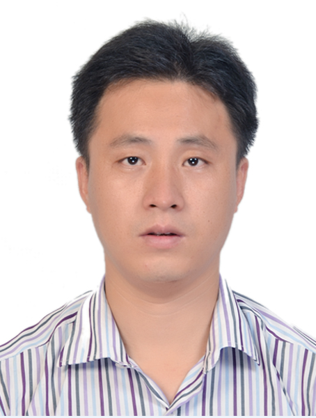 Yunlin Zhang (张运林)合作论文数Nanjing Institute of Geography & Limnology, Chinese Academy of Sciences1
 Mingliang Jiang (蒋明亮)合作论文数Research Institute of Wood Industry, Chinese Academy of Forestry1
 Jiangfeng She (佘江峰)合作论文数School of Geography and Ocean Science, Nanjing University1
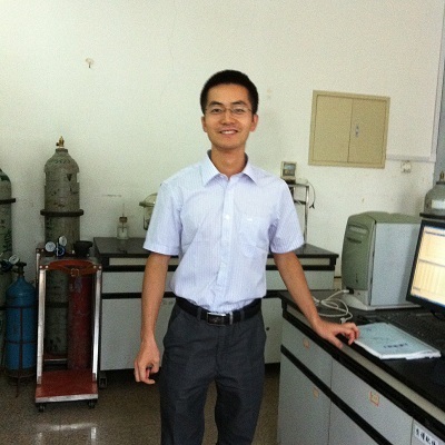 Yibo Zhang (张一波)合作论文数Changchun Institute of Applied Chemistry Chinese Academy of Sciences1
 Xi Chen (陈曦)合作论文数College of Geoinformatics, Zhejiang University of Technology1
 Minwei Zhang合作论文数Center for Earth Observation and Digital Earth, Chinese Academy of Sciences1Hongdan Jiang合作论文数1
 Muhua Feng (冯慕华)合作论文数Nangjing Institute of Geography & Limnology, Chinese Academy of Sciences;University of Chinese Academy of Sciences1




