The GeoNet programme at GNS Science has monitored and managed data for volcanoes, earthquakes, landslides, and tsunami in Aotearoa New Zealand since 2001. Volcano monitoring data are collected from seismometers, acoustic sensors, GNSS receivers, webcams, remote gas monitoring sensors, and a range of environmental sensors, as well as manually during visits to volcanoes. The primary user of volcano data is the internal cross-specialised Volcano Monitoring Group (VMG), which fulfils the role of the national volcano observatory. GeoNet concentrates on automatic data collection and analysis, while supporting members of the VMG with manual data collection and interpretation. The application of open-data principles to both data and metadata has always been a core aspect of GeoNet; responses have been overwhelmingly positive, despite concerns regarding some high value, manually collected datasets. The website www.geonet.org.nz represents the primary data access portal. Data analysis and delivery applications are organised by data type rather than hazard, with no volcano-specific data applications. Most datasets have web-based and API delivery application options; both provide standard data formats from a cloud-based archive. One of the challenges for volcano data collection and management has been shifting from a reliance on manually collected data to automatic collection. Additionally, awareness of important questions related to Indigenous Māori data governance is increasing, although the associated impact is not yet understood. Overall, the current centralised, cooperative volcano monitoring and data collection and management system, which benefits from improved efficiency, interoperability, and data quality, has proved effective in Aotearoa New Zealand. Ongoing work aims to ensure optimal data collection and management for volcano monitoring and downstream activities.
All historical eruptions at Ruapehu have occurred from its Crater Lake, Te Wai ā-moe. This study aims to better understand Crater Lake dynamics by using visible light and long wavelength infrared images of the lake. Over 10,000 images from 1902 – 2021 were analysed to produce a time-series of lake observations. Our results show that visible light observations reveal colour changes on the entire Crater Lake surface from blue to grey, and localised grey, yellow, and black discolourations. Grey discolourations are interpreted as localised upwellings of lake-floor sediment, and yellow and black material to comprise vent-hosted sulphur/sulphides, both transported by volcanic fluids from subaqueous vents to the surface. The locations of upwellings were used to identify five vent locations beneath Crater Lake, three more vents than were previously recognised. Upwellings appeared and disappeared in 10 min. Steam above the lake surface was controlled by both lake temperature and cloud conditions. Blue lakes were most common in summer and autumn, implying a relationship with ice or snow melt entering the lake. Grey lakes were observed in the month before 97
Hydrothermal features in the Okataina Volcanic Centre, North Island, New Zealand, are found predominantly along the northern and southern boundaries of the centre. Very little work has been done studying the northern fluids, although yearly samples are collected from a handful of locations for monitoring purposes. In this study, we examine fluids from the Tikitere and Rotoma-Tikorangi geothermal fields, which are located along the northern OVC boundary near Lakes Rotoiti, Rotoehu and Rotoma and compare them to published, historical data from the region and more recent monitoring data where available. Samples taken from the lakeshores of Lake Rotoiti and at Waitangi Soda Springs indicate bicarbonate-chloride rich fluids that show minimal changes since 1970. Alkali geothermometer temperatures estimating reservoir temperatures range from around 220 at Waitangi Soda Springs to 290 degrees C at Manupirua Spring and show great consistency over the years despite their equilibrium immaturity. In contrast, slightly further south and higher in elevation, the Hells Gate Thermal Park, a popular tourist location, has a wider range of hotter geothermometer temperatures and features acid-sulfate fluids. There have been noticeable changes here since 1970, with new pools formed, and an evident enrichment in stable water isotopes, indicating greater water rock interactions and greater evaporation have occurred over time. Overall, hydrothermal fluids from the northern Okataina Volcanic Centre show good stability and low eruption risk at present time.
Purpose The assessment of frailty remains an integral part in selecting patients for durable left ventricular assist device (LVAD). A standard objective multi-disciplinary approach is needed. Methods From March 2019-July 2021, a novel frailty score was applied to 54 patients with the following components: hand grip strength (0=strong/ normal; 2=weak, normalized to age/gender), nutritional status by registered dietician (0= standard risk; 1=intermediate risk; 2=high risk); Timed Up and Go (TUG) test (0 pts < 10 seconds; 1 pt - 11-20 seconds; 2 pts - > 20 seconds or patient unwilling, unable or required assistance), cognitive function (draw clock hands to indicate a time of 'ten after eleven' (0= no errors, 1=minor spacing errors, 2=more errors), mood (sad or depressed; 0=no, 1=sometimes, 2=often), anemia (Hgb < 13 for men and < 12 for women (but greater than values below): 1 pt; Hgb < 10 for men and < 9 for women: 2 pts.) Cumulative scores are grouped as not or mildly frail (0-3, Group 1), moderate-severely frail (4-12, Group 2) or no score obtainable (Group 3). Results Group 3 had the worst one year post-implant survival (Figure 1), the longest median post-implant length of stay (Figure 2), the highest rolling 12-month rates of unplanned RVAD use (25% compared to 0%) and highest rates of CVA within 6 months of implant (20% compared to 0%). Conclusion Patients too sick and unable to complete a frailty score had the worst outcomes post LVAD implant. These data underscore the importance of a standard objective assessment of frailty in the selection of LVAD candidates.
Combined interpretation of Electrical Resistivity Tomography (ERT) data, with plume and fumarolic gas emissions provides a snapshot of the Whakaari/White Island hydrothermal system 11 months prior to an eruption on December 9,2019. Two and three dimensional inversion of the ERT data images the F0 fumarole as a low resistivity (2-5 Omega m) feature reflecting the two-phase zone surrounding the single phase vapour conduit. Crucially, interpretation of the inversion images is well constrained by a large existing dataset of rock electrical properties, including surface conductivity, porosity and intrinsic formation factor, alongside new measurements of liquid phase electrical conductivity taken from a range of hot-springs on the island. Pore-filling liquids are an order of magnitude more conductive than sea-water with their low to very low pH (3.4 to -03) contributing to their extremely conductive nature. An extensive low-resistivity feature (0.2 Omega m) at similar to 125 m depth is therefore interpreted as a liquid saturated layer exposed to hydrothermal alteration by acid fluids. The intersection of the F0 fumarole trace with this layer is coincident with a previously determined source of deformation, suggesting that heat transport inside the fumarole conduit pressurises surrounding liquid and vapour filled pore space, generating the deformation signal. The timeseries of fumarolic and plume emissions in the year prior to the ERT survey show that the gases transported by the fumarole are a mixture of high temperature magmatic vapour and lower temperature gas equilibrated within the hydrothermal environment. Interpretation of the gas data suggests that the snapshot captured by the ERT image shows the single-phase vapour and two-phase vapourliquid regions adjacent to the conduit were likely at close to their smallest extent, consisting of mostly hydrothermal derived gases. (C) 2020 Elsevier B.V. All rights reserved.
The 1886 eruption of Tarawera, New Zealand, produced a ~17 km long fissure across the Tarawera Volcanic Complex (TVC), Lake Rotomahana (LR), and the Waimangu Geothermal System (WGS). We combine new soil CO2 flux and isotope measurements of TVC with previous data from LR and WGS to fingerprint the CO2 source, understand the current pathways for degassing, and quantify the CO2 released along the entire fissure. The total CO2 emissions from the fissure are 1227 t·d-1 (742–3398 t·d-1). The CO2 flux from WGS and LR is far higher than from TVC (>549 vs. ~4 t·d-1 CO2), likely influenced by a shallow silicic body at depth and caldera rim faults increasing permeability at the southern end of the fissure. Highly localised regions of high CO2 flux occur along the fissure and are likely caused by cross-cutting faults that focus the flow. One of these areas occurs in the TVC, which is emitting ~1 t·d-1 CO2 with a δ13CO2 of -5.5 ± 0.5 ‰, and comparison with previous observations shows that activity is declining over time. Future CO2 flux surveys could be compared to this baseline survey to understand changes in volcanic activity.
Measuring CO2 emissions in geothermal and volcanic areas is sometimes difficult because of large areas to cover and sites often inaccessible. Measuring high levels of CO2 concentration can provide information on hidden structure in geothermal areas and recording changes in CO2 concentration on volcanic areas can help monitor the level of volcanic activity. The purpose of this study was to use the Tunable Laser Diode (TDL) absorption spectroscopy method to test levels of CO2 concentrations at two extreme environments: White Island volcano, the most active volcano of New Zealand, with large and concentrated gas fluxes, and Ngapouri geothermal area, a small geothermal area in the Taupo Volcanic Zone, New Zealand, with relatively low and diffuse gas emissions. In 2017, for the first time using TDL at White Island, CO2 concentration measurements performed across the active fumarole fields had the highest CO2 concentrations of 657 ppm. TDL survey measurements were also conducted across fault strands near the Ngapouri geothermal area, and the results complemented CO2 flux results obtained with the accumulation chamber method. Higher CO2 concentrations were measured close to the mapped Ngapouri splays with a maximum of 484 ppm. The maximum CO2 flux measured in the same area was 100 g M-2 day(-1) however the highest CO2 fluxes measured along the transects and by the mapped faults were less clear, but the CO2 concentrations increased closer to the fault splays. Advantages and disadvantages of using a TDL system have been described and compared to the accumulation chamber method. The results from the TDL system demonstrated that CO2 concentrations can be used as a tool, with other geophysical tools, for both detecting and highlighting geological structures where no obvious thermal activity is present and for monitoring purposes on active volcanoes. (C) 2019 Elsevier B.V. All rights reserved.
White Island has a long and varied history of acid spring discharge and shallow ephemeral lake formation on its main crater floor. In the 12 months prior to the onset of the 1976-2000 eruptive episode, mass discharge from the spring system increased ca. 10-fold, pointing to a strong coupling of the hydrothermal environment to the evolving magmatic system. Between 1976 and 1978, the formation of numerous eruption vents to 200 m depth in the Westem Sub-crater abruptly changed the hydraulic gradients in the volcano, resulting in the reversal of groundwater flow in the massif towards the newly-formed crater(s). This affected not only the style of volcanic activity (leading to phreatic-phreatomagmatic-magmatic eruption cycles), but also led to the demise of the spring system, with discharge from the main crater declining by a factor > 100 by 1979. Eruptive activity ended shortly after a moderate Strombolian eruption in mid-2000, after which ephemeral lakes started to form in the eruption crater complex Between 2003 and 2015 there were three complete lake filling and evaporative cycles, reflecting varying heat flow through the conduit system beneath the lake. Over these cycles, lake water concentrations of Cl and SO4 varied between ca. 35-150 and 5-45 g/L respectively, with pH values temporally ranging from +1.5 to -1. Springs appeared on the Main Crater floor in 2004, and their discharges varied with lake level, pointing to the lake level being a primary control over the piezometric surface in the crater area. Springs closest to the crater complex show direct evidence of crater lake water infiltration into the crater floor aquifer, whereas distal spring discharges show compositional variations reflecting vertical displacement of the interface between shallow, dilute condensate and underlying acidic brine fluids. Source components for the spring fluids include magmatic vapour, dissolved andesitic host rocks, seawater and meteoric water. Lake waters, on the other hand, consist predominantly of magmatic vapour, meteoric water and solutes derived from host andesites and their altered derivatives. delta H-2 and delta O-18 signatures of the enclosing acid brine fluids, indicate they are predominantly seawater which have been affected by both vapour loss, but also mixing with arc-type vapour. An interesting finding of this study is that crater floor deformation correlates directly to both lake level and volatile emissions, in an apparent poroelastic response to the establishment of a hydrostatic water column in the eruption crater complex, and a net decrease in permeability owing to hydrothermal mineralization in the conduit (predominantly elemental sulfur and sulfate minerals). The hydrostatic pressurization of the vent environment also leads to increased gas pressures and flows through fumarolic channels, and consequent expansion of fitmarolic areas on the main crater floor. A period of unrest, which commenced in August 2012 and lasted until October 2013, included the extrusion of a small dome into the eruption crater complex. This activity, and related high heat flow, led once again to evaporation of the lake, and ongoing phreatic eruption activity which has provided interesting insights into the role which elemental sulfur, associated hydrothermal alteration minerals and of course water play in regulating pressures in the magmatic-hydrothermal environment. (C) 2017 Published by Elsevier B.V.
From April 2010 to February 2011, CO2 flux surveys were performed on Lake Rotomahana, New Zealand. The area has been hydrothermally active with fumaroles and sublacustrine hydrothermal activity before and since the eruption of Mt Tarawera in 1886. The total CO2 emission from the lake calculated by sequential Gaussian simulation is 549 ± 72 t d−1. Two different mechanisms of degassing, diffusion through the water‐air interface and bubbling, are distinguished using a graphical statistical approach. The carbon dioxide budget calculated for the lake confirms that the main source of CO2 to the atmosphere is by diffusion covering 94.5% of the lake area (mean CO2 flux 25 g m−2 d−1) and to a lesser extent, bubbling (mean CO2 flux 1297 g m−2 d−1). Mapping of the CO2 flux over the entire lake, including over lake floor vents detected during the survey, correlates with eruption craters formed during the 1886 eruption. These surveys also follow regional tectonic patterns present in the southeastern sector of Lake Rotomahana suggesting a deep magmatic source (∼10 km) for CO2 and different pathways for the gas to escape to the surface. The values of δ13CCO2 (−2.88 and −2.39‰) confirm the magmatic origin of CO2.
In November 2007 we conducted a water column and seafloor mapping study of the submarine volcanoes of the Aeolian Arc in the southern Tyrrhenian Sea aboard the R/V Urania. On 26 conductivity-temperature-depth casts and tows we measured temperature, conductivity, pressure, and light scattering and also collected discrete samples for helium isotopes, methane, and pH. The He-3/He-4 isotope ratio, an unambiguous indicator of hydrothermal input, showed a clear excess above background at 6 of the 10 submarine volcanoes surveyed. Marsili seamount had the highest anomaly, where the He-3/He-4 ratio reached a delta He-3 value of 23% at 610 m depth compared with background values of similar to 5%. Smaller but distinct delta He-3 anomalies occurred over Palinuro, Enarete, Eolo, Sisifo, and Secca del Capo. Although hydrothermal emissions are known to occur offshore of some Aeolian subaerial volcanoes, and hydrothermal deposits have been sampled throughout the arc, our results are the first to confirm active discharge on Marsili, Enarete, Eolo, Sisifo, and Secca del Capo. Samples collected over Lametini, Filicudi North, Alicudi North, and Alcione had delta He-3 near the regional background values, suggesting either absence of, or very weak, hydrothermal activity on these seamounts. Hydrocasts between the volcanoes revealed a consistent delta He-3 maximum between 11% and 13% at 2000 m depth throughout the SE Tyrrhenian Sea. The volcanoes of the Aeolian arc and the Marsili back arc, all <1000 m deep, cannot contribute directly to this maximum. This deep He-3 excess may be a remnant of tritium decay or may have been produced by an unknown deep hydrothermal source.
A dangerous block-ash eruption occurred without warning from Ruapehu Crater Lake on 25 September 2007, ending a 6 month period of temperature decline in the lake. The northerly-directed blast sent ballistics of up to 2 m diameter more than 2 km from the source. The ejecta comprised a variety of volcano-lacustrine lithologies, many showing evidence of intense hydrothermal alteration. Petrographic studies of the ballistics reveal numerous examples of pores/vesicles being filled with assemblages of elemental sulphur, anhydrite, pyrite and natroalunite, and many ballistics exuded liquid sulphur from their pores during cooling at atmospheric pressure. Up to 5% of the ash was comprised of fine-grained, juvenile glass material, confirming the presence of magma in the shallow vent environment.A long-recognised characteristic of this volcano is the thermal cycling behaviour of the Crater Lake, behaviour which has remained effectively unchanged through two magmatic eruption events in 1945 and in 1995/96. Airborne measurements of CO2 and SO2 flux from the volcano since 2003 show a strong, positive correspondence with temperature cycling in the lake, pointing to a definitive link between heat and mass discharge through the system. Low SO2 emission rates and C/S mole ratios >30 were typical of the period 2003 to early 2007, and appear to reflect vigorous scrubbing of S gases in the hydrothermal system during this time.To better understand the chemical and physical processes operating in this very dynamic volcanic-hydrothermal system, and its propensity to develop potentially dangerous hydrothermal seals, we have developed an integrated finite-difference (TOUGH2) heat-mass transport simulation of the hydrothermal environment. The model, which is constrained by observed heat and mass flux characteristics of the volcano, demonstrates the transient nature of the heating cycles on the vent/lake system. Of particular interest is the role of CO2 as a relatively inert, pressure-transmitting medium in the hydrothermal environment. Seal formation was simulated using the reactive transport code X1t, which showed that condensation of magmatic vapour into a highly porous medium of andesitic composition leads to rapid formation of an elemental sulphur-anhydrite-natroalunite mineral assemblage, and a drastic reduction in permeability. We suggest that since the 1995/96 vent-clearing eruptions, a shroud of elemental sulphur and other alteration phases formed along the margins of the 2-phase liquid-vapour region enclosing the conduit. This effectively seals the upper portion of the vent from the adjacent, hydrostatically controlled environment, and allows for development of pressurised, vapour-static gas columns beneath the northern and central vents. (C) 2010 Elsevier B.V. All rights reserved.
We report on 4 years of airborne measurements of CO2, SO2, and H2S emission rates during a quiescent period at White Island volcano, New Zealand, beginning in 2003. During this time a significant crater lake emerged, allowing scrubbing processes to be investigated. CO2 emissions varied from a baseline of 250 to >2000 t d−1 and demonstrated clear annual cycling that was consistent with numbers of earthquake detections and annual changes in sea level. The annual variability was found to be most likely related to increases in the strain on the volcano during sea level highs, temporarily causing fractures to reduce in size in the upper conduit. SO2 emissions varied from 0 to >400 t d−1 and were clearly affected by scrubbing processes within the first year of lake development. Scrubbing caused increases of SO42− and Cl− in lake waters, and the ratio of carbon to total sulphur suggested that elemental sulphur deposition was also significant in the lake during the first year. Careful measurements of the lake level and chemistry allowed estimates of the rate of H2O(g) and HCl(g) input into the lake and suggested that the molar abundances of major gas species (H2O, CO2, SO2, and HCl) during this quiescent phase were similar to fumarolic ratios observed between earlier eruptive periods. The volume of magma estimated from CO2 emissions (0.015–0.04 km3) was validated by Cl− increases in the lake, suggesting that the gas and magma are transported from deep to shallow depths as a closed system and likely become open in the upper conduit region. The absence of surface deformation further leads to a necessity of magma convection to supply and remove magma from the degassing depths. Two models of convection configurations are discussed.
The 17 March 2006 eruption from Raoul Island (Kermadec arc, north of New Zealand) is interpreted as a magmatic‐hydrothermal event triggered by shaking associated with a swarm of local earthquakes. The eruption, which tragically claimed the life of New Zealand Department of Conservation Ranger Mark Kearney, occurred without significant volcanic seismicity or any of the precursory responses the volcanic hydrothermal system exhibited prior to a similarly sized eruption in 1964.Preliminary evidence suggests that the absence of precursory behavior is probably the consequence of hydrothermal sealing of the volcanic conduit since the 1964 eruption, and points to potential hazards associated with quiescent oceanic island volcanoes.
We present the first routine measurements of emissions (CO2, SO2, and H2S) from Ruapehu volcano, New Zealand during a crater lake heating cycle. Emissions were generally at a low level consistent with quiescent degassing of the volcano and the presence of a crater lake. Maximum concentrations (∼ 3–4 km downwind) during the highest measurement in May, 2004 were 14 ppm, 0.37 ppm, and 7 ppb for CO2, SO2 and H2S, respectively. CO2 emissions varied between not detectable to 900 t d−1 over periods of months. SO2 was not detectable until February, but gradually increased to 35 t d−1. Emissions of H2S were detected in April and May, although were <1 t d−1. The CO2/SO2 ratio in the plume was ∼ 37 by weight for each measurement during the peak of the cycle suggesting that significant scrubbing of SO2 occurs through the crater lake, and that a common source exists for both gases. Magma volumes estimated from CO2 emissions (0.001–0.004 km3) are consistent with eruptive volumes given repose periods of 20–30 years. Delays between peaks in crater-lake heating and degassing suggests that volcanic emissions do not primarily reside in the shallow hydrothermal system directly beneath the crater. Further data is needed to adequately model the system, but first indications of the travel time associated with the degassing cycle suggests that the gas resides at minimally 300 m depth beneath the crater lake. Depths greater than 300 m are consistent with the top of the single-phase steam zone in heat pipe models (200–700 m depth) or perhaps even below the plastic–brittle transition zone above the cooling magmas (>1 km deep).
At the point of flashing, at 224°C and 25 bar absolute, black silica scales enriched in Cu (5.6%), Ag (4.0%), Te (3.0%) Zn (1.5%), Pb (0.6%) and Au (0.2%) form in the wellhead of production well RK-9. Silver, Pb, Cu and Au are deposited as tellurides; Cu, Pb and Zn as sulfides; and Au as a native element. These elements decrease rapidly downstream of the wellhead to other parts of the surface geothermal pipeline. Mercury, B, As, Se, Sb and reduced S are partially transported in the gas phase and largely deposited at a distance from the wellhead. Total S and B occur primarily in the steam line where B is stabilised by silica deposited from carry-over brine and S by sulfide mineralisation. Arsenic and Se are mainly found in scales from the steam and mixing/reinjection lines; Hg in the condensate and mixing/reinjection lines; and Sb in the mixing/reinjection line where 80–105°C low-salinity condensate mixes with 140–170°C brine. A decrease in the solubility of minerals in solution is the primary cause for deposition of opal–A and increased concentrations of base and precious metal concentrations in scales. Scale deposition is thus induced by flashing at the wellhead of the production wells attached to the ORMAT binary plant, phase separation, dilution, cooling and mixing of cooled brine and condensate. The reaction of steel with circulating solutions and gases results in a corrosion mineral assemblage reflecting local oxidation potentials and variations in H2S partial pressures along the pipeline. Corrosion of steel introduces and augments trace elements such as P, Cr, Mn, Ni and Mo in the pipeline solutions. Selective incorporation or sorption of elements, onto opal–A and opal–CT or corrosion products such as goethite and pyrite, may increase concentrations of Li, B, Cl and P in opal; Cr, Mn, Ni, Cu, Zn and Mo in goethite and Cu, Zn, As, Hg, Sb and Se in pyrite. Wherever water circulates in the pipeline system, silica precipitates initially from solution as a gel, which later solidifies to opal–A and subsequently crystallises to opal–CT then quartz aggregates. The transformation of opal–A to more ordered and stable silica polymorphs in the pipelines is a kinetically-induced dissolution–reprecipitation–crystal growth process that is accelerated at temperatures 200–224°C.
Recent attention has focused on the T helper type 2 (Th2) lymphocyte as a source of interleukin 4 (IL-4) in allergic disease. However, Th2 cells themselves require a pulse of IL-4 to initiate this synthesis. Here we provide immunohistochemical evidence of IL-4 localization to human mast cells of the skin and respiratory tract, and demonstrate that immunoglobulin E-dependent stimulation of purified human lung mast cells leads to the rapid release of IL-4 into the extracellular environment. We propose that mast cell activation in an allergic response provides a rapid and local pulse of IL-4 into the local environment essential for the triggering of T lymphocytes into sustained IL-4 production and to initiate inflammatory cell accumulation and activation.
 Bruce Christenson合作论文数GNS Science11
 Peter Howarth合作论文数Faculty of Medicine, University of Southampton8
 Stephen Holgate合作论文数Faculty of Medicine, University of Southampton7
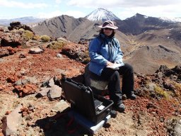 Agnes Mazot合作论文数Instituto de Geofísica, Universidad Nacional Autómoma de México6
 Cynthia Werner合作论文数5Ratko Djukanovic合作论文数Faculty of Medicine, University of Southampton5WR ROCHE合作论文数4
 John W. Wilson合作论文数Mayo Clinic4
 Bradley Scott合作论文数4
 Agnes Reyes合作论文数3
 Craig A. Miller合作论文数2S Sherburn合作论文数2Cameron Asher合作论文数GNS Science2
 Ery C. Hughes合作论文数California Institute of Technology2S Wilson合作论文数2W Roche合作论文数2
 Cornel E. J. De Ronde合作论文数GNS Science2J. Cole-Baker合作论文数2
 Andrew F. Walls合作论文数Immunopharmacology Group, Southampton General Hospital2Tony Hurst合作论文数GNS Sci2Steven Sherburn合作论文数2Matthew Leybourne合作论文数1Anthony W. Hurst合作论文数1J P Bews合作论文数1Y Okayama合作论文数1I H Feather合作论文数1G R Bullock合作论文数1
 Harry Keys合作论文数1R. Grayburn合作论文数1tim hunt合作论文数1M. Gonzalez合作论文数1
 Christoph Heusser合作论文数1JA ROBERTS合作论文数1Anna Jentsch合作论文数1brad scott合作论文数1Thomas Brakenrig合作论文数1
 Paul Antony Jarvis合作论文数Dept Sci Terre, Univ Geneva1
 Gabe S. Epstein合作论文数1R MUELLER合作论文数1p drysdale合作论文数1l job合作论文数1
 David Fermin合作论文数Spectrum Health., Frederick Meijer Heart & Vascular Institute1
 Geoff Kilgour合作论文数GNS Sci, Wairakei Res Ctr, Taupo, New Zealand1Yves Feisel合作论文数Inst Geosci, Johannes Gutenberg Univ Mainz1Rebecca Fitzgerald合作论文数Department of Geological Sciences, University of Canterbury, Private Bag 4800, Christchurch 8140, New Zealand1
 Oliver D. Lamb合作论文数Wairakei Res Ctr, Te Pu Ao GNS Sci1
 Leighton M. Watson合作论文数School of Earth and Environment, University of Canterbury1Meenu Wadhwa合作论文数1Meghna Jani合作论文数Division of Musculoskeletal and Dermatological Sciences, School of Biological Sciences, Faculty of Biology, Medicine and Health, The University of Manchester1




