SUMMARY The São Francisco Paleocontinental block (SFPB) and the Congo Paleocontinental block (CPB) composed, prior to the Atlantic opening in the Cretaceous, the São Francisco-Congo Paleocontinent (SFCP). The SFCP was one of the landmasses involved in the Neoproterozoic Brasiliano-Pan African Orogeny and the assembly of Western Gondwana. Both the SFPB and CPB underwent reworking during the amalgamation of Western Gondwana, forming the orogenic belts that surround the preserved portions of the SFPB and CPB that are known today as the São Francisco and Congo cratons. Although the crustal portions in the outermost areas of these paleocontinents are no longer visible in the surface due to this reworking, the limits of these paleocontinents remain relatively intact at subcrustal depths. The objectives of this study are to delimit the SFPB and to image the structures beneath the Araçuaí belt at mantle lithosphere depths. We present the results of our study which were obtained by the multiple-frequency seismic tomography method for the SFPB and adjacent structures between depths of 68 and 587 km. Data were obtained by processing broad-band seismograms recorded between 2023 August 11 and 2024 July 31 for P and PKIKP phases. The processed data base comprised 9254 residuals, which were added to the data base of a previous regional study resulting in 97 150 traveltime delays. Checkerboard resolution tests using patterns with horizontal dimensions of 390×390 km reveal very good recovery between depths of 68 and 226 km, although the sharp vertical transition between the checkerboard layers is not fully recovered between the depths of 316 and 384 km. The checkerboard pattern with horizontal dimensions of 312×312 km reveals that the best recovery is observed in the southern and eastern portions of the São Francisco craton (SFCr) and in the Borborema province (BP) between depths of 68 and 226 km. Our results show a high-velocity anomaly with roughly NE-SW trend that extends from the Paranapanema block (PaBl), through the entire extension of the SFCr up to the southern BP. This anomaly contains two major segmentations, one in the southern Brasilia belt, marking the division of the PaBl with the SFPB, and the other dividing the eastern and western arms of the SFPB with a roughly NW-SE trend, interpreted as the Paramirim aulacogen. We also observe a high-velocity anomaly beneath the Araçuaí belt (ArBe) that dips with a SE direction. This anomaly starts at the northern end of the Abre Campo suture at a depth of 136 km, deepens to the south and is interpreted as the foundered cratonic lithosphere that originated from the delamination of the SFCr due to the passage of the Trindade plume. To reinforce our interpretation, we tested several synthetic models with geometries that were based on our results and previous studies in the area. The synthetic model which presents the most resemblance to the real data model contains a high-velocity anomaly beneath the Araçuaí belt between depths of 226 and 384 km. A strong low-velocity anomaly beneath the Ribeira Belt is interpreted as material rising from the Nazca Slab dehydration.
ORFEUS (Observatories and Research Facilities for European Seismology, www.orfeus-eu.org; orfeus.readthedocs.io; forum.orfeus-eu.org) is a non-profit foundation that coordinates the collection, archival, and distribution of seismic waveform (meta)data, services and products based on international standards. It serves a broad community of seismological data users, on behalf of the Euro-Mediterranean seismic networks and monitoring agencies (orfeus.readthedocs.io/en/latest/governance.html). ORFEUS core domains comprise: (i) the European Integrated waveform Data Archive (EIDA; orfeus-eu.org/data/eida), providing access to raw seismic waveform data and basic station metadata; (ii) the European Strong-Motion databases (orfeus-eu.org/data/strong), offering automatically/manually processed waveforms, advanced station/site metadata, and associated products ; and iii) the European Mobile Instrument Pools (orfeus-eu.org/data/mobile), facilitating access to seismic instrumentation for temporary deployments. Currently, ORFEUS services distribute waveform data from more than 33,000 stations, including DAS deployments and dense temporary regional experiments (eg., orfeus.readthedocs.io/en/latest/adria_array_main.html), with an emphasis on FAIR principles, open access, and high data quality. ORFEUS services constitute a core component of EPOS (www.epos-eu.org/tcs/seismology) and are seamlessly integrated into the EPOS Data Access Portal (www.ics-c.epos-eu.org). Access to data and products relies on state-of-the-art information and communication technologies, with a strong emphasis on web services (www.orfeus-eu.org/data/eida/webservices; https://esm-db.eu/webservices) enabling programmatic interaction. ORFEUS promotes transparent data policies and licenses and acknowledges the indispensable contribution of data providers. Ongoing activities focus on further development of existing services and on facilitating access to massive and multidisciplinary datasets through collaboration with global and regional initiatives, including the FDSN (www.fdsn.org) and EarthScope (www.earthscope.org), as well as through support from EC-funded projects (e.g., www.geo-inquire.eu). ORFEUS implements community-oriented services that include software and travel grants, a sustained training/outreach programme of webinars and workshops (www.orfeus-eu.org/other/workshops), and editorial initiatives supporting best practices in seismological data use and dissemination.
We have inverted a very large combination of delay times for P, pP, PcP, PKPab, PKPbc from the ISC-EHB catalog, augmented with hand-picked OBS and MERMAID onset data and cross-correlation delays from broadband stations to derive a new global model, UNICA25, of P-wave velocity variations in the mantle. This paper presents the model, summarizes the data processing and inversion, and shows resolution tests at different scales. After rejecting 109,917 outliers (1% of the total), the data set comprises 10,571,152 arrival times. The misfit of the observed delays, with respect to a background model consisting of the crust of LITHO1.0 on top of model AK135, is on average 2.14 standard errors (σ), which is reduced to 0.99σ by inverting for P-wave velocity variations using both ray theory and finite frequency theory, and 5000 iterations of the iterative solver LSQR. Extensive resolution tests show a resolution at 500 km scale or better in most of the lower mantle. An upper mantle resolution of the order of 300 km is obtained under densely instrumented continents, but upper mantle resolution remains deficient under much of the oceans except where covered by MERMAIDs. Linearized tomography is at least three orders of magnitude faster than recent full waveform inversions (FWI), and reaches much higher frequencies for cross-correlated delays. Model UNICA25 has a P-velocity resolution that rivals that of FWI and shows a superior performance in fitting delay times, notably the ISC-EHB P-delays.
AdriaArray is a multinational initiative to cover the Adriatic Plate and its tectonically active surroundings - including units of Adriatic origin - with a dense regional array of seismic stations. AdriaArray provides data for imaging of the crustal and upper mantle structure and for the analysis of seismic activity and hazard. It will help to understand the causes of active tectonics and volcanic fields in the region. The network consists of 1092 permanent and 436 temporary broadband stations from 23 mobile pools. A homogeneous coverage of broadband stations is achieved in an area from the Massif Central in the west to the Carpathians in the east, from the Alps in the north to the Calabrian Arc and mainland Greece in the south. The backbone network (2022-2026) is complemented by locally densified broadband deployments in the western Carpathians, along the Dubrovnik fault and in the Vrancea region. Data recorded by AdriaArray stations is transmitted in real-time to 12 nodes of the European Integrated Data Archive (EIDA) where it is accessible as a single virtual network. Regular availability and quality checks ensure high data usability. AdriaArray, the largest passive seismic experiment in Europe to date, is based on the cooperation between local network operators, mobile pool providers, technicians, engineers, field teams, researchers, students, and organizations such as ORFEUS (Observatories and Research Facilities for European Seismology) and EPOS (European Plate Observing System). The AdriaArray Seismology Group, founded in 2022, encompasses 64 institutions from 30 countries with 451 participants. Initial Collaborative Research Groups have been established to coordinate data analysis and scientific research. We present the evolution of the experiment and its objectives, describe its preparation and planning, and show maps of the AdriaArray Seismic Network, station properties and coverage. We further describe the data archiving and distribution, list the participating institutions, individuals and networks and discuss collaborative research topics.
We present the analysis of more than 9000 hydro-acoustic earthquake records, recorded by a network of 50 instruments called Mobile Earthquake Recording in Marine Areas by Independent Divers (MERMAIDs), which are freely floating in the South Pacific Ocean. This network is part of the collaborative South Pacific Plume Imaging and Modeling (SPPIM) project. Our analysis focuses on evaluating how the MERMAID stations complement the conventional worldwide network of stations reporting to the ISC, comprising records of globally distributed seismic stations. In the context of routine earthquake (re)location, we evaluate the improvement of results of earthquake location estimates, particularly focusing on the Tonga-Kermadec subduction zone, where current distribution of seismic land stations is extremely sparse. MERMAIDs are often the closest “station” to earthquakes occurring in the Tonga subduction zone, and frequently fill significant station azimuthal gaps. We matched the MERMAID records from June 2018 to December 2023 to more than 3000 earthquakes which are reported to the ISC by many international agencies worldwide, allowing us to construct the MERMAID catalogue, complimented with additional parametric data such as MERMAIDs locations, observed direct P-phase picks and travel time residuals with respect to ak135 model, as well as their corrections for bathymetry. These data were integrated into the existing ISC Bulletin, and relocated using the ISC hypocentre relocation algorithm ISCLoc. The results of this successful first integration of MERMAID data into ISC routines presents an important step towards routinely including MERMAID traveltime picks in ISC Bulletin.
A MERMAID float was deployed in the Mediterranean Sea offshore Nice between July and September 2024. It dove to a depth of 2,200 meters to record earthquake time series using its hydrophone. MERMAID floats have been developed as part of a collaboration between GEOAZUR research lab and their manufacturing partner OSEAN since 2014.An anchoring system, called guiderope, allows the float to rest on the seabed at depth up to 4000 meters, preventing its drift in deep sea currents. In two and a half months, the float surfaced three times and changed position by only 10 km, mainly due to suface drift for transmitting data. Without an anchoring system, the drift would have been in excess of 100 km, as for standard MERMAID floats, which have been operating for example in the southern Pacific since 2018.The onboard signal acquisition and processing system automatically detected 11 teleseismic P-waves from earthquakes of magnitudes between 6.0 and 7.4, as well as one T wave from a nearby earthquake in the Mediterranean of magnitude 4.1. These recordings were transmitted by Iridium satellite each time the float surfaced.Manual analysis of the continuous times series recording after recovery of the float, too voluminous to transmit by satellite during the mission, revealed numerous additional events. Namely 17 teleseismic P-waves from earthquakes of magnitudes 4.5 to 7.9 and 57 T-waves from the Mediterranean basin from earthquakes of magnitudes 1.6 to 4.5, as well as 24 T waves not identifiable in the catalogs. Numerous other signals related to maritime navigation and weather conditions were also recorded.
Lagrangian floats are used since the early 2000s for monitoring temperature and salinity of the oceans, and more recently for recording tele-seismic waves. This technology is originally dedicated to global monitoring because it’s drifting with oceanic currents over thousands of kilometers. Recent developments have shown that the floats can also be equipped with an anchoring or semi-anchoring system to prevent the current drift. It opens up even more possible applications for many multidisciplinary ocean science studies. However, it also highlights the needs of modularity to handle different users, and evolving needs, while reducing development time without affecting reliability and cost of the instrument. We introduce some use cases from seismology to biology to identify the main requirements of modularity and discuss about software and hardware limitations. We present our approach of modular software, with a domain-specific language, allowing deployment of several applications, on a float equipped with high and low frequency hydrophones for multidisciplinary acoustic monitoring. A first prototype will be deployed in 2023 and further developments are to come in the next years.
Floating seismometers (‘MERMAIDs’) operating in the noisy environment of the world’s oceans pose a challenge for picking the time of earthquake first arrivals. We report on an experiment to estimate the errors in picked arrivals from 49 MERMAIDS operating in the South Pacific, using two independent strategies. For 15 events, the same arrivals were redundandly picked by several analysts, allowing for a direct estimate of error distributions. Standard errors in times from MERMAID seismograms vary from 0.2 s for close events at mantle depths in the Kermadec subduction zone to more than 2 s for crustal events at large epicentral distance. In a second experiment we analysed the a posteriori misfits after tomographically inverting all events. The residual traveltime misfit is consistent with the error estimates from the first experiment, but also shows inconsistencies with arrival times from the ISC-EHB and NEIC catalogues, which we attribute to errors in the published hypocentres and/or origin times.
A fruitful close collaboration between teams of researchers and engineers of Geoazur, a research laboratory specializing in seismic observation, and Osean, a dynamic company combining the talents of engineers in low-noise, low-power electronics specialized in underwater acoustics, gives this instrument a guarantee of robustness, reliability and innovation by capitalizing on all their knowledge in their respective fields. Halios has an autonomy of 18 months, dimensions of 1.1 x 1.1 x 1m and a total weight with ballast of 346 kg. Electrical power is supplied by lithium or alkaline batteries. Halios is made entirely from corrosion-resistant materials. The 4-panel, mortise-and-tenon structure naturally creates a well in which the seismometer is protected. This well is covered by two flaps that open when the OBS sinks into the water, and close when the OBS stops on the bottom. During descent, the seismometer is suspended in the well. Once the OBS is in place, the seismometer is released automatically or by an acoustic command to land on the ground without any mechanical contact with the structure. This type of coupling is ideal, and protects the sensor from underwater currents. Communication with the OBS is possible via Ethernet, Wi-fi or acoustics once in the water by non-specialists. An acoustic module makes it possible to retrieve a health report on demand, which groups together the essential parameters of the station, and to modify some of them once the OBS is in the water. Halios incorporates precise clock or a CSAC-type atomic clock, if time precision is required.The seismometer is a compact Nanometrics Trillium, integrated in a dedicated container which also houses an accelerometer. An hydrophone, a precision temperature sensor and an absolute pressure sensor complete the range of sensors integrated on Halios. An dedicated acoustic modem also enables partial data retrieval from the surface.To retrieve the OBS, an acoustic command activates a mechanical release which frees the ballast. Dynamic assistance from leaf springs accelerates the positive thrust provided by the OBS's high-density syntactic foam. This foam is injected into a PHD shell, which effectively protects the whole unit and, thanks to its compact shape, provides effective anti-shock protection. The ascent of the OBS into the water column can be monitored by the acoustic module.Once at the surface, the time difference between the OBS clock and the GPS datum is automatically calculated. The OBS sends its GPS coordinates to the ship by VHF to facilitate recovery. At night, an LED flashing light can also be used to pinpoint its position. Halios is equipped with an interface that enables it to be connected to a real-time cable network, making it a versatile OBS of the highest performance and innovation.
ORFEUS (Observatories and Research Facilities for European Seismology, http://orfeus-eu.org/) is a non-profit foundation that promotes seismology in the Euro-Mediterranean area and beyond through the collection, archival and distribution of seismic waveform data, metadata, and associated services and products. The data and services are collected or developed at national level by more than 60 contributing Institutions. They are further developed, integrated, standardised, homogenised and promoted through ORFEUS. Among the goals of ORFEUS are: (a) the development and coordination of waveform data products; (b) the coordination of a European data distribution system, and the support for seismic networks in managing digital seismic waveform data; (c) the encouragement of the adoption of best practices for seismic network operation, data quality control and data management; (d) the promotion of open access to seismic waveform data, products and services for the broader solid Earth science community. These goals are achieved through the development and maintenance of data services targeted to a broad community of seismological data users, ranging from earth scientists to earthquake engineering practitioners. Three Service Management Committees (SMCs) are consolidated within ORFEUS, devoted to managing, operating and developing (with the support of one or more Infrastructure Development Groups): (i) the European Integrated waveform Data Archive (EIDA; https://www.orfeus-eu.org/data/eida/); (ii) the European Strong-Motion databases (SM; https://www.orfeus-eu.org/data/strong/); the European mobile instrument pools (https://orfeus-eu.org/data/mobile/). Products and services for computational seismologists are also considered for integration in the ORFEUS domain. ORFEUS services currently provide access to the waveforms acquired by ~ 24,000 stations, including dense temporary experiments (e.g. AdriaArray; https://orfeus.readthedocs.io/en/latest/adria_array_main.html), with strong emphasis on open, high-quality data. Contributing to ORFEUS data archives means benefitting from long-term archival, state-of-the-art quality control, improved access, increased usage, and community participation. Access to data and products is ensured through state-of-the-art information and communication technologies, with strong emphasis on federated web services that considerably improve seamless user access to data gathered and/or distributed by the various ORFEUS institutions. Web services also facilitate the automation of downstream products. Particular attention is paid to adopting clear policies and licenses, and acknowledging the crucial role played by data providers, who are part of the ORFEUS community. There are significant efforts by ORFEUS participating institutions to enhance the existing services to tackle the challenges posed by Big Data, with emphasis on data quality, improved user experience, and implementation of strategies (e.g. Cloud) for scalability, high-volume data access and archival. ORFEUS actively encourages interoperability and integration of multidisciplinary datasets in seismological and Earth Science workflows. ORFEUS data and services are assessed and improved through the technical and scientific feedback of a User Advisory Group (UAG), which comprises selected European Earth scientists with expertise on a broad range of disciplines. All ORFEUS services are developed in coordination with EPOS and are largely integrated in the EPOS Data Access Portal (https://www.ics-c.epos-eu.org/). ORFEUS is one of the founding Parties and a fundamental pillar of EPOS Thematic Core Service (TCS) for Seismology. ORFEUS and its community are actively involved in EC projects (http://www.orfeus-eu.org/organization/projects/), notably Geo-INQUIRE (https://www.geo-inquire.eu/) and DT-GEO (https://dtgeo.eu/) in 2024.
Tomotectonics hindcasts paleo-trenches, through the spatiotemporal superposition of subducted lithosphere (slabs imaged in the earth’s mantle) with plate reconstructions (constrained by seafloor isochrons). The two geophysical datasets are linked through the tomotectonic null hypothesis, that oceanic lithosphere sinks vertically down after entering in the mantle. This linkage permits simple and testable predictions about the location and lifespan of volcanic arcs, and specifically about arc-continent collisions, switches in subduction polarity, and switches from consuming to transform plate boundaries. In a second stage, tomotectonics uses land geological observations from the accretionary orogen in order to test predictions arising from the geophysical data sets.We have applied the tomotectonic method to the North American Cordillera, where lower-mantle slab geometries indicate the nearly simultaneous initiation (~200-180 Ma) of three intra-oceanic archipelagos in the northeastern proto-Pacific (figure: MEZ, ANG, and CR slabs). Westward subduction beneath 10,000 km-long MEZ and ANG pulled North America from Pangaea, opening the Central Atlantic. Coeval eastward convergence of Farallon plate beneath intra-oceanic CR is predicted from Pacific seafloor isochrons. This configuration of subduction zones facing each other across an archipelago is analogous to today’s southwest Pacific, where Australia, embedded in Indian/Tethys Ocean floor, and the Pacific Ocean are drawn in by double-sided subduction.Each slab must be associated with a paleo-arc. Central and controversial in formation accounts of the Cordilleran has been the Insular microcontinent (INS, comprising Peninsular, Alexander, Wrangellia superterranes of Alaska and B.C.) and its southward extension of Guerrero superterrane (GUE) of Mexico. When, where and in what style did MEZ accrete to North America? Did INS subsequently translate thousands of kilometres along the margin (the “Baja-BC” debate between geology and paleomagnetism)? How did INS unite with the remainder of accretionary terranes that form Alaska?We demonstrate how tomotectonics hindcasts the INS journey. Massive MEZ slab wall fixes INS-GUE’s initial, stationary, offshore position – in an accretionary regime. Full consumption of North American oceanic lithosphere, pulled beneath INS-GUE arcs, caused diachronous collision from ~155 Ma to ~90 Ma (Nevadan-Sevier deformation), leaving a trail of collapsed basins. Subduction was gradually forced outboard of MEZ: flip to Farallon subduction, eastward beneath INS-GUE (now attached to North America), brought another accretionary episode of Franciscan and Chugach subduction complexes, linked to Sierra Nevada and Coast Mountain batholith arcs.Northward translation of INS by ~2000 km between 90-50 Ma (the “BajaBC” regime) corresponds with a lack of subduction (slab) beneath the paleo-margin. A key result is that both tomotectonics and paleomagnetic observations, which are completely independent, support large-scale translation.Simultaneously, INS and North Americal collided obliquely with Central Alaska and Farallon arcs in a second collisional phase ~100-50 Ma, again in double-sided subduction. Since 170 Ma, Insular micro-continent experienced all regimes of modern double-sided archipelagos: subduction accretion, collision, subduction flip, and transform. Reference: Sigloch, K. & Mihalynuk, M.G. (2025), Tomotectonics of Cordilleran North America since Jurassic times: double-sided subduction, archipelago collisions, and Baja-BC translation. In review (revision) with GSA Books. Preprint: https://eartharxiv.org/repository/view/7460/
Seismic travel time tomography is a geophysical imaging method to infer the 3-D interior structure of the solid Earth. Most commonly formulated as a linear(ized) inverse problem, it maps differences between observed and expected wave travel times to interior regions where waves propagate faster or slower than the expected average. The Earth's interior is typically parametrized by a single kind of localized basis function. Here we present an alternative approach that uses matching pursuits on large dictionaries of basis functions. Within the past decade the (Learning) Inverse Problem Matching Pursuits ((L)IPMPs) have been developed. They combine global and local trial functions. An approximation is built in a so-called best basis, chosen iteratively from an intentionally overcomplete set or dictionary. In each iteration, the choice for the next best basis element reduces the Tikhonov-Phillips functional. This is in contrast to classical methods that use either global or local basis functions. The LIPMPs have proven its applicability in inverse problems like the downward continuation of the gravitational potential as well as the MEG-/EEG-problem from medical imaging. Here, we remodel the Learning Regularized Functional Matching Pursuit (LRFMP), which is one of the LIPMPs, for travel time tomography in a ray theoretical setting. In particular, we introduce the operator, some possible trial functions and the regularization. We show a numerical proof of concept for artificial travel time delays obtained from a contrived model for velocity differences. The corresponding code is available at https://doi.org/10.5281/zenodo.8227888 under the licence CC-BY-NC-SA 3.0 DE.
A fruitful close collaboration between teams of researchers and engineers of Geoazur, a research laboratory specializing in seismic observation, and Osean, a dynamic company combining the talents of engineers in low-noise, low-power electronics specialized in underwater acoustics, gives this instrument a guarantee of robustness, reliability and innovation by capitalizing on all their knowledge in their respective fields. Halios has an autonomy of 18 months, dimensions of 1.1 x 1.1 x 1m and a total weight with ballast of 346 kg. Electrical power is supplied by lithium or alkaline batteries. Halios is made entirely from corrosion-resistant materials. The 4-panel, mortise-and-tenon structure naturally creates a well in which the seismometer is protected. This well is covered by two flaps that open when the OBS sinks into the water, and close when the OBS stops on the bottom. During descent, the seismometer is suspended in the well. Once the OBS is in place, the seismometer is released automatically or by an acoustic command to land on the ground without any mechanical contact with the structure. This type of coupling is ideal, and protects the sensor from underwater currents. Communication with the OBS is possible via Ethernet, Wi-fi or acoustics once in the water by non-specialists. An acoustic module makes it possible to retrieve a health report on demand, which groups together the essential parameters of the station, and to modify some of them once the OBS is in the water. Halios incorporates precise clock or a CSAC-type atomic clock, if time precision is required.The seismometer is a compact Nanometrics Trillium, integrated in a dedicated container which also houses an accelerometer. An hydrophone, a precision temperature sensor and an absolute pressure sensor complete the range of sensors integrated on Halios. An dedicated acoustic modem also enables partial data retrieval from the surface.To retrieve the OBS, an acoustic command activates a mechanical release which frees the ballast. Dynamic assistance from leaf springs accelerates the positive thrust provided by the OBS's high-density syntactic foam. This foam is injected into a PHD shell, which effectively protects the whole unit and, thanks to its compact shape, provides effective anti-shock protection. The ascent of the OBS into the water column can be monitored by the acoustic module.Once at the surface, the time difference between the OBS clock and the GPS datum is automatically calculated. The OBS sends its GPS coordinates to the ship by VHF to facilitate recovery. At night, an LED flashing light can also be used to pinpoint its position. Halios is equipped with an interface that enables it to be connected to a real-time cable network, making it a versatile OBS of the highest performance and innovation.
Tomotectonics uses deep mantle structure in order to hindcast paleo-trenches, by spatially superposing subducted lithosphere (slabs) imaged by seismic tomography with plate reconstructions at the surface. The two geophysical datasets combined make predictions about geologic events, specifically about volcanic arcs and their collisions with continents. The tomotectonic null hypothesis is simple, predictive and testable. It uses land geological observations for validation. We explain the method, with a clear conceptual separation of its hypothesis-generating stage (using geophysics and the hypothesis of vertical slab sinking) from its subsequent hypothesis-testing stage (using geological observations from accretionary orogens). With the North American Cordillera as a case study, we generate a full suite of tomotectonic inferences on the slab assemblage that now occupies the mantle under North America to depths of 1800-2000 km. We reason why this assemblage originated as a completely intra-oceanic archipelago of paleo-trenches at a time of worldwide tectonic reorganization: around 200-170 Ma, when the Atlantic began to spread and the Pacific plate was born. An Archipelago is circumscribed by trenches that pull in seafloor from (at least) two sides: here, roughly from the east and from the west. North America was pulled westward by, and overrode, the westward-subducting arcs. These collisions since ~150 Ma caused the Nevadan and Sevier orogenies, and spawned the eastward-subducting arc that built Sierra Nevada Batholith ~120-80 Ma. From ~110-50 Ma, the continent collided with the arc of future Central Alaska and with the Farallon arc of the Pacific Northwest, which sat offshore until ~90-50 Ma. Override of this double-sided arc pair enabled a range of collision styles, including the Baja-BC northward sprint and its accretion to Central Alaska. Tomotectonics infers large-scale northward displacement of Insular Superterrane since its accretion, which provides independent support for the “Baja-BC” hypothesis of paleomagnetism.
The evolving mosaic of tectonic plates across the surface of the Earth sets boundary conditions for the evolution of biotic and abiotic processes and helps shape the dynamics of its interior. Reconstructing plate tectonics back through time allows scientists from a range of disciplines (such as palaeobiology, palaeoclimate, geodynamics and seismology) to investigate Earth evolution through these spatiotemporal dimensions. However, the variety and complexity of plate reconstructions can lead to some of their limitations being overlooked. In this Technical Review, we discuss the domain-specific knowledge underpinning modern quantitative plate reconstructions and convey a set of principles on how to use (but not abuse) the software or results. Open-source plate tectonic reconstruction software, like GPlates, has led to a major shift in working practices, handing non-specialists the tools to develop and integrate reconstructions based on their own datasets and expertise. However, there is no ‘one-size-fits-all’ and users need to understand what data and underlying assumptions go into making different, sometimes competing reconstruction models. It is therefore essential to consider the many ways reconstructions simplify reality when interpreting them to avoid circular reasoning. Although many aspects of deep-time reconstructions remain unresolved, future work on intercomparisons between models and uncertainty quantification is an essential pathway towards next-generation plate reconstructions. The advent of advanced plate tectonic reconstruction software has instigated an explosive growth in their generation and use by the wider Earth science community. This Technical Review provides a best-practice guide for quantitative plate reconstructions and their applications.
ORFEUS (Observatories and Research Facilities for European Seismology, orfeus-eu.org) is a non-profit foundation that coordinates and promotes seismology in the Euro-Mediterranean area and beyond, through harmonized collection, archival and distribution of seismic waveform data, metadata, alongside offering services and products managed at national level by more than 60 participating seismological Institutions. ORFEUS is one of the founding members of EPOS Seismology (www.epos-eu.org/tcs/seismology) and a fundamental partner of EC-funded projects. ORFEUS services are largely integrated in the EPOS Data Access Portal (www.ics-c.epos-eu.org). The key goals of ORFEUS (Bylaws, Article I.3: orfeus-eu.org/documents//ORFEUS_Bylaws_September_2022.pdf) are achieved through the development and maintenance of data services targeted to a broad community of seismological data users. ORFEUS comprises: (i) the European Integrated waveform Data Archive (EIDA; orfeus-eu.org/data/eida); (ii) the European Strong-Motion databases (orfeus-eu.org/data/strong); and iii) the recently established group representing the community of European mobile pools, including amphibian instrumentation (orfeus-eu.org/data/mobile). Products and services for computational seismology are also considered for integration in the ORFEUS domain. Currently, ORFEUS services provide access to the waveforms acquired by ~18,000 stations in the Euro-Mediterranean region, including dense temporary experiments (e.g., AlpArray, AdriaArray), with strong emphasis on open, high-quality data. Access to data and products is ensured through state-of-the-art information and communication technologies, with strong emphasis on federated web services, clear policies and licenses, and acknowledging the crucial role played by data providers. Significant efforts are underway, by ORFEUS participating institutions, to enhance the existing services to tackle the challenges posed by the Big Data Era, and to actively encourage interoperability and integration of multidisciplinary datasets in seismological and Earth Science workflows. ORFEUS also implements Community services that include software and travel grants, webinars, workshops and editorial initiatives. ORFEUS data and services are assessed and improved through the technical and scientific feedback of a User Advisory Group, which comprises European Earth scientists with expertise on a broad range of disciplines.
We have developed autonomous, Lagrangian floats that make seismo-acoustic measurements in the oceans, with mission durations of 4+ years and running (http://earthscopeoceans.org). Earthquakes generate seismic waves that traverse the solid earth, convert to acoustic waves when they hit the seafloor from below, and are recorded by the hydrophone on our “Mermaid” floats drifting at ~1500m depth.In the long-term, we aim for dense and even global coverage of the oceans for seismology, following the model of oceanography’s Argo initiative, or of internationally federated seismometer networks on land. In order to grow the network, we are exploring synergies with oceanography and the marine environmental sciences.We present technical developments towards the first multidisciplinary mission in 2024 in the Mediterranean, whose floats will run embedded applications in two frequency ranges: the seismic (~0.1-5 Hz) as well as the “conventional” ocean acoustics range (10 Hz to 30 kHz). It will feature detection and classification algorithms for earthquakes, rainfall, marine mammal vocalizations, and ship noise. While energy-limited, these seismological floats carry significantly larger batteries than Argo floats and allow for up to eight physical/chemical/other sensors and their analysis algorithms, whose concurrent needs are managed by a domain-specific language written for the purpose (Bonnieux 2020). Reference: Bonnieux, S. (2020). Float for multidisciplinary monitoring of the marine environment. From business expertise to embedded codes (Doctoral dissertation, Université Côte d'Azur).
We attempt the reconstruction of the solid earth’s interior three-dimensional structure using seismic wave observations. The interior structure of the mantle deviates moderately from spherically symmetrical reference models and therefore seismological observables also vary moderately from spherically symmetrical predictions. Hence we consider here the linearized inverse problem of seismic traveltime tomography.Usually, the solution is approximated in a fixed basis system: either global (e.g. polynomials) or local (e.g. finite elements) basis functions. Here we use a dictionary-based approximation approach, called the Learning Regularized Functional Matching Pursuit (LRFMP). A dictionary is an intentionally redundant set of diverse trial functions from which iteratively an approximation in a best basis is built. The next best basis element is chosen such that the Tikhonov functional is minimized.The methods have been used for a variety of spherical as well as tomographic tasks from the geosciences as well as medical imaging. Here we apply them to seismic traveltime tomography for the first time. We discuss relevant developments and challenges in the process of tailoring the methods to the problem and show first promising results.
The three-dimensional structure of the Earth's interior shapes its geomagnetic and gravity fields, and can thus be constrained by observing these fields. 3-D Earth structure also causes seismological observables to deviate from those predicted for approximated, spherically symmetrical reference models. Travel time tomography is the inverse problem that uses these observed differences to constrain the 3-D structure of the interior. On the planetary scale, i.e. in a spherical geometry, this linearized inverse problem has been parameterized with a variety of basis systems, either global (e.g. spherical harmonics) or local (e.g. finite elements). The Geomathematics Group Siegen has developed alternative approximation methods for certain applications from the geosciences: the Inverse Problem Matching Pursuits (IPMPs). These methods combine different basis systems by calculating an approximation in a so-called best basis, which is chosen iteratively from a so-called dictionary, an intentionally overcomplete set of diverse trial functions. In each iteration, the choice of the next best basis element reduces the Tikhonov functional. A particular numerical expertise has been gained for applications on spheres or balls. Hence, the methods were successfully applied to, for instance, the downward continuation of the gravitational potential as well as the MEG-/EEG-problem from medical imaging. Our aim is to remodel the IPMPs for travel time tomography. This includes developing the data-dependent operator, deciding for specific trial functions and applying the operator to them. We also have to define termination criteria and develop the regularization in theory and practice. We introduce the IPMPs and show results from our remodelling.
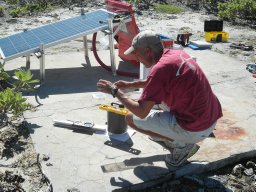 Guilhem Barruol合作论文数Laboratoire de Tectonophysique30
 Kasra Hosseini合作论文数Research Engineering Group, The Alan Turing Institute28
 Guust Nolet合作论文数University of Nice/Sophia Antipolis23
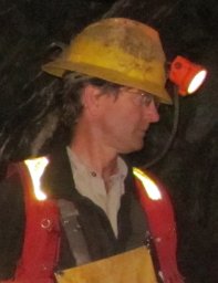 Mitchell G. Mihalynuk合作论文数BC Ministry of Energy and Mines20
 Tarje Nissen Meyer合作论文数Department of Earth Sciences, University of Oxford16
 Simon C. Stähler合作论文数Eidgenössische Technische Hochschule Zürich14
 Fabrice R Fontaine合作论文数Research School of Earth Sciences, Australian National University14
 Eleonore Stutzmann合作论文数Institut de Physique du Globe de Paris13
 John-Robert Scholz合作论文数Max Planck Institute for Solar System Research, 37077 Göttingen, Germany.12
 Alessandro Mazzullo合作论文数11
 Jean-Paul Montagner合作论文数Seismology Laboratory, Institut de Physique du Globe de Paris, Universite Paris-Diderot11
 Maria Tsekhmistrenko合作论文数Geophys Sect, Dublin Inst Adv Studies10Wayne C. Crawford合作论文数10
 Heiner Igel合作论文数Department für Geo- und Umweltwissenschaften, Fakultät für Geowissenschaften, Ludwig-Maximilians-Universität München;ROSE School9Sébastien Bonnieux合作论文数8
 Frederik J. Simons合作论文数The Department of Geosciences, Princeton University;Princeton High Meadows Environmental Institute, Princeton University;Andlinger Center for Energy and the Environment, Princeton University8
 Martha Deen合作论文数5Yann Hello合作论文数5Christian Haberland合作论文数GeoForschungsZentrum Potsdam5
 Afsaneh Mohammadzaheri合作论文数Earthquake Research Center, Ferdowsi University of Mashhad5Ignace Loris合作论文数5Sergey Kiselev合作论文数4
 Satish Maurya合作论文数Dept. of Earth Sciences, IIT- Bombay4
 Lucía Pérez-Díaz合作论文数Univ London, Egham, Surrey, England4
 Laurent Michon合作论文数Laboratoire des sciences de la Terre, université de la Réunion4
 Ingrid Daubechies合作论文数Department of Mathematics, Trinity College of Arts & Sciences, Duke University;Department of Electrical and Computer Engineering, Pratt School of Engineering, Duke University4
 Graeme Eagles合作论文数Department of Earth Sciences, Royal Holloway University of London4Thomas Meier合作论文数4michael r andrews合作论文数3Ilaria Mosca合作论文数3Olivier Philippe合作论文数3Andrew J. Parsons合作论文数3Naomi Schneider合作论文数3
 Sarah Hable合作论文数3ludwig auer合作论文数Swiss Seismological Survey, ETH Zurich3Martin van Driel合作论文数Institute of Geophysics, ETH Zürich3
 Celine Davy合作论文数3Luigia Cristiano合作论文数3Jean Charléty合作论文数Univ Nice Sophia Antipolis, CNRS, UMR 6526, Observ Cote Azur,Geoazur, Valbonne, France3
 Andrew Curtis合作论文数Earth and Planetary Science, School of GeoSciences, The University of Edinburgh3
 Maria Seton合作论文数School of Geosciences, Faculty of Science, The University of Sydney3Sergey Voronin合作论文数3
 Tian Yue合作论文数Department of General Surgery Daping Hospital, Army Medical University3Brian Baptie合作论文数3
 Ying Zhou合作论文数Department of Geosciences, College of Science, Virginia Polytechnic Institute and State University3Wolfgang Friederich合作论文数3
 Nicholas Harmon合作论文数Natl Oceanog Ctr Southampton, Univ Southampton3
 Partha P. Mitra合作论文数Mitra Laboratory, Cold Spring Harbor Laboratory3
 Petr Kolínský合作论文数Institute of Rock Structure and Mechanics, Academy of Sciences of the Czech Republic3




