Algorithms that enable the process of automatically mining distinct topics in document collections have become increasingly important due to their applications in many fields and the extensive growth of the number of documents in various domains. In this paper, we propose a generative model based on latent Dirichlet allocation that integrates the temporal ordering of the documents into the generative process in an iterative fashion. The document collection is divided into time segments where the discovered topics in each segment is propagated to influence the topic discovery in the subsequent time segments. Our experimental results on a collection of academic papers from CiteSeer repository show that segmented topic model can effectively detect distinct topics and their evolution over time.
We propose a generative model based on latent Dirichlet allocation for mining distinct topics in document collections by integrating the temporal ordering of documents into the generative process. The document collection is divided into time segments where the discovered topics in each segment is propagated to influence the topic discovery in the subsequent time segments. We conduct experiments on the collection of academic papers from CiteSeer repository. We augment the text corpus with the addition of user queries and tags and integrate the citation graph to boost the weight of the topical terms. The experiment results show that segmented topic model can effectively detect distinct topics and their evolution over time.
Algorithms that enable the process of automatically mining distinct topics in document collections have become increasingly important due to their applications in many fields and the extensive growth of the number of documents in many domains. Traditionally, the task of topic discovery has been mainly addressed through algorithms that work on a snapshot view of the repository, which ignores the temporal characteristics of the collection. In a significant number of collections, the documents are temporal in nature and this temporal dimension can influence the topic discovery process. This paper proposes a generative model based on latent Dirichlet allocation that integrates the temporal ordering of the documents into the generative process in an iterative fashion. The document collection is divided into time segments where the discovered topics in each segment is propagated to influence the topic discovery in the subsequent time segments. We conduct experiments on the collection of academic papers from CiteSeer repository. In addition to the textual content of the documents, we augment the text corpus with the addition of user queries and tags and integrate the citation graph to boost the weight of the topical terms. The experiment results show that segmented topic model can effectively detect distinct topics and their evolution over time.
With the amount of scientific digital content available online constantly increasing, the community of science has been increasing its efforts towards automatically collecting and organizing such information. This has led to such system architectures as CiteSeer , a digital library and search engine focusing on scientific literature in Computer and Information Science and related fields, the virtual observatory for astronomy, arXiv, and others. In chemistry, the growth of data and collaboratory teams has been explosive. This has led to the ChemXSeer project and architecture, a portal and search tool for academic researchers in environmental chemistry that integrates the scientific literature with experimental, analytical and simulation result datasets.
Discovery of latent semantic groupings and identification of intrinsic structures in data collections is a crucial task for many data analysis needs. Various unsupervised machine learning algorithms have been devised to accomplish this task for a vast number of applications, including topic identification in text databases, clustering similar images in web search, disease identification in medical fields to name a few. Most algorithms, however, have been designed for homogeneous data where the algorithm works on a uniform set of attributes that represent the data objects. Real-world datasets, on the other hand, are richer in structure and contain multiple levels of connectivity among the data objects, such as hyperlinks in web pages, textual annotations or text contexts surrounding images on the web and citations and authorship information of scientific literature. Utilizing only a single information source provides a narrow focus of view into the real nature of the relationships between data objects. Each additional dimension of connectivity increases our understanding of the semantic characteristics of the collection and improves our ability to detect distinct groups of objects where the objects in each group exhibit similar properties. This thesis presents three algorithms that merge multiple sources of information for clustering and topic discovery in collections of academic papers. The first algorithm combines textual content of academic papers with the information extracted from the citation relationships between the papers for finding scientific topic clusters in the data collection. The second algorithm integrates authorship information of documents into the text-based clustering process to yield improved clustering solutions. Based on the validation from these two algorithms that it is possible to improve topic discovery by utilizing additional dimensions of similarity among data objects, we provide a generative model that merges citation relationships, authorship information, user queries, user tags and the timestamps of documents for discovering scientific topics in collections of academic papers. Further, the generative process can effectively model the evolutionary characteristics of document collections and can discover the change of the popularity of scientific topics over time.
Traditional clustering algorithms work on "flat" data, making the assumption that the data instances can only be represented by a set of homogeneous and uniform features. Many real world data, however, is heterogeneous in nature, comprising of multiple types of interrelated components. We present a clustering algorithm, K-SVMeans, that integrates the well known K-Means clustering with the highly popular Support Vector Machines(SVM) in order to utilize the richness of data. Our experimental results on authorship analysis of scientific publications show that K-SVMeans achieves better clustering performance than homogeneous data clustering.
Machine learning for predicting user clicks in Web-based search offers automated explanation of user activity. We address click prediction in the Web search scenario by introducing a method for click prediction based on observations of past queries and the clicked documents. Due to the sparsity of the problem space, commonly encountered when learning for Web search, new approaches to learn the probabilistic relationship between documents and queries are proposed. Two probabilistic models are developed, which differ in the interpretation of the query-document co-occurrences. A novel technique, namely, conditional probability hierarchy, flexibly adjusts the level of granularity in parsing queries, and, as a result, leverages the advantages of both models.
Algorithms that enable the process of automatically mining distinct topics in document collections have become increasingly important due to their applications in many fields and the extensive growth of the number of documents in many domains. Traditionally, the task of topic discovery has been mainly addressed through algorithms that work on a snapshot view of the documents, which ignores the temporal characteristics of the collection. In a significan t number of collections, the documents are temporal in nature and this temporal dimension can influence the topic discovery process. In this paper, we propose a generative model based on latent Dirichlet allocation that integrates the temporal ordering of the documents into the generative process in an iterative fashion. The document collection is divided into time segments and the topics discovered in each segment is propagated to influence the topic discovery in the subsequent time segments. We conduct experiments on the collection of academic papers from CiteSeer repository . In addition to the textual content of the documents, we augment the text corpus with the addition of user queries and tags and integrate the citation graph to boost the topica l terms. The experiment results show that we can effectively detect distinct topics and their evolution over time.
It is well known that connectivity analysis of linked documents provides significant information about the structure of the document space for unsupervised learning tasks. However, the ability to identify distinct clusters of documents based on link graph analysis is proportional to the density of the graph and depends on the availability of the linking and/or linked documents in the collection. In this paper, we present an information theoretic approach towards measuring the significance of individual words based on the underlying link structure of the document collection. This enables us to generate a non-uniform weight distribution of the feature space which is used to augment the original corpus-based document similarities. The experimental results on the collection of scientific literature show that our method achieves better separation of distinct groups of documents, yielding improved clustering solutions.
Citation matching, or the automatic grouping of bibliographic references that refer to the same document, is a data management problem faced by automatic digital libraries for scientific literature such as CiteSeer and Google Scholar. Although several solutions have been offered for citation matching in large bibliographic databases, these solutions typically require expensive batch clustering operations that must be run offline. Large digital libraries containing citation information can reduce maintenance costs and provide new services through efficient online processing of citation data, resolving document citation relationships as new records become available. Additionally, information found in citations can be used to supplement document metadata, requiring the generation of a canonical citation record from merging variant citation subfields into a unified "best guess" from which to draw information. Citation information must be merged with other information sources in order to provide a complete document record. This paper outlines a system and algorithms for online citation matching and canonical metadata generation. A Bayesian framework is employed to build the ideal citation record for a document that carries the added advantages of fusing information from disparate sources and increasing system resilience to erroneous data
CiteSeer is a scientific literature digital library and search engine which automatically crawls and indexes scientific documents in the fields of computer and information science. Since it's inception in 1997 CiteSeer has grown to index over 730,000 documents and serves over 800,000 requests daily, pushing the limits of the current system's capabilities. In addition, CiteSeer's monolithic architecture inconveniences system maintenance and reduces the flexibility of the system in terms of new feature development, algorithm updates, and system interoperability. In this paper, we discuss the problems of the current CiteSeer architecture and propose a new architecture for a next generation CiteSeer application. The new architecture is based on modular web services and pluggable service components. Preliminary results based on a prototype system show the new architecture enhances flexibility, scalability, and performance for CiteSeer. In addition, new services in development for the next generation CiteSeer system are discussed.
Current computing systems do not support human work effectively. They restrict human-computer interaction to one mode at a time and are designed with an assumption that use will be by individuals (rather than groups), directing (rather than interacting with) the system. To support the ways in which humans work and interact, a new paradigm for computing is required that is multimodal, rather than unimodal, collaborative,e, rather than personal, and dialogue-enabled, rather than unidirectional. To address this challenge, we have developed an approach for designing natural, multimodal, multiuser dialogue-enabled interfaces to geographic information systems that make use of large-screen displays and integrated speech-gesture interaction. After outlining our goals and providing a brief overview of relevant literature, we introduce the Dialogue-Assisted Visual Environment for Geoinformation (DAVE_G). DAVE_G is being developed using a human-centred systems approach that contextualizes development and assessment in the current practice of potential users. In keeping with this human-centred approach, we outline a user task analysis and associated scenario development that implementation is designed to support (grounded in the context of emergency response), review our own precursors to the current prototype system and discuss how the current prototype extends upon past work, provide a detailed description of the architecture that underlies the current system, and introduce the approach implemented for enabling mixed-initiative human-computer dialogue. We conclude with a discussion of goals for future research.
We demonstrate a same-time different-place collaboration system for managing crisis situations using geospatial information. Our system enables distributed spatial decision-making by providing a multimodal interface to team members. Decision makers in front of large screen displays and/or desktop computers, and emergency responders in the field with tablet PCs can engage in collaborative activities for situation assessment and emergency response.
Advances in computer hardware and software technologies have enabled sophisticated information visualization techniques as well as new interaction opportunities to be introduced in the development of GIS (Geographical Information Systems) applications. Especially, research efforts in computer vision and natural language processing have enabled users to interact with computer applications using natural speech and gestures, which has proven to be effective for interacting with dynamic maps [1, 6]. Pen-based mobile devices and gesture recognition systems enable system designers to define application-specific gestures for carrying out particular tasks. Using force-feedback mouse for interacting with GIS has been proposed for visually-impaired people [4]. These are exciting new opportunities and hold the promise of advancing interaction with computers to a complete new level. The ultimate aim, however, should be directed on facilitating human-computer communication; that is, equal emphasis should be given to both understanding and generation of multimodal behavior. My proposed research will provide a conceptual framework and a computational model for generating multimodal responses to communicate spatial information along with dynamically generated maps. The model will eventually lead to development of a computational agent that has reasoning capabilities for distributing the semantic and pragmatic content of the intended response message among speech, deictic gestures and visual information. In other words, the system will be able to select the most natural and effective mode(s) of communicating back to the user. Any research in computer science that investigates direct interaction of computers with humans should place human factors in center stage. Therefore, this work will follow a multi-disciplinary approach and integrate ideas from previous research in Psychology, Cognitive Science, Linguistics, Cartography, Geographical Information Science (GIScience) and Computer Science that will enable us to identify and address human, cartographic and computational issues involved in response planning and assist users with their spatial decision making by facilitating their visual thinking process as well as reducing their cognitive load. The methodology will be integrated into the design of DAVE_G [7] prototype: a,6e of Computer Science andUSAtyd Engineeringerface to Support Emergency Management. meaning. natural, multimodal, mixed - initiative dialogue interface to GIS. The system is currently capable of recognizing, interpreting and fusing users' natural occurring speech and gesture requests, and generating natural speech output. The communication between the system and user is modeled following the collaborative discourse theory [2] and maintains a Recipe Graph [5] structure - based on SharedPlan theory[3] - to represent the intentional structure of the discourse between the user and system. One major concern in generating speech responses for dynamic maps is that spatial information cannot be effectively communicated using speech. Altering perceptual attributes (e.g. color, size, pattern) of the visual data to direct user's attention to a particular location on the map is not usually effective, since each attribute bears an inherent semantic meaning and those perceptual attributes should be modified only when the system's judgement states that those attributes are not crucial to the user's understanding of the situation at that stage of the task. Gesticulation, on the other hand, is powerful for conveying location and form of spatially oriented information [6] without manipulating the map and the benefit of facilitating speech production. My research aims at designing feasible, extensible and effective multimodal response generation (content planning and modality allocation) model. A plan-based reasoning algorithm and methodology integrated with the Recipe Graph structure has the potential to achieve those goals.
A novel interface system for accessing geospatial data (GeoMIP) has been developed that realizes a user-centered multimodal speech/gesture interface for addressing some of the critical needs in crisis management. In this system we primarily developed vision sensing algorithms, speech integration, multimodality fusion, and rule-based mapping of multimodal user input to GIS database queries. A demo system of this interface has been developed for the Port Authority NJ/NY and is explained here.
Managing crises requires collecting geographical intelligence and making spatial decisions through collaborative efforts among multiple agencies and task forces. Typically, one or more emergency operation centers (EOCs) work in cooperation with teams of field responders through communication of the situation and coordination of actions. In such collaborative processes, maps, when shared, can be an ideal media to facilitate the construction of team knowledge, and coordinate perspectives, as maps encourage efficient communication of knowledge, perceptions, judgment, and actions. Paper or electronic maps have been used in collaborative work environments. Unfortunately, current geographical information technologies are not designed for use by such collaborative applications. They were used mainly by technical experts in single user environment where desktop GUI interfaces are the norm. Among many impediments for wider use of GIS in crisis management (as identified in the literature (Zerger and Smith 2003)), the lack of support for same-time, different-place collaboration is a fundamental one.
Managing large scale and distributed crisis events is a national priority; and it is a priority that presents information technology challenges to the responsible government agencies. Geographical information systems (with their ability to map out evolving crisis events, affected human and infrastructure assets, as well as actions taken and resources applied) have been indispensable in all stages of crisis management. Their use, however, has been mostly confined to single users within single agencies. The potential for maps and related geospatial technologies to be the media for collaborative activities among distributed agencies and teams have been discussed [1-4], but feasible technological infrastructure and tools are not yet available. An interdisciplinary team from Penn State University (comprised of GIScientists, information Scientists and computer scientists), currently funded by the NSF/DG program, have joined efforts with collaborators from federal, state, and local agencies to develop an approach to and technology to support "GeoCollaborative Crisis Management" (NSF-EIA-0306845). The dual goals of this project are: (1) to understand the roles of geographical information distributed crisis management activities; and (2) to develop enabling geospatial information technologies and human-computer systems to facilitate geocollaborative crisis management. This demonstration presents initial progress towards supporting geocollaborative activities, focusing on one type of collaboration involving crisis managers in the field coordinating with those in an emergency operation center (EOC).
 C. Lee Giles合作论文数College of Information Sciences and Technology, The Pennsylvania State University14
 Seyda Ertekin合作论文数Department of Computer Science and Engineering, The Pennsylvania State University8
 Ding Zhou合作论文数Facebook Inc.7
 Isaac Councill合作论文数6
 Guoray Cai合作论文数Pennsylvania State University, University Park, PA6
 Alan MacEachren合作论文数Department of Geography, College of Earth and Mineral Sciences, Pennsylvania State University6Sven Fuhrmann合作论文数The Pennsylvania State University5
 Rajeev Sharma合作论文数4
 Ingmar Rauschert合作论文数Department Computer Science and Engineering, Pennsylvania State University;Laboratory for Perception, Action and Cognition, Pennsylvania State University4
 James D. Kubicki合作论文数Department of Earth, Environmental and Resource Sciences, The University of Texas at El Paso3
 Barbara Garrison合作论文数Department of Chemistry, Eberly College of Science, Pennsylvania State University3
 Wang-Chien Lee (李旺謙)合作论文数Department of Computer Science and Engineering, The Pennsylvania State University3Hongmei Wang合作论文数3
 Anand Sivasubramaniam合作论文数Department of Computer Science and Engineering, School of Electrical Engineering and Computer Science, College of Engineering, The Pennsylvania State University;Institute of Energy and the Environment, The Pennsylvania State University3Ying Liu合作论文数The Pennsylvania State University, University Park, PA, USA
Pennsylvania State Univ., University Park, PA
3Bingjun Sun合作论文数The Pennsylvania State University3Isaac Brewer合作论文数3
Anand Sivasubramaniam合作论文数Department of Computer Science and Engineering, School of Electrical Engineering and Computer Science, College of Engineering, The Pennsylvania State University;Institute of Energy and the Environment, The Pennsylvania State University3Ying Liu合作论文数The Pennsylvania State University, University Park, PA, USA
Pennsylvania State Univ., University Park, PA
3Bingjun Sun合作论文数The Pennsylvania State University3Isaac Brewer合作论文数3 Prasenjit Mitra合作论文数College of Information Sciences and Technology, Penn State University3Huajing Li合作论文数3Qingzhao Tan合作论文数3
 James Z. Wang (王则)合作论文数College of Information Sciences and Technology, The Pennsylvania State University3
 Anuj R. Jaiswal合作论文数Varo Bank3
 Joel Z. Bandstra合作论文数Department of Environmental and Biomolecular Systems, Oregon Health & Science University3
 Karl Mueller合作论文数Pacific Northwest National Laboratory2
 Yang Song合作论文数Kuaishou Technology2William Brower合作论文数2X Lu合作论文数1
 Jia Li合作论文数Department of Statistics, Eberly College of Science, The Pennsylvania State University1
 Hongyuan Zha (查宏远)合作论文数School of Data Science, The Chinese University of Hong Kong, Shenzhen1Juan Pablo Fernández Ramírez合作论文数1
 Vijay V Raghavan合作论文数Center for Advanced Computer Studies, University of Louisiana at Lafayette1Keerati Inochanon合作论文数1
 Ziming (Rick) Zhuang合作论文数Stanford Graduate School of Business1Xiaonan Lu合作论文数1William J. Brouwer合作论文数1Adrienne L. Broadwater合作论文数1
 Kemal Efe合作论文数Middle East Technical University1
 Sandip Debnath合作论文数1
 Michael D. Mcneese合作论文数College of Information Sciences and Technology, Pennsylvania State University1Bita Mortazavi合作论文数1
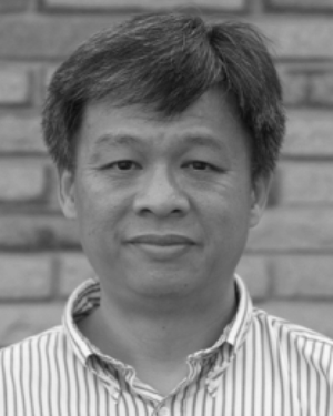 Chee-Hung Henry Chu合作论文数University of Louisiana at Lafayette1
 Kun Bai合作论文数Amazon1B. Shaparenko合作论文数1




