Cities increasingly form the habitat of humans and are thereby key to solutions to current human-induced sustainability challenges. In response, we here present a model of spatial urban form linked to human behaviour by cognitive geometry, and, in aggregation, urban processes of social, economic and ecological kinds, such as social networks, local markets and urban ecosystems. It aims to demonstrate how spatial form can influence and direct such processes and thereby constitute a capital in the sense of embodied labour, here called spatial capital, that not only can improve the use value of such processes but also increase the monetary value of urban land.
How the built environment, understood as spatial capital, governs both everyday life in cities and urban systems more generally. In an age of social and environmental crises, we need to critically rethink the role of the built environment and how best to put it to work. Measures and Meanings of Spatial Capital presents a new theory of spatial capital, arguing that spatial form is essential for building resilience into highly complex urban systems. Lars Marcus argues that the built environment constitutes a form of capital that enhances other forms of capital in cities (such as social, economic, and ecological capital), if designed with those goals in mind. This represents an important and necessary shift in how we approach urban space in the numerous studies of cities that are conducted in a range of disciplines today, such as urban sociology, urban economics, and urban ecology. In contemporary urban studies, land has oddly lost its position alongside labor and capital as one of the three fundamental production factors in economic theory, but as Marcus shows, misconceptions of land are at the root of social and environmental crises worldwide. By defining the challenges and modeling our use of spatial form to enhance/improve land, and then synthesizing data into a unified theory of spatial capital, Marcus provides a crucial reframing of how we can best plan and design our cities for the global challenges we are facing.
Due to unsustainable land management and climate change, floods have become more frequent and severe over the past few decades and the problem is exacerbated in urban environments. In the context of climate-proofing cities, the importance of nature-based solutions (NBSs), obtaining relevant outcomes in the form of ecosystem services, has been highlighted. Although the role of ecosystem services in building resilience against negative climate change effects is widely recognized and there is an identified need to better integrate ecosystem services into urban planning and design, this has proven difficult to operationalize. A critical limitation is that modeling is a time-consuming and costly exercise. The purpose is to roughly estimate the ecosystem service of water run-off mitigation through simplified, cost-effective, and user-friendly modelling at three nested biophysical scales, under four climate change scenarios. Using the Swedish city of Gothenburg as an example, we propose an approach for navigating NBS-oriented flooding adaptation strategies, by quantifying the ecosystem service of water run-off mitigation at three nested biophysical scales, under four climate change scenarios, hence, proposing an approach for how to navigate nature-based solutions in a multi-scale, social–ecological urban planning context against present and future flooding events. Our findings validate the effectiveness of employing an ecosystem service approach to better comprehend the significant climate change issue of flooding through user-friendly and cost-efficient modeling.
Resilience thinking provides valuable insights into the dynamics of complex adaptive systems. To achieve resilience in urban systems, it can be fruitful to delve into the intricacies of resilience processes. This paper theorizes about how the specific characteristics of resilient systems can be integrated into the spatial design of cities. Emphasizing the importance of the built form and spatial systems in maintaining order within urban processes, we focus on how adaptive renewal cycles can be applied to various systems and dimensions where urban change, adaptation, and renewal occur. The paper identifies key resilient system characteristics applicable to urban spatial form and contextualizes urban renewal within the adaptive renewal cycle—a framework originally developed to capture temporal and spatial ecosystem dynamics. We integrate insights within ‘space syntax theory’, theorizing about how cities renew themselves over space and time. We discuss instances of ‘compressed resilience’ and the challenges posed by the ‘tyranny of small decisions’ in urban planning and development. In conclusion, we identify future research directions in the theory of spatial morphology and resilient urban systems, emphasizing the need for a deeper understanding of the interplay between urban processes, urban form, resilience, and adaptive renewal.
hardly consider Healey as a forecaster or scenario builder. Her way of looking at the future starts from the power of citizens active in civil society. ‘The collective power mobilised by civil society activism draws on the voluntary involvement of individual agency’ (p.189). Healey is very aware that such commitment will most of the time be in conflict with forces ‘flowing through the state and the market’. ‘While our activism has had some impact on the boundaries between formal government and civil society, we have little power to alter the economic changes affecting our area’ (p. 189). Still, based on her experience as an activist and analyst she believes in the power of the community to have a real impact on ‘Framing its Future’ (Chapter 7) and to extend community benefit and public value into the future of the Wooler–Glendale place community. What I appreciate most in this book is how Patsy Healey valorises her experience as an academic, a planner and a committed citizen in three different initiatives of community development. Hybridising theory, research, empathy, caring, visioning and activism, the Wooler–Glendale community has stamped its feet in the mud of its vales and built up the potential to redress itself. Being maybe slightly naive in its analysis of power – overlooking for example, the behavioural impact of market ideology, the suffocating impact of the practice of the control state – this book and the protagonists it stages join the civil movement that still dreams of grand transformations but works within the scope of (ingenuous?) realism; positing that the combination of micro-initiatives of place-communities is probably the only hopeful way forward to overcome capitalism and ecological mass destruction. It is maybe for this reason that the author only listened with half an ear to the arguments of post-political authors and kept a careful distance from literature on utopia and commoning – or unwillingly put both together in one tub? – whereas both can tell us a lot about how socio-political experimenting offers fertile insights for badly needed socio-political transformation.
A closer partnership between urban design and urban ecology can yield new knowledge with the predictive advancement of both fields. However, achieving such partnership is not always a straight-forward process due to different epistemological departures. This chapter provides a rudimentary background of the fields of urban design and urban ecology and familiarizes readers with some epistemological characteristics that are useful to consider in all forms of partnership activities between designers and ecologists. Social-ecological resilience offers a useful framework for inquiry of particular relevance for urban transition at a time when global societal challenges of massive biodiversity loss and climate change require urgent attention and where wicked environmental problems require creative urban tinkering. Such a framework could open up for more dynamic research approaches with a greater potential to bridge the gap between design and ecology that has tended to be dominated by relatively static design approaches in the past, ignoring a more non-linear understanding of the interconnectedness of social and ecological systems. The chapter ends by focusing on some important determinants for cooperation and dealing with ‘Research Through Design(ing)’ as a viable methodology for transition to urban sustainability.
Today we experience and acknowledge the nexus of ecology, culture and politics as a moving objective, defined by local realities placed within global developments. Large-scale change is no longer a distant probability but an approaching condition, which forces us to accept instability and envision sustainability transitions as the ground of future inhabitation. When looking closer into atmospheric, water (riverine, maritime, deltaic), and land systems and their inherent uncertainties we realize the agency that local sensitivities, culture and planning regimes have in defining the success or failure of sustainable development. This dialogue will question what the real ground of preMarsent and future urbanization is, imagining adaptive and transformative change as material and ecologically sensitive practices to site, context and culture. This dialogue is the transcription of the round table talk on the International Forum on Urbanism held in Delft on 26 November 2021. Lars Marcus, Chris Zevenbergen and Carola Hein presented their work in the light of the environmental crisis, sectoral versus integral: the agency of change. With moderator Fransje Hooimeijer they elaborated and related their work in a discussion around the main questions of history, the longue durée, disciplinarity and agency of change.
This paper describes a new approach in urban ecological design, referred to as social–ecological urbanism (SEU). It draws from research in resilience thinking and space syntax in the analysis of relationships between urban processes and urban form at the microlevel of cities, where social and ecological services are directly experienced by urban dwellers. The paper elaborates on three types of media for urban designers to intervene in urban systems, including urban form, institutions, and discourse, that together function as a significant enabler of urban change. The paper ends by presenting four future research frontiers with a potential to advance the field of social–ecological urbanism: (1) urban density and critical biodiversity thresholds, (2) human and non-human movement in urban space, (3) the retrofitting of urban design, and (4) reversing the trend of urban ecological illiteracy through affordance designs that connect people with nature and with each other.
EDITORIAL article Front. Built Environ., 30 August 2022Sec. Urban Science Volume 8 - 2022 | https://doi.org/10.3389/fbuil.2022.982681
Transport infrastructure such as railways, motorways and arterial roads increases regional accessibility for motorised transport but simultaneously can create barriers in local street networks that can decrease accessibility for pedestrians and cyclists. Although several tools for an objective assessment of these barrier effects have been developed, their use in practice is limited; impact assessments are instead based on subjective descriptions. This article reviews the literature on barrier effects of the last 60 years and aims to offer guidance for the use of objective methods of assessment of barrier effects. The first contribution is a conceptual model for the barrier effects of transport infrastructure and their determinants. The second contribution is an overview of tools for the assessment of barrier effects. We conclude that a multi-disciplinary approach is required, supported by the conceptual model and the overview of assessment tools. Investments in transport infrastructure can then be based on broader decision support involving not only the benefits of increasing regional accessibility but also the cost of reducing local accessibility.
The importance of the plot (also referred to as ‘property’) as one of the fundamental elements of urban form is well recognized within the field of urban morphology. Despite the fact that it is often described as the basic element in the pattern of land divisions, which are essential as organizational frameworks for urban form, studies offering comprehensive descriptions and classifications of plot systems are quite scant. The aim of the paper is to introduce a classification of plot systems into typologies based on five European cities, in order to distinguish particular spatial differences and similarities in terms of their plot structure. The proposed typologies are developed using unsupervised k-means cluster analysis based on numeric attributes derived from central theories in urban morphology. The introduced typologies are essentially configurational, allowing collective systematic properties of plot systems to be captured. Numeric attributes include plot differentiation (or plot size), plot frontage and compactness ratio, corresponding to essential qualities of plot systems such as the capacity to carry differences in space, the ability to operate as interface between street and building and providing a framework for evolution of built form over time. All three attributes are translated into configurational measures in order to capture the context of the plot system, rather than the parameters of individual plots. The combination of these deductively defined variables with algorithmically defined classification methods results in seven plot types that can be used to scale up traditional urban morphological analysis to whole city regions and conduct substantial comparison of patterns within, but also between these regions. Further, it also makes it possible to describe commonly recognized plot patterns and discover new ones.
Interest in the green infrastructure of cities has rapidly increased in recent years. The reasons are several but generally relate to the great increase of research and policy on sustainable urban development. Of particular importance here is the more recent shift in this field towards greater emphasis on biodiversity and urban ecosystems and not only climate change and environmental engineering. This shift brings new demands for a deeper understanding of the morphology of green infrastructures in cities, understood as ecological environments and not only as areas for human use, as has been the general case in urban morphology. In an earlier paper (Marcus et al., 2019), we discussed how descriptions of landscape patterns of both urban and natural kinds, as developed in urban morphology and landscape ecology respectively, could be integrated into a joint socio-ecological spatial morphology. That paper outlined a framework for such a morphology where green (and blue) as well as built-up areas in cities can be jointly described as configurations of patches. However, the discussion in that paper does not address how to capture the relation between such configurations and the processes that they structure, or how such processes over time may alter such configurations, which is the aim of the present paper. It does so by extending the theory of generic function (Hillier, 1996) to other species than humans, and by applying the theory of affordances (Gibson, 1986) as a means to develop distance measures specific for different species. The origin of the discussion in both papers is the need for progress in sustainable urban development for which this relation is vital, since if we are to address the function of both urban and ecological systems through spatial form, we need to develop an understanding of how such patterns underpin and structure urban and ecological systems.
This paper focuses on the need for a widened definition of the notion of technology within the smart city discourse, with a particular focus on the "built environment". The first part of the paper describes how current tendencies in urban design and architecture are inclined to prioritize high tech-solutions at the expense of low-tech functionalities and omits that information and communication technology (ICT) contrasts the art of building cities as an adaptable and habitually smart technology in itself. It continues with an elaboration on the need for expanding the limits of system boundaries for a better understanding of the energy and material telecouplings that are linked to ICT solutions and account for some perils inherent in smart technologies, such as rebound effects and the difficulty of measuring the environmental impacts of ICT solutions on a city level. The second part of the paper highlights how low-tech technologies and nature-based solutions can make cities smarter, representing a new technology portfolio in national and international policies for safeguarding biodiversity and the delivery of a range of ecosystem services, promoting the necessary climate-change adaption that cities need to prioritize to confer resilience.
The central variables in any urban model are distance and attraction. Space syntax research has contributed to the development of new geometric descriptions and measures of distance that have broken new ground, not least when it comes to capturing pedestrian movement. However, the description and measurement of attractions has not been central to the field. In this paper we extend measurement of attractions to the variable of differentiation. Earlier empirical studies have shown strong indications that there is a correlation between the degree of land division into plots (parcels) and the diversity of socio-economic content, such as residents and economic activity (Marcus et al., 2017; Cantarino & Netto, 2017). Building on this, we present results from an extensive empirical study of Stockholm, in the aim to pave the way towards a spatial variable of differentiation in spatial morphology, with direct impact on socio- economic diversity. The investigation concerns a correlation analysis between, on the one hand, measures of the configuration of plot systems, and on the other hand, categories of economic activity, measured using Simpson Diversity Index. Special attention has been payed to the demands in studies of this kind for close scrutiny of, on the one hand, the definition of the urban scale the study concerns, and on the other hand, the categorisation of economic activity related to this. Diversity in economic activity can be found at different urban scales. For instance, on the district level, the retail category ‘clothes’ may be part of creating diversity together with ‘food’ and ‘computers’, while on the street level, we may find retail related only to ‘clothes’, implying no diversity. In addition, on the city level, areas that have variety of basic services (retail, public and cultural facilities), but homogeneous in terms of retail categories, can be also considered as generally diverse. Hence, the question ‘diversity of what’ and ‘diversity on what urban scale’, and sensitive categorisations in accordance with this, are central issues, for this study. The twofold aim of the paper includes first, presenting an overview of complex issues behind diversity concept with the focus on categorisation and scale, and second, empirical studies that support the proposed impact of variable of differentiation on urban diversity.
Typologies have always played an important role in urban planning and design practice and formal studies have been central to the field of urban morphology. These studies have predominantly been of a historical-qualitative nature and do not support quantitative comparisons between urban areas and between different cities, nor offer the precise and comprehensive descriptions needed by those engaged in urban planning and design practice. To describe contemporary urban forms, which are more diffuse and often elude previous historic typologies, systematic quantitative methods can be useful but, until recently, these have played a limited role in typo-morphological studies. This paper contributes to recent developments in this field by integrating multi-variable geometric descriptions with inter-scalar relational descriptions of urban form. It presents typologies for three key elements of urban form (streets, plots and buildings) in five European cities, produced using statistical clustering methods. In a first instance, the resulting typologies contribute to a better understanding of the characteristics of streets, plots and buildings. In particular, the results offer insight into patterns between the types (i.e. which types are found in combination and which not) and provide a new large scale comparative analysis across five European cities. To conclude, a link between quantitative analysis and theory is established, by testing two well-known theoretical propositions in urban morphology: the concept of the burgage cycle and the theory of natural movement.
A better understanding of the relationship between the built environment and urban processes is central in guiding urban processes in more sustainable trajectories. Of particular importance to this endeavour is the idea of urban types. However, on closer scrutiny, while such types may capture the symbolic dimension of urban form, they frequently do not capture its performance or functional dimension. This prohibits precise policy formulation on the topic. This paper first presents a methodology for generating urban types relevant to urban practice (using analytical and statistical methods) and, second, an empirical test of the differences in performance concerning their influence on the presence of people in public space (an essential driver of many other urban processes). For this reason, a large (and to our knowledge unique) pedestrian survey of three European metropolitan areas was conducted and used to test the performance of the urban types developed. The results prove that the methodology for developing the types is robust, as it picks up generally recognised spatial patterns in all three cities. Further, the types were able to explain the intensity of pedestrian flow, its spatial distribution and fluctuations of intensity in space and time. These are vital steps forward and provide more useable typologies in urban planning and design practice.
 Meta Berghauser Pont合作论文数40
 Ann Legeby合作论文数School of Architecture, School of Architecture and the Built Environment, KTH Royal Institute of Technology29
 Alexander Ståhle合作论文数Spacescape22
 Daniel Koch合作论文数School of Architecture, School of Architecture and the Built Environment, KTH Royal Institute of Technology18
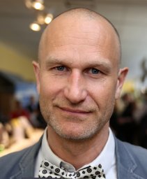 Stephan Barthel合作论文数Stockholm Resilience Ctr, Stockholm Univ17
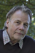 Johan Colding合作论文数Beijer International Institute of Ecological Economics, Royal Swedish Academy of Sciences17
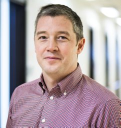 Nordström Tobias合作论文数11
 Hanna Erixon合作论文数10
 Evgeniya Bobkova合作论文数Dept Architecture & Civil Engn, Chalmers Univ Technol10
 Asa Gren合作论文数Beijer Institute of Ecological Economics, Royal Swedish Academy of Sciences;Beijer Institute of Ecological Economics, Royal Swedish Academy of Sciences10
 jonas torsvall合作论文数9carl karsten合作论文数8malin dahlhielm合作论文数8
 Henrik Ernstson合作论文数Division of Strategic Sustainability Studies, Department of Sustainable Development, Environmental Science and Engineering, School of Architecture and the Built Environment, KTH Royal Institute of Technology8sara grahn合作论文数7
 Ioanna Stavroulaki合作论文数Chalmers Univ Technol5Anders Karlström合作论文数Division of Transport and Systems Analysis, Department of Urban Planning and Environment, School of Architecture and the Built Environment, KTH Royal Institute of Technology5
 Gianna Stavroulaki合作论文数4Jesper Olsson合作论文数3sara sardari sayyar合作论文数3
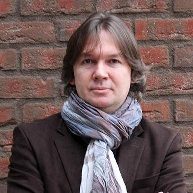 Tigran Haas合作论文数Division of Urban and Regional Studies, Department of Urban Planning and Environment, School of Architecture and the Built Environment, KTH Royal Institute of Technology3
 Jorge Gil合作论文数Space Syntax Limited3Olof Netzell合作论文数3Kailun Sun合作论文数2Karl Samuelsson合作论文数2Anders Bergstrom合作论文数2
 Matteo Giusti合作论文数Dept Bldg Engn Energy Syst & Sustainabil Sci, Univ Gavle2
 Miguel Serra合作论文数Res Ctr Terr Transports & Environm2Ashley Dhanani合作论文数The Bartlett School of Architecture, The Bartlett Faculty of the Built Environment, University College London2
 Birgit Hausleitner合作论文数Department of Urbanism, Faculty of Architecture and the Built Environment, Delft University of Technology2
 Henrik Markhede合作论文数2Orjan Sjoberg合作论文数2m y berghauser pont合作论文数1
 Job van Eldijk合作论文数1
 Lasse Suonperä Liebst合作论文数Department of Sociology, Faculty of Social Sciences, University of Copenhagen1Ge LIN (林戈)合作论文数1Chengru DENG (邓成汝)合作论文数1Shuaizheng LI (李帅峥)合作论文数1
 Anna Kaczorowska合作论文数1
 David Bolin合作论文数1
 Chris Zevenbergen合作论文数Department of Urbanism, Faculty of Architecture and the Built Environment, Delft University of Technology1
 Nabil Ibrahim Mohareb合作论文数College of Engineering, United Arab Emirates University1
 Patrik Ström合作论文数1
 Jesper Steen合作论文数1
 Marita Wallhagen合作论文数1
 Carola.M. Hein合作论文数Department of Architecture, Faculty of Architecture and the Built Environment, Delft University of Technology1Alexander St合作论文数1
 Berit Brokking Balfors合作论文数Division of Sustainability Assessment and Management, Department of Sustainable Development, Environmental Science and Engineering, School of Architecture and the Built Environment, KTH Royal Institute of Technology1Paulo C. M. L. Miranda合作论文数UNICAMP Institute of Chemistry, University of Campinas1




