During the COVID-19 pandemic, physical distancing, mobility restrictions and self-isolation measures were implemented around the world as the primary intervention to prevent the virus from spreading. Urban life has undergone sweeping changes, with people using spaces in new ways. Stockholm is a particularly relevant case of this phenomenon since most facilities, such as day care centres and schools, have remained open, in contrast to cities with a broader lockdown. In this study, we use Twitter data and an online map survey to study how COVID-19 restrictions have impacted the use of different locations, services and amenities in Stockholm. First, we compare the spatial distribution of 87,000 geolocated tweets pre-COVID-19 and during the COVID-19 pandemic. Second, we analyse 895 survey responses asking people to identify places they ‘still visit’, ‘use more’, ‘avoid’ and self-report reasons for using locations. The survey provides a nuanced understanding of whether and how restrictions have affected people. Service and seclusion were found to be important; therefore, the accessibility of such amenities was analysed, demonstrating how changes in urban habits are related to conditions of the local environment. We find how different parts of the city show different capacities to accommodate new habits and mitigate the effects of restrictions on people’s use of urban spaces. In addition to the immediate relevance to COVID-19, this paper thus contributes to understanding how restrictions on movement and gathering, in any situation, expose more profound urban challenges related to segregation and social inequality.
As a showcase for ideal urban visions, Olympic Villages encompass the utopian disposition of the Olympic Games. More precisely, Olympic Villages could be understood as a heterotopia, a theorization that stems from an analysis of their historical, conceptual, and spatial evolution over the course of the Summer Olympic Games. Against this backdrop, we analysed some notable examples of Olympic Villages as we questioned the relationship between their proposed “legacies” and their subsequent integration in the urban realities of their host cities. We conclude that most Olympic Villages have not fulfiled their legacy role as proposed by the IOC. This suggests that we need to further explore the relationship between the host region’s urban development and the Olympic Games so that the desired “Olympic legacy” may become part of the daily life of the host cities.
Este artigo discute a interação entre leiautes espaciais efêmeros e perenes que, embora observáveis em diversos tipos edilícios, são particularmente evidentes em espaços expositivos, e propõe três modelos descritivos – complexo, genérico e específico – capazes de capturar e relacionar suas possibilidades máximas, mínimas e intermédias de desempenho das funções genéricas de ocupação e movimento. Para tal, utiliza a Bienal de São Paulo como objeto empírico, expressão que designa um conjunto de exposições e um edifício, cuja configuração espacial é simultaneamente descrita como complexa e genérica, e que, desde 1957, é reconfigurado a cada dois anos para sediar o evento – composto por exposições de arte moderna e contemporânea de grande especificidade. A análise de nove casos de leiautes de exposições Bienais e do leiaute de seu edifício no ano correspondente permitiu elaborar e testar tais modelos e sintetizar os resultados por meio de escalas que relacionam os três sistemas e suas sequências de distribuição. Estes modelos e sequências caracterizam a propriedade de mediação espacial da arquitetura (Nóbrega, 2022) e podem suportar a descrição e análise da interação entre leiautes superpostos e o desempenho de suas funções genéricas em edifícios de outros tipos e usos.
Recent empirical research has confirmed the importance of green infrastructure and outdoor recreation to urban people’s well-being during the COVID-19 pandemic. However, only a few studies provide cross-city analyses. We analyse outdoor recreation behaviour across four Nordic cities ranging from metropolitan areas to a middle-sized city. We collected map-based survey data from residents ( n = 469–4992) in spring 2020 and spatially analyse green infrastructure near mapped outdoor recreation sites and respondents’ places of residence. Our statistical examination reveals how the interplay among access to green infrastructure across cities and at respondents’ residential location, together with respondents’ socio-demographic profiles and lockdown policies or pandemic restrictions, affects outdoor recreation behaviour. The results highlight that for pandemic resilience, the history of Nordic spatial planning is important. To support well-being in exceptional situations as well as in the long term, green infrastructure planning should prioritise nature wedges in and close to cities and support small-scale green infrastructure.
This article engages with the role of what one might tentatively call “secondary” urban spaces, in that while they are public, they are not the most vibrant, populated, or active places. These are not the spaces envisioned in many project illustrations. They are not full of people and activity. They are however a crucial part of a wider texture of urban situations, and important to extending our understanding of seclusion, solitude, and tranquility beyond distant parks and recreation areas. My aim here is to understand the emergence of these spaces in-between; those that are close to the vibrant streets and are embedded in city centers yet which offer a respite from the most bustling urbanity. These spaces, I will argue, more easily allow for the kinds of interactions that can lead to bridging and bonding with the unknown, in addition to the important everyday encounters that occur on central streets and squares. Using qualitative methods which build on Lefebvre’s rhythmanalysis, the discussion will draw on observations of the syntactic properties that condition, enable, and characterize such spaces, and address a series of concepts, including capacity, insulation, sequencing, and interface. A better understanding of such places, it is argued, not only allows a richer set of tools for working with urban design and planning, but offers possibilities for more resilient planning in terms of generating social relations, the emergence of communities, and for cities to manage and withstand extraordinary conditions.
During the Coronavirus pandemic, extensive interventions have been introduced to limit the spread of Covid-19. Authorities, companies, and organisations introduce comprehensive restrictions. To capture new routines, we launched a web questionnaire (PPGIS) including maps in three cities in Sweden; Stockholm, Uppsala and Gothenburg. From the first month results, we see dramatic changes of habits. Places still used are primarily where people find service, while places people avoid are where they normally work or study. Places used more, are where people find seclusion; primarily green spaces and easy to access. This pandemic reinforces existing urban inequalities. Access to urban resources and green spaces becomes even more important in areas characterized by poverty and overcrowding.
During the Corona pandemic, extensive interventions have been introduced to limit the spread of Covid-19. Authorities, companies, and organisations introduce comprehensive restrictions. To capture new routines, we launched a web questionnaire (PPGIS) including maps in three cities in Sweden; Stockholm, Uppsala and Gothenburg. From the first month results, we see dramatic changes of habits. Places still used are primarily where people find service, while places people avoid are where they normally work or study. Places used more, are where people find seclusion; primarily green spaces and easy to access. This pandemic reinforces existing urban inequalities. Access to urban resources and green spaces becomes even more important in areas characterized by poverty and overcrowding.
During the Corona pandemic, extensive interventions have been introduced to limit the spread of Covid-19. Authorities, companies, and organisations introduce comprehensive restrictions. To capture new routines, we launched a web questionnaire (PPGIS) including maps in three cities in Sweden; Stockholm, Uppsala and Gothenburg. From the first month results, we see dramatic changes of habits. Places still used are primarily where people find service, while places people avoid are where they normally work or study. Places used more, are where people find seclusion; primarily green spaces and easy to access. This pandemic reinforces existing urban inequalities. Access to urban resources and green spaces becomes even more important in areas characterized by poverty and overcrowding.
In his 2018 Stockholm prize winner lecture, Goldstein highlighted the need for problem-oriented policing (POP) to be not only effective but also fair. Contributing to the development of POP, this study examines how a wider perspective on problem-solving generally, and scoping in particular, can be adopted to address some of the growing challenges in 21st century policing. We demonstrate that the concept of ‘problem’ was too narrowly defined and that, as a result, many problem-solving models found in criminology are ill-structured to minimize the negative side-effects of interventions and deliver broader benefits. Problem-solving concepts and models are compared across disciplines and recommendations are made to improve POP, drawing on examples in architecture, conservation science, industrial ecology and ethics.
Space syntax has established itself as a significant field of research into architectural and urban phenomena through the analysis of spatial configuration. Analyses that predominantly consist of v ...
Vi behover vidga forstaelsen for vad en ”stad” ar och bor vara, och hur produktionen kan integreras i den saval arkitektoniskt och organisatoriskt sa som ett infrastrukturellt system, skriver Daniel Koch. Framtidens hallbara stad ar en minst sagt het potatis. En mangd olika aktorer presenterar forslag, modeller och ideer som ror allt fran problembeskrivning till losningar. Trots alla inlagg och oavsett hur problematiken beskrivs sa formuleras losningen ofta som en relativt tat, kvarterslik stadsstruktur med aktiva bottenvaningar och levande stadsrum. Samtidigt blir fragor om lokal produktion och resurshantering allt viktigare, och lyfts som utmaningar for framtida hallbar utveckling av bland annat FN. Men hur val gar lokal produktion och levande stadsmiljo ihop? https://arkitekten.se/kultur/den-produktiva-staden/
This paper proposes and explains a type of diagrams which share some of the characteristics distinctive of axial maps, while also differing substantially in some other aspects. A main discussion in Space Syntax is the capacity of different diagrammatic representations to describe relevant morphological characteristics of space: convex maps or visibility graphs at the scale of buildings; axial maps and other topological representations of streets or roads at urban and geographic scales. The relevance of these representations is often assessed through the correlation of the different metrics they afford with empirical observations of real phenomena, such as the flow, circulation and presence of people in space. This has led to an instrumentalist understanding of representations and models through their capacity to produce measurements that may be empirically correlated, relegating other aspects to a secondary plane. In their “Space Syntax” paper from 1976, Hillier et al. outlined a research programme based on the proposition of morphic languages and their syntaxes; the collection of maps and diagrams proposed by Hillier and Hanson years later in “the Social Logic of Space,” including the axial map, carried further this programme of a science of diagrams and “morphic languages,” rather than one focused on metrics and their empirical correlations. This paper wants to reconsider some of these original characteristics of the representations of spatial configurations, through the proposition of a diagram and an algorithm to generate it. This diagram has been developed for its use in the comparison and classification of spatial configurations. Using data available from Open Street Map, the algorithm presented here builds a graph in which its vertices consist of straight paths on the original graph, and edges represent crossings or adjacencies of these straight paths. The process involves the implicit construction of what is known in graph theory as the line graph and a set of operations so as to derive the final graph from it. This graph is referred to in the paper as the “straight path graph,” as it consists of paths, both in their graph theoretical sense of a sequence of non-repeated vertices, and in their more general sense as circulation paths on a map. The insistence on its qualities as a diagram is the result of a need to describe more concisely spatial organisations in order to map, compare and classify them, either by hand or through the use of diverse automatic techniques and algorithms, rather than its use in the production and correlation of metrics with empirical observations.
One of the rare representational problems encountered during the construction of axial representations of architectural configurations in space syntax is the so called 'visibility accessibility problem'. This is the condition when it is possible to perceive a space but not be able to directly traverse to that space. This condition arises in a number of cases for example in an office with half height partitions, or glass walls, in an urban street where safety barriers prevent free pedestrian movement or in a multi-storey building with an atrium which permits the direct perception of spaces on the second or story but not provide direct access to them. This paper introduces a new spatial representation called the multi-layered network that is asserted to be a more general representation of topological spaces than previous representations. Proofs are argued for certain aspects of the representation that is based as an extension of current topological representations and computations. A software implementation of this representation is demonstrated with a number of examples from the problematic cases. Finally it is argued that this new multilayered representation could also be used as the basis for a spatial representation which included signage and so by extension could make testable conditions that could measure the effect of differing types of signage in a building context.
The structure of the tandem lipid-binding PX and pleckstrin-homology (PH) domains of the Cdc42 GTPase-activating protein Bem3 fromSaccharomyces cerevisiae(strain S288c) has been determined to a resolution of 2.2 Å (Rwork= 21.1%,Rfree= 23.4%). It shows that the domains adopt a relative orientation that enables them to simultaneously bind to a membrane and suggests possible cooperativity in membrane binding.
This article discusses extended implications of Lefebvre’s The Production of Space in the context of contemporary global neoliberalism, by focus on its presence in architectural space as lived space and spatial practice. The main discussion concerns Lefebvre’s concepts of abstract space, in relation to Felix Guattari’s three ecologies, and the Aristotelean triad of aisthesis, poiesis and techné. The focus here concerns material architectural space and its relation to modes of subjectivity, especially creative-productive versus consuming subjectivities. The argument begins by elaborating on an understanding of abstract space as present in material architectural space as pervasive processes of disassociation of materiality and labor, and proceeds to through these concepts discuss modes of subjectivity—the dependence of abstract space on subjects as consumers—and the way this relates to challenges of sustainability. It further points to the importance of architectural space considered as built material environment for creative-productive modes of subjectivity which challenge abstract space and in extension consumer society, by offering potential dispositions that set subjects in a different relation to the world.
Flooding is one of the most destructive natural disasters which have rapidly been growing in frequency and intensity all over the world. In this view, assessment of the resilience of the city against such disturbances is of high necessity in order to significantly mitigate the disaster effects of flooding on the city structures and the human lives. The aim of this paper is to develop a method to assess the resilience of a river city (the city of Gothenburg in Sweden), which is prone to flood Hazard, against such disturbances. By simulating flood inundation with different return periods, in the first step, the areas of impact are determined. To assess the resilience, two different methods are followed. One is a syntactic method grounded in the foreground network in space syntax theory and the other is based on measuring accessibility to the essential amenities in the city. In the first method, similarity and sameness parameters are defined to quantitatively measure the syntactic resilience in the city. In the next step, accessibility to amenities and the minimum distance to amenities before and after each disturbance is measured. The results, in general, show that such disturbances affect the city structure and the resilience of the city differently. For instance, the city is more resilient after flooding according to accessibility measures. This clearly means that the answer to the question of resilience is mainly dependent on “resilience of what and for what.”
 Lars Marcus合作论文数18
 Ann Legeby合作论文数School of Architecture, School of Architecture and the Built Environment, KTH Royal Institute of Technology8
 Timo Betz合作论文数Institute of Experimental Physics II, University of Leipzig8
 Jesper Steen合作论文数7pablo miranda carranza合作论文数6
 Josef Käs合作论文数Soft Matter Physics Division, University of Leipzig;Peter Debye Institute for Soft Matter Physics, University of Leipzig;Faculty of Physics and Earth Sciences, University of Leipzig6
 Allen J. Ehrlicher合作论文数Department of Bioengineering, Faculty of Engineering, McGill University5Josef A. Kaes合作论文数4
 Ehsan Abshirini合作论文数4
 Henrik Markhede合作论文数4Bjorn Stuhrmann合作论文数4
 Walter Leitner合作论文数Max-Planck-Institute for Chemical Energy Conversion;Max-Planck-Institute for Coal Research;Institute of Technical and Macromolecular Chemistry, RWTH Aachen University3Michael Gögler合作论文数3
 Jeff Urbach合作论文数Department of Physics, College of Arts & Sciences, Georgetown University;Institute for Soft Matter, Georgetown University3Anders Karlström合作论文数Division of Transport and Systems Analysis, Department of Urban Planning and Environment, School of Architecture and the Built Environment, KTH Royal Institute of Technology3
 Michael Gogler合作论文数2
 Gunnar Ohlen合作论文数2Anders Bergstrom合作论文数2
 Hervé Borrion合作论文数Department of Security and Crime Science, Faculty of Engineering Sciences, University College London2Fuhs Thomas合作论文数Division of Soft Matter Physics Department of Physics, University of Leipzig;Paul Flechsig Institute of Brain Research, University of Leipzig;University of Leipzig, University of Leipzig2
 Yunbi Lu (卢韵碧)合作论文数School of Medicine, Zhejiang University2
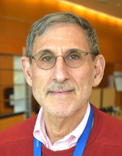 Herbert M. Geller合作论文数Developmental Neurobiology Laboratory, Cell and Developmental Biology Center, National Heart, Lung, and Blood Institute, The National Institutes of Health2
 Alexander Ståhle合作论文数Spacescape2Paulo C. M. L. Miranda合作论文数UNICAMP Institute of Chemistry, University of Campinas2Klaus Langemann合作论文数2Christian Six合作论文数2
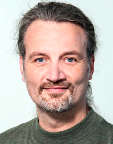 Kristian Franze合作论文数Institute of Medical Physics and Microtissue Engineering, Medizinische Fakultät, Friedrich-Alexander-Universität;Max-Planck-Zentrum für Physik und Medizin;University of Cambridge2William J Rosoff合作论文数1S. Park合作论文数1R Cardenas合作论文数1Roman Heissenberger合作论文数1M. Goegler合作论文数1Claudia Brunner合作论文数1Jiji Jiang合作论文数1sungmin eu合作论文数1
 Tiina Rinne合作论文数1Yu Liu合作论文数1
 Anton Olafsson合作论文数Department of Geosciences and Natural Resource Management, Faculty of Science, University of Copenhagen1Cate Heine合作论文数Massachusetts Institute of Technology1
 Renata Latuf合作论文数1
 Tom Benson合作论文数Senseable City Lab, MIT1
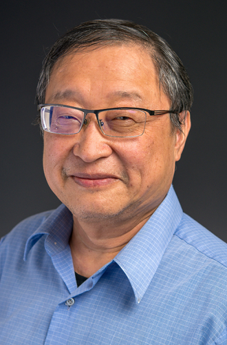 Chih-Kang Shih合作论文数Department of Physics, College of Natural Sciences, University of Texas at Austin1salla eilola合作论文数1
 Stefan O Brockmann合作论文数1Ja Kas合作论文数1
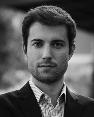 Umberto Fugiglando合作论文数MIT Senseable City Laboratory, Cambridge, MA, USA1Karl Samuelsson合作论文数1Dalal Alrajeh合作论文数Imperial College London1
 Anna Kajosaari合作论文数School of Engineering, Aalto University1




