CGS, lOl, 2, pp. 92 - 109 (1996). - The article presents basic information on the long-time research programme dealing with long-termed land-use changes. This research pro gramme is based on the land-use data of 1845, 1948, 1990, and 1995. It deals with issues marked by the International Geographic Union in 1995 as important part of the interdisci plinary research. Apart from the methodological process the article also outlines the evalu ation of land-use structural changes at the district level by the index of change. This is an overall index reflecting all changes in the respective region. The case-study of Semily District verifies the methodology used at the cadastral level and shows possible applica tions in detailed studies of the nature/society relations. This article compiled as part of the research project No. 205/95/0611 backed by the Czech Grant Agency.
This article assesses and compares Land Use changes in eastern regions of Europe: East Central Europe (ECE ) and South East Europe (SEE ). This part of the continent has to a certain extent common historical experience: multinational empires, ethic nationalism, peripheral position to markets and the communist experiment within 1940s–1980s. All these developments, complemented by specific environmental characteristics, different from each other, have affected the evolution of Land Use structure over the last fifty years. Considerable differences in LU structure of SEE and ECE had existed undoubtedly already in pre-war period. Here we try to on the basis of FAO LU database reveal how geographical and historical contexts shaped Land Use structural changes in both regions and led to important distinctions. LUCC v post-komunistických zemích střední a východní Evropy v letech 1960–2000 a jeho historickogeografické kořeny Předkládaný článek zachycuje v komparativní perspektivě změny ve využití půdy v regionech jihovýchodní (SEE ) a středovýchodní (ECE ) Evropy. Část kontinentu, dnes vnímaná především jako postkomunistická, má mnohem širší společné novověké dějiny: periferní pozici vůči světovému trhu, opožděný nástup industrializace, mnohonárodnostní impéria před a nevelké národní státy v době meziválečné. Zatímco tyto historickogeografické faktory vytvořily předpoklady pro analogický vývoj využití půd v obou regionech, rozdílné fyzickogeografické podmínky naopak posilovaly jeho specifické stránky. Na základě statistik Organizace OSN pro výživu a zemědělství (FAO) jsou v článku sledovány a zhodnoceny hlavní trendy ve využití půdy v obou regionech a jejich dominantní příčiny
Changes in the cultural landscape provide essential evidence about the manner and intensity of the interactions between humans and nature. Czechia has a specific location in Central Europe. It is positioned at the crossroads of European landscape changes. These changes can be documented based on a unique database that shows the development of land use since the middle of the 19th century. In this study, we aimed to address the major processes of landscape change that occurred during four periods over the past 165 years, at the cadastral level on the territory of present-day Czechia. Further we identify and discuss proximate and underlying driving forces of the landscape changes. We used land use data from the year 1845, 1896, 1948, 1990, and 2010 that correspond to key events in Czech history. The major processes and intensity of landscape change were evaluated based on calculations of increases and decreases in land use classes between the first and last year of each examined period. The period 1845–1896 was the only period in which arable land increased, and the most recent period, 1990–2010, was the only period during which a grassing over process was recorded. Afforestation was recorded in all periods. The communist period was characterized by unified changes—urbanization, afforestation, arable land decrease, and landscape devastation. The post-communist period was, in some respects, beneficial to the landscape (e.g., grassing over and afforestation, particularly in mountain areas), but it also led to negative processes, such as strong urbanization and land abandonment. Such changes lead to landscape polarization. The landscape changes in Czechia during the period 1845–2010 reflect many important historical events in Europe. In our analysis, we demonstrate the essential impact of underlying drivers and also identify driving forces specific to the development of the Czech territory.
We explore the agroecosystem energy flows in two former communist countries, Czechia and Poland, in the two decades after the fall of the totalitarian regimes. Energetic agroecosystem productivity, i.e., the energy content of crops, livestock products per unit of area is compared to energy inputs, i.e., external inputs from society, i.e., labour, industrial inputs, and external biomass inputs and linked to land use change and demographic and economic changes. Using the social metabolism concept and the Material and Energy Flow Accounting method, our analysis looks at the system from a biophysical perspective and explores the interactions between the economic system and nature. We calculate the Energy Return On Investment (EROI) indicators and also present an easily understandable index for policy makers, the Input/Output Index. After the end of communism in both countries in 1989, they both joined the EU in 2004. Along with this, both states started the integration towards a global economy. Our main research questions are 1) to what extent does the development of the energy flows and energy efficiency depend on the political organisation and the socioeconomic conditions and 2) if it follows rather more general trends or if it depends on the socioeconomic structure of the agricultural system. In the first decade immediately after 1990, the agricultural production radically slumped in both countries together with an overall slowdown of the economic performance. The production started to grow again and stabilised in the second decade mainly due to joining the EU in 2004. The integration to the global markets raised the volume of trade by a factor of 5 in Czechia and 10 in Poland. The number of agricultural workers decreased 1/3 in both countries over the whole period. Also, the cropland has been decreasing in both countries by about 20% and production has concentrated to more fertile areas, while the abandonment of agricultural area occurred mainly in less favoured areas. Both agricultural systems underwent structural changes in respect of change of ownership, economic conditions and subsequently the structure of production. Recently, the crops of economic significance dominate and Czechia exports raw materials as e.g., cereals and oil crops, and imports mainly fruits, vegetables and processed food. Poland has become an important producer and exporter of agricultural products in Europe (fruits, meat). But this is rather an issue of scale than of gaining efficiency. Poland is less efficient in the case of its share of inputs per outputs of energy flows with 21% while Czechia is 17%. Final EROI is stable in both countries. In Czechia, it is slightly improving from 0.6 in 1993 to 1 in 2012, while in Poland, the FEROI is stagnating around 0.6. The External Final EROI has slightly improved in Czechia from 2.8 to 3.8, while in Poland, it has been continuously decreasing from 2.6 to 2.2. The Internal Final EROI shows a declining share of the biomass reused in Czechia: from 0.8 to 1.4, while keeping its volumes in Poland at the value of 0.8.
Agroforestry in the Czech Republic has vanished both from the landscape and public conscience. That raises questions about its history and fate; there are examples of this land use type from all neighbouring countries. The article looks at the record of such systems in a historical land tax survey, the Franciscan cadastre made in the Czech Republic in the mid nineteenth century. With this source, patterns of preindustrial-era subsistence systems were analysed in a considerable part of what is now the Czech Republic. Any correlation among occurrences of various land uses (including agroforestry cultures) and influences of chosen natural and cultural factors was statistically tested and further visualised by multivariate analysis. The main existing agroforestry types and their historical distribution were investigated. The results have shown that cropland with fruit trees, and meadows, and pastures with either fruit trees or wood use, were a common part of Czech countryside in the mid-nineteenth century. Some agroforestry plots were found in the 1689 total studied cadastral areas. The types of agroforestry and the overall subsistence patterns were attuned to elevation, soil fertility, population density, and the dominant language group of the inhabitants. Cropland and pastures with fruit trees were associated with more fertile inland lowlands with sound infrastructure and prevalently Czech inhabitants (so-called ‘old settlement’ areas), wood meadows and pastures with cadastral units located in border regions at higher elevations characterised by lower soil fertility, a greater ratio of coniferous forests and predominantly inhabited by Czech Germans. Traditional agroforestry, as is discussed, however, did not survive the industrialisation of agriculture.
The history of land use changes on the Czech territory since the very beginning is outlined; each subchapter deals with one important historical period. The emergence of organized agriculture (Neolithic revolution) is seen as the first period when humans began to influence nature on a certain scale. For thousands of years, however, land use changes were largely limited to inhabited lowlands. The transition from wilderness towards largely agricultural landscape accelerated only during the German plantation (eleventh-fourteenth centuries) when many forests were cleared in the frontier. As a whole, however, changes were rather modest until the eighteenth century. Really important economic and social changes that fundamentally influenced land use patterns have been taking place since the eve of Industrial Revolution. In that time, agricultural society was being gradually transformed into the industrial one at the beginning of the 20th century. The second half of the nineteenth century brought general modernization; agricultural land and arable land expanded to maximum. Since the turn of nineteenth and twentieth centuries, however, reverse trends are recorded: decrease of agricultural land (due to more intensive farming) and gradual expansion of forests. Land use patterns during the twentieth century were much influenced by turbulent political events like Czechoslovak independence (1918), World War II (1939-1945), Communist coup d'etat (1948), and restoration of democratic conditions (1989). The Communist legacy included outdated technology and production-oriented agriculture that could not compete on the international markets. The post-Communist period brought restitution of confiscated property (including land) and return to market-oriented conditions. In the most recent period, the accession of Czechia to European Union (2004) has also had profound effects on land use changes.
Land use changes between mid-nineteenth century and present in four selected model areas are outlined. The analyses are based on research by individual plots and bring detailed results that cannot be obtained using conventional statistical methods. The model areas were chosen so that they would represent different landscape types in different parts of Czechia. The first one, Abertamy-Hrebecna, is a remote village located in the border mountains. The place has poor natural conditions and has been much influenced by the expulsion of German speaking population after World War II. In other words, human activities decreased significantly over the past 160 years; shift towards permanent grassland and forests was typical. Second, Kutlire is found in the fertile Elbe Plain in Central Bohemia and typifies the long tradition of farming. Unlike many other regions, farming remains crucial also nowadays, with emphasis on grain and other crops that require favourable soils and climate. Third, Cestlice is located near Prague adjacent to the main freeway, also in a quite fertile area. Due to the proximity of the capital city, however, the place has been recently much affected by suburbanization. In land use terms the result was a significant expansion of built-up and remaining areas. The last model area, Brekova Lhota, represents the so-called "inner periphery", placed outside the major economic zones and part of the Less Favoured Areas (LFA). The traditional reliance on subsistence agriculture has been replaced over the past 150 years by a mix of agriculture and leisure activities (second homes). Changing patterns of land use are shown in tables for each of the model areas that include eight basic land use classes. Importance of aerial images as an evidence of land use/cover change is documented using an example of the mountainous cadastre Horni Rokytnice nad Jizerou.
Historical and current data sources and research methods in land use studies are described in this chapter. Regarding historical data sources, the Land Registry is mentioned as a primary source. Its long tradition spans almost 1000 years; from the second half of the eighteenth century Land Registry includes maps also. The so-called Stable Cadastre (data collected in the first half of the eighteenth century) presents an especially important source of historical land use data. Military Land Survey was a series of detailed land surveying covering the whole Austria-Hungary in three phases (eighteenth and nineteenth centuries). Maps produced by Military Land Survey had high quality and were often used during the following decades. Commencing mid-twentieth century, aerial photography brought new qualities and new possibilities into land use studies. Multispectral satellite images have been in use since 1970s. Creation and structure of the "LUCC Czechia Database: Database of long-term land use changes in Czechia 1845-2010" are described in detail. This database forms the main information source used by the research team. It includes cadastral data from 1845, 1896, 1948, 1990, 2000, and 2010. As the structure of land use data collected was slightly different in each of the above-mentioned years, compatibility of data must be secured in order to allow historical comparisons. Methods of land use change analyses are outlined, including various indices (development index, saturation index, index of change, ecological coefficients, etc.), typologies, and other quantitative methods. In selected model areas, detailed land use changes were studied. To do so, GIS technology was applied. Results include quantitative data as well as detailed spatial information.
Basic terms, including "land use" and "land cover" are defined. Land use patterns are seen as a result of long-term interaction between humans and natural environment. Practical applications of land use research are discussed, namely with regard to land management and policy and land use planning. Later, the history of land use in the world is outlined. Four scientists that contributed most to land use research in the past are mentioned. First, Johann Heinrich von Thunen, who formulated the intensity theory and theory of crop zones. Second, Karl Marx, author of the term "differential ground rent". Third, British geographer L. D. Stamp who is considered founder of modern land use research. Last, but not least, the Polish geographer J. Kostrowicki who focused on typology and classification of agricultural systems in the second half of the twentieth century. Current approaches in land use research in the world are also discussed. Special attention is given to the DPSIR model that works with "drivers" and "pressures", "impacts" and "responses". The multi-level explanatory scheme, formulated by Scottish geographer A. Mather, is seen as the most complex concept used in land use research so far. Mather worked with proximate, intermediate, and underlying factors and he is also the author of the "forest transition" concept. In Czechia, the first research projects focused on land use were carried out in the early 1960s. At the moment there are two main research directions: analyses of small areas, and complex land use studies carried out by the so-called "Prague school". The latter studies often span a long period of time, starting in late eighteenth century. Old maps are utilized for comparisons; recently also remote sensing data have become available.
This article deals with the impact of the social and economic transformation in Czechia (Czechoslovakia) after the collapse of the Communist regime in 1989 in general and focuses particularly on the relatively well developed agricultural sector in the country.It characterizes the main transformation measures implemented in new state agricultural policy, which is conceived of as politicaleconomic driving forces both in structural and economic changes in Czech agriculture and particularly in land use changes in Czechia in 1990-2010.These changes reflected the transition of Czech agriculture to a capitalist system of production, the influence of foreign markets, and especially the European Union's agricultural policy.It is peculiar that the privatization of agricultural land and forests (in the form of land restitution, land sales, and confiscation) had nearly no impact on the farm structure, which was focused on large-scale production.Farm structure remained nearly the same as it was before 1989.
The main focus of this chapter is put on driving forces of land use changes. Authors distinguish among political, economic, social, technological, and cultural driving forces; the importance of different types much depends on how developed the society is. The greatest attention is devoted to social driving forces as these were behind the land use changes over the last 200 years especially in Europe and North America. Different phases of the "Complex Revolution of the Modern Age" are outlined and the spatial diffusion of new technologies are shown. In the nineteenth century Czechia, technological advance in agriculture and farming innovations were crucial and allowed to cultivate land in a more intensive way. Political driving forces of land use changes were especially important in the second half of the twentieth century. After Communists had seized the power in Czechoslovakia (1948), cooperatives and state-owned estates prevailed, private farming was suppressed. Later on, following the collapse of Communism in 1989, rural areas were significantly influenced by economic and social transformation. Socio-economic conditions in Czechia are outlined in brief, with special emphasis on geographical location and transport infrastructure. The concepts of centrality and peripherality are seen as crucial; core areas, neutral, and peripheral (marginal) regions are defined. The steady urban growth meant that most of the decision-making processes moved from rural areas to cities and towns-process that keeps continuing. The effects of transport infrastructure are studied too. The advance of railways seems to have a big influence on land use patterns in the fertile regions especially in the - nineteenth century; later on, highways and modern roads became more important.
This chapter deals with the influence of natural conditions on land use patterns. It also examines the human impacts on land use. Basic overview of - natural conditions in Czechia is outlined with special regard to geology, climate and soils. Geological conditions are seen as the key factors that form landscapes and influence the diversity of soils. Climate, of course, also has profound influence on regional farming patterns; very warm (VW) and warm climatic regions are best suitable for agriculture. The biggest part of the Czech territory is - covered by - moderately heavy soils. Soil types are crucial for the spatial distribution of forests, arable lands, and permanent grasslands. Climatic zones and soil types are shown in maps. Regional patterns of Czech agriculture are discussed and the so-called less-favoured areas (LFA; important for allocation of EU subsidies) are explained. The history of human impacts on land use patterns over the past two centuries ( covered by this research) has three phases. First, important changes in agriculture were - taking place ( changing balance between extensive and intensive farming). Second, forests began to shrink as more agricultural land was needed; with the advance of intensive farming, however, this process was reversed ("forest transition"). Third, new technologies and pressures exerted by the modern society brought a significant rise of built-up land and "other" areas. The ways how recent trends influenced the natural environment are explained. Changing political climate, especially the collapse of Communism and reintroduction of market conditions, has had profound effects on land use. The same applies to mining that caused large-scale devastation in some areas. Conservation programmes that accelerated after 1990 are seen as a "return to nature".
This chapter presents synthesis of the land use research covering the last 175 years and discusses the main findings. During this period, modernization trends and new forms of spatial organization have much altered the existing functions, including land use patterns. Major land use changes in different periods of time are presented. The first phase covered by the research (1845-1896) brought the peak of extensive farming; land use structure was rather similar regardless of different natural, social, and economic conditions. During the second period (1896-1948), though it included crucial political and economic events (World War I and II, independence), no major changes of land use patterns were recorded. On the contrary, the Communist period (1948-1990) brought fundamental changes. The transfer of ethnic Germans, transition to a centrally planned economy, and technological modernization were among the crucial driving forces of land use changes. Regarding the most recent period (from 1990 onwards), a number of different concepts have been enforced (restitution of property seized by the Communists, privatization, etc.) and these have profound effects on land use patterns. Regional differences in land use classes as well as major landscape processes in Czechia 1845-2010 are shown in maps and tables. In the very end, an outlook for future landscape changes in Czechia is given. These are likely to be affected especially by external factors that include EU Agricultural Policy, global food prices, and climatic changes. Though fertile regions will probably be intensively farmed also in the future, land use trends in uplands and highlands remain uncertain.
The objective of this book is to analyze changes in the landscape of Czechoslovakia / the Czech Republic since the first half of the 19th century. The text focuses not only on describing these conside
Akademický atlas ceských dějin zpřistupňuje na mapach, kartografických modelech, vyobrazenich, grafech a kartogramech soubor vybraných, hierarchicky uspořadaných poznatků moderni ceske historicke vědy po roce 1989 k ceským a ceskoslovenským dějinam s vazbami na evropský, ale zejmena středoevropský prostor. Cilem projektu, v němž se prolinala tři hlavni temata - clověk, prostor a cas - bylo zpracovani výsledků historickeho badani o ceských dějinach v mezinarodnich souvislostech kartografickou metodou, jednou z metod moderni historicke prace.
I. Bicik, L. Jeleck : Land use and landscape changes in Czechia During the period of transition 1990-2007 - Geografie - Sbornik CGS, 114, 4, pp. 263-281 (2009). - The article analyzes land use changes and their influence on landscape development in Czechia during the complex period of transition after 1990 to a democratic system with a capitalist economy. To analyze the database of cadastral data on land use of about 13,000 comparable basic territorial units (CTU) and their regional differentiation the typology method (the establishment of types of changes in CTUs and their portion of all CTUs) was used above all. At the same time tables follow the periods which formed over the long-term the preceding land use situation in Czechia at the start of the transition (1845-1948 and 1948-1990). Ascertained changes and trends in land use changes are then interpreted on the basis of searching out and explaining the main political, economic and social factors (or societal driving forces) that caused them. Their interaction with natural conditions is taken into account as well.
The article informs readers of the monothematic issue of Geografie journal devoted to the 150th anniversary of geography at Charles University in Prague about historical roots of geography at Prague University in the context of its development in Czechia during the last 150 years. The aim of the contribution is not to assess either the history of geographical thinking or the latest history of geography, but to present above all the development of personal and institutional backing of scientific and pedagogical activities in Czech geography. When assessing this development, the authors take account of the fact that Czech geography, as a discipline of science at Charles University, was developing in relatively frequently changing and sensibly different constitutional and political systems, socio-economical and socio-cultural conditions and also in different geopolitical situations and links of the Czech state. Besides external conditions that have been determining the changes of geography, the authors stress also the role of internal (subjective) factors - existence of key personalities of the discipline (fathers founders), their capacity to get recognition in the international context and to form their continuators.
 Ivan Bičı́K合作论文数17
 Lucie Kupkova合作论文数11
 Premysl Stych合作论文数10J Winklerova合作论文数Dept Social Geog & Reg Dev, Charles Univ Prague9Jan Kabrda合作论文数Department of Social Geography and Regional Development Albertov, Charles University in Prague9
 Zbynek Janousek合作论文数8
 Pavel Chromy合作论文数Dept Social Geog & Reg Dev, Charles Univ Prague6petr schnur合作论文数2Vít Štěpánek合作论文数2Ruzena Zimova合作论文数1Jaroslav Šebek合作论文数1Antonín Götz合作论文数1dalibor janis合作论文数1Petr Vorel合作论文数1Pavel Cibulka合作论文数1eva semotanova合作论文数1pavel krafl合作论文数1Jiří Friedl合作论文数1jan gebhart合作论文数1Jan Němeček合作论文数1eva doležalova合作论文数1roman baron合作论文数1zbyněk svitak合作论文数1ladislav hladký合作论文数1Pavel Seemann合作论文数1josef žemlicka合作论文数1dusan třestik合作论文数1Mlada Holá合作论文数1Milan Hlavačka合作论文数1jaroslav panek合作论文数1Kateřina Křováková合作论文数1Ivana Knížková合作论文数1Vaclav Matousek合作论文数1Petra J. E. M. van Dam合作论文数1
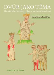 dana dvořackovamala合作论文数1vaclava horcakova合作论文数1
 Jiri Janac合作论文数1Tomáš Klír合作论文数Faculty of Arts, Charles University1
 Lajos Racz合作论文数1
 Petra Greslova合作论文数1Jana Krčmářová合作论文数1
 Jakub Havlicek合作论文数Dept Geomat, Czech Tech Univ1
 pavel krejci合作论文数1
 Tomasz Noszczyk合作论文数University of Agriculture in Krakow1
 Tomasz Salata合作论文数Dept Land Management & Landscape Architecture, Agr Univ Krakow1
 Vit Jancak合作论文数Dept Social Geog & Reg Dev, Charles Univ Prague1
 Barbara Prus合作论文数Dept Land Management & Landscape Architecture, Agr Univ Krakow1Tomas Janata合作论文数Dept Geomat, Czech Tech Univ1
 Jozef Hernik合作论文数Faculty of Environmental Engineering and Land Surveying, University of Agriculture in Krakow1




