The necessity of marine object detection has grown in prominence in recent years due to an increasing need for maritime surveillance. However, the object detection in adverse weather still poses a challenge, causing potential accidents. In this paper, we investigate object detection in adverse weather by dual-phase learning method to train a detector and a preprocessor for four adverse weather conditions (foggy, rainy, cloudy and dusk). The designed dual-phase learning method employs an innovative training strategy to drive a preprocessor to generate intermediate features that are most friendly to the downstream detector. Through experiments on our datasets, our proposed approach outperforms the baseline in overall detection accuracy (mAP50) and localization quality/overall performance (mAP50:95) under cloudy (+0.8
In recent years, underactuated unmanned surface vehicles have attracted considerable research interest. These vehicles exhibit underactuated characteristics, meaning the independent control inputs are outnumbered by the degrees of freedom. This characteristic poses significant challenges to controller design. Furthermore, unmodeled dynamics within the system and external ocean disturbances further complicate the controller design process. This paper proposes a fixed-time control scheme for underactuated unmanned surface vehicles. First, the trajectory tracking error is reformulated by using center-of-gravity shift technique (CGST). Second, to handle unknown marine disturbances, a radial basis function neural network (RBFNN) is established, complemented by the the minimum learning parameter (MLP) method to lower the controller’s computational complexity. Third, a fixed-time sliding mode control (FTSMC) strategy is developed to achieve fixed-time convergence of the tracking error to a bounded set. Finally, simulations demonstrate the performance of the overall approach.
In the field of unmanned surface vehicles (USV) autonomous control, fusing visible and infrared images enhances target detection robustness and supports navigation and obstacle avoidance tasks. However, infrared image acquisition is constrained by high equipment costs and harsh offshore environments, resulting in scarce samples and high acquisition costs that severely hinder the deployment of USV perception-control systems. To address this issue, this paper proposes a supervised improved Pix2Pix-based visible-to-infrared image generation method to supplement paired datasets. Three optimizations are adopted: the generator integrates cross-layer feature fusion and channel attention modules to enhance vessel structural details and feature focus; the discriminator employs a multi-scale local-global joint structure to ensure detail authenticity and overall consistency; the loss function incorporates perceptual loss under cycle consistency constraints. Experiments on a self-constructed dataset of 4000 paired vessel images show that the generated infrared images have reasonable thermal features and intact structures, with metrics significantly outperforming supervised baseline models. Ablation studies validate the effectiveness of each module, providing reliable data support for USV infrared target detection and improving the environmental adaptability of autonomous control systems.
Traffic flow forecasting, a vital task of multivariate time series prediction, has recently expanded to incorporate Points of Interest (POI) as an additional source of data. Rather than merely leveraging historical traffic flows, POIs facilitate the understanding of inherent geographical connections and potential functional interactions between nodes. However, traditional POI-based methods tend to use POI as static feature embeddings to compute functional similarity matrices, failing to consider the dynamic influence of node functionality on traffic patterns. This overlooks the reality that even regions with analogous POIs can exhibit fluctuating traffic flow trends, particularly over extended periods. In this paper, we propose the POI-based Double-deck Graph Convolution Network (PDGCN) for more nuanced traffic forecasting. To identify potential POI-based traffic patterns, we employ the spectral clustering method to group nodes with comparable POI functionalities into regions. We then devise a POI-based dynamic graph module with temporal convolution and attention mechanisms to trace the evolving relationships between traffic nodes. This novel design underpins regional features. Experiments on two real datasets demonstrate that PDGCN effectively detects dynamic functional relationships between nodes and delivers superior prediction accuracy.
Ocean data for instance segmentation is scarce and labeling is complex and time-consuming. A weakly supervised instance segmentation method using a ship dataset labelled only with bounding box annotations to achieve instance segmentation of ocean objects. We propose Object-BoxInst to improve ocean object instance segmentation performance without mask annotations. Object-BoxInst activates the object features in the box region of the class features and fuses them with the mask features to enhance the semantic information for mask prediction. Meanwhile, we build a Box Supervised Ocean Object InsSeg Dataset with 10,692 ship images and six classes. That has great significance to the application in the ocean field. The comparison experiment results show that Object-BoxInst has 40.21% AP, which is higher than BoxInst, thus effectively improving the ocean object accuracy of box-supervised segmentation.
Accurate ship object detection ensures navigation safety and effective maritime traffic management. Existing ship target detection models often have the problem of missed detection in complex marine environments, and it is hard to achieve high accuracy and real-time performance simultaneously. To address these issues, this paper proposes a lightweight ship object detection model called YOLOv7-Ship to perform end-to-end ship detection in complex marine environments. At first, we insert the improved “coordinate attention mechanism” (CA-M) in the backbone of the YOLOv7-Tiny model at the appropriate location. Then, the feature extraction capability of the convolution module is enhanced by embedding omnidimensional dynamic convolution (ODconv) into the efficient layer aggregation network (ELAN). Furthermore, content-aware feature reorganization (CARAFE) and SIoU are introduced into the model to improve its convergence speed and detection precision for small targets. Finally, to handle the scarcity of ship data in complex marine environments, we build the ship dataset, which contains 5100 real ship images. Experimental results show that, compared with the baseline YOLOv7-Tiny model, YOLOv7-Ship improves the mean average precision (mAP) by 2.2% on the self-built dataset. The model also has a lightweight feature with a detection speed of 75 frames per second, which can meet the need for real-time detection in complex marine environments to a certain extent, highlighting its advantages for the safety of maritime navigation.
Recently, self-supervised video object segmentation (VOS) has attracted much interest. However, most proxy tasks are proposed to train only a single backbone, which relies on a point-to-point correspondence strategy to propagate masks through a video sequence. Due to its simple pipeline, the performance of the single backbone paradigm is still unsatisfactory. Instead of following the previous literature, we propose our self-supervised progressive network (SSPNet) which consists of a memory retrieval module (MRM) and collaborative refinement module (CRM). The MRM can perform point-to-point correspondence and produce a propagated coarse mask for a query frame through self-supervised pixel-level and frame-level similarity learning. The CRM, which is trained via cycle consistency region tracking, aggregates the reference & query information and learns the collaborative relationship among them implicitly to refine the coarse mask. Furthermore, to learn semantic knowledge from unlabeled data, we also design two novel mask-generation strategies to provide the training data with meaningful semantic information for the CRM. Extensive experiments conducted on DAVIS-17, YouTube-VOS and SegTrack v2 demonstrate that our method surpasses the state-of-the-art self-supervised methods and narrows the gap with the fully supervised methods.
Existing point cloud classification researches are usually conducted on datasets with complete structure and clear semantics. However, in real point cloud scenes, the occlusion and truncation may destroy the completeness of objects affecting the classification performance. To solve this problem, we propose an incomplete point cloud classification network (IPC-Net) with data augmentation and similarity measurement. The proposed network learns the feature representation of incomplete point clouds and the semantic differences compared to the complete ones for classification. Specifically, IPC-Net adopts a random erasing-based data augmentation to deal with incomplete point clouds. IPC-Net also introduces an auxiliary loss function weighted by attention scores to measure the similarity between the incomplete and the complete point clouds. Extensive experiments verify that IPC-Net has the ability to classify incomplete point clouds and significantly improves the robustness of point cloud classification under different completeness.
In maritime scenes, instance segmentation of small object ships is of vital importance. Small ship objects in images have the characteristics of smaller size, lower image cover rate and fewer appearance features. However, existing instance segmentation methods fail to recognize and segment them and can cause missed ship segmentation. To this end, we propose a dual-branch activation network (DANet) for small object instance segmentation of ship images. DANet consists of a Feature Encoding, a Dual Mask Branch, and a Dual Activation Branch. The Feature Encoding adopts feature refinement and a pyramid structure to obtain more fine-grained features. The proposed Dual Mask Branch extracts dual-path mask features for encoding small object information. We propose a Dual Activation Branch to activate more small object regions and generate instance features. Furthermore, we build the Small ShipInsSeg dataset from a total of 5,256 images and 11,612 instances. The experiments show that DANet outperforms the SparseNet baseline and achieves state-of-the-art performance. Additionally, our method achieves a good trade-off between accuracy and speed.
The field of computer vision has been applied in many topics and scenes, especially in the shipping business which occupies a large position in the world trade. With the development of ship intellectualization, the task of detection, tracking, segmentation and classification of interested targets become more and more important. Publicly available dataset is the foundation to promote research in shipping. Based on this intention, we systematically present a review of maritime datasets on maritime perception. In this paper, comparison is made in terms of data type, environment, ground authenticity, and applicable research directions. The aim of writing this paper is to help researchers quickly identify the most suitable dataset for their work.
Instance segmentation technology has great application in the field of intelligent ships. However, existing methods still have many problems when used directly for ship instance segmentation. For the problems of imprecise bounding box and poor segmentation of detailed contour of ships. We propose a new Cascade Aggregation Network (CAN) for ship instance segmentation. The GIoU loss function is used to optimize the bounding box. And we propose an aggregation segmentation network with multi-scale edge aggregation information can improve mask. Finally, CAN can predict more accurate bounding boxes and generates higher quality masks. Experimental comparison and visual analysis show that our CAN outperforms Cascade Mask R-CNN on the ship instance segmentation dataset.
Global sensitivity analysis (GSA), particularly for Sobol index, is a powerful tool to quantify the variation of model response sourced from the uncertainty of input variables over the entire design space. However, GSA requires a large number of model evaluations to achieve satisfactory accuracy, which will lead to a great challenge in computational efforts when the model is expensive to be evaluated. To address this issue, an efficient method based on multi-fidelity Kriging (Cokriging) surrogate model is proposed. To this end, high dimensional model representation of Cokriging predictor is preformed to derive the analytical expressions of total and partial variances. Then, the sensitivity analysis is transformed into the computation of several one-dimensional in-tegrals, which is beneficial to reduce the computational burden. Four examples are employed to validate the performance of the proposed method. The results demonstrate that Cokriging estimator is an efficient approach to yield promising accuracy and reduce computational costs in the sensitivity analysis.
Frequent bad weather at sea severely damages the quality of visual images captured by imaging equipment. Ship instance segmentation in adverse weather conditions remains a major challenge because of poor visibility at sea. Existing approaches for instance segmentation are primarily designed for clear days and rarely consider the aforementioned severe weather. Blurred ship objects can easily cause missed ship detection and decrease the instance segmentation performance on ship images, especially in the case of frequent fog at sea. To this end, we propose a ship instance segmentation framework (IRDCLNet) based on Interference Reduction and Dynamic Contour Learning in foggy scenes. The Interference Reduction Module is proposed to reduce the interference caused by fog and solves the problem of missed ship detection. Meanwhile, we present Dynamic Contour Learning to predict the overall contour of the blurred ships to assist in mask prediction. To handle the scarcity of ocean data in foggy weather, we build the Foggy ShipInsseg dataset, which contains 5,739 real and simulated foggy ship images with 10,900 fine instance mask annotations. Experiments on the Foggy ShipInsseg dataset show that our IRDCLNet outperforms the Mask R-CNN and CondInst baselines and achieves the state-of-the-art performance.
Instance segmentation technology can provide accurate and efficient segmentation methods for visual perception of marine scenes, especially in the development of unmanned ships. However, the community lacks suitable open-source datasets. In order to address the problem of insufficient datasets, an instance segmentation dataset for the marine ship was collected and labeled. Our dataset, named MariShipInsSeg, consists of 4k high-quality visible light marine ship images with 8,413 instances. Due to marine ships being photographed far away, which causes ship objects with less detail information. Therefore, a global method is adopted to make full use of global location and semantic information, which is helpful for ship instance segmentation. We proposed a new method called Global Mask R-CNN (GM R-CNN), which utilized Precise RoI Pooling and Global Mask Head aiming to preserve global information of instances for improving the performance of ship instance segmentation. Experiments on the challenging MS COCO dataset and MariShipInsSeg dataset show that Global Mask R-CNN achieves state-of-the-art performance. Without any bells and whistles, the proposed GM R-CNN achieves 38.7% mask AP on MS COCO test-dev and 48.6% mask AP on MariShipInsSeg testing sets, which are gain of 1.6% and 1.9% compared with Mask R-CNN.
深度学习在计算机视觉领域已经取得很大发展,虽然基于深度学习的实例分割研究近年来才成为研究热点,但其技术可广泛应用在自动驾驶,辅助医疗和遥感影像等领域.实例分割作为计算机视觉的基础问题之一,不仅需要对不同类别目标进行像素级别分割,还要对不同目标进行区分.此外,目标形状的灵活性,不同目标间的遮挡和繁琐的数据标注问题都使实例分割任务面临极大的挑战.本文对实例分割中一些具有价值的研究成果按照两阶段和单阶段两部分进行了系统性的总结,分析了不同算法的优缺点并对比了模型在COCO数据集上的测试性能,归纳了实例分割在特殊条件下的应用,简要介绍了常用数据集和评价指标.最后,对实例分割未来可能的发展方向及其面临的挑战进行了展望.
面向大规模机器类通信的高可靠、低时延要求,以及时变信道的特性,提出高可靠低时延的联合编码调制技术.基于幅度相移键控(Amplitude Phase ShiftKeying,APSK)调制技术,提出一种APSK星座放置优化方案(Place-APSK,P-APSK).该方案的基本原理是平均欧氏距离与比特发生错误数量成正比,通过使最小欧氏距离的平均值最大来提高系统性能.通过对不同码率、APSK的星座图的误块率分析,证明优化后的星座图比未优化的星座图误块率降低了1 dB.为了减小P-APSK的计算复杂度与时间复杂度,将禁忌搜索算法与P-PASK结合,提出一种低复杂度的P-APSK.通过对复杂度的分析,证明了该方法的有效性.
该文提出一种基于SLAM定位的多位置和姿态点云的拼接与分割方法,可提供信息量大且准确的点云样本数据.首先,利用RTAB-MAP框架构建SLAM算法,由Kinect V2传感器采集获得带有位姿信息的多角度RGBD图像样本,并转化为三维点云场景数据;其次,改进ICP算法并基于SVD算法设计多位姿点云的拼接算法;再次,根据原始点云的RGB信息与凹凸性特征,设计三维点云分割算法,以此形成一系列点云目标;最后,开展点云拼接和点云分割实验,实验结果验证了该文所提算法的正确性和有效性.
3D object detection based on LiDAR point cloud has wide applications in autonomous driving and robotics. Recently, many approaches use voxelization representation in feature extraction and apply 3D convolution neural networks for 3D object detection. How to get expressive 3D voxelization representation is important for the detection performance. Therefore, we propose a new 3D object detection framework (DVFENet) based on dual-branch voxel feature extraction, which can provide rich and complete 3D information. The first branch is a graph-attention-network-based voxel feature extraction, which applies an improved voxel graph attention feature extractor (VGAFE) on large-scale voxelization. This branch uses graph convolution networks with an attention mechanism to extract more local neighborhood and context information. The second branch is a 3D-sparse-convolution-based voxel feature extraction that captures finer geometric features based on small-scale voxelization. We also design a decoupled RPN module that can obtain task-specific features to reduce the task conflict. Experiments on the challenging KITTI 3D object detection benchmark and nuScenes detection task show that our method achieve good performance. At the same time, we conduct extensive experiments to verify the effectiveness of each component.
Fog is a common weather phenomenon at sea. In foggy conditions, image quality collected by imaging equipment is relatively poor, and ship targets are blurred. This interference seriously affects the accuracy of ship instance segmentation. To this end, we propose a new instance segmentation with channel attention module, called CondInstAtt for ship segmentation in foggy scene. Meanwhile, to solve data scarcity in foggy scene, a foggy image simulation method based on an atmospheric scattering model for the marine scene is used. We also label the instance segmentation dataset with 2929 ship images in fog. Finally, the numerical and visual results clearly show that our method outperforms a few recent methods including Mask RCNN and CondInst.
Multiple ship tracking (MST) is an important task in marine surveillance and ship situational awareness systems. Considerable work has been conducted on multiple object tracking in recent years, but it has focused primarily on pedestrians and automobiles, leaving a gap in studies on MST due to the particularities of complex marine scenes, such as ship scale variations, the long-tailed distribution of ships, and long-term occlusions caused by ship movements. In this article, we present a robust deep affinity network (RoDAN) for MST. To overcome the above difficulties in MST, we start with the basic deep affinity network (DAN) and improve it in three aspects: scale, region, and motion. For the scale dimension, we integrate an atrous spatial pyramid pooling (ASPP) module to improve the modeling ability for multiscale ships. For the region dimension, we propose the joint global region modeling (JGRM) module, which further strengthens the modeling ability of DAN and exploit it to overcome the long-tailed distribution property of ships. For the motion dimension, we propose the motion-matching optimization (MMO) module to fine-tune the tracking results and make our tracker more robust, less reliant on the front-end detector, and ameliorate long-term occlusions. The experimental results demonstrate that our MST method outperforms the state-of-the-art methods. In particular, it reduces the number of ID switches (IDSs) and trajectory fragmentations (FMs), achieving holistically preferable performance. Meanwhile, our method achieves a comparable speed.
 Zhilin Liu (刘志林)合作论文数College of Intelligent Systems Science and Engineering, Harbin Engineering University16
 Rong Sun (孙蓉)合作论文数College of Intelligent Systems Science and Engineering, Harbin Engineering University11
 Shuping Lv (吕淑平)合作论文数College of Intelligent Systems Science and Engineering, Harbin Engineering University9
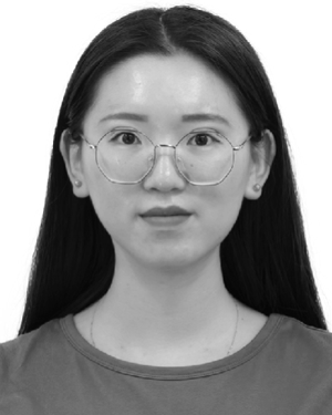 Yuxin Sun (孙雨鑫)合作论文数8
 Hao Meng (孟浩)合作论文数College of Intelligent Systems Science and Engineering, Harbin Engineering University7
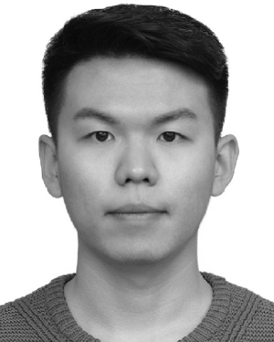 Shouzheng Yuan合作论文数6
 Wanyi Li (黎万义)合作论文数中国科学院自动化研究所6
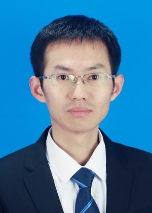 Yongkang Luo (罗永康)合作论文数School of Electrical and Electronic Engineering, Huazhong University of Science and Technology;Wuhan National High Magnetic Field Center, Huazhong University of Science and Technology6
 Xin Yuan (原新)合作论文数College of Intelligent Systems Science and Engineering, Harbin Engineering University6
 Zhi Zhang合作论文数ByteDance6
 Bing Li (李冰)合作论文数College of Intelligent Systems Science and Engineering, Harbin Engineering University5
 Wen Zhang (张雯)合作论文数College of Intelligent Systems Science and Engineering, Harbin Engineering University5
 Peng Wang (王鹏)合作论文数Institute of Automation, Chinese Academy of Sciences;School of Artificial Intelligence, University of Chinese Academy of Sciences5
 pang di合作论文数4
 Hai Lan (兰海)合作论文数College of Intelligent Systems Science and Engineering, Harbin Engineering University4
 Chengtao Cai (蔡成涛)合作论文数College of Intelligent System Science and Engineering, Harbin Engineering University4yisong yin合作论文数3Wenchang NIE (聂文昌)合作论文数3RenYan Zhang (张仁彦)合作论文数3Xin Liu (刘心)合作论文数3GuoLiang Zhao (赵国良)合作论文数3
 Lipeng Wang (王立鹏)合作论文数College of Intelligent Systems Science and Engineering, Harbin Engineering University3
 Qidan Zhu (朱齐丹)合作论文数College of Intelligent Systems Science and Engineering, Harbin Engineering University3
 Xujie He合作论文数2Yusheng Chen合作论文数2Guoliang Zhao (赵国良)合作论文数2Yunqian He合作论文数2Wenxian GUO (郭文县)合作论文数2Chun-hua WANG (王春华)合作论文数2Jun-jie WU (吴俊杰)合作论文数2Xin Yu (于鑫)合作论文数2
 Guorong Li (李国荣)合作论文数School of Computer Science and Technology, University of Chinese Academy of Sciences2
 Hui Wang (王辉)合作论文数College of Intelligent Systems Science and Engineering, Harbin Engineering University2
 Lijun Yu (于立君)合作论文数College of Automation, Harbin Engineering University2
 Qingming Huang (黄庆明)合作论文数School of Computer Science and Technology, University of Chinese Academy of Sciences2
 Jun Zhang (张峻)合作论文数Global College, Shanghai Jiao Tong University;University of Michigan–Shanghai Jiao Tong Univeristy Joint Institute2Ran DONG (董然)合作论文数1
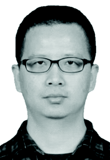 Zhe Wu合作论文数Intelligence Department, Peng Cheng Laboratory1Haibo Yao合作论文数1Hai Fang合作论文数1Meiyuan Chen (陈美远)合作论文数1Congying Xu合作论文数1Zhiyuan Deng (邓志远)合作论文数1Boyu Wang合作论文数1wen zhang (张雯)合作论文数1




