Reliable long-horizon planning remains a key challenge in end-to-end autonomous driving. By accounting for future motion evolution and potential consequences, it provides forward-looking guidance for safe and consistent driving in evolving traffic environments. Existing methods use historical planning states as temporal context. Self-generated history may become stale or conflict with the current motion stage, introducing unreliable priors. We propose StableDrive to address cross-cycle historical reliability and within-horizon motion-stage evolution. Selective Momentum Memory (SMM), implemented with a Mamba selective state-space operator, controls the influence of the preceding self-predicted planning state on the current cycle. Motion-Stage Training Scaffold (MSTS) uses motion-stage, long-horizon trajectory, and longitudinal-motion supervision to guide stage-aware future motion learning and is removed before inference. A fixed parameter midpoint between two architecture-aligned endpoints yields a single deployable SMM planner without model ensembling or extra inference-time computation. On nuScenes under the MomAD evaluation protocol, StableDrive achieves SOTA performance across all reported planning metrics from 1 to 6 s, reducing average collision rate by 23.3
In recent times, 4D radar sensors have gained significant attention in the autonomous driving sector for their cost-effectiveness and reliability under adverse weather conditions. Despite their advantages, the sparsity and lack of surface texture in the acquired 4D radar data pose challenges for perception tasks. Currently, 4D radar faces the issue of sparse point clouds and a lack of clear geometric appearance. We propose a novel detection method called V2-Fusion using image information to densify the foreground 4D radar voxels to highlight the foreground information and reducing the impact of projection misalignment errors. Firstly, V2-Fusion presents a Voxel-level Foreground Semantic Feature Enhancement Module (VFSFE), utilizing image semantic information to densify the foreground part, improving the model’s capability to discern foreground probabilities and thus refining voxel densification quality. Besides, V2-Fusion exhibits an Objective Contextual Texture Feature Aggregation Module (OCTFA) incorporating contextual information from target position image features, expanding the receptive field, and alleviating the inaccuracies in loss fusion caused by projection alignment errors. Evaluations on the View-of-Delft(VoD) and Dual-Radar datasets demonstrate the efficacy of our proposed method, which shows notable performance enhancements.
The integration of machine learning (ML) into materials science has introduced a transformative approach for predicting complex material behavior, particularly in systems where traditional modeling methods face significant limitations. Bulk metallic glasses (BMGs), characterized by their amorphous atomic structure, exhibit unique mechanical properties such as high strength and elastic limit, yet their deformation behavior remains difficult to predict due to the absence of conventional dislocation mechanisms. This study explores the application of data-driven machine learning techniques to model and predict the flow curve and deformation behavior of BMGs under varying conditions. By utilizing experimental datasets that incorporate parameters such as temperature, strain rate, and alloy composition, ML models-including neural networks and support vector machines-are trained to capture nonlinear relationships between input variables and mechanical response. The results demonstrate that ML-based models can accurately reproduce stress-strain behavior and outperform traditional empirical approaches in predictive capability and generalization. Furthermore, the study highlights the advantages of ML in reducing experimental costs and enabling rapid exploration of material design spaces. However, challenges related to data quality, model interpretability, and integration with physics-based frameworks are also discussed. The findings underscore the potential of machine learning as a powerful tool for advancing the understanding and design of amorphous materials, paving the way for future innovations in materials engineering.
Recent advances in multimodal large models have significantly improved UAV vision-language navigation (UAV-VLN) by enhancing high-level perception and reasoning. However, existing methods mainly focus on predicting discrete actions, local targets, or sparse waypoints, while the continuous transition from navigation intent to executable UAV motion remains weakly modeled. This motion-interface gap limits the continuity, stability, and executability of generated UAV trajectories. To address this gap, we propose DynFly, a dynamic-aware continuous trajectory generation framework that bridges high-level navigation reasoning and executable UAV motion. DynFly bridges high-level navigation intent and continuous UAV motion through a lightweight trajectory generation layer. Specifically, it represents expert trajectories in B-spline control-point space and employs a Spline-DiT generator to learn conditional trajectory generation via flow matching. Furthermore, we introduce UAV-oriented dynamic-aware supervision over position, finite-difference velocity, finite-difference acceleration, heading consistency, and local target alignment, enabling the generated trajectories to better satisfy UAV motion characteristics. And our trajectory generation framework can also be integrated with an existing UAV-VLN framework while preserving its original visual-language reasoning pipeline. Extensive experiments on the OpenUAV UAV-VLN benchmark show that DynFly improves both navigation performance and trajectory quality. On the Test Unseen Full split, DynFly improves the strongest baseline by 4.69 NDTW, 2.40 SDTW, 2.14 SR points and 4.87 OSR points, while reducing NE by 4.51 m.
Long-horizon planning is critical for safe autonomous driving in complex scenarios. Existing methods improve planning continuity with temporal memory, but such memory may become invalid and mislead decisions when the driving command changes. Thus, selectively leveraging useful history while suppressing command-inconsistent memory remains a key challenge. To address this issue, we propose MomADv2, a reliable state-space memory framework for long-horizon end-to-end autonomous driving. At its core, MomADv2 introduces a Selective State-Space Planning Memory Query Module, which filters historical planning queries based on temporal continuity and command consistency, selects planning modes relevant to the current command, and models the evolution of planning intentions through a selective state-space mechanism. To further alleviate local trajectory deviations and error accumulation in long-horizon planning, we design a Flow-Matching Trajectory Residual Refiner. It learns a continuous residual correction field from the refined planning output to the expert trajectory, enabling fine-grained trajectory refinement while preserving the stability of anchor-based planning. Extensive experiments on closed-loop NAVSIM and Bench2Drive, as well as open-loop nuScenes, demonstrate that MomADv2 improves long-horizon planning consistency and reduces the average collision rate by 15.6
The sparse cross-modality detector offers more advantages than its counterpart, the Bird's-Eye-View (BEV) detector, particularly in terms of adaptability for downstream tasks and computational cost savings. However, existing sparse detectors overlook the quality of token representation, leaving it with a sub-optimal foreground quality and limited performance. In this paper, we identify that the geometric structure preserved and the class distribution are the key to improving the performance of the sparse detector, and propose a Sparse Selector (SS). The core module of SS is Ray-Aware Supervision (RAS), which preserves rich geometric information during the training stage, and Class-Balanced Supervision, which adaptively reweights the salience of class semantics, ensuring that tokens associated with small objects are retained during token sampling. Thereby, outperforming other sparse multi-modal detectors in the representation of tokens. Additionally, we design Ray Positional Encoding (Ray PE) to address the distribution differences between the LiDAR modality and the image. Finally, we integrate the aforementioned module into an end-to-end sparse multi-modality detector, dubbed CrossRay3D. Experiments show that, on the challenging nuScenes benchmark, CrossRay3D achieves state-of-the-art performance with 72.4% mAP and 74.7% NDS, while running 1.84 x faster than other leading methods. Moreover, CrossRay3D demonstrates strong robustness even in scenarios where LiDAR or camera data are partially or entirely missing. The code is available on https://github.com/xuehaipiaoxiang/CrossRay3D
Traditional Simultaneous Localization and Mapping (SLAM) systems often face limitations including coarse rendering quality, insufficient recovery of scene details, and poor robustness in dynamic environments. 3D Gaussian Splatting (3DGS), with its efficient explicit representation and high-quality rendering capabilities, offers a new reconstruction paradigm for SLAM. This survey comprehensively reviews key technical approaches for integrating 3DGS with SLAM. We analyze performance optimization of representative methods across four critical dimensions: rendering quality, tracking accuracy, reconstruction speed, and memory consumption, delving into their design principles and breakthroughs. Furthermore, we examine methods for enhancing the robustness of 3DGS-SLAM in complex environments such as motion blur and dynamic environments. Finally, we discuss future challenges and development trends in this area. This survey aims to provide a technical reference for researchers and foster the development of next-generation SLAM systems characterized by high fidelity, efficiency, and robustness.
Open-World Object Detection (OWOD) presents a critical challenge for modern computer vision systems: detecting known classes, identifying unknown objects, and incrementally learning to recognize them over time. However, current approaches have two fundamental limitations: (1) the fixed-dimensional classification head inherently restricts incremental learning capabilities, and (2) heavy reliance on extensive annotated data hinders adaptability in few-shot settings. To address these limitations, we propose OWOD-FSL that integrates dynamic prototype classification head with few-shot learning. At the core of our approach are two major contributions: a dynamic prototype classification head that supplants traditional fixed classifiers with an expandable prototype classifier for unlimited class expansion, and a biologically-inspired bi-phase learning strategy that integrates offline prototype generation with incremental learning refinement. Comprehensive experiments on M-OWODB benchmark shows that OWOD-FSL achieves state-of-the-art performance in both unknown class recall (U-Recall) and known class mAP, significantly outperforming existing methods.
UAVs play an important role in applications such as autonomous exploration, disaster response, and infrastructure inspection. However, UAV VLN in complex 3D environments remains challenging. A key difficulty is the structural representation mismatch between 2D visual perception and the 3D trajectory decision space, which limits spatial reasoning. To this end, we propose SpatialFly, a geometry-guided spatial representation framework for UAV VLN. Operating on RGB observations without explicit 3D reconstruction, SpatialFly introduces a geometry-guided 2D adaptive representation mechanism. Specifically, the geometric prior injection module injects global structural cues into 2D semantic tokens to provide scene-level geometric guidance. The geometry-aware reparameterization module then uses geometry-conditioned cross-modal attention and gated residual fusion to adaptively reparameterize the visual tokens. Experimental results show that SpatialFly consistently outperforms state-of-the-art UAV VLN baselines across both seen and unseen environments, reducing NE by 4.03m and improving SR by 1.27
Fixed-viewpoint infrastructure sensors repeatedly observe the same traffic space, making roadside 3D occupancy structurally different from ego-vehicle perception: a near-persistent static scaffold is overlaid with sparse, short-lived dynamic events. Existing occupancy benchmarks and methods, however, are built around moving ego vehicles and neither measure nor exploit this structure, instead treating occupancy as flat one-shot voxel classification. We address this gap from both data and model perspectives. We build InfraOcc, to our knowledge, the first real-world infrastructure-side semantic occupancy benchmark, with dense voxel annotations for 290 multi-modal sequences in a fixed roadside frame, a static-dynamic decoupled annotation pipeline, unified camera-only, LiDAR-only, and multi-modal evaluation, and diagnostics for static and dynamic occupancy. InfraOcc shows that static infrastructure fills 97.3
Vehicle-Infrastructure Collaborative Perception (VICP) is pivotal for resolving occlusion in autonomous driving, yet the trade-off between communication bandwidth and feature redundancy remains a critical bottleneck. While intermediate fusion mitigates data volume compared to raw sharing, existing frameworks typically rely on spatial compression or static confidence maps, which inefficiently transmit spatially redundant features from non-critical background regions. To address this, we propose Risk-intent Selective detection (RiSe), an interaction-aware framework that shifts the paradigm from identifying visible regions to prioritizing risk-critical ones. Specifically, we introduce a Potential Field-Trajectory Correlation Model (PTCM) grounded in potential field theory to quantitatively assess kinematic risks. Complementing this, an Intention-Driven Area Prediction Module (IDAPM) leverages ego-motion priors to proactively predict and filter key Bird's-Eye-View (BEV) areas essential for decision-making. By integrating these components, RiSe implements a semantic-selective fusion scheme that transmits high-fidelity features only from high-interaction regions, effectively acting as a feature denoiser. Extensive experiments on the DeepAccident dataset demonstrate that our method reduces communication volume to 0.71% of full feature sharing while maintaining state-of-the-art detection accuracy, establishing a competitive Pareto frontier between bandwidth efficiency and perception performance.
Post-training model quantization is a widely adopted technique for reducing the memory and computational costs of large language models (LLMs). However, most existing methods rely on uniform or heuristic bitwidth assignments, failing to account for the nonuniform sensitivity of weights to quantization noise. In this paper, we propose a novel framework for allocating quantization bitwidths based on sensitivity metrics derived from a Hessian proxy. We make key assumptions, which allow the layer/component-wise loss function to be expressed as an explicit function of the bitwidths. This enables a neat formulation of the bit allocation problem as a convex optimization task, whose closed-form solution adapts precision across weights to minimize the layer-wise quantization loss. Inspecting the solution provides several insights (such as the equal-loss structure), which are then exploited to design the proposed BAQ (Bit Allocation Quantization) algorithm. The proposed algorithm achieves a good trade-off between loss minimization and complexity and allows BAQ to be integrated into standard quantization pipelines with minimal overhead. Experimental results show that BAQ consistently outperforms GPTQ, achieving up to 56× lower perplexity at the same bitwidth on large language models ranging from 125M to 30B parameters. Leveraging our analytical results derived from solving the optimal bit allocation problem, we also provide a theoretical explanation for the observed gains. All codes of this paper are available at https://github.com/CSU-ModelCompression/BAQ.
Unmanned aerial vehicles (UAVs) are crucial tools for post-disaster search and rescue, facing challenges such as high information density, rapid changes in viewpoint, and dynamic structures, especially in long-horizon navigation. However, current UAV vision-and-language navigation(VLN) methods struggle to model long-horizon spatiotemporal context in complex environments, resulting in inaccurate semantic alignment and unstable path planning. To this end, we propose LongFly, a spatiotemporal context modeling framework for long-horizon UAV VLN. LongFly proposes a history-aware spatiotemporal modeling strategy that transforms fragmented and redundant historical data into structured, compact, and expressive representations. First, we propose the slot-based historical image compression module, which dynamically distills multi-view historical observations into fixed-length contextual representations. Then, the spatiotemporal trajectory encoding module is introduced to capture the temporal dynamics and spatial structure of UAV trajectories. Finally, to integrate existing spatiotemporal context with current observations, we design the prompt-guided multimodal integration module to support time-based reasoning and robust waypoint prediction. Experimental results demonstrate that LongFly outperforms state-of-the-art UAV VLN baselines by 7.89% in success rate and 6.33% in success weighted by path length, consistently across both seen and unseen environments.
In recent years, researchers have focused on identifying tasks related to driver state, traffic environment, and others to enhance the safety of autonomous driving assistance systems. However, current research on these tasks is conducted independently, neglecting the interconnections between the driver, traffic environment, and vehicle. In this paper, we propose a Unified Multi-task Assistive Driving Network Based on Multimodal Fusion (UMD-Net), the first unified model capable of recognizing four tasks simultaneously by utilizing multimodal data: driver behavior recognition, driver emotion recognition, traffic context recognition, and vehicle behavior recognition. In order to better enhance the synergistic effects between multiple tasks, we designed the position-sensitive multi-directional attention feature extraction subnetwork and recursive dynamic feature fusion module. The former captures the key features of multi-view images by different directions of attention mechanism to improve the generalization of the model across multiple tasks. The latter dynamically adjusts the fusion weight according to the multimodal features to enhance the representation ability of important features in multi-task learning. Our model was evaluated on the public dataset AIDE, achieving the best performance across all four tasks and a high accuracy of 95.31% in the traffic context recognition task, demonstrating the superiority of our approach. The code is available on https://github.com/Wenzhuo-Liu/UMD-Net.
4D radar has higher point cloud density and precise vertical resolution than conventional 3D radar, making it promising for adverse scenarios in the environmental perception of autonomous driving. However, 4D radar is more noisy than LiDAR and requires different filtering strategies that affect the point cloud density and noise level. Comparative analyses of different point cloud densities and noise levels are still lacking, mainly because the available datasets use only one type of 4D radar, making it difficult to compare different 4D radars in the same scenario. We introduce a novel large-scale multi-modal dataset that captures both types of 4D radar, consisting of 151 sequences, most of which are 20 seconds long and contain 10,007 synchronized and annotated frames. Our dataset captures a variety of challenging driving scenarios, including multiple road conditions, weather conditions, different lighting intensities and periods. It supports 3D object detection and tracking as well as multi-modal tasks. We experimentally validate the dataset, providing valuable insights for studying different types of 4D radar.
Safety is a long-standing and final pursuit in the development of autonomous driving systems, with many safety challenge arising from perception. How to effectively evaluate the safety and reliability of perception algorithms is becoming an emerging issue. Despite its critical importance, existing perception methods exhibit a limitation in their robustness, primarily due to benchmarks being entirely simulated, which fail to align predicted results with actual outcomes, particularly under extreme weather conditions and sensor anomalies that are prevalent in real-world scenarios. To fill this gap, in this study, we propose a Sim-to-Real Evaluation Benchmark for autonomous driving (S2R-Bench). We collect diverse sensor anomaly data across various road conditions to evaluate the robustness of perception methods comprehensive and realistic manner. This is the first corruption robustness dataset based on real-world scenarios, encompassing various road conditions, weather conditions, lighting intensities, and time periods. By comparing real-world data with simulated data, we demonstrate the reliability the collected data for real-world use and aim to foster research on more robust perception models for autonomous driving.
While most recent autonomous driving system focuses on developing perception methods on ego-vehicle sensors, people tend to overlook an alternative approach to leverage intelligent roadside cameras to extend the perception ability beyond the visual range. We discover that the state-of-the-art vision-centric detection methods perform poorly on roadside cameras. This is because these methods mainly focus on recovering the depth regarding the camera center, where the depth difference between the car and the ground quickly shrinks while the distance increases. In this paper, we propose a simple yet effective approach, dubbed BEVHeight++, to address this issue. In essence, we regress the height to the ground to achieve a distance-agnostic formulation to ease the optimization process of camera-only perception methods. By incorporating both height and depth encoding techniques, we achieve a more accurate and robust projection from 2D to BEV spaces. On popular 3D detection benchmarks of roadside cameras, our method surpasses all previous vision-centric methods by a significant margin. In terms of the ego-vehicle scenario, BEVHeight++ surpasses depth-only methods with increases of +2.8% NDS and +1.7% mAP on the nuScenes test set, and even higher gains of +9.3% NDS and +8.8% mAP on the nuScenes-C benchmark with object-level distortion. Consistent and substantial performance improvements are achieved across the KITTI, KITTI-360, and Waymo datasets as well.
Due to the complexity of real-world traffic scenarios, autonomous driving systems still face safety challenges and uncontrolled threats in blind spots. Currently, it primarily relies on cameras, LiDAR, radar, and their fusion to perceive the environment. However, under special road conditions or extreme weather, there may exhibit defects, resulting in false or missed detections, which can lead to safety accidents. This paper proposes the VibV dataset, which introduces vehicle vibration signals into perception system. By utilizing vibration information as supervisory signals for the detection system, it enhances perception accuracy and thereby improves safety. This dataset recorded vibration signals and vision data simultaneously in scenes such as rumble strips and speed bumps. It performed a total of 39 experiments over two months, resulting in 39 segments of vibration data and 22,677 original video frames. The vibration signals underwent preliminary processing, and the images were manually annotated and classified. Technical evaluations have proven the dataset’s usability and reliability. It can be applied to various autonomous driving tasks to enhance safety and robustness.
Roadside perception can significantly enhance the safety of autonomous vehicles by extending their perceptual capabilities beyond the visual range and addressing occluded regions. However, current state-of-the-art vision-based roadside detection methods exhibit high accuracy on labeled scenes but perform poorly on new scenes. This limitation arises because roadside cameras remain stationary after installation and can only gather data from a single scene, leading the algorithm to overfit these roadside backgrounds and camera positions. To tackle this issue, we propose an innovative Scenario Generalization Framework for Vision-based Roadside 3D Object Detection, called SGV3D. Specifically, we utilize a Background-suppressed Module (BSM) to reduce background overfitting in vision-centric pipelines by diminishing background features during the 2D to bird’s-eye-view projection. Furthermore, by introducing the Semi-supervised Data Generation Pipeline (SSDG) that employs unlabeled images from new scenes, we generate diverse foreground instances with varying camera poses, mitigating the risk of overfitting to specific camera positions. Experiments conducted on two large-scale roadside benchmarks demonstrate that SGV3D, with only a minimal increase in latency, effectively improves the scenario generalization capabilities of vision-based roadside 3D object detectors. The code is available here (https://github.com/yanglei18/SGV3D).
Lane detection is a critical part of autonomous driving technology. When difficult situations are encountered (i.e., adverse light, severe occlusion), the lane detection task is still challenging. However, previous methods strongly depend on the extracted image features and ignore other features. It is necessary to consider the information from other modalities to assist the model for lane detection, especially in the task of curved lane detection. In this paper, considering that the vehicle steering angle is closely related to the visual feature of lane lines, we propose a novel model named Image-Angle Fusion Network (IAFNet) to solve the lane detection problem by fusing vehicle steering angle features with image features. To make the steering angle features better match the image features, we use the tensor outer product to extend the dimensionality of the steering angle information. A lightweight Image-Angle cross-attention module (LIA-CAM) is proposed to learn the implicit relationship between steering angles and visual features of lane lines, aimed at improving the performance of our model in difficult situations. To guide the network to retain the correct steering angle information, we introduced regression prediction loss of steering angle. Besides, we also released a new dataset based on the Udacity dataset: ImageAngle-Udacity (IA-Udacity) dataset. Extensive experiments on the IA-Udacity dataset show that our method outperforms the current state-of-the-art methods showing both higher efficiency and accuracy. Code and data are available on https://github.com/gongyan1/LIA-CAM.
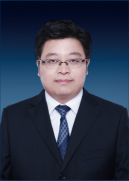 Xinyu Zhang (张新钰)合作论文数School of Vehicle and Mobility, Tsinghua University;Information Technology Center, Tsinghua University;State Key Laboratory of Automotive Safety and Energy, Tsinghua University29
 Lei Yang合作论文数27
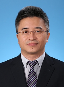 Huaping Liu (刘华平)合作论文数State Key Laboratory of Intelligent Technology and Systems, Department of Computer Science and Technology, Tsinghua University;Beijing National Research Center for Information Science and Technology, Tsinghua University19
 Jun Li (李俊)合作论文数School of Computer Science and Engineering, Nanjing University of Science and Technology16
 Ziying Song (宋子盈)合作论文数School of Computer Science and Technology, Beijing Jiaotong University12李志威合作论文数长沙理工大学7
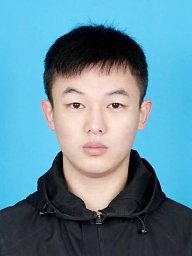 Chuang Zhang合作论文数Luzhou Military Representatives of the Working Croup, Luzhou Military Representatives of the Working Croup5
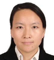 Caiyan Jia (贾彩燕)合作论文数School of Computer Science & Technology, Beijing Jiaotong University5
 Ruifeng Li (李瑞峰)合作论文数State Key Laboratory of Robotics and Systems, Harbin Institute of Technology5
 Zhiyu Wang合作论文数Department of Environmental Science and Engineering, Tsinghua University5
 Tao Xie (谢涛)合作论文数School of Mechatronics Engineering, Harbin Institute of Technology4
 Kangyao Huang (黄康尭)合作论文数Department of Computer Science and Technology, Tsinghua University4
 Jingwen Sun合作论文数4Bin Dai (戴斌)合作论文数National University of Defense Technology4
 Chee Kwang Quah合作论文数4
 Zhiwei Li (李志伟)合作论文数Microsoft Research Asia4
 Seah Hock Soon (谢福顺)合作论文数College of Computing and Data Science, Nanyang Technological University;CACANi Pte Ltd4
 Budianto Tandianus合作论文数Singapore Institute of Technology4Feiyang Jia合作论文数3
 Lin Liu合作论文数3Haoming Zhang合作论文数3
 Guoxin Zhang合作论文数3
 Kaicheng Yu (于开丞)合作论文数Autonomous Intelligence Lab, Westlake University;KMind.com3
 Xiaofei Zhang合作论文数3
 Ke Wang (王珂)合作论文数哈尔滨工业大学3
 Kunfeng Wang (王坤峰)合作论文数College of Information Science and Technology, Beijing University of Chemical Technology3
 Wei Fan (樊伟)合作论文数School of Mechanical Engineering, Beijing Institute of Technology3
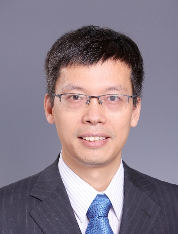 Xiangyang Ji (季向阳)合作论文数Department of Automation, Tsinghua University;Beijing National Research Center for Information Science and Technology, Tsinghua University3
 Liang Xiao合作论文数Unmanned Systems Research Center, National Innovation Institute of Defense Technology3
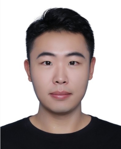 Jinyuan Liu (刘晋源)合作论文数School of Software, Dalian University of Technology;International School of Information Science and Engineering, Dalian University of Technology - Ritsumeikan University3Yichen Wang合作论文数2
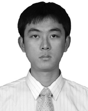 Yi Huang合作论文数2
 Linqi Yang合作论文数2Rong Fu合作论文数2
 Shaoqing Xu合作论文数2Hong Wang合作论文数2
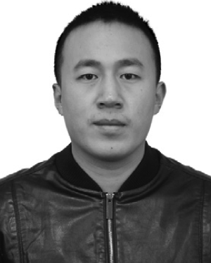 Hao Fu合作论文数2
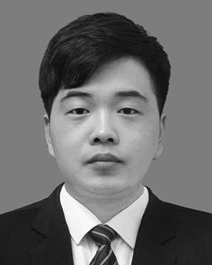 Yan Gong合作论文数2
 Minghan Zhu合作论文数2
 Kun Yuan (袁坤)合作论文数Center for Machine Learning Research, Peking University2Chenfei Wang合作论文数2Zhu Lei合作论文数Mogo Auto Intelligence and Telemetics Information Technology Co. Ltd.2
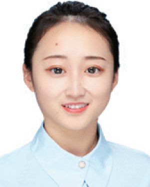 Mo Zhou合作论文数Tsinghua Univ, Dept Comp Sci & Technol, Beijing 100084, Peoples R China2
 Xiaoyu Li (李小雨)合作论文数College of Science, Nanjing University of Posts and Telecommunications2
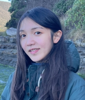 Yadan Luo合作论文数School of Electrical Engineering and Computer Science, Faculty of Engineering, Architecture and Information Technology, The University of Queensland;Centre for Enterprise AI, Faculty of Engineering, Architecture and Information Technology, The University of Queensland2
 Bin Xu (许斌)合作论文数School of Automation, Northwestern Polytechnical University2
 Lijun Zhao (赵立军)合作论文数School of Automotive Engineering, Harbin Institute of Technology, Weihai2




