The progress in robot autonomy has opened up opportunities for various applications, notably in autonomous navigation and mapping missions with mobile platforms. This motivates us to exploit such technologies to develop a humanrobot collaboration system. Such a system improves task efficiencies and ensures the safety of human counterparts in search and rescue operations and site surveillance missions. In this paper, we present a robotic system of systems as a strategy for human-robot teaming missions in unexplored and unstructured environments. The system comprises a single human operator and multiple custom-built aerial robots equipped with various sensors for localization, mapping, and object detection. It enables the human operator to set operation modes and assign tasks to the robots individually or as a group via a human-robot interaction device, allowing the human operator to focus on critical mission objectives and decision-making. In each operation mode, the robot(s) navigates the environment autonomously while avoiding obstacles for a given set of waypoints. Additionally, a formation planning policy has been developed for group navigation and relative poses between the human operator and robots are estimated using UWB ranging and odometry measurements to improve the human operator's IMU positioning accuracy. The robots are fitted with RGB-D cameras for object detection and real-time image streaming to the operator. Results from the deployment of the system in indoor settings are presented to demonstrate the feasibility of a human-robot collaboration system in an unknown environment.
We present an approach for radar-inertial odometry which uses a continuous-time framework to fuse measurements from multiple automotive radars and an inertial measurement unit (IMU). Adverse weather conditions do not have a significant impact on the operating performance of radar sensors unlike that of camera and LiDAR sensors. Radar's robustness in such conditions and the increasing prevalence of radars on passenger vehicles motivate us to look at the use of radar for ego-motion estimation. A continuous-time trajectory representation is applied not only as a framework to enable heterogeneous and asynchronous multi-sensor fusion, but also, to facilitate efficient optimization by being able to compute poses and their derivatives in closed-form and at any given time along the trajectory. We compare our continuous-time estimates to those from a discrete-time radar-inertial odometry approach and show that our continuous-time method outperforms the discrete-time method. To the best of our knowledge, this is the first time a continuous-time framework has been applied to radar-inertial odometry.
Nighttime stereo depth estimation is still challenging, as assumptions associated with daytime lighting conditions do not hold any longer. Nighttime is not only about low-light and dense noise, but also about glow/glare, flares, non-uniform distribution of light, etc. One of the possible solutions is to train a network on night stereo images in a fully supervised manner. However, to obtain proper disparity ground-truths that are dense, independent from glare/glow, and have sufficiently far depth ranges is extremely intractable. To address the problem, we introduce a network joining day/night translation and stereo. In training the network, our method does not require ground-truth disparities of the night images, or paired day/night images. We utilize a translation network that can render realistic night stereo images from day stereo images. We then train a stereo network on the rendered night stereo images using the available disparity supervision from the corresponding day stereo images, and simultaneously also train the day/night translation network. We handle the fake depth problem, which occurs due to the unsupervised/unpaired translation, for light effects (e.g., glow/glare) and un-informative regions (e.g., low-light and saturated regions), by adding structure-preservation and weighted-smoothness constraints. Our experiments show that our method outperforms the baseline methods on night images.
Many self-driving vehicles use a multi-sensor system comprising multiple 3D LiDAR and radar sensors for robust all-round perception. Precise calibration of this multi-sensor system is a critical prerequisite for accurate perception data which facilitates safe operation of self-driving vehicles in highly dynamic urban environments. This paper proposes the first-known automatic targetless method for extrinsic calibration of multiple 3D LiDAR and radar sensors, and which only requires the vehicle to be driven over a short distance. The proposed method first estimates the 6-DoF pose of each LiDAR sensor with respect to the vehicle reference frame by minimizing point-to-plane distances between scans from different LiDAR sensors. In turn, a 3D map of the environment is built using data from all calibrated LiDAR sensors on the vehicle. We find the 6-DoF pose of each radar sensor with respect to the vehicle reference frame by minimizing (1) point-to-plane distances between radar scans and the 3D map, and (2) radial velocity errors. Our proposed calibration method does not require overlapping fields of view between LiDAR and radar sensors. Real-world experiments demonstrate the accuracy and repeatability of the proposed calibration method.
We present a real-time dense geometric mapping algorithm for large-scale environments. Unlike existing methods which use pinhole cameras, our implementation is based on fisheye cameras whose large field of view benefits various computer vision applications for self-driving vehicles such as visual-inertial odometry, visual localization, and object detection. Our algorithm runs on in-vehicle PCs at approximately 15 Hz, enabling vision-only 3D scene perception for self-driving vehicles. For each synchronized set of images captured by multiple cameras, we first compute a depth map for a reference camera using plane-sweeping stereo. To maintain both accuracy and efficiency, while accounting for the fact that fisheye images have a lower angular resolution, we recover the depths using multiple image resolutions. We adopt the fast object detection framework, YOLOv3, to remove potentially dynamic objects. At the end of the pipeline, we fuse the fisheye depth images into the truncated signed distance function (TSDF) volume to obtain a 3D map. We evaluate our method on large-scale urban datasets, and results show that our method works well in complex dynamic environments.
Project AutoVision aims to develop localization and 3D scene perception capabilities for a self-driving vehicle. Such capabilities will enable autonomous navigation in urban and rural environments, in day and night, and with cameras as the only exteroceptive sensors. The sensor suite employs many cameras for both 360-degree coverage and accurate multi-view stereo; the use of low-cost cameras keeps the cost of this sensor suite to a minimum. In addition, the project seeks to extend the operating envelope to include GNSS-less conditions which are typical for environments with tall buildings, foliage, and tunnels. Emphasis is placed on leveraging multi-view geometry and deep learning to enable the vehicle to localize and perceive in 3D space. This paper presents an overview of the project, and describes the sensor suite and current progress in the areas of calibration, localization, and perception.
We present a visual odometry (VO) algorithm for a multi-camera system and robust operation in challenging environments. Our algorithm consists of a pose tracker and a local mapper. The tracker estimates the current pose by minimizing photometric errors between the most recent keyframe and the current frame. The mapper initializes the depths of all sampled feature points using plane-sweeping stereo. To reduce pose drift, a sliding window optimizer is used to refine poses and structure jointly. Our formulation is flexible enough to support an arbitrary number of stereo cameras. We evaluate our algorithm thoroughly on five datasets. The datasets were captured in different conditions: daytime, night-time with near-infrared (NIR) illumination and nighttime without NIR illumination. Experimental results show that a multi-camera setup makes the VO more robust to challenging environments, especially night-time conditions, in which a single stereo configuration fails easily due to the lack of features.
Cameras are a crucial exteroceptive sensor for self-driving cars as they are low-cost and small, provide appearance information about the environment, and work in various weather conditions. They can be used for multiple purposes such as visual navigation and obstacle detection. We can use a surround multi-camera system to cover the full 360-degree field-of-view around the car. In this way, we avoid blind spots which can otherwise lead to accidents. To minimize the number of cameras needed for surround perception, we utilize fisheye cameras. Consequently, standard vision pipelines for 3D mapping, visual localization, obstacle detection, etc. need to be adapted to take full advantage of the availability of multiple cameras rather than treat each camera individually. In addition, processing of fisheye images has to be supported. In this paper, we describe the camera calibration and subsequent processing pipeline for multi-fisheye-camera systems developed as part of the V-Charge project. This project seeks to enable automated valet parking for self-driving cars. Our pipeline is able to precisely calibrate multi-camera systems, build sparse 3D maps for visual navigation, visually localize the car with respect to these maps, generate accurate dense maps, as well as detect obstacles based on real-time depth map extraction.
We present a direct visual odometry algorithm for a fisheye-stereo camera. Our algorithm performs simultaneous camera motion estimation and semi-dense reconstruction. The pipeline consists of two threads: a tracking thread and a mapping thread. In the tracking thread, we estimate the camera pose via semi-dense direct image alignment. To have a wider field of view (FoV) which is important for robotic perception, we use fisheye images directly without converting them to conventional pinhole images which come with a limited FoV. To address the epipolar curve problem, plane-sweeping stereo is used for stereo matching and depth initialization. Multiple depth hypotheses are tracked for selected pixels to better capture the uncertainty characteristics of stereo matching. Temporal motion stereo is then used to refine the depth and remove false positive depth hypotheses. Our implementation runs at an average of 20 Hz on a low-end PC. We run experiments in outdoor environments to validate our algorithm, and discuss the experimental results. We experimentally show that we are able to estimate 6D poses with low drift, and at the same time, do semi-dense 3D reconstruction with high accuracy. To the best of our knowledge, there is no other existing semi-dense direct visual odometry algorithm for a fisheye-stereo camera.
Automated valet parking services provide great potential to increase the attractiveness of electric vehicles by mitigating their two main current deficiencies: reduced driving ranges and prolonged refueling times. The European research project V-Charge aims at providing this service on designated parking lots using close-to-market sensors only. For this purpose the project developed a prototype capable of performing fully automated navigation in mixed traffic on designated parking lots and GPS-denied parking garages with cameras and ultrasonic sensors only. This paper summarizes the work of the project, comprising advances in network communication and parking space scheduling, multi-camera calibration, semantic mapping concepts, visual localization and motion planning. The project pushed visual localization, environment perception and automated parking to centimetre precision. The developed infrastructure-based camera calibration and semi-supervised semantic mapping concepts greatly reduce maintenance efforts. Results are presented from extensive month-long field tests.
We present a semi-direct visual odometry algorithm for a fisheye-stereo camera. In a tracking thread, we simultaneously track oriented patches and estimate the camera pose. In a mapping thread, we estimate the coordinates and surface normal for each new patch to be tracked. Estimation of the surface normals allows us to track patches over a wide variety of viewpoints. In our algorithm, we do not make use of descriptors and robust descriptor matching to find patch correspondences. Instead, we use photoconsistency-based techniques to find patch correspondences. For tracking, we use sparse model-based image alignment to find the relative motion estimate, and feature alignment to find 2D-3D patch correspondences. For mapping, we use plane-sweeping stereo to find matching patches between stereo images. We also implement a state estimator based on the Extended Kalman Filter (EKF) to fuse inertial measurements and relative pose estimates from our visual odometry implementation. We run experiments in two different outdoor environments to validate our algorithm, and discuss the experimental results. Our implementation runs at an average of 42 Hz on a commodity Intel CPU. To the best of our knowledge, there is no other existing semi-direct visual odometry algorithm for a fisheye-stereo camera.
In this paper, we propose a novel and computationally efficient algorithm for simultaneous exploration and coverage with a vision-guided micro aerial vehicle (MAV) in unknown environments. This algorithm continually plans a path that allows the MAV to fulfil two objectives at the same time while avoiding obstacles: observe as much unexplored space as possible, and observe as much of the surface of the environment as possible given viewing angle and distance constraints. The former and latter objectives are known as the exploration and coverage problems respectively. Our algorithm is particularly useful for automated 3D reconstruction at the street level and in indoor environments where obstacles are omnipresent. By solving the exploration problem, we maximize the size of the reconstructed model. By solving the coverage problem, we maximize the completeness of the model. Our algorithm leverages the state lattice concept such that the planned path adheres to specified motion constraints. Furthermore, our algorithm is computationally efficient and able to run on-board the MAV in real-time. We assume that the MAV is equipped with a forward-looking depth-sensing camera in the form of either a stereo camera or RGB-D camera. We use simulation experiments to validate our algorithm. In addition, we show that our algorithm achieves a significantly higher level of coverage as compared to an exploration-only approach while still allowing the MAV to fully explore the environment.
Most existing calibration methods for multi‐camera rigs are computationally expensive, use installations of known fiducial markers, and require expert supervision. We propose an alternative approach called infrastructure‐based calibration that is efficient, requires no modification of the infrastructure (or calibration area), and is completely unsupervised. In infrastructure‐based calibration, we use a map of a chosen calibration area and leverage image‐based localization to calibrate an arbitrary multi‐camera rig in near real‐time. Due to the use of a map, before we can apply infrastructure‐based calibration, we have to run a survey phase once to generate a map of the calibration area. In this survey phase, we use a survey vehicle equipped with a multi‐camera rig and a calibrated odometry system, and self‐calibration based on simultaneous localization and mapping to build the map that is based on natural features. The use of the calibrated odometry system ensures that the metric scale of the map is accurate. Our infrastructure‐based calibration method does not assume an overlapping field of view between any two cameras, and it does not require an initial guess of any extrinsic parameter. Through extensive field tests on various ground vehicles in a variety of environments, we demonstrate the accuracy and repeatability of the infrastructure‐based calibration method for calibration of a multi‐camera rig. The code for our infrastructure‐based calibration method is publicly available as part of the CamOdoCal library at https://github.com/hengli/camodocal.
The use of a multi-camera system enables a robot to obtain a surround view, and thus, maximize its perceptual awareness of its environment. If vision-based simultaneous localization and mapping (vSLAM) is expected to provide reliable pose estimates for a micro aerial vehicle (MAV) with a multi-camera system, an accurate calibration of the multi-camera system is a necessary prerequisite. We propose a novel vSLAM-based self-calibration method for a multi-camera system that includes at least one calibrated stereo camera, and an arbitrary number of monocular cameras. We assume overlapping fields of view to only exist within stereo cameras. Our self-calibration estimates the inter-camera transforms with metric scale; metric scale is inferred from calibrated stereo. On our MAV, we set up each camera pair in a stereo configuration which facilitates the estimation of the MAV’s pose with metric scale. Once the MAV is calibrated, the MAV is able to estimate its global pose via a multi-camera vSLAM implementation based on the generalized camera model. We propose a novel minimal and linear 3-point algorithm that uses relative rotation angle measurements from a 3-axis gyroscope to recover the relative motion of the MAV with metric scale and from 2D-2D feature correspondences. This relative motion estimation does not involve scene point triangulation. Our constant-time vSLAM implementation with loop closures runs on-board the MAV in real-time. To the best of our knowledge, no published work has demonstrated real-time on-board vSLAM with loop closures. We show experimental results from simulation experiments, and real-world experiments in both indoor and outdoor environments.
Autonomous navigation of micro aerial vehicles (MAVs) in a-priori unknown environments is one of the most challenging problems in robotics. First, a MAV has to incrementally build a 3D geometric map from raw sensor data. Then, based on the mapping information, the path planner has to search for a cost-optimal trajectory to the goal in real-time. It is common practice to discretize the search space into a state lattice; by doing so, we reduce the path planning problem with differential constraints to a graph search problem that is easier to solve. However, a regular 3D state lattice requires a large amount of memory while graph search in a regular 3D state lattice incorporating numerous states is computationally intensive. In this paper, we introduce a novel path planning algorithm which extends the concept of a regular state lattice to an octree-based state lattice, and searches for an optimal trajectory in the octree-partitioned search space. Our octree-based state lattice representation discretizes large swathes of free space into few symbolic octants, and thus, encodes a significantly fewer number of states. As a result, memory consumption is kept to a minimum, and at the same time, graph search is made more efficient. Simulation experiments demonstrate the efficiency of path planning with an octree-based state lattice, and further field trials prove the viability of this path planning algorithm.
Cameras are a natural fit for micro aerial vehicles (MAVs) due to their low weight, low power consumption, and two‐dimensional field of view. However, computationally‐intensive algorithms are required to infer the 3D structure of the environment from 2D image data. This requirement is made more difficult with the MAV's limited payload which only allows for one CPU board. Hence, we have to design efficient algorithms for state estimation, mapping, planning, and exploration. We implement a set of algorithms on two different vision‐based MAV systems such that these algorithms enable the MAVs to map and explore unknown environments. By using both self‐built and off‐the‐shelf systems, we show that our algorithms can be used on different platforms. All algorithms necessary for autonomous mapping and exploration run on‐board the MAV. Using a front‐looking stereo camera as the main sensor, we maintain a tiled octree‐based 3D occupancy map. The MAV uses this map for local navigation and frontier‐based exploration. In addition, we use a wall‐following algorithm as an alternative exploration algorithm in open areas where frontier‐based exploration under‐performs. During the exploration, data is transmitted to the ground station which runs large‐scale visual SLAM. We estimate the MAV's state with inertial data from an IMU together with metric velocity measurements from a custom‐built optical flow sensor and pose estimates from visual odometry. We verify our approaches with experimental results, which to the best of our knowledge, demonstrate our MAVs to be the first vision‐based MAVs to autonomously explore both indoor and outdoor environments.
Autonomous microhelicopters will soon play a major role in tasks like search and rescue, environment monitoring, security surveillance, and inspection. If they are further realized in small scale, they can also be used in narrow outdoor and indoor environments and represent only a limited risk for people. However, for such operations, navigating based only on global positioning system (GPS) information is not sufficient. Fully autonomous operation in cities or other dense environments requires microhelicopters to fly at low altitudes, where GPS signals are often shadowed, or indoors and to actively explore unknown environments while avoiding collisions and creating maps. This involves a number of challenges on all levels of helicopter design, perception, actuation, control, and navigation, which still have to be solved. The Swarm of Micro Flying Robots (SFLY) project was a European Union-funded project with the goal of creating a swarm of vision-controlled microaerial vehicles (MAVs) capable of autonomous navigation, three-dimensional (3-D) mapping, and optimal surveillance coverage in GPS-denied environments. The SFLY MAVs do not rely on remote control, radio beacons, or motion-capture systems but can fly all by themselves using only a single onboard camera and an inertial measurement unit (IMU). This article describes the technical challenges that have been faced and the results achieved from hardware design and embedded programming to vision-based navigation and mapping, with an overview of how all the modules work and how they have been integrated into the final system. Code, data sets, and videos are publicly available to the robotics community. Experimental results demonstrating three MAVs navigating autonomously in an unknown GPS-denied environment and performing 3-D mapping and optimal surveillance coverage are presented.
 Marc Pollefeys合作论文数Computer Vision and Geometry Lab, Institute of Visual Computing, Department of Computer Science, ETH Zurich;Mixed Reality and AI Lab, Microsoft24
 Gim Hee Lee合作论文数Department of Computer Science, National University of Singapore;Computer Vision and Robotic Perception (CVRP) Laboratory, National University of Singapore;Graduate School for Integrative Sciences and Engineering, National University of Singapore;Institute of Data Science, National University of Singapore15
 Friedrich Fraundorfer合作论文数Institute of Computer Graphics and Vision, Graz University of Technology10
 Roland Siegwart合作论文数Autonomous Systems Lab, ETH Zurich;Department of Mechanical and Process Engineering, ETH Zurich7
 Petri Tanskanen合作论文数Astrivis7
 Lorenz Meier合作论文数Auterion;PX47
 Torsten Sattler合作论文数Czech Institute of Informatics, Robotics and Cybernetics, Czech Technical University6
 Christian Häne合作论文数Meta4
 Andreas Geiger合作论文数Department of Computer Science, University of Tübingen4
 Bo Li (李博)合作论文数TrunkTech4
 Paul Timothy Furgale合作论文数Facebook4
 Wojciech Derendarz合作论文数3Benjamin Choi合作论文数3Martin Stellmacher合作论文数3Ye Chuan Yeo合作论文数DSO National Lab3Stefan Wonneberger合作论文数3
 Davide Scaramuzza合作论文数Institute of Neuroinformatics, Department of Informatics, University of Zurich3Mathias Burki合作论文数3
 Peidong Liu (刘沛东)合作论文数Computer Vision and Geometric Learning Lab, School of Engineering, Westlake University3
 Elias B. Kosmatopoulos合作论文数Department of Electrical & Computer Engineering, Democritus University of Thrace3
 Agostino Martinelli合作论文数INRIA Rhone Alpes3
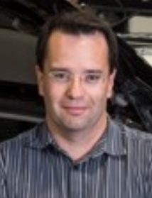 Paul Newman合作论文数Oxford Robotics Institute, Department of Engineering Science, University of Oxford;Oxbotica3Chiara Troiani合作论文数3
 Laurent Kneip合作论文数Mobile Perception Lab, School of Information Science and Techonology, ShanghaiTech University3Stephan Rottmann合作论文数3
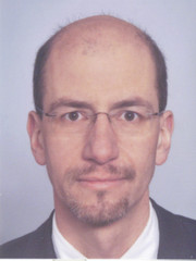 Lars Wolf合作论文数Institute of Operating Systems and Computer Networks, Carl-Friedrich-Gauß-Fakultät, Technische Universität Braunschweig;Department of Computer Science, Technische Universität Braunschweig3
 Alessandro Renzaglia合作论文数Rome U. & INFN, Rome3
 Dominik Honegger合作论文数Leica Geosystems Part of Hexagon3
 Markus Achtelik合作论文数Auterion3
 Lefteris Doitsidis合作论文数Technological Educational Institute of Crete, Technical University of Crete3
 Margarita Chli合作论文数Department of Electrical and Computer Engineering, Faculty of Engineering, University of Cyprus3
 Simon Lynen合作论文数Google Zurich3
 Ingmar Posner合作论文数Department of Engineering Science, University of Oxford;Amazon3
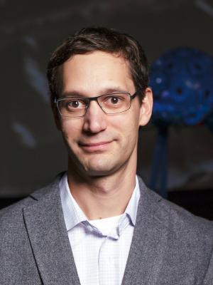 Stephan Michael Weiss合作论文数Department of Smart System Technologies, University of Klagenfurt;Control of Networked Systems;Jet Propulsion Laboratory3Daniel Gurdan合作论文数3Michael Achtelik合作论文数3Marco Allodi合作论文数2
 Ulrich Schwesinger合作论文数2Fabian Pucks合作论文数2Rene Waldmann合作论文数2Benson Kuan合作论文数DSO National Lab2Jan Stumpf合作论文数2
 Julian Timpner合作论文数2
 Kevin Koser合作论文数Department of Computer Science, ETH Zurich2
 Lina María Paz合作论文数Oxford Robotics Institute, Department of Engineering Science, University of Oxford2
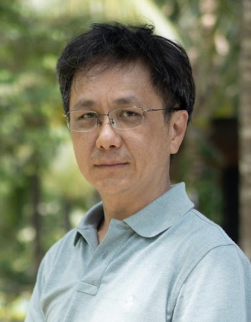 Robby T. Tan合作论文数Department of Electrical and Computer Engineering, College of Design and Engineering, National University of Singapore;Asus Intelligent Cloud Services, Asus2
 Zhaopeng Cui (崔兆鹏)合作论文数College of Computer Science and Technology, Zhejiang University2
 Hugo Grimmett合作论文数university of oxford2
 Savvas A. Chatzichristofis合作论文数Neapolis University Pafos2