Non-exhaust emissions (NEEs) from brake and tyre wear cause detrimental health effects, yet their relationship with mobility has not been examined rigorously. We constructed an agent-based traffic simulator to illustrate the coupled problems of emissions, behaviour, and the estimated exposure to PM10 for groups of drivers and subway commuters in Seoul CBD. Having calibrated the parameters, the results regarding the air quality revealed that roughly 25–30% of the roadside PM10 was significantly higher than the background PM10. Additionally, compared to intra-urban cars, pedestrians who commuted for longer periods of time and were exposed to more ambient particles suffered significant health losses; however, drivers only became aware of the health risk when PM10 levels were consistently high for a few days. Compared to the business-as-usual scenario of vehicle entry, a 90% vehicle restriction was able to reduce PM10 by 18–24% and cut the percentage of resident drivers who were at risk. However, it was not effective for subway commuters. Using an agent-based traffic simulator in a health context can provide insights into how exposure and health effects can vary depending on the time of exposure and the form of transportation.
Vital to the increased rigour (and hence reliability) of Agent-based modelling are various kinds of model comparison. The reproduction of simulations is an essential check that models are as they are described. Here we argue that we need to go further and carry out large-scale, systematic and persistent model comparison—where different models of the same phenomena are compared against standardised data sets and each other. Lessons for this programme can be gained from the Model Intercomparison Projects (MIP) in the Climate Community and elsewhere. The benefits, lessons and particular difficulties of implementing a similar project in social simulation are discussed, before sketching what such a project might look like. It is time we got our act together!
Non-exhaust emission (NEE) from brake and tyre wear cause deleterious effects on human health, but the relationship with mobility has not been thoroughly examined. We construct an in silico agent-based traffic simulator for Central Seoul to illustrate the coupled problems of emissions, behaviour, and the estimated exposure to PM10 (particles less than 10 microns in size) for groups of drivers and subway commuters. The results show that significant extra particulates relative to the background exist along roadways where NEEs contributed some 40% of the roadside PM10. In terms of health risk, 88% of resident drivers had an acute health effect in late March but that kind of emergence rarely happened. By contrast, subway commuters’ health risk peaked at a maximum of 30% with frequent oscillations whenever the air pollution episodes occurred. A 90% vehicle restriction scenario reduced PM10 by 18-24%, and reduced the resident driver's risk by a factor of 2, but not effective for subway commuters as the group generally walked through background areas rather than along major roadways. Using an agent-based traffic simulator in a health context can give insights into how exposure and health outcomes can depend on the time of exposure and the mode of transport.
Coastal communities, land covers and intertidal habitats are vulnerable receptors of erosion, flooding or both in combination. This vulnerability is likely to increase with sea level rise and greater storminess over future decadal-scale time periods. The accurate, rapid and wide-scale determination of shoreline position, and its migration, is therefore imperative for future coastal risk adaptation and management. Developments in the spectral and temporal resolution and availability of multispectral satellite imagery opens new opportunities to rapidly and repeatedly monitor change in shoreline position to inform coastal risk management decisions. This presentation discusses the development and application of an automated tool, VEdge_Detector, to extract the coastal vegetation line from high spatial resolution (Planet's 3 – 5 m) remote sensing imagery, training a very deep convolutional neural network (Holistically-Nested Edge Detection) to predict sequential vegetation line locations on annual/decadal timescales. The VEdge_Detector outputs were compared with vegetation lines derived from ground-referenced positional measurements and manually digitised aerial photographs, revealing a mean distance error of <6 m (two image pixels) and > 84% producer accuracy at six out of the seven sites. Extracting vegetation lines from Planet imagery of the rapidly retreating cliffed coastline at Covehithe, Suffolk, UK identified a mean landward retreat rate >3 m a-1 (2010 - 2020). Plausible vegetation lines were successfully retrieved from images of other global locations, which were not used to train the neural network; although significant areas of exposed rocky coastline proved to be less well recovered by VEdge_Detector. The method therefore promises the possibility of generalising to estimate retreat of sandy coastlines in otherwise data-poor areas, which lack ground-referenced measurements. Vegetation line outputs derived from VEdge_Detector are produced rapidly and efficiently compared to more traditional non-automated methods. These outputs also have the potential to inform upon a range of future coastal risk management decisions, including hazard and risk mapping considering future shoreline change.
It is argued that certain kinds of problem in modern society impose a requirement on ABM to represent all human agents on the planet. Eleven reason are given, including the need for realism in social models, the importance of boundary conditions and scale, the need for global social justice, the existence of global scale dynamics created by and impacting directly on individuals, and the need to interface with other global models in order to address pressing problems such as climate change and ecosystem destruction. An indication of the difficulties involved in creating such models is given, drawing on experience of creating models with RepastHPC. The paper concludes by suggesting that rather than creating ever more model platforms and frameworks, what we need is a series of shared and collectively developed models, in a similar way to existing traffic models or, models of the physical parts of the earth system.
Aim Mechanistic general ecosystem models are used to explore fundamental ecological dynamics and to assess possible consequences of anthropogenic and natural disturbances on ecosystems. The Madingley model is a mechanistic general ecosystem model (GEM) that simulates a coherent global ecosystem, consisting of photo-autotrophic and heterotrophic life, based on fundamental ecological processes. The C++ implementation of the Madingley model delivers fast computational performance, but it (a) limits the userbase to researchers that are familiar with the intricacies of C++ programming, (b) has limited possibility to change model settings and provide model outputs required to address specific research questions, and (c) has limited reproducibility of simulation experiments. The aim of this paper is to present an R package of the Madingley model to aid with increasing the accessibility and flexibility of the model. Innovation The MadingleyR R package streamlines the installation procedure and supports all major operating systems. MadingleyR enables users to combine multiple consecutive simulations, making case study specific modifications to MadingleyR objects along the way. Default input files are available from the package and study-specific inputs can be easily loaded from the R environment. MadingleyR also provides functions to plot and summarize MadingleyR outputs. We provide a comprehensive description of the MadingleyR functions and workflow. We also demonstrate the applicability of the MadingleyR package using three case studies: (a) simulating the cascading effects of the loss of mega-herbivores on food-web structure, (b) simulating the impacts of increased land-use intensity on the total biomass of different feeding guilds by restricting the total vegetation biomass available for feeding and (c) simulating the impacts of an intensive land-use scenario on a continental scale. Main conclusions The MadingleyR package provides direct accessibility to simulations with the mechanistic ecosystem model Madingley and is flexible in its application without a loss in performance.
This study develops a definition of what mangrove-fisheries can encompass, incorporating a broad range of their possible characteristics. A detailed case study was conducted to develop a typology of mangrove-fishing in the Perancak Estuary, Bali, Indonesia, using interview surveys to investigate the fishing activities associated with mangroves. This case study demonstrated the complexity that a mangrove-fishery can entail, where fishing is connected to the mangrove forest by fishers of multiple sectors, functions, locations and temporal scales. Through a comparison with other mangrove-fishing communities in Bali, it also highlighted that mangrove-fisheries are variable even when in close proximity. With particular reference to this case study, a framework was developed as a flexible tool for identifying the multiple dimensions of a mangrove-fishery in a local context. Following this framework should encourage researchers and managers to look outside of the groups of fishers traditionally expected to benefit from mangrove fishing. This will enable the development of a broader definition of mangrove-fisheries in a site specific way. Identifying the full scope of fishers that contribute to or benefit from a mangrove-fishery is the first step towards building management measures that reflect the interests of groups of fishers that may otherwise remain under-represented. This is in line with international efforts for sustainability, especially in promoting small-scale fishers’ access to sustainable resources under the UN Sustainable Development Goals.
Whilst previous studies have applied economic value to the ecosystem services mangroves provide to fisheries, most quantitative studies in the peer reviewed literature have limited their measurements to the value provided through a single fishing sector, gear or particular target species group. It can be argued that present research into mangrove-fisheries has not yet represented the full complexity that mangrove-fisheries can encompass in terms of the wide range of people and activities that benefit from the mangrove ecosystem. The reported values of mangroves to fishing livelihoods are therefore likely to fall short of a full valuation. The study provides an all-encompassing value of mangrove benefits to fishing, purposefully investigating the value gained from mangroves through all fishing sectors, fishing activities and target species existing in the Peam Krasaop Fishing Community (PKFC), Koh Kong Province, southwest Cambodia. The ecosystem service value of mangroves for fishing to households in the PKFC was calculated using daily landings volumes collected through semi-structured interviews with fishers, scaled to approximated annual catches. Catch figures were converted to economic value, based on the local market prices given by respondents. Results suggested that the PKFC derives approximately 90% of fishing catch, and 85% of gross income, from mangrove-associated species. Fishing activities are diverse within households; they conduct between 1 and 8 different seasonal fishing activities, spread across mangrove gathering, fishing by boat and mariculture. This study provides a higher estimated proportion of mangrove-associated catches than many studies of fishing communities elsewhere. It may be the case that the PKFC does not have higher levels of mangrove dependency than other mangrove-fisheries. Rather, this study may provide a better quantification of mangrove value than has previously been achieved. Further studies along the same lines, taking a similarly holistic approach to mangrove-fishery valuation, are necessary to test this proposition.
This study aims to use a whole systems approach (1) to understand the processes of adaptation to flooding of the urban poor; (2) to identify new knowledge of how low‐income settlements might better adapt to climatic risks; and (3) to begin to develop appropriate guidance on this. Low‐income urban settlements in the least developed countries (LDCs) present an extreme case where catastrophic natural hazards and chronic social hazards overlap. These low‐income urban populations face the greatest adaptation challenges as they often occupy informal settlements that are particularly exposed to hazards, and have multiple vulnerabilities arising from their lack of basic services. There is a dynamic complexity of issues arising from the many levels of actor involved and multiple social and physical factors. Analysing such a complex phenomenon calls for a specific conceptual framing, and a systems theory approach is suggested to provide a holistic perspective. The case study for this research is located in Dhaka East, where there is both high vulnerability to flooding, and a significant low‐income population. The research has adopted a mixed methods approach involving different data collection methods governed by the different scales and actors being investigated. The research develops new systems understandings of perceptions and experiences of the local population about adaptation processes in low‐income urban settlements, and how these processes may be positively influenced by integrating bottom‐up and top‐down approaches.
The production of fish biomass and the quantity that can be extracted for human use result from the interaction of both "bottom-up" and "top-down" forcing mechanisms where the relative importance of each varies through time-variant ecological, geographical, and species-specific controls. These complexities are particularly poorly understood in vegetated coastal ecosystems, even though such systems play a critical role in supporting marine biodiversity and fisheries production across a wide range of actors. When formulating policy for management purposes or to meet sustainability targets, the dynamics of oceanographic and ecological systems must be seen alongside the dynamics of human societies. Agent-based models, and new-generation earth system models, are ideally placed to incorporate human dynamics and allow coupled socioecological models of fisheries production to be developed and interrogated.
Coupling activity-based models with dynamic traffic assignment appears to form a promising approach to investigating travel demand. However, such an integrated framework is generally time-consuming, especially for large-scale scenarios. This paper attempts to improve the performance of these kinds of integrated frameworks through some simple adjustments using MATSim as an example. We focus on two specific areas of the model—replanning and time stepping. In the first case we adjust the scoring system for agents to use in assessing their travel plans to include only agents with low plan scores, rather than selecting agents at random, as is the case in the current model. Secondly, we vary the model time step to account for network loading in the execution module of MATSim. The city of Baoding, China is used as a case study. The performance of the proposed methods was assessed through comparison between the improved and original MATSim, calibrated using Cadyts. The results suggest that the first solution can significantly decrease the computing time at the cost of slight increase of model error, but the second solution makes the improved MATSim outperform the original one, both in terms of computing time and model accuracy; Integrating all new proposed methods takes still less computing time and obtains relatively accurate outcomes, compared with those only incorporating one new method.
How one builds, checks, validates and interprets a model depends on its 'purpose'. This is true even if the same model code is used for different purposes. This means that a model built for one purpose but then used for another needs to be re-justified for the new purpose and this will probably mean it also has to be re-checked, re-validated and maybe even re-built in a different way. Here we review some of the different purposes fora simulation model of complex social phenomena, focusing on seven in particular: prediction, explanation, description, theoretical exploration, illustration, analogy, and social interaction. The paper looks at some of the implications in terms of the ways in which the intended purpose might fail. This analysis motivates some of the ways in which these 'dangers' might be avoided or mitigated. It also looks at the ways that a confusion of modelling purposes can fatally weaken modelling projects, whilst giving a false sense of their quality. These distinctions clarify some previous debates as to the best modelling strategy (e.g. KISS and KIDS). The paper ends with a plea for modellers to be clear concerning which purpose they are justifying their model against.
Agent-based modelling (ABM) simulates Social-Ecological-Systems (SESs) based on the decision-making and actions of individual actors or actor groups, their interactions with each other, and with ecosystems. Many ABM studies have focused at the scale of villages, rural landscapes, towns or cities. When considering a geographical, spatially-explicit domain, current ABM architecture is generally not easily translatable to a regional or global context, nor does it acknowledge SESs interactions across scales sufficiently; the model extent is usually determined by pragmatic considerations, which may well cut across dynamical boundaries. With a few exceptions, the internal structure of governments is not included when representing them as agents. This is partly due to the lack of theory about how to represent such as actors, and because they are not static over the time-scales typical for social changes to have significant effects. Moreover, the relevant scale of analysis is often not known a priori, being dynamically determined, and may itself vary with time and circumstances. There is a need for ABM to cross the gap between micro-scale actors and larger-scale environmental, infrastructural and political systems in a way that allows realistic spatial and temporal phenomena to emerge; this is vital for models to be useful for policy analysis in an era when global crises can be triggered by small numbers of micro-level actors. We aim with this thought-piece to suggest conceptual avenues for implementing ABM to simulate SESs across scales, and for using big data from social surveys, remote sensing or other sources for this purpose.
This study presents a proof-of-concept agent-based model (ABM) of health vulnerability to long-term exposure to airborne particulate pollution, specifically to particles less than 10 micrometres in size (PM10), in Seoul, Korea. We estimated the differential effects of individual behaviour and social class across heterogeneous space in two districts, Gwanak and Gangnam. Three scenarios of seasonal PM10 change (business as usual: BAU, exponential increase: INC, and exponential decrease: DEC) and three scenarios of resilience were investigated, comparing the vulnerability rate both between and within each district. Our first result shows that the vulnerable groups in both districts, including those aged over 65, aged under 15, and with a low education level, increased sharply after 5,000 ticks (each tick corresponding to 1 day). This implies that disparities in health outcomes can be explained by socioeconomic status (SES), especially when the group is exposed over a long period. Additionally, while the overall risk population was larger in Gangnam in the AC100 scenarios, the recovery level from resilience scenarios decreased the risk population substantially, for example from 7.7% to 0.7%. Our second finding from the local-scale analysis indicates that most Gangnam sub-districts showed more variation both spatially and in different resilience scenarios, whereas Gwanak areas showed a uniform pattern regardless of earlier prevention. The implication for policy is that, while some areas, such as Gwanak, clearly require urgent mitigating action, areas like Gangnam may show a greater response to simpler corrections, but aggregating up to the district scale may miss particular areas that are more at risk. Future work should consider other pollutants as well as more sophisticated population and pollution modelling, coupled with explicit representation of transport and more careful treatment of individual doses and the associated health responses.
How one builds, checks, validates and interprets a model depends on its ‘purpose’. This is true even if the samemodel code is used for di erent purposes. This means that a model built for one purpose but then used for another needs to be re-justified for the new purpose and this will probably mean it also has to be rechecked, re-validatedandmaybeeven re-built in adi erentway. Herewe reviewsomeof thedi erentpurposes for a simulationmodel of complex social phenomena, focusing on seven in particular: prediction, explanation, description, theoretical exploration, illustration, analogy, and social interaction. The paper looks at some of the implications in terms of the ways in which the intended purpose might fail. This analysis motivates some of the ways in which these ‘dangers’ might be avoided or mitigated. It also looks at the ways that a confusion of modelling purposes can fatally weakenmodelling projects, whilst giving a false sense of their quality. These distinctions clarify some previous debates as to the best modelling strategy (e.g. KISS and KIDS). The paper ends with a plea for modellers to be clear concerning which purpose they are justifying their model against.
The use of agent-based modelling approaches in ex-post and ex-ante evaluations of agricultural policies has been progressively increasing over the last few years. There are now a sufficient number of models that it is worth taking stock of the way these models have been developed. Here, we review 20 agricultural agent-based models (ABM) addressing heterogeneous decision-making processes in the context of European agriculture. The goals of this review were to i) develop a framework describing aspects of farmers' decision-making that are relevant from a farm-systems perspective, ii) reveal the current state-of-the-art in representing farmers' decision-making in the European agricultural sector, and iii) provide a critical reflection of underdeveloped research areas and on future opportunities in modelling decision-making. To compare different approaches in modelling farmers' behaviour, we focused on the European agricultural sector, which presents a specific character with its family farms, its single market and the common agricultural policy (CAP). We identified several key properties of farmers' decision-making: the multi-output nature of production; the importance of non-agricultural activities; heterogeneous household and family characteristics; and the need for concurrent short- and long-term decision-making. These properties were then used to define levels and types of decision-making mechanisms to structure a literature review. We find most models are sophisticated in the representation of farm exit and entry decisions, as well as the representation of long-term decisions and the consideration of farming styles or types using farm typologies. Considerably fewer attempts to model farmers' emotions, values, learning, risk and uncertainty or social interactions occur in the different case studies. We conclude that there is considerable scope to improve diversity in representation of decision-making and the integration of social interactions in agricultural agent-based modelling approaches by combining existing modelling approaches and promoting model inter-comparisons. Thus, this review provides a valuable entry point for agent-based modellers, agricultural systems modellers and data driven social scientists for the re-use and sharing of model components, code and data. An intensified dialogue could fertilize more coordinated and purposeful combinations and comparisons of ABM and other modelling approaches as well as better reconciliation of empirical data and theoretical foundations, which ultimately are key to developing improved models of agricultural systems.
A policy and research agenda has emerged in recent years to understand the interconnected risks natural resource systems face and drive. The so-called 'Food-Energy-Water' (FEW) nexus has served as a focal point for the conceptual, theoretical and empirical development of this agenda. This special issue provides an opportunity to reflect on whether natural resource use, as viewed through the FEW-nexus lens, provides a useful basis for guiding integrated environmental management. Within this piece, we describe how the partiality of the FEW-nexus overlooks major pathways of resource use (i) within the food system and (ii) across the wider burden of human activity. As a result, we argue FEW-centric analysis is more likely to disguise rather than reveal key opportunities for integrated environmental management.
Deforestation has been widespread in the Northern Albertine Rift Landscape in rural Western Uganda. In this paper, we present perceptions from local residents and narratives from key informants on causes of forest loss during a 30-year period between 1985 and 2014. While the generic drivers we find are consistent with previous literature, we suggest that the specific context in which forest cover is lost in rural areas is path dependent, and this is vital for adequate management. In the Ugandan case, the history of the sugar industry and its relation to local political drivers and international considerations (e.g. biofuel) are prominent. Global drivers of forest loss therefore mask local-level complexities, but an amalgamation of local-level dynamics does not necessarily sum up to larger-scale manifestations (in a linear manner): striking a balance between understanding local-level and large-scale dynamics could be key in addressing the deforestation conundrum. We surveyed 263 households in 7 parishes around Budongo and Bugoma forests, and conducted 22 key informant interviews. Our findings indicate that the drivers and mechanisms of deforestation are local; they also vary between Budongo and Bugoma. Key amongst these include: agricultural expansion (28%–58.5% of the responses)—with large-scale commercial and small-scale subsistence farming significant around Budongo and Bugoma respectively; “poverty” (26%–76%) often alluding to heavy dependence on forests for livelihoods. Others include: population growth driven by dissimilar migratory patterns; and moving protected forest boundaries. Our data suggest that a combination of both local and key informant perceptions is instrumental in filling data gaps where a dearth of information is prevalent (especially around Bugoma forest), and is important for corroboration of other scientific data (e.g. remote sensing). However, a survey of wider literature indicates that there are significant issues missing from their stated views. While the continued expansion of cash-crop farming and lack of inclusion of local people in forest policy continues to raise concern, the stability of protected forest (i.e. Budongo and Bugoma) is encouraging and suggests a refocusing of the forest debate on practical working schemes for forest preservation and recovery might be the way forward for sustainable forestry and livelihoods.
 Keith S Richards (Keith Richards)合作论文数Energy Interdisciplinary Research Centre, University of Cambridge;Department of Geography, University of Cambridge14
 James Brasington合作论文数Department of Geography, University of Cambridge8
 Lesley J Gray (Lesley Gray)合作论文数Atmospheric Physics Clarendon Laboratory, Department of Physics, University of Oxford7
 B. D. Cox合作论文数4
 Chris McOwen合作论文数World Conservat Monitoring Ctr UNEP WCMC, UN Environm Programme4
 Tom Spencer合作论文数Department of Geography, University of Cambridge4Rachel Seary合作论文数Natl Marine Fisheries Serv, Southwest Fisheries Sci Ctr3
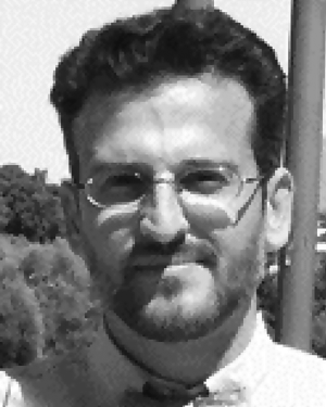 Alexander Antonarakis合作论文数Department of Organismic and Evolutionary Biology, Harvard University3
 Hyesop Shin合作论文数Geo Consulting &Information;Geo Consulting & Information3
 Dr. Ronald Twongyirwe合作论文数3
 Christophe Le Page合作论文数The French Agricultural Research Centre for International Development3Rebecca Hodge合作论文数2
 Gina Ziervogel合作论文数Department of Environmental & Geographical Science, Faculty of Science, University of Cape Town2
 Paul Ormerod合作论文数2
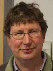 Martin T Dove合作论文数Centre for Condensed Matter and Materials Physics, School of Physics and Astronomy, Queen Mary University of London2
 Gareth Rees合作论文数Department of Geography, University of Cambridge2
 Richard Washington合作论文数School of Geography and the Environment, University of Oxford2
 Edmund Chattoe Brown合作论文数School of Media, Communication and Sociology, University of Leicester;Department of Sociology, University of Leicester2
 Hilton L. Root合作论文数2Flaminio Squazzoni合作论文数Department of Social Sciences, University of Brescia, Via San Faustino 74/B, 25122 Brescia, Italy2
 Volker Grimm合作论文数Department of Ecological Modelling, Helmholtz Centre for Environmental Research - UFZ2
 Bruce Edmonds合作论文数Business School, Manchester Metropolitan University;Centre for Policy Modelling, Manchester Metropolitan University2Tom Downing合作论文数1Ümmüye Nur Tüzün合作论文数1Gao Jian合作论文数1
 Robert A. Huber合作论文数1
 Martin S. J. Rogers合作论文数Artifical Intelligence Laboratory, British Antarctic Survey1
 Oliver Taherzadeh合作论文数1Kevin Thellmann合作论文数1
 Selwyn Hoeks合作论文数Radboud Univ Nijmegen, Inst Water & Wetland Res, Dept Environm Sci, Nijmegen, Netherlands1E. Muller合作论文数1
 Peter Barbrook-Johnson合作论文数Inst New Econ Thinking, Univ Oxford1
 Hang Xiong合作论文数Coll Econ & Management, Nanjing Agr Univ1
 Christian Troost合作论文数1
 Davide Natalini合作论文数Global Sustainability Institute, Anglia Ruskin University1
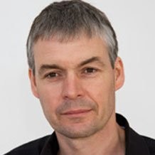 Matthew R. Evans合作论文数Queen's University1
 Geraint Vaughan合作论文数Department of Earth and Environmental Sciences, School of Natural Sciences, Faculty of Science and Engineering, The University of Manchester1
 John-Paul Latham合作论文数Department of Earth Science and Engineering, Faculty of Engineering, Imperial College London1
 Robert Finger合作论文数Department of Environmental Systems Science, ETH Zürich1
 Adrienne Grêt Regamey合作论文数Department of Civil, Environmental and Geomatic Engineering, Eidgenössische Technische Hochschule Zürich1
 Sasha Dall合作论文数Centre for Ecology and Conservation, University of Exeter1
 Patrick Meyfroidt合作论文数Land Systems for Sustainability Lab, Universite Catholique de Louvain1
 Mark New合作论文数University of Cape Town1
 Tim Benton合作论文数School of Biology, Faculty of Biological Sciences, University of Leeds1
 Tittensor Derek P合作论文数Dept Biol, Dalhousie Univ1
 Simon Lewis合作论文数School of Geography, Faculty of Environment, University of Leeds;Department of Geography, University College London1
 Cristina Montanola Sales合作论文数1
 Anika N. Haque合作论文数Department of Environment and Geography, University of York1
 James Millington合作论文数Department of Geography, School of Global Affairs, Faculty of Social Science & Public Policy, King’s College London1




