The Capricorn Orogen, central to the West Australian Craton (WAC) and flanked by the Pilbara Craton to the north and the Yilgarn Craton to the south, records complex tectonic processes spanning from the Archean to the Neoproterozoic, including two major Paleoproterozoic collisions—the 2,215–2,145 Ma Ophthalmia Orogeny and the 2,005–1,950 Ma Glenburgh Orogeny—that welded the two cratons. Using finite‐frequency tomography, we present the first high‐resolution P wave velocity model of the upper mantle beneath this region, providing new constraints on cratonic architecture and tectonic evolution. Our results reveal high‐velocity anomalies beneath the Pilbara and Yilgarn Cratons, extending to depths of ∼150–200 km, indicative of thick cratonic keels. The northern edge of the Yilgarn Craton trends northeast, likely extending beneath sedimentary basins to connect with the Pilbara Craton. Its eastern surface trace aligns with the Goodin Fault, while its western margin lies south of the Narryer Terrane, a component of the northwest Yilgarn Craton, suggesting that southward translation of this terrane occurred during the Glenburgh and Capricorn Orogenies. The southern edge of the Pilbara Craton, marked by the Talga Fault, appears structurally diffuse, possibly reflecting its passive margin origins prior to collision. Low‐ (<−0.5%) velocity anomalies within the Capricorn Orogen suggest extensive mantle metasomatism, likely associated with subduction‐driven hydration during the Ophthalmia and Glenburgh Orogenies. These findings provide new insights into the long‐term stabilization and reworking of Archean lithosphere, underscoring the significance of early Paleoproterozoic orogenesis in shaping the deep structure of cratonic regions.
In recent years there has been a considerable expansion of deployments of portable seismic stations across Australia, which have been analysed by receiver function or autocorrelation methods to extract estimates of Moho depth. An ongoing program of full-crustal reflection profiles has now provided more than 25,000 km of reflection transects that have been interpreted for Moho structure. The Moho dataset is further augmented by extensive marine reflection results. These new data sources have been combined with earlier refraction and receiver function results to provide full continental coverage, though some desert areas remain with limited sampling. The dense sampling of the Moho indicates the presence of rapid changes in Moho depth and so the Moho surface has been constructed using an approach that allows different weighting and spatial influence depending on the nature of the estimate. The inclusion of Moho results from continental-wide gravity inversion with low weighting helps to resolve the continent-ocean transition and to provide additional control in the least sampled zones. The refined distribution indicates the presence of widespread smaller-scale variations in Moho structure. Strong lateral contrasts in crustal thickness remain, but some have become more subdued with improved sampling of critical areas. The main differences from earlier results lie in previously poorly sampled regions around the Lake Eyre Basin, where additional passive seismic results indicate somewhat thicker crust though still with a strong contrast in crustal thickness to the cratonic zone to the west.
The present research aims to explicate the tectonics of the northwest Himalayas, Pakistan, based on integrated gravity, magnetic and earthquake data. The raw gravity and magnetic data were processed, and seven isoanomaly maps were prepared for qualitative interpretation, whereas a gravity model was prepared along the selected profile for quantitative interpretation. The local earthquake data have also been used to identify the various seismogenic layers in the subsurface and to understand how seismicity relates to regional structural features. Three northwest‐trending thick‐skinned blind basement faults are identified from the present study, namely the Indus Kohistan Seismic Zone (IKSZ), Bagh Basement Fault and Hazara Lower Seismic Zone. The IKSZ is the tectonically most active among them and responsible for the 2005 Kashmir earthquake (Mw = 7.6) and 1974 Pattan earthquake (Mw = 6.2) in the region. The present study also delineated the prominent location of the Main Central Thrust in which the high‐grade metamorphic rocks of Higher Himalayan Crystalline thrust over low‐grade metamorphic rocks of Lesser Himalayas along this thick‐skinned fault. The field evidence such as ductile deformation, zone of inverted metamorphism, and brittle deformation also confirm this location. The sharp bending of the crystalline crust, as well as deep basement just south of Kohistan Island Arc (KIA), indicate that the high density and susceptibility rocks of this arc thrust on the leading margin of the Indian Plate along the Main Mantle Thrust. This thrust fault is a major suture zone separating the KIA in the north from the Indian Plate in the south. The other faults in the region exist in the sedimentary/meta‐sedimentary wedge and are thin‐skinned. It is inferred from the current investigation that the study area exhibits a composite style of deformation. Moreover, the gravity model combined with earthquake data suggested the existence of multiple décollement zones below the Hazara‐Kashmir Syntaxis. The model envisaged an increase in the thickness of the Indian Plate continental crust in the northeast direction.
Moho results from continental-wide gravity inversion with low weighting helps to resolve the continent-ocean transition and to provide additional control in the least sampled zones. The refined distribution indicates the presence of widespread smaller-scale variations in Moho structure. Strong lateral contrasts in crustal thickness remain, but some have become more subdued with improved sampling of critical areas. The main differences from earlier results lie in previously poorly sampled regions around the Lake Eyre Basin, where additional passive seismic results indicate somewhat thicker crust though still with a strong contrast in crustal thickness to the cratonic zone to the west.
Ambient wavefield data acquired on existing (so-called 'dark fibre') optical fibre networks using distributed acoustic sensing (DAS) interrogators allow users to conduct a wide range of subsurface imaging and inversion experiments. In particular, recorded low-frequency (<2 Hz) surface-wave information holds the promise of providing constraints on the shear-wave velocity (V-S) to depths exceeding 0.5 km. However, surface-wave analysis can be made challenging by a number of acquisition factors that affect the amplitudes of measured DAS waveforms. To illustrate these sensitivity challenges, we present a low-frequency ambient wavefield investigation using a DAS data set acquired on a crooked-line optical fibre array deployed in suburban Perth, Western Australia. We record storm-induced microseism energy generated at the nearby Indian Ocean shelf break and/or coastline in a low-frequency band (0.04-1.80 Hz) and generate high-quality virtual shot gathers (VSGs) through cross-correlation and cross-coherence interferometric analyses. The resulting VSG volumes clearly exhibit surface wave energy, though with significant along-line amplitude variations that are due to the combined effects of ambient source directivity, crooked-line acquisition geometry and the applied gauge length, fibre coupling, among other factors. We transform the observed VSGs into dispersion images using two different methods: phase shift and high-resolution linear Radon transform. These dispersion images are then used to estimate 1-D near-surface V-S models using multichannel analysis of surface waves (MASW), which involves picking and inverting the estimated Rayleigh-wave dispersion curves using the particle-swarm optimization global optimization algorithm. The MASW inversion results, combined with nearby deep borehole information and 2-D elastic finite-difference modeling, show that low-frequency ambient DAS data constrain the V-S model, including a low-velocity channel, to at least 0.5 km depth. Thus, this case study illustrates the potential of using DAS technology as a tool for undertaking large-scale surface wave analysis in urban geophysical and geotechnical investigations to depths exceeding 0.5 km.
Seismicity in the intraplate southwest of Western Australia is poorly understood, despite evidence for potentially damaging earthquakes of magnitude > M6. Identifying stress-focusing geological structures near significant earthquake sequences assists in understanding why these earthquakes occur in seemingly random locations across a region of more than 250 000 km(2). On 16 September 2018, an M(L)5.7 earthquake occurred near Lake Muir in the southwest of Western Australia and was followed by an M(L)5.4 aftershock. The main earthquake formed a mainly north-trending fault scarp similar to 5 km in length and with a maximum vertical displacement of similar to 40 cm. The main event was followed by a series of aftershocks, one of which had a magnitude of M(L)5.4. Using high-resolution aeromagnetic data, we analyse bedrock geology in a wide area surrounding the new scarp and map a series of major similar to east-west-trending faults segmenting eight distinct geological domains, as well as a network of less prominent northwest-trending faults, one of which aligns with the southern segment of the scarp. Surface faulting, surface deformation and earthquake focal mechanism studies suggest movements on north- and northeast-trending structures. The main shock, the aftershocks, surface faulting and changes in InSAR-derived surface elevation all occur in a region bounded to the south by a prominent northwest-trending fault and to the north by a west-northwest-trending domain-bounding structure. Thus, we interpret the north-trending thrust fault associated with the main Lake Muir event as due to local stress concentration of the regional east-west stress field at the intersection of these structures. Further, we propose that a particularly large west-northwest-trending structure may be broadly focusing stress in the Lake Muir area. These findings encourage similar studies to be undertaken in other areas of Australia's southwest to further the current understanding of seismic release in the region.
The accurate characterization of mafic and ultramafic rocks is a challenging but necessary task given the spatial and genetic relationship of mineralization with specific lithologies (e.g. komatiite hosted nickel-sulfides preferentially associated with cumulate-rich ultramafic rocks). Rock classification is further complicated as most mafic and ultramafic rocks have undergone varying degrees of alteration. The accuracy and reproducibility of characterization can be significantly improved by using portable energy dispersive X-ray fluorescence (pXRF) chemical data with portable visible and near-infrared (pVis-NIR) mineralogical data. A new workflow using pXRF and pVis-NIR is presented and used to reliably characterize mafic and ultramafic rocks from the Yilgarn Craton, Western Australia. The workflow involves six steps: (1) Mitigate and identify compound processing and closure issues. For example, we used a pXRF with helium flush to reliably and rapidly measure light elements and mitigate closure, i.e. problems related to data failing to sum to 100%. (2) Identify and exclude geochemically heterogeneous samples. Heterogeneity may be unrelated to alteration and caused by veining or small-scale structure interleaving of different rock types. Geochemical heterogeneity was evaluated using skewness and kurtosis of SiO2 data. (3) Relate rocks from similar magmatic, weathering and alteration events. This was achieved by interpreting data grouping of Vis-NIR ferric and ferrous iron data via a 852 nm/982 nm reflectance v. 651 nm/982 nm reflectance plot and the ferrous abundance index. Unrepresentative data were omitted. (4) Correct XRF iron data, and characterize lithology and alteration. Values ascribed to regions in the TAS (total alkali silica) diagram were used to approximate FeO and Fe2O3. Subsequently, geochemical indices (e.g. Mg#) were used to characterize the alteration box plot. (5) Characterize fractionation in detail. Fractionation variation diagrams were used to interpret fractionation, e.g. MgO v. Al2O3, Ca/Al v. Al2O3, Ni/Cr v. Ni/Ti, and MgO v. Cr. (6) Identify and quantify talc alteration and serpentinization. This included the use of a new alteration plot (Mg# v. 1410 nm(RAD)/Albedo) to estimate serpentinization and identify relationships between serpentine, carbonate, chlorite and talc abundances. The results and observations contained in this contribution have important implications for progressive technologies such as core logging platforms that are equipped with pXRF and pVis-NIR instruments.
The declining discovery rate of world-class ore deposits represents a significant obstacle to future global metal supply. To counter this trend, there is a requirement for mineral exploration to be conducted in increasingly challenging, uncertain, and remote environments. Faced with such increases in task and environmental complexity, an important concern in exploratory activities are the behavioural challenges of information perception, interpretation and decision-making by geoscientists tasked with discovering the next generation of deposits. Here, we outline the Dynamics model, as a diagnostic tool for situational analysis and a guiding framework for designing working and training environments to maximise exploration performance. The Dynamics model is based on an Ecological Dynamics framework, combining Newell’s Constraints model, Self Determination Theory, and including feedback loops to define an autopoietic system. By implication of the Dynamics model, several areas are highlighted as being important for improving the quality of exploration. These include: (a) provision of needs-supportive working environments that promote appropriate degrees of effort, autonomy, creativity and technical risk-taking; (b) an understanding of the wider motivational context, particularly the influence of tradition, culture and other ‘forms of life’ that constrain behaviour; (c) relevant goal-setting in the design of corporate strategies to direct exploration activities; and (d) development of practical, representative scenario-based training interventions, providing effective learning environments, with digital media and technologies presenting decision-outcome feedback, to assist in the development of expertise in mineral exploration targeting.
SUMMARY In contrast to global observations in stable continental crust, the present-day orientation of the maximum horizontal stress in Western Australia is at a high angle to plate motion, suggesting that in addition to large-scale plate driving forces, local factors also play an important role in stress repartitioning. As a reliable stress indicator, full waveform moment tensor solutions are calculated for earthquakes that occurred between 2010 and 2018 in the southern Yilgarn Craton and the adjacent Albany-Fraser Orogen in southwestern Australia. Due to regional velocity heterogeneities in the crust, we produced two geographically distinct shear wave velocity models by combining published crustal velocity models with new ambient noise tomography results. We applied a full waveform inversion technique to 15 local earthquakes and obtained 10 robust results. Three of these events occurred near Lake Muir in the extreme south of the study area within the Albany-Fraser Orogen. The focal mechanism of the 16th September 2018 Lake Muir event is thrust; two ML≥ 4.0 aftershocks are normal and strike-slip. Our results are consistent with field observations, fault orientations inferred from aeromagnetic data and surface displacements mapped by Interferometric Synthetic Aperture Radar which are all consistent with reactivation of existing faults. The other seven solutions are in the southeastern Yilgarn Craton. These solutions show that the faulting mechanisms are predominantly thrust and strike-slip. This kinematic framework is consistent with previous studies that linked active seismicity in the Yilgarn Craton to the reactivation of the NNW–SSE oriented Neoarchean structures by an approximately E–W oriented regional stress field. Our results suggest that the kind of faulting that occurs in southwest Australia is critically dependent on the local geological structure. Thrust faulting is the dominant rupture mechanism, with some strike-slip faulting occurring on favourably oriented structures.
•Compared gold endowment estimates made by geoscience experts and non-geoscientists.•Significant differences identified between geoscience expert estimates.•Half of geoscience expert estimates comparable to non-geoscientists.•Inconsistent estimates suggest varying expertise/choice of appropriate strategies.•Scenario-based training promotes development of expertise/appropriate strategies.
PreviousNext No AccessFifth International Conference on Engineering Geophysics, Al Ain, UAE, 21–24 October 2019The deep crustal structure of the c. 1080 Ma Warakurna LIP, and insights on its processes and mineralisation: Results of 3D gravity inversionAuthors: Abdulrhman Alghamdi*Alan AitkenMichael DentithAbdulrhman Alghamdi*Centre for Exploration Targeting, University of Western Australia M006, 35 Stirling Highway, Crawley, Western Australia 6009, AustraliaKing Abdulaziz City for Science and Technology (KACST), Riyadh, Saudi ArabiaSearch for more papers by this author, Alan AitkenCentre for Exploration Targeting, University of Western Australia M006, 35 Stirling Highway, Crawley, Western Australia 6009, AustraliaSearch for more papers by this author, and Michael DentithCentre for Exploration Targeting, University of Western Australia M006, 35 Stirling Highway, Crawley, Western Australia 6009, AustraliaSearch for more papers by this authorhttps://doi.org/10.1190/iceg2019-070.1 SectionsAboutPDF/ePub ToolsAdd to favoritesDownload CitationsTrack CitationsPermissions ShareFacebookTwitterLinked InRedditEmail Abstract Large Igneous Provinces (LIPs) of the Proterozoic era in terms of interpreting geophysical characterise of their deep crustal structure and upper mantle are still complicated due to absence of the thermal system related to the younger LIPs. However, seismically-constrained gravity inversion method can provide a reliable way of identifying magmatic underplating that characterized by a high velocity and density lower crust, a highly transitional Moho, and often by significant crustal thickness. In this study, a seismically-constrained gravity inversion method was applied to the Warakurna LIP region in central-western Australia with focusing on imaging the deep crust of this region, and defining the extent and intensity of mafic magmatism. In particular, a thick mafic underplate has been imaged in some regional seismic studies, but its regional extent is unknown. The results of 3D gravity inversions demonstrate an extensive area with very thick crust (> 45 km) and high-density materials (> 2.83 g/cm3), which are interpreted to represent a mafic underplate. The mass-excess (i.e. thickness and/or density) of this underplate is greatest beneath the magmatic centre of the LIP in the west Musgrave Province (WMP). Variations in mass excess suggest that the intensity of mafic magmatism closely followed the likely lithospheric architecture of the Australian continent at the time of emplacement, with magmatic centres concentrated adjacent to craton margins and along translithospheric shear zones. This suggests either that upwelling magma has been diverted by the roots of the Archean cratons or that melting was focused in the Proterozoic regions with thinner lithosphere. This arrangement is reflected in Ni-Cu-PGE prospectivity, with known deposits focused in the WMP, which has a thick, dense underplate. In contrast the Capricorn Orogen and Yilgarn Craton, which are not underplated, do not possess known deposits, despite extensive sill-networks in the upper crust. Our results show that this method for mapping the extent and mass-excess of lower-crustal magmatic products provides an effective indicator of the extent and intensity of magmatism during LIP events, and that this can help understand LIP processes, including ore-deposit formation. Keywords: gravity, inversion, crustal structure, sediment, densityPermalink: https://doi.org/10.1190/iceg2019-070.1FiguresReferencesRelatedDetails Fifth International Conference on Engineering Geophysics, Al Ain, UAE, 21–24 October 2019ISSN (online):2159-6832Copyright: 2020 Pages: 315 publication data© 2020 Published in electronic format with permission by the Society of Exploration GeophysicistsPublisher:Society of Exploration Geophysicists HistoryPublished: 03 Apr 2020 CITATION INFORMATION Abdulrhman Alghamdi*, Alan Aitken, and Michael Dentith, (2020), "The deep crustal structure of the c. 1080 Ma Warakurna LIP, and insights on its processes and mineralisation: Results of 3D gravity inversion," SEG Global Meeting Abstracts : 277-279. https://doi.org/10.1190/iceg2019-070.1 Plain-Language Summary Keywordsgravityinversioncrustal structuresedimentdensityPDF DownloadLoading ...
Discovery of new deposits has slowed dramatically since the beginning of the 21st century despite increased expenditure. Targeting below deep, complex cover is recognised as key to opening up new search-spaces and re-invigorating exploration success. Existing techniques and technologies are reaching maturity as direct-detection exploration methods are costly and have limited success when targeting beneath cover. Thus, the application of a predictive, conceptual-based approach to exploration targeting is required. The mineral systems concept provides a framework within which the critical elements of a system can be defined and incorporated into a predictive exploration targeting model. However, modelling of entire mineral systems remains in its infancy. As such, the effective translation of the mineral systems concept into robust targeting models is defined as a significant research challenge by several authors. A conceptual whole-system modelling approach is proposed in light of the critical elements of an orogenic gold mineralising system and a review of existing exploration tools. The approach combines probabilistic submodels for predicting total mineral endowment with localised mineral distribution. Linking resource endowment assessments (total mineral endowment), with fluid dynamics and fluid-rock interaction modelling (local mineral distribution), provides an opportunity to develop resource-potential maps that define the approximate cost-benefit of exploring any given location. Further research is required for such modelling methods to become feasible. Although hydrodynamic and hydrogeologic modelling has advanced in other research fields, methods for modelling auriferous fluid flow through the crust remain under-developed. This, in part, is due to detailed 3D geological data being unavailable or prohibitively expensive to acquire. Potential solutions to limited data availability include the development of more advanced interpolation and geophysical inversion methodologies, based on data from well-understood geological provinces, resulting in improved 3D geological interpretations. Collaboration between academia and the minerals industry, to develop an integrated approach to entire mineral system modelling, may lead to successful predictive exploration, by providing a meaningful output to guide decision-making during the exploration targeting process.
The United States Geological Survey (USGS) Three-part Undiscovered Mineral Resource Assessment provides a framework for estimating undiscovered mineral endowment. Previous studies that applied the Three-part Assessment to estimate the undiscovered orogenic gold endowment of the Sandstone Greenstone Belt, Western Australia, have relied upon dated or expert-derived grade-tonnage models. Here, several assessments are conducted using local grade-tonnage models, comprising known orogenic gold deposits within the entire Yilgarn Block and several individual terranes with contrasting lithosphere- to terrane-scale characteristics. These models are generated through comprehensive review of historical exploration, resource and production data. Based on these models, the Sandstone Greenstone Belt is estimated to contain significant undiscovered gold mineralisation, with a median total endowment of between 166 and 298 t gold, and mean of 167-319 t gold. Although these updated grade-tonnage models provide an approximately 80 per cent variation in predicted gold endowment, it is still evident that the belt remains an underexplored region within the Yilgarn Block, Western Australia.
Light element data are required for robust and accurate lithogeochemical interpretations and are important components in the study of hydrothermal alteration and mineralization processes. In this contribution we review the latest available portable energy dispersive X-Ray Fluorescence (pXRF) technologies exclusively in the context of light element analysis, with focus on the acquisition of data for Na, Mg, Al and Si. We discuss pXRF hardware design limitations, quantify variables that attenuate X-ray energies through numerical modelling, including common pXRF configurations, and empirically investigate modern pXRF technologies used to mitigate X-ray attenuation and improve light element analysis. The void between the sample and detector is a key issue regarding the success of pXRF light element analysis. Dry-air (normal conditions), vacuum purge and helium flush systems are evaluated. Modelled data that use a nominal sample-detector void of 10 mm show that using helium in lieu of air improves X-ray transmission effectiveness from approximate to 2% to approximate to 99% for Na and approximate to 10% to approximate to 100% for Mg. Modelled detector window data show that using a graphene detector window in lieu of a traditional beryllium detector window improves X-ray transmission effectiveness for Na from approximate to 38% to approximate to 64% and approximate to 57% to approximate to 77% for Mg. Progressive X-ray transmission effectiveness equates to approximate to 63% Na and approximate to 76% Mg when using a helium-graphene pXRF configuration v. approximate to 1% for Na and approximate to 6% Mg when using a traditional in-air beryllium pXRF arrangement (i.e. without sample or X-ray entrance window media). Empirically determined improvements of the resolved signal are more modest than those of modelled X-ray transmission effectiveness data. Instrument noise, spectral overlaps and random counting errors are unavoidable and inherent with the limitations of modern detector technologies. However, the employment of helium with graphene detector window technology allows very precise data to be obtained at significantly shorter scan times (i.e. 20 s, instead of the traditional 60-180 s, i.e. 3-9 times faster): a scan time of 20 s can achieve a precision of approximate to 18% @ approximate to 0.4% Na and approximate to 8% @ approximate to 0.3% Mg for elemental interference-free samples. Precision will improve with increasing analyte concentration.
As mineral exploration seeks deeper targets, there will be a greater reliance on geophysical data and a better understanding of the geological meaning of the responses will be required, and this must be achieved with less geological control from drilling. Also, exploring based on the mineral system concept requires particular understanding of geophysical responses associated with altered rocks. Where petrophysical datasets of adequate sample size and measurement quality are available, physical properties show complex variations, reflecting the combined effects of various geological processes. Large datasets, analysed as populations, are required to understand the variations. We recommend the display of petrophysical data as frequency histograms because the nature of the data distribution is easily seen with this form of display. A petrophysical dataset commonly contains a combination of overlapping sub-populations, influenced by different geological factors. To understand the geological controls on physical properties in hard rock environments, it is necessary to analyse the petrophysical data not only in terms of the properties of different rock types. It is also necessary to consider the effects of processes such as alteration, weathering, metamorphism and strain, and variables such as porosity and stratigraphy. To address this complexity requires that much more supporting geological information be acquired than in current practice. The widespread availability of field portable instruments means quantitative geochemical and mineralogical data can now be readily acquired, making it unnecessary to rely primarily on categorical rock classification schemes. The petrophysical data can be combined with geochemical, petrological and mineralogical data to derive explanations for observed physical property variations based not only on rigorous rock classification methods, but also in combination with quantitative estimates of alteration and weathering. To understand how geological processes will affect different physical properties, it is useful to define three end-member forms of behaviour. Bulk behaviour depends on the physical properties of the dominant mineral components. Density and, to a lesser extent, seismic velocity show such behaviour. Grain and texture behaviour occur when minor components of the rock are the dominate controls on its physical properties. Grain size and shape control grain properties, and for texture properties the relative positions of these grains are also important. Magnetic and electrical properties behave in this fashion. Thinking in terms of how geological processes change the key characteristics of the major and minor mineralogical components allows the resulting changes in physical properties to be understood and anticipated.
The 920 km(2) Archean Sandstone greenstone belt lies in the central-northern part of the Southern Cross Domain of the Youanmi Terrane, Western Australia. The belt, forming an arrow-head geometry, is bounded by the Youanmi and Edale shear zones on its eastern and western margins, respectively. The belt has a total gold endowment, including historic production, resources and reserves, of approximately 62 t (2.0 Moz). Most known deposits are situated within a central-southern ultramafic domain, although this is likely a function of exploration focus. The distribution of historical exploration efforts and domaining of deposit types, based on litho-structural controls on ore formation, highlight the potential for significant undiscovered deposits, hosted within arrays of shear zones parallel and adjacent to the lithosphere-scale Youanmi and Edale shear zones.
Regional-scale ground selection presents a significant risk in mineral exploration targeting. As any exploration search space contains a finite and fixed number of ore bodies, selection of barren or depleted search spaces incurs wasted exploration expenditure. By defining regions of estimated high mineral endowment, via generation of quantitative information as to the value of potential discoveries, mineral exploration effectiveness, project acquisition, and exploration portfolio management can be improved. The Three-Part Mineral Resource Assessment, developed by the United States Geological Survey (USGS), is a methodology designed to assist in this process. Here, two separate assessments are applied to estimate the orogenic gold endowment of the Sandstone Greenstone Belt in the Yilgarn Craton, Western Australia. First, the results of a global regression assessment (median endowment of 33 t/1.16 Moz Au, mean of 130 t/4.59 Moz Au), based on an available, but outdated, global grade-tonnage model for low-sulfide gold-quartz vein deposits, suggest that most outcropping and shallow orebodies in the Sandstone Greenstone Belt have been discovered and fully delineated. In contrast, an expert assessment (median endowment of 210 t/7.41 Moz Au, mean of 220 t/7.76 Moz Au), using expert-derived grade and tonnage distributions specific to the Sandstone Greenstone Belt, predicts that significant gold mineralization remains to be discovered, largely beneath cover. The contrasting assessments imply a step change in exploration focus, from surficial deposits at the time of the USGS global grade-tonnage model to those buried under cover at the present time. The expert assessment, in contrast to the global regression assessment, implies the potential for deeper exploration targets within the Sandstone Greenstone Belt. Based on the predicted total number of deposits, much of the undiscovered mineral endowment is likely to be distal to known ore bodies, beneath cover, and at greater depths within the belt.
 Huaiyu Yuan合作论文数School of Earth Sciences, The University of Western Australia;Centre for Exploration Targeting, The University of Western Australia12
 Allan Trench合作论文数Department of Earth Sciences, University of Oxford11
 Jeremy Hall合作论文数Centre for Earth Resources Research, Memorial University of Newfoundland10
 Klaus Gessner合作论文数School of Earth and Geographical Sciences, The University of Western Australia9Ruth Murdie合作论文数8
 Eun-Jung Holden合作论文数School of Computing and Information Systems, Faculty of Engineering and Information Technology, The University of Melbourne;School of Earth and Oceans, The University of Western Australia8
 Perla Pina-Varas合作论文数Departament de Dinàmica de la Terra i dels Oceans, Universitat de Barcelona7
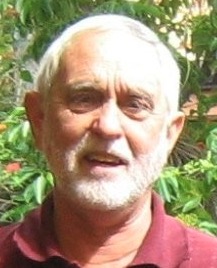 David Groves合作论文数Centre for Exploration Targeting, School of Earth Sciences, The University of Western Australia;School of Earth and Oceans, The University of Western Australia7
 Simon p Johnson合作论文数Geological Survey of Western Australia, Mineral House7Cameron Adams合作论文数6Jj Doody合作论文数6
 Rhys Samuel Davies合作论文数The University of Western Australia6
 John Sykes合作论文数Geog Dept, Simon Fraser Univ5
 Will Featherstone合作论文数School of Earth and Planetary Sciences, Curtin University5
 Alan R. A. Aitken合作论文数University of Western Australia, University of Western Australia5
 Brian L. N. Kennett合作论文数Research School of Earth Sciences, College of Science and Medicine, Australian National University5A Conway合作论文数4R. D. List合作论文数4
 Peter Kovesi合作论文数School of Computer Science & Software Engineering
The University of Western Australia4Wanwu Guo合作论文数4A. J. Buckingham合作论文数3
Peter Kovesi合作论文数School of Computer Science & Software Engineering
The University of Western Australia4Wanwu Guo合作论文数4A. J. Buckingham合作论文数3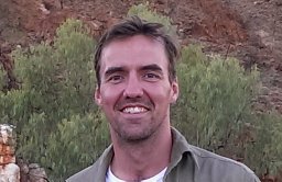 Mark Douglas Lindsay合作论文数Centre for Exploration Targeting, The University of Western Australia, 35 Stirling Hwy, Crawley, WA 6009, Australia3
 Alexei Gorbatov合作论文数3Phillip E Playford合作论文数3Mike F Middleton合作论文数3We Featherstone合作论文数3
 Jeffrey Chilver Shragge合作论文数3
 Fawna J Korhonen合作论文数3
 K. Czarnota合作论文数pmd*CRC, Geoscience Australia3
 Barry Bourne合作论文数3
 A. W. R. Bevan合作论文数2P. J. Hawke合作论文数2m r wheatley合作论文数2R Murdie合作论文数2D. Windrim合作论文数2
 Jihyun Yang合作论文数Los Alamos Natl Lab2
 Marianne Davies合作论文数University of Leicester2
 Shubham Agrawal合作论文数Res Sch Earth Sci, Australian Natl Univ2
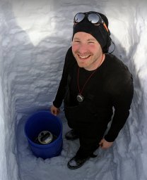 J. P. O'Donnell合作论文数Geol Survey South Australia2
 Trond Helge Torsvik合作论文数Centre for Earth Evolution and Dynamics, Department of Geosciences, The Faculty of Mathematics and Natural Sciences, University of Oslo2
 Fabio Boschetti合作论文数CSIRO Marine Research2
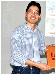 Zheng-Xiang Li (李正祥)合作论文数School of Earth and Planetary Sciences, Faculty of Science and Engineering, Curtin University2B. J. Evans合作论文数2
 Simon Wilde合作论文数School of Earth and Planetary Sciences, Faculty of Science and Engineering, Curtin University2
 David Annetts合作论文数2P. Muhling合作论文数2John Ridley合作论文数Department of Geosciences, Colorado State University2
 Nader A. Issa合作论文数Abt. Molekulare Strukturbiologie, Max-Planck-Institut für Biochemie2




