Long-term Micro-Erosion Meter (MEM) datasets are commonly summarised using average downwearing rates, masking the hierarchical spatial and temporal variability they contain. We analyse a 13-year micro-erosion meter (MEM) monitoring dataset (2011–2024) from the tectonically stable Otway coast, southeastern Australia, using an integrated statistical framework combining robust linear mixed-effects modelling (RLMM), piecewise (broken-stick) mixed-effects analysis, and hierarchical centred autoregressive AR(1) modelling. The integrated modelling framework developed in this study explicitly resolves spatial hierarchy, non-linear temporal structure, and downwearing memory across nested platforms, MEM bolt sites, and point scales. RLMM results demonstrate strong scale dependence in downwearing variability: point-scale observations exhibit high variance and skewness, whereas platform-scale mean downwearing rates are comparatively stable. Relative to classical mixed-effects models, robust estimation substantially reduces residual variance and moderates slope estimates, indicating that extreme MEM values represent temporary spikes in downwearing rates rather than persistent geomorphic trends. Piecewise modelling identifies an early monitoring phase characterised by elevated downwearing rates, followed by a lower long-term downwearing rate, indicating a distinct transition between early and sustained monitoring phases. Hierarchical centred AR(1) modelling shows that downwearing rates are partly influenced by their previous values at the point (φ₁ = 0.325), site (φ₁ = 0.353), and platform (φ₁ = 0.382) scales, indicating that past downwearing conditions continue to influence present-day downwearing. Using the 2011–2024 MEM record, representing the contemporary monitoring period of the long-term Otway dataset, the hierarchical modelling framework reveals scale-dependent mean downwearing rates of 0.264–0.561 mm/yr, highlighting the value of the approach for resolving spatial and temporal structure. Together, these results demonstrate that MEM-derived downwearing rates provide a statistically robust, process-consistent framework for interpreting long-term shore platform evolution.
The Estuarine Turbidity Maximum (ETM) is a biogeochemical hotspot in estuaries that regulates ecosystem health by amplifying estuarine water filtering. Convergence of elevated turbidity in an ETM is due to the intersection of repeated sediment resuspension and physical characteristics of a system. ETM formation depends on various tidal and freshwater conditions, making its ecological impact difficult to predict. Understanding the mechanisms of ETM formation has been predominantly studied in estuaries with strong tides or salt wedges. We examine how ETMs behave in a mesotidal estuary where the salt wedge is weak due to low freshwater input. Transect surveys and long-term deployments measuring salinity, suspended sediment, and currents were conducted over two summers (2024/2025) and one winter (2024) to capture spatial, tidal, and seasonal variability in ETM formation. The data revealed, for the first time, the formation of two tidally induced, intermittent ETMs. Both ETMs formed only at mid-tide, as neither gravitational circulation, tidal pumping, nor topographic trapping were strong enough to sustain cyclic/tidal sediment resuspension. The upstream ETM formed at the salt-wedge, extending further seaward in winter, whereas the downstream ETM formed due to tidal pumping, possibly assisted by topographic trapping during ebb tide. The co-occurrence of two intermittent ETMs suggests that estuaries host multiple, temporal biogeochemical hotspots. This could enhance nutrient filtering capacity but may also increase material trapping and amplify eutrophication risks. This highlights that estuarine filtering capacity may be more variable than previously assumed, with implications for water quality management within estuaries and the connected marine and freshwater systems.
With the increase of climate change and local stressors on estuarine ecosystem health, there is an increased interest and demand for better understanding of estuarine physical and biogeochemical processes. New Zealand estuaries experience a high sediment input and are often undersampled. The large fine re-suspendable sediment pool is expected to interact with nutrients within the water column and therefore the Estuary Turbidity Maximum (ETM) is expected to play a large role in estuarine biogeochemical processes. Here we present our experience in setting up a measurement scheme in a large, shallow, mesotidal and undersampled estuary. We monitor turbidity, salinity, and nutrients both via transects and deployments. This provides a spatial and temporal snapshot of general trends and relevant processes within an estuary tributary. In addition, this method allowed the localization of the ETM and subdivision of the tributary into zones to assist in future sample site selection and post-processing.
Near-horizontal shore platforms display highly irregular plan shapes, but little is known about the way in which these irregularities influence the significant wave height (Hs) on the platforms and the frequency components of the nearshore wave field. We use a nonlinear Boussinesq wave model to conduct harmonic and bispectral mode decomposition analyses, studying the control of concave and convex platform edges over wind (WW: 0.125 - 0.33 Hz), swell (SW: 0.05 - 0.125 Hz) and infragravity (IG: 0.008 - 0.05 Hz) frequencies. For breaking and non-breaking waves, increasing the platform edge concavity intensified wave divergence and subsequent attenuation of SW and IG across the outer platforms, reducing by up to 25%. Increasing the platform edge convexity intensified focusing and amplification of SW and WW over the outer platforms, increasing by up to 18% and 55% for breaking and non-breaking waves. In the presence of breaking, IG amplification depended on the generation of wave divergence across the inner platform, a condition determined by a critical convex curvature threshold (Κ=1.8) balancing wave focusing from refraction and defocusing from breaking. We find that convex curvature can determine the relative dominance of WW, SW and IG across platforms. Alongshore, coherent wave interactions governed IG stationary patterns defined by a node near the platform centreline and two antinodes on either side of concave edges. A node was generated at the platform centreline, and two antinodes were observed on either side of the convex edges for Κ>1.8, with the opposite pattern observed for Κ<1.8.
Downwearing rates obtained from tectonically active coasts provide evidence of rapid rock breakdown following coseismic uplift. These measurements help solve puzzles about 'missing' marine terraces and have implications for accurate reconstruction of past sea levels, earthquakes and rock coast evolution. However, very few detailed erosion datasets exist for uplifted shore platforms, making it uncertain if erosion records from one coast can be extrapolated to other regions with similar tectonic, geologic, or geomorphic characteristics. Here we present new downwearing rates from an inter-tidal mudstone shore platform at Kahutara Point, M & amacr;hia Peninsula, New Zealand that was uplifted likely by similar to 3 m within the last 300 years. Downwearing rates were measured over 49 months/4.05 years using the Micro-Erosion Meter (MEM) and Structure-from-Motion photogrammetry: the mean annual downwearing rate was 1.08 mm yr(-1), while the total erosion at individual MEM stations ranged from 0.44 to 14.37 mm (equivalent to mean downwearing rates of 0.11 to 3.54 mm yr(-1)). Orthophotographs of the eroded rock surfaces indicate the combined role of marine processes (waves and tides), sub-aerial weathering processes, salt weathering and biological activity in the erosion of the mudstone platform surface. The downwearing rates from Kahutara Point, M & amacr;hia Peninsula are statistically similar to previously published downwearing rates (1.23 mm yr(-1)) from mudstone platforms at Kaik & omacr;ura Peninsula, New Zealand, that were obtained prior to the 2016 Kaik & omacr;ura earthquake, but are significantly different from perturbed post-uplift downwearing rates (2.25 mm yr(-1)) obtained from the same MEM stations following coseismic uplift of similar to 1 m. This work provides valuable data to support comparison of the development of shore platforms and marine terraces at Kaik & omacr;ura and M & amacr;hia at different stages of their tectonic evolution.
Oceanic volcanoes develop distinct post-eruptive morphologies depending on the geomorphic conditions they experience. Submerged, truncated, flat-topped volcanoes, known as guyots, result from marine erosion and subsidence, whereas on reefs or carbonate-capped volcanoes, carbonate accretion veneers the summit. New and existing bathymetric data are utilised to identify different geomorphic forms of oceanic volcanoes in the Tasmantid Seamount Chain, a hotspot chain off the east coast of Australia, dated from similar to 6 Ma in the south to >50 Ma in the north. Profiles and slope calculations across long and short axes provide morphometric values on the basis of which four morphologic forms are identified: seamount, guyot, modern reef, and carbonate-capped guyot. Volcanoes which erupted on oceanic lithosphere are estimated to have subsided at an average rate of 46.5 mMyr(-1), faster than the subsidence rate of volcanoes that erupted on continental lithosphere (33.0 mMyr(-1)). The guyots are estimated to have eroded at an average rate of 1.9 +/- 0.5 kmMyr(-1). Substantial carbonate accretion has formed on the summits of eleven volcanoes, ranging in thickness from 1146 m in the north to 93 m in the south. The geomorphic evolution of the Tasmantid Seamount Chain, since the Oligocene, is synthesised into a conceptual model. This study finds that the post-eruptive morphology of each volcano in the chain is a product of the combined influence of the northward movement of the Australian Plate, erosion, subsidence, and carbonate accretion.
Coastal hazards threaten properties, infrastructure, and cultural sites around Aotearoa New Zealand's (hereafter Aotearoa) coastline and sea-level rise (SLR) will escalate this problem. At present it is unclear how archaeological sites will be affected by future coastal erosion and inundation. In this paper we combine national-scale archaeological and environmental datasets to provide a first-pass overview of archaeological heritage at risk in Aotearoa. Two key national-scale datasets are utilized: (1) coastal sensitivity index (CSI) developed by the National Institute of Water and Atmospheric Research; and (2) ArchSite, Aotearoa's archaeological site database. The integrated datasets produce insights into the sensitivity of coastal archaeology to SLR and associated hazards, which are vital to planning for the loss of coastal archaeological sites. More than half (& SIM;55%) of recorded coastal archaeological sites around Aotearoa are midden (n = 4938) and about 25% (n = 2271) are earthworks. In total, ca. 12% (9054) of all known archaeological sites are within 1000 m of soft shore shorelines. Of this total, only about 3% (302) of sites are burials, but the loss of these 302 burial sites would have very high cultural impact. Coastal erosion is a particularly important threat to archaeology as it would permanently remove sites, whereas the risk of site removal by coastal flooding inundation is lower. Our results show that about 22% (1954) of coastal archaeological sites are located on landforms that are sensitive to SLR-driven erosion: 29% (2660) of archaeological sites are located on foredune barrier beaches, 23% (2059) on foredune barrier plains, 14% (1283) on beaches, and 9% (808) on beach ridge barriers. This work draws attention to the scale of coastal archaeology in Aotearoa that needs adequate documentation, preservation, and potentially protection in the face of SLR. Robust coastal erosion and inundation datasets are needed to more deeply understand potential SLR-driven impacts on coastal archaeology and provide a scientific foundation for considering future adaptation options.
Coastal landforms and associated archaeological records are at risk of erosion from a combination of rising sea levels and increasingly frequent high-intensity storms. Improved understanding of this risk can be gained by braiding archaeological and geomorphological methodologies with Indigenous knowledge.(1) In this article, archaeological, geomorphological and matauranga (a form of Indigenous knowledge) are used to analyse a prograded Holocene foredune barrier in northern Aotearoa/New Zealand. Anthropogenic deposits within dune stratigraphy are radiocarbon-dated and used as chronological markers to constrain coastal evolution, alongside geomorphological analyses of topographic data, historical aerial photographs and satellite imagery. These investigations revealed that the barrier is eroding at a rate of 0.45 m/year. A midden in the foredune, which has been radiocarbon dated to 224-270 B.P. (95% Confidence), has been exposed by coastal erosion, confirming that the barrier is in the most eroded state it has been within the past similar to 300 years. Vertical stratigraphy reveals the presence of midden and palaeosol deposits capped by dune sand deposits in the foredune, indicating that vertical accretion of the foredune continued over the last similar to 200 years, despite the barrier now being in an eroding state. Matauranga played a vital role in this project, as it was the coastal taiao (environmental) monitoring unit of Patuharakeke (a Maori sub-tribe) that discovered the midden. The ecological matauranga shared also played a vital role in this project, adding experiential evidence to empirical observations. The work of local Indigenous groups, like Patuharakeke, demonstrates the active use of matauranga, woven with Western science methods to preserve or capture the knowledge contained within archaeological sites at risk of being lost to coastal erosion. In this study, we present a method for weaving matauranga, geomorphological and archaeological approaches to gain a deeper understanding of coastal landscape development.
Coastal archaeological heritage is in danger of being lost to coastal erosion, the risk of which is amplified by accelerating sea-level rise (SLR). In Aotearoa/New Zealand, coastal archaeological heritage is closely associated with indigenous ancestral communities, but our understanding of the spatiotemporal variability in coastal erosion risk for cultural heritage is limited. Coastal erosion hazard zones have typically been implemented to manage erosion risk to modern infrastructure at regional scales. In this study, we applied a hazard zone methodology in the context of coastal archaeological heritage for a selected region of Aotearoa (Te Tai Tokerau/Northland). Historical coastal change analyses reveal that most beaches in the region have been stable or slightly accretionary over the past -80 years, but a reversal of this trend is likely under the projected SLR, which is expressed in the coastal erosion hazard zones. Our analyses indicate that -8 % (155) of coastal archaeological sites in Te Tai Tokerau/Northland may be at risk of erosion with a relatively modest 20 cm of SLR, which is expected for the region by 2040, and -19 % (356) of sites are threatened by 1 m of SLR. Scenarios are presented that should assist a broad range of stakeholders to assess heritage risk and provide an opportunity for coastal managers to include heritage within adaptive planning pathways. (c) 2024 The Author(s). Published by Elsevier Masson SAS on behalf of Consiglio Nazionale delle Ricerche (CNR). This is an open access article under the CC BY-NC-ND license ( http://creativecommons.org/licenses/by-nc-nd/4.0/ )
AbstractNotch development at the base of sea cliffs is an important control on cliff recession rates, but a detailed mechanistic understanding of notch formation by swash abrasion is lacking. We conducted physical experiments, using homogeneous erodible rock simulants, to study notch‐forming mechanisms under periodic sediment‐laden bore impacts. Our findings reveal shifts in the temporal dynamics of notch development. Initially, swash uprush and vortex formation contribute to a positive feedback loop that creates a shallow and wide notch. Subsequently, upward erosion ceases, and notch backwear and downwear are dominated by the vortex. Eventually, sediment deposition armors the notch floor; this negative feedback loop reduces erosion. The sediment size determines the amount of erosion, with a range of grain sizes generating maximum erosion. This indicates a dependence on the momentum of the sediment particles entrained within the bore. This research reveals fundamental notch formation mechanisms driven by swash abrasion.
Rock coasts occupy over 50% of the global shoreline and many sandy beaches are underlain by coastal platforms and rocky cliffs. The problem of wave-driven cliff erosion is of great societal importance, with many coastal communities located on top of cliffs that are at risk from erosion. Continuing global mean sea level rise and changes in storminess are generally expected to exacerbate the erosion of coastlines (Hurst et al., 2016), as larger waves can reach the cliff toe without breaking offshore. However, the science underpinning wave-induced cliff erosion is still at a relatively early stage. Even the relative contributions of waves to cliff erosion, which include hydraulic forces, impulse pressures and abrasion, are not well resolved. Most insights into wave impacts on cliffs come from field observations of coastal ground motion during storm events (e.g. Young et al., 2011, Huppert et al., 2020). These field investigations demonstrate the dependence of large wave impacts on both water levels and wave conditions, and in some cases the correlation of periods of large ground motion with increased erosion (Earlie et al., 2015). Unsurprisingly, although large impacts generally occur at high tide during storms characterised by large significant wave heights, the largest impacts occur when tidal levels and storm surge combine to provide water levels that are conducive to the incident waves breaking on the cliffs (Thompson et al., 2019; 2022). Larger wave heights or shallower water levels tend to lead to breaking further offshore, with a broken wave interacting with the cliff, while smaller wave heights or deeper water levels may preclude strong wave breaking on the cliffs. There have been relatively few experimental studies into wave-driven cliff erosion; these were generally undertaken under very idealised wave conditions (e.g. Sunamura, 1977) and using materials that were either too soft to approximate natural rocks (e.g. Sunamura, 1977; 1982) or too hard to be eroded (Hansom et al., 2008). Although these experiments have informed the development of rocky coast evolution models, their results have not been replicated or verified, and rigorous scaling laws to link laboratory erosion rates to field time scales are currently lacking. However, considering cliffs as steep or vertical (natural) coastal structures, a large body of experimental work has been undertaken to investigate impact pressures and their implications for the failure of engineered structures (e.g. Peregrine, 2003, Bullock et al., 2007). These investigations are complicated by the inherent variability of the wave impact pressures, even within controlled experiments undertaken with highly repeatable incident wave conditions (Raby et al., 2022). Although field and laboratory data are valuable, it is still very challenging to quantify wave contributions to cliff erosion due to the relatively short durations and variable conditions of most field records. On the other hand, most controlled laboratory investigations have typically focused on loads on non-erodible engineered structures such as seawalls. The current project seeks to advance understanding of the fundamental mechanisms and timescales of wave-driven erosion on rocky cliffs, which will be vital in improving assessments of cliff erosion hazard in high-energy wave environments as sea levels rise.
The Holocene evolution of beach, cliff and substrate on an idealized sand/gravel shoreface is investigated using a newly developed numerical model. The model describes a geomorphic system in which a gently sloping alluvial fan composed of sand and gravel is eroded by wave action under stable relative sea level. In this system landward erosion into the sloping surface produces cliffs that increase in height with time. Beneath water level, wave orbital motions impart stress on the seabed, which gradually lowers as a result. Excavation of the alluvial fan, both at the shoreline and in the nearshore, releases sediment that is transported onshore by wave asymmetry, building beaches. With no abrasion of the beach sediment, the beaches build to an elevation and volume that prevents erosion of the backshore, and the system progresses to a steady state where the nearshore has been excavated to closure depth. By contrast, with abrasion of the beach sediment (producing fine material that is assumed to be transported offshore and lost from the system), the beach volume reduces until the beach only provides intermittent protection against backshore erosion, leading to the formation of cliffs which, when they erode during storms, recharge the beach with sediment. In this situation, a translating shoreline develops. Depending on the various rates assumed for abrasion, seafloor lowering and cliff recession, beaches of various sizes and shapes emerge, and these provide a feedback in terms of the frequency of erosion events.
Oblique terrestrial laser scanning (TLS) enables topographic change detection at scales (10- 1 -100 cm) that are appropriate for coastal cliff erosion monitoring. Despite this, published applications of TLS on cliff are limited to a small number of sites around the world. Here we report new TLS point cloud datasets from 9 years of monitoring (2014-2023) at Rothesay Bay within the Hauraki Gulf, New Zealand, which has relatively low wave energy and a meso-tidal range. The 120 m-length scan area includes cliffs of 10-30 m height, formed of horizontally bedded soft sedimentary flysch rock. The cliffs are fronted by an 140 m wide near-horizontal shore platform that terminates in an abrupt seaward edge. Previous research at this site has estimated long-term cliff erosion rates within a range of 1.4 +/- 0.1 to 14.3 +/- 0.1 mm/year on the basis of measured shore platform width, assuming that the shore platform has widened over time over 6000 years of stable Holocene sea level, and that the seaward edge of the shore platform has not retreated. Volumetric cliff-face erosion rates were detected through 17 scans over a 9-year window (2014-2023), including intensive monthly TLS scanning between July 2021 and July 2022. Results show that the average cliff recession rate over the past decade has been 41 +/- 2 mm/ year, and monthly scans show a range in erosion rates of 30 to 288 mm/year. The cliff recession rate detected with TLS is 3 to 30 times higher than erosion rates derived based on the shore platform width. If erosion had been constant at this rate over approximately 6000 years, a total cliff retreat of >245 m would be expected, whereas the contemporary shore platform is only 140 m wide. We discuss two possible hypotheses for the confounding width of the modern shore platform: 1) that modern cliff retreat rates are faster than past erosion rates; 2) that the seaward edge of the shore platform does not reliably demarcate Holocene cliff recession. We present new bathymetric survey mapping seaward of the shore platform edge that reveals multiple rocky features that are distinguished by steep slope breaks and planar surfaces. Understanding the evolution of the intertidal shore platforms during the Holocene era may necessitate new insights on how cliffs formed toward the end of the last marine transgression. This could potentially be investigated through the study of subtidal marine bathymetry.
It is often assumed that future coastal cliff retreat rates will accelerate as global sea level rises, but few studies have investigated how SLR (sea level rise) might change cliff-front wave dynamics. Using a new simple numerical model, this study simulates the number and type (breaking, broken, or unbroken) of cliff-front waves under future SLR scenarios. Previous research shows breaking waves deliver more energy to cliffs than broken waves, and unbroken waves generate minimal impact. Here, we investigated six cliff-platform profiles from three regions (USA, New Zealand, and UK) with varied tidal ranges and wave climates. Model inputs included 2013-2100 hindcast/forecast incident wave height and tidal water level, and three future SLR scenarios. Results show the number of both cliff-front breaking and broken waves generally increase for a high-elevation (relative to tide) cliff-platform junction. In contrast, breaking/broken wave occurrence decrease by 38-92% for a near-horizontal shore platform with a low-elevation cliff-platform junction under a high SRL scenario, leading to high (96-97%) unbroken wave occurrence. Overall, results suggest the response of cliff-front waves to future SLR is complex and depends on shore platform geometries and SLR scenarios, indicating that future cliff retreat rates may not homogeneously accelerate under SLR.
The youngest uplifted marine terrace at Kahutara Point on M & amacr;hia Peninsula, New Zealand, is undergoing rapid retreat (backwear) despite being fronted by a wide contemporary shore platform that attenuates wave energy. In this paper, wave energy and water level were recorded across the shore platform, and these data were used to model (a) how frequently waves reach the terrace riser and potentially erode it and (b) how frequently waves overtop the terrace. Analyses of wave data across shore normal transects show that under quiescent and storm conditions >90% of the energy delivered to the back beach and terrace riser is at infragravity frequencies (i.e., <0.05 Hz). Significant wave heights are reduced in a landward direction for both gravity (H-m0H) and infragravity (H-m0L) wave frequencies, with 50%-80% of H-m0H and 20%-50% of H-m0L reduced between seaward and landward sensors. Wave energy during quiescent conditions is strongly attenuated at the seaward margin whereas under storm conditions, proportionally more energy is delivered to the marine terrace riser. The development of a simple inundation model at M & amacr;hia reveals that the northern flank of Kahutara Point is more vulnerable to wave inundation, with 17 storms overtopping the youngest marine terrace between 1980 and 2020. Furthermore, despite there being no evidence of a 1-in-100 year storm event occurring at M & amacr;hia since 1980, there has been an increase in storminess since 2013. Changes in storm frequency may have offset decreases in wave energy (from energy attenuation) with increased platform width associated with marine terrace retreat.
Comprehensive historical coastal change datasets are crucial resources for effective coastal management. In Aotearoa New Zealand, available coastal change data is outdated, or sporadic, hindering large-scale, long-term analysis of coastal change, and coastal planning nationwide. Here we introduce New Zealand's Coastal Change Dataset (NZCCD) a detailed record of coastal change around New Zealand from the early 1940′s to 2023. NZCCD was generated through a nationally consistent, rigorous process in which five coastal scientists manually interpreted and digitized the position of the coastline along New Zealand's open and soft cliffed coasts, using historic aerial photographs and high-resolution satellite imagery. NZCCD provides two datasets i) NZCCD Coastlines, comprising manually mapped coastlines, and ii) NZCCD Coastal Change Rates, 228, 611 points where rates of coastal change were calculated. The dataset enables a significant advancement in coastal management enhancing our understanding of the patterns and drivers of coastal change around New Zealand.
Climate change relocation of Indigenous communities is increasing globally. For Māori (the Indigenous peoples of Aotearoa New Zealand), many pā (complexes of significant structures) are at risk to climate change impacts with relocation as one potential adaptation option. For Indigenous peoples, this step is not taken lightly, as connection to place is imperative. The aim of this research is to highlight some histories of Māori communities relocating in response to natural hazards, providing insights from the past to help plan for future adaptation. To do this, we undertook a national-scale textual analysis and identified 51 examples of pā relocating in response to natural hazards since pre-1840. We then focused on a case study with members of two iwi (tribes), who relocated following the 1886 eruption of Mount Tarawera to identify enablers and barriers to relocation, and to draw insights to assist with Māori-led responses to climate change adaptation. We found that key enablers of relocation included whānau (family)-level decision-making, cultural norms of awhi (support), whanaungatanga (relationships), whakapapa (genealogical connection), koha (donation), tuku whenua (gifts of land), and mātauranga Māori (Māori knowledge). In summary, Māori and other Indigenous peoples have rich histories of relocations, utilising their own Indigenous knowledge, local implementation, and adaptability to natural hazards that can be implemented in our modern context.
Coastal cities and towns are at risk from climate change and relative sea level rise (RSLR). There is uncertainty in how and when these will impact and how to adapt, meaning there is a need for flexible tools to help decision-making and decision-makers. Decision-makers have many available actions to respond to sea level rise and other coastal hazards, but there is uncertainty around which action to take in different situations and when is the best time to act. We use agent-based modelling (ABM) to investigate multi-hazard interaction and Dynamic Adaptive Pathways Planning (DAPP) to explore the impact of an applied DAPP to work with the deep uncertainty around urban coastal systems. We developed an ABM, which included five physical hazards, whose occurrence in time was influenced by six plausible future shared socio-economic pathway / representative concentration pathway (SSP/RCP) scenarios.
AbstractWe develop a methodological approach through integrated assessment using System Dynamics modelling and Scenario Planning to investigate the economic vulnerability of coastal communities to the compounding impacts of sea‐level rise (SLR) and storm flooding and inundation associated with climate change. The approach uses a coastal flood risk assessment that quantifies physical drivers alongside socio‐economic well‐being for coastal communities to provide a methodology for managing uncertain futures through causal relationships in System Dynamics. A New Zealand case study is used to illustrate the long‐term economic impacts of inaction under different SLR projections and recognise critical tolerance thresholds to help exposed property owners plan their future. Modelling scenarios using this integrated approach identified two stand‐out drivers that influence a behavioural response of communities to coastal inundation at the local scale: first, the ongoing likelihood of risk transfer to the insurance industry, and second, the decisions of households and firms to accept risk for the added value of coastal living. Model outputs suggest that the threat posed by coastal hazards drives a behavioural, socio‐economic response that exceeds the initial economic exposure of capital assets. In the economic short term (1–10 years) and medium term (10–20 years), vulnerable communities accept the risk of capital loss and loss of insurability, favouring the amenity of coastal living. However, in the long term (+20 years), economic losses from repeat flooding increase risk‐based insurance premiums, promote insurance withdrawal and drive negative corrections in property valuations. Unanticipated insights were obtained from the modelling, including the likely timing of tolerance thresholds, particularly the insurance withdrawal point, which is critical to insurer/consumer decision‐making and community planning.
Shore platforms are generally supply-limited environments and few studies have attempted to measure sediment transport within this rock coast setting. This paper summarises a field-based pilot study that successfully collected fine-grain sediment moving across a sub-horizontal platform at Mudstone Bay, Kaiko over bar ura, New Zealand. Two large-aperture and two small-aperture Time-Integrated Mass-sediment Samplers (TIMS) were deployed for 9-days, encompassing 2 days of storm conditions (offshore significant wave heights between 2.0 and 3.6 m, with sediment trapped in both landward and seaward facing directions. The net flux of sediment captured in large aperture samplers was greatest in a seaward-direction (15.2 g), whereas the narrow-mouth samplers, that principally collected suspended sediment had a net onshore flux (5.4 g). The sediment traps yielded sufficient sample to undertake geochemical and textural analysis. Interpretation of these data suggests that the origin of transported material was autochthonous to the platform, being >80 % silt-sized and compositionally consistent with material derived from the shore platform and/or cliff colluvium. This pilot experiment demonstrates that mass-sediment samplers can be used in supply-limited intertidal shore platform settings. Further research involving greater sampling frequency and duration and concomitant detailed hydrodynamic measurements are likely to reveal important insights into the erosion environment.
 Mike J. A. Walkden合作论文数School of Civil Engineering and Geosciences, Newcastle University Tyndall Centre for Climate Change Research27
 Wayne J. Stephenson合作论文数Department of Geography;University of Melbourne;Department of Geography, University of Melbourne23
 Paul S. Kench合作论文数Department of Geography, Faculty of Arts and Social Sciences, National University of Singapore18
 Jim Hall合作论文数Environmental Change Institute, University of Oxford;Department of Engineering Science, University of Oxford;Linacre College, University of Oxford17Hironori Matsumoto合作论文数Corresponding author.9
 Emma Ryan合作论文数School of Environment, Faculty of Science, The University of Auckland9
 Richard Dawson合作论文数School of Engineering, Newcastle University9
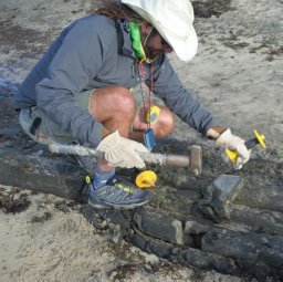 Kevin Norton合作论文数School of Physical Education, Exercise and Sport Studies, University of South Australia8
 Adam P. Young合作论文数Scripps Institution of Oceanography, University of California San Diego8Sophie Horton合作论文数6
 Andrew Watkinson合作论文数School of Environmental Sciences, University of East Anglia;Collaborative Centre for Sustainable Use of the Seas, University of East Anglia;Centre for Environment, Fisheries and Aquaculture Science6
 Robert Nicholls合作论文数School of Engineering, Faculty of Engineering and Physical Sciences, University of Southampton6
 Murray Ford合作论文数School of Environment, Faculty of Science, The University of Auckland6
 P Stansby合作论文数School of Mechanical, Aerospace and Civil Engineering, University of Manchester6
 Simon J. T. Pollard合作论文数School of Management, Cranfield University5
 David M. Kennedy合作论文数School of Geography, Earth and Atmospheric Sciences, Faculty of Science, The University of Melbourne5
 Hurst Martin D合作论文数School of Geosciences, University of Edinburgh5Hiroki Ogawa合作论文数5
 Colin David Woodroffe (Colin Woodroffe)合作论文数School of Earth and Environmental Sciences, University of Wollongong;Faculty of Science, Medicine and Health, University of Wollongong;GeoQuEST Research Centre, University of Wollongong5M. Mokrech合作论文数5
 Sotirios Koukoulas合作论文数Department of Geography, University of the Aegean5
 Andres Payo合作论文数5Jokotola Omidiji合作论文数4Raphael L. Krier-Mariani合作论文数4
 Andrew Allison合作论文数4Judy Lawrence合作论文数4Susan Hanson合作论文数4
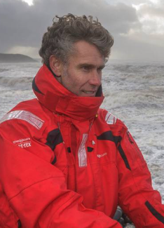 Gerd Masselink合作论文数School of Biological and Marine Sciences, Faculty of Science and Engineering, University of Plymouth4
 Iain Michael Brown合作论文数Department of Geography, University of Aberdeen4Daniel Hikuroa合作论文数3
 Benjamin David Jones合作论文数3Nick Rosser合作论文数3
 Paula Blackett合作论文数3
 Karen Fisher合作论文数School of Environment, Faculty of Science, The University of Auckland3Jason Lowe合作论文数3
 Sarah J. Wakes合作论文数Department of Design Studies;University of Otago;Department of Design Studies, University of Otago3
 Corentin M. Fontaine合作论文数School of GeoSciences, The University of Edinburgh3
 Martin J. Austin合作论文数School of Earth, Ocean and Environmental Sciences, University of Plymouth3
 Nicola Litchfield合作论文数GNS Science3s nicholsoncole合作论文数2j a richards合作论文数2
 Catriona Thompson合作论文数2Emma C. Vann Jones合作论文数2
 Yvonne Sharon Matthews合作论文数2
 Tim Poate合作论文数Coastal Proc Res Grp, Univ Plymouth2
 Yaxiong Shen合作论文数Corresponding author.2Peter Cowell合作论文数School of Geosciences, Faculty of Science, The University of Sydney2
 Simon F. Thrush合作论文数Institute of Marine Science, University of Auckland2




