Accounting for the effects of fire suppression and containment efforts has posed a challenge in wildfire modeling. Fire suppression is a complex phenomenon depending on factors such as resource availability, weather, terrain, and fire suppression priorities in a given place and time. Suppression is an influential factor in wildfire growth though, and should be considered in models. We developed a generalized model of fire containment by utilizing daily reports on size and percent containment of wildfires in the United States. We used this model to support wildfire risk analysis simulations in the Large Fire Simulation System (FSim). The suppression model determines the daily proportion of fire containment as a function of the proportion of the fire's duration that has elapsed and a regression coefficient, or suppression factor. This suppression factor allows differing patterns of fire containment to be represented.In this analysis, we tested the influence of the suppression model on FSim simulations by running simulations in four regions with a range of nine suppression factors, and one simulation run without the suppression model. To test whether the suppression model resulted in fire shapes that were more similar to historical observed fires, we calculated six metrics of shape complexity from the simulated wildfire perimeters. We then compared these shape metrics to shape metrics of the historical wildfire perimeters in each region. This established that the suppression model contributed to closer agreement in shape metrics between simulated and historical fire perimeters, and that the suppression factor where this agreement was maximized differed between simulation areas.
The potential spread and intensity of wildfires can be estimated with fire modelling simulators that produce valuable datasets which can be used during the prevention and suppression stages by fire management agencies. In the absence of observational data for all potential ignition sources, since a fire has not yet occurred or has burned many decades ago, fire behavior algorithms such as the Minimum Travel Time incorporated in the FSim simulator can be used to reveal these hidden fire patterns and trajectories. FSim is widely used in the USA for that purpose and its outputs, i.e., fire perimeters, ignition locations, fire intensity and burn probability are used in numerous assessments and applications, from fireshed delineation and community protection planning to exposure calculations of wildfire risk by the reinsurance industry. However, no country-scale application exists for Europe, due to the previous lack of essential model input data at an adequate spatial resolution (∼100 m), specifically fuel models, canopy base height and canopy bulk density. The EU H2020 funded project “FIRE-RES” filled that gap and produced the necessary input dataset at a pan-European level, enabling the first large scale nationwide stochastic fire behavior modelling application for Greece. The methods can be replicated and the datasets produced and presented in this work can be produced for every continental EU country. After retrieving the necessary spatial datasets from on-line open access repositories, we assembled them to create a landscape file. Greece was divided into 23 Pyromes that are regions with similar vegetation, climate and fire behavior. Then, weather patterns were summarized in a format compatible with FSim using hourly data of air temperature, dewpoint temperature, incident solar radiation, precipitation, and northward and eastward wind components for the years 2000-2021 from the state-of-the-art global reanalysis dataset ERA5-Land. Ignition locations were distributed across each Pyrome using an ignition probability grid, ensuring that we simulated enough fires so that each burnable pixel of the landscape experiences at least one event. Simulations were validated by comparing the historic fire size distribution of each Pyrome with the simulated one. The dataset includes the burn probability and conditional flame length rasters at 100 m spatial resolution, and the 3.65 million fire perimeters and ignition locations in vector format. In addition, we provide those input datasets that are not available in other repositories, specifically the modified fuel models and the ignition probability rasters. The data provided in this article offers a valuable resource for fire management and civil protection agencies, enabling them to understand the fire size potential of each area and the expected burning intensity. In addition, metanalyses of fire perimeters intersecting them with settlement boundary polygons can provide their exposure profiles to inform fuel treatment and community protection plans. Risk profiles may also be produced by linking exposure with expected fire intensity, even at building level, providing useful datasets for insurance purposes and spatial planning.
Our objective in the present study is to provide basic insights into the coupling between external-gas and solid biomass vegetation processes that control the dynamics of flame spread in wildland fire problems. We focus on a modeling approach that resolves processes occurring at vegetation and flame scales, i.e., the formation of flammable vapors due to the thermal degradation of the solid biomass, the subsequent combustion in ambient air, the thermal feedback to the biomass through radiative and convective heat transfer, and the possible transition from flaming combustion (taking place outside of the solid biomass) to smoldering combustion (taking place inside the solid biomass). The capability uses a multiphase combustion framework and treats external-gas processes through a Large Eddy Simulation solver and solid biomass processes through a discrete particle model. The discrete particle model adopts a one-dimensional porous medium formulation, includes descriptions of drying, thermal pyrolysis, oxidative pyrolysis, and char oxidation, as well as a description of the external-gas-to-solid-biomass diffusion of oxygen mass; the discrete particle model thereby provides a treatment of in-depth oxidative processes and allows the simulation of smoldering combustion. The modeling capability is applied to the simulation of fire spread across a surrogate biomass vegetation bed corresponding to a discrete array of cylindrical-shaped, vertically-oriented, pine wood sticks, characterized by a monomodal size distribution, in horizontal flat terrain and under wind-aided conditions. The numerical results demonstrate that the model can simulate successful flaming-to-smoldering transition followed by complete biomass consumption. Novelty and Significance statement: • A new computational model is proposed to simulate wildland fire behavior at high levels of resolution capable of capturing vegetation- and flame-scale phenomena. • Solid biomass vegetation processes are treated using a discrete particle model that features a porous medium formulation and includes a description of in-depth oxygen mass diffusion, and exothermic oxidative pyrolysis and char oxidation reactions. • The computational model is shown to be capable of simulating the transition from flaming to smoldering combustion, often observed in wildland fire spread problems.
Large and downed woody fuels remaining behind a wildfire’s flame front tend to burn in a smoldering regime, producing large quantities of toxic gases and particulate emissions, which deteriorates air quality and compromises human health. Smoldering burning rates are affected by fuel type and size, the amount of oxygen reaching the surface, and heat losses to the surroundings. An external wind has the dual effects of bringing fresh oxidizer to the fuel surface and porous interior, while at the same time enhancing convective cooling. In this work, a series of experiments were conducted on single and adjacent poplar dowels to investigate the effect of fuel geometry and wind speed on smoldering of woody fuels, including its burning rate and combustion products. Dowels had variable thickness (19.1 and 25.4 mm), aspect ratios, and arrangement (number of dowels and spacing between them). Using measurement of mass loss, CO, and HC production as indicators of the smoldering intensity, the results indicate that the arrangement of smoldering objects significantly affects burning rates and emissions. Specifically, spacings of 1/8 and 1/4 of the dowel thickness enhanced the smoldering process. The smoldering intensity was also enhanced by increased external wind (ranging between 0.3 m/s and 1.5 m/s), but its effect was dependent upon the spacing between the dowels. The convective losses associated with the spacing were further investigated with a simplified computational model. The simulations show that the wind significantly increases convective losses from the smoldering surfaces, which in turn may offset the increase in smoldering intensity related to the higher oxygen flux at higher wind speeds.
Our objective in the present study is to provide fundamental insights into the main factors that control the thermal degradation processes occurring inside the biomass vegetation during wildland fire spread. These processes determine the formation of flammable volatiles through pyrolysis reactions and the intensity of the internal heat release through char oxidation reactions; both aspects are central to flaming and smoldering combustion. We adopt here a simplified framework in which the biomass vegetation is viewed as a population of discrete elongated particles that are made of pine wood, are cylindrical-shaped and feature different diameters. The exposure conditions experienced by these particles in an assumed fire are characterized by a given intensity of the external thermal load, a given duration during which this load is applied, and a given external flow velocity that controls the rates of convective heat transfer and oxygen mass transfer. The response of the biomass particles is studied using a one-dimensional computational model, called the particle burning rate (PBR) model. The PBR model adopts a porous medium formulation, and provides a description of drying, (thermal and oxidative) pyrolysis, and char oxidation. We focus in the present study on the conditions required for complete "fuel consumption", i.e., for complete particle degradation from virgin solid to ash. It is found that in thin biomass particles, complete biomass degradation requires sufficiently high intensities of the external thermal load and sufficiently low external flow velocities; high flow velocities correspond to excessive cooling effects. Similarly, in thick biomass particles, complete biomass degradation requires sufficiently high intensities of the external thermal load, sufficiently long application times of the thermal load, and sufficiently high external flow velocities; low flow velocities correspond to insufficient oxygenation of the (exothermic) oxidative pyrolysis and char oxidation reactions.
ABSTRACT The current study presents a series of experiments investigating the smoldering behavior of woody fuel arrays at various porosities under the influence of wind. Wildland fuels are simulated using wooden cribs burned inside a bench scale wind tunnel. Smoldering behavior was characterized using measurements of both mass loss and emissions. Results showed that the mean burning rate increased with wind speed for all cases. In high porosity cases, increases in burning rate between 18% and 54% were observed as wind speed increased. For low porosity cases an increase of about 170% in burning rate was observed between 0.5 and 0.75 m/s. The ratio of CO/CO2 emissions decreased with wind speed. Thus, wind likely served to promote smoldering combustion as indicated by the decrease of CO/CO2 which is a marker of combustion efficiency. A theoretical analysis was conducted to assess the exponential decay behavior in the time-resolved mass loss data. Mass and heat transfer models were applied to assess whether oxygen supply or heat losses can solely explain the observed exponential decay. The analysis showed that neither mass transfer nor heat transfer alone can explain the exponential decay, but likely a combination thereof is needed.
Wildfire spread models that couple physical transport and chemical kinetics sometimes simplify or neglect gas-phase pyrolysis product oxidation chemistry. However, empirical evidence suggests that oxygen (O2) is available for gas-phase and solid-phase combustion within the flaming reaction zone. This study addresses outstanding questions of O2 availability by directly measuring O2 concentrations near fuel surfaces within spreading fuel bed fires for the first time. Temporally and spatially resolved O2 concentrations within laboratory fires were investigated using uniform fuel beds of medium density fiberboard (MDF) and cardboard (CB) combs at various packing ratios (β) and angles. Minimum O2 concentration reached approximately 2–5 mol
Dimensionality reduction simplifies high-dimensional data into a small number of representative patterns. One dimensionality reduction method, principal component analysis (PCA), often selects oscillatory or U-shaped patterns, even when such ...Principal component analysis (PCA) is a dimensionality reduction method that is known for being simple and easy to interpret. Principal components are often interpreted as low-dimensional patterns in high-dimensional space. However, this simple ...
<p>Wildland fires have been increasing in size, frequency and intensity during recent decades, affecting entire ecosystems and societies even in regions historically not considered fire prone. Some of those fires display dynamics of extreme fire behaviour, which chaotic and large-scale nature make them challenging to study. Thus, there is a need of new methodologies for wildland fire analysis, capable of capturing spatiotemporal characteristics suitable for this application. This work presents two applications of the image velocimetry technique applied to wildland fires, offering new details on the morphology and structure of large-scale medium-intensity prescribed shrubland fires, as well as an outlook on new applications in more complex scenarios. Fire flow displacement vectors and streamlines were calculated and mapped from a high-resolution overhead visible-spectrum (RGB) video acquired during a four-hectare prescribed gorse fire. This method allowed for identification of spatially interleaved flow convergence and divergence regions, providing insight on the high-level structure of the fire front and flaming zone. The method was further expanded to identify what we refer to as &#8220;fire sweeps&#8221;, via the application of a 2D convolution operation on the displacement vector based upon a kernel carefully designed to highlight the characteristics highly divergent fire flows.</p>
The 2022 summer fire in the Bohemian Switzerland National Park (BSNP) is the largest in the 30-year recorded history of the Czech Republic, with an affected area of over 1000 ha. The FlamMap fire modeling system was used to investigate the fire behavior in the BSNP and to evaluate scenarios under a range of fuel types, fuel moistures, and weather conditions. The model was used to simulate fire conditions, propagation, and extent. We focused on matching the observed fire perimeter and fire behavior characteristics. The fire occurred in a region of the BSNP heavily affected by Spruce bark beetle (Ips typographus L.) infestation; hence, most of the burned area encompassed dead spruce forest (Picea abies Karst.). The best FlamMap simulations of the observed fire behavior and progression were compared with several created scenarios exhibiting various input conditions. These scenarios included a fire in a healthy spruce forest, clearcuts, or different meteorological conditions. We could calibrate and use FlamMap to recreate the 2022 summer wildfire in the BSNP under the observed conditions. It was found that the fire would have likely spread to the observed final perimeter even if standing dead trees had been removed, albeit at a lower fire intensity and with a considerably shorter duration. Alternatively, if healthy standing vegetation with a closed canopy had been present, the wildfire perimeter would have reached approximately half the observed value. Similar results were obtained for both the non-native spruce forest and deciduous forest, which is a native alternative.
The effects of radiation and convection in determining the heating that leads to ignition of fuel particles were explored using experiments with spreading laboratory fires and a numerical fuel particle heating model. As a follow-on to "Fuel Particle Heat Transfer, Part 1" (this issue), two sizes of square wood fuel particles (1 mm and 12 mm) were instrumented with fine-wire thermocouples to measure particle surface temperatures and adjacent gas temperatures. Radiation heat flux from the approaching fire was measured at the fuel bed particle location. Seven laboratory fires with varying fuel beds, spread rates, and wind speeds were used to measure the conditions experienced by both particles. Experimental results demonstrated that intermittent flame contact ahead of the advancing flame front was principally responsible for heating fuel particles to ignition even with peak irradiance up to 44 kW/m(2). A two-dimensional numerical fuel particle heat transfer model was employed to separate the influences of the measured irradiance (radiation) and gas temperature (convection) on particle heating as the flame front approached. Results demonstrated that radiation heating was insufficient for ignition of both particle sizes during the spreading laboratory fires. The low convective heat transfer of the 12 mm particle did not significantly cool the particle, and the brief duration of irradiance was insufficient for ignition. The greater 1 mm particle convective heat transfer offset radiant heating by convectively cooling with ambient air, but rapidly heated the particle during intermittent impingement of hot gases from the flaming front leading to particle pre-ignition.
Wildfire spread requires fuel particles heated to ignition but the roles of radiation and convection heat transfer have not before been examined in detail. This paper reports on laboratory experiments and numerical modeling of wood particle response when subjected to a fixed radiant flux. The experiments used a propane-fueled radiant panel with an elliptical mirror system to focus a constant radiant flux on fuel particles of different sizes and cross-sectional shapes. Particle temperature was measured with fine-wire thermocouples embedded on the surface. Particle heating during free and forced convection with ambient air was found to depend on particle size, specifically the convective length of the irradiated surface. Ambient convection cooled 1 mm square particles sufficiently to prevent ignition but not 3 mm particles and larger. Surface area-to-volume ratio did not govern particle surface heating but did determine a particle's thermal response rate. A finite difference, numerical method was developed to solve a two-dimensional, transient conduction model with radiative and convective boundary conditions. Model results were reliable when compared to experimental results and confirmed particle surface length (convection) as a principal determining factor governing fuel particle heating and fuel particle ignition.
Background Previously established correlations of flame length L with fireline intensity IB are based on theory and data which showed that flame zone depth D of a line fire could be neglected if L was much greater than D. Aims We evaluated this correlation for wildland fires where D is typically a non-negligible proportion of L (i.e. roughly L/D < ~2). Methods Experiments were conducted to measure flame length L from line-source fires using a gas burner where IB and D were controlled independently (0.014 ≤ L/D ≤ 13.6). Key results The resulting correlation showed D significantly reduced L for a given IB over the entire range of observations and was in accord with independent data from spreading fires. Flame length is reduced because the horizontal extent of deep flame zones entrains more air for combustion than assumed by theory involving only the vertical flame profile. Conclusions Analysis suggested that the noted variability among published correlations of L with IB may be partly explained by varying L/D ratios typical of wildland fires. Implications Fire behaviour modelling that relies on correlations of L with IB for scaling of heat transfer processes would likely benefit by including the effects of D.
<p><span>Wildfires are increasing in intensity, frequency, and occurring earlier and later than normal on the seasonal timeline. Coupled atmosphere-flame-fuel dynamics makes wildfire a difficult phenomenon to understand and predict across its temporal and spatial spectrum of scales. This is especially true at the turbulence scale where rapid fluctuations of near-surface wind velocity and temperature within the atmosphere-fire boundary layer can control fire spread rates and extreme fire behavior. Appropriate observations from wildfires suitable for process-based investigations of coupled atmosphere-fire boundary layer dynamics do not exist, instead experimentally controlled fire burns are usually carried out. These experiments rely on repeated short-term wind driven fires that are usually restricted to certain meteorological regimes. Experimental design remains a challenging endeavor, which still lacks spatially coherent ambient and fire-induced atmospheric observations for understanding coupled dynamics. We have carried out several experimental fire burns in New Zealand for short stubble wheat and more dense and higher gorse shrubs. Our observations covered fuel properties, atmospheric turbulence, and flaming zone behavior. We have used uncrewed aerial vehicles carrying high speed infrared and visible video cameras, along with in-situ eddy covariance towers for ambient and fire-induced turbulence heat and momentum measurements. Some methodological highlights include the combination of image processing techniques, fuel density maps from aerial Lidar, and atmospheric turbulence structure analysis. We present a synthesis of research findings over the last two observational campaigns and introduce our new objectives for the upcoming crown fire forest canopy fire experiments. In addition, we discuss large eddy simulations of carefully designed numerical experiments allowing for a better understanding of the fire-atmosphere energetics at the atmospheric boundary layer scales.</span></p>
Complex interactions between fuel structure and fire highly affects the fire spread efficiency and localized behaviour. Heterogeneous arrangement of the fuel coupled with variability in fuel characteristics can strengthen or hinder heat transfer efficiency, preheating of unburned fuel and consecutive ignition. In this study, we leverage recently developed non-intrusive unmanned aerial vehicle-based (UAV) methods to spatially resolved field-scale fire behaviour properties and compare them with the Canopy Height Model (CHM) derived from pre-burn lidar measurements. Rate of spread and flaming residence time are calculated and mapped from high-resolution overhead visible footages acquired during a four-hectare prescribed gorse fire. The proposed method allows for quantification of the influence of fuel structure spatial variation on fire behaviour properties by capturing localized fire front and burning time variations associated with negative (“gapsâ€) and positive (“bumpsâ€) changes in canopy height. These findings are supported by results obtained from a novel fire flow visualization method based upon image velocimetry, described here for the first time. Complex fire flow is synthetised via 2D time-averaged motion streamlines and compared with CHM fuel structure. Results suggest that localized fire behaviour changes may be related to flow channelling effects induced by the presence of gaps, enhancing fire flow contact and overall heat transfer efficiency.
Our general objective in the present study is to develop tools to better describe the coupling between solid phase and gas phase processes that control the dynamics of flame spread in wildland fire problems. We focus on a modelling approach that resolves processes occurring at flame scales, i.e., the formation of flammable vapors from the biomass vegetation due to pyrolysis, the subsequent combustion of these fuel vapors with ambient air, the establishment of a turbulent flow because of heat release and buoyant acceleration, and the thermal feedback to the solid biomass through radiative and convective heat transfer. The modelling capability is based on a general-purpose Computational Fluid Dynamics (CFD) library called OpenFOAM and an in-house Lagrangian particle model that treats drying, thermal pyrolysis, oxidative pyrolysis and char oxidation using a one-dimensional porous medium formulation that allows descriptions of thermal degradation processes occurring during both flaming and smoldering combustion. The modelling capability is calibrated for pine wood and is first applied to simulations of fire spread across a surrogate vegetation bed corresponding to thin, monodisperse, cylindrical-shaped sticks of pine wood with prescribed particle and environmental properties (i.e., bed height, surface-to-volume ratio, packing ratio, moisture content, and wind velocity). While the model can be used in sloped terrain, the present simulations are limited to a flat ground surface. The current emphasis is on determining threshold conditions for successful spread, differences between the plume-dominated and wind-driven flame regimes, possible transitions to a steady or time-dependent flame structure, and differences in the relative weights of the flaming and smoldering regions.
While previously disputed as a plausible ignition source, civilian firearms use has emerged as a wildfire cause of concern in the United States (US). The National Wildfire Coordinating Group (NWCG) included it as a newly recognized fire cause in the wildfire-reporting data standard approved in 2020. Here we report on shooting-caused wildfire ignitions using data mapped over to the new NWCG cause standard from historical wildfire records spanning 1992–2018. This is the first time that data on shooting-related fires have been assembled and summarized for the US, with the intention of raising awareness concerning this relatively small but impactful cause of preventable wildfires.
The TreeMap 2016 dataset provides detailed spatial information on forest characteristics including number of live and dead trees, biomass, and carbon across the entire forested extent of the continental United States at 30 x 30m resolution, enabling analyses at finer scales where forest inventory is inadequate. We used a random forests machine learning algorithm to assign the most similar Forest Inventory Analysis (FIA) plot to each pixel of gridded LANDFIRE input data. The TreeMap 2016 methodology includes disturbance as a response variable, resulting in increased accuracy in mapping disturbed areas. Within-class accuracy was over 90% for forest cover, height, vegetation group, and disturbance code when compared to LANDFIRE maps. At least one pixel within the radius of validation plots matched the class of predicted values in 57.5% of cases for forest cover, 80.0% for height, 80.0% for tree species with highest basal area, and 87.4% for disturbance. A new feature of the dataset is that it includes linkages to select FIA data in an attribute table included with the TreeMap raster, allowing users to map summaries of 21 variables in a GIS. TreeMap estimates compared favorably with those from FIA at the state level for number of live and dead trees and carbon stored in live and dead trees.Study Implications: TreeMap 2016 provides a 30 x 30 m resolution gridded map of the forests of the continental United States. Attributes of each grid cell include a suite of forest characteristics including biomass, carbon, forest type, and number of live and dead trees. Users can readily produce maps and summaries of these characteristics in a GIS. The TreeMap also includes a database containing, for each pixel, a list of trees with the species, diameter, and height of each tree. TreeMap is being used in the private sector for carbon estimation and by land managers in the National Forest system to investigate questions pertaining to fuel treatments and forest productivity as well as Forest Plan revisions.
Large, severe wildfires continue to burn in frequent-fire adapted forests but the mechanisms that contribute to them and their predictability are important questions. Using a combination of ground based and remotely sensed data we analyzed the behavior and patterns of the 2020 Creek Fire where drought and bark beetles had previously created substantial levels of tree mortality in the southern Sierra Nevada. We found that dead biomass and live tree densities were the most important variables predicting fire severity; high severity fire encompassed 41% of the area and the largest high severity patch (19,592 ha) comprised 13% of total area burned. Areas with the highest amounts of dead biomass and live tree densities were also positively related to high severity fire patch size indicating that larger, more homogenous conditions of this forest characteristic resulted in adverse, landscape-scale fire effects. The first two days of the Creek Fire were abnormally hot and dry but weather during the days of the greatest fire growth was largely within the normal range of variation for that time of year with one day with lower windspeeds. From September 5 to 8th the fire burned almost 50% of its entire area and fire intensity patterns inferred from remotely sensed brightness-temperature data were typical except on September 6th when heat increased towards the interior of the fire. Not only was the greatest heat concentrated away from the fire perimeter, but a significant amount of heat was still being generated within the fire perimeter from the previous day. This is a classic pattern for a mass fire and the high amount of dead biomass created from the drought and bark beetles along with high live tree densities were critical factors in developing mass fire behavior. Operational fire behavior models were not able to predict this behavior largely because they do not include post-frontal combustion and fire-atmosphere interactions. An important question regarding this mass fire is if the tree mortality event that preceded it could have been avoided or reduced or was it within the natural range of variation for these forests? We found that the mortality episode was outside of historical analogs and was exacerbated by past management decisions. The Creek Fire shows us how vulnerable of our current frequent-fire forest conditions are to suffering high tree mortality and offering fuel conditions capable of generating mass fires from which future forest recovery is questionable because of type conversion and probable reoccurring high severity fire.
We demonstrate the use of a deep learning (DL) approach for representing the behavior of a high-resolution physics-based wildland fire spread model. The ultimate objective is being able to efficiently use the DL model for intensive simulations of large fires while retaining fidelity to the fine-scale physical processes. We begin with a fire model that reduces the spatial domain of the fire spread problem to one dimension (1D). The 1D model explicitly resolves cm-scale fuel variations, heat transfer and heating/drying dynamics of individual fuel particles and burning behavior of the bed. We then ran the fire model for 78,125 factorial combinations of fuel, weather, and topographic conditions as training data for the DL algorithm. The results of the DL analysis show overall agreement of 96% of the variation in fire behavior as represented by steady state rate of spread, flame length and flame zone depth. Exceptions to the DL regression indicate areas where more work is required in refining the resolution in training cases and use of advanced methods of embedding the fire model inside the DL algorithm loop.
 Alan Ager合作论文数Department of Forest Engineering, Resources & Management, College of Forestry, Oregon State University;Rocky Mountain Research Station, Missoula Fire Sciences Laboratory;Department of Natural Resources, Forest Research Centre, School of;Agriculture, University of Lisbon42
 Jason Forthofer合作论文数Forest Service;Rocky Moun - tain Research Station;Fire Sciences Laboratory23
 Sara Mcallister合作论文数university of california berkeley22
 Isaac C. Grenfell合作论文数Missoula Fire Sciences Laboratory, USDA Forest Service21
 Charles W. Mchugh合作论文数Missoula Fire Sciences Laboratory, USDA Forest Service18Jack D. Cohen合作论文数16
 Karin L. Riley合作论文数Systems for Environmental Management, PO Box 8868, Missoula, MT 59802, USA15
 Matthew P. Thompson合作论文数Pyrologix13
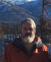 David E. Calkin合作论文数Rocky Mountain Research Station, USDA Forest Service12
 Short Karen合作论文数Fire Sciences Laboratory, Rocky Mountain Research Station10
 R Stratton合作论文数10
 William M. Jolly合作论文数Fire Sciences Laboratory, Rocky Mountain Research Station, US Forest Service9
 Michael Gollner合作论文数Department of Mechanical Engineering , University of California, Berkeley9
 Larry Bradshaw合作论文数9
 Bret W. Butler合作论文数US Forest Service8
 Michele Salis合作论文数Department of Economics and Woody Plant Ecosystems;University of Sassari;Department of Economics and Woody Plant Ecosystems, University of Sassari8
 Bachisio Arca合作论文数8
 Donatella Spano合作论文数8Torben P. Grumstrup合作论文数7Dave E Calkin合作论文数7
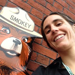 Nicole M. Vaillant合作论文数Western Wildland Environm Threat Assessment Ctr, USDA7Joe H. Scott合作论文数6
 Craig B. Clements合作论文数 Fire Weather Research Laboratory, United States
6Grant Pearce合作论文数5
Craig B. Clements合作论文数 Fire Weather Research Laboratory, United States
6Grant Pearce合作论文数5 Robert E. Keane合作论文数US Forest Service Rocky Mountain Research Station Missoula Fire Sciences Laboratory5
 Scott Stephens合作论文数Department of Environmental Science, Policy, and Management, Rausser College of Natural Resources, University of California, Berkeley5
 Marwan Katurji合作论文数Centre for Atmospheric Research, University of Canterbury5
 Kostas Kalabokidis合作论文数Department of Geography, University of the Aegean5Tara Strand合作论文数4
 Andres Valencia Correa合作论文数Dept Civil & Nat Resources Engn, Univ Canterbury4
 Colin H. Miller合作论文数College Pk, Univ Maryland4
 Brandon Collins合作论文数Department of Environmental Sciences, Policy and Management, Rausser College of Natural Resources, University of California, Berkeley;Forest Biology Research Center4
 Arnaud Trouvé合作论文数Department of Fire Protection Engineering, A. James Clark School of Engineering, University of Maryland4Julie W. Gilbertson-Day合作论文数4
 Valentina Bacciu合作论文数CNR - IBIMET, Institute of Biometeorology, Sassari, Italy4
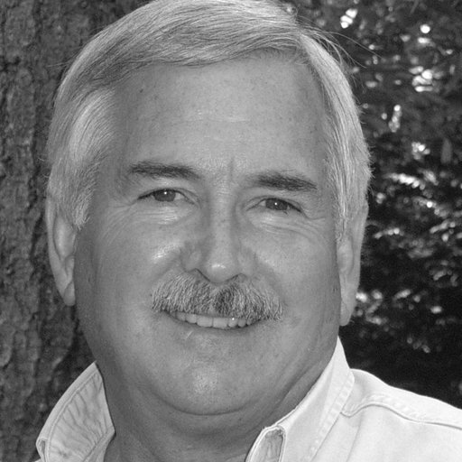 James K Agee (James Agee)合作论文数School of Environmental and Forest Sciences, University of Washington4
 Carol Miller合作论文数4Robert C. Seli合作论文数4Evan Sluder合作论文数3Jason M. Wiener合作论文数3Jiawei Zhang合作论文数3
 Daniel J. Gorham合作论文数Insurance Inst Business Home Safety3
 Mohamed Mohsen Ahmed合作论文数Department of Fire Protection Engineering, University of MarylandCollege Park3
 Kevin C. Vogler合作论文数College of Forestry, Oregon State University3
 Wei Tang合作论文数University of Science and Technology of China, Univ. of Sci. and Technol. of China3
 Dillon Gregory K合作论文数3L Bradshaw合作论文数3Patricia L. Andrews合作论文数3
 Kozo Saito合作论文数Department of Mechanical Engineering, University of Kentucky3




