Information on the contribution of offshore oil and gas (O &G) platforms to fish productivity is required to contribute to the decision -making process to remove, partially remove, or retain these structures during decommissioning after petroleum production ceases. The present study assesses the biomass and fish production of one common and abundant fish species ( Caesioperca lepidoptera - butterfly perch) and two commercially fished species ( Helicolenus percoides - reef ocean perch; Nemadactylus macropterus - jackass morwong) on eight O &G platforms and in surrounding natural habitats in the Bass Strait, south-east Australia, where options for decommissioning are being assessed. High -definition stereo -video imagery was collected by remotely operated vehicle (ROV) from eight platform facilities, their immediate benthic surrounds, reference areas reflective of the likely pre -installation seabed state (sand -dominated) and a nearby natural 'reef ' area referred to as south-east reef (some limestone foundation). The biomass of all three species was low in the benthic surrounds of platforms, at reference locations and at south-east reef where minimal cover by benthic organisms was recorded and, as such, there was little to no fish production for the three study species in these areas. We observed a total fish biomass of 2.85 tonnes across the eight platforms for the three fish species surveyed, with high variability across platforms. Total production (P) across all platforms was estimated at 1244 kg/year for the three species, with a mean fish production density of 82 g/m(2) /year. Approximately 79% of total production is considered 'new ' production (984 kg/year i.e., the production attributed to the presence of the platforms; with a mean production density of 64 g/m(2) /year). The remaining 21% could be retained or redistributed into the surrounding area if platforms were removed. C. lepidoptera accounted for the majority (90%) of biomass and of total production for all three species across all locations surveyed. Despite only accounting for a small proportion of platform surface area, the bottom 5 m sections of platforms had 41% of the total biomass observed and accounted for 46% of total production of these three study species. Production measures for platforms surveyed here are relatively high compared to other artificial reefs and habitats around the world. Total removal of these platforms will likely result in a reduction of fish biomass and fish productivity (incl. several fishery species) in the immediate vicinity.
This dataset is the output of a long term multi-resolution calibrated hydrodynamic model of Bass Strait waters in south-eastern Australia. The model is 3 dimensional with 16 sigma layers. It is forced by tides, wind, non-tidal sea level variability as well as salinity and temperature through a nudging scheme. The model was calibrated against existing data from previous fixed location instrument deployments and hull mounted ADCP data. While the model has limitations, it performs well against measured data and provides a useful tool for describing spatially varying currents throughout East Victorian waters.
Key ecological features (KEFs) are elements of Australia's Commonwealth marine environment considered to be important for biodiversity or ecosystem function, yet many KEFs are poorly researched, which can impede effective decision-making about future development and conservation. This study investigates a KEF positioned over the Last Glacial Maximum (LGM) shoreline on the northwest shelf of Australia (known as the 'Ancient Coastline at ~125m depth contour'; AC125). Seafloor bathymetry, sedimentology and benthic habitats were characterised within five study areas using multibeam sonar, sediment samples and towed video imagery. Direct evidence for the existence of a palaeoshoreline formed during the LGM was not found, however candidate areas to find palaeoshoreline material at or just below the modern seabed were discovered. Approximately 98% of the seabed surveyed was comprised of unconsolidated soft sediment habitat (mud/sand/silt) supporting negligible epibenthic biota. The prevalence of soft sediment suggests that post-glacial sediments have infilled parts of the palaeoshoreline, with cross-shelf, probably tidal currents in the northern section of the study area responsible for some of the sediment mobilisation and southern study areas more influenced by oceanic conditions. Within study areas, total biotic cover ranged from 0.02% to 1.07%. Of the biota encountered, most comprised filter feeder organisms (including gorgonians, sponges, and whip corals) whose distribution was associated with pockets of consolidated hard substrate. Benthic community composition varied with both study area and position in relation to the predicted AC125. In general, consolidated substrate was proportionally higher in water shallower than the AC125 compared to on the AC125 or deeper than the AC125. Spatially continuous maps of predicted benthic habitat classes (pre-determined benthic communities) in each study area were developed to characterise biodiversity. Spatial modelling corroborated depth and large-scale structural complexity of the seafloor as surrogates for predicting likely habitat class. This study provides an important assessment of the AC125 and shows that if a distinct coastline exists in the areas we surveyed, it is now largely buried and as such does not provide a unique hard substrate habitat. However, much work remains to fully locate and map the ancient coastline within the vast region of the AC125 and additional surveys in shallow waters adjacent to the AC125 may identify whether some sections lie outside the currently defined KEF.
Regional patterns of fish diversity, abundance, distribution, and assemblage composition are driven by a combination of biotic and abiotic conditions in the marine environment, but these conditions can be altered through anthropogenic activities, such as those associated with oil and gas extraction. The present study utilises data on fish relative abundance and diversity obtained from 1546 baited remote underwater video deployments conducted between 2004 – 2019 in depths of 9 – 170 m across 2000 km of coastline in north-west Australia on natural habitats and subsea pipelines to understand the influence of oil and gas infrastructure on fish assemblages. A total of 450 fish taxa from 56 families was observed, with populations dominated by generalist and invertebrate carnivore taxa. At the regional scale, subsea pipelines had lower diversity (lower taxonomic richness) than natural environments, but possessed a higher abundance of piscivorous and herbivorous fish taxa. Clear patterns in fish assemblage composition were observed in multivariate analyses, reflecting the proximity of oceanic shoals and banks, depth, and to a lesser extent, oil and gas infrastructure. Shallow-water and close to shoals assemblages were characterised by a diversity of site-attached (e.g., wrasses, tuskfish), reef-associated taxa (e.g., emperors). Mesophotic fish assemblages were characterised by commercially important (e.g., goldband snapper), wide-ranging (e.g., sharks) and sand-affiliated (e.g., toadfish, threadfin bream) taxa. Proximity to pipelines and platforms ranked low as predictors in the multivariate analyses suggesting a negligible regional influence of these structures on fish communities in comparison to depth and shoal habitats. Local-scale influences of subsea infrastructure, however, may be important for some fish species (infrastructure vs. immediate surrounds). Our study highlights the influence of abiotic factors on regional-scale patterns in fish assemblage structure across north-west Australia.
Subsea pipelines and wells installed to support the oil and gas industry represent some of the most extensive and numerous anthropogenic structures throughout global marine ecosystems. There remains a paucity of information on the habitat value of these structures for fishery target species and, as a result, little understanding of how decommissioning should be conducted to minimise impacts to populations of these economically and socially important species. We assess the diversity and abundance of species that are targets of recreational and commercial fisheries on 33 subsea wells and 17 pipelines across the tropical northwest and temperate southeast marine regions of Australia. We examine relationships between fish identity and abundance and a range of environmental (e.g., depth, location), infrastructure-specific (e.g., pipeline position, diameter, age, length of pipeline, height of well, position on well), and biological (% cover of epibiota) variables using video filmed by remotely operated vehicles during their routine offshore inspection and maintenance campaigns. A total of 100 fishery target species were observed across subsea well and pipeline infrastructure, 56 species uniquely observed on pipelines and nine unique to wells. The families Lutjanidae (snapper), Serranidae (rock cods, groupers, perch), and Carangidae (trevallies) were most common and abundant on both wells and pipelines. In the northwest, lutjanids were most abundant around the base of wells, in shallow depths, on shorter wells, and where pipelines spanned the seafloor. A greater number of fishery target species and abundance of ocean perch ( Helicolenus spp.) were also associated with pipelines that spanned the seafloor in temperate southeast Australia. The combined biomass of three species of snapper on wells in the northwest was 1,270 kg, with production levels for these species on each well estimated to be 105.2 g m 2 year -1 . The present study serves as an important reference point for informing decommissioning decisions for pipeline and well infrastructure and demonstrates the utility of industry-held data for science. We suggest that key predictor variables identified here be incorporated into comprehensive before-after-control-impact scientific studies for specific fields/assets to enable the prediction of potential impacts of decommissioning scenarios on marine communities present and quantification of such impacts after the decommissioning activity has occurred.
Novel tools and methods for monitoring marine environments can improve efficiency but must not compromise long-term data records. Quantitative comparisons between new and existing methods are therefore required to assess their compatibility for monitoring. Monitoring of shallow water coral reefs is typically conducted using diver-based collection of benthic images along transects. Diverless systems for obtaining underwater images (e.g. towed-cameras, remotely operated vehicles, autonomous underwater vehicles) are increasingly used for mapping coral reefs. Of these imaging platforms, towed-cameras offer a practical, low cost and efficient method for surveys but their utility for repeated measures in monitoring studies has not been tested. We quantitatively compare a towed-camera approach to repeated surveys of shallow water coral reef benthic assemblages on fixed transects, relative to benchmark data from diver photo-transects. Differences in the percent cover detected by the two methods was partly explained by differences in the morphology of benthic groups. The reef habitat and physical descriptors of the site—slope, depth and structural complexity—also influenced the comparability of data, with differences between the tow-camera and the diver data increasing with structural complexity and slope. Differences between the methods decreased when a greater number of images were collected per tow-camera transect. We attribute lower image quality (variable perspective, exposure and focal distance) and lower spatial accuracy and precision of the towed-camera transects as the key reasons for differences in the data from the two methods and suggest changes to the sampling design to improve the application of tow-cameras to monitoring.
AIMS undertook field work at Scott Reef in October 2014 to monitor benthic and fish communities in accordance with an on-going Co-investment Agreement with Woodside Energy Ltd (WEL). The Scott Reef Research Project (SRRP) has been running for the past 20 years, and as such, is one of the longest running and most comprehensive studies of coral reef ecosystems in the world, providing unique and valuable insights into tropical coral reef ecology. The scope of the most recent field trip ('SRRP 2014') included on-going long-term monitoring of shallow water coral and fish communities, as well as deployment and recovery of temperature loggers and recovery of sediment traps. All data collection as completed at Scott Reef in October 2014 as outlined in the co-investment contract, of which the analyses and results are presented herein. This 2014 report aims to combine the most recent 2014 data with historic data to answer several key questions relating to benthic and fish communities at Scott Reef, which are: - What was the recent disturbance history for 2012-2014 at Scott Reef and how has this affected coral and fish communities? - Have coral and fish communities recovered from the recent monsoonal storm and cyclone in 2012? - Has community recovery varied among LTM locations? - How are coral and fish communities structured now compared to before the mass coral bleaching in 1998? - What are the key processes underlying recovery of coral and fish communities? - How resilient are communities at Scott Reef in light of the current disturbance regime?
The Australian Institute of Marine Science (AIMS), in partnership with Woodside Energy Ltd (Woodside), established permanent long-term monitoring (LTM) sites at the Rowley Shoals reef system in 1994, to quantify spatial and temporal patterns in benthic and reef fish communities. The Rowley Shoals is located approximately 260 km west, north-west of Broome near the edge of the continental shelf, and consists of three reef atolls (Mermaid, Clerke, & Imperieuse), 30 to 40 km apart. AIMS has lead ten research trips to the Rowley Shoals, of which the most recent was in 2013.This report presents the results of the most recent trip in the context of previous work, summarising the temporal patterns in coral and fish communities at reef slope sites from 1994 to 2013, examining differences in coral and fish communities among reef slope and lagoon habitats in 2013, and providing a comparison of the fish communities sampled with Underwater Visual Census (UVC) and Baited Remote Underwater Video Systems (BRUVS™) at the same habitats in 2013.
Rankin Bank and Glomar Shoal shoals are situated 147 km North West and 93km North, respectively, of the Dampier Archipelago in North Western Australia. They are the only large, complex bathymetrical features on the outer western shelf of the West Pilbara. Rankin Bank rises steeply from 120m depth along its north eastern margin and in all other quadrants it rises above the surrounding continental shelf from approximately 80m depth. The main body of the shoal takes the form of several highly complex and rugose peaks and plateaus, reaching 20-40m below the sea surface. In comparison, the much larger Glomar Shoal riseson all sides from 80m depth and, as a whole, shallows more gradually to include a plateau region lying within 40m of the surface. At the 60m depth contour Glomar Shoal covers an area of 14699.6 hectares, which is approximately 8.5 times larger than Rankin Bank which covers an area of 1721.5 hectares.The shoals were surveyed from the Australian Institute of Marine Science (AIMS) Research Vessel, RV Solander, using multibeam equipment and technicians provided by Fugro Survey Pty Ltd, during August - September 2013. For both shoals, continuous coverage bathymetry, rugosity digital elevation and terrain models were produced. These data were then used to ensure key areas of depth, aspect and slope were sampled during the subsequent biodiversity sampling cruise in September 2013. Data on biota was collected using underwater towed cameras for benthic habitat assessment and stereo baited remote underwater video stations (SBRUVS) to sample fish. In addition, seabed surface sediments were collected around each shoal, using a grab sampler, and analysed for grain size and chemical composition.
 Ben Radford合作论文数Australian Institute of Marine Science7Jamie Colquhoun合作论文数5
 Speed Conrad W合作论文数Australian Inst Marine Sci5
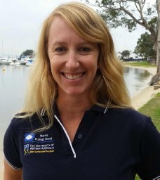 McLean Dianne L合作论文数UWA Oceans Institute and School of Biological Sciences (M470), University of Western Australia4
 Rebecca Fisher合作论文数Australian Institute of Marine Science4
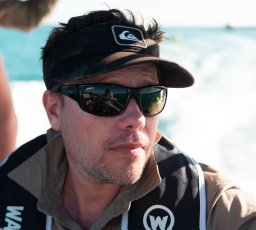 James P. Gilmour合作论文数Australian Institute of Marine Science, The University of Western Australia4Brigit Vaughan合作论文数3Matthew J. Birt合作论文数Indian Ocean Marine Research Centre, The Australian Institute of Marine Science3
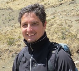 Ronen Galaiduk合作论文数Indian Ocean Marine Res Ctr IOMRC, Australian Inst Marine Sci3Andrew Heyward合作论文数3Tinkler Paul合作论文数3Marcus Stowar合作论文数Australian Institute of Marine Science3
 Martial Depczynski合作论文数Centre for Coral Reef Biodiversity;Department of Marine Biology;James Cook University;Centre for Coral Reef Biodiversity, James Cook University3Marji Puotinen合作论文数3
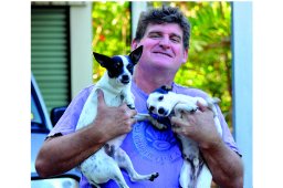 Mike Cappo合作论文数Australian Institute of Marine Science3
 M.D. Taylor合作论文数UWA Oceans Inst, Univ Western Australia2
 Todd Bond合作论文数Oceans Institute, The University of Western Australia2
 Karen J. Miller合作论文数UCLA2
 Nicole M Ryan合作论文数School of Medicine and Public Health, The University of Newcastle;Hunter Hospital, Hunter Medical Research Institute;School of Medicine and Public Health, The University of Newcastle2Mary Wakeford合作论文数2Mark Chinkin合作论文数1William Nicholas合作论文数1
 Laura Fullwood合作论文数1
 Damon Driessen合作论文数1Mathew Wyatt合作论文数1
 Taryn Foster合作论文数Univ Western Australia, Australian Inst Marine Sci, Indian Ocean Marine Res Ctr, 39 Fairway St, Crawley, WA 6009, Australia1
 Anna K. Cresswell合作论文数Australian Inst Marine Sci1
 Sasha Whitmarsh合作论文数Marine Mapping Grp, Deakin Univ1
 Ashley M. Fowler合作论文数School of the Environment, University of Technology Sydney1
 David Booth合作论文数Centre for Environmental Sustainability, School of the Environment, University of Technology Sydney;School of Life Sciences, University of Technology Sydney1
 Luke Thomas合作论文数The Oceans Institute (M470), The University of Western Australia;School of Plant Biology (M084), The University of Western Australia;The University of Western Australia, The University of Western Australia1
 Smith Adam N H合作论文数New Zealand Institute for Advanced Study, Massey University Albany1
 Peter Macreadie合作论文数CSIRO, P-Health;CSIRO Molecular and Health Technologies;CSIRO, CSIRO Molecular and Health Technologies1
 Jim N Underwood合作论文数Australian Institute of Marine Science, The UWA Oceans Institute (MO96)1
 Steve Whalan合作论文数School of Marine and Tropical Biology, James Cook University1
 Daniel Ierodiaconou合作论文数School of Life and Environmental Sciences, Deakin University1
 Iain Parnum合作论文数Centre for Marine Science and Technology;Curtin University;Centre for Marine Science and Technology, Curtin University1
 Jeremy T Claisse合作论文数Department of Zoology, University of Hawaii1Timothy F. Cooper合作论文数Townsville Mail Centre, The Australian Institute of Marine Science1
 Zoe T. Richards合作论文数australian museum1
 Cordelia H. Moore合作论文数School of Plant Biology (M090),, The University of Western Australia1
 Euan Harvey合作论文数School of Molecular and Life Sciences, Faculty of Science and Engineering, Curtin University1
 Eric A Treml合作论文数Nicholas School of Environment & Earth Sciences, Duke University1




