This paper establishes standardized terminology and field documentation protocols for cryostructures and cryogenic soil structures in permafrost-affected soils and provides brief guidance on descriptions of ground ice morphology and ice volume estimates. We consolidate permafrost terminology from Russian and North American literature, clarify long-standing ambiguities, and provide explicit guidelines that align with US Department of Agriculture-Natural Resources Conservation Service soil description standards. Our scheme makes critical distinctions between cryostructure, the distribution of ice within soil, and cryogenic soil structure, the morphological structure of soil resulting from ice formation. The scheme organizes cryostructures into three main categories: non-segregated ice, visible segregated ice, and ice matrices. We introduce standardized codes and parameters for field descriptions of ice and soil that enable machine-readable data collection compatible with existing soil information systems. This standardization will significantly enhance the integration of field observations into landscape-scale assessments of permafrost stability, infrastructure vulnerability, and ecosystem response to permafrost thaw, addressing an urgent need for quantitative data to inform modeling and decision-making in rapidly changing Arctic and subarctic environments.
Arctic permafrost landscapes are undergoing rapid transformation due to climate-driven thaw, with ice-wedge polygons (IWPs) serving as key indicators of ground-ice conditions, hydrological connectivity, and landscape stability. Despite their importance, mapping IWPs at continental scales remains challenging because of the extensive spatial coverage of Arctic tundra and the limitations of conventional field and remote sensing approaches. Recent growth in very high spatial resolution (VHSR) satellite image archives provides unprecedented opportunities for large-scale observation of Arctic microtopography but requires scalable analytical frameworks capable of processing petabyte-scale datasets. We present the first Pan-Arctic ice-wedge polygon map derived from commercial VHSR satellite imagery using HABITAT (High-resolution Arctic Built Infrastructure and Terrain Analysis Tool), a scalable, novel GeoAI framework that integrates deep learning, geospatial processing, and high-performance computing. The HABITAT employs deep learning models trained on more than 30,000 manually delineated IWPs and deployed across > 30,000 Maxar VHSR scenes (>200 TB) covering nearly 5 million km² of Arctic tundra. The model achieved a mean Average Precision (mAP50) of 0.832 and a mean F1-score of 0.849, demonstrating robust performance across diverse tundra environments. Operational deployment of the HABITA resulted in the detection and characterization of more than 1.8 billion individual IWPs across the Arctic. Beyond producing the first consistent Pan-Arctic inventory of IWPs, the resulting dataset enables derivation of secondary geospatial products related to tundra hydrology, ground-ice distribution, permafrost degradation, and landscape connectivity. The HABITAT framework demonstrates how GeoAI, Earth observation archives, and high-performance computing can be integrated into scalable image-to-assessment workflows for continental-scale environmental monitoring and geospatial product generation.
The Yukon-Kuskokwim Delta has the largest intertidal wetland in North America, is a globally critical breeding area for waterbirds, and is home to the largest regional indigenous population in the Arctic. Here, coastal tundra ecosystems, wildlife, and indigenous communities are highly vulnerable to sea-ice loss in the Bering Sea, sea-level rise, storm flooding, erosion, and collapsing ground from permafrost thaw caused by climate warming. These drivers interact in non-linear ways to increase flooding, salinization, and sedimentation, and thus, alter ecosystem trajectories and broader landscape evolution. Rapid changes in these factors over decadal time scales are highly likely to cause transformative shifts in coastal ecosystems across roughly 70% of the outer delta this century. We project saline and brackish ecotypes on the active delta floodplain with frequent sedimentation will maintain dynamic equilibrium with sea-level rise and flooding, slightly brackish ecotypes on the inactive floodplain with infrequent flooding and low sedimentation rates will be vulnerable to increased flooding and likely transition to more saline and brackish ecotypes, and fresh lacustrine and lowland ecotypes on the abandoned floodplain with permafrost plateaus will be vulnerable to thermokarst, salinization and flooding that will shift them toward brackish ecosystems. This will greatly affect bird nesting and foraging habitats, with both winners and losers. Already, some Yup'ik communities are facing relocation of their low-lying villages. The societal challenges and consequences of adapting to these changing landscapes are enormous and will require a huge societal effort.
Climate change is expected to induce shifts in the composition, structure and functioning of Arctic tundra ecosystems. Increases in the frequency and severity of tundra fires have the potential to catalyse vegetation transitions with far‐reaching local, regional and global consequences. We propose that post‐fire tundra recovery, coupled with climate change, may not necessarily lead to pre‐fire conditions. Our hypothesis, based on surveys and literature, suggests two climate–fire driven trajectories. One trajectory results in increased woody vegetation under low fire frequency; the other results in grass dominance under high frequency. Future research should address uncertainties regarding possible tundra ecosystem shifts linked to fires, using methods that encompass greater temporal and spatial scales than previously addressed. More case studies, especially in underrepresented regions and ecosystem types, are essential to broaden the empirical basis for forecasts and potential fire management strategies. Synthesis . Our review synthesises current knowledge on post‐fire vegetation trajectories in Arctic tundra ecosystems, highlighting potential transitions and alternative ecosystem states and their implications. We discuss challenges in defining and predicting these trajectories as well as future directions.
As the northern high-latitude permafrost zone experiences accelerated warming, permafrost has become vulnerable to widespread thaw. Simultaneously, wildfire activity across northern boreal forest and Arctic/subarctic tundra regions impacts permafrost stability through the combustion of insulating organic matter, vegetation, and post-fire changes in albedo. Efforts to synthesis the impacts of wildfire on permafrost are limited and are typically reliant on antecedent pre-fire conditions. To address this, we created the FireALT dataset by soliciting data contributions that included thaw depth measurements, site conditions, and fire event details with paired measurements at environmentally comparable burned and unburned sites. The solicitation resulted in 52 466 thaw depth measurements from 18 contributors across North America and Russia. Because thaw depths were taken at various times throughout the thawing season, we also estimated end-of-season active layer thickness (ALT) for each measurement using a modified version of the Stefan equation. Here, we describe our methods for collecting and quality-checking the data, estimating ALT, the data structure, strengths and limitations, and future research opportunities. The final dataset includes 48 669 ALT estimates with 32 attributes across 9446 plots and 157 burned-unburned pairs spanning Canada, Russia, and the United States. The data span fire events from 1900 to 2022 with measurements collected from 2001 to 2023. The time since fire ranges from 0 to 114 years. The FireALT dataset addresses a key challenge: the ability to assess impacts of wildfire on ALT when measurements are taken at various times throughout the thaw season depending on the time of field campaigns (typically June through August) by estimating ALT at the end-of-season maximum. This dataset can be used to address understudied research areas, particularly algorithm development, calibration, and validation for evolving process-based models as well as extrapolating across space and time, which could elucidate permafrost-wildfire interactions under accelerated warming across the high-northern-latitude permafrost zone.
Both lateral surface and subsurface water flow affect soil moisture dynamics, yet most land surface models only solve subsurface water movement vertically. Here, we use a 3D ecosystem model that considers both land surface and subsurface hydrologic processes to simulate soil moisture, which is then used to drive a 1-D vertical soil thermal model to simulate the soil moisture effects on soil thermal dynamics in central Alaska. Our coupled model improves soil temperature (ST) estimates by 43.5% in comparison with observational data. Soil moisture has little effect on ST during the wet season (-1.5%) and a substantial influence during the dry season (60%). Spatially, water lateral flow has significant impacts on both soil moisture and ST, causing model estimates for thawed areas in the transition season to increase by similar to 10% in the study area. Our results highlight the importance of considering dynamical soil moisture, as well as lateral flow effects, on soil thermal dynamics in permafrost regions.
Permafrost degradation has been recognized for decades due to climate warming, wildfire, and infrastructure development. However, a large-scale characterization of permafrost thaw status has not been attempted before due to difficulties in ground data collection, inherent complications and heterogeneity of thaw in ecosystemprotected permafrost, and constraints of remote sensor observations and process-based modeling techniques. Here we made a first effort to map the status of permafrost thaw across a large ice-rich lowland fire-influenced landscape (2500 km2) in interior Alaska by developing a new protocol and combining decades of field measurements, repeat airborne lidar, spaceborne WorldView-2, Sentinel-2, Landsat time series products, and a terrain elevation dataset. The repeat lidar and fine-resolution imagery offered a key to solving the bottleneck issue of thaw reference data collection, which further provided an opportunity to track post-fire thaw caused by six large fires in the past 25 years in four stages over time: old thaw, lateral thaw, vertical shallow thaw and vertical deep thaw. The developed protocol achieved an overall accuracy of 79 % in classifying these thaw stages and generated a reasonable thaw pattern mainly controlled by fires and locally modified by other drivers. Identifying degradation patterns can help understand the permafrost-fire-climate system. The protocol is a valuable alternative to current thermokarst mapping techniques.
Permafrost roughly affects half of the boreal region in Alaska and varies greatly in its thermo‐physical properties and genesis. In boreal ecosystems, permafrost formation and degradation respond to complex interactions among climate, topography, hydrology, soils, vegetation, and disturbance. We synthesized data on soil thermal conditions and permafrost characteristics to assess current permafrost conditions in central Alaska, and classified and mapped soil landscapes vulnerable to future thaw and thermokarst development. Permafrost soil properties at 160 sites ranged from rocky soils in hillslope colluvium and glacial till, to silty loess, to thick peats on abandoned floodplains and bogs, across 64 geomorphic units. Ground‐ice contents (% moisture) varied greatly across geomorphic units. Mean annual ground temperatures at ∼1 m depth varied 12.5°C across 77 sites with most permafrost near thawing or actively thawing. To assess the vulnerability of permafrost to climate variability and disturbance, we differentiated permafrost responses in terms of rate of thaw, potential thaw settlement, and thermokarst development. Using a rule‐based model that uses geomorphic units for spatial extrapolation at the landscape scale, we mapped 10 vulnerability classes across three areas in central Alaska ranging from high potential settlement/low thaw rate in extremely ice‐rich loess to low potential settlement/high thaw rate in rocky hillslope colluvium. Permafrost degradation is expected to result in 10 thermokarst landform types. Vulnerability classes corresponded to thermokarst features that developed in response to past climates. Differing patterns in permafrost vulnerability have large implications for ecosystem trajectories, land use, and infrastructure damage from permafrost thaw.
Ice wedges, which are ubiquitous in permafrost areas, play a significant role in the evolution of permafrost landscapes, influencing the topography and hydrology of these regions. In this paper, we combine a detailed multi-generational, interdisciplinary, and international literature review along with our own field experiences to explore the development of low-centered ice-wedge polygons and their orthogonal networks. Low-centered polygons, a type of ice-wedge polygonal ground characterized by elevated rims and lowered wet central basins, are critical indicators of permafrost conditions. The formation of these features has been subject to numerous inconsistencies and debates since their initial description in the 1800s. The development of elevated rims is attributed to different processes, such as soil bulging due to ice-wedge growth, differential frost heave, and the accumulation of vegetation and peat. The transition of low-centered polygons to flat-centered, driven by processes like peat accumulation, aggradational ice formation, and frost heave in polygon centers, has been generally overlooked. Low-centered polygons occur in deltas, on floodplains, and in drained-lake basins. There, they are often arranged in orthogonal networks that comprise a complex system. The prevailing explanation of their formation does not match with several field studies that practically remain unnoticed or ignored. By analyzing controversial subjects, such as the degradational or aggradational nature of low-centered polygons and the formation of orthogonal ice-wedge networks, this paper aims to clarify misconceptions and present a cohesive overview of lowland terrain ice-wedge dynamics. The findings emphasize the critical role of ice wedges in shaping Arctic permafrost landscapes and their vulnerability to ongoing climatic and landscape changes.
Flowpaths of water through catchments influence water quality and flow regimes of streams. Depths of dominant flowpaths respond to variation in climate and catchment characteristics, such as topography, vegetation, and soil type. In high‐latitude regions, the depth and spatial extent of permafrost influences catchment hydrology, and thawing permafrost might change sources and pathways of water supplying solutes and flow to streams. We estimated contributions of precipitation, soil water, and groundwater flowpaths to streams during the open‐water period after snowmelt by applying a Bayesian mixing model to 4–6 years of observed solute concentrations in five catchments of boreal Alaska. The relative contribution of groundwater to streams varied from 12% to 82% across catchments and years and declined as spatial extent of permafrost increased from 25% to 58% across catchments, indicating potential for increased infiltration and drainage as permafrost thaws. Temporal patterns in precipitation also influenced flowpaths. The mean annual contribution of precipitation to streamflow increased in years with more rain. Groundwater contribution increased, on average, in years with few large storms, suggesting deepening flows due to seasonal ground thaw or loss of shallow water to evapotranspiration. In contrast, groundwater contributed less in years when large storms delivered most of the year's rain in late summer or autumn. Overall, spatial and temporal variation in relative flowpath contributions to streams suggest that permafrost thaw will deepen flowpaths, but increasing precipitation expected in high‐latitude regions under warming climate might obscure this effect by routing water via shallow flowpaths following large storms.
One of the most conspicuous signals of climate change in high-latitude tundra is the expansion of ice wedge thermokarst pools. These small but abundant water features form rapidly in depressions caused by the melting of ice wedges (i.e., meter-scale bodies of ice embedded within the top of the permafrost). Pool expansion impacts subsequent thaw rates through a series of complex positive and negative feedbacks which play out over timescales of decades and may accelerate carbon release from the underlying sediments. Although many local observations of ice wedge thermokarst pool expansion have been documented, analyses at continental to pan-Arctic scales have been rare, hindering efforts to project how strongly this process may impact the global carbon cycle. Here we present one of the most geographically extensive and temporally dense records yet compiled of recent pool expansion, in which changes to pool area from 2008 to 2020 were quantified through satellite-image analysis at 27 survey areas (measuring 10-35 km2 each, or 400 km2 in total) dispersed throughout the circumpolar tundra. The results revealed instances of rapid expansion at 44% (+/- $\pm $15%) of survey areas. Considered alone, the extent of departures from historical mean air temperatures did not account for between site variation in rates of change to pool area. Pool growth was most clearly associated with upland (i.e., hilly) terrain and elevated silt content at soil depths greater than one meter. These findings suggest that, at short time scales, pedologic and geomorphologic conditions may exert greater control on pool dynamics in the warming Arctic than spatial variability in the rate of air temperature increases. Ice wedge thermokarst pools are meter-scale water features with a distinctive shape that form on the tundra in response to permafrost thaw. They occupy pits in the ground surface caused by the melting of ice wedges, or subsurface ice bodies which form an interconnected network that manifests at the surface as polygonal ground. Ice wedge thermokarst pool growth not only signals permafrost thaw, but also creates feedbacks on subsequent thaw by altering the surface energy balance, which may accelerate carbon release from permafrost-affected soils. There are many prior observations of pool growth, but they have typically been locally or regionally focused, and circumpolar analyses are rare. We analyzed recent (2008-2020) time series of sub-meter resolution satellite imagery at 27 survey areas throughout the Arctic to create one of the largest observational records yet of ice wedge thermokarst pool extent. We then analyzed which environmental and meteorological factors have been most strongly associated with recent trends in pool area at the circumpolar scale. Overall, we found evidence for recent pool growth at 44% (+/- $\pm $15%) of the survey areas. There was no difference in the recent rate of air temperature increase between sites with and without expanding pools. However, sites with ice wedge thermokarst pool expansion were hillier and had more silt-rich soils than sites with stable or shrinking pools. Decadal-scale thermokarst pool expansion was observed at 12 (plus or minus 4) of 27 landscapes monitored throughout the Arctic Expanding thermokarst pools were most likely to be found in topographically convex positions within hilly landscapes Trends in air temperature alone were a poor predictor of recent thermokarst pool expansion
Quantification of active-layer thickness (ALT) over seasonally frozen terrains is critical to understand the impacts of climate warming on permafrost ecosystems in cold regions. Current large-scale process-based models cannot characterize the heterogeneous response of local landscapes to homogeneous climatic forcing. Here we linked a climate-permafrost model with a machine learning solution to indirectly quantify soil conditions reflected in the edaphic factor using high resolution remote sensor products, and then effectively estimated ALT across space and time down to local scales. Our nine-year field measurements during 2014-2022 and coincident high resolution airborne hyperspectral, lidar, and spaceborne sensor products provided a unique opportunity to test the developed protocol across two permafrost experiment stations in lowland terrains of Interior Alaska. Our developed model could explain over 60% of the variance of the field measured ALT for estimating the shallowest and deepest ALT in 2015 and 2019, suggesting the potential of the designed procedure for projecting local varying terrain response to long-term climate warming scenarios. This work will enhance the National Aeronautics and Space Administration's Arctic-Boreal Vulnerability Experiment's mission of combining field, airborne, and spaceborne sensor products to understand the coupling of permafrost ecosystems and climate change.
Understanding the fate of organic carbon in thawed permafrost is crucial for predicting climate feedback. While minerals and microbial necromass are known to play crucial roles in the long-term stability of organic carbon in subsoils, their exact influence on carbon persistence in Arctic permafrost remains uncertain. Our study, combining radiocarbon dating and biomarker analyses, showed that soil organic carbon in Alaskan permafrost had millennial-scale radiocarbon ages and contained only 10%-15% microbial necromass carbon, significantly lower than the global average of ~30%-60%. This ancient carbon exhibited a weak correlation with reactive minerals but a stronger correlation with mineral weathering (reactive iron to total iron ratio). Peroxidase activity displayed a high correlation coefficient (p < 10-6) with Δ14C and δ13C, indicating its strong predictive power for carbon persistence. Further, a positive correlation between peroxidase activity and polysaccharides indicates that increased peroxidase activity may promote the protection of plant residues, potentially by fostering the formation of mineral-organic associations. This protective role of mineral surfaces on biopolymers was further supported by examining 1451 synchrotron radiation infrared spectra from soil aggregates, which revealed a strong correlation between mineral OH groups and organic functional groups at the submicron scale. An incubation experiment revealed that increased moisture contents, particularly within the 0%-40% range, significantly elevated peroxidase activity, suggesting that ancient carbon in permafrost soils is vulnerable to moisture-induced destabilization. Collectively, this study offers mechanistic insights into the persistence of carbon in thawed permafrost soils, essential for refining permafrost carbon-climate feedbacks.
In 2007, the Anaktuvuk River fire burned more than 1000 km2 of arctic tundra in northern Alaska, ~ 50% of which occurred in an area with ice-rich syngenetic permafrost (Yedoma). By 2014, widespread degradation of ice wedges was apparent in the Yedoma region. In a 50 km2 area, thaw subsidence was detected across 15% of the land area in repeat airborne LiDAR data acquired in 2009 and 2014. Updating observations with a 2021 airborne LiDAR dataset show that additional thaw subsidence was detected in < 1% of the study area, indicating stabilization of the thaw-affected permafrost terrain. Ground temperature measurements between 2010 and 2015 indicated that the number of near-surface soil thawing-degree-days at the burn site were 3 × greater than at an unburned control site, but by 2022 the number was reduced to 1.3 × greater. Mean annual ground temperature of the near-surface permafrost increased by 0.33 °C/yr in the burn site up to 7-years post-fire, but then cooled by 0.15 °C/yr in the subsequent eight years, while temperatures at the control site remained relatively stable. Permafrost cores collected from ice-wedge troughs (n = 41) and polygon centers (n = 8) revealed the presence of a thaw unconformity, that in most cases was overlain by a recovered permafrost layer that averaged 14.2 cm and 18.3 cm, respectively. Taken together, our observations highlight that the initial degradation of ice-rich permafrost following the Anaktuvuk River tundra fire has been followed by a period of thaw cessation, permafrost aggradation, and terrain stabilization.
Abrupt thaw of ice-rich permafrost in the Arctic Foothills yielded to the formation of hillslope erosional features. In the infrastructure corridor, we observed thermal erosion and thaw slumping that self-healed near an embankment. To advance our understanding of processes between infrastructure and hillslope erosional features (INF-HEF), we combined climate and remote sensing analyses to field investigations to assess an INF-HEF system and validate our findings in a broader area along the infrastructure corridor. We identified that thaw consolidation along an embankment formed a thermokarst ditch that was ubiquitous in the broader study area, and which was extensively affected by shrubification and supported other positive feedback (e.g., snow accumulation, water impoundment, and weakened vegetation mat). The thermokarst ditch facilitated channelization of cross-drainage water, thus increasing the terrain vulnerability to thermal erosion that evolved into thaw slumping after heavy rainfalls. The terrain resilience to thaw slumping benefited from the type of ground ice and topography prevailing at our site. The lateral discontinuity of massive ice in an ice-wedge polygonal system (i.e., interchange soil and massive ice) compounded to a low-slope gradient with topographic obstacles (e.g., baydzherakhs) decreased slumping activity and supported self-stabilization.
The permafrost–fire–climate system has been a hotspot in research for decades under a warming climate scenario. Surface vegetation plays a dominant role in protecting permafrost from summer warmth, thus, any alteration of vegetation structure, particularly following severe wildfires, can cause dramatic top–down thaw. A challenge in understanding this is to quantify fire-induced thaw settlement at large scales (>1000 km 2 ). In this study, we explored the potential of using Landsat products for a large-scale estimation of fire-induced thaw settlement across a well-studied area representative of ice-rich lowland permafrost in interior Alaska. Six large fires have affected ∼1250 km 2 of the area since 2000. We first identified the linkage of fires, burn severity, and land cover response, and then developed an object-based machine learning ensemble approach to estimate fire-induced thaw settlement by relating airborne repeat lidar data to Landsat products. The model delineated thaw settlement patterns across the six fire scars and explained ∼65% of the variance in lidar-detected elevation change. Our results indicate a combined application of airborne repeat lidar and Landsat products is a valuable tool for large scale quantification of fire-induced thaw settlement.
<p>Permafrost peatlands are responding to recent high-latitude climate warming in dramatic fashion. These changes in terrain surface characteristics are affecting hydrology in a variety of ways. Increasing summer precipitation is leading to top-down thaw of permafrost across a variety of ecotypes. At smaller scales, studies are reporting the expansion of lateral thaw features and increased rates of thermokarst formation. Surface water plays a critical role in these processes. We have been combining site level field measurements, geophysics, remote sensing, and machine learning geospatial analyses to establish connections between the snowpack, vegetation, and permafrost thaw. The relationships we have identified allow projection of our site scale measurements across broader regions. This presentation summarizes results of recent studies by our research group at a variety of Interior Alaska peatland sites. In the first study, of the seasonal snowpack, we combined airborne hyperspectral and LiDAR measurements with machine learning methods to characterize relationships between ecotype and more than 26,000 snow end of winter snowpack measurements. We focused from 2014-2019 at three field sites representing common boreal ecoregion land cover types. These winters represent anomalously low (2016), typical mean, and high (2018) snowpacks. Hyperspectral measurements account for two thirds or more of the variance in the relationship between ecotype and snow depth. An ensemble analysis of model outputs using hyperspectral and LiDAR measurements yielded the strongest relationships between ecotype and snow depth. Since the seasonal snowpack often provides more than half of the yearly water equivalent these results have ramifications for surface water dynamics. In another study we used Landsat products to estimate fire-induced thaw settlement across the ice-rich Tanana Flats lowland in Interior Alaska that contains fens, bogs, and a variety of other wetland features. After linking fire areal extent, burn severity, land cover changes, and post-fire vegetation recovery we developed an object-based machine learning ensemble approach to estimate fire-induced thaw settlement from comparing repeat LiDAR to Landsat products. Our model delineated thaw settlement patterns across six unique fire scars and explained ~65% of the variance in LiDAR-detected elevation change. Results from a long term study of fen hydrology and climatology across Tanana Flats has tracked changes to hydrologic features and thermokarst development using historical image analysis, site scale measurements, and ground based geophysics. Repeat electrical resistivity tomography and high resolution ground surface elevation measurements identified thaw subsidence at a 10 year fire scar of more than a meter as a result of up to three meters of top-down permafrost thaw. At the same sites we have been able to quantify how lateral thaw of permafrost has led to the expansion of small ponds and bogs. We are now working to combine these geophysical and survey measurements with remote sensing information to project these land cover changes over a larger spatial extent.</p>
The 2015 spring flood of the Sagavanirktok River inundated large swaths of tundra as well as infrastructure near Prudhoe Bay, Alaska. Its lasting impact on permafrost, vegetation, and hydrology is unknown but compels attention in light of changing Arctic flood regimes. We combined InSAR and optical satellite observations to quantify subdecadal permafrost terrain changes and identify their controls. While the flood locally induced quasi-instantaneous ice-wedge melt, much larger areas were characterized by subtle, spatially variable post-flood changes. Surface deformation from 2015 to 2019 estimated from ALOS-2 and Sentinel-1 InSAR varied substantially within and across terrain units, with greater subsidence on average in flooded locations. Subsidence exceeding 5 cm was locally observed in inundated ice-rich units and also in inactive floodplains. Overall, subsidence increased with deposit age and thus ground ice content, but many flooded ice-rich units remained stable, indicating variable drivers of deformation. On average, subsiding ice-rich locations showed increases in observed greenness and wetness. Conversely, many ice-poor floodplains greened without deforming. Ice wedge degradation in flooded locations with elevated subsidence was mostly of limited intensity, and the observed subsidence largely stopped within 2 years. Based on remote sensing and limited field observations, we propose that the disparate subdecadal changes were influenced by spatially variable drivers (e.g., sediment deposition, organic layer), controls (ground ice and its degree of protection), and feedback processes. Remote sensing helps quantify the heterogeneous interactions between permafrost, vegetation, and hydrology across permafrost-affected fluvial landscapes. Interdisciplinary monitoring is needed to improve predictions of landscape dynamics and to constrain sediment, nutrient, and carbon budgets.
Since the discovery of frozen megafauna carcasses in Northern Siberia and Alaska in the early 1800s, the Yedoma phenomenon has attracted many Arctic explorers and scientists. Exposed along coastal and riverbank bluffs, Yedoma often appears as large masses of ice with some inclusions of sediment. The ground ice particularly mystified geologists and geographers, and they considered sediment within Yedoma exposures to be a secondary and unimportant component. Numerous scientists around the world tried to explain the origin of Yedoma for decades, even though some of them had never seen Yedoma in the field. The origin of massive ice in Yedoma has been attributed to buried surface ice (glaciers, snow, lake ice, and icings), intrusive ice (open system pingo), and finally to ice wedges. Proponents of the last hypothesis found it difficult to explain a vertical extent of ice wedges, which in some cases exceeds 40 m. It took over 150 years of intense debates to understand the process of ice-wedge formation occurring simultaneously (syngenetically) with soil deposition and permafrost aggregation. This understanding was based on observations of the contemporary formation of syngenetic permafrost with ice wedges on the floodplains of Arctic rivers. It initially was concluded that Yedoma was a floodplain deposit, and it took several decades of debates to understand that Yedoma is of polygenetic origin. In this paper, we discuss the history of Yedoma studies from the early 19th century until the 1980s—the period when the main hypotheses of Yedoma origin were debated and developed.
 Yuri Shur合作论文数Water and Environmental Research Center, Institute of Northern Engineering, College of Engineering and Mines, University of Alaska Fairbanks71
 Mikhail Kanevskiy合作论文数Department of Civil and Environmental Engineering, University of Alaska Fairbanks69
 Jennifer Harden合作论文数Geology, Minerals, Energy, and Geophysics Science Center, U.S. Geological Survey38
 Jonathan A. O'Donnell合作论文数Department of Biology and Wildlife, University of Alaska34
 Chien-Lu Ping合作论文数Agricultural and Forestry Experiment Station, University of Alaska Fairbanks27
 Daniel Fortier合作论文数University of Alaska Fairbanks, University of Alaska Fairbanks24
 Anna Liljedahl合作论文数21
 Kimberly P. Wickland合作论文数U.S. Geological Survey20
 Frost Gerald V合作论文数Department of Environmental Sciences, University of Virginia17
 Thomas A. Douglas合作论文数U.S. Army Corps of Engineers- Engineer Research and Development Center Cold Regions Research and Engineering Laboratory17
 Benjamin Jones合作论文数16
 Neal J. Pastick合作论文数Stinger Ghaffarian Technologies, Inc., USGS EROS Center16
 Joshua C. Koch合作论文数16
 A. Dave McGuire合作论文数Institute of Arctic Biology, University of Alaska Fairbanks16
 Rob Striegl合作论文数United States Geological Survey16
 Bruce K. Wylie合作论文数15
 Stephanie A Ewing合作论文数Department of Environmental Science, Policy and Management, The University of California at Berkeley15
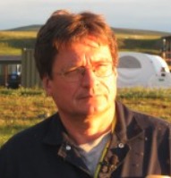 Vladimir E. Romanovsky合作论文数Permafrost Laboratory, Geophysical Institute, University of Alaska Fairbanks15
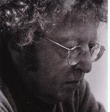 G. J. Michaelson合作论文数 Computer Science
School of Mathematical & Computer Sciences
Heriot-Watt University14Janet C. Jorgenson合作论文数13
G. J. Michaelson合作论文数 Computer Science
School of Mathematical & Computer Sciences
Heriot-Watt University14Janet C. Jorgenson合作论文数13 D. A. Walker合作论文数Department of Biology and Wildlife, Faculty of Biology and Wildlife, University of Alaska Fairbanks13
 Edward (Ted) Schuur合作论文数Center for Ecosystem Sciences and Society, Department of Biological Sciences, College of the Environment, Forestry, and Natural Sciences, Northern Arizona University;University of Alaska13
 Eva Stephani合作论文数13
 Guido Grosse合作论文数Permafrost Research Section, Alfred Wegener Institute Helmholtz Centre for Polar and Marine Research;Institute of Geosciences, University of Potsdam13
 Howard E. Epstein合作论文数Department of Environmental Sciences, College and Graduate School of Arts & Sciences, University of Virginia11
 Kristen L. Manies合作论文数U. S. Geological Survey11
 Michelle A. Walvoord合作论文数U. S. Geological Survey10
 Fugen Dou合作论文数International Arctic Research Center, University of Alaska Fairbanks10
 Breen Amy L合作论文数9
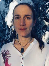 Genet Helene合作论文数9
 Burke J. Minsley合作论文数US Geol Survey, Crustal Geophys & Geochem Sci Ctr9
 Merritt R. Turetsky合作论文数Department of Ecology and Evolutionary Biology, College of Arts and Sciences, University of Colorado Boulder9
 Matthew R Dillon合作论文数No Arizona Univ, Pathogen & Microbiome Inst, Flagstaff, AZ 86011 USA8
 Peter Kuhry合作论文数Department of Physical Geography, Faculty of Science, Stockholm University8Johnson Kristofer D合作论文数8Charles Racine合作论文数8Erik R. Pullman合作论文数7Bruce G. Marcot合作论文数7
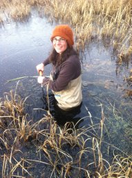 Dana R. N. Brown合作论文数Institute of Arctic Biology, University of Alaska Fairbanks7Philip Camill合作论文数7Martha K. Raynolds合作论文数7
 Charles Tarnocai合作论文数7
 Qianlai Zhuang合作论文数Ecosystems & Biogeochemical Dynamics Laboratory, Department of Earth, Atmospheric, and Planetary Sciences, College of Sciennce, Purdue University;Department of Agronomy, College of Agriculture, Purdue University7
 Gustaf Hugelius合作论文数Department of Physical Geography, Stockholm University7
 Jens Strauss合作论文数Department of Periglacial Research, Alfred Wegener Institute for Polar and Marine Research7Joanna E. Roth合作论文数6Adrian V. Rocha合作论文数The Ecosystems Center, Marine Biological Laboratory, 7 MBL Street, Woods Hole, Massachusetts 02543, USA6Melissa K. Ward Jones合作论文数5
 David Olefeldt合作论文数Dept Renewable Resources, Univ Alberta5




