In recent years, extensive technology adoption has become a notable trend in China’s environmental governance. Although various analytical frameworks such as authoritarian environmentalism have been employed to understand China’s state-led model of environmental governance, the implications of digital technologies for local governance practices remain underexamined. This study investigates how technology adoption shapes China’s water governance at a local scale, focussing on the River Chief System (RCS) in a southern Chinese city. Our findings suggest that digital tools enhance accountability and further consolidate the top-down central-local relationship in China by promoting data-driven modes of governance but do not fundamentally alter underlying power relations or the broader governance structure. By examining how digitalisation interacts with the local operation of the RCS, this paper contributes to hydropolitical literature by shedding light on how small-scale technologies may recalibrate the dynamics of power and water. Beyond the Chinese context, this analysis enriches wider debates on digital environmental governance by demonstrating how “smart” water technologies can reinforce existing hierarchies in authoritarian settings and Global South contexts.
With global climate warming, sea-level rise has become a significant challenge for coastal cities. A three-dimensional resilience model is developed based on resilience breadth, depth, and effectiveness, providing a comprehensive evaluation of urban resilience. Furthermore, the Mann-Kendall test (M-K test) was applied to analyze the spatiotemporal evolution of urban resilience, and a Grey Model (GM) was employed to forecast future resilience levels. Taking Shanghai as a case study, extensive data collection and processing were conducted for a thorough resilience assessment. The main findings include: (1)Shanghai’s urban resilience has shown a significant declining trend since 2011, with notable spatial disparities between central and peripheral districts.(2)The three-dimensional model revealed structural imbalances (e.g., Pudong’s “inverted truncated cone” shape), which traditional 2D models fail to capture.(3)Projections indicate that urban resilience will continue to decline through 2100, though the rate of decline is expected to slow.(4)Key drivers include sea-level rise, aging infrastructure, and regional disparities in economic and policy capacity.Our analysis highlights the need for differentiated resilience strategies to address rapidly evolving climate risks.
This study systematically investigates the spatiotemporal evolution of sea level rise under climate change, employing a tri-scale quantitative framework (global, China's coastal waters, and Shanghai municipality) to elucidate its underlying drivers and regional disparities. By synthesizing IPCC AR6 datasets and NASA sea level projection models, we integrate the Theil-Sen Median Method with Mann-Kendall Test to analyze trajectory patterns from 2030 to 2100. Spatial clustering effects are further identified through hotspot analysis (Getis-Ord Gi*) implemented in ArcGIS Pro. The findings reveal a statistically significant upward trend in global sea levels, primarily attributed to thermal expansion and cryospheric melt (glaciers and polar ice sheets), with localized subsidence observed in certain high-latitude regions. China's coastal waters exhibit accelerated sea level rise, particularly in the South China Sea and East China Sea, where rates surpass the global mean-a phenomenon driven by coupled effects of monsoon circulation, Kuroshio Current dynamics, and freshwater discharge from major rivers (e.g., Yangtze and Yellow Rivers). At the urban scale, Shanghai's coastal zone demonstrates exacerbated relative sea level rise due to superimposed land subsidence and localized hydrodynamic processes, manifesting distinct spatiotemporal clustering patterns. By integrating global-scale thermodynamic baselines, regional oceanic drivers, and local land subsidence patterns, this study provides a quantitative foundation for place-based adaptation strategies in delta cities. The findings enable evidence-based risk assessment and inform anticipatory governance measures-such as targeted infrastructure reinforcement and land-use planning adjustments-to address the compound sea level risks identified at each scale.
Global climate change-induced sea level rise has emerged as a critical environmental challenge for coastal cities in the 21st century. Shanghai, China's economic, financial, and shipping hub, faces significantly amplified inundation risks in its coastal areas due to the compounding effects of sea level rise, land subsidence, and storm surges. This study constructs a multi-case simulation framework using the sixth assessment report of intergovernmental panel on climate change sea level projection data, land subsidence monitoring records, and historical storm surge data to evaluate the impacts of three cases on future inundation risks: sea level rise alone (case1), sea level rise combined with land subsidence (case 2), and sea level rise coupled with land subsidence and storm surges (case 3). Leveraging Autoregressive Integrated Moving Average model time-series modeling, Geographic Information System spatial analysis, and numerical simulations, the study predicts relative sea level rise and inundation extents for 2050, 2070, and 2100. Results indicate that Shanghai's relative sea level rise rate far exceeds the global average, with land subsidence and storm surges synergistically amplifying disaster risks in low-lying coastal zones. Under case 1, the projected inundation area reaches 361.32 km2 by 2100. Case 2 increases this area to 460.97 km2, while case 3 shows a dramatic escalation to 1,331.91 km2 by 2100-a surge of 870.94 km2 compared to case 2-highlighting the dominant role of storm surges in extreme weather events. Spatial analysis identifies Chongming District, Pudong New Area, and Fengxian District as high-risk zones, with Chongming Island being the most severely affected (54.5% inundation by 2100). This study elucidates the compound impact mechanisms of sea level rise, land subsidence, and storm surges in Shanghai, providing a scientific foundation for coastal disaster mitigation and adaptive urban management. Recommendations include enhancing coastal flood defenses, optimizing land-use planning, improving extreme weather early-warning systems, and fostering international collaboration and technological innovation to bolster urban resilience against climate risks.
Chinese state-owned enterprises (SOEs) are increasingly active in overseas mergers and acquisitions in the mining sector, driven by the need to secure access to critical minerals. Australia’s rich mineral resources and stable investment environment make it a key destination. This paper examines the inside mechanisms of Chinese SOEs when they undertake Outward Foreign Direct Investment (OFDI) to understand how they perceive and navigate geopolitical change and regulations in the critical minerals sector. Drawing on interviews and documentary analysis of China Minmetals Corporation (Minmetals) and its establishment of the Australian subsidiary MMG, the research analyses the heterogeneous ways in which MMG and Minmetals perceive and respond to regulations and changing geopolitical realities. It contributes to studies of SOEs by providing insights into how decision-makers in SOEs perceive and react to Australian regulations, how they translate mandates from Chinese administrative institutions to their Australian subsidiaries, and how they handle conflicting interests between the headquarters and subsidiaries, as well as across borders. It also contributes to a broader understanding of opportunities and challenges SOEs face in Australia. While state ownership brings MMG advantages of market access and policy support, it also generates constraints, including frequent leadership rotations, short-term performance incentives, and challenges to integration with overseas firms. This study shows continuous coordination and negotiation across levels between MMG and Minmetals, and with regulatory bodies in Australia, such as the FIRB, and in China, exemplified by the State-owned Assets Supervision and Administration Commission (SASAC).
Indonesia's palm oil industry, the world's largest supplier, faces significant scrutiny because of its severe environmental and social impacts. The expansion of Chinese companies in this sector has raised concerns about exacerbating existing problems. This study examines the case of Jade (pseudonym), a Chinese-owned palm oil company, to assess the socio-environmental consequences of Chinese investments in Indonesia. Employing a dual methodology combining an analysis of public discourse with primary field data, the research reveals the complexity and contradictions within Chinese, global and local perspectives on the company's operations, highlighting a collision of priorities: Economic growth, environmental protection and governance reform. At the field site, unresolved land disputes and weak governance have created a fragile balance between local resistance and the company's partial compromises. Although Chinese companies are often perceived as autonomous entities advancing national interests, this study underscores how their activities are deeply embedded in Indonesia's political, historical and cultural contexts, exposing them to systemic challenges in the palm oil sector. The study also critiques the 'global ecological civilisation' concept, arguing that China's non-interference stance, by avoiding engagement with entrenched local conflicts, risks undermining efforts to achieve meaningful socio-environmental progress.
Central China's Danjiangkou Reservoir supplies clean water to major cities as part of the South-North Water Transfer Project (SNWTP). Fencing is presented as essential to establishing borders, controls, and authority over the water reservoir and surrounding areas that were previously settled lands. Drawing on Tania Li's work, as well as work by geographers and anthropologists on the contested production of the state and the border through practice, we focus on the mundane engagements and material practices of a range of actors with this state-led development to illustrate how even state lines that seem natural, and are used to justify or facilitate the massive resettlement and landscape reorganization, also require ongoing construction and engagement. While fencing is presented as part of establishing pristine first class water quality, our research shows that fences have failed, been crossed and are constantly negotiated. We contend that to unravel the apparent solidity of fencing technologies, they should be understood as an interface, one that is under constant negotiation and reconfiguration and that in practice requires the work of a range of actors. In considering these engagements, we contribute to a burgeoning literature critically examining the state in China.
A detailed exploration of the nexus between land use change (LUC) and ecosystem service value (ESV) at the urban level is crucial for fostering high-quality urban economic growth alongside the sustainable management of land resources. This study focuses on Jiangsu Province, employing an enhanced and refined ESV assessment model to perform a dynamic examination of the spatial and temporal variations in land use and ESV across the region from 2000 to 2020. Additionally, it delves into the intricate coupled coordination dynamics between land use intensity and ESV by developing a coupled coordination model. Key findings include: (1) Jiangsu Province experienced notable land use transformations over the two decades, with a marked reduction in cropland and a significant expansion of construction sites being the most prominent shifts. (2) The ESV in Jiangsu Province has exhibited fluctuating trends over the past 20 years, with water bodies and agricultural lands serving as the cornerstone for the province's ESV. Areas with high ESV are predominantly located around the Yangtze River's water bodies, along the coastline, and around lakes and radiate outward from these aquatic centers. (3) The coupling between LUC and ESV in Jiangsu Province has been upward, albeit with pronounced city disparities. This coupling displays distinct spatial patterns, characterized by higher levels in the east and lower levels in the west, as well as higher levels in the north and lower levels in the south. The outcomes of this analysis offer valuable insights and policy recommendations for enhancing land use planning, refining land use configurations, and promoting the synergistic development of land use and ecosystem service functions in Jiangsu Province.
Cultivated land’s ecological security ensures human well-being and is critical to global food security. However, the unchecked expansion and excessive exploitation of agricultural resources have led to considerable land degradation issues in China, including soil erosion, contamination, and environmental degradation, raising concerns over the cultivated land ecological security (CLES). Current research on cultivated land (CLES is relatively limited, particularly at the national level across different provinces. In addition, a unified and comprehensive CLES evaluation index system has yet to be formed. To fill this research gap, we construct a CLES evaluation system with 35 indicators from three dimensions of “society-natural-economy” based on the DPSIR model framework and entropy weight TOPSIS model. Simultaneously, we conducted a spatial–temporal analysis of CLES in 31 provinces of China from 2012 to 2021 and applied the obstacle degree model to analyze the main factors impeding the CLES in China. The results showed that: (1) During the study period, the CLES and its subsystems showed a good development trend. Spatially, the CLES in China presents a regional difference of “high in the east and low in the west” and a significant regional difference among provinces. (2) The spatial CLES in different provinces of China presents a significant positive correlation, and the spatial clustering effect of CLES is gradually strengthening. The “High-High” clusters are mainly distributed in the northeast and eastern regions, while the “Low-Low” clusters are mainly located in the western region. (3) From the perspective of the criterion level, the state subsystem and the impact subsystem are the main obstacles hindering the improvement of CLES in China. At the indicator level, the common obstacle factors affecting the enhancement of CLES across provinces in China include soil erosion control intensity, number of green food certifications, per capita agricultural loans, per capita cultivated land area, and per capita grain production. Our research results can provide practical policy reference for further improving the ecological protection of cultivated land.
Land use changes (LUC) have exacerbated the evolution of ecosystem structure in the urban agglomeration of the Yangtze River Delta (YRDUA), significantly affecting ecosystem service functions and values. Although the impact of land use on ecosystem service value (ESV) has received significant attention, most existing studies explore the relationship between LUC and ESV at the national, provincial, or regional scales. Few studies focus on urban agglomerations, particularly in the YRDUA. Additionally, while many studies analyze the driving factors of ecosystem services and the trade-offs and synergies among them, there is a relative scarcity of research on the coupling coordination relationship between LUC and ESV. In this study, we used the ecosystem service assessment model to dynamically analyze the spatio-temporal changes of land use and ESV in the YRDUA from 2000 to 2020 and evaluated the dynamic relationship between the two using the coupled coordination model system. The results show the following: (1) Land use types within the YRDUA underwent significant changes during the study period, with a notable decrease in farmland and a substantial increase in construction land being the dominant trends. (2) ESV showed upward and downward trends over different periods, with water bodies having the highest value, followed by forested land and farmland, respectively. The ESV of water bodies showed a trend of first increasing and then decreasing. Higher ESVs were mainly concentrated around lakes such as Taihu Lake and coastal areas along the Yangtze River, radiating outward from these central points. (3) Currently, the coupling coordination degree (CCD) between land use intensity and ESV in the YRDUA is mostly reluctant coordinated or in the state of primary coordination. However, with time, the CCD trend has increased. In addition, variations between cities were more pronounced, showing a spatial pattern characterized by higher coupling levels in eastern/northern regions compared to western/southern regions. Our study can provide policy references for improving land planning, optimizing land use structures, and realizing high-quality, sustainable, green, and coordinated development in the YRDUA.
The Yangtze River Economic Belt (YEB) is at the centre of China's economy and development. Its regional carbon emissions account for about 36.9% of the country's total carbon emissions, and thus, there is an urgent need to sustain the development of a low-carbon economy. However, the complex patterns of embodied carbon flows arising from multi-scale trade in such a megaregion are often ignored in carbon environmental governance. This study incorporates a megaregion into an environmentally extended multi-regional input-output (EEMRIO) framework and identifies the drivers of production and consumption-based carbon emissions using four measures through structural decomposition analysis (SDA). The results show that (1) the YEB strengthens inter-provincial trade links while reducing international trade links; (2) there is obvious carbon transfer in multi-scale trade in the YEB, with a corresponding transfer of responsibility for carbon reduction occurring; and (3) consumption volume and carbon intensity are the main drivers and inhibitors of the increasing carbon emissions, respectively, and the optimisation of production structure and consumption structure are effective ways to control production-based carbon emissions (PBEs) and consumption-based carbon emissions (CBEs), respectively. This study extends the research scale of "national-provincial-city" to a megaregion. Studies based on multiple trade scales would provide additional insights to understand the carbon reduction responsibilities of megaregions and help achieve coordinated regional carbon reductions.
Given the central government of China’s greater attention on the concept of green development and the construction of ecological civilization in recent years, the redevelopment of existing neighbourhoods in inner-city areas has undergone a significant transformation to accommodate to these national strategies, promoting green and low-carbon and eventually achieving the policy goal of ‘Common Prosperity’. However, by reviewing the existing government documents, initiatives and policies on green and low-carbon-oriented urban (re)development, this chapter finds that the current version of green and low-carbon-oriented urban (re)development is inadequate, as it has continued to be blind to the socioeconomic, spatial and environmental disparities between different cities and between different communities within a city and ignored the situations of the marginalized population. The chapter therefore argues that the conventional governance mechanism would be a stumbling block that impedes cities to solve poor environmental conditions and socioeconomic polarization, and green and low-carbon-oriented urban (re)development involves institutional and governance reform in China. The chapter suggests that in their pursuit of green and low-carbon-oriented urban (re)development, governments at different levels need to reconstitute the mode of governance and refine the development values.
Those who have been forced to resettle by water conservancy projects (WCP) have always been a group that is characterised by high poverty and livelihood vulnerability, mainly due to insufficient compensation and the fragmentation of their social networks. In 2020, the Chinese government announced that China had achieved comprehensive poverty alleviation, implying that all WCP-induced resettlers, have been lifted out of poverty. However, China’s current poverty line is based on the minimum subsistence standard, namely the absolute poverty line, which fails to objectively reflect China’s uneven development and individuals’ actual consumption needs. Therefore, in order to comprehensively analyse the poverty status of WCP-induced resettlers in contemporary China, this paper reassessed the poverty status of contemporary WCP-induced resettlers from the perspective of development-based poverty and consumption-based poverty. Based on survey data from over 1000 households who were forced to resettle due to China’s ‘Yangtze River to Huai River Inter-basin Water Diversion’ project, this paper concludes that: (1) China’s current absolute poverty line is outdated for contemporary WCP-induced resettlers, due to the fact they had basically been lifted out of absolute poverty by 2018, and those who remain poor need to be addressed through the bottom line guarantee of local governments; (2) the role of land as a form of basic insurance can alleviate income inequality and mitigate the risk of force majeure. Therefore, those resettled from rural areas have stronger income stability and greater resilience to risks; (3) the poverty status of contemporary WCP-induced resettlers is mainly consumption-based, and it is worse for resettlers from urban areas. Based on these conclusions, we suggest that the government should try to avoid large-scale relocation of WCP-induced resettlers to urban areas, and try to provide more insurances to them, such as providing arable land and sharing the benefits of water conservancy projects with the resettlers.
China has announced ambitious dual-carbon targets to peak carbon emissions by 2030 and achieve carbon neutrality by 2060. However, due to regional differences and lack of accurate emission monitoring data, local governments have been given greater autonomy to achieve these targets. Based on semi-structured interviews and document analysis on emission peak campaigns in inland regions, this article identifies one local game strategy - 'Dauling Dragon' whereby local governments prioritize high emission projects to be completed by 2030 in order to create a margin for future development, a phenomenon known as 'carbon rush' . The article explores the consequences and antecedents of such a strategy through the lens of environmental authoritarianism. It also makes a theoretical contribution to the conceptualization of the Dauling Dragon strategy, by focusing on its effects on local environmental implementation. Findings from our case study show that China's climate ambitions, especially its long-term carbon neutrality goal, faces local political obstacles.
At present, the zero-tolerance and co-existence approaches are the two basic concepts used to manage COVID-19. With the increase in vaccination rates and the continuing impact of the pandemic on people's lives, the co-existence approach has become the mainstream global practice. However, its high infection rate is still an inevitable fact. China was the first country to adopt the zero-tolerance approach to deal with COVID-19 and successfully control it. Due to its immediate effects and low infection rates, this approach has been used in China until now. Through the co-operation of the government and community, China has achieved precise regional lockdowns and patient identification. This article uses the CBCM model to interpret how China has achieved its zero-tolerance approach. Finally, the secondary hazards and applicability of China's CBCM model are discussed. This article draws the following conclusions: (1) China's CBCM basically replicates Singapore's crisis management model for SARS. With the co-operation of the community, it achieved universal coverage of prevention, detection and control; (2) Government leadership in dealing with major crises is very important; (3) In addition to relying on the extreme power of the government to realize China's CBCM model, the two major factors of a submissive society and collectivism have played an important role; (4) China's CBCM model is essentially an excessive anti-pandemic strategy.
This article applies the pluralistic concept of environmental justice to the issue of park accessibility between people across different socioeconomic strata in the metropolitan region of Shanghai. Data were obtained from China's 2000 and 2010 population census, Shanghai Landscaping and City Appearance Administrative Bureau, semi-structured interviews and secondary sources. The article finds significant environmental injustice between foreign citizens and Chinese citizens (including people from Hong Kong, Macau and Taiwan and mainland people with and without Shanghai hukou) and between blue collar, white collar and wealthy white collar people from distributive, recognition, participatory and procedural justice perspectives. The article then discusses why such injustice is the result of urban China's unique authoritarian mode of governance, power structure, neoliberal practice and globalisation development. The findings offer insights into the development of the concept of environmental justice in the Chinese context and the country's objective to build an impartial society.
Ecological agriculture (EA) is commonly regarded as a top-down agricultural reform plan in China. However, the policy process is more complicated than that. Taking Xichuan, Henan province, the water source area for the Middle Route of South-North-Water-Transfer (MR-SNWT) project, as a case study, this paper tracks the participation of various agencies and their interactions with Xichuan's government, to reveal how EA has been integrated into local rural development. As agents were assembled to promote Xichuan's development, EA in Xichuan was considered both as a goal in itself and as a tactic employed to meet the multiple goals of various participants: water protection, poverty alleviation, follow-up support for people who lost their land to the reservoir and changing customer food preferences. With the dominant initiative from a strong central state, the local government and other stakeholders integrated their investments and concerns into policy process, seeking to maximise their own interests; however, they sometimes had to compromise on some standards. This study expands our understanding of 'fragmented authoritarianism' by illustrating the overlap and interaction of different actors in advancing similar policies even if they have varied and sometimes competing interests, and it encourages the study of policy processes over space that incorporate multi-actors.
The COVID-19 pandemic has been the most globally disruptive event since the Great Depression in the 1920s and 1930s.It has substantially impacted our way of life over more than two and a half years and has forced us to rethink how we deal with the health, economic, social and environmental challenges ahead.In this special edition, emerging and established academics from Asian Studies, geography, politics, sociology and environmental studies share their latest research and analysis on the pandemic's effects on politics, society and environment in Asia and Australia. Political and social challengesSome of the most significant (post-)COVID challenges in Asia are unfolding in China.China continues to enforce a so-called 'zero-COVID' policy which is characterised by huge-scale, rapid and frequent testing, strict lockdowns, isolation, quarantine and border closures.Such an approach has contributed to the very low pandemic death rate in China since COVID-19 began in Wuhan in late 2019.Chinese leaders strongly believe that the 'zero-COVID' approach could only be applied for such long time in China mainly due to its political system and the Chinese Communist Party's (CCP) mobilisation capacity.However, such approach is not only criticised as 'brutal'
 Michael Evan Webber合作论文数Walker Department of Mechanical Engineering, Cockrell School of Engineering, The University of Texas at Austin26
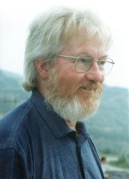 Brian Finlayson合作论文数School of Geography, University of Melbourne24
 Jiaping Wu合作论文数14Tg Mcgee合作论文数11Chen Li (谌丽)合作论文数9
 Sarah Rogers合作论文数Asia Institute, Faculty of Arts, The University of Melbourne9
 George Chu Sheng Lin (林初昇)合作论文数Department of Geography, Faculty of Social Sciences, The University of Hong Kong8
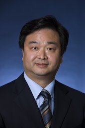 Ying Zhu合作论文数University of Melbourne, University of Melbourne8
 Michael Webber合作论文数McMaster University8J. L. Barnett合作论文数7
 Ziheng Shangguan合作论文数6
 Shangguang Yang (杨上广)合作论文数East China University of Science and Technology School of Business6
 Chunlan Wang (王春兰)合作论文数School of Social Development, East China Normal University6
 Jon Barnett合作论文数Centre for Contemporary Chinese Studies, Research Units and Centres, Faculty of Arts, The University of Melbourne5
 Sun Sheng Han合作论文数Melbourne School of Design, The University of Melbourne5
 Guoqing Shi (施国庆)合作论文数School of Public Administration, Hohai University5
 Zhongyuan Chen (陈中原)合作论文数State Key Laboratory of Estuarine and Coastal Research, East China Normal University5
 Yanji Ma (马延吉)合作论文数Northeast Institute of Geography and Agricultural, Chinese Academy of Sciences5
 Pingyu Zhang (张平宇)合作论文数Northeast Institute of Geography and Agricultural, Chinese Academy of Sciences5Xiaodong JING (景晓栋)合作论文数4
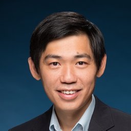 Kevin Lo合作论文数Geography, University of Melbourne4
 Ray Green合作论文数Melbourne School of Design, The University of Melbourne4
 Maotian Li (李茂田)合作论文数State Key Laboratory of Estuarine and Coastal Research, East China Normal University4
 Jing Chen (陈静)合作论文数State Key Laboratory of Estuarine and Coastal Research, East China Normal University4
 Tao Xue合作论文数3
 Min Jiang合作论文数Victoria University Melbourne, Victoria University ^3
 Zhonggen Sun (孙中艮)合作论文数School of Public Administration, Hohai University3
 Taoyuan Wei (韦桃源)合作论文数School of Geographic Sciences, East China Normal University3Debbie Dickinson合作论文数3
 Wenjing Zhang合作论文数2Tianhe Jiang合作论文数2
 Nahui Zhen合作论文数Sch Geog, Univ Melbourne2
 Hong Jiang合作论文数University of Melbourne2Danyang Wang合作论文数2
 Vanessa Lamb合作论文数School of Geography, Earth and Atmospheric Sciences, Faculty of Science, The University of Melbourne2
 Jennifer Day合作论文数Melbourne School of Design, The University of Melbourne2
 Rui Qi (齐睿)合作论文数School of Economics and Management, China University of Geosciences2
 Jie Li (黎洁)合作论文数School of Public Policy and administration, Xi'an Jiaotong University2
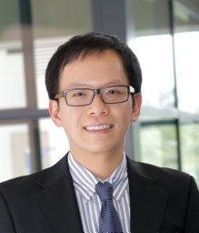 Zhiming Cheng合作论文数University of Wollongong, Univ of Wollongong2Rivlin Michael合作论文数2
 Chenchen Shi合作论文数Beijing Normal University, Beijing Normal University2Xiaodan Wu合作论文数2
 Guiliang Tian (田贵良)合作论文数School of Economics and Finance, Hohai University2
 Dengcai Yan (严登才)合作论文数School of Public Administration, Hohai University2
 Dan Chen (陈丹)合作论文数河海大学水利水电学院2
 Yingnan Zhang (张英男)合作论文数School of Public Affairs, Zhejiang University2Lianjun Tong合作论文数2




