Lane-level maps are critical infrastructure for autonomous driving and lane-level navigation, yet constructing and maintaining standardized lane networks for hundreds of cities remains highly labor-intensive. Recent end-to-end vectorized mapping methods can predict lane geometry and topology directly from sensor data, but they typically treat mapping specifications and traffic regulations as implicit, dataset-dependent supervision. Moreover, in complex scenes (e.g., worn or missing markings and occlusions), correct lane configurations are often under-determined by visual evidence alone, making specification violations a major source of human post-editing. We propose MapAgent, an industrial-grade agentic architecture that augments a vectorization backbone for specification-compliant lane-map production. Rather than merely adding an agent loop to map prediction, MapAgent couples backbone perception with explicit specification verification, constraint-aware reasoning, and deterministic map editing under a bounded, verification-driven Judge-Planner-Worker loop. A vision-language Judge diagnoses errors by jointly inspecting visual evidence and draft vectors, while a tool-calling Planner generates minimal corrective edits with post-edit re-validation. To remain scalable for city-scale production, MapAgent is selectively triggered only on tiles with low backbone confidence, adding modest overhead while preserving throughput. Experiments on real-world datasets show consistent gains over strong production baselines, especially in complex and long-tail scenarios. Additionally, MapAgent has been integrated into Baidu Maps, supporting lane-level map generation for over 360 cities nationwide and elevating the overall production automation to over 95
In this article, the challenging collision-free navigation problem of a heavy-duty cooperative transportation system (CTS) with one oversized load transported by multiple vehicle carriers in confined environment is investigated. Different from the common "trajectory planning and tracking control" pipeline, the navigation problem is converted to the generation of spatiotemporal inequality constraints, and the design of a corresponding controller that keeps the CTS strictly satisfying the constraints to avoid collision. Considering the special occupancy feature of the CTS, the inequality constraints are formulated from the safe corridor constructed by the disk center expansion strategy (DCES) with the expansion of a collision-free global reference trajectory. Then a diffeomorphism-based prescribe performance controller (DPPC) is proposed to ensure strict compliance with the constraints through state transformation. Navigation safety can be theoretically guaranteed without the need for repeatedly tuning the tracking performance, which is extremely tedious for the oversized load CTS with the time-varying shape topology and complex dynamics. Comprehensive simulation experiments are conducted in different representative scenarios, which verify the effectiveness of the proposed method.
The dominance of traditional rule-based methods in autonomous driving has gradually been replaced by learning-based approaches. While learning-based planners have achieved considerable success in passenger vehicles, their performance on heavy-duty trucks, particularly modern distributed electric-drive trucks (DETs), remains largely unexplored. To facilitate research and application of learning-based planners in DETs, this letter presents the first high-fidelity benchmark, called nuTruck, designed to support large-scale neural network training and closed-loop evaluation. Given the complex dynamics and high rollover susceptibility of DETs, we first incorporate a highly accurate nonlinear truck dynamical model into the simulation, which enables independent driving and steering of all wheels and captures dynamic load transfer caused by acceleration, deceleration, and cornering, thereby allowing quantitative assessment of rollover risk in closed-loop simulation. Second, we adapt several rule-based and learning-based planners as baselines for DETs and evaluate their performance in closed-loop simulation. Finally, using real-world driving scenarios from the nuPlan dataset, we conduct extensive closed-loop evaluations, analyzing not only conventional collision-free planning performance, but also the dynamical safety of the planned trajectories. The proposed nuTruck benchmark is expected to serve as a new standard for fair and realistic evaluation of autonomous driving planners on DETs.
LiDAR-based 3D object detection is essential for autonomous driving. This paper investigates the distinctive capability of FMCW LiDAR for short-term predictive perception. Given a single-frame FMCW point cloud with per-point radial velocity measurements, we study predictive object detection (POD), a detection-centric task that estimates future 3D bounding boxes from the current observation alone. Unlike conventional motion forecasting methods that typically rely on historical frames, trajectories, or tracking results, POD uses the instantaneous velocity cue of the current scan and therefore avoids additional temporal buffering. To this end, we design a velocity-aware framework that compensates radial velocity, generates virtual future points along the radial direction, and forms a virtual two-frame point cloud from a single scan. The virtual current-future points are encoded by sparse 4D voxel encoders and then separated into bird’s-eye-view (BEV) features for current-frame detection and future-frame prediction. We instantiate this framework with two representative 4D encoders, namely 4D SparseConv VoxelNet and 4D Voxel Transformer, and evaluate their accuracy-efficiency trade-offs. Experiments on data from this modality show that the proposed framework can perform short-horizon future-box detection while maintaining practical response time. Additional baseline, complexity, and failure-case analyses further clarify the benefits and limitations of single-frame POD.
Forecasting the future evolution of dynamic scenes is crucial in autonomous driving. However, existing feed-forward paradigms are primarily designed for interpolation. When extended to future extrapolation, they suffer from ghosting artifacts under large displacements and are constrained by simplified motion assumptions or strict future priors. To overcome these challenges, we propose Envision4D, a fully self-supervised feed-forward framework for pose-free future extrapolation. Specifically, we introduce a Future Pose Prediction module that infers future camera parameters via an iterative denoising process. Furthermore, to capture non-linear dynamics, we propose In-layer Temporal Attention and employ Conditioned Motion Lifting, which transforms the highly uncertain extrapolation process into robust relational mappings. Finally, a Progressive Training Strategy is utilized to stabilize unsupervised motion learning against error accumulation. Extensive experiments demonstrate that Envision4D achieves state-of-the-art performance, significantly outperforming existing methods in future view synthesis.
High-precision vehicle localization is essential for high-level autonomous driving. Recent end-to-end localization frameworks have shown promising capabilities in pose estimation, yet their performance is still limited by suboptimal visual perception and insufficient cross-modal alignment, leading to degraded accuracy and robustness under challenging visual conditions. To address these issues, we propose MaPLocator, a novel end-to-end visual-only localization network that performs cross-modal localization using surrounding cameras and high-definition (HD) maps. In the network, a novel Map Prior-Guided Perception Enhancement Module is proposed, which leverages misaligned HD map priors to improve visual bird’s-eye-view (BEV) features while generating a coarse pose estimation. Subsequently, a cross-modal Transformer module is employed to further refine the estimated pose so that the whole localization procedure is performed in a coarse-to-fine strategy, yielding high-precision pose estimation. Extensive experiments on the nuScenes dataset demonstrate that MaPLocator achieves state-of-the-art localization performance, improving longitudinal and yaw accuracy by 47% and 31%, respectively, compared with the previous leading method BEV-Locator.
We present 4DLidarOpen, a large-scale open multi-modal dataset for autonomous driving, centered on 4D frequency-modulated continuous-wave (FMCW) Lidar sensing. Unlike conventional time-of-flight Lidar datasets that mainly provide geometric measurements, 4DLidarOpen includes point-wise radial velocity measurements from a forward-facing 4D FMCW Lidar, together with multiple Lidars of different types, including rotating, solid-state, and blind-spot variants, surround-view cameras, and 6-DOF ego-vehicle poses. The dataset was collected in complex urban environments in Beijing and covers dense pedestrian interactions, congested traffic, high-speed driving, and unprotected maneuvers. 4DLidarOpen provides synchronized multi-sensor data and 3D bounding-box annotations with persistent track IDs across five object categories. A hybrid annotation strategy is adopted, where large-scale auto-labeled data support scalable training and human experts refine annotations for the human-annotated training and validation sets. Based on this dataset, we establish benchmarks for 3D object detection, birds-eye view (BEV) segmentation and flow prediction, and motion forecasting with planning. Extensive experiments show that direct velocity measurements from 4D FMCW Lidar provide complementary motion cues for dynamic-scene understanding. Compared with geometric-only sensing, the velocity-aware representation improves motion-related perception and downstream forecasting and planning, especially in scenarios involving vulnerable road users and fast-moving objects. These results indicate that 4D FMCW Lidar is a promising sensing modality for motion-aware autonomous driving. The dataset and evaluation toolkit are publicly released to support research on 4D scene understanding, multi-Lidar fusion, and velocity-aware perception and planning.
LiDAR-based bird’s-eye-view (BEV) perception has emerged as an appealing approach for practical autonomous driving applications due to its direct leveraging of precise 3D structures and delivering efficient performance. This paradigm aims to jointly determine the semantics and motion states of various traffic participants on BEV grids. However, most existing LiDAR-based BEV perception methods primarily focus on motion prediction, leading to inferior semantic performance. To address this limitation, we propose a novel multi-frame, multi-view, and multi-task unified framework in this work, which enhances scene perception for both improved BEV semantic segmentation and comparative motion prediction performances. Our framework, named temporal range-point-voxel fusion (T-RPVFusion), leverages a sequence of LiDAR sweeps as input and jointly outputs semantic and motion information on BEV grids. In T-RPVFusion, we first introduce a novel multi-view semantic encoder that extracts high-quality semantic features from each LiDAR sweep. These semantic feature maps are then aggregated into an integrated feature map using the proposed bi-layer spatio-temporal pyramid network. Subsequently, the integrated feature map undergoes processing in both the semantic and motion heads and yields corresponding outputs, respectively. Extensive experiments conducted on Waymo and nuScenes show that our method outperforms previous state-of-the-art (SOTA) in terms of BEV semantic segmentation, while concurrently demonstrating comparable performance in motion prediction. Notably, our method achieves a significant improvement on BEV semantic segmentation task, attaining a mIOU of 49.5%, surpassing the previous SOTA with a great margin of + 12.1% mIOU on Waymo Open Dataset. The code is available at https://github.com/thuwyl/trpvfusion
QoS-based web service prediction is widely used in service computing but raises privacy concerns when collecting user data. Although local differential privacy (LDP) offers strong protection, its direct use in QoS prediction is hindered by attribute heterogeneity, which reduces data utility and prediction accuracy. To address this, we propose LDP-QWSP, an LDP-compliant framework that incorporates attribute-aware normalization and a perturbation mechanism favoring high-utility intervals. Experiments on real-world datasets confirm that LDP-QWSP achieves higher prediction accuracy than existing methods under comparable privacy budgets.
Previous fastslow system architectures demonstrated that pairing a reactive E2E planner with a deliberative vision-language model (VLM) can address these long-tail scenarios. However, these dual-system models that query the slow module at fixed intervals are computationally inefficient and introduce unnecessary latency during normal operation. To bridge this gap, we introduce textbf{FASIONAD}, an adaptive fastslow framework for autonomous driving that selectively integrates E2E planning and VLM reasoning. A lightweight fast planner manages general control, while a slow reasoner is activated only when a Laplace-based uncertainty gate detects changed uncertainty. Rather than overriding control, the VLM provides concise planning states and high-level plans. These inform the planner through an information bottleneck and high-level action guidance, enhancing interpretability and safety. Evaluated on the nuScenes, Bench2Drive, and CARLA Town05 closed-loop benchmarks, FASIONAD lowers the average trajectory error by 6.7% and the collision rate by 28.1% compared with strong E2E baselines, while also markedly reducing computational overhead relative to always-on fastslow dual systems. These results demonstrate that adaptive fastslow fusion is a practical route to safer, more reliable, and more efficient autonomous driving.
Advanced autonomous driving systems require accurate vehicle dynamics modeling. However, identifying a precise dynamics model remains challenging due to strong nonlinearities and the coupled longitudinal and lateral dynamic characteristics. Previous research has employed physics-based analytical models or neural networks to construct vehicle dynamics representations. Nevertheless, these approaches often struggle to simultaneously achieve satisfactory performance in terms of system identification efficiency, modeling accuracy, and compatibility with linear control strategies. In this paper, we propose a fully data-driven dynamics modeling method tailored for complex distributed electric-drive trucks (DETs), leveraging Koopman operator theory to represent highly nonlinear dynamics in a lifted linear embedding space. To achieve high-precision modeling, we first propose a novel dual-branch encoder which encodes dynamic states and provides a powerful basis for the proposed Koopman-based methods entitled KODE. A physics-informed supervision mechanism, grounded in the geometric consistency of temporal vehicle motion, is incorporated into the training process to facilitate effective learning of both the encoder and the Koopman operator. Furthermore, to accommodate the diverse driving patterns of DETs, we extend the vanilla Koopman operator to a mixture-of-Koopman operator framework, enhancing modeling capability. Simulations conducted in a high-fidelity TruckSim environment and real-world experiments demonstrate that the proposed approach achieves state-of-the-art performance in long-term dynamics state estimation.
Vision-Language-Action (VLA) models drive next-generation autonomous systems, but training them requires scalable, high-quality annotations from complex environments. Current cloud pipelines rely on generic vision-language models (VLMs) that lack geometric reasoning and domain semantics due to their 2D image-text pretraining. To address this mismatch, we propose XEmbodied, a cloud-side foundation model that endows VLMs with intrinsic 3D geometric awareness and interaction with physical cues (e.g., occupancy grids, 3D boxes). Instead of treating geometry as auxiliary input, XEmbodied integrates geometric representations via a structured 3D Adapter and distills physical signals into context tokens using an Efficient Image-Embodied Adapter. Through progressive domain curriculum and reinforcement learning post-training, XEmbodied preserves general capabilities while demonstrating robust performance across 18 public benchmarks. It significantly improves spatial reasoning, traffic semantics, embodied affordance, and out-of-distribution generalization for large-scale scenario mining and embodied VQA.
Corner cases are crucial for training and validating autonomous driving systems, yet collecting them from the real world is often costly and hazardous. Editing objects within captured sensor data offers an effective alternative for generating diverse scenarios, commonly achieved through 3D Gaussian Splatting or image generative models. However, these approaches often suffer from limited visual fidelity or imprecise pose control. To address these issues, we propose G^2Editor, a framework designed for photorealistic and precise object editing in driving videos. Our method leverages a 3D Gaussian representation of the edited object as a dense prior, injected into the denoising process to ensure accurate pose control and spatial consistency. A scene-level 3D bounding box layout is employed to reconstruct occluded areas of non-target objects. Furthermore, to guide the appearance details of the edited object, we incorporate hierarchical fine-grained features as additional conditions during generation. Experiments on the Waymo Open Dataset demonstrate that G^2Editor effectively supports object repositioning, insertion, and deletion within a unified framework, outperforming existing methods in both pose controllability and visual quality, while also benefiting downstream data-driven tasks.
Significance Autonomous driving maps are essential for the safe operation of intelligent vehicles, especially on Chinese urban roads, where road structures are complex and traffic conditions change frequently. For a long time, map production has relied on specialized surveying and extensive manual annotation, resulting in high costs, low efficiency, and long update cycles, making large-scale coverage and continuous updating difficult to sustain. Under these conditions, end-to-end autonomous driving map generation has gradually become an important direction in this field. Its fundamental goal is to infer structured map outputs more directly from sensor observations, thereby reducing dependence on complex intermediate procedures and intensive manual intervention. With the continued development of deep learning, the two core tasks of autonomous driving map generationu2014lane network generation and lane topology predictionu2014have both shifted toward end-to-end approaches. Concurrently, industrial end-to-end systems have been developed for city-scale map production and updating, while large models, vision-language models, and agent-based systems have further expanded the research space in this area. Nevertheless, several challenges remain unresolved, including generalization in complex scenes, dynamic change detection, interpretability, and consistency in multi-vehicle collaboration. Therefore, it is important to systematically review existing research to provide clearer guidance for the future development of this field. Progress For lane network generation, the technical route has evolved from early convolutional neural network (CNN)-based methods to Transformer-based and hybrid architectures. CNN-based methods were widely adopted at an early stage due to their mature operators, stable training, and low deployment cost. They are effective in modeling local geometry; however, their ability to preserve long-range structural consistency becomes more limited in complex scenes. Transformer-based methods later emerged as a major direction because query-based decoding is well suited for structured instance prediction and global relation modeling. Subsequent studies further expanded this line of work to include geometric constraints, map element representation, prior-guided prediction, and temporal consistency in online mapping. Hybrid architectures combine convolutional feature extraction, Transformer-based reasoning, graph modules, and temporal memory, enabling local geometric precision, topological consistency, and engineering feasibility to be addressed within a unified framework. A similar shift can be observed in lane topology prediction. Early methods mainly relied on local connection inference, whereas later studies increasingly treated topology as a structured prediction problem involving order, connectivity, and global consistency. Transformer-based methods strengthened long-range dependency modeling and gradually incorporated geometry, order, connectivity, and generation into a more unified framework. In contrast, graph neural network-based methods explicitly represent node relationships, edge constraints, and multi-scale connectivity patterns through graph structure. Hybrid methods further combine segmentation, sequence modeling, graph reasoning, and redundant supervision to improve robustness in complex road scenes. The main challenge is no longer limited to recovering local geometric shapes, but increasingly lies in maintaining structural consistency when map elements, topological relations, temporal information, and prior knowledge are considered together. Beyond these academic methods, industrial practice has also developed end-to-end map generation systems for large-scale urban deployment, aiming to improve automation, reduce production costs, and shorten update latency. Related studies also cover online high-definition map construction and pseudo-label learning under weak or missing annotations. Meanwhile, large models and vision-language models have gradually entered this line of research. Their potential in map generation has attracted increasing attention; however, their practical use is still constrained by data quality, structural priors, engineering controllability, and the requirements of real production environments. Conclusions and Prospects Overall, end-to-end autonomous driving map generation is reshaping the conventional map construction paradigm and has shown clear advantages in process simplification, timeliness, and structured prediction. With the introduction of large models, vision-language models, and agent-based systems, map generation may gradually move beyond geometric construction toward a stage that also involves semantic understanding and humanu2013machine interaction. Further progress in this direction will depend not only on model capability but also on the establishment of stable data pipelines, quality control mechanisms, and closed-loop engineering workflows, thereby supporting the large-scale and stable deployment of autonomous driving systems.
Vision-Language Models (VLMs) have demonstrated significant potential for end-to-end autonomous driving, yet a substantial gap remains between their current capabilities and the reliability necessary for real-world deployment. A critical challenge is their fragility, characterized by hallucinations and poor generalization in out-of-distribution (OOD) scenarios. To bridge this gap, we introduce MTRDrive, a novel framework that integrates procedural driving experiences with a dynamic toolkit to enhance generalization and proactive decision-making. MTRDrive addresses these limitations through a closed-loop system that combines a memory-based experience retrieval mechanism with dynamic toolkits. This synergy enables the model to interact more effectively with its environment, improving both reasoning and decision-making capabilities with the help of our memory-tool synergistic reasoning. Additionally, we introduce a new benchmark based on complex Roadwork construction scenarios to rigorously evaluate zero-shot generalization. Extensive experiments demonstrate the effectiveness of our approach. On the public NavSim benchmark, MTRDrive achieves state-of-the-art performance with a driving metric score of 79.8% and a planning accuracy of 82.6%. To rigorously test generalization, we evaluate our model in a zero-shot setting on our new Roadwork-VLM benchmark. In this challenging out-of-distribution test, it attains a driving metric score of 80.2% and a planning accuracy of 33.5%, showcasing its strong ability to reason robustly in unseen scenarios. These results highlight the potential of MTRDrive to advance the field of autonomous driving towards safer and more reliable systems.
Releasing individual user data under local differential privacy (LDP) protection and analyzing data correlations from globally perturbed user data have gained significant attention. However, as data dimensionality increases, the utility of perturbed data decreases, since perturbing high-dimensional sparse data introduces numerous errors . This study proposes LDP-CHSP, which maps high-dimensional sparse data to low-dimensional dense data using Gaussian random projection, preserving the Euclidean distance among raw data records. It reduces the effect of noise on data correlation by perturbing the dimensionalized data, rather than the raw data. Due to the sensitivity of reduced-dimensional data to noise, data perturbation with LDP mechanisms often results in poor utility. We establish the relationship between privacy loss and privacy leakage risk using the privacy loss probability function, determining the minimum noise variance that satisfies this relationship and preserves data correlation by reducing the size of the noisy data. Additionally, we theoretically demonstrate the privacy and utility of LDP-CHSP. Experimental validation using five comparison methods on four real datasets demonstrates that LDP-CHSP outperforms the comparison methods in terms of accuracy and noise variance.
Principal component analysis is a fundamental data analysis task, widely used in various fields of data mining. However, it faces several security threats that pose a potential threat to user privacy. Local differential privacy safeguards individual data while permitting the analysis of global user statistics. In this paper, we propose a local differential privacy-preserving principal component analysis method, named LDP-PPA. LDP-PPA provides local differential privacy protection for computing attribute means and user covariance matrices in principal component analysis but suffers serious challenges. For the attribute mean computation, due to the heterogeneity between different attributes, adding the same level of differential privacy noise to different attributes results in different levels of impact. To address this challenge, LDP-PPA maps heterogeneous attribute data to homogeneous data space and perturbs the mapped data in that space through the truncated Laplace mechanism. For user covariance matrix computation, local differential privacy noise can destroy the correlation among data, significantly impacting the accuracy of covariance matrix computations. To address this challenge, LDP-PPA divides the attribute perturbation intervals into high-functionality and low-functionality categories, maintaining the correlation among perturbed data by boosting the likelihood that perturbation outcomes fall within the high-functionality intervals. In addition, we theoretically analyze the privacy of LDP-PPA. Finally, we conducted experimental comparisons of LDP-PPA against existing methods using three publicly available datasets. The results demonstrate that LDP-PPA significantly outperforms current methods in both accuracy and the trade-off between privacy and utility.
Constructing high-definition (HD) maps is a crucial requirement for enabling autonomous driving. In recent years, several map segmentation algorithms have been developed to address this need, leveraging advancements in Bird's-Eye View (BEV) perception. However, existing models still encounter challenges in producing realistic and consistent semantic map layouts. One prominent issue is the limited utilization of structured priors inherent in map segmentation masks. In light of this, we propose DiffMap, a novel approach specifically designed to model the structured priors of map segmentation masks using latent diffusion model. By incorporating this technique, the performance of existing semantic segmentation methods can be significantly enhanced and certain structural errors present in the segmentation outputs can be effectively rectified. Notably, the proposed module can be seamlessly integrated into any map segmentation model, thereby augmenting its capability to accurately delineate semantic information. Furthermore, through extensive visualization analysis, our model demonstrates superior proficiency in generating results that more accurately reflect real-world map layouts, further validating its efficacy in improving the quality of the generated maps.
 Diange Yang (杨殿阁)合作论文数School of Vehicle and Mobility, Tsinghua University85
 Kun Jiang (江昆)合作论文数School of Vehicle and Mobility, Tsinghua University76
 Tuopu Wen合作论文数Tsinghua University37
 Zheng Fu合作论文数23
 Jinyu Miao合作论文数School of Automation Science and Electrical Engineering, Beihang University19
 Yining Shi合作论文数Lab of Automated Driving, School of Vehicle and Mobility, Tsinghua University18
 Benny Wijaya合作论文数Tsinghua Univ, State Key Lab Automot Safety & Energy, Beijing 100084, Peoples R China17
 Yunlong Wang合作论文数14
 Jin Huang (黄晋)合作论文数School of Vehicle and Mobility, Tsinghua University14
 Tianqing Zhu (朱天清)合作论文数School of Computer Science, China University of Geosciences14Xuewei Tang合作论文数13
 Shuiqing Li (李水清)合作论文数Department of Energy and Power Engineering, School of Mechanical Engineering, Tsinghua University;Rescarch & Development Affairs Office, Tsinghua University13
 Zhihua Zhong (钟志华)合作论文数Chinese Academy of Engineering11
 Wanlei Zhou (周万雷)合作论文数Faculty of Data Science, City University of Macau11
 LAM, Kwok Yan合作论文数School of Computer Science and Engineering, Nanyang Technological University;President’s Office, Nanyang Technological University;National Centre for Research in Digital Trust11Ziang Luo合作论文数9ChengHua Tang (唐成华)合作论文数桂林电子科技大学8
 Yang Xiang合作论文数School of Software and Electrical Engineering, Swinburne University of Technology8Kangan Qian合作论文数7Ke Wang合作论文数7Peijin Jia合作论文数7
 Xinyu Jiao合作论文数School of Vehicle and Mobility, Tsinghua University, Beijing, China7
 Jun Zhao (赵俊)合作论文数School of Computer Science and Engineering, Nanyang Technological University;Chain Intelligence Pte. Ltd;United Nations6Jiusi Li合作论文数5Bowei Zhang合作论文数5
 Yuelin Li (李跃林)合作论文数South China Botanical Garden, Chinese Academy of Sciences;University of Chinese Academy of Sciences5
 Taohua Zhou合作论文数5Sijia Wang (王思佳)合作论文数5
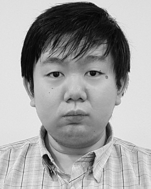 Ivan Tjuawinata合作论文数Nanyang Technol Univ, Strateg Ctr Res Privacy Preserving Technol & Syst, Singapore 637553, Singapore5
 Taolin Guo合作论文数Southeast Univ, Sch Comp Sci & Engn, Nanjing, Jiangsu, Peoples R China5
 Jie Feng (冯婕)合作论文数School of Artificial Intelligence, Xidian University5
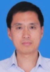 Baohua Qiang (强保华)合作论文数School of Computer Science and Information Security, Guilin University of Electronic Technology5Deguo Xia合作论文数School of Vehicle and Mobility, Tsinghua University;Baidu Inc4Shunshun Peng合作论文数4Yonggan Ji合作论文数4
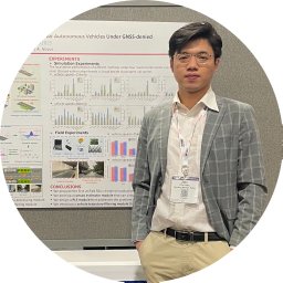 Zilin Huang (黄紫林)合作论文数School of Civil Engineering and Transportation, South China University of Technology4Wen Yang合作论文数4
 Xiao Zhongyang合作论文数Tsinghua Univ, Dept Automot Engn, Collaborat Innovat Ctr Intelligent New Energy Veh, State Key Lab Automot Safety & Energy, Beijing, Peoples R China4Jinbao Wang合作论文数4
 Junjie Chen (陈俊杰)合作论文数School of Vehicle and Mobility, Tsinghua University4ZhiSheng Wang (王志昇)合作论文数4
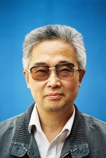 Xianlin Liu (刘先林)合作论文数Capital Normal University;Chinese Academy of Surveying & Mapping4Shizhong Liu (刘世忠)合作论文数South China Botanical Garden, Chinese Academy of Sciences;University of Chinese Academy of Sciences4
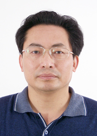 Youchuan Wan (万幼川)合作论文数School of Remote Sensing Information Engineering, Wuhan University4
 Jingzhong Xu (徐景中)合作论文数School of Remote Sensing and Information Engineering, Wuhan University4Bo Zhang合作论文数3Kehua Sheng合作论文数3Zhang Wei合作论文数3Mingliang Yang合作论文数3




