Trees sequester and store carbon in their biomass and are therefore often part of cities’ plans to become carbon neutral. However, nursing and management of trees result in emissions. In order to quantify carbon sources and sinks along the lifecycle of street trees in Germany, a life cycle inventory study was performed in this research. The inventory was based on interviews with nurseries, municipal green space managers, and arborist experts as well as insights from published studies. The life cycle inventory study was performed for three common tree species and three emission scenarios. The emission scenarios illustrate how individual processes such as the irrigation requirement, pruning, and pest management can impact the overall CO2 balance. Within 26 years at the urban site, all three tree species in all scenarios reached net zero. In the medium emissions scenario, it took 4 years for Quercus robur ‘Fastigiata’, 12 years for Corylus colurna, and 15 years for Tilia cordata. The urban site management was associated with more emissions than the nursery and end-of-life stage. If pest management at the urban site was required, this became the process with the highest emissions, followed by pruning, irrigation, and felling. This study highlights the importance of favorable growth conditions, short transport distances, and optimized urban tree management for minimizing emissions and maximizing sequestration.
Knowledge on the status and trends of biodiversity in urban areas is scattered and biased towards a few taxonomic groups, despite the fact that cities are where most humans get in touch with nature today. As part of the German Biodiversity Assessment (‘Faktencheck Artenvielfalt’), we conducted a nationwide review of published studies that recorded species occurrences in urban areas in Germany. We found that urban areas can host a large proportion of all plant, animal, and fungal species found in Germany, thus contributing to the nationwide conservation of biodiversity. However, compared to other habitat types outside of cities, the number of studies analysing the status and trends of urban biodiversity is relatively small. We could not identify a general trend over time for species diversity in German cities, based on the available studies. Even within individual species groups, there are combinations of declining, positive, and/or neutral trends. Information on population trends remains limited. Similarly, evidence of whether urbanisation promotes the homogenisation or differentiation of species groups is weak, with those groups investigated more thoroughly showing mixed patterns. With regard to biodiversity promotion, preserving the environmental heterogeneity that contributes to biodiversity is important, such as the maintenance of various habitat types (forests, parks, gardens, ponds, streams, etc.) that offer various food and nesting resources. Hence, the proportion of built-up impervious areas must remain limited, i.e. must not increase, and additional measures to promote biodiversity must be implemented. However, local authorities are largely ill-equipped to systematically monitor species occurrence across the variety of habitat types, or elements of green-blue infrastructure and taxonomic groups in cities. We discuss these findings, considering international urban biodiversity assessments and suggest key attributes of an effective national monitoring system to support urban biodiversity conservation and enhancement.
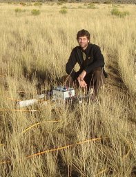
The impact of climate change is increasingly restricting water availability in the soil, posing a significant challenge in urban areas where plants have to deal with limited space and sealed surfaces hinder rainwater infiltration. However, the amount of plant-available soil moisture plays a crucial role in plant vitality and is therefore important for ecosystem health. In urban environments, obtaining information on soil moisture is challenging. Commonly used methods, such as soil-moisture sensors, are often not applicable or do not provide a spatially resolved picture of soil moisture. Within the context of the interdisciplinary project CliMax, we explore the applicability of geophysical methods to characterize soil moisture in the rhizosphere in urban areas. Over the past year, monthly monitoring Electrical Resistivity Tomography (ERT) measurements were conducted at nine different tree locations in Braunschweig, Germany, characterized by diverse tree species and degrees of sealing of the surface. Additionally, temporally and spatially higher-resolution measurements were selectively taken. Various time-lapse inversion approaches implemented in the open geophysical inversion library pyGIMLi were tested and applied. Furthermore, Time-Domain Reflectometry (TDR) soil-moisture sensor data from different depths are available at each site, allowing calibration of ERT results with respect to soil moisture. The time-lapse inversion reveals well-resolved variation in soil moisture over the observed period, distinguishing between weather fluctuations and the influence of trees on the water balance. The water uptake is evident through increased resistivity values directly beneath the trees. Our study indicates that, depending on tree species and degree of sealing, the investigated urban trees predominantly extract water from the upper 1-4 meters. This finding is substantiated at specific locations by the data from deployed soil-moisture sensors.
Vor dem Hintergrund des geringen Selbstversorgungsgrades Deutschlands an Obst und Gemüse fordert die Politik regionale und lokale nachhaltige Agrar- und Ernährungssysteme als Wege in eine krisenfeste Landwirtschaft. Darin spielt die Ausrichtung der Landwirtschaft auf die Stadt eine besondere Rolle. Anlässlich des 2. Braunschweiger Stadtgrün-Tages stellten sich die Teilnehmenden darüber hinaus die Frage, welchen Beitrag die nicht-professionelle urbane Nahrungserzeugung in Braunschweigs Gärten für die Selbstversorgung der Stadt mit Obst und Gemüse spielen könnte. Das überraschende Ergebnis war, dass sich Braunschweig theoretisch innerhalb seiner Stadtgrenzen mit Gemüse und Obst selbst versorgen könnte. Die Faktoren, die die praktische Umsetzung begrenzen, wurden diskutiert.
Against the backdrop of Germany's low self-sufficiency in fruits and vegetables, policymakers are advocating for regional and local sustainable agricultural and food systems as pathways towards a crisis -resistant agriculture. In this context, the alignment of agriculture towards urban areas plays a significant role. During the 2nd Braunschweig Urban Green Day, participants further explored the potential contribution of non-professional urban food production in Braunschweig's gardens to the city's self-sufficiency in fruits and vegetables. The surprising outcome was that, in theory, Braunschweig could self -supply with fruits and vegetables within its city limits. However, the practical implementation barriers were discussed extensively.
Animals within social groups respond to costs and benefits of sociality by adjusting the proportion of time they spend in close proximity to other individuals in the group (cohesion). Variation in cohesion between individuals, in turn, shapes important group-level processes such as subgroup formation and fission-fusion dynamics. Although critical to animal sociality, a comprehensive understanding of the factors influencing cohesion remains a gap in our knowledge of cooperative behavior in animals. We tracked 574 individuals from six species within the genus Canis in 15 countries on four continents with GPS telemetry to estimate the time that pairs of individuals within social groups spent in close proximity and test hypotheses regarding drivers of cohesion. Pairs of social canids (Canis spp.) varied widely in the proportion of time they spent together (5%-100%) during seasonal monitoring periods relative to both intrinsic characteristics and environmental conditions. The majority of our data came from three species of wolves (gray wolves, eastern wolves, and red wolves) and coyotes. For these species, cohesion within social groups was greatest between breeding pairs and varied seasonally as the nature of cooperative activities changed relative to annual life history patterns. Across species, wolves were more cohesive than coyotes. For wolves, pairs were less cohesive in larger groups, and when suitable, small prey was present reflecting the constraints of food resources and intragroup competition on social associations. Pair cohesion in wolves declined with increased anthropogenic modification of the landscape and greater climatic variability, underscoring challenges for conserving social top predators in a changing world. We show that pairwise cohesion in social groups varies strongly both within and across Canis species, as individuals respond to changing ecological context defined by resources, competition, and anthropogenic disturbance. Our work highlights that cohesion is a highly plastic component of animal sociality that holds significant promise for elucidating ecological and evolutionary mechanisms underlying cooperative behavior.
Das interdisziplinäre Forschungsprojekt CliMax ist eine Kooperation des Julius Kühn-Instituts und der Technischen Universität Braunschweig. Das Projekt erforscht die Grundlagen für effizientere Entscheidungshilfen für Städte und Kommunen, mit deren Hilfe nicht nur der Status Quo des Beitrages des Stadtgrüns zur Kohlenstoffsequestrierung geschätzt, sondern auch die Klimawirksamkeit des Stadtgrüns maximiert werden kann. Die Berücksichtigung der Multifunktionalität des Stadtgrüns bezieht dessen positive Effekte in eine Entscheidungsmatrix mit ein und unterstützt dadurch die Integration des Klimaschutzaspektes bei Pflanz- oder Pflegeentscheidungen. Zum Anlass des Auftaktsymposiums berichten wir hier von den Projektvorhaben.
The interdisciplinary research project CliMax is a cooperation between the Julius Kuhn-Institute and the Technische Universitat Braunschweig. It provides information on the status quo of the contribution of urban green spaces to carbon sequestration and aims for the development of decision-support tools for maximizing the climate effectiveness of urban green. Considering the multifunctionality of urban green spaces, such tools must incorporate many effects of urban green space into a decision matrix and thereby support the integration of the climate mitigation aspects in planting or maintenance decisions. On the occasion of the kick-off meeting, we report here on our plans for the project.
Preserving and expanding green infrastructure (GI) is key to biodiversity conservation in cities, but a significant share of urban land is commonly underutilized in GI plans: gardens. This is despite the fact that gardens can support diverse wildlife communities by providing habitat and by functioning as corridors. In this article, we apply circuit theory-based modeling in order to quantify the contribution of two types of gardens to connectivity in the city of Braunschweig, Germany: private gardens and allotment gardens. We ran four permeability scenarios: 1.) all green spaces including private and allotment gardens are permeable; 2.) private gardens are non-permeable; 3.) allotment gardens are non-permeable; 4.) only public green spaces but no gardens are permeable. We based our modeling on the European hedgehog (Erinaceuseuropaeus), a common, relatively well-understood and well-liked urban species. Observations by citizen scientists were used for a plausibility analysis and interpreting the results. Our results confirm the importance of gardens for providing habitat and connectivity. The overall landscape permeability to the movement of hedgehogs would decrease by 75% and the area of core habitats would decline by 63% without private and allotment gardens. While private gardens contribute most to landscape connectivity, some allotment gardens occupy key areas for the overall connectivity in the city. In conclusion, circuit theory-based modeling is a promising tool for urban GI planning and the output of those models can inform decision makers and gardeners.
Trap-neuter-return ( TNR ) is promoted as a “humane” alternative to lethal methods for population control of feral domestic cats ( Felis catus ). This paper explores feedbacks between feral domestic cats, coyotes ( Canis latrans ), raccoons ( Procyon lotor ), and skunks ( Mephitis mephitis ) at a TNR feral cat colony in Rhode Island, USA. A total of 12,272 photographs from a motion-activated camera were analyzed. Cat population size and visitation frequency of wildlife were estimated during three different feeding regimes. Abundant food on the ground was associated with increased wildlife visits, while elevated or limited food was associated with decreased wildlife visits. During the two-year study period, the population of cats dropped from 17 to 12 individuals and the cats appeared to have short life spans, which could have been due to predation by coyotes. Our results suggest that wildlife confluence and predation risks can be influenced by feeding regime.
The relationship between urban green spaces (UGS) and residential development is complex: UGS have positive and negative immediate impacts on residents’ well-being, residential location choice, housing, and land markets. Property owners and real estate agents might consider how prospective clients perceive UGS and act accordingly, while urban planners influence UGS location and management as well as aim at steering the built environment. Typically, studies focus on one of these perspectives at a time. Here, we provide a synopsis of results from studies, taking different perspectives for a single case study: Leipzig, Germany. We summarise and discuss the findings of eight studies on UGS and residential development. In detail, these studies focus on spatial pattern analysis, hedonic pricing analysis, mixed-methods studies on experts’ perspectives, surveys, and choice experiments exploring residents’ perceptions of UGS. We reflect on the feasibility of deriving a synthesis out of these independent studies and to what extent context matters. We conclude that both triangulating of data and methods, as well as long-term and context-sensitive studies are needed to explain the interlinkages between UGS and residential development and their context dependency.
Private gardens make up large parts of urban green space. In contrast to public green spaces, planning and management is usually uncoordinated and independent of municipal planning and management strategies. Therefore, the potential for private gardens to provide ecosystem services and habitat and to function as corridors for wildlife is not fully utilized. In order to improve public knowledge on gardens, as well as provide individual gardeners with information on what they can contribute to enhance ecosystem services provision, we developed a GIS-based web application for the city of Braunschweig (Germany): the 'GartenApp' (garden app). Users of the app have to outline their garden on a web map and provide information on biodiversity related features and management practices. Finally, they are asked about observations of well recognizable species in their gardens. As an output, the gardeners are provided with an estimate of the ecosystem services their garden provides, with an evaluation of the biodiversity friendliness, customized advice on improving ecosystem services provision, and results from connectivity models that show gardeners the role of their garden in the green network of the city. In this paper, we describe the app architecture and show the first results from its application. We finish with a discussion on the potential of GIS-based web applications for urban sustainability, planning and conservation.
The ambitious goal of the German federal government to achieve a "nearly climate-neutral" building stock by 2050 should be underpinned by detailed knowledge on the whole life cycle of the housing stock in Germany. Therefore, a life cycle assessment (LCA) tool is developed, that combines the embodied energy (energy used for production of a building) as well as the energy consumption of existing buildings. By combining LCA data with a customized extract from the 2011 census for parts for Lower Saxony, the tool allows for spatially explicit assessments on a square kilometer grid. The classification of buildings, using building type and construction year, offers the possibility to quickly evaluate the building stock without the need for detailed information. In the future, the tool will be expanded to enable comparing the impact of actions like renovation of existing buildings on the one hand, and demolition with new construction on the other. Thus, scenarios can be analyzed and priorities for interventions identified. Combined with other information in regional sustainability assessments, for example mobility analyses and environmental impacts of land consumption, the tool will allow exploring paths to greater sustainability for the built environment.
Humans have become an urban species, but this is a rather recent phenomena. The first cities appeared around six thousand years ago and while their number increased, their population remained relatively small. This changed in the industrial revolution and today cities are home to more than 50 percent of the world’s human population. Considering that most people live in cities and that ecology has been around for more than one hundred years, it seems obvious to have a subdiscipline called urban ecology. Not until the 1960s and 1970s, however, did urban ecology fully emerge and not until the 1990s did it become wildly popular. Most ecologists shunned urban areas, which have traditionally been viewed in opposition to natural, pristine, and wilderness places. It is true enough that water, air, and soil in cities are often polluted, open spaces are scarce and heavily managed, and communities resemble a wild mix of native and non-native species. It took a while until ecologists perceived this not just as a mess, but also as a research opportunity for understanding key ecological principles. Such principles are treated in separate Oxford Bibliographies in Ecology articles “Competition and Coexistence in Animal Communities,” “Metapopulations and Spatial Population Processes,” “Island Biogeography Theory,” “Succession,” and “Invasive Species.” The study of these phenomena is often referred to as ecology in cities. In the 1970s, a broader, interdisciplinary perspective took hold. It is often referred to as ecology of cities and understands urban areas as social-ecological systems. This shift in perspective stemmed from a recognition that people are influencing ecosystems everywhere on earth. In fact, cities are at the heart of many environmental problems and, therefore, they are a good place to look for solutions. Today, urban ecology is a key discipline for an urban planet. The need to adapt cities to climate change, maintain vegetation in the face of climate extremes, balance the need for development with the need for green space, or decrease the negative local-to-global environmental impacts of cities can be achieved without the interdisciplinary perspective urban ecology provides. This article gives an overview of the ever-increasing urban ecology literature. Of course, the list is subjective, reflecting our academic background, professional network, and research interest as well as our language skills. We acknowledge that we may have ignored important publications, published perhaps in a language we cannot read, or we may have focused too much on one topic and too little on another. We ask readers to understand these limitations and we encourage them to help us improve this article in the future.
Land consumption through expansive urbanization is a major obstacle towards sustainable development. In reaction, sustainability strategies and goals on national, supranational and global scale frequently include the target of slowing land consumption. The success of such strategies and goals is commonly measured with indicators that track the conversion of open space (e.g., forests and farmland) into built-up space. A process generally hidden from such indicators is the loss of pervious surface at the fine scale within residential areas, but evidence from case studies suggests that this process can be quite substantial. In this article, we studied this phenomenon from a slightly different angle by comparing the anticipated and actual impervious surface of residential areas. In order to do so, we compared development plans (i.e., the legally binding documents that steer building in Germany) with the actual implementation. We selected eight development plans of low-density (single-family) housing (PLAN), which were digitized along with the actual implementation visible on 2016 orthophotos (STATUS QUO). All sites but one showed a relative increase between 8 and 56% of impervious surface from PLAN to STATUS QUO. We then modelled the environmental impacts of these changes, using the local water balance as an illustrative example. For all sites with an increase of impervious cover, infiltration rates decreased by 4 to 19%, evaporation rates increased by 0.2 to 1% and surface runoff increased by 4 to 18%. The more impervious surface, the stronger the effect, but it also depended on soil type and modelled rain intensity. Our results point to a gap between planning and real-world outcomes and they underline the environmental consequences, illustrated by effects on the water balance. In order to prevent hidden urbanization, we suggest that more emphasis should be put on integrated sustainable design and monitoring of the real-world results.
Effective urban planning, and urban green space management in particular, require proper data on urban green spaces. The potential of urban green spaces to provide benefits to urban inhabitants (ecosystem services) depends on whether they are managed as a comprehensive system of urban green infrastructure, or as isolated islands falling under the responsibility of different stakeholders. Meanwhile, different urban green space datasets are based on different definitions, data sources, sampling techniques, time periods and scales, which poses important challenges to urban green infrastructure planning, management and research. Using the case study of Lodz, the third largest city in Poland, and an additional analysis of 17 other Polish cities, we compare data from five publicly available sources: 1) public statistics, 2) the national land surveying agency, 3) satellite imagery (Landsat data), 4) the Urban Atlas, 5) the Open Street Map. The results reveal large differences in the total amount of urban green spaces in the cities as depicted in different datasets. In Lodz, the narrowly interpreted public statistics data, which are aspatial, suggest that green spaces account for only 12.8% of city area, while the most comprehensive dataset from the national land surveying agency reveals the figure of 61.2%. The former dataset, which excludes many types of green spaces (such as arable land, private and informal green spaces), is still the most commonly used. The analysis of the 17 other cities confirms the same pattern. This results in broader institutional failures related to urban green infrastructure planning, management, and research, including a lack of awareness of green space quality (e.g. connectivity) and benefits (ecosystem services), and the related political disregard for urban green spaces. Our comparison suggests that a better understanding of green space data sources is necessary in urban planning, and especially when planning urban green infrastructure.
The smaller size of mini-parks in relation to conventional parks makes them a flexible and adaptable greening option for high-density neighbourhoods, despite limiting their individual service capacity. Consequently, some densely populated cities have developed clusters of mini-parks to meet intense recreational demands. We endeavoured to study the factors that support visits to mini-park groups, rather than to individual parks, taking 106 mini-park groups within Nanjing as samples. We utilised Tencent user density (TUD) data to trace the visit intensity of these groups and integrated multi-source data to measure their internal and external features. By establishing a regression model series, we investigated how the mini-park groups' internal amenities, proximity to surrounding recreation-related facilities, neighbourhood features, and layout affected their visit intensity over time (day/night, week/weekend). The results showed that larger open sites, proximate restaurants, higher density of commerce, offices and residents, and higher housing prices promoted visits, whereas greater neighbourhood green coverage discouraged visits. We also found that the service provision of most mini-park groups in Nanjing was inefficient or unbalanced, and that most mini-parks within a group worked competitively rather than complementarily. These findings can inform future decision making and mini-park planning in Nanjing and similar cities.
Agriculture has been, and still is, strongly shaping landscapes across Europe. In recent decades, agricultural land use has changed considerably, mainly driven by reforms of agricultural and bioenergy policies. Here, we related temporal and spatial changes in agricultural land use at both the landscape and regional scale to population trends of farmland birds. Monitoring data of the Common Breeding Bird Survey of Lower Saxony, Germany, and high-resolution data on agricultural land use from 2005 to 2012 were used to calculate the temporal trend slopes of farmland birds and agricultural variables at the landscape scale (1 km(2)). Agricultural variables comprised the area covered by maize, set-aside, permanent grassland as well as crop diversity. The number of territories were analysed for all farmland birds together as well as for two subgroups ('field nesters' and 'non-field nesters'). Further, we tested whether population trends of farmland birds differed between agricultural regions, characterised by different land-use change dynamics.Trends of farmland birds and non-field nesters were negatively related to increasing maize cultivation at the landscape scale. We further found that population trends of field nesters reacted region specifically and performed worst in an agricultural region that was characterised by the strongest increase of maize and decrease of crop diversity, indicating a negative effect of broad-scale landscape homogenisation. To counteract the process of spatial and temporal land-use homogenisation and to inform policy-makers on options for mitigation, we conclude that conservation actions should be tailored at a regional scale to halt or even reverse negative farmland bird population trends. (C) 2017 Elsevier B.V. All rights reserved.
Most species exhibit periodic behaviors in response to cycles in resources and risks in the environment (circadian, lunar, seasonal, and so on). The ability to respond to anthropogenic perturbations by modifying periodic behaviors remains little studied, as does the question of whether and how periodic behaviors translate into periodic patterns in animal space use, on which we focus. Extending existing continuous-time stochastic movement models, we propose two new parametric approaches to detect and quantify periodic patterns of space use in animal tracking data, via periodicity in the expected position or circulation in the stochastic component of the path. We use them to study the movements of maned wolves (Chrysocyon brachyurus) and coyotes (Canis latrans) along anthropization gradients. These case studies illustrate how periodic patterns can be of natural origin (cycles in the environment) or anthropogenic origin (periodicity in human activity or restrictions on available habitat), suggesting a role for periodic patterns of space use in species persistence in anthropized areas. The method builds upon and extends existing functionalities in the R-package ctmm, in which the necessary tools are made available.
Worldwide, the role of farmlands for biodiversity conservation and the delivery of multiple ecosystem services has been widely acknowledged. In the European Union (EU), societal demands to include environmental conservation concerns within the Common Agricultural Policy (CAP) have resulted in the recognition of the importance of maintaining High Nature Value farmlands (HNVf). HNVf constitute complex social-ecological systems, which owe their nature conservation value to the maintenance of specific, mostly low-intensity farming systems, supporting high levels of species and habitats dependent on agricultural practices. Even though HNVf assessment in space and time is essential to evaluate the effectiveness of Rural Development Programmes, the diversity of rural landscapes across EU, the scarcity of data on farming systems, and the lack of common methodological guidelines has hampered the implementation of HNVf mapping and monitoring across Europe. Thus, there is a pressing need to develop and test methodological approaches that may support HNVf assessment across the EU. The Integrated Administration and Control System (IACS) which is mandatory for all EU Member States constitutes a system for the management and control of CAP payments to farmers. Essentially, IACS comprises high-resolution, spatially explicit information on the type and intensity of agricultural land-use. Even though such data exhibits high thematic, spatial and temporal resolution, IACS has seldom been used, due to significant access restrictions. Here, the potential to use IACS data to support the assessment of HNVf was evaluated within the German Federal State of Lower Saxony by implementing a recently developed methodological framework. Sets of indicators known to be essential for identifying potential HNVf and underlying farming systems (expressing landscape structure and composition, farming systems, and crop diversity), were derived from IACS. Spatial patterns of indicators were analyzed at two different scales to delineate the potential distribution of HNVf across Lower Saxony. Results highlighted that most regions in Lower Saxony were characterized by intensive farming practices including high livestock density, high share of intensive crops and low density of linear elements. Only 3% of the Utilized Agricultural Area (UAA) of Lower Saxony potentially constituted HNVf, with the majority of HNVf coinciding with mosaics of arable and/or permanent crops and semi-natural features under less intensive farming practices. Semi-natural grasslands, partially under agri-environment scheme management contracts, covered roughly 1% of the UAA and were mostly intermingled with other farmland habitats in extensively managed agricultural landscapes. In the context of the EU-wide HNVf assessment, IACS constitutes an important source of data, characterized by a high spatial, thematic and temporal resolution of data collected annually. Whilst having the potential for use in HNVf assessment, some challenges remain, especially due to significant access restrictions. Nevertheless, IACS constitutes a powerful tool to evaluate the extent and condition of HNVf across the EU countryside. Making use of LACS data in such a way could provide a stepping-stone towards achieving a more effective balance between the management and control of CAP support payments and the growing societal demands related to the maintenance and enhancement of farmland biodiversity and ecosystem services. (C) 2016 Elsevier Ltd. All rights reserved.
 Dagmar Haase合作论文数Geography Department, Faculty of Mathematics and Natural Sciences, Humboldt-Universitat zu Berlin;Geographisches Institut, Mathematisch-Naturwissenschaftliche Fakultät, Humboldt-Universitat zu Berlin12
 Paige S. Warren合作论文数International Institute for Sustainability;Arizona State University;International Institute for Sustainability, Arizona State University6
 Falko Feldmann合作论文数4
 Nadja Kabisch合作论文数Institute of Physical Geography and Landscape Ecology, Faculty of Natural Sciences, Leibniz University Hannover4
 Boris Schröder合作论文数University of Potsdam Institute of Geoecology4
 Johannes Hoppenbrock合作论文数3Mona Quambusch合作论文数3Sara Vollrodt合作论文数3
 numi mitchell合作论文数Dept Nat Resources Sci, Univ Rhode Isl3eric arnold合作论文数3Malkin Gerchow合作论文数3
 Matthias Beyer合作论文数Environm Geochem, IGOE3
 Matthias Bücker合作论文数Inst Geophys & Extraterr Phys, Tech Univ Carolo Wilhelmina Braunschweig3
 Anne-Kathrin Schneider合作论文数3
 Jens Dauber合作论文数3Sebastian Klimek合作论文数3Saskia Bothe合作论文数2rachel s danford合作论文数2
 Burkhard Golla合作论文数2vera hormann合作论文数2
 Mario App合作论文数2
 Sabrina Jerrentrup合作论文数2
 Carsten Dormann合作论文数Department of Biometry and Environmental System Analysis, University of Freiburg2
 Robert Ryan合作论文数2
 Jakub Kronenberg合作论文数Department of International Economics;University of Lodz;Department of International Economics, University of Lodz2Nina Schwarz合作论文数Department Computational Landscape Ecology, Helmholtz Centre for Environmental Research - UFZ2
 Jeroen Everaars合作论文数2
 Bernd Gruber合作论文数Department of Conservation Biology, UFZ—Helmholtz Centre for Environmental Research2Seth A. Moore合作论文数1David I. McCracken合作论文数1
 Justin Lee Brown合作论文数1Benjamin Allen合作论文数1Malte Moeck合作论文数1Daniel L. J. Dupont合作论文数1Sana Zabihi-Seissan合作论文数1
 Sarah C. Webster合作论文数1Pat Jackson合作论文数1Austin T Homkes合作论文数1Joern Strassemeyer合作论文数1Dean E. Beyer合作论文数1Anneke O. Döring合作论文数1Annegret Haase合作论文数1Jack Tatler合作论文数1Ann-Kristin Mühlbach合作论文数1Yvette Chenaux-Ibrahim合作论文数1Katrien A Kingdon合作论文数1Mathew S. Sorum合作论文数1
 Josef Kaiser合作论文数1
 Connor A Thompson合作论文数1




