Many territorial and development policies in the European Union recognize that rural mountainous regions suffer from enduring natural and demographic disadvantages. These regions frequently face undesirable, persistent and self-reinforcing challenges, often conceptualized as traps. Through engagement with a panel of experts on mountainous regions, we examined whether the trap concept effectively explains the development challenges in European mountainous areas. We find that the distinguishing feature of these challenges is their multidimensional interrelatedness, which can give rise to multiple, simultaneously occurring traps (e.g. rigidity traps, poverty traps, lock-in traps, and regional development traps). In effect, we find that mountainous regions experience a polytrap - a complex of concurrent traps, maladaptive processes, an absence or severe limitation of bounce-back resilience, and difficulties in achieving bounce-forward resilience, largely due to dependence on external actors and factors. This polytrap concept emphasizes the need for rural policies to acknowledge these multifaceted challenges and both enable and promote place-based approaches for revitalizing left-behind places.
The article provides an overview of published articles and topics covered in the international scientific journal Urban Forestry and Urban Greening (UFUG) and students' final theses up to 2023. The analysis includes 2,550 scientific articles published in UFUG between 2002 and 2023, as well as 88 final theses published in Slovenia. To compare developments, we divided this material into four comparative periods, extracted the authors' keywords from the articles, and assigned each one to a single subcategory. We then analysed the terms used in the titles and abstracts of UFUG articles. In addition to the increase in the number of articles published, the number of articles using keywords related to biodiversity and nature conservation has also increased over the past two decades. The results show that interest among authors has declined the most in field of politics and management, while an interdisciplinary expansion has been observed mainly in the fields of health and psychology. We estimate that interdisciplinary expansion will continue in the future and ultimately transition into transdisciplinarity.
A significant number of studies have been conducted in order to explore the effects of greenery on various aspects of human functioning. However, little is known about how natural elements affect indicators of well-being at work, such as work burnout or work engagement. Two studies (Study 1, winter – Ljubljana, Slovenia; Study 2, spring – Novi Sad, Serbia) were performed in order to: 1) assess the effect of natural elements on work burnout and work engagement in two different seasons (winter and spring); 2) explore if gender moderates the effects of workplace greenery on work burnout and work engagement. The results from Study 1 (winter) showed that, after the exclusion of outliers from the dataset, neither indoor nor outdoor greenery had a significant effect on work engagement and work burnout. Contrary to this, in Study 2 (spring) outdoor greenery exerted a significant effect on both burnout and engagement, while indoor greenery did not. The moderating effect of gender was not clear and further studies on this topic are needed. Thus, the current research extends the existing literature on workplace greenery and demonstrates that natural elements can, to some extent, affect indicators of employee well-being, such as burnout and work engagement.
Green (and blue) spaces receive attention as important components of cities that can help to mitigate the effects of climate change, support biodiversity and improve public health. Green space planning aims to transform cities towards urban sustainability and resilience. In a longitudinal study, representatives from eleven European municipalities that had previously been interviewed in 2014 were re-interviewed in 2020-2021 on changes in urban greening and related practices. The interviewees reported mainly advancements in dealing with ecological issues, such as new plans, strategies, regulations or funding programmes for climate adaptation or biodiversity support, as well as some progress in co-governance with non-governmental stakeholders. Promising developments include breaking professional silos by creating new units that can better deal with complex urban issues. In a few cases, high-level local politicians induced profound changes. These changes stimulated the development of new planning and governance cultures, resulting in more co-creation of urban green spaces. However, from a transformation studies perspective, incremental strategies dominate, and even when municipal representatives are aware that substantive changes are needed, they often lack the means to act. For more radical system change, significant extra efforts are needed.
Urban and peri-urban forests are strongly influenced by urbanisation and infrastructure-driven development. The main objective of the study is to evaluate and assess key factors characterising of urban and peri-urban forests in Slovenian regions with large differences in landscape fragmentation, from the Pannonian Plain to the Alps and the Mediterranean Sea. To assess landscape fragmentation and potential urban and peri-urban forests (UPFs), we used a spatial model of landscape structure and spatial characteristics of forests’ fragmentation and connectivity. The basis for estimating landscape structure and spatial characteristics of UPFs was tested for the 69 settlements with city status and for 150 smaller, rural settlements, which are the centres of individual municipalities. Of the 219 Slovenian settlements analysed, forest core areas within walking distance were estimated for 98% of the settlements. The proportion of the walking distance area with forest cover and 100 m or more from the forest edge is no more than one tenth of this area for 45% of Slovenian towns and for 42% of smaller settlements. By assessing the gradients of landscape ecological variables and accessibility of UPFs, it is possible to compare UPFs in different regions and take them into account when preparing guidelines for spatial planning based on landscape structure principles at the local level. Large differences in the landscape and UPF fragmentation within cities and settlements highlight the importance of spatial planning that adapts to the individuality of the landscape and each UPF.
The perception of linkages between ecosystem services (ES) and the urban green infrastructure (UGI) is evaluated, and their impact on human well-being (WB) is defined. Using a theoretical approach, the UGI’s specific contribution to WB is calculated as the sum of the products of (a) the number of perceived ES per ES group and the WB weight factor divided by the product of (b) the number of respondents and (c) the sum of the products of ES and the WB weight factor. Stakeholders demand more ES than the perceived ES supply from all types of UGI, especially for the social relations component of WB. The highest number of perceived ES and greatest impact on all WB components is provided by urban forests. This method could be helpful in acknowledging ES and involving stakeholders not previously familiar with the ES concept with the aim of introducing ES into UGI governance.
Preschool children spend a large part of their everyday life in kindergartens, so it is necessary to include visits to the forest, which is the most extensive natural environment in Slovenia, in preschool childcare programs. Based on surveys with preschool teachers of public kindergartens in Slovenia (N = 133), we analysed the habits, purposes, barriers and concerns associated with visiting the forest. The frequency and duration of forest visits largely depend on the distance of the forest from the kindergarten. The habits of forest visits among forest kindergartens which are included in the Network of Forest Kindergartens organized by the Institute of Forest Pedagogy do not differ significantly from that of general public kindergartens. They differ mainly with respect to the frequency of visitation in bad weather and the purpose of visitation. The main concerns when visiting the forest are ticks, fear of injury, and the children having inappropriate equipment. The reasons for less frequent forest visitation include different pedagogical priorities of the kindergartens and lack of support from the management and parents, which highlight the need for the strategic promotion and implementation of forest visitation in preschool education.
Preschool children spend a large part of their everyday life in kindergartens, so it is necessary to include visits to the forest, which is the most extensive natural environment in Slovenia, in preschool childcare programs. Based on surveys with preschool teachers of public kindergartens in Slovenia (N = 133), we analysed the habits, purposes, barriers and concerns associated with visiting the forest. The frequency and duration of forest visits largely depend on the distance of the forest from the kindergarten. The habits of forest visits among forest kindergartens which are included in the Network of Forest Kindergartens organized by the Institute of Forest Pedagogy do not differ significantly from that of general public kindergartens. They differ mainly with respect to the frequency of visitation in bad weather and the purpose of visitation. The main concerns when visiting the forest are ticks, fear of injury, and the children having inappropriate equipment. The reasons for less frequent forest visitation include different pedagogical priorities of the kindergartens and lack of support from the management and parents, which highlight the need for the strategic promotion and implementation of forest visitation in preschool education.
Heat islands (HI) are a common anthropogenic phenomenon and are defined as artificial surfaces (urban areas) that have a higher average temperature than their surroundings (rural areas). The aim of this work was to determine the influence of land use on the spatial distribution and intensity (HIi ) of HI in Slovenia. The MODIS Land Surface Temperature (LST) and Corine Land Cover (CLC) databases were used to perform the analysis. Within the identified HI, two HI levels were determined based on temperature difference. The results revealed a statistically significant negative correlation between HIi and both forest co%ver and forest fragmentation (forest edge density and ratio of mean forest patch size to HI size). Artificial surface was positively correlated with HIi . The results contribute to the understanding of the spatial distribution of HI and HIi and provide informati%on for spatial planning and policy-making to reduce the negative impact of HI.
By providing ecosystem services, urban forests contribute significantly to the well-being of urban populations. Urban forests, along with other urban green spaces, are often the closest natural environment in the city where a child can play. The majority of pre-school children spend a large part of the day in kindergarten, which means that forest visits should have a prominent place in the kindergarten curriculum. Therefore, this study focuses on making the forest more suitable and thus more accessible for visits with children. The first goal of the research is to identify teachers' preferences for the forest environment they visit with a group of pre-school children. The second goal is to present a forest suitability model for a visit with kindergarten children based on the teachers' preferences. Based on the research survey conducted among the teachers in Slovenian public kindergartens, we formed and evaluated the criteria for the construction of a model of forest suitability for a visit with children. As the most important requirement for visiting a forest, the teachers note its proximity. They prefer a mature, mixed forest, with a bit of undergrowth, dead wood, and a presence of water and a meadow. Based on the identified criteria, we used the multi-criteria evaluation method in the GIS-environment in order to build a model of urban forest suitability for a visit with kindergarten groups of children in the study area of the City of Ljubljana, Slovenia. The results are useful in urban forest planning and management to ensure better forest suitability and accessibility for visits by children. Suitability maps can be used as one of the spatial foundations necessary for an integrated urban forest planning with emphasis on social functions. The model can be adapted beyond Slovenia to different spatial and social requirements and contexts.
The phenomenon of increased temperature in cities compared to their rural environs, also referred to as urban heat island, is one of the most evident anthropogenic climatic modifications. Introducing green spaces and vegetation is the fastest, simplest, and a highly effective way of mitigating and adapting urban temperature conditions. The primary goal of the presented research is to identify the interrelationship between urban heat island magnitude (UHIM) and urban green infrastructure extent, shape, and distribution on European scale comparing different green space planning traditions - planning families (PFs). The UHIM for the European cities was calculated based on a reconstructed MODIS LST dataset of a period of ten years. The reasons for the arrangement of UHIMs according to PFs and green land use are not easily explained and are certainly influenced by a number of various conditions in different PFs. UHIM increases with the longitude of cities. In some of the PFs, the relation between the UHIM and land use proportion is characteristic for certain land uses, but a considerable difference between PFs regarding land use proportion with significant impact on UHIM can only be noted in case of a forest. The configuration and composition of the forest correlate with UHIM with statistical significance, but the share of the forest does not affect UHI in all PFs in the same way. While a higher proportion of forest, higher largest patch index, higher mean patch area, higher edge density and higher proportional landscape core is associated with a lower UHIM in the New member and Mediterranean PFs, the relationship in other PFs is reversed. Information on general patterns of UHIM occurrence in relation to urban green infrastructure characteristics could help urban planners and politicians introduce changes on the local level, which would help providing nature-based solutions for the mitigation of the UHI phenomenon.
While urban growth contributes to the biodiversity crisis, biodiverse greenspaces within cities could support both human wellbeing and biodiversity conservation. Yet, urban greenspaces are under pressure due to the rapid densification of cities worldwide. Urban conservation policies thus need broad support, ideally from people with different sociocultural backgrounds. Whether urban residents prefer biodiverse over simply green spaces, however, largely remains an open question. We tested how diverse respondents (N = 3716) from five European cities valued three levels of biodiversity (plant species richness) in four ubiquitous greenspace types. Our field survey revealed that biodiversity matters: People largely prefer higher plant species richness in urban greenspaces (i.e., parks, wastelands, streetscapes) and agree that higher plant species richness allows for more liveable cities. Despite variation across European cities, positive valuations of high plant species richness prevailed among different sociocultural groups, including people of migrant background. The results of this study can thus support policies on a biodiversity-friendly development and management of urban greenspaces by highlighting social arguments for integrating biodiversity into urban development plans.
The role of urban parks in delivering cultural ecosystem services related to outdoor recreation is widely acknowledged. Yet, the question remains as to whether the recreational opportunities of parks meet the demands of increasingly multicultural societies and whether recreational patterns vary at spatial scales. In a pan-European survey, we assessed how people use urban parks (in five cities, N= 3814) and how recreational patterns relate to respondents' sociocultural and geographical contexts (using 19 explanatory variables). Our results show that across Europe (i) respondents share a general pattern in their recreational activities with a prevalence for the physical uses of parks, especially taking a walk; (ii) the geographic context matters, demonstrating a high variety of uses across the cities; and that (iii) the sociocultural context is also important; e.g., the occupation and biodiversity valuations of respondents are significantly associated with the uses performed. The sociocultural context matters particularly for physical park uses and is associated to a lesser extent with nature-related uses. Given that our results attest to a high variety of park uses between sociocultural groups and the geographical context, we conclude that it is important to consider the specific backgrounds of people to enhance recreational ecosystem services in greenspace development. (C) 2018 Elsevier B.V. All rights reserved.
Urban green infrastructure (UGI) and nature-based solutions are increasingly recognized as instruments to address urban sustainability challenges, yet rely on a good understanding of complex social-ecological system (SES) to function adequately. Adaptive co-management (ACM), engaging a broad variety of stakeholders in collaborative learning, is an effective strategy to improve the resilience of a SES. However, ACM studies have been criticized for neglecting the urban context, while also offering little clarity on process objectives and outcomes. To address these knowledge gaps, while also drawing attention to the important issue of socially inclusive UGI development, we present a guiding framework and approach to encourage the ACM of UGI featuring two main components. Firstly, a Learning Alliance (LA) serves as an instrument for collaborative learning and experimentation across different scales. To facilitate upscaling, we propose to establish a complementary Urban Learning Lab (ULL) to facilitate a regular exchange between the LA and legitimate peripheral networks and stakeholders in the city region. Secondly, a stepwise approach to SES analysis serves to engage a representative group of stakeholders in the LAs and ULLs, and support the processes of setting LA objectives and monitoring of adaptive capacity. We illustrate our approach to the ACM of UGI with a case study of LivadaLAB in Ljubljana, Slovenia. Applying the framework and approach, we demonstrate increased adaptive capacity of the SES around UGI as indicated by: 1) improved overall stakeholder salience, in particular for previously disempowered actor groups, 2) increased number and strength of connections between stakeholders, and 3) the consideration of a broader range of sustainable development objectives by stakeholders in their daily practice.
The perceptions and attitude of local people towards a protected area have been identified in literature as a key factor for its success, since perceptions affect operations within the environment. The study identifies and analyses the perceptions of local stakeholders in the Slovenian Kamnisko-Savinjske Alps Regional Park in designation in order to improve further stakeholder participation planning in the establishment and management of the park. Contrary to similar studies, the study is carried out on the case of the park in designation where the attitudes of local stakeholders strongly influence the process of establishment. The qualitative method of the grounded theory is used to inductively develop the theory from in-depth, semi-structured, and open-ended interviews with local stakeholders and park founders. The article discovers links between main entities influencing the perception and provides a more comprehensive description of the reasons and the background of their formation. The perception of benefits, the inclusion in the park establishment and past experiences with institutions represented by founders have the most influence on the local stakeholders' attitudes towards the park. (C) 2015 Elsevier Ltd. All rights reserved.
The article explores the possibilities of urban agriculture as a tool for facilitated socially inclusive urban greening and governance of sites in transition. “Beyond the Construction Site” (BCS) is the research focus of this article. Urban agriculture proves a tool for including people in site planning and management since it requires presence of users on site. The case study reveals two novelties in the facilitation process in relation to the urban agriculture greening of sites in transition: a) multiple level operation engaging users, municipality and general public, and b) gradual inclusion of users in site governance. The article presents an example of how general participation in spatial planning between municipalities, spatial planners, and citizens could be developed and institutionalised in the future.
Extensive green areas generate a recognizable green identity of Ljubljana. Due to the challenges of climate change and urbanization the city's spatial policy highlights revitalization of degraded urban areas, preserving the quality and scope of the existing green network and the protection of multifunctional natural areas surrounding the city. Article describes the project of Rakova Jelsa Park as a good example of these policies. With an NGO initiative a former degraded area with illegal dumping and non-indigenous vegetation was transformed into recreational park with increased biocultural diversity. Important lesson of the project is that opening up space for public use not only prevents degradation, but also improves the quality of urban ecosystems. One of the challenges for the city's future sustainable ecosystem development will be a more active cooperation with its citizens in the green infrastructure policy and later also a partial transfer of responsibility for green areas to them. (C) 2015 Elsevier Ltd. All rights reserved.
To effectively organize cooperation with stakeholders in the planning and management of protected areas, it is important to understand their perception of the protected area and the factors influencing that perception.This study identifies the factors and their impact on locals' perceptions of the Kamniško-Savinjske Alps Regional Park in designation, Slovenia.The results of discriminant analysis show that the local population that supports the park has significantly different views of its potential from the population that opposes it.In addition, the local population that supports the park was personally notified by the founders about the plans, while the opposing population was not.Therefore, the former is more trustful of the founders' procedures and there is more cooperation with all interest groups than with the opposing population.Contrary to our expectations, higher education, place of residence, and gender do not affect the population's support for the park.These results confirm that a consideration of the factors that affect the local population's perception of the protected area contributes to more effective involvement of stakeholders in the process of park creation, which is important for the successful management of protected areas.
 Rozalija Cvejic合作论文数6
 Tim Delshammar合作论文数6
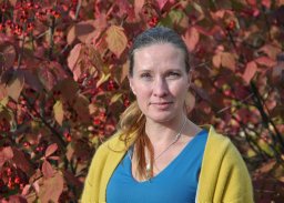 Kati Vierikko合作论文数Department of Biological and Environmental Sciences, University of Helsinki5
 Marina Pintar合作论文数5
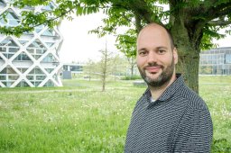 Thomas J. M. Mattijssen合作论文数Wageningen Economic Research4Špela Železnikar合作论文数4
 Alexander van der Jagt合作论文数Dept Environm Sci, Forest & Nat Conservat Policy Grp, Wageningen Univ & Res4
 Rieke Hansen合作论文数4
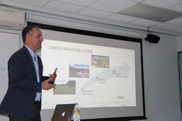 Raffaele Lafortezza合作论文数Department of Plant Production Science, University of Bari4
 Bianca Ambrose-Oji合作论文数School of Agricultural and Forest Sciences;University of Wales Bangor;School of Agricultural and Forest Sciences, University of Wales Bangor4Éva Gerőházi合作论文数3
 Hanna Fors合作论文数Dept Landscape Architecture Planning & Management, Swedish Univ Agr Sci3
 Dagmar Haase合作论文数Geography Department, Faculty of Mathematics and Natural Sciences, Humboldt-Universitat zu Berlin;Geographisches Institut, Mathematisch-Naturwissenschaftliche Fakultät, Humboldt-Universitat zu Berlin3
 Birgit Elands合作论文数Forest and Nature Conservation Policy Group, Wageningen University3
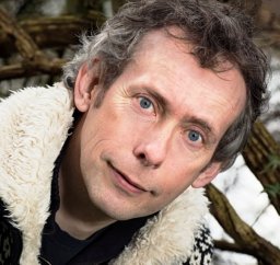 Arjen Buijs合作论文数Alterra Green World Research3Aleš Golob合作论文数2laura žižek kulovec合作论文数2
 Anton Olafsson合作论文数Department of Geosciences and Natural Resource Management, Faculty of Science, University of Copenhagen2Sabrina Erlwein合作论文数2
 Cecil Konijnendijk合作论文数Department of Forest Resources Management, Faculty of Forestry, The University of British Columbia2
 Stephan Pauleit合作论文数Department of Civil, Geo and Environmental Engineering, Technische Universität München2
 Luz Ana C合作论文数Institut de Ciència i Tecnología Ambientals, Universitat Autònoma de Barcelona2
 Kobal Milan合作论文数Biotechnical Faculty, University in Ljubljana2
 Anders Busse Nielsen合作论文数2
 Werner Rolf合作论文数2
 Jakub Kronenberg合作论文数Department of International Economics;University of Lodz;Department of International Economics, University of Lodz2
 Ingo Kowarik合作论文数Institute of Ecology, Technical University of Berlin2
 Leonie K Fischer合作论文数2
 Cristina Branquinho (Cristina)合作论文数Faculdade de Ciências, Universidade de Lisboa, Campo Grande, Bloco C2, 1749-016 Lisbon, Portugal2
 Nadja Kabisch合作论文数Institute of Physical Geography and Landscape Ecology, Faculty of Natural Sciences, Leibniz University Hannover2
 Janez Pirnat合作论文数2Sandra Fohlmeister合作论文数1Mandy Cook合作论文数1
 Margarida Santos-Reis合作论文数1
 Sandra Gentin合作论文数Department of Geosciences and Natural Resource Management, Faculty of Science, University of Copenhagen1
 Snezana Popov合作论文数Dept Biol & Ecol, Univ Novi Sad1
 Hanna Nieminen合作论文数1
 Pelyukh Oksana合作论文数Dept Ecol Econ, Ukrainian Natl Forestry Univ1jasmin honold合作论文数1Mike Smith合作论文数1Yaşar Selman Gültekin合作论文数1
 Maja Steen Møller合作论文数Department of Geosciences and Natural Resource Management, University of Copenhagen1
 Ivana Zivojinovic合作论文数Ctr Bioecon, Univ Nat Resources & Life Sci Vienna BOKU1
 Boris Popov合作论文数Dept Psychol, Univ Novi Sad1
 Vincenzo Giannico合作论文数Dept Agr & Environm Sci, Univ Bari A Moro1
 Hilbert Sven合作论文数1
 Alexandra Botzat合作论文数1
 Emily Lorance Rall合作论文数1
 Langemeyer Johannes合作论文数1




