Chemicals in the aquatic environment can be harmful to biota and may cause toxic risks to the aquatic ecosystems. A high number of these chemicals originate from households, manufacturing and industries and are released to the aquatic environment as point source when connected to wastewater treatment plants (WWTP´s). A subset of the substances is permanently released and the load is proportional to the number of people connected to WWTPs, while the concentration of these substances shows higher variability. Especially at low discharges of the receiving waters the toxic risk may increase due to reduced dilution.With a hydrologically informed approach that combines river network hierarchy, river discharge, wastewater loads and spatial allocation of point sources we developed a parsimonious model to calculate the total toxicity risk at each location of wastewater treatment plant (WWTP) discharges. The total toxicity risk was calculated as the sum of individual risks for 42 substances selected from a reference mixture of chemicals being considered as representative for European wastewater treatment plant effluents for a river network in Central Germany with about 300 WWTP´s of various sizes.The results showed consistent patterns of substance specific cumulative toxicity and allowed an assessment of toxicity risks locally and at catchment scale. Different scenarios were analyzed to evaluate the consequences of different strategies to minimize toxic risks either by (1) source control, (2) relocation of WWTPs or their effluents or (3) end-of-pipe solutions like the 4th treatment level depending on local conditions. With these capabilities the approach and model may support the implementation of the revised European Urban Wastewater Treatment Directive.
The concept of land-use intensity has been widely used to quantify human impacts in terrestrial systems, yet such approaches fail to capture the cumulative effects of land use on connected river networks. Here, we introduce the Land Use Intensity Index for Stream Ecosystems (LUIS), a spatially explicit, hydrologically informed index that integrates crop-specific inputs of nitrogen, phosphorus, and pesticides with river network structure. To evaluate the relationship between agricultural pressures and water quality, we used logistic regression and a random forest classification model to assess overall ecological status and biological quality elements across Germany. Pesticide pressure showed the strongest association with ecological status, exhibiting the highest effect sizes, R² values, and predictor importance across both low- and high-order streams. These associations were especially pronounced in low-order streams and the central highlands, likely due to their limited dilution capacity and direct exposure to runoff. Phosphorus showed secondary relevance, particularly in higher-order streams, while nitrogen’s effects were less distinct. LUIS is a valuable tool for assessing the compound-specific and combined pressures of agricultural land use on stream ecosystems. Its mechanistically informed yet conceptually flexible framework provides a solid basis for future development and integration into operational monitoring and management contexts. Pesticide pressure has the strongest association with ecological status in Germany particularly in low-order streams and the central highlands, as revealed by a new land use intensity index explicitly considering multiple hydrological information.
Eutrophication persists in many freshwater systems despite extensive efforts to control nutrient emissions from point and diffuse sources. While intensely studied at local or regional scales, the joint response of benthic and pelagic algae to nutrient loading across entire river networks remains poorly understood. Here, we assessed spatial patterns of pelagic and benthic algal biomass in response to point source and diffuse phosphorus loading in the Elbe River Basin, a temperate, transboundary river network, based on extensive monitoring data and with the parsimonious hydro-ecological model CnANDY (Coupled Complex Algal-Nutrient Dynamics). We referenced our simulations to median river discharge data and phosphorus inputs from point (1,900 wastewater treatment plants) and diffuse sources, determined with the MoRE model and CORINE land cover analysis. We found distinct spatial eutrophication patterns across the river network and complex responses to local and cumulative anthropogenic nutrient emissions. Lower stream orders, particularly those in urban and agricultural areas, showed the highest dissolved phosphorus concentration and benthic algae density. Conversely, pelagic algae dominated higher stream orders, influenced by nutrient transport from lower-order streams to downstream reaches. The validated CnANDY model effectively identified eutrophication hotspots, enabling prioritized nutrient and eutrophication management. Although extensive monitoring data were available, systematic gaps in established monitoring schemes limited the model calibration and validation. Therefore, we advocate for a revision and propose model-aided eutrophication monitoring at the river basin scale with representative coverage of all stream orders from up to downstream and the algal biomass in the benthic and pelagic compartments.
Central Europe has experienced an extreme drought over the last five summers, which has led to a deficit in precipitation and discharge unlikely to be replenished quickly. Due to climate change, extreme weather events and accompanying droughts are likely to occur more frequently in the future putting pressure on aquatic ecosystems. In addition, rivers have been significantly modified over the years, with channelization and the construction of dams drastically altering the natural flow of the river. Floodplains have been cut off and natural habitats have been lost. This underlines the need to investigate the interactions of climate change and antropogenic alterations to rivers and to establish a safe operating space for floodplain areas to ensure their ecological function. To achieve this, we investigated 36 floodplain lakes near the Elbe River in Magdeburg, Germany, with varying connectivity to the main river and different characteristics of each lake. Water samples were taken from the lakes, the main river and the groundwater. Major ions and isotopes to determine the origin of the water. Further, chlorophyll a was sampled and parameters such as oxygen and hydrogen sulfide were taken. Along with recorded fish kills and measured water level, a scoring system was established to determine the degree of impairment and habitat loss of each lake. Connectivity, defined here as the frequency of an existing surface connection of the lake to the main river, was determined to provide a measure of the impact of anthropogenic modification and channelization of the river bed. The difference in deuterium excess between fall and spring served as a measure of evaporation and thus of the influence of climate change during the sampling campaign. Critical chlorophyll a concentrations were measured in surface waters in lakes with less than 50 % connectivity, critical oxygen concentrations in lakes with less than 10 % connectivity. Fish kills, hydrogen sulfide, siltation and dry-out occurred predominantly in lakes with a low connectivity. Finally, lakes with a small perimeter by area were found to exhibit fewer signs of degradation and habitat loss. Our results suggest that lakes that are connected to the main river are better able to respond to drought stress caused by climate change. Therefore, better connectivity to the main river may help to reduce habitat degradation or loss in the floodplain ecosystem.
Microplastics (MP) enter the aquatic environment through both diffuse and point sources, and are transported through the river networks into the seas and oceans. MP threatens the aquatic ecosystems and are present in water, sediment and biota. One of the main entry paths of MP pollution are wastewater treatment plant (WWTP) effluents as well as untreated surface runoff and combined sewer overflows (CSO). In this study, we aimed to estimate the average annual load of MP to the Seas and Oceans for 125 European catchments of different sizes. We coupled a mass balance model modified adapted from (Bollmann et al. 2019) and a transport model representing the river network as graph theory network (GTN). The GTN is based on the HydroShed network (Lehner et al. 2008) with WWTPs inserted as additional nodes. The partitioning of MP was calculated for three sinks (sewage sludge, river sediments, load to the sea) relying on literature-derived MP concentrations from untreated surface runoff, combined sewer overflow, and WWTPs effluents. Concentrations for average discharge conditions were calculated for all stream segments using steady-state discharge data from the HydroShed database. Based on 125 European catchments containing approximately 75% of the European WWTPs with population equivalents > 2000, we found that 77% of MP entering the river network originates from WWTP effluents, the remaining 23% is sourced from untreated surface runoff and combined sewer overflow. Of the MP that has entered the river systems, 24% are transported to seas and ocean while 76% accumulate in the river sediment. The most sensitive parameters in the model related to the loads to seas and oceans are sedimentation rates. In a next step, the model will be updated with improved hydrological parameters. Furthermore we will apply it to future scenarios of hydro-climatic and socioeconomic conditions. As the HydroShed database is globally available, the model can be applied to other regions of the world. References Bollmann, U.E., Simon, M., Vollertsen, J. and Bester, K. (2019) 'Assessment of input of organic micropollutants and microplastics into the Baltic Sea by urban waters', Marine Pollution Bulletin, 148, 149-155, available: http://dx.doi.org/https://doi.org/10.1016/j.marpolbul.2019.07.014. Lehner, B., Verdin, K. and Jarvis, A. (2008) 'New global hydrography derived from spaceborne elevation data', Eos, Transactions American Geophysical Union, 89(10), 93-94.
Preservation of urban aquatic ecosystems is of primary importance for human well-being, biodiversity protection and the future of society. Lake-groundwater-river interactions within urban floodplains harbour intrinsic fragility, yet remain largely understudied. Appropriate environmental management can help assure the conservation of these sites through strategies that are based on physical, chemical and isotope constraints. Here we present the example of the Groundwater and Lakes Urban Observatory (GLUO) in Magdeburg, Germany, where monitoring has been carried out since 2022. Our database for the year 2023 includes data from the Elbe River, two lakes named Lake Salbker South and Lake Salbker North, and two groundwater wells. Major ion patterns point to the Elbe River and Lake Salbker South as the end-members for water compositions within the system, although contributions from the former appear less significant. Stiff plots suggest the existence of a more saline end-member that may receive inputs from the Zechstein Formation and drives the geochemistry of Lake Salbker South. Dissolved oxygen (DO) concentrations in Lake Salbker South during stratification show a marked depletion in the hypolimnion with values down to 1.8 mg L-1 that we attribute to mineralization of organic matter as well as oxidation of sulphur compounds. This feature acknowledges Lake Salbker South as a natural hydrogen sulphide (H2S) reactor. Water stable isotope compositions (delta 2HH2O and delta 18OH2O) of the water bodies within the GLUO outline a trend that is compatible with moderate evaporation. We discuss that dissolution of saline deposits may also play a role. These findings emphasize the need to implement the study of lake-groundwater-river interactions within floodplains, especially when hypertrophic or sulphur-rich water bodies are involved. Due to the inherent vulnerability and potential hazards associated to these environments, we stress the importance of establishing a multidisciplinary monitoring framework to evaluate their geochemical fluxes and ecological integrity.
There is increasing awareness that chemical pollution of freshwater systems with complex mixtures of chemicals from domestic sources, agriculture and industry may cause a substantial chemical footprint on water organisms, pushing aquatic ecosystems outside the safe operating space. The present study defines chemical footprints as the risk that chemicals or chemical mixtures will have adverse effects on a specific group of organisms. The aim is to characterise these chemical footprints in European streams based on a unique and uniform screening of more than 600 chemicals in 445 surface water samples, and to derive site- and compound-specific information for management prioritisation purposes. In total, 504 pesticides, biocides, pharmaceuticals and other compounds have been detected, including frequently occurring and site-specific compounds with concentrations up to 74 µg/L. Key finding is that three-quarter of the investigated sites in 22 European river basins exceed established thresholds for chemical footprints in freshwater, leading to expected acute or chronic impacts on aquatic organisms. The largest footprints were recorded on invertebrates, followed by algae and fish. More than 70 chemicals exceed thresholds of chronic impacts on invertebrates. For all organism groups, pesticides and biocides were the main drivers of chemical footprints, while mixture impacts were particularly relevant for invertebrates. No clear significant correlation was found between chemical footprints and the urban discharge fractions, suggesting that effluent-specific quality rather than the total load of treated wastewater in the aquatic environment and the contribution of diffuse sources, e.g. from agriculture, determine chemical footprints.
Achieving good ambient water quality for rivers, lakes and groundwater is anchored in the Sustainable Development Goals (SDGs). Poor water quality has considerable impacts on ecosystem integrity, human health, and food security. Information on the state of water quality is the basis for decision-making on pollution reduction measures.To date, water quality information has mostly relied on data from on-site sampling and, increasingly, sensor-based monitoring stations. Despite the increasing amount of in-situ data and growing efforts to make these data easily accessible, spatial coverage and temporal consistency are not sufficient to provide comprehensive water quality information worldwide. In-situ data are particularly missing in low-income countries and regions known for their lack of data sharing policy . Therefore, it is necessary to tap into additional methods to obtain water quality information worldwide.Data from satellites can provide information on optical water quality parameters such as turbidity and chlorophyll. Water quality models integrate observational data and build on the relationships between the state of water quality and its drivers such as agricultural practices and/or the discharge of untreated municipal wastewater. Models provide spatially and temporally consistent information and are the only tool that allows forecasts and projection of possible future water quality scenarios.Combining information from these three sources (in situ data, satellite data, modeled data) helps to overcome specific limitations of each data source; and provides complementary information on the state of water quality parameters. We present the outcome of the GlobeWQ project (www.globewq.info) that has developed a prototype of a web-based platform that provides access to global and regional water quality information. The platform combines data from in-situ observations, satellite-based remote sensing, and water quality modeling to provide robust and timely water quality information. GlobeWQ provides global water quality information based on the WorldQual model, data-driven approaches and by incorporating in-situ data from the GEMStat water quality database (https://gemstat.org). At European scale the long-term nitrogen surplus has been reconstructed for more than a century (1850–2019) to assist modeling of nitrogen exports in European river catchments. Regional case studies have been established in a co-design process so that the data products are tailored to the needs of the regional users.We demonstrate the capability of the “ triangulation” approach that combines the best available information from in-situ data , remote sensing and water quality modeling to improve the availability of water quality for the regional case studies (e.g.: Lake Victoria, Lake Sevan, Elbe River Basin). At the global scale, water quality modeling results are used to provide spatially and temporally resolved and consistent water quality information.
Abstract Over the last decades, treatment of domestic wastewater promoted by environmental regulations have reduced human health risks and improved water quality. However, ecological risks caused by effluents of wastewater treatment plants (WWTPs) discharged into rivers still persist. Moreover, the evolution of these ecological risks in the future is intimately related to effects of changing climate, especially regarding streamflow in receiving rivers. Here, we present an analytical and transferable framework for assessing the ecological risks posed by WWTP‐effluents at the catchment scale. The framework combines the size‐class k of WWTPs, which is a load‐proxy, with their outflows' location in river networks, represented by stream‐order ω. We identify ecological risks by using three proxy indicators: the urban discharge fraction and the local‐scale concentrations of each total phosphorous and ammonium‐nitrogen discharged from WWTPs. About 3,200 WWTPs over three large catchments (Rhine, Elbe, and Weser) in Central Europe were analyzed by incorporating simulated streamflow for the most extreme projected climate change scenario. We found that WWTPs causing ecological risks in the future prevail in lower ω, across almost all k. Distinct patterns of ecological risks are identified in the k‐ω framework for different indicators and catchments. We show, as climate changes, intensified risks are especially expected in lower ω receiving effluents of intermediate‐k WWTPs. We discuss the implications of our findings for prioritizing WWTPs upgrading and urging updates on environmental regulations. Further discussions underline the feasibility of applying the framework to any geographical regions and highlight its potentials to help in achieving global long‐term commitments on freshwater security.
Environmental data are the key to defining and addressing water quality and quantity challenges at the catchment scale. Here, we present the first large-sample water quality data set for 1386 German catchments covering a large range of hydroclimatic, topographic, geologic, land use, and anthropogenic settings. QUADICA (water QUAlity, DIscharge and Catchment Attributes for large-sample studies in Germany) combines water quality with water quantity data, meteorological and nutrient forcing data, and catchment attributes. The data set comprises time series of riverine macronutrient concentrations (species of nitrogen, phosphorus, and organic carbon) and diffuse nitrogen forcing data (nitrogen surplus, atmospheric deposition, and fixation) at the catchment scale. Time series are generally aggregated to an annual basis; however, for 140 stations with long-term water quality and quantity data (more than 20 years), we additionally present monthly median discharge and nutrient concentrations, flow-normalized concentrations, and corresponding mean fluxes as outputs from Weighted Regressions on Time, Discharge, and Season (WRTDS). The catchment attributes include catchment nutrient inputs from point and diffuse sources and characteristics from topography, climate, land cover, lithology, and soils. This comprehensive, freely available data collection with a large spatial and temporal coverage can facilitate large-sample data-driven water quality assessments at the catchment scale as well as mechanistic modeling studies. QUADICA is available at https://doi.org/10.4211/hs.0ec5f43e43c349ff818a8d57699c0fe1 (Ebeling et al., 2022b) and https://doi.org/10.4211/hs.88254bd930d1466c85992a7dea6947a4 (Ebeling et al., 2022a).
Long-term monitoring shows evidence of persistent changes in the magnitude and timing of the seasonal pattern of nitrate concentrations in streams, with possibly grave effects on aquatic ecosystems. Seasonal patterns of stream nutrient concentrations are determined by a complex interplay of inputs, transport, and turnover. Over multi-decadal periods, each of these factors may change due to socio-economic factors such as consumption patterns, governance regimes, or technological control measures. Here we test the hypothesis that observed multi-decadal changes in stream nitrate seasonality could be explained by changes in the relative importance of catchment nutrient sources over time. We analyze 66 years of shifting nitrate seasonality in a large, central-European river (Elbe) during a period of significant socio-political changes (1954–2019), with correspondingly significant changes in the sources of anthropogenic nitrate emissions. We develop a mixed-source succession model to test how the multi-decadal evolution of the composition of nitrate sources (point and diffuse) influences in-stream seasonality. We show that the in-stream nitrate seasonality of the River Elbe changed significantly from a weak seasonal pattern with peak concentrations during summer in the 1950s to a strong seasonal pattern with peak concentrations during winter in the 1990s. We link these shifts to a succession of technical and political developments which influence the contribution of point and diffuse sources over time. Such shifts in seasonal concentration patterns can significantly impact the macronutrient (carbon, nitrogen, phosphorus) ratios in rivers, which in turn highly affect the health of aquatic ecosystems.
There is significant debate about why less than half of European rivers and streams are in good ecological status, despite decades of intense regulatory efforts. Of the multiple stressors that are recognized as potential contributors to stream degradation, we focus on discharge from 26,500 European wastewater treatment plants (WWTPs). We tested the hypothesis that stream ecological status degradation across Europe is related to the local intensity of wastewater discharge, with an expected stream-order (omega) dependence based on the scaling laws that govern receiving stream networks. We found that ecological status in streams (omega & LE;3) declined consistently with increasing urban wastewater discharge fraction of stream flow (UDF) across river types and basins. In contrast, ecological status in larger rivers (omega & GE;4) was not related to UDF. From a continental-scale logistic regression model (accuracy 86%) we identified an ecologically critical threshold UDF = 6.5% +/- 0.5. This is exceeded by more than one third of WWTPs in Europe, mostly discharging into smaller streams. Our results suggest that new receiving water-specific strategies for wastewater management are needed to achieve good ecological status in smaller streams.
Over the last decades, treatment of domestic wastewater promoted by environmental regulations have reduced human health risks and improved water quality. However, ecological risks caused by effluents of wastewater treatment plants (WWTPs) discharged into rivers still persist. Moreover, the evolution of these ecological risks in the future is intimately related to effects of changing climate, especially regarding streamflow in receiving rivers. Here, we present a systematic and transferable framework for assessing the ecological risks posed by individual WWTP-effluents at the catchment-scale. The framework combines the size-class k of WWTPs, which is a proxy for load, with the location of their outflows in river networks, represented by its stream-order ω. We identify ecological risks by using three proxy indicators: the urban discharge fraction and the local-scale concentrations of each total phosphorous and ammonium-nitrogen discharged from WWTPs. About 3,200 WWTPs over three large catchments (Rhine, Elbe, and Weser) in Central Europe were analyzed by incorporating simulated streamflow for the most extreme projected climate change scenario. We found that WWTPs causing ecological risks in future prevail in lower stream-orders, across almost all size-classes. Distinct patterns of ecological risks are identified in the k-ω framework for different indicators and catchments. We show that, as climate changes, intensified risks are especially expected in lower stream-orders receiving effluents of intermediate size WWTPs. We discuss implications of our findings for prioritizing WWTPs advancement and urging updates on environmental regulations. Further applications of the k-ω framework are discussed to help achieving global long-term commitments on freshwater security.
Fe(III) hydroxides stabilize organic carbon (OC) and P in soils. Observations of rising stream Fe concentrations are controversially posited to result from a flushing of iron-rich deeper soil layers or a decrease of competing electron acceptors inhibiting Fe reduction (NO3- $\mathrm{N}{{\mathrm{O}}_{3}}<^>{-}$ and SO42- $\mathrm{S}{{\mathrm{O}}_{4}}<^>{2-}$). Here, we argue that catchment topography constrains the release of Fe, OC, and P to streams. We therefore incubated organic topsoil and mineral subsoil and modified the availability of NO3- $\mathrm{N}{{\mathrm{O}}_{3}}<^>{-}$. We found that Fe leaching was highest in topsoil. Fe, OC, and P released at quantities proportional to their ratios in the source soil. Supply of NO3- $\mathrm{N}{{\mathrm{O}}_{3}}<^>{-}$ reduced Fe leaching to 18% and increased pore water OC:Fe and P:Fe ratios. Subsoil, however, was an insignificant Fe source (<0.5%). Here, the leached quantities of Fe, OC and P were highly disproportionate to the soil source with an excess of released OC and P. We tested if experimental findings scale up using data from 88 German catchments representing gradients in NO3- $\mathrm{N}{{\mathrm{O}}_{3}}<^>{-}$ concentration and topography. Average stream Fe concentrations increased with decreasing NO3- $\mathrm{N}{{\mathrm{O}}_{3}}<^>{-}$ and were high in catchments with shallow topography where high groundwater levels support reductive processes and topsoils are hydrologically connected to streams; but Fe concentrations were low in catchments with steep topography where flow occurs primarily through subsoils. OC:Fe and P:Fe ratios in the streams similarly varied by NO3- $\mathrm{N}{{\mathrm{O}}_{3}}<^>{-}$ and topography. This corroborates the findings from the laboratory experiment and suggests that catchment topography and competing electron acceptors constrain the formation of Fe-reducing conditions and control the release of Fe, OC, and P to streams.
Algae, as primary producers in riverine ecosystems, are found in two distinct habitats: benthic and pelagic algae typically prevalent in shallow/small and deep/large streams, respectively. Over an entire river continuum, spatiotemporal patterns of the two algal communities reflect specificity in habitat preference determined by geomorphic structure, hydroclimatic controls, and spatiotemporal heterogeneity in nutrient loads from point- and diffuse-sources. By representing these complex interactions between geomorphic, hydrologic, geochemical, and ecological processes, we present here a new river-network-scale dynamic model (CnANDY) for pelagic (A) and benthic (B) algae competing for energy and one limiting nutrient (phosphorus, P). We used the urbanized Weser River Basin in Germany (7th-order; ~8.4 million population; ~46 K km2) as a case study and analyzed simulations for equilibrium mass and concentrations under steady median river discharge. We also examined P, A, and B spatial patterns in four sub-basins. We found an emerging pattern characterized by scaling of P and A concentrations over stream-order ω, whereas B concentration was described by three distinct phases. Furthermore, an abrupt algal regime shift occurred in intermediate streams from B dominance in ω≤3 to exclusive A presence in ω≥6. Modeled and long-term basin-scale monitored dissolved P concentrations matched well for ω>4, and with overlapping ranges in ω<3. Power-spectral analyses for the equilibrium P, A, and B mass distributions along hydrological flow paths showed stronger clustering compared to geomorphological attributes, and longer spatial autocorrelation distance for A compared to B. We discuss the implications of our findings for advancing hydro-ecological concepts, guiding monitoring, informing management of water quality, restoring aquatic habitat, and extending CnANDY model to other river basins.
Rivers transport carbon from continents to oceans. Surprisingly, this carbon has often been found to be centuries old, not originating from contemporary plant biomass. This can be explained by anthropogenic disturbance of soils or discharge of radiocarbon–depleted wastewater. However, land enclosure and channel bypassing transformed many rivers from anabranching networks to single–channel systems with overbank sediment accumulation and lowered floodplain groundwater tables. We hypothesized that human development changed the fluvial carbon towards older sources by changing the morphology of watercourses. We studied radiocarbon in the Elbe, a European, anthropogenically–transformed lowland river at discharges between low flow and record peak flow. We found that the inorganic carbon, dissolved organic carbon (DOC) and particulate organic carbon was aged and up to 1850 years old. The ∆ 14 C values remained low and invariant up to median discharges, indicating that the sources of modern carbon (fixed after 1950) were disconnected from the river during half of the time. The total share of modern carbon in DOC export was marginal (0.04%), 72% of exported DOC was older than 400 years. This was in contrast to undisturbed forested subcatchments, 72% of whose exported DOC was modern. Although population density is high, mass balances showed that wastewater did not significantly affect the ∆ 14 C-DOC in the Elbe river. We conclude that wetlands and other sources of contemporary carbon were decoupled from the anthropogenically transformed Elbe stream network with incised stream bed relative to overbank sediments, shifting the sources of fluvial carbon in favor of aged stores.
Climate change impacts on natural environments and human-built landscapes have been extensively studied from the meteorological, hydrological, agricultural, and urban point of views. Embracing the inevitability of climate change, there is a need for investigating and establishing adaptation strategies to changing climate conditions in order to protect essential resources for the survival of humans and ecosystems. Especially for surface water resources, water quality in rivers is a sensitive aspect which might be affected by the impact of climate change on hydrological regimes along river networks. In fact, with a grand target of achieving Good-Ecological-Status for all European surface water bodies, the implementation of the EU Water Framework Directive since year 2000 has facilitated remarkable reductions of point-source nutrient loads discharged from municipal wastewater treatment plants (WWTPs) into rivers. Nevertheless, satisfying the environmental regulations at the emission-pipe-end of individual WWTPs has not guaranteed a perfect resolution of river water quality problems (e.g., eutrophication) at the scale of entire river basins. This likely occurred because decisions concerning WWTPs size and location were mainly influenced by the scale and location of residential areas and driven by efficiency purposes. That is, the hydrological, biogeochemical, and ecological characteristics of river water bodies receiving the WWTPs emissions were less likely to be considered. Climate-change-driven shifts of hydrological regimes in rivers could exacerbate the current situation and accelerate the water quality degradation caused by the urban emissions. To tackle this issue, this study aims to decipher the interplays between WWTPs discharges and hydrological regimes of the receiving river water bodies, and to assess water quality risks due to WWTPs emissions under climate-change-induced alteration of hydrologic regimes, by using systematic and general tools at the scale of entire river networks (e.g., combined dimensions of stream-orders and WWTP-sizes). To this end, we synthesize the EU-scale reliable dataset for river networks and WWTPs and the simulation results of the mesoscale hydrologic model under a climate change scenario. We focus on nutrient concentrations (NH4-N, total P) and urban discharge fraction from WWTPs (i.e., the fraction of treated wastewater in river flows), performing the risk assessments for three large European river basins. Our diagnostic results at the river-network-scale could assist river basin managers and stakeholders to select WWTPs to be preferentially managed for minimizing water quality risks in the future under climate change. The presented concept here for the specific components is generally applicable to assess environmental risks and guide strategic management options for other pollutants in urban emissions (e.g., microplastics and pharmaceuticals).
Due to global climate change, the past decade has been the warmest for Germany since the beginning of climate records. Not only air temperature but also precipitation patterns are changing and therefore influencing the hydrologic cycle. This will certainly influence the chemical status of ground- and surface water bodies as mobilization, dilution and chemical reactions of contaminants are altered. However, it is uncertain if those alterations will impact water quality for better or worse and how they occur spatially. Since water management in Europe is handled at the regional scale, we suggest that an investigation is needed at the same scale to capture and quantify the different responses of the chemical status of water bodies to climate change and extreme weather conditions. In this study, we use open-access data to (1) quantify changes in temperature, precipitation, streamflow and groundwater levels for the past 40 - 60 years and (2) assess their impacts on nutrient concentrations in surface- and groundwater bodies. To disentangle management from climate effects we pay special attention to extreme weather conditions in the past decade. Referring to the Water Framework Directive, we chose the river basin district Elbe as our area of interest. Preliminary results indicate that especially the nitrate concentrations in surface water bodies of the Elbe catchment were positively affected in the last two years, while no significant impact on nitrate levels in shallow groundwater bodies was witnessed. However, many wells showed the first significant increase in water table depth in both years since 1985, raising the question of how fast groundwater-surface water interactions will change in the next years.
Wastewater treatment plants (WWTP) are considered to be a point source of microplastic ( particles <5 mm) for riverine environments. However, data on microplastic effluent concentrations in WWTPs is collected with a broad range of methods, which impede comparisons across data sets. We provide an estimate of the annual emissions of microplastic partides by WWTPs into the ten major river basins of Germany. We analyze the concentration patterns of microplastics among different stream orders resulting from the spatial organization of WWTPs along the river network. The local in-stream microplastic concentrations are estimated through a network model that accounts for routing of microplastics through the entire fluvial network under the assumption of no losses by sedimentation, entanglement or degradation. Previous studies have observed microplastic concentrations in treated WWTPs effluents ranging several orders of magnitude. In 19 studies reviewed (2016-2020), the concentrations of observed microplastic concentrations (size range between 10 and 5000 mu m) in 79 WWTP effluents ranged between 4 * 10(0) and 4.5 = 10(5) items/m(3) with a median of around 6400 items/m(3). The total, median microplastic load emitted by WWTPs in Germany is 7 * 10(12) items/year. The simulated microplastic concentrations, on average, tend to increase with increasing stream order suggesting that the WWTP effluent fraction accumulates with a higher rate than discharge. Simulated WWTP-derived in-stream concentrations are higher than observed concentrations with all sources of microplastic, not only those from WWTP's. Observed microplastic concentrations in rivers as well as the considerably higher simulated, WWTP-derived microplastic concentration, even for low flow conditions, are approximately one order of magnitude below currently known toxic effect levels. (C) 2020 The Authors. Published by Elsevier B.V.
Why have ecological targets for the majority of water bodies in Europe not been met despite decades of water protection programs? We hypothesize that restoration strategies have not adequately accounted for whole-river network perspectives, including interactions between stream orders, spatial patterns of pollutant sources, and ecoregion-dependent susceptibility. We used high-resolution data from Germany to identify relationships between urban wastewater-river discharge fraction (UDF), agricultural land use fraction (ALF), and ecological status by stream order across three ecoregions. Low-flow UDF values were used to reflect the strong vulnerability of low-order streams under these conditions. We found ecological status of good or better in less than 8% of all river sections with the highest proportions in low-order streams and complete disappearance at higher orders. Increasing ALF impaired the ecological status for river reaches across all stream orders. In contrast, relationships between UDF and ecological status impairment were significant only in low-order streams, independent from ecoregion. Concentrating integrative restoration efforts in low-order streams would maximize the potential to mitigate anthropogenic impacts.
 Dietrich Borchardt合作论文数IAG Gewässerforschung und Gewässerschutz, Universität26
 Burkard Hillebrands合作论文数Fachbereich Physik, Technische Universität Kaiserslautern12
 Michael Rode合作论文数Helmholtz Centre for Environmental Research-UFZ12
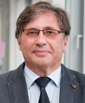 Sergej Demokritov合作论文数Institute for Applied Physics, Westfalische Wilhelms-Universität Munster;Center for Nonlinear Science, Westfalische Wilhelms-Universität Munster;Graduate School of Molecules and Interfaces, University of Münster11
 Soohyun Yang合作论文数10
 Wolf Von Tumpling合作论文数Department River Ecology, Helmholtz Centre for Environmental Research - UFZ10
 Rohini Kumar合作论文数UFZ Helmholtz Ctr Environm Res, Leipzig, Germany9
 Kurt Friese合作论文数Centre for Environmental Research;Department Lake Research;Department Lake Research, Centre for Environmental Research9
 Markus Bauer合作论文数8
 Martina Baborowski合作论文数8
 Andreas Musolff合作论文数7
 Michael Matthies合作论文数7
 Joerg Tittel合作论文数6
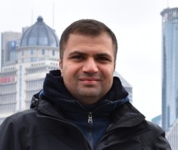 Seifeddine Jomaa合作论文数Department of Aquatic Ecosystem Analysis and Management Helmholtz Centre for Environmental Research, UFZ Magdeburg6Marcus Schulz合作论文数6Michael Böhme合作论文数6
 Martin Schultze合作论文数6
 James W. Jawitz合作论文数Soil and Water Science Department, University of Florida6An Slavin合作论文数5
 Andrew Kaus合作论文数Dept Aquat Ecosyst Anal, UFZ Helmholtz Ctr Environm Res5Mikhail Kostylev合作论文数The University of Western Australia5Katrin Wendt-Potthoff合作论文数5
 Peter Herzsprung合作论文数5Jörg Tittel合作论文数5BA Kalinikos合作论文数4Michael Schäffer合作论文数4V. Grimalsky合作论文数National Institute for Astrophysics, Optics and Electronics (INAOE), Z.P. 72000, Puebla, Pue, Mexico4
 Bertram Boehrer合作论文数Helmholtz-Centre for Environmental Research;Department Lake Research4Frank Krüger合作论文数4
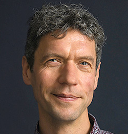 Karsten Rinke合作论文数Department of Lake Research, Helmholtz-Centre for Environmental Research4C. Mathieu合作论文数4B Kuehn合作论文数3S. Riedling合作论文数3
 Christian Schmidt合作论文数3Enrico Bertuzzo合作论文数3
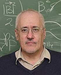 Rapoport, Y.合作论文数Phys. Fac., Taras Shevchenko Nat. Univ. of Kyiv;c;Phys. Fac., Taras Shevchenko Nat. Univ. of Kyiv3
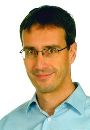 Norbert Kamjunke合作论文数Institute of Biochemistry and Biology, University of Potsdam3
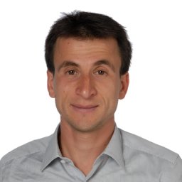 Stefano Basso合作论文数Osservatorio Astronomico di Brera3
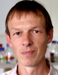 Matthias Koschorreck合作论文数Centre for Environmental Research Leipzig-Halle GmbH;Dept . of Lake Research;Dept . of Lake Research, Centre for Environmental Research Leipzig-Halle GmbH3Markus Weitere合作论文数Zoological Institute, University of Cologne3P. Suresh C. Rao合作论文数3
 Daniel Karthe合作论文数Helmholtz Centre for Environmental Research3Se Hwan Yang合作论文数2Burkhard Kuehn合作论文数2Helmut Rönicke合作论文数2
 Martina Flörke合作论文数Ingenieurhydrologie und Wasserwirtschaft, Fakultät für Bau- und Umweltingenieurwissenschaften, Ruhr-Universität Bochum2B. Roos合作论文数2Susanne Halbedel合作论文数2Alexander Wachholz合作论文数Department of Aquatic Ecosystem Analysis, Helmholtz Centre for Environmental Research - UFZ2




