Computer Vision (CV) has become increasingly important for Single-Board Computers (SBCs) due to their widespread deployment in addressing real-world problems. Specifically, in the context of smart cities, there is an emerging trend of developing end-to-end video analytics solutions designed to address urban challenges such as traffic management, disaster response, and waste management. However, deploying CV solutions on SBCs presents several pressing challenges (e.g., limited computation power, inefficient energy management, and real-time processing needs) hindering their use at scale. Graphical Processing Units (GPUs) and software-level developments have emerged recently in addressing these challenges to enable the elevated performance of SBCs; however, it is still an active area of research. There is a gap in the literature for a comprehensive review of such recent and rapidly evolving advancements on both software and hardware fronts. The presented review provides a detailed overview of the existing GPU-accelerated edge-computing SBCs and software advancements including algorithm optimization techniques, packages, development frameworks, and hardware deployment specific packages. This review provides a subjective comparative analysis based on critical factors to help applied Artificial Intelligence (AI) researchers in demonstrating the existing state of the art and selecting the best suited combinations for their specific use-case. At the end, the paper also discusses potential limitations of the existing SBCs and highlights the future research directions in this domain.
The COVID-19 pandemic has caused major disruptions to people’s daily life and travel. This paper aims to reveal the impact of the COVID-19 pandemic on people’s travel in New South Wales (NSW), Australia, and to explore potential measures to recover public transport patronage in the new normal. Research data is collected from a survey of 1,045 residents in NSW, Australia between October 2021 and May 2022. Results show that travel behaviors are significantly different during the pandemic compared to the pre-COVID and the new normal periods. Multiple key factors affecting travelers’ choices in terms of travel mode, travel purpose and their acceptance of emerging mobilities like on-demand transport, autonomous vehicles and drones are identified, including age group, residential area, household status (e.g., couple family with children), household income, need for travel assistance, and travel-related attitude towards health and safety. The research findings suggest that emerging mobilities could provide potential solutions to transport services in a pandemic scenario.
This research aimed to determine whether accomplished surfers could accurately perceive how changes to surfboard fin design affected their surfing performance. Four different surfboard fins, including conventional, single-grooved, and double-grooved fins, were developed using computer-aided design combined with additive manufacturing (3D printing). We systematically installed these 3D-printed fins into instrumented surfboards, which six accomplished surfers rode on waves in the ocean in a random order while blinded to the fin condition. We quantified the surfers’ wave-riding performance during each surfing bout using a sport-specific tracking device embedded in each instrumented surfboard. After each fin condition, the surfers rated their perceptions of the Drive, Feel, Hold, Speed, Stiffness, and Turnability they experienced while performing turns using a visual analogue scale. Relationships between the surfer’s perceptions of the fins and their surfing performance data collected from the tracking devices were then examined. The results revealed that participants preferred the single-grooved fins for Speed and Feel, followed by double-grooved fins, commercially available fins, and conventional fins without grooves. Crucially, the surfers’ perceptions of their performance matched the objective data from the embedded sensors. Our findings demonstrate that accomplished surfers can perceive how changes to surfboard fins influence their surfing performance.
Worldwide, natural hazards have an increasing impact on ever expanding urbanised areas. Therefore, authorities need more sophisticated planning support systems (PSS) to enhance city resilience. This study explored the potential of a Cellular Automata-based model developed using Metronamica PSS for goal-oriented and collaborative resilience planning in the context of Greater Sydney, Australia. The process was embedded within a geodesign framework and participants (n = 19) collaborated in developing and validating four scenarios for 2050. The mitigating effects on the risks of bushfire, flood, and urban heat were analysed to support decision-making. The resulting Bushfire resilience scenario was significantly different from a present policy abiding, Business-As-Usual, scenario. This should encourage planners to consider the issue more closely. The study identified potential locations for resilient future growth, although additional land will be required by 2050, while medium-density developments were found to lessen urban heat impact. The research showed that city resilience scenarios can be constructed collaboratively using an advanced computer-based model, and stakeholders can understand such complex models, and participate in their improvement if the data and models are adequately shared. Future research can extend this approach by engaging the wider community in the scenario planning process.
The extensive deployment of wireless infrastructure provides the possibility of locating mobile users in indoor environments using received signal strength (RSS). One approach to localization in this context is the use ofWiFi RSS fingerprinting and this formulation has been found to work reasonably well for location recognition of mobile phone users. For such, machine learning techniques such as Hidden Markov Models (HMM) and Hidden Semi Markov Model (HsMM) have been extensively used to study human mobility and movements which permits the inclusion of prior knowledge about the geography of the environment alongside RSS measurements in the estimation process. Conventional HMMs, with their assumption of the Markov property, whose memory length is 1, i.e. dependency only on the last state, offering a simpler and more computationally manageable framework. Movements of typical mobile users through the quantized cells of the building, however, are usually not Markovian. HMM estimates suffer from ambiguity recognition on the movement of a Markov chain between subsets of state spaces. HsMMs outperform HMMs by allowing a semi-Markov chain with a variable sojourn time for each state, however still fail to capture the longer dependency beyond just the previous state. Combinatory Categorial Grammar (CCG) was designed to deal with the long-range dependencies in computational linguistics. In this paper we investigate the feasibility of implementing CCG as an alternative to HMM to formulate the building layout to a category of semantics and construct a walking path by CCG parsing from the RSS observations. The CCG parser allows the construction of the estimated path by recursively combining different path segments, thus building up longer dependency between locations. The authors believe this is the first application of computational linguistic in the field of localization. Field test results demonstrate the effectiveness and reliability of the grammar based approach which can achieve a resolution of 87.5% room level matching accuracy based on crowdsourced fingerprints under a real large-scale university public wireless sensor network. Comparison between HMM, HsMM and the grammar approach has been made to reveal the fact that both methods show promising performance, while the grammar approach is more reliable as HMM/HsMM can occasionally fail due to ambiguity recognition while the grammar approach consistently maintains good localization accuracy.
Public transportation systems play a vital role in modern cities, but they face growing security challenges, particularly related to incidents of violence. Detecting and responding to violence in real time is crucial for ensuring passenger safety and the smooth operation of these transport networks. To address this issue, we propose an advanced artificial intelligence (AI) solution for identifying unsafe behaviours in public transport. The proposed approach employs deep learning action recognition models and utilises technologies like NVIDIA DeepStream SDK, Amazon Web Services (AWS) DirectConnect, local edge computing server, ONNXRuntime and MQTT to accelerate the end-to-end pipeline. The solution captures video streams from remote train stations closed circuit television (CCTV) networks, processes the data in the cloud, applies the action recognition model, and transmits the results to a live web application. A temporal pyramid network (TPN) action recognition model was trained on a newly curated video dataset mixing open-source resources and live simulated trials to identify the unsafe behaviours. The base model was able to achieve a validation accuracy of 93% when trained using open-source dataset samples and was improved to 97% when live simulated dataset was included during the training. The developed AI system was deployed at Wollongong Train Station (NSW, Australia) and showcased impressive accuracy in detecting violence incidents during an 8-week test period, achieving a reliable false-positive (FP) rate of 23%. While the AI correctly identified 30 true-positive incidents, there were 6 cases of false negatives (FNs) where violence incidents were missed during the rainy weather suggesting more data in the training dataset related to bad weather. The AI model’s continuous retraining capability ensures its adaptability to various real-world scenarios, making it a valuable tool for enhancing safety and the overall passenger experience in public transport settings.
Blockage of culverts by debris material is reported as main cause of urban flash floods. Extraction of blockage information using intelligent video analytic (IVA) algorithms can prove helpful in making timely maintenance-related decisions toward avoiding flash floods. Having known the percentage of visual blockage at culverts can help better prioritise the maintenance of highly blocked culvert sites. This article proposes a deep learning-based segmentation-classification pipeline where visible culvert openings are segmented at the first stage and classified into one of four percentage visual blockage classes at the second stage. Images of Culverts and Blockage (ICOB) and Visual Hydraulics-Lab Blockage Dataset (VHD) dataset were used to train the deep learning models. From the results, Mask R-CNN (ResNet50 backbone) achieved the best segmentation performance (i.e. mAP@75 of 77.2%), while NASNet achieved the best classification performance (i.e. 81.2% test accuracy). To demonstrate the implication, a potential visual blockage monitoring use-case has been proposed.
Blockage of cross-drainage hydraulic structures is a key factor to be recursively assessed within flood management domain because of its involvement in originating flash floods. However, this issue has been least addressed in literature because of highly complex nature of blockage formulation and unavailability of relevant data to investigate the hydraulic impacts of blockage. Given the success of data-driven approaches in dealing with complex real-world problems within water resources management domain (e.g. water depth estimation, ground water prediction, water demand forecasting, drainage pipe detection, sewer fault detection), this paper proposes the idea of an Artificial Intelligence of Things (AIoT)-oriented framework for the assessment of blockage at cross-drainage hydraulic structures to facilitate the flood management agencies in better managing the blockage related issues. The proposed framework makes use of multiple AI approaches (e.g. image classification, object detection, object segmentation, regression, end-to-end deep learning) to assess visual and hydraulic blockage at a given structure using both visual and hydraulic data coming from sensors (i.e. camera, water level sensors, inlet discharge sensor, surface velocity sensor). As the output, the framework provides the information about the blockage status, estimation of percentage visual blockage and estimation of percentage hydraulic blockage. This information will be used by the flood management agencies in maintaining the hydraulic structures and to incorporate the blockage in hydraulic structures design process.
The rapid urbanisation in cities, and its associated complexities demand that sophisticated decision support tools such as the LUTI models be employed to assist the balanced and sustainable development of transport and land use. It is evident from literature studies that the majority of LUTI models need extensive data, making them expensive and time-consuming, which will be a challenge for developing countries. On the other hand, with the advent of information and communication technology, the availability of high frequency (HF) data is increasing which can be collected at disaggregated level data frequently at little or no cost. The main focus of this research is trying to bridge the gap that exists between research with this type of data and it subsequent application in real context. On the basis of this, the paper focuses on (1) summarizing existing LUTI models and their corresponding data requirements; (2) explaining the sources of HF data in LUTI modelling; and (3) discussing the applications and challenges in implementation of such data in LUTI modelling. This review identifies the recent development of technology and availability of HFD can fill the gap of data availability for LUTI which has been discussed by a great number of authors in literature. Furthermore this kind of novel source of data can increase the potential of LUTI model particularly in developing countries, where land use and transport patterns are changing rapidly and where traditional forms of data are expensive to collect.
Floods are one of the most often occurring and damaging natural hazards. They impact the society on a massive scale and result in significant damages. To reduce the impact of floods, society needs to keep benefiting from the latest technological innovations. Drones equipped with sensors and latest algorithms (e.g., computer vision and deep learning) have emerged as a potential platform which may be useful for flood monitoring, mapping and detection activities in a more efficient way than current practice. To better understand the scope and recent trends in the domain of drones for flood management, we performed a detailed bibliometric analysis. The intent of performing the bibliometric analysis waws to highlight the important research trends, co-occurrence relationships and patterns to inform the new researchers in this domain. The bibliometric analysis was performed in terms of performance analysis (i.e., publication statistics, citations statistics, top publishing countries, top publishing journals, top publishing institutions, top publishers and top Web of Science (WoS) categories) and science mapping (i.e., citations by country, citations by journals, keyword co-occurrences, co-authorship, co-citations and bibliographic coupling) for a total of 569 records extracted from WoS for the duration 2000–2022. The VOSviewer open source tool has been used for generating the bibliographic network maps. Subjective discussions of the results explain the obtained trends from the bibliometric analysis. In the end, a detailed review of top 28 most recent publications was performed and subjected to process-driven analysis in the context of flood management. The potential active areas of research were also identified for future research in regard to the use of drones for flood monitoring, mapping and detection activities.
Efficient management of water resources is an important task given the significance of water in daily lives and economic growth. Water resource management is a specific field of study which deals with the efficient management of water resources towards fulfilling the needs of society and preventing from water‐related disasters. Many activities within this domain are getting benefitted with the recent technological advancements. Within many others, computer vision‐based solutions have emerged as disruptive technologies to address complex real‐world problems within the water resource management domain (e.g., flood detection and mapping, satellite‐based water bodies monitoring, monitoring and inspection of hydraulic structures, blockage detection and assessment, drainage inspection and sewer monitoring). However, there are still many aspects within the water resource management domain which can be explored using computer vision technologies. Therefore, it is important to investigate the trends in current research related to these technologies to inform the new researchers in this domain. In this context, this paper presents the bibliometric analysis of the literature from the last two decades where computer vision technologies have been used for addressing problems within the water resource management domain. The analysis is presented in two categories: (a) performance analysis demonstrating highlighted trends in the number of publications, number of citations, top contributing countries, top publishing journals, top contributing institutions and top publishers and (b) science mapping to demonstrate the relation between the bibliographic records based on the co‐occurrence of keywords, co‐authorship analysis, co‐citation analysis and bibliographic coupling analysis. Bibliographic records (i.e., 1059) are exported from the Web of Science (WoS) core collection database using a comprehensive query of keywords. VOSviewer opensource tool is used to generate the network and overlay maps for the science mapping of bibliographic records. Results highlighted important trends and valuable insights related to the use of computer vision technologies in water resource management. An increasing trend in the number of publications and focus on deep learning/artificial intelligence (AI)‐based approaches has been reported from the analysis. Further, flood mapping, crack/fracture detection, coastal flood detection, blockage detection and drainage inspections are highlighted as active areas of research.
Blockage of cross-drainage hydraulic structures (e.g., bridges, culverts) is reported as an exacerbating factor during flash flooding in Wollongong and Newcastle. Lack of data from flooding events and the fragmentary nature of post-flood data are the factors hindering research in studying the impact of blockage on the performance of hydraulic structures. This paper proposes lab-scale simulations using scaled physical models of culverts to study the behaviour and effects of urban and vegetative debris. The first investigation studies the interaction between specific debris types with culvert inlet geometries and their impact on the hydraulic blockage. In the second investigation, a flood hydrograph is simulated in the laboratory to study complex relationships between blockage-related influential factors and to relate the observed visual blockage and hydraulic blockage. From the results of first investigation, urban debris was reported the main contributor in increasing the hydraulic blockage at structures. Furthermore, the degree of hydraulic blockage was found sensitive to the orientation of the debris. Results from the second investigation reported several insights regarding the complex relationships between blockage-related influential factors. The temporally variable nature of blockage was observed from the experiments that suggested revising the existing constant blockage based Australian Rainfall and Runoff (ARR) guidelines.
The assessment of visual blockages in cross-drainage hydraulic structures, such as culverts and bridges, is crucial for ensuring their efficient functioning and preventing flash flooding incidents. The extraction of blockage-related information through computer vision algorithms can provide valuable insights into the visual blockage. However, the absence of comprehensive datasets has posed a significant challenge in effectively training computer vision models. In this study, we explore the use of synthetic data in combination with a limited real-world dataset, the images of culvert openings and blockage (ICOB), to evaluate the performance of a culvert opening detector. The Faster R-CNN model with a ResNet50 backbone was used as the culvert opening detector. The impact of synthetic data was evaluated through two experiments. The first involved training the model with different combinations of synthetic and real-world data, while the second involved training the model with reduced real-world images. The results of the first experiment revealed that structured training, where the synthetic images of culvert (SIC) were used for initial training and the ICOB was used for fine-tuning, resulted in slightly improved detection performance. The second experiment showed that the use of synthetic data, in conjunction with a reduced number of real-world images, resulted in significantly improved degradation rates.
Cross-drainage hydraulic structures such as culverts and bridges in urban landscapes are prone to get blocked by the transported debris (e.g., urban, vegetated), which often reduces their hydraulic capacity and triggers flash floods. Unavailability of relevant data from blockage-originated flooding events and complex nature of debris accumulation are highlighted factors hindering the research within the blockage management domain. Wollongong City Council (WCC) blockage conduit policy is the leading formal guidelines to incorporate blockage into design guidelines; however, are criticized by the hydraulic engineers for its dependence on the post-flood visual inspections (i.e., visual blockage) instead of peak floods hydraulic investigations (i.e., hydraulic blockage). Apparently, no quantifiable relationship is reported between the visual blockage and hydraulic blockage; therefore, many consider WCC blockage guidelines invalid. This paper exploits the power of Artificial Intelligence (AI), motivated by its recent success, and attempts to relate visual blockage with hydraulic blockage by proposing a deep learning pipeline to predict hydraulic blockage from an image of the culvert. Two experiments are performed where the conventional pipeline and end-to-end learning approaches are implemented and compared in the context of predicting hydraulic blockage from a single image. In experiment one, the conventional deep learning pipeline approach (i.e., feature extraction using CNN and regression using ANN) is adopted. In contrast, in experiment two, end-to-end deep learning models (i.e., E2E_ MobileNet, E2E_ BlockageNet) are trained and compared with the conventional pipeline approach. Dataset (i.e., Hydraulics-Lab Blockage Dataset (HBD), Visual Hydraulics-Lab Dataset (VHD)) used in this research were collected from laboratory experiments performed using scaled physical models of culverts. E2E_ BlockageNet model was reported best in predicting hydraulic blockage with R^2 score of 0.91 and indicated that hydraulic blockage could be interrelated with the visual features at the culvert.
Private health insurance (PHI) companies have a growing claims dataset that could be used to identify leading indicators for hospitalisation. This study is primarily focused on addiction, mental health, obesity and musculoskeletal disorders disease groups. Leading indicator analysis employed three methods: association rule mining, sequential rule mining, and a heuristic method. Evaluating program effectiveness was performed using propensity score-based matching. PHI professionals were working alongside the research to aid in comprehending data and essential information from a PHI perspective. Analysis has broken down into four major disease groups addiction, obesity, musculoskeletal diseases and mental disorders. Association rule mining uncovers frequent but little known comorbidities of obesity such as male infertility, cellulitis and mesenteric adenitis. Heuristic method uncovered that 0.9% of members undergoing joint replacement developed sepsis, a life-threatening condition.
With the development of charging technology, chargers with dropped price and increased charging power make fast charging more applicable and competitive to provide efficient and effective charging solution to electric vehicles. Compared to normal chargers, fast chargers can top up battery in a short time, which enables battery electric buses to get top-up charging at selected bus stops when the buses load and unload passengers. Such en-route charging solution can avoid deadhead trips during daily operation and further reduce energy consumption due to smaller size of battery required. In this paper, we develop a two-stage stochastic programming model to locate fast chargers at selected bus stops considering uncertainties of passenger demand and energy consumption during bus operation. A modified L-shaped method is proposed to solve the challenging problem since its size grows exponentially with the increasing number of scenarios. Numerical results show that the en-route top-up charging time keeps in line with passengers' boarding and alighting time at intermediate stops when the bus loads and unloads passengers, which causes negligible passengers' extra waiting time and corresponding penalty cost caused by charging activities. The modified Lshaped method is further compared to the commercial solver Gurobi with better performance and higher efficiency.
The outbreak of COVID-19 has made a profound impact on mobility, especially for public transport users. Extensive research has been conducted on the change of travel patterns in major cities where public transport systems have been well developed and heavily used. However, in small cities, the public transport network is relatively sparse, especially in suburban areas, which makes the corresponding travel patterns differ from those in major cities. Therefore, proper investigation of the public transport usage in such small cities is still needed, especially under the COVID-19 impact. This paper aims to reveal the change of public transport users' travel patterns based on a comparative study of public transport usage PreCOVID and during the COVID-19 period. The Illawarra, a coastal region close to Sydney in Australia is used as a case study. Smart card data is used to reveal relevant changes in both intraregion (in the Illawarra) and inter-region (between the Illawarra and Sydney) travels in consideration of heterogeneous user groups. The results show a significant decrease (around 47%) in public transport ridership by both train and bus. However, compared to intra-region ridership, the inter-region trips by train drop much more (around 62%). Moreover, heterogeneous age group passengers show different changes after the COVID19 outbreak. The research findings are expected to provide valuable suggestions for policy making and public transport service adjustment when a similar crisis occurs again.
Blockage of culverts causes reduction in hydraulic capacity and is one of the main contributors to trigger urban flooding. However, the highly non-linear nature of debris interaction during the flood and lack of blockage-related data from actual flooding events make conventional numerical modelling almost impossible. Literature investigating blockage phenomena reports blockage as a complex hydraulic process, which suggests exploring adaptive solutions using latest technologies. In this context, motivated by the success of data-driven algorithms, in this article, four data driven models (i.e., K-NN, ANN, SVR, 1D-CNN) are implemented to predict the hydraulic blockage at culverts. A new numerical Hydraulics-Lab Blockage Dataset (HBD) is established from a series of lab-scale hydraulic experiments. From the experimental investigations, the ANN model was reported as the best with a R2 score of 0.95. A potential use-case of presented research for real-world application is also discussed to demonstrate the practical feasibility.
The presence of floodborne objects (i.e., vegetation, urban objects) during floods is considered a very critical factor because of their non-linear complex hydrodynamics and impacts on flooding outcomes (e.g., diversion of flows, damage to structures, downstream scouring, failure of structures). Conventional flood models are unable to incorporate the impact of floodborne objects mainly because of the highly complex hydrodynamics and non-linear nature associated with their kinematics and accumulation. Vegetation (i.e., logs, branches, shrubs, entangled grass) and urban objects (i.e., vehicles, bins, shopping carts, building waste materials) offer significant materialistic, hydrodynamic and characterization differences which impact flooding outcomes differently. Therefore, recognition of the types of floodborne objects is considered a key aspect in the process of assessing their impact on flooding. The identification of floodborne object types is performed manually by the flood management officials, and there exists no automated solution in this regard. This paper proposes the use of computer vision technologies for automated floodborne objects type identification from a vision sensor. The proposed approach is to use computer vision object detection (i.e., Faster R-CNN, YOLOv4) models to detect a floodborne object's type from a given image. The dataset used for this research is referred to as the "Floodborne Objects Recognition Dataset (FORD)" and includes real images of floodborne objects blocking the hydraulic structures extracted from Wollongong City Council (WCC) records and simulated images of scaled floodborne objects blocking the culverts collected from hydraulics laboratory experiments. From the results, the Faster R-CNN model with MobileNet backbone was able to achieve the best Mean Average Precision (mAP) of 84% over the test dataset. To demonstrate the practical use of the proposed approach, two potential use cases for the proposed floodborne object type recognition are reported. Overall, the performance of the implemented computer vision models indicated that such models have the potential to be used for automated identification of floodborne object types.
 Anne Dray合作论文数College of Asia & the Pacific, The Australian National University48
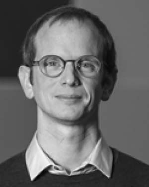 Johan Barthelemy合作论文数Namur Research Center for Complex Systems NAXYS, FUNDP-University of Namur44
 Rohan Wickramasuriya合作论文数School of Earth & Environmental Sciences, University of Wollongong24
 Umair Iqbal合作论文数21
 Ian White合作论文数Fenner School of Environment and Society, College of Science, Australian National University;Institute for Climate, Energy & Disaster Solutions, Australian National University16
 Christophe Le Page合作论文数The French Agricultural Research Centre for International Development16
 Alison Ritter合作论文数National Drug and Alcohol Research Centre, University of NSW15
 M Sene合作论文数14
 Natalie Jones合作论文数School of the Environment, Faculty of Science, The University of Queensland14
 Matthew J. Berryman合作论文数Centre for Biomedical Engineering;School of Electrical and Electronic Engineering;University of Adelaide;School of Electrical and Electronic Engineering, University of Adelaide14
 Shiva Pedram合作论文数Smart Infrastruct Facil, Univ Wollongong13
 Mehrdad Amirghasemi合作论文数Faculty of Informatics, University of Wollongong12
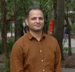 Nagesh Shukla合作论文数University of Wollongong12
 Hugh I Forehead合作论文数UWA Oceans Institute and School of Plant Biology, University of Western Australia11
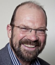 Stewart Burn合作论文数CSIRO11Nicolas Becu合作论文数11
 Robert Ighodaro Ogie合作论文数Corresponding author.10
 Bo Du (杜博)合作论文数School of Computer Science, Wuhan University10
 Jun Ma合作论文数10
 Sigrid Aubert合作论文数10
 Magnus Moglia合作论文数CSIRO Sustainable Ecosystems10Matthew Farrelly合作论文数Coal Services Mines Rescue, Australia9
 Tony Falkland合作论文数9
 Stephen Palmisano合作论文数University of Wollongong Faculty of Health and Behavioural Sciences, School of Psychology Wollongong NSW 2500 Australia9
 Gabriele Bammer合作论文数Research School of Population Health, College of Health and Medicine, The Australian National University8Olivier Barreteau合作论文数Cemagref, UR Irrigation
361, rue J.-F. Breton
BP 50358
Gabriele Bammer合作论文数Research School of Population Health, College of Health and Medicine, The Australian National University8Olivier Barreteau合作论文数Cemagref, UR Irrigation
361, rue J.-F. Breton
BP 50358 Annemarie van Paassen合作论文数Communication and Innovation Studies, Wageningen University and Research Centre8
 Nils Ferrand合作论文数8
 Vu Lam Cao合作论文数7
 Francois Lamy合作论文数Scientific and Medical Affairs, ICTA PM7
 Mohammad-Reza Namazi-Rad合作论文数7Marc Overmars合作论文数7
 Katherine Daniell合作论文数Centre for Policy Innovation, The Australian National University7
 Raphaël Mathevet合作论文数Centre d´Ecologie Fonctionelle & Evolutive7
 Paul Dietze合作论文数Centre for Population Health, Burnet Institute7
 Jean Albergel合作论文数Mission IRD, IRD7Raphaele Ducrot合作论文数7Bilal Arshad合作论文数6
 Muhammad Zain Bin Riaz合作论文数6
 Nicolas Verstaevel合作论文数Univ Wollongong, SMART Infrastruct Facil, Wollongong, NSW, Australia6
 Lorraine Mazerolle合作论文数School of Social Science, Faculty of Humanities and Social Sciences, The University of Queensland6Nam Huynh合作论文数Medical Physics and Biomedical Engineering, Faculty of Engineering Sciences, University College London6Eita Metai合作论文数6
 Guy Trebuil合作论文数CIRAD, UPR GREEN, Montpellier, F-34398 France and CIRAD, UPR GREEN, Bangkok, 10330 Thailand6Malainy Diatta合作论文数6Taboia Metutera合作论文数6
 Deborah Cleland合作论文数Fenner School of Environment and Society, Australian National University6pierre ruelle合作论文数5Aurélie Botta合作论文数5




