Objectives: Higher body mass index (BMI) is reportedly associated with improved prognosis of patients with various cancers. However, it is unclear whether this phenomenon, also known as the obesity paradox, applies to metastatic renal cell carcinoma (mRCC). We aimed to determine the prognostic significance of BMI in patients with mRCC receiving first-line therapies. Materials and methods: We retrospectively reviewed patients with mRCC receiving first-line immune checkpoint inhibitor (ICI)-based combination therapy or tyrosine kinase inhibitor monotherapy. Overall survival (OS) was defined as the time from systemic therapy initiation to death from any cause or last follow-up. Baseline patient characteristics were compared by Mann-Whitney U test or Fisher's exact test. OS curves were constructed by Kaplan-Meier estimates and were compared by log-rank test. Multivariable analysis was performed via Cox proportional-hazards regression. Results: Of the 183 patients included, 130 (71 %) were overweight (>= 22 and 18 kg/m2 in men and women, respectively), and 63 (34%) received ICI-based combination therapy. There was a significantly higher proportion of men in the overweight subgroup (87 % versus 64%; P = 0.002). During the study period, 97 patients died, and median (95% confidence interval) OS was 39.0 months (31.5-66.3 months) and 28.1 months (17.6-39.7 months) in overweight and normoweight patients, respectively (P = 0.015). On multivariable analysis, overweight was independently associated with longer OS (HR 0.57; P = 0.014). Subgroup analyses of patients receiving ICI-based combinaConclusion: Overweight is associated with favorable outcomes in patients with mRCC receiving first-line therapies. (c) 2024 Elsevier Inc. All rights are reserved, including those for text and data mining, AI training, and similar technologies.
Global wind measurements are essential for numerical weather prediction (NWP), climate studies, and various meteorological studies. Current space-based passive sensors and micro sensors have large coverage and high temporal resolution but low vertical resolution. The Doppler Wind Llidar (DWL) is a useful technique for wind measurement. JAXA studies the feasibility of a future space-based coherent DWL (CDWL) for global wind profile observation. The mission concept of the space-based CDWL is designed to have one look for line-of-sight (LOS) wind measurement at an off-nadir angle of 35° at an azimuth angle of 90° (270°) along satellite track. The candidate altitude and orbit of the satellite are 300 km and dawn-dusk sun-synchronous polar orbit. The forecast impacts of both 1.5- and 2-µm space-based DWL were evaluated using the operational global data assimilation system. The data assimilation experiments were conducted in August in 2018 to assess overall impact and seasonal dependence. It is found that the two space-based DWL have positive impact on NWP. Relative forecast error reduction for 1.5- and 2-µm space-based DWLs can be expected to about 3 and 2
AbstractDetermining the distribution and dynamics of water on land at any given moment poses a significant challenge due to the constraints of observation. Consequently, as advancements in land surface models (LSMs) have been made, numerical simulation has emerged as an increasingly accurate and effective method for hydrological research. Nonetheless, systems that represent multiple land surface parameters in a near‐real‐time manner are scarce. In this study, we present an innovative land surface and river simulation system, termed Today's Earth (TE), which generates state and flux values for the near‐surface environment with multiple outputs in near‐real‐time. There are currently three versions of TE, distinguished by the forcing data utilized: JRA‐55 version, employing the Japanese 55‐year Reanalysis (JRA‐55, from 1958 to the present); GSMaP version, utilizing, the Global Satellite Mapping of Precipitation (GSMaP, from 2001 to the present), and MODIS version, utilizing the Moderate Resolution Imaging Spectroradiometer (MODIS, from 2003 to the present). These long‐term forcing data set allow for outputs of the JRA‐55 version from 1958, the GSMaP version from 2001, and the MODIS version from 2003. Aiming to provide water and energy values on a global scale in real‐time, the TE system utilizes the LSM Minimal Advanced Treatments of Surface Interaction and Runoff (MATSIRO) (Takata et al., 2003, https://doi.org/10.1016/s0921‐8181(03)00030‐4; Yamazaki et al., 2011, https://doi.org/10.1029/2010wr009726) at a horizontal resolution of 0.5°, along with the river routing model CaMa‐Flood (Yamazaki et al., 2011, https://doi.org/10.1029/2010wr009726) at a horizontal resolution of 0.25°. Both land surface and river products are available in 3‐hourly, daily, and monthly intervals across all three versions. A notable feature of TE is its ability to release both state and flux parameters in near‐real‐time, offering convenience for various aspects of hydrological research. In addition to presenting the general features of TE‐Global, this study examines the performance of snow depth, soil moisture, and river discharge data in daily intervals from 2003 to 2021, with validation spanning 2003 to 2016. When comparing snow depth results, the correlation coefficient ranged between 0.644 and 0.658, while for soil moisture it ranged between 0.471 and 0.494. These findings suggest that the LSM yields comparable results when utilizing JRA‐55, MODIS, or GSMaP. Interestingly, river output from the three products exhibited distinct characteristics varying from GSMaP to JRA‐55 and MODIS. For river discharge, the correlation coefficient ranged from 0.494 to 0.519, the root mean square error ranged from 3,730 m3/s to 6,330 m3/s, and the mean absolute error ranged from 3,000 m3/s to 5,160 m3/s among the different forcing versions. The overall bias in river discharge from GSMaP was 1,570 m3/s, in contrast to −589 m3/s for JRA‐55 and −200 m3/s for MODIS. These metrics demonstrate that the TE system is capable of generating practical land surface and river products, highlighting differences arising from the use of various types of forcing data. This comprehensive system would be valuable for monitoring water‐related movements, predicting disasters, and contributing to sophisticated water resource management. Regarding its application, the TE system has been included in the World Meteorological Organization as a Global Hydrological Modelling System. All TE‐Global products can be freely accessed through File Transfer Protocol.
To manage Earth in the Anthropocene, new tools, new institutions, and new forms of international cooperation will be required. Earth Virtualization Engines is proposed as an international federation of centers of excellence to empower all people to respond to the immense and urgent challenges posed by climate change.
<p>Japan Aerospace Exploration Agency (JAXA) currently operates six Earth observation missions for water cycle and climate studies, disaster mitigation, and various application studies including weather forecasts. One of six missions, the Global Precipitation Measurement (GPM) is an international mission to achieve highly accurate and highly frequent global precipitation observations (Hou et al. 2014, Skofronick-Jackson et al. 2017). The GPM mission consists of the GPM Core Observatory jointly developed by U.S. and Japan and Constellation Satellites that carry microwave radiometers and provided by the GPM partner agencies. The GPM Core Observatory, launched on February 2014, carries the Dual-frequency Precipitation Radar (DPR) by JAXA and the National Institute of Information and Communications Technology (NICT) (Kojima et al. 2012, Iguchi 2020).</p> <p>&#160;</p> <p>Regarding future satellite missions, Global Change Observation Mission - Water "SHIZUKU" (GCOM-W) follow-on mission (AMSR3) with high-frequency channels (166 & 183 GHz) will be installed on the Global Observing Satellite for Greenhouse gases and Water cycle (GOSAT-GW) satellite (Kasahara et al. 2020). Japan will provide the world's first satellite-based cloud vertical motion information by the Cloud Profiling Radar (CPR) to the Earth Clouds, Aerosols and Radiation Explorer (EarthCARE), Europe-Japan joint mission (Illingworth et al. 2015, Wehr et al. 2023). JAXA is currently conducting R&D of the Precipitation Measuring Mission carrying the Ku-band Doppler Precipitation Radar to succeed and expand currently operating GPM/DPR.</p> <p>&#160;</p> <p>It is also required to evolve combined use of multi-satellite to provide the &#8220;best&#8221; information to users. Under the GPM mission, the Global Satellite Mapping for Precipitation (GSMaP) produces high-resolution and frequent global rainfall map based on multi-satellite passive microwave radiometer observations with information from the Geostationary InfraRed (IR) instruments (Kubota et al. 2020). Output product of GSMaP algorithm is 0.1-degree grid for horizontal resolution and 1-hour for temporal resolution. The GSMaP near-real-time version product (GSMaP_NRT) has been in operation at JAXA since November 2007 in near-real-time basis, and browse images and binary data available at JAXA GSMaP web site (http://sharaku.eorc.jaxa.jp/GSMaP/).</p> <p>JAXA also collaborates with model development community to expand satellite data utilization in various fields. With the goal of providing reliable water cycle information and achieving integrated water resources management, JAXA has developed the global hydrological simulation system &#8220;Today&#8217;s Earth (TE)&#8221; under the joint research with University of Tokyo (Ma et al. 2021). To provide the products with better accuracy, rainfall from the GSMaP is used for TE-Global GSMaP version. The Over 50 hydrological variables are now accessible through the web page and ftp site of the &#8220;TE-Global&#8221; system (https://www.eorc.jaxa.jp/water/).</p> <p>JAXA continues to provide useful satellite-based information related to the global water cycle.</p>
This article describes four-year calibration results of the dual-frequency precipitation radar (DPR) onboard the Global Precipitation Measurement (GPM) Core Observatory. The calibration method basically follows the method that was used to calibrate the precipitation radar (PR) onboard the Tropical Rainfall Measuring Mission (TRMM) satellite. However, both the hardware and data processing method for calibration are improved by taking advantage of the lessons learned from the PR’s calibration. Since the response of the radar receivers was found to depend on the waveform, the active calibrator was improved in such a way that the external calibration can be performed with both continuous and pulse waves. The methods for evaluating the calibration data were also improved. Instead of assuming a Gaussian antenna pattern, the effective beamwidths were determined by assuming an antenna pattern created by the Taylor distribution that was used to design the antennas. The results of the calibration including these improvements provide the new precise parameters of DPR’s calibration. The new parameters increased the Ku-band precipitation radar’s (KuPR’s) radar reflectivity factor ( $Z$ ) by about 1.3 dB and that of the Ka-band precipitation radar (KaPR) by about 1.2 dB from the precalibrated $Z$ values, and the minimum detectable radar reflectivities were 15.46, 19.18, and 13.71 dBZ for KuPR, matched beam of KaPR, and high-sensitivity beam of KaPR, respectively. After applying the new calibration methods to both DPR and PR, normalized radar cross sections ( $\sigma ^{0}$ ) from the DPR and PR agree with each other.
A flood forecasting system (FFS) is widely recognized as essential to protect people’s lives and prosperities. Developing an FFS with high accuracy, longer lead time, and high resolution is the ideal goal, but there are lots of obstacles to achieving this challenge. Here, we would like to introduce our progress in the development of 5-km resolution FFS system in Japan by Today’s Earth (TE) system (Ma et al., 2021). TE was developed by the collaboration between JAXA and The University of Tokyo and is routinely run at https://www.eorc.jaxa.jp/water/index.html. Among various events, we focus on a case study for forecasting Typhoon Hagibis by assessing its forecasting performance. The results showed that this method was accurate in predicting floods at 130 locations, approximately 91.6% of the total of 142 flooded locations, with a lead time of approximately 32.75 h. In terms of precision, these successfully predicted locations accounted for 24.0% of the total of 542 locations under a flood warning. On average, the predicted flood time was approximately 8.53 h earlier than a given dike-break time. Further, we would like to present our current work for developing an FFS with much higher resolution (1 km), with a probabilistic approach by the ensemble method using NEXRA (NICAM-LETKF JAXA Research Analysis, Kotsuki et al. 2017, https://www.eorc.jaxa.jp/theme/NEXRA/) data, and other developing versions of Today’s Earth system of Global scale (https://www.eorc.jaxa.jp/water/). Ma, W., Ishitsuka, Y., Takeshima, A. et al. (2021). Applicability of a nationwide flood forecasting system for Typhoon Hagibis 2019. Sci Rep 11, 10213. https://doi.org/10.1038/s41598-021-89522-8. Kotsuki S, Miyoshi T, Terasaki K. Lien GY, Kalnay E (2017) Assimilating the global satellite mapping of precipitation data with the Nonhydrostatic Icosahedral Atmospheric Model (NICAM), J. Geophys. Res. Atmos., 122, 631–650. doi: 10.1002/2016JD025355.
The Earth Clouds, Aerosol, and Radiation Explorer (EarthCARE) is a satellite mission jointly developed by the Japan Aerospace Exploration Agency (JAXA) and the European Space Agency (ESA). One challenging feature of this mission is the observation of Doppler velocity by the Cloud Profiling Radar (EC-CPR). The Doppler measurement accuracy is affected by random errors induced by Doppler broadening due to the finite beamwidth and Doppler folding caused by the finite pulse repetition frequency. We investigated the impact of horizontal (along-track) integration and unfolding methods on the reduction of Doppler errors, in order to improve Doppler data processing in the JAXA standard algorithm. We simulated EC-CPR-observed Doppler velocities from pulse-pair covariances with the latest EC-CPR specifications using the radar reflectivity factor and Doppler velocity fields simulated by a satellite data simulator and a global cloud system resolving simulation. Two representative cases of a cirrus cloud and precipitation were examined. In the cirrus cloud case, the standard deviation of random error was decreased to 0.5 m/s for −10 dB ${Z} _{\mathbf {e}}$ after 10-km horizontal integration. In the precipitation case, large falling speeds of precipitation caused Doppler folding errors due to larger Doppler velocities than that in the cirrus cloud case. When ${Z} _{\mathbf {e}}$ is larger than −15 dB ${Z} _{\mathbf {e}}$ , the standard deviations of random error were less than 1.0 m/s after 10-km horizontal integration and unfolding.
To enhance precipitation monitoring, this study attempts integration among Global Precipitation Measurement (GPM) products such as the Dual-Frequency Precipitation Radar (DPR) and the merged satellite precipitation product, and ground-based radars. Here, radar reflectivity and rainfall composites are produced using three ground-based radars in Fiji. Calibration correction factors of the ground-based radars are calculated with reference to the GPM/DPR in the radar reflectivity composite. In the rainfall composite, two types of correction factors are calculated. One is a factor of the ground radars with the GPM/DPR, and the other is a factor of the merged satellite precipitation product with the ground-based radars. For making the composite, a weighting function is implemented with consideration of a beam height in the ground-based radar. These techniques can be helpful for the precipitation monitoring, because it allows seamless monitoring from the ground-based radar's observation range to satellite observation areas.
Abstract For the past two decades, precipitation radars (PR) onboard low‐orbiting satellites such as Tropical Rainfall Measuring Mission (TRMM) have provided invaluable insight into global precipitation variability and led to advancements in numerical weather prediction through data assimilation. Building upon this success, planning has begun on the next generation of satellite‐based PR instruments, with the consideration for a future geostationary‐based PR (GPR), bringing the advantage of higher observation frequency over previous and current PR satellites. Following the successful demonstration by a recent study to test the feasibility of a GPR to obtain three‐dimensional precipitation data, this study takes the first step to investigate the potential usefulness of GPR observations for numerical weather prediction by performing a perfect model observing system simulation experiment (OSSE) for a West Pacific tropical cyclone (TC). Data assimilation experiments are performed assimilating reflectivity observations obtained for a range of beam sampling spans, following a previous finding that oversampling improves observation quality. Results showed observations obtained with finer sampling spans of 5 km and 10 km were able to better capture key tropical cyclone features in analyses, including the eye, heavy rainfall associated with the eyewall, and outer convective rainbands. Results also showed that through increased moistening and upward velocity within the inner storm environment, assimilation of observations drove an intensification of the secondary circulation and deepening of the storm, leading to an improvement in TC intensity error. Intensity forecasts were found improved for assimilation of observations obtained with increasingly finer beam sampling span, suggesting an important benefit of oversampling.
The Global Precipitation Measurement (GPM) mission is an international collaboration to achieve highly accurate and highly frequent global precipitation observations. The GPM mission consists of the GPM Core Observatory jointly developed by U.S. and Japan and Constellation Satellites that carry microwave radiometers and provided by the GPM partner agencies. The GPM Core Observatory, launched on February 2014, carries the Dual-frequency Precipitation Radar (DPR) by the Japan Aerospace Exploration Agency (JAXA) and the National Institute of Information and Communications Technology (NICT). JAXA and NASA started to release the GPM/DPR Experimental product (Version 06X) in June 2020. This Version 06X is the first product to respond to the KaPR scan pattern changes implemented on May 21, 2018. This change in scan pattern allows for a more accurate precipitation estimation method based on two types of precipitation information, Ku-band Precipitation radar (KuPR) and KaPR, to be applied to the entire observation swath. A new version 07 of the GPM/DPR products will appear in 2021. JAXA also develops the Global Satellite Mapping of Precipitation (GSMaP), to distribute hourly and 0.1-degree horizontal resolution rainfall map through the “JAXA Global Rainfall Watch” website (https://sharaku.eorc.jaxa.jp/GSMaP/index.htm). The GSMaP near-real-time version (GSMaP_NRT) product provides global rainfall map in 4-hour after observation, and an improved version of GSMaP near-real-time gauge-adjusted (GSMaP_Gauge_NRT) product has been published since Dec. 2018. Now the JAXA is developing the GPM-GSMaP V05 (algorithm version 8) which will be released in 2021. In the GPM-GSMaP V05, the passive microwave (PMW) algorithm will be improved in terms of retrievals extended to the pole-to-pole, updates of databases for the PMW retrievals, and heavy Orographic Rainfall Retrievals. Normalization module for PMW retrievals (Yamamoto and Kubota 2020) will be implemented. A histogram matching method by Hirose et al. (2020) will be implemented in the PMW-IR Combined algorithm. In the Gauge-adjustment algorithm based upon Mega et al. (2019), artificial patterns appeared in V04 will be mitigated in V05.
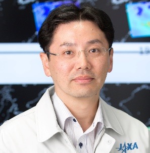 Takuji Kubota (久保田拓志)合作论文数Earth Observation Research Center, Japan Aerospace Exploration Agency104
 Toshio Iguchi合作论文数National Institute of Information and Communications Technology76
 Misako Kachi合作论文数48
 Kinji Furukawa合作论文数28
 Takayabu Yukari (高薮 縁)合作论文数Atmosphere and Ocean Research Institute, The University of Tokyo28
 Shuji Shimizu合作论文数27
 Kenji Nakamura合作论文数26
 Takeshi Masaki合作论文数21
 Hiroshi Hanado合作论文数21
 Masaki Satoh (佐藤正樹)合作论文数Atmosphere and Ocean Research Institute, The University of Tokyo;Japan Aerospace Exploration Agency20
 Tomoo Ushio合作论文数Osaka University17
 Moeka Yamaji合作论文数Dept Geog, Tokyo Metropolitan Univ16
 Naofumi Yoshida合作论文数Komazawa University16
 Shoichi Shige合作论文数Department of Aerospace Engineering;Osaka Prefecture University16masahiro kojima合作论文数15
 Kazumasa Aonashi合作论文数14
 Kosuke Yamamoto合作论文数13
 Toshiki Iwasaki合作论文数13
 Nobuhiro Takahashi合作论文数12Philippe Baron合作论文数Cabinet d’Hépato-Gastroentérologie, 10 rue Dampierre,Dunkerque12
 Kozo Okamoto合作论文数EMC, NOAA12Yuki Kaneko合作论文数Sabancõ University12Shoken Ishii合作论文数National Institute of Information and Communications Technology12
 Nishizawa Tomoaki合作论文数10
 Tomoko Tashima合作论文数9
 Kaya Kanemaru合作论文数Japan Aerosp Explorat Agcy, Earth Observat Res Ctr, Tsukuba, Ibaraki, Japan9M. Kachi合作论文数9
 Atsushi Hamada合作论文数Atmosphere & Ocean Res Inst, Univ Tokyo9
 Taichu Y. Tanaka合作论文数Atmospheric Environment and Applied Meteorology Research Department, Meteorological Research Institute, Japan Meteorological Agency9Yohei Satoh合作论文数8
 Daisuke Sakaizawa合作论文数8Motoaki Yasui合作论文数8
 Atsushi Sato合作论文数7
 Hajime Okamoto合作论文数Res Inst Appl Mech, Kyushu Univ7Kenshi Hibino合作论文数6Kohei Unagami合作论文数6Satoshi Kida合作论文数Department of Bioscience, Tokyo University of Agriculture6
 Katsuhiro Nakagawa合作论文数6
 Satoshi Ochiai合作论文数6
 Hideki Ishida合作论文数Department of Urology, Tokyo Women’s Medical University6
 Yuichiro Hagihara (萩原雄一朗)合作论文数Remote Sensing Lab, National Institute of Information and Communications Technology6
 Tsuyoshi Thomas Sekiyama (関山剛)合作论文数2nd Laboratory, Department of Physical Meteorology Research, Meteorological Research Institute, Japan Meteorological Agency6
 Shinta Seto合作论文数Institute of Industrial Science;University of Tokyo;Institute of Industrial Science, University of Tokyo6
 Kei Yoshimura (芳村圭)合作论文数Institute of Industrial Science, The University of Tokyo;Atmosphere and Ocean Research Institute, The University of Tokyo;Department of Human and Social Systems, The University of Tokyo6
 Tetsuya Tagawa合作论文数6Masafumi Hirose合作论文数6Nozomi Kawamoto合作论文数5




