In satellite remote sensing of land surface Essential Climate Variables (ECVs) using optical sensors, an atmospheric correction step is typically required to convert top-of-atmosphere (TOA) bi-directional reflectances into top-of-canopy (TOC) bi-directional reflectances. We analyse the error covariance structure of TOC reflectances that arises specifically from uncertainties in atmospheric correction. Using SMAC as the atmospheric correction model and Automatic Differentiation (AD) for efficient Jacobian computation, we quantify these error covariances across different scenarios. Our results show that uncertainties in the atmospheric state introduce non-negligible error correlations of both signs between different satellite bands. Since these error correlations are often overlooked, explicitly accounting for them could improve the accuracy of land surface ECV retrievals.
This paper describes the selected algorithm for the ESA climate change initiative vegetation parameters project. Multi- and hyper-spectral, multi-angular, or multi-sensor top-of-canopy reflectance data call for an efficient generic retrieval system which can improve the consistent retrieval of standard canopy parameters as albedo, Leaf Area Index (LAI), Fraction of Absorbed Photosynthetically Active Radiation (fAPAR) and their uncertainties, and exploit the information to retrieve additional parameters (e.g. leaf pigments). We present a retrieval system for canopy and sub-canopy parameters (OptiSAIL), which is based on a model comprising SAIL (canopy reflectance), PROSPECT-D (leaf properties), TARTES (snow properties), a soil model (soil reflectance anisotropy, moisture effect), and a cloud contamination model. The inversion is gradient based and uses codes created by Automatic Differentiation. The full per pixel covariance-matrix of the retrieved parameters is computed. For this demonstration, single observation data from the Sentinel-3 SY_2_SYN (synergy) product is used. The results are compared with the MODIS 4-day LAI/fAPAR product and PhenoCam site photography. OptiSAIL produces generally consistent and credible results, at least matching the quality of the technically quite different MODIS product. The system is computationally efficient with a rate of 150 pixel s−1 (7 ms per pixel) for a single thread on a current desktop CPU using observations on 26 bands. Not all of the model parameters are well determined in all situations. Significant correlations between the parameters are found, which can change sign and magnitude over time. OptiSAIL appears to meet the design goals and puts real-time processing with this kind of system into reach.
Motions within the Earth mantle and tectonics constitute a single self-organized system which is cooling the planet over its geological history. Since the end of the XXth century, models of mantle convection self-generating plate tectonic behavior have progressed to a state that makes them applicable to global tectonic problems. The possibility of combining geological and geophysical data with dynamic models to retrieve the recent history of mantle flow and tectonics becomes realistic. Therefore, it is a challenge to build inverse methods to study inverse and sensitivity problems in the Earth's mantle convection. We have automatically generated the tangent-linear and the adjoint source code from the StaggYY code (Tackley, Phys. Earth Planet. Int. 171, 7-18, 2008). The Fortran code of the model was translated to the corresponding derivative codes using TAF (Transformation of Algorithms in Fortran), source-to-source translator. All codes run in parallel mode, using MPI (Message Passing Interface). The economic taping strategy of TAF, including re-computations, and checkpointing, helps to keep the memory footprint of the adjoint code low and the performance high. We highlight some key features of the automatic differentiation, evaluate the performance of the adjoint code, and show first results from 2D and 3D sensitivity fields, focusing on the relationships between temperature in the mantle and tectonics. Ultimately the addjoint code shall be applied to inversion and assimilation problems using a bayesian framework.
Uncertainty in predicting solar energy resources introduces major challenges in power system management and necessitates the development of reliable probabilistic solar forecasts. As the first part of the development of probabilistic forecasts based on the Weather Research and Forecasting model with solar extensions (WRF-Solar), this study presents a tangent linear approach to identify input variables responsible for the largest uncertainties in predicting surface solar irradiance and clouds. A tangent linear analysis is capable of efficiently investigating sensitivities of output variables with respect to various input variables of WRF-Solar because this approach avoids the computational burden of perturbing the initial conditions of individual input variables. We develop tangent linear models (TLMs) for six WRF-Solar physics packages that control the formation and dissipation of clouds and solar radiation, and we evaluate the validity of TLMs using a linearity test. The tangent linear sensitivity analysis is conducted under various scenarios based on satellite observations and model simulations to consider realistic input conditions. A simple method is used to quantify the impact of the uncertainty of input variables on the output variables from the TLMs. The results demonstrate that uncertainties in the output variables that are the focus of this study—including global horizontal irradiance, direct normal irradiance, cloud mixing ratio, cloud tendency, cloud fraction, and sensible and latent heat fluxes—are highly sensitive to uncertainties in 14 input variables. This study indicates that the tangent linear method can identify key variables of physics modules in WRF-Solar that can be stochastically perturbed to generate ensemble-based probabilistic forecasts.
Multi- and hyper-spectral, multi-angular top-of-canopy reflectance data call for an efficient retrieval system which can improve the retrieval of standard canopy parameters (as albedo, LAI, fAPAR), and exploit the information to retrieve additional parameters (e.g. leaf pigments). Furthermore consistency between the retrieved parameters and quantification of uncertainties are required for many applications. % (2) methods We present a retrieval system for canopy and sub-canopy parameters (OptiSAIL), which is based on a model comprising SAIL, PROSPECT-D (leaf properties), TARTES (snow properties), a soil model (BRDF, moisture), and a cloud contamination model. The inversion is gradient based and uses codes % created by Automatic Differentiation. The full per pixel covariance-matrix of the retrieved parameters is computed. For this demonstration, single observation data from the Sentinel-3 SY_2_SYN (synergy) product is used. The results are compared with the MODIS 4-day LAI/fPAR product and PhenoCam site photography. OptiSAIL produces generally consistent and credible results, at least matching the quality of the technically quite different MODIS product. For most of the sites, the PhenoCam images support the OptiSAIL retrievals. The system is computationally efficient with a rate of 150 pixel per second (7 millisecond per pixel) for a single thread on a current desktop CPU using observations on 26 bands. Not all of the model parameters are well determined in all situations. Significant correlations between the parameters are found, which can change sign and magnitude over time. OptiSAIL appears to meet the design goals, puts real-time processing with this kind of system into reach, seamlessly extends to hyper-spectral and multi-sensor retrievals, and promises to be a good platform for sensitivity studies. The incorporated cloud and snow detection adds to the robustness of the system.
Fundamental and thematic climate data records derived from satellite observations provide unique information for climate monitoring and research. Since any satellite only operates over a relatively short period of time, creating a climate data record also requires the combination of space-borne measurements from a series of several (often similar) satellite sensors. Simply combining calibrated measurements from several sensors can, however, produce an inconsistent climate data record. This is particularly true of older, historic sensors whose behaviour in space was often different from their behaviour during pre-launch calibration and more scientific value can be derived from considering the series of historical and present satellites as a whole. Here, we consider harmonisation as a process that obtains new calibration coefficients for revised sensor calibration models by comparing calibrated measurements over appropriate satellite-to-satellite matchups, such as simultaneous nadir overpasses and which reconciles the calibration of different sensors given their estimated spectral response function differences. We present the concept of a framework that establishes calibration coefficients and their uncertainty and error covariance for an arbitrary number of sensors in a metrologically-rigorous manner. We describe harmonisation and its mathematical formulation as an inverse problem that is extremely challenging when some hundreds of millions of matchups are involved and the errors of fundamental sensor measurements are correlated. We solve the harmonisation problem as marginalised errors in variables regression. The algorithm involves computation of first and second-order partial derivatives using Algorithmic Differentiation. Finally, we present re-calibrated radiances from a series of nine Advanced Very High Resolution Radiometer sensors showing that the new time series has smaller matchup differences compared to the unharmonised case while being consistent with uncertainty statistics.
The High resOlution Land Atmosphere surface Parameters from Space (HOLAPS) programme provides a modeling system to maximize the use of satellite-based products and ensure internally consistent estimation of surface water and energy fluxes. Leaf area index (LAS) and land surface albedo are two key parameters for estimation of latent and sensible heat fluxes with HOLAPS. Thus, to facilitate the generation of long-term high accuracy latent and sensible heat fluxes, high quality global long-term LAI and land surface albedo datasets are essential. The Quality Assurance for Essential Climate Variables (QA4ECV) project released quality-assured longterm LAI and albedo datasets with traceable and reliable uncertainty information provided in the dataset. Taking MODIS-BNU-LAI and MODIS albedo as reference, different global long-term LAI and albedo datasets including GlobAlbedo, QA4ECV and GLOBMAP were investigated for estimation of latent/sensible heat fluxes with HOLAPS in this study. The results show that all albedo datasets show similar accuracy for estimation of latent and sensible heat fluxes when validated against FLUXNET observations. The QA4ECV LAI leads to worse latent heat flux estimation due to its use of effective LAI rather than green leaf LAI. Sensitivity analysis also shows that the HOLAPS estimated latent heat flux (LE) is more sensitive to uncertainty in LAI than land surface albedo. Overall, the combined use of QA4ECV albedo and GLOBMAP LAI is suggested for estimation of latent/sensible heat fluxes with HOLAPS. The root mean square differences (RMSD) between estimations and FLUXNET measurements are 54 (30) W/m(2) for hourly (monthly) latent heat flux, and 80.5 (24.5) W/m(2) for sensible heat flux, which are comparable to estimates with MODIS and other reported studies.
Drought in Australia has widespread impacts on agriculture and ecosystems. Satellite-based Fraction of Absorbed Photosynthetically Active Radiation (FAPAR) has great potential to monitor and assess drought impacts on vegetation greenness and health. Various FAPAR products based on satellite observations have been generated and made available to the public. However, differences remain among these datasets due to different retrieval methodologies and assumptions. The Quality Assurance for Essential Climate Variables (QA4ECV) project recently developed a quality assurance framework to provide understandable and traceable quality information for Essential Climate Variables (ECVs). The QA4ECV FAPAR is one of these ECVs. The aim of this study is to investigate the capability of QA4ECV FAPAR for drought monitoring in Australia. Through spatial and temporal comparison and correlation analysis with widely used Moderate Resolution Imaging Spectroradiometer (MODIS), Satellite Pour l’Observation de la Terre (SPOT)/PROBA-V FAPAR generated by Copernicus Global Land Service (CGLS), and the Standardized Precipitation Evapotranspiration Index (SPEI) drought index, as well as the European Space Agency’s Climate Change Initiative (ESA CCI) soil moisture, the study shows that the QA4ECV FAPAR can support agricultural drought monitoring and assessment in Australia. The traceable and reliable uncertainties associated with the QA4ECV FAPAR provide valuable information for applications that use the QA4ECV FAPAR dataset in the future.
How can the in-flight spectral response functions of a series of decades-old broad band radiometers in Space be retrieved post-flight? This question is the key to developing Climate Data Records from the Meteosat Visible and Infrared Imager on board the Meteosat First Generation (MFG) of geostationary satellites, which acquired Earth radiance images in the Visible (VIS) broad band from 1977 to 2017. This article presents a new metrologically sound method for retrieving the VIS spectral response from matchups of pseudo-invariant calibration site (PICS) pixels with datasets of simulated top-of-atmosphere spectral radiance used as reference. Calibration sites include bright desert, open ocean and deep convective cloud targets. The absolute instrument spectral response function is decomposed into generalised Bernstein basis polynomials and a degradation function that is based on plain physical considerations and able to represent typical chromatic ageing characteristics. Retrieval uncertainties are specified in terms of an error covariance matrix, which is projected from model parameter space into the spectral response function domain and range. The retrieval method considers target type-specific biases due to errors in, e.g., the selection of PICS target pixels and the spectral radiance simulation explicitly. It has been tested with artificial and well-comprehended observational data from the Spinning Enhanced Visible and Infrared Imager on-board Meteosat Second Generation and has retrieved meaningful results for all MFG satellites apart from Meteosat-1, which was not available for analysis.
Data from Earth observation (EO) satellites are increasingly used to monitor the environment, understand variability and change, inform evaluations of climate model forecasts, and manage natural resources. Policymakers are progressively relying on the information derived from these datasets to make decisions on mitigating and adapting to climate change. These decisions should be evidence based, which requires confidence in derived products, as well as the reference measurements used to calibrate, validate, or inform product development. In support of the European Union’s Earth Observation Programmes Copernicus Climate Change Service (C3S), the Quality Assurance for Essential Climate Variables (QA4ECV) project fulfilled a gap in the delivery of climate quality satellite-derived datasets, by prototyping a generic system for the implementation and evaluation of quality assurance (QA) measures for satellite-derived ECV climate data record products. The project demonstrated the QA system on six new long-term, climate quality ECV data records for surface albedo, leaf area index (LAI), fraction of absorbed photosynthetically active radiation (FAPAR), nitrogen dioxide (NO2), formaldehyde (HCHO), and carbon monoxide (CO). The provision of standardised QA information provides data users with evidence-based confidence in the products and enables judgement on the fitness-for-purpose of various ECV data products and their specific applications.
Meaningful study and quantification of climatic trends requires decades of observational data. Within satellite remote sensing this motivates the generation fundamental climate data records (FCDRs) -datasets containing the combined observations from a series of missions of a given sensor, to span the required duration for study. Ensuring the radiometric stability of such series is vital for such applications. To this end a consistent in-flight retrospective recalibration of all the sensors in such a series is required, called harmonisation. Presented here is a methodology for achieving this by analysing match-ups between sensors in the series and applicable sensors with modern, well-calibrated reference sensors, fitting new calibration parameters for each sensor in the series. Such a problem is not tractable in the most optimal, metrologically rigorous manner by existing solvers, due to the possibly complex error and geophysical correlation structures and high data volume (potentially >10(8) match-ups). Discussed are a palette of novel optimisation algorithms developed to overcome this, which investigate alternative approaches to handling the full problem. Preliminary results are shown for one these approaches, Fast EIV (Errors in Variables), for the recalibration of the AVHRR sensor series.
Numerous global satellite-based leaf area index (LAI) products have been generated and widely used for a number of applications such as crop assessment in agro-meteorology or to achieve a better understanding of soil-vegetation-atmosphere interactions and modeling BioGeochemical Cycles (eg, Forzieri, Alkama, Miralles, & Cescatti, 2017; Morton et al., 2014; Spracklen, Arnold, & Taylor, 2012; Zeng et al., 2017). The theoretical and physical uncertainties of these products have been quantified for certain areas and temporal periods (eg, Chen et al., 2002; Garrigues et al., 2008; Morisette et al., 2006). Furthermore, Jiang et al. (2017) comprehensively evaluated the consistency of the existing long-term (≥30 years) global satellite-based LAI products, in terms of uncertainty variations, trends and inter-annual variabilities. Their results indicate that these long-term LAI products are not internally consistent over time and also not consistent with each other. None of them are suitable for serving as a reference dataset in long-term global change research. These inconsistencies among these products are likely due to the different definitions of LAI (eg, effective LAI vs. green leaf LAI), spectral responsivity differences, satellite orbit drift, as well as the different methods of retrieval. Therefore, there is a strong need for a quality-assured long-term LAI product, which means reliable, traceable and understandable quality information is provided. These datasets need to refer to comprehensive details of the processing algorithm (eg, in the form of an ATBD), undergo independent traceable ongoing and globally explicit validation, and contain estimates of uncertainties from the propagation through the processing algorithms. The Quality Assurance for Essential Climate Variables (QA4ECV) project (funded by the European Union's Seventh Framework Programme (FP7/2007-2013) under QA4ECV grant agreement no. 607405) is developing a prototype international quality assurance framework between data producers, national metrology and standards organizations and data users to capture and provide understandable and traceable quality information for ECVs (http://www.qa4ecv.eu). This framework will be further developed for operational application within the European Copernicus Climate Change Service and will ensure that long-term ECV data products, such as LAI, are provided with full uncertainty metrics in a format that can be readily used by end users (in netCDF4-CM format). One such product is the effective LAI that is produced using the Two-stream Inversion Package (Clerici et al., 2010; Voßbeck et al., 2010), based on the Two-Stream Model developed by Pinty et al. (2006), which implements the two-stream approximation of radiative transfer for a homogeneous canopy (1D-canopy). The 1D radiative transfer model is consistent with large-scale climate and Earth system models and does not require assumptions about other factors such as biome type. This LAI product will provide the uncertainties of LAI for each pixel, which have been propagated through the whole processing chain, also taking into account uncertainty correlations in an enhancement of the LAI product presented in Disney et al. (2016). This product will add greater transparency and openness between ECV producers and end users, and facilitate the application of a long-term LAI product for global change research. This research has been supported by the FP7 Project Quality Assurance for Essential Climate Variables (QA4ECV), grant No. 607405.
We describe the Max Planck Institute Carbon Cycle Data Assimilation System (MPI-CCDAS) built around the tangent-linear version of the JSBACH land-surface scheme, which is part of the MPI-Earth System Model v1. The simulated phenology and net land carbon balance were constrained by globally distributed observations of the fraction of absorbed photosynthetically active radiation (FAPAR, using the TIP-FAPAR product) and atmospheric CO2 at a global set of monitoring stations for the years 2005 to 2009. When constrained by FAPAR observations alone, the system successfully, and computationally efficiently, improved simulated growing-season average FAPAR, as well as its seasonality in the northern extra-tropics. When constrained by atmospheric CO2 observations alone, global net and gross carbon fluxes were improved, despite a tendency of the system to underestimate tropical productivity. Assimilating both data streams jointly allowed the MPI-CCDAS to match both observations (TIP-FAPAR and atmospheric CO2) equally well as the single data stream assimilation cases, thereby increasing the overall appropriateness of the simulated biosphere dynamics and underlying parameter values. Our study thus demonstrates the value of multiple-data-stream assimilation for the simulation of terrestrial biosphere dynamics. It further highlights the potential role of remote sensing data, here the TIP-FAPAR product, in stabilising the strongly underdetermined atmospheric inversion problem posed by atmospheric transport and CO2 observations alone. Notwithstanding these advances, the constraint of the observations on regional gross and net CO2 flux patterns on the MPI-CCDAS is limited through the coarse-scale parametrisation of the biosphere model. We expect improvement through a refined initialisation strategy and inclusion of further biosphere observations as constraints.
A new reverse engineering method for the recovery of the MVIRI/VIS band launch-time sensor spectral response and its spectral ageing is presented here. This method, developed in the framework of the H2020 FIDUCEO project, supports the generation of a fundamental climate data record from archived MVIRI data. This reverse engineering method relies on advanced radiative transfer modelling over PICS and inverse modelling techniques. It has been verified recovering the SEVIRI/HRVIS band that has been accurately characterized on ground and then applied on Met-7 MVIRI/VIS band data.
Modeling jointly the deep convective motions in the mantle and the deformation of the lithosphere in a selfconsistent way is a long-standing quest, for which significant advances have been made in the late 1990’s. The complexities used in lithospheric models are making their way into the models of mantle convection (density variations, pseudo-plasticity, elasticity, free surface), hence global models of mantle motions can now display tectonics at their surface, evolving self-consistantly and showing some of the most important properties of plate tectonics on Earth (boundaries, types of boundaries, plate sizes, seafloor spreading properties, continental drift).
 Thomas Kaminski合作论文数FastOpt52Marko Scholze合作论文数University of Bristol, University of Bristol32Wolfgang Knorr合作论文数Institutionen for Naturgeografi och Ekosystemvetenskap, Naturvetenskapliga Fakulteten, Lund University25
 Nadine Gobron合作论文数Joint Research Centre, European Commission22Simon Blessing合作论文数15Michael Voßbeck合作论文数15
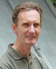 Peter Rayner合作论文数Division of Science, School of Geography, Earth and Atmospheric Sciences, The University of Melbourne14
 Bernard Pinty合作论文数Institute for Environment and Sustainability, EC Joint Research Centre13m vossbeck合作论文数12
 Lee-Lueng Fu合作论文数NASA Jet Propulsion Laboratory11
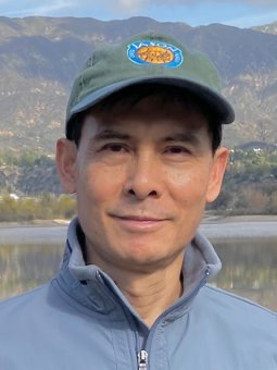 Tong (Tony) Lee合作论文数Jet Propulsion Laboratory, NASA;California Institute of Technology11
 Martin Heimann合作论文数Department Biogeochemical Signals, Max Planck Institute for Biogeochemistry;Institute for Atmospheric and Earth System Research, University of Helsinki9
 Michael Karcher合作论文数Climate Sciences/Sea ice Physics, Ocean Atmosphere Systems/Alfred Wegener Institute9Frank Kauker合作论文数Alfred Wegener Institute8
 Rudiger Gerdes合作论文数Alfred-Wegener-Institut Helmholtz-Zentrum für Polar- und Meeresforschung, Bremerhaven, Germany8
 Jochem Marotzke合作论文数Max Planck Institute for Meteorology8
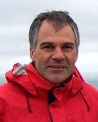 Dimitris Menemenlis合作论文数Jet Propulsion Laboratory, California Institute of Technology8
 Detlef Stammer合作论文数Institut fur Meereskunde, Universitat Hamburg8Christoph Köstler合作论文数7Gregor Schürmann合作论文数7
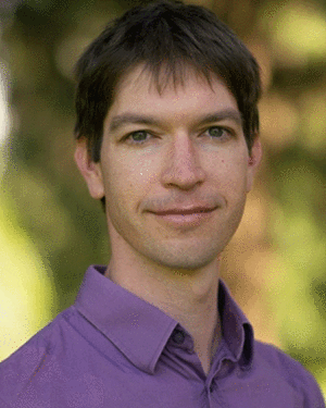 Thomas Lavergne合作论文数7
 Patrick Heimbach合作论文数Department of Geological Sciences, Jackson School of Geosciences, University of Texas at Austin7
 Jens Kattge合作论文数Max Planck Institute for Biogeochemistry7
 Ichiro Fukumori合作论文数Jet Propulsion Laboratory, California Institute of Technology7
 Sönke Zaehle合作论文数Department of Biogeochemical Signals, Max Planck Institute for Biogeochemistry7H. Widmann合作论文数6
 John Marshall合作论文数Department of Earth, Atmospheric and Planetary Sciences, Massachusetts Institute of Technology6R. Quast合作论文数6
 Carl Wunsch合作论文数Department of Earth and Planetary Sciences, Harvard University;Department of Earth, Atmospheric and Planetary Sciences, Massachusetts Institute of Technology6
 Pierre-Philippe Mathieu合作论文数6
 Jan-Peter Muller合作论文数Department of Space and Climate Physics, Faculty of Mathematical & Physical Sciences, University College London6Jean-Luc Widlowski合作论文数6
 Malcolm Taberner合作论文数European Commission – DG Joint Research Centre, Institute for Environment and Sustainability, TP 440, I-21020 Ispra (VA), Italy6
 Michel M. Verstraete合作论文数University of the Witwatersrand5
 Yves M. Govaerts合作论文数EUMETSAT5
 Christopher N. Hill合作论文数Earth, Atmospheric and Planetary Sciences, Massachusetts Institute of Technology5Christian Reick合作论文数Max Planck Institute for Meteorology5
 Nuno Carvalhais合作论文数Max Planck Institute for Biogeochemistry5o aussedat合作论文数4Frank Rüthrich合作论文数4Christian Rödenbeck合作论文数4Olaf Danne合作论文数4Saïd Kharbouche合作论文数4
 Alistair Adcroft合作论文数Princeton University;Geophysical Fluids Dynamics Laboratory, National Oceanic and Atmospheric Administration4
 Jian Peng合作论文数Department of Geography, Ludwig-Maximilians-University Munich/
School of Geography and the Environment, University of Oxford4Rob Roebeling合作论文数4
Jian Peng合作论文数Department of Geography, Ludwig-Maximilians-University Munich/
School of Geography and the Environment, University of Oxford4Rob Roebeling合作论文数4 Ricardo Todling合作论文数Goddard Space Flight Center, National Aeronautics and Space Administration4




