In satellite remote sensing of land surface Essential Climate Variables (ECVs) using optical sensors, an atmospheric correction step is typically required to convert top-of-atmosphere (TOA) bi-directional reflectances into top-of-canopy (TOC) bi-directional reflectances. We analyse the error covariance structure of TOC reflectances that arises specifically from uncertainties in atmospheric correction. Using SMAC as the atmospheric correction model and Automatic Differentiation (AD) for efficient Jacobian computation, we quantify these error covariances across different scenarios. Our results show that uncertainties in the atmospheric state introduce non-negligible error correlations of both signs between different satellite bands. Since these error correlations are often overlooked, explicitly accounting for them could improve the accuracy of land surface ECV retrievals.
This paper describes the selected algorithm for the ESA climate change initiative vegetation parameters project. Multi- and hyper-spectral, multi-angular, or multi-sensor top-of-canopy reflectance data call for an efficient generic retrieval system which can improve the consistent retrieval of standard canopy parameters as albedo, Leaf Area Index (LAI), Fraction of Absorbed Photosynthetically Active Radiation (fAPAR) and their uncertainties, and exploit the information to retrieve additional parameters (e.g. leaf pigments). We present a retrieval system for canopy and sub-canopy parameters (OptiSAIL), which is based on a model comprising SAIL (canopy reflectance), PROSPECT-D (leaf properties), TARTES (snow properties), a soil model (soil reflectance anisotropy, moisture effect), and a cloud contamination model. The inversion is gradient based and uses codes created by Automatic Differentiation. The full per pixel covariance-matrix of the retrieved parameters is computed. For this demonstration, single observation data from the Sentinel-3 SY_2_SYN (synergy) product is used. The results are compared with the MODIS 4-day LAI/fAPAR product and PhenoCam site photography. OptiSAIL produces generally consistent and credible results, at least matching the quality of the technically quite different MODIS product. The system is computationally efficient with a rate of 150 pixel s−1 (7 ms per pixel) for a single thread on a current desktop CPU using observations on 26 bands. Not all of the model parameters are well determined in all situations. Significant correlations between the parameters are found, which can change sign and magnitude over time. OptiSAIL appears to meet the design goals and puts real-time processing with this kind of system into reach.
Within the past 30 years, numerical models of mantle convection have been able to predict observations on Earth and planets, and among them tectonics. The possibility of building inverse problems in global geodynamics became concrete, and often involve the development of adjoint codes. Such tools provide efficient ways to estimate sensitivities of misfit functions relative to control parameters, like errors on predicted velocities relative to mantle 3D structure. One issue to build an adjoint code is that such code is problem specific in many cases, while forward codes are versatile. We propose here a way to build adjoint codes that are exact adjoints of forward codes through an automated process. Using the automatic differentiation translator TAF \cite{giering2003} and incorporating specific implementations for MPI communications, we generate two adjoint codes of the 3D spherical thermomechanical mantle convection code StagYY \cite{tackley2008}. We first present a benchmarking example computing the sensitivities of a thermal state to initial conditions with a 3D spherical thermochemical model. We then compute the sensitivities of present-day plate velocities relative to guessed temperature distribution in the mantle. The sensitivities reflect either the intrinsic sensitivity of the problem (sensitivity to upper mantle structure) and the errors made in reconstructing the thermal structure of the mantle (deepest mantle structure). Both codes successfully pass the rigorous and demanding gradient test, also called Taylor test. We show that our workflow for automatic generation of adjoint codes for StagYY provides a sustainable and adaptive method to engage in inverse modelling and sensitivity computations of 3D global geodynamics.
Motions within the Earth mantle and tectonics constitute a single self-organized system which is cooling the planet over its geological history. Since the end of the XXth century, models of mantle convection self-generating plate tectonic behavior have progressed to a state that makes them applicable to global tectonic problems. The possibility of combining geological and geophysical data with dynamic models to retrieve the recent history of mantle flow and tectonics becomes realistic. Therefore, it is a challenge to build inverse methods to study inverse and sensitivity problems in the Earth's mantle convection. We have automatically generated the tangent-linear and the adjoint source code from the StaggYY code (Tackley, Phys. Earth Planet. Int. 171, 7-18, 2008). The Fortran code of the model was translated to the corresponding derivative codes using TAF (Transformation of Algorithms in Fortran), source-to-source translator. All codes run in parallel mode, using MPI (Message Passing Interface). The economic taping strategy of TAF, including re-computations, and checkpointing, helps to keep the memory footprint of the adjoint code low and the performance high. We highlight some key features of the automatic differentiation, evaluate the performance of the adjoint code, and show first results from 2D and 3D sensitivity fields, focusing on the relationships between temperature in the mantle and tectonics. Ultimately the addjoint code shall be applied to inversion and assimilation problems using a bayesian framework.
Multi- and hyper-spectral, multi-angular top-of-canopy reflectance data call for an efficient retrieval system which can improve the retrieval of standard canopy parameters (as albedo, LAI, fAPAR), and exploit the information to retrieve additional parameters (e.g. leaf pigments). Furthermore consistency between the retrieved parameters and quantification of uncertainties are required for many applications. % (2) methods We present a retrieval system for canopy and sub-canopy parameters (OptiSAIL), which is based on a model comprising SAIL, PROSPECT-D (leaf properties), TARTES (snow properties), a soil model (BRDF, moisture), and a cloud contamination model. The inversion is gradient based and uses codes % created by Automatic Differentiation. The full per pixel covariance-matrix of the retrieved parameters is computed. For this demonstration, single observation data from the Sentinel-3 SY_2_SYN (synergy) product is used. The results are compared with the MODIS 4-day LAI/fPAR product and PhenoCam site photography. OptiSAIL produces generally consistent and credible results, at least matching the quality of the technically quite different MODIS product. For most of the sites, the PhenoCam images support the OptiSAIL retrievals. The system is computationally efficient with a rate of 150 pixel per second (7 millisecond per pixel) for a single thread on a current desktop CPU using observations on 26 bands. Not all of the model parameters are well determined in all situations. Significant correlations between the parameters are found, which can change sign and magnitude over time. OptiSAIL appears to meet the design goals, puts real-time processing with this kind of system into reach, seamlessly extends to hyper-spectral and multi-sensor retrievals, and promises to be a good platform for sensitivity studies. The incorporated cloud and snow detection adds to the robustness of the system.
The High resOlution Land Atmosphere surface Parameters from Space (HOLAPS) programme provides a modeling system to maximize the use of satellite-based products and ensure internally consistent estimation of surface water and energy fluxes. Leaf area index (LAS) and land surface albedo are two key parameters for estimation of latent and sensible heat fluxes with HOLAPS. Thus, to facilitate the generation of long-term high accuracy latent and sensible heat fluxes, high quality global long-term LAI and land surface albedo datasets are essential. The Quality Assurance for Essential Climate Variables (QA4ECV) project released quality-assured longterm LAI and albedo datasets with traceable and reliable uncertainty information provided in the dataset. Taking MODIS-BNU-LAI and MODIS albedo as reference, different global long-term LAI and albedo datasets including GlobAlbedo, QA4ECV and GLOBMAP were investigated for estimation of latent/sensible heat fluxes with HOLAPS in this study. The results show that all albedo datasets show similar accuracy for estimation of latent and sensible heat fluxes when validated against FLUXNET observations. The QA4ECV LAI leads to worse latent heat flux estimation due to its use of effective LAI rather than green leaf LAI. Sensitivity analysis also shows that the HOLAPS estimated latent heat flux (LE) is more sensitive to uncertainty in LAI than land surface albedo. Overall, the combined use of QA4ECV albedo and GLOBMAP LAI is suggested for estimation of latent/sensible heat fluxes with HOLAPS. The root mean square differences (RMSD) between estimations and FLUXNET measurements are 54 (30) W/m(2) for hourly (monthly) latent heat flux, and 80.5 (24.5) W/m(2) for sensible heat flux, which are comparable to estimates with MODIS and other reported studies.
Drought in Australia has widespread impacts on agriculture and ecosystems. Satellite-based Fraction of Absorbed Photosynthetically Active Radiation (FAPAR) has great potential to monitor and assess drought impacts on vegetation greenness and health. Various FAPAR products based on satellite observations have been generated and made available to the public. However, differences remain among these datasets due to different retrieval methodologies and assumptions. The Quality Assurance for Essential Climate Variables (QA4ECV) project recently developed a quality assurance framework to provide understandable and traceable quality information for Essential Climate Variables (ECVs). The QA4ECV FAPAR is one of these ECVs. The aim of this study is to investigate the capability of QA4ECV FAPAR for drought monitoring in Australia. Through spatial and temporal comparison and correlation analysis with widely used Moderate Resolution Imaging Spectroradiometer (MODIS), Satellite Pour l’Observation de la Terre (SPOT)/PROBA-V FAPAR generated by Copernicus Global Land Service (CGLS), and the Standardized Precipitation Evapotranspiration Index (SPEI) drought index, as well as the European Space Agency’s Climate Change Initiative (ESA CCI) soil moisture, the study shows that the QA4ECV FAPAR can support agricultural drought monitoring and assessment in Australia. The traceable and reliable uncertainties associated with the QA4ECV FAPAR provide valuable information for applications that use the QA4ECV FAPAR dataset in the future.
Data from Earth observation (EO) satellites are increasingly used to monitor the environment, understand variability and change, inform evaluations of climate model forecasts, and manage natural resources. Policymakers are progressively relying on the information derived from these datasets to make decisions on mitigating and adapting to climate change. These decisions should be evidence based, which requires confidence in derived products, as well as the reference measurements used to calibrate, validate, or inform product development. In support of the European Union’s Earth Observation Programmes Copernicus Climate Change Service (C3S), the Quality Assurance for Essential Climate Variables (QA4ECV) project fulfilled a gap in the delivery of climate quality satellite-derived datasets, by prototyping a generic system for the implementation and evaluation of quality assurance (QA) measures for satellite-derived ECV climate data record products. The project demonstrated the QA system on six new long-term, climate quality ECV data records for surface albedo, leaf area index (LAI), fraction of absorbed photosynthetically active radiation (FAPAR), nitrogen dioxide (NO2), formaldehyde (HCHO), and carbon monoxide (CO). The provision of standardised QA information provides data users with evidence-based confidence in the products and enables judgement on the fitness-for-purpose of various ECV data products and their specific applications.
Numerous global satellite-based leaf area index (LAI) products have been generated and widely used for a number of applications such as crop assessment in agro-meteorology or to achieve a better understanding of soil-vegetation-atmosphere interactions and modeling BioGeochemical Cycles (eg, Forzieri, Alkama, Miralles, & Cescatti, 2017; Morton et al., 2014; Spracklen, Arnold, & Taylor, 2012; Zeng et al., 2017). The theoretical and physical uncertainties of these products have been quantified for certain areas and temporal periods (eg, Chen et al., 2002; Garrigues et al., 2008; Morisette et al., 2006). Furthermore, Jiang et al. (2017) comprehensively evaluated the consistency of the existing long-term (≥30 years) global satellite-based LAI products, in terms of uncertainty variations, trends and inter-annual variabilities. Their results indicate that these long-term LAI products are not internally consistent over time and also not consistent with each other. None of them are suitable for serving as a reference dataset in long-term global change research. These inconsistencies among these products are likely due to the different definitions of LAI (eg, effective LAI vs. green leaf LAI), spectral responsivity differences, satellite orbit drift, as well as the different methods of retrieval. Therefore, there is a strong need for a quality-assured long-term LAI product, which means reliable, traceable and understandable quality information is provided. These datasets need to refer to comprehensive details of the processing algorithm (eg, in the form of an ATBD), undergo independent traceable ongoing and globally explicit validation, and contain estimates of uncertainties from the propagation through the processing algorithms. The Quality Assurance for Essential Climate Variables (QA4ECV) project (funded by the European Union's Seventh Framework Programme (FP7/2007-2013) under QA4ECV grant agreement no. 607405) is developing a prototype international quality assurance framework between data producers, national metrology and standards organizations and data users to capture and provide understandable and traceable quality information for ECVs (http://www.qa4ecv.eu). This framework will be further developed for operational application within the European Copernicus Climate Change Service and will ensure that long-term ECV data products, such as LAI, are provided with full uncertainty metrics in a format that can be readily used by end users (in netCDF4-CM format). One such product is the effective LAI that is produced using the Two-stream Inversion Package (Clerici et al., 2010; Voßbeck et al., 2010), based on the Two-Stream Model developed by Pinty et al. (2006), which implements the two-stream approximation of radiative transfer for a homogeneous canopy (1D-canopy). The 1D radiative transfer model is consistent with large-scale climate and Earth system models and does not require assumptions about other factors such as biome type. This LAI product will provide the uncertainties of LAI for each pixel, which have been propagated through the whole processing chain, also taking into account uncertainty correlations in an enhancement of the LAI product presented in Disney et al. (2016). This product will add greater transparency and openness between ECV producers and end users, and facilitate the application of a long-term LAI product for global change research. This research has been supported by the FP7 Project Quality Assurance for Essential Climate Variables (QA4ECV), grant No. 607405.
We present the development of the Adjoint of the Global Eulerian–Lagrangian Coupled Atmospheric (A-GELCA) model that consists of the National Institute for Environmental Studies (NIES) model as an Eulerian three-dimensional transport model (TM), and FLEXPART (FLEXible PARTicle dispersion model) as the Lagrangian Particle Dispersion Model (LPDM). The forward tangent linear and adjoint components of the Eulerian model were constructed directly from the original NIES TM code using an automatic differentiation tool known as TAF (Transformation of Algorithms in Fortran; http://www.FastOpt.com), with additional manual pre- and post-processing aimed at improving transparency and clarity of the code and optimizing the performance of the computing, including MPI (Message Passing Interface). The Lagrangian component did not require any code modification, as LPDMs are self-adjoint and track a significant number of particles backward in time in order to calculate the sensitivity of the observations to the neighboring emission areas. The constructed Eulerian adjoint was coupled with the Lagrangian component at a time boundary in the global domain. The simulations presented in this work were performed using the A-GELCA model in forward and adjoint modes. The forward simulation shows that the coupled model improves reproduction of the seasonal cycle and short-term variability of CO2. Mean bias and standard deviation for five of the six Siberian sites considered decrease roughly by 1 ppm when using the coupled model. The adjoint of the Eulerian model was shown, through several numerical tests, to be very accurate (within machine epsilon with mismatch around to ±6 e−14) compared to direct forward sensitivity calculations. The developed adjoint of the coupled model combines the flux conservation and stability of an Eulerian discrete adjoint formulation with the flexibility, accuracy, and high resolution of a Lagrangian backward trajectory formulation. A-GELCA will be incorporated into a variational inversion system designed to optimize surface fluxes of greenhouse gases.
Carbon dioxide (CO2) is the most important anthropogenic greenhouse gas contributing to about half of the total anthropogenic change in the Earth's radiation budget. And about half of the anthropogenic CO2 emissions stay in the atmosphere, the remainder is taken up by the biosphere. It is of paramount importance to better understand CO2 sources and sinks and their spatio-temporal distribution. In the context of climate change this information is needed to improve the projections of future trends in carbon sinks and sources. Since the terrestrial carbon and water cycles are tightly coupled by biological plant processes, i.e. through the stomatal gas exchange with the atmosphere, it is expected that information on the soil moisture state will help to constrain terrestrial carbon fluxes. In the present feasibility study we employ the Carbon Cycle Data Assimilation System CCDAS to pioneer the assimilation of the SMOS L3 soil moisture product together with another biophysical data set — in this case atmospheric CO2 flask samples. The two data streams are assimilated into a process-based model of the terrestrial carbon cycle over two years. CCDAS aims to optimise model process parameters and subsequently land surface CO2 exchange fluxes. We find that the assimilation of SMOS data improves the agreement with independent soil moisture data from the active ASCAT instrument. In both cases the assimilation also improves the fit of modelled atmospheric CO2 to the observations at flask sampling sites which have not been used in the assimilation. Reduction of uncertainty relative to the prior is generally high for both regional net ecosystem productivity and net primary productivity and considerably higher than for assimilating CO2 only, which quantifies the added value of SMOS observations as a constraint on the terrestrial carbon cycle. The study demonstrates a high potential for a SMOS L4 carbon flux product.
(1) Vienna University of Technology, Department of Geodesy and Geoinformation, Vienna, Austria (wouter.dorigo@tuwien.ac.at), (2) Geoville GmbH, Innsbruck, Austria, (3) Laboratoire des Sciences du Climat et de l’Environnement, CEA CNRS, France, (4) Climate Research Unit, University of East Anglia, UK, (5) FastOpt GmbH, Hamburg, Germany, (6) National Reasearch Council, Perugia, Italy, (7) Ghent University, Ghent, Belgium, (8) VU University, Amstredam, Netherlands, (9) Transmissivity BV, Netherlands, (10) Lund University, Sweden, (11) MPI for Biogeochemistry, Jena, Germany
We present a variational assimilation system around a coarse resolution Earth System Model (ESM) and apply it for estimating initial conditions and parameters of the model. The system is based on derivative information that is efficiently provided by the ESM's adjoint, which has been generated through automatic differentiation of the model's source code. In our variational approach, the length of the feasible assimilation window is limited by the size of the domain in control space over which the approximation by the derivative is valid. This validity domain is reduced by non-smooth process representations. We show that in this respect the ocean component is less critical than the atmospheric component. We demonstrate how the feasible assimilation window can be extended to several weeks by modifying the implementation of specific process representations and by switching off processes such as precipitation.
We present the development of an inverse modeling system employing an adjoint of the global coupled transport model consisting of the National Institute for Environmental Studies (NIES) Eulerian transport model (TM) and the Lagrangian plume diffusion model (LPDM) FLEXPART. NIES TM is a three-dimensional atmospheric transport model, which solves the continuity equation for a number of atmospheric tracers on a grid spanning the entire globe. Spatial discretization is based on a reduced latitude-longitude grid and a hybrid sigma-isentropic coordinate in the vertical. NIES TM uses a horizontal resolution of 2.5× 2.5. However, to resolve synoptic-scale tracer distributions and to have the ability to optimize fluxes at resolutions of 0.5 and higher we coupled NIES TM with the Lagrangian model FLEXPART. The Lagrangian component of the forward and adjoint models uses precalculated responses of the …
 Ralf Giering合作论文数Fast Optimisation and Sensitivities15
 Thomas Kaminski合作论文数FastOpt9
 Nadine Gobron合作论文数Joint Research Centre, European Commission7
 Jan-Peter Muller合作论文数Department of Space and Climate Physics, Faculty of Mathematical & Physical Sciences, University College London6Marko Scholze合作论文数University of Bristol, University of Bristol6Frank Lunkeit合作论文数5Olaf Danne合作论文数4Saïd Kharbouche合作论文数4
 Jian Peng合作论文数Department of Geography, Ludwig-Maximilians-University Munich/
School of Geography and the Environment, University of Oxford4
Jian Peng合作论文数Department of Geography, Ludwig-Maximilians-University Munich/
School of Geography and the Environment, University of Oxford4 Klaus Fraedrich合作论文数Department of Climate Physics, Max Planck Institute for Meteorology4Wolfgang Knorr合作论文数Institutionen for Naturgeografi och Ekosystemvetenskap, Naturvetenskapliga Fakulteten, Lund University4Benjamin Müller合作论文数3
 Alexander Ganshin合作论文数Yandex3
 Dmitry Belikov合作论文数National Institute for Environmental Studies3
 Ralf Ludwig合作论文数Dept Geog, Ludwig Maximilians Univ Munchen3
 Wouter Arnoud Dorigo合作论文数Institute of Geodesy and Geoinformation, Faculty of Mathematics and Geoinformation, Vienna University of Technology3
 Klaus Scipal合作论文数Mission Management Office, European Space Agency3Michael Voßbeck合作论文数3
 Shamil Maksyutov合作论文数Center for Global Environmental Research, National Institute for Environmental Studies3Joerg Schulz合作论文数2
 Youva Aoun合作论文数2Christoph Köstler合作论文数2Gregor Schürmann合作论文数2m vossbeck合作论文数2
 Jennifer Grant合作论文数2
 Guoyong Leng (冷国勇)合作论文数Institute of Geographic Sciences and Natural Resources Research, Chinese Academy of Sciences2
 Frédéric Chevallier合作论文数Laboratoire des Sciences du Climat et de I'Environnement2
 Simon Dadson合作论文数School of Geography and the Environment, University of Oxford2
 Christian Lanconelli合作论文数Institute of Atmospheric Sciences and Climate (ISAC) of the Italian National Research Council (CNR), Via Gobetti 101, 40129 Bologna, Italy2
 Joanne M. Nightingale合作论文数College of Forestry, Oregon State University2
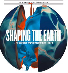 Nicolas Coltice合作论文数Laboratoire de Sciences de la Terre UMR 5570, Université Lyon 12
 Klaas Folkert Boersma合作论文数Meteorological and Air Quality department, Wageningen University2
 Alessio Lattanzio合作论文数Makalumedia2
 Sönke Zaehle合作论文数Department of Biogeochemical Signals, Max Planck Institute for Biogeochemistry2
 Paul J. Tackley合作论文数Institute of Geophysics, Department of Earth Sciences, ETH Zurich2maya george合作论文数1Jörg Schulz合作论文数1H. Widmann合作论文数1Heiko Jansen合作论文数1Pierre Coheur合作论文数1Alexey Yaremchuk合作论文数1franziska albrecht合作论文数1
 Thomas Lees合作论文数Sch Geog & Environm, Univ Oxford1
 Douglas Kelley合作论文数UK Ctr Ecol & Hydrol1
 Peter Rayner合作论文数Division of Science, School of Geography, Earth and Atmospheric Sciences, The University of Melbourne1
 Qinglong You (游庆龙)合作论文数Department of Atmospheric and Oceanic Sciences, Fudan University1
 Alexander M. Wood合作论文数1
 Zheng Duan (段征)合作论文数School of Chemistry, Zhengzhou University1
 C. Van Der Tol合作论文数Department of Water Resources, Faculty of Geo-Information Science and Earth Observation, Univerisity of Twente;Digital Society Institute, Univerisity of Twente1




