The University of South Florida (USF) College of Marine Science operates a fleet of six Teledyne Webb Research Slocum gliders as cost-effective research platforms for sampling the water column. Underwater gliders are autonomous robots that traverse the water to collect a suite of physical (e.g., temperature and salinity) and chemical (e.g., nutrients and dissolved oxygen) data to better understand the environment of coastal and open oceans. Over the past decade, the USF glider group has added sensors to obtain biological data (e.g., fluorometers, acoustic telemetry receivers, echosounders, and passive acoustic monitors) to help survey and monitor marine organisms. The data collected on these glider missions has been used in the forecasting of red tide blooms, detection of tagged aquatic animals, collection of biomass data, and recording of fish and marine mammal sounds in the Gulf of Mexico (GoM) and the Atlantic Ocean. Here we describe how our glider fleet has obtained critical biological data and is continuously evolving to better assist in addressing ecosystem-level challenges associated with global environmental changes.
Measuring seafloor motion in shallow coastal water is challenging due to strong and highly variable oceanographic effects. Such measurements are potentially useful for monitoring near‐shore coastal subsidence, subsidence due to petroleum withdrawal, strain accumulation/release processes in subduction zones and submerged volcanoes, and certain freshwater applications, such as volcano deformation in caldera‐hosted lakes. We have developed a seafloor geodesy system for this environment based on an anchored spar buoy topped by high‐precision GPS. Orientation of the buoy is measured using a digital compass that provides heading, pitch, and roll information. The combined orientation and GPS tracking data are used to recover the three‐dimensional position of the seafloor marker (anchor). A test system has been deployed in Tampa Bay, Florida, for over 1 year and has weathered several major storms without incident. Even in the presence of strong tidal currents which can deflect the top of the buoy several meters from vertical, daily repeatability in the corrected three‐component position estimates for the anchor is 1–2 cm or better.
The benefits of untethered or drifting buoys and platforms have been well documented over the past decade. Study of physical, chemical and biological processes in the ocean can often be optimized using systems that profile and/or drift. However, it is at times useful to station a sensing system so that measurements are made only after or during specific conditions, e.g. a storm, an algae bloom, or underwater geologic event. A new autonomous platform has been developed that can provide the benefits of an untethered drifter while also providing the benefits of a stationary buoy. The Bottom Stationing Ocean Profiler (BSOP) is an instrument platform that stations itself on the sea floor and ascends and descends autonomously to gather water column profile data. While at the surface the BSOP transmits acquired data via the ORBCOMM satellite system to provide researchers with a near real-time observation of the study area. The BSOP unit is designed to remain at sea for extended periods up to several months. It uses an oil-based buoyancy control system to ascend and descend at speeds up to 0.5 meters per second. The unit is low cost, easy to deploy and recover using only light duty gear and can support a wide variety of sensors. Command scripts are downloadable while the unit is in communication with a satellite ground station; this permits reprogramming of mission parameters if needed. The unit has an integral global positioning system receiver to accurately identify surface position. This is important to the scientific mission but is also used for recovery operations. BSOP design and early results are presented.
A pH sensor based upon spectrophotometric techniques has been developed for in-situ analysis of surface seawater. This sensor utilizes a spectrophotometric pH indicator (Thymol Blue) which has been calibrated for use in seawater as a function of temperature and salinity. Shipboard spectrophotometric pH analyses routinely demonstrate a precision on the order of plus or minus 0.0004 pH units. In- situ analysis of seawater pH has demonstrated a precision on the order of plus or minus 0.001 and an accuracy, using shipboard measurements as a standard, on the order of plus or minus 0.01. The sensor is a self-contained system which pumps seawater, meters in indicator, spectrophotometrically determines indicator absorbance and stores data with a 1 Hz acquisition frequency. The sensor employs two absorbance cells, each with three wavelength channels, to obtain the spectrophotometric absorbance. The sensor system, rated for depths up to 500 m, provides pH, conductivity, temperature and can be operated via computer or in a standalone mode with internal data storage. The sensor utilizes less than 12 watts of power and is packaged in a 29' long by 4.5' diameter aluminum housing.
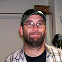 Chad Lembke合作论文数3
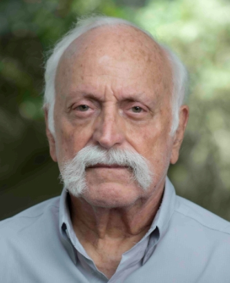 Robert H. Byrne合作论文数Department of Chemical Oceanography, College of Marine Science, University of South Florida3
 sean mcelligott合作论文数2Robert D. Waterbury合作论文数Department of Marine ScienceSt. Petersburg, University of South Florida2Jason Law合作论文数1Nicola Fraticelli合作论文数1Jennifer Brizzolara合作论文数1Edmund Hughes合作论文数1
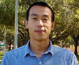 Surui Xie (谢苏锐)合作论文数Scripps Institution of Oceanography, University of California San Diego1
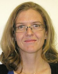 Mel Rodgers合作论文数Sch Geosci, Univ S Florida1Alex Silverman合作论文数1
 Timothy Dixon合作论文数School of Geosciences, College of Arts & Sciences, University of South Florida;Geodesy Lab, College of Arts & Sciences, University of South Florida1
 Raymond Carr合作论文数New York University1
 Robert H. Weisberg合作论文数College of Marine Science, University of South Florida1Lawrence C. Langebrake合作论文数1
 David F. Naar合作论文数Department of Marine Science;University of South Florida;Department of Marine Science, University of South Florida1
 Rocco Malservisi合作论文数School of Geosciences, College of Arts and Sciences, University of South Florida;Department of Geology, College of Arts and Sciences, University of South Florida1Graham Tilbury合作论文数1
 Heather A. Broadbent合作论文数1
 Sergio Guardato合作论文数1Giovanni Iannaccone合作论文数Dipartimento di Geofisica e Vulcanologia, Universita' di Napoli1




