We present earthquake scenarios developed to accompany the release of the 2023 update to the US Geological Survey National Seismic Hazard Model (NSHM). Scenarios can serve a range of local and regional needs, from developing proactive-targeted mitigation strategies for minimizing impending risk to aiding emergency management planning. These deterministic scenarios can also be used to communicate seismic hazard and risk to audiences who are not well versed in methods, such as probabilistic seismic hazard analyses. Specifically, we discuss the scenarios developed, challenges, and lessons learned in the development process, and how this work aided the development of the 2023 NSHM itself. In total, 28 scenarios were developed for Hawaii, Utah, Alaska, and Virginia considering the 2023 NSHM science, past scenario efforts, and input from local experts and stakeholders. Finally, we investigate how NSHM modeling decisions can change estimated impacts to Utah and Hawaii in more detail showing, for example, that a shallower dip of the Wasatch fault under Salt Lake City can increase predicted ground-motion intensities and therefore estimated losses and deaths.
The US National Seismic Hazard Model (NSHM) was updated in 2023 for all 50 states using new science on seismicity, fault ruptures, ground motions, and probabilistic techniques to produce a standard of practice for public policy and other engineering applications (defined for return periods greater than ∼475 or less than ∼10,000 years). Changes in 2023 time-independent seismic hazard (both increases and decreases compared to previous NSHMs) are substantial because the new model considers more data and updated earthquake rupture forecasts and ground-motion components. In developing the 2023 model, we tried to apply best available or applicable science based on advice of co-authors, more than 50 reviewers, and hundreds of hazard scientists and end-users, who attended public workshops and provided technical inputs. The hazard assessment incorporates new catalogs, declustering algorithms, gridded seismicity models, magnitude-scaling equations, fault-based structural and deformation models, multi-fault earthquake rupture forecast models, semi-empirical and simulation-based ground-motion models, and site amplification models conditioned on shear-wave velocities of the upper 30 m of soil and deeper sedimentary basin structures. Seismic hazard calculations yield hazard curves at hundreds of thousands of sites, ground-motion maps, uniform-hazard response spectra, and disaggregations developed for pseudo-spectral accelerations at 21 oscillator periods and two peak parameters, Modified Mercalli Intensity, and 8 site classes required by building codes and other public policy applications. Tests show the new model is consistent with past ShakeMap intensity observations. Sensitivity and uncertainty assessments ensure resulting ground motions are compatible with known hazard information and highlight the range and causes of variability in ground motions. We produce several impact products including building seismic design criteria, intensity maps, planning scenarios, and engineering risk assessments showing the potential physical and social impacts. These applications provide a basis for assessing, planning, and mitigating the effects of future earthquakes.
Earthquake risk associated with Quito, Ecuador; Cali, Colombia; and Santiago de los Caballeros, Dominican Republic is examined by generating a set of hypothetical earthquake scenarios considering seismic sources, recent seismicity, and major historical earthquakes recorded in the vicinity. In this study, particular focus is given to the development of earthquake scenarios for use in emergency planning in each city as well as stimulating discussion with respect to addressing the gaps in current understanding of built stock inventory and their vulnerability when subjected to strong shaking. Exposure and vulnerability models from the Global Earthquake Model foundation, hazard and local site information available for the cities, and the U.S. Geological Survey near-real-time products are utilized to estimate potential consequences for postearthquake response planning. Results showed that the historic city centers remain the most susceptible to experiencing severe damage resulting in widespread casualties. Similarly, the scenarios highlight areas susceptible to shaking induced ground failure hazards, which may pose additional challenges when responding to such earthquakes. Moderate earthquakes originating from nearby seismic sources, for example, Quito fault system for Quito or the Septentrional fault zone in the case of Santiago de Los Caballeros, could potentially be of greater consequence in terms of direct economic impact and disruption to the city when compared to very large distant subduction interface earthquakes.
The rise in the number of anthropogenic small- to moderate-magnitude earthquakes in the central United States raises questions about the damageability of the built environment in such events. This study examines the performance of modern light-frame wood buildings, including single, multifamily, and commercial constructions, in earthquakes with moment magnitudes of 3–6, using dynamic analysis of building models subjected to ground motions recorded in past induced events in North America. We focus on first onset of damage, for example, wallboard or wallpaper cracking, and nails popping out. The results show that earthquakes with magnitudes less than 4–4.25 are unlikely to cause damage to modern constructions. However, moderate-magnitude events can cause damage over a wide geographic area (more than 30 mi from the earthquake epicenter, or 40 or more miles from a wastewater injection well). These results can be used to suggest setback distances between injection wells and certain neighborhoods or facilities, and magnitude thresholds for post-earthquake inspections.
Activities related to oil and gas production, especially deep disposal of wastewater, have led to sequences of induced earthquakes in the central United States. This study aims to quantify damage to and seismic losses for light-frame wood buildings when subjected to sequences of induced, small to moderate magnitude, events. To conduct this investigation, one- and two-story multifamily wood frame buildings are designed, and their seismic response dynamically simulated using three-dimensional nonlinear models, subjected to ground motion sequences recorded in induced events. Damage is quantified through seismic losses, which are estimated using the FEMA P-58 methodology. Results show that at levels of shaking experienced in recent earthquakes, minor damage, consisting of cracking of interior finishes and nonstructural damage to plumbing and heating, ventilation, and air conditioning systems, is expected, which is consistent with observed damage in these events. The study also examines how expected losses and building fragility will accumulate and/or change over a sequence of earthquakes. Results indicate that damage quantified in terms of absorbed hysteretic energy tended to accumulate over the sequences; this damage corresponds to elongation or widening of cracks. However, fragility is not significantly altered by damage in a preceding event, meaning structures are not becoming more vulnerable due to existing damage. In addition, sequences of events do not change losses if the building is only repaired once at the end of the sequence, as the worsening of damage does not alter repair actions. If repairs are conducted after each event, though, total seismic losses can increase greatly from the sequence.
 Kishor Jaiswal合作论文数Department of Civil Engineering;Indian Institute of Technology Bombay;Department of Civil Engineering, Indian Institute of Technology Bombay3
 Bridger W. Baird合作论文数2
 Nicolas Luco合作论文数Geologic Hazards Science Center, U.S. Geological Survey2Abbie B. Liel合作论文数Dept . of Civil and Environmental Engineering;Stanford University;Dept . of Civil and Environmental Engineering, Stanford University2
 Mark D. Petersen合作论文数U.S. Geological Survey2H. Benjamin Mason合作论文数1James A. Smith合作论文数1
 Catalina Yepes-Estrada合作论文数1Jason M. Altekruse合作论文数1Brandon S Clayton合作论文数1
 Kirstie L Haynie合作论文数Geol Survey Geol Hazards Sci Ctr, US Geol Survey1
 Neal Simon Kwong合作论文数Univ Calif Berkeley1
 Jessica Ann Thompson Jobe合作论文数Geologic Hazards Science Center, U.S. Geological Survey1
 Julie A Herrick合作论文数US Geol Survey1Kyle B. Withers合作论文数1Devin McPhillips合作论文数1
 Adrian M. Bender合作论文数US Geol Survey, Alaska Sci Ctr1
 Alexandra E. Hatem合作论文数Geol Hazards Sci Ctr Golden, US Geol Survey1
 Eileen L. Evans合作论文数Dept Geol Sci, Calif State Univ Northridge1
 Andrew J. Makdisi合作论文数U.S. Geological Survey1
 Alejandro Calderon合作论文数1Leah Salditch合作论文数Dept Earth & Planetary Sci, Northwestern Univ1
 Brian Shiro合作论文数Hawaiian Volcano Observatory U.S. Geological Survey1Peter M Powers合作论文数1
 Sean Ahdi合作论文数Department of Earth, Planetary, and Space Sciences, College of Physical Sciences, University of California1
 Fred Pollitz合作论文数United States Geological Survey1
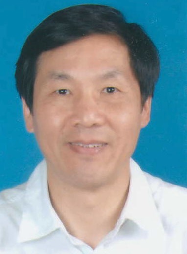 Zhengkang Shen (沈正康)合作论文数Institute of Earthquake Prediction, China Earthquake Administration;Department of Earth, Planetary, and Space Sciences, University of California, Los Angeles1
 Arthur Frankel合作论文数Department of Earth and Space Sciences, University of Washington1
 Charles Mueller合作论文数1
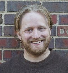 Eric M Thompson合作论文数Sars International Centre for Marine Molecular Biology;Bergen High Technology Centre;Max Planck Institute for Molecular Genetics;Max Planck Institute for Molecular Genetics, Bergen High Technology Centre1
 Morgan T. Page合作论文数US Geol Survey1Oliver S. Boyd合作论文数University of Colorado at Boulder1
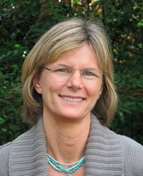 Elizabeth Harding Hearn合作论文数Department of Geological Sciences;University of Oregon;Department of Geological Sciences, University of Oregon1
 Robert C. Witter合作论文数Oregon Department of Geology and Mineral Industries, Newport Coastal Field Office1
 Daniel E. Mcnamara合作论文数US Geol Survey1Paul G. Okubo合作论文数1
 Allison M. Shumway合作论文数1
 Peter J. Haeussler合作论文数Alaska Science Center, USGS1
 Hugo Yepes合作论文数1
 Sanaz Rezaeian合作论文数1
 Bruce E Shaw合作论文数Lamont-Doherty Earth Observatory;Columbia University;Lamont-Doherty Earth Observatory, Columbia University1Justin L. Rubinstein合作论文数Department of Geophysics;Stanford University;Department of Geophysics, Stanford University1
 Morgan P. Moschetti合作论文数Center for Imaging;Department of Physics;University of Colorado at Boulder;Center for Imaging, University of Colorado at Boulder1
 Andrea L. Llenos合作论文数1Brad T. Aagaard合作论文数USGS, Menlo Park, California, USA1
 Erin Wirth合作论文数1
 Edward H. Field合作论文数Southern California Earthquake Center, University of Southern California1W. J. Stephenson合作论文数1
 Kevin Milner合作论文数University of Southern California1




