New evidence was sought for sub-pan silcrete formation along the southern margin of Ntwetwe Pan in the Botswana Makgadikgadi basin. This was achieved by integrating drillhole and surface sample descriptions with element and isocon analysis. The silcrete deposit which lies ~1.0 m below the pan surface, comprises Ntane sandstone fragments and detrital infill, cemented by amorphous silica. The deposit probably evolved during sequential periods of palaeo-lake infilling and drying since at least the Mid-Pleistocene. Changes in basin water pH brought about during fresher water infill interspersed with brine evapo-concentration and later evaporative pumping, induced the mobilisation and precipitation of the silica cement immediately below the pan floor.
LakeLake NgamiNgami and the MababeMababe DepressionDepression form elongated troughs peripheral to the Okavango DeltaOkavango Delta from which they currently receive inflow. The two basinsBasin originated as structural depressionsDepression resulting from East African RiftRift (EAREast African Rift System (EARS)) propagation along the KunyereKunyere and ThamalakaneThamalakane (MababeMababe) faultFault lines and are also embedded in older Okavango DeltaOkavango Delta fans. Both basinsBasin are partially ringed by palaeo-shorelines at heights that vary from 945 to 920 m with a dominant 936 m level. Dates of shoreline formationFormation are currently under debate. (Moore et al. 2012) suggest that the NgamiNgami and MababeMababe basinsBasin were mostly submerged as a result of major inflowing riverRiver captures during the Early-Mid PleistocenePleistocene. Major shorelines in the basins developed during the Palaeo-LakeLake ThamalakaneThamalakane (PLT-936 m) period of the Mid PleistocenePleistocene at 200–500 ka. This contrasts with interpretations in (Burrough and Thomas 2008), whoWorld Health Organisation (WHO) suggest that palaeo-shorelines at ca. 936 m were formed on numerous occasions within the last 100 ka due to climatic conditions and feedback factors. Hence controversies revolve around possible dates and palaeo-climatic conditions for shoreline formationFormation. Preliminary work on basinBasin sedimentsSediment suggests that palaeo-lakes in both basins operated as separate mostly closed system alkaline lakes for the last 65 ka, inferring an absence of numerous large high-level palaeo-lakes (at 936 m) during this interval. As further information is needed, a comparative deep drilling programme is recommended for both basins with full sedimentological analysis and sample dating to resolve issues regarding past climates and the possible extent of both early (Mid PleistocenePleistocene) and later (Late Glacial to HoloceneHolocene) palaeo-lakesLake in the region.
This paper examines the geomorphological evolution of the Criffel-Dalbeattie granitic pluton (CDGP). Research is based on data from Shuttle Radar Topography Mission, Google Earth, Ordnance Survey maps and field measurements. Granitic emplacement into Southern Uplands terrain along Caledonian structural trends took place during the mid-late Devonian. Faulting and subsidence during the late Palaeozoic and Mesozoic preceded assumed differential uplift of the pluton during the early Palaeocene. This led to the development of bidirectional palaeo-surfaces. Structural rather than lithological controls formed the dominant bases for subsequent weathering during the Palaeogene and Neogene. Shallow surface weathering over the CDGP and absence of saprolite imply that weathering episodes may have been relatively short-lived. However, joint enlargement and in situ eroded corestones indicate that earlier weathered features were substantially modified by glacial agencies. Pleistocene glacial events included ice streaming from the NNW which took place over moulded hills. Thinner late-stage ice scoured irregular hill long profiles while divergent ice contributed to basin erosion. Localised resurgent ice streaming was shortlived. After early uplift and palaeo-surface formation, the CDGP hills evolved through phases of granitic weathering and glacial erosion likely over the past 65 Ma since the early Palaeocene.
The present work considers morphological and sedimentary evidence from floodplain island sediments in the ephemeral Kuiseb river of central coastal Namibia. Morphologically the islands constitute point bars, curvilinear ridges and composite megaforms. The island sediments consistently comprise two lithofacies – a lower relatively thick often massive silt-very fine sand which is overlain by an upper, thinner, intermittent fine sand. The structure and texture of the lower beds suggest that early island deposition took place as a series of mass flows in association with low velocity stream flow. Originating from pre-existing upstream silt and very fine sand, the mass flows appear to have entered the main Kuiseb valley under unusual conditions of relatively heavy, coastal rainfall during the generally drier conditions of the Little Ice Age. Upon desiccation the sediments were soon partially indurated due to extreme evaporation effects. The upper fine sand lithofacies are regarded as being the product of more recent major flood events. The fine sands were deposited as a result of upper catchment rainfall leading to the formation of mainly overbank and levee deposits, in addition to eroding the islands into their current morphology. Hence the Kuiseb floodplain islands are characterised as hybrid deposits reflecting changing palaeo-climatic conditions over the last 600 years or so. This type of hybridisation involving infrequent earlier mudflow deposition, the induration and retention of the deposits and their later modification by renewed flooding, might be regarded as an important characteristic of moderate to low energy hyper-arid rivers worldwide.
In data-poor regions, especially when they are large and remote, the measurement of biodiversity presents considerable challenges. This paper explores a way of estimating regional patterns of biodiversity through a combination of land-cover field mapping, remote sensing and interpretative GIS techniques. The results show spatial variations of potential biodiversity in the remote Ngamiland region of Botswana, with areas of higher variability of land-cover classes indicative of higher degrees of biodiversity. The methodology is potentially replicable in other data-poor regions in developing countries.
ABSTRACTThe Boteti palaeo‐estuary in northern Botswana is located where the endoreic Boteti river, an overflow from the regional Okavango river system, enters the Makgadikgadi pans. The present work considers diagenetic silica and calcium carbonate dominated transformations. The aims are to help identify precursor conditions for the origin of microcrystalline silcrete–calcrete intergrade deposits while developing insight into pene‐contemporaneous silica and calcite matrix formation. General precursor conditions require the presence of cyclical endoreic freshwater inflow into a saline pan. The pan should be deep enough to sustain a permanent watertable under climatic conditions sufficient to cause carbonate fractionation within the groundwater. Freshwater inflow into a saline pan drives the geochemistry of the system (from freshwater to saline, from neutral to high pH). The geochemistry is controlled by the periodicity of inflow relative to salinity levels of phreatic groundwater in the receptor saline pan. The source of most silica and localized CaCO3 is derived from the dissolution and precipitation of micro‐fossils, while more general CaCO3 enrichment stems from saline pan based carbonate fractionation. Diagenetic change leads to colloidal then more consolidated bSiO2/CaO aggregate formation (amorphous silica) followed by transformations into opaline silica over time. Irregular zones of siliceous sediment forming in otherwise calcareous deposits may relate to the irregular occurrence of biogenic silica in the source sediments, inferring a source for local silica mobilization in intergrade deposits. The distribution of calcareous micro‐fossils may have a similar converse effect. Diagenetic evidence from an intergrade deposit with a low SiO2/CaO ratio suggests that transformation occurred more into the pan, while an intergrade deposit with a high SiO2/CaO ratio more likely formed closer to a land margin and was frequently inundated by freshwater. Pene‐contemporaneous silcrete–calcrete intergrade formation under the above conditions may take place where dissolved silica crystallizes out in the vicinity of calcite crystals due to local decreases in pH. The continuing consolidation of bSiO2/CaO aggregates may be facilitated by the presence of increasing amounts of calcite. It appears that CaCO3 may act as a catalyst leading to pene‐contemporaneous bSiO2/CaO aggregate formation. However the processes involved require further work. Copyright © 2013 John Wiley & Sons, Ltd.
Topographic and sediment work in the Kuiseb river, currently an ephemeral stream in central Namibia, has shown that floodplain deposition took place mainly downstream from zones of significant external sediment input. Two floodplain types are identified as floodplain islands which developed as braided river deposits in the midstream section of the river, and infill deposits developed from anastomosing streams in the downstream section. The two types are dependent on the geometry of the river cross section and the amount of sediment available. The topography, sediment content (fine sand and silt units) and structure all imply the deposition of floodplain deposits under wetter conditions. Particle size analysis of floodplain silts in relation to river bed and sand dune silt, indicates a closer association between the floodplains and Quaternary Homeb deposits. These data suggest that the floodplains likely formed under locally wet conditions which eroded the Quaternary Homeb deposits during the early-mid Holocene.
The contribution of savannas to global carbon storage is poorly understood, in part due to lack of knowledge of the amount of belowground biomass. In these ecosystems, the coexistence of woody and herbaceous life forms is often explained on the basis of belowground interactions among roots. However, the distribution of root biomass in savannas has seldom been investigated, and the dependence of root biomass on rainfall regime remains unclear, particularly for woody plants. Here we investigate patterns of belowground woody biomass along a rainfall gradient in the Kalahari of southern Africa, a region with consistent sandy soils. We test the hypotheses that (1) the root depth increases with mean annual precipitation (root optimality and plant hydrotropism hypothesis), and (2) the root-to-shoot ratio increases with decreasing mean annual rainfall (functional equilibrium hypothesis). Both hypotheses have been previously assessed for herbaceous vegetation using global root data sets. Our data do not support these hypotheses for the case of woody plants in savannas. We find that in the Kalahari, the root profiles of woody plants do not become deeper with increasing mean annual precipitation, whereas the root-to-shoot ratios decrease along a gradient of increasing aridity.
The objective of the study was to investigate the role played by the natural environment in protecting the transboundary Save River from the impacts of metals derived from phosphate mining at Dorowa. The study is a follow up study from a previous one that noted that there is natural attenuation at Dorowa. Water and sediment samples were collected in the Save River and the streams that drain the Dorowa dumps. Inductively coupled plasma mass spectrometry (ICP–MS) was used to analyze the cations (Na+, K+, Ca2+, Mg2+, Cu2+, Co2+, Fe2+, Ni2+, Zn2+, Pb2+, Sn2+, Mn2+, Cd2+) in the samples. Major anions Cl−, SO42- and NO3- were analyzed by standard chromatography whilst CO32- and HCO3- were determined by titration. pH was measured on site. Geochemical modeling of the water composition was conducted with Visual Minteq. The results show that natural attenuation is being achieved through precipitation of solids from the water and subsequent deposition onto the sediments. Six of the metals are almost completely precipitated (Cu 99.99%, Fe 99.39%, Ni 91.24%, Pb 99.87%, Sn 99.99% and Zn 88.66%). However Mn, Co and Cd remain in solution. Thus the natural environment is protecting the Save River which is a transboundary river from the impacts of mining through precipitation of the metals. Users downstream of Dorowa mine are therefore not being affected by mining pollution. This study demonstrates that besides being a legitimate and important user of water, the natural environment can also play a significant role in protecting water quality by attenuating metals naturally. By analyzing costs incurred in several places where alternative methods are employed to remediate metal related pollution the study concludes that natural remediation at Dorowa is saving the nation in environmental costs. Therefore the paper advocates for appreciation of the role that the natural environment plays in protecting ecosystems from the impact of human developments and environmental costs. Subsequently, this calls for recognition of natural environment’s role in water resources management for the sustenance of ecosystems and peoples livelihoods.
A methodology was devised for comparison of generalised range condition over time, irrespective of the nature of original imagery used. It was applied for range condition change mapping throughout Botswana through 1984–2000. Results showed that range degradation was most widespread during the 1980s drought when 25% of the country was affected, decreased to 6.5% in 1994 and increased to 9.8% in 2000. This suggests that these semi-arid rangelands are fairly resilient and can withstand “normal” droughts even under conditions of heavy grazing pressure. However, degradation that persists during normal or above average rainfall years is related to increasing livestock and other pressures on rangelands and may represent areas with severe range recovery problems. This application meets some requirements of a semi-arid developing country looking to improve range condition monitoring over relatively remote areas.
The study set out to determine the weathering and dissolution of metal hosting minerals at Dorowa for purposes of deducing pollution potential to the nearby Save River. Phosphate rock is mined at Dorowa for the production of phosphate fertilizer. The major minerals found in the ring complex are feldspars, pyroxenes, apatite, magnetite and calcite. Chemical analysis established that the rocks are associated with metals that include copper, lead, zinc, cobalt, nickel, tin and cadmium. Among the many minerals present apatite and calcite host metals more than the other minerals due to their crystal structure. This study investigated the weathering and dissolution of these two minerals. Both apatite and calcite dissolve in natural environmental conditions prevalent at Dorowa. From the analysis the study concludes that the potential availability of metals trapped in the calcite and apatite structures is high. The understanding of weathering and dissolution of metal hosting minerals is important in predicting quality of water around the study area, because most villagers use the Save River as their primary drinking water source.
 W. Matheson合作论文数29Cornelis Vanderpost合作论文数22Wilma Matheson合作论文数15P. Huntsman-Mapila合作论文数9
 Piotr Wolski合作论文数Climate Syst Anal Grp, Univ Cape Town8
 Kelly Caylor合作论文数Department of Geography, Bren School of Environmental Science & Management, University of California, Santa Barbara;Earth Research Institute, University of California, Santa Barbara8
 Donald Kgathi合作论文数University of Botswana Harry Oppenheimer Okavango Research Centre6Ali Basira Kampunzu合作论文数6Dominic Kniveton合作论文数Department of Geography, University of Sussex5
 Lotta E Andersson合作论文数Swedish Meteorological and Hydrological Institute5
 Lin Cassidy合作论文数University of Florida Land Use and Environmental Change Institute5Stephan H. Coetzee合作论文数5S H Coetzee合作论文数5
 Gregory S. Okin合作论文数Department of Geography, College of Social Sciences, University of California, Los Angeles4
 Paolo D'Odorico合作论文数Department of Environmental Science, Policy, and Management, University of California4
 N. Mladenov合作论文数INSTAAR, University of Colorado4
 William Samuel Downey合作论文数Physics Department, University of Botswana4B. Vink合作论文数4
 Frank D. Eckardt合作论文数Department of Environmental and Geographical Science, University of Cape Town4Faith Tempest合作论文数4B.W. Vink合作论文数3j atlhopheng合作论文数3
 Thoralf Meyer合作论文数Department of Geography and the Environment, College of Liberal Arts, University of Texas at Austin3Seely Mary合作论文数3
 O'Donnell Frances合作论文数Northern Arizona University3
 Chris Harris合作论文数Stable Isotope Lab, Department of Geological Sciences, University of Cape Town3
 Lixin Wang (王立新)合作论文数Department of Earth Sciences , School of Science, Indiana University-Purdue University Indianapolis3
 H.H. Hank Shugart合作论文数Department of Environmental Science, College and Graduate School of Arts & Sciences, University of Virginia3
 Denis Hughes合作论文数Institute for Water Research, Rhodes University3
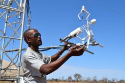 Kebonye Dintwe合作论文数3
 Stephen A. Macko合作论文数Department of Environmental Sciences, College of Arts & Sciences, University of Virginia3Andre Jellema合作论文数3Wolter Arnberg合作论文数3
 Russell Layberry合作论文数Pilio3
 Maideyi Meck合作论文数Department of Geology;University of Zimbabwe;Department of Geology, University of Zimbabwe3
 Elmar M. Veenendaal合作论文数Wageningen University;Nature Conservation and Plant Ecology Group;Nature Conservation and Plant Ecology Group, Wageningen University3
 Hubert Savenije合作论文数Department of Water Management, Faculty of Civil Engineering and Geosciences, Delft University of Technology3
 M. C. Todd合作论文数3
 Thomas Gumbricht合作论文数Geology Department, University of Witwatersrand3Wellington R.L. Masamba合作论文数Department of Chemistry, The George Washington University3
 Mpaphi C. Bonyongo合作论文数3
 Mike Murray-Hudson合作论文数Harry Oppenheimer Okavango Research Centre, University of Botswana3Julie Wilk合作论文数3S. Diskin合作论文数3H. Hamandawana合作论文数2M. J. McFarlane合作论文数2J. Wilk合作论文数2R. Chanda合作论文数2Michael Murray-Hudson合作论文数2




