This study presents the new version of MODIS/Terra + Aqua Surface Radiation Daily/3-h downward shortwave radiation (DSR) (MCD18A1 V6.2) and photosynthetic active radiation (PAR) (MCD18A2 V6.2) product generated by MODIS adaptive processing system (MODAPS) using the latest version of the science algorithm developed by the NASA MODIS land science team. Key improvements in the new algorithm include using multiple bands covering visible, near-infrared, and shortwave infrared to enhance the capability of characterizing cloud optical characteristics, especially over snow-covered surfaces, and adopting linear interpolation for temporal scaling from instantaneous to 3-hourly retrievals. Comparative validation against MCD18 V6.1 and clouds and the Earth’s radiant energy system synoptic (CERES-SYN) demonstrates that V6.2 significantly improves accuracy at instantaneous, 3-hourly, and daily scales, particularly in snow-covered regions. The root mean square error (RMSE) (relative RMSE: rRMSE) of V6.2 reaches 101.9 W/m2 (18.8%) and 48.4 W/m2 (20.8%) for instantaneous DSR and PAR. The RMSE (rRMSE) reaches 29.9 W/m2 (16.9%) and 14.1 W/m2 (18.4%) for daily DSR and PAR, respectively. Aggregated to 100 km, V6.2 matches CERES-SYN accuracy using only polar-orbiting satellite data. This study also explores the potential for future improvement by integrating geostationary observations to enhance accuracy further.
Terrestrial evapotranspiration (ET), as the link between water, energy, and carbon cycles, is key to understanding climate impacts on freshwater availability, agricultural yields, and forest mortality. Earth-observing sensors, such as the Moderate Resolution Imaging Spectroradiometer (MODIS) carried by NASA's Earth Observing System (EOS), are well suited to the study of ET at regional to global scales. As the era of EOS comes to a close, we present a comprehensive calibration and validation of the latest MODIS MOD16 ET product as well as new ET estimates based on data from the Visible Infrared Imaging Radiometer Suite (VIIRS) sensor, which is very similar to MODIS and is carried by the Suomi NPP and NOAA-20 satellites, to continue the now 25-yr record of ET estimates from MOD16. Substantial updates and improvements to MOD16 are reported for the first time in over a decade of widespread use. Ground data sources including tower latent heat fluxes and plant traits are used in a Bayesian model-data fusion to constrain MODIS-and VIIRS-based ET estimates. Independent validation against sapflow and tower data shows that the resulting products have lower absolute bias and higher accuracy than the current MOD16 Collection 6.1 product. While MOD16 underestimates cropland ET, an intercomparison with the OpenET suite of models indicates that the improved MOD16 has the lowest error, lowest absolute bias, and highest model efficiency at noncropland sites. In combination with MODIS primary productivity estimates, these updates to MOD16 ensure the continuity of multidecadal ET and water-use efficiency estimates through 2030 or later.
This paper provides a review and summary status of the research underway by the NASA Terra Aqua Suomi-NPP Land Discipline Team to provide continuity of global land data products from the NASA Moderate resolution Imaging Spectroradiometer (MODIS) to the Visible Infrared Imaging Radiometer Suite (VIIRS). The two MODIS instruments on the NASA Earth Observing System Terra (morning overpass) and Aqua (afternoon overpass) platforms have provided more than twenty years of data. The peer-reviewed land products generated from MODIS are now being transitioned to production using VIIRS inputs, with the intention of providing dynamic continuity for the Aqua observations. As part of that process, the products from the two instruments are undergoing intercomparison and evaluation. These results are provided where available and show promising levels of agreement and accuracy in all cases. The paper also offers options for establishing continuity of Terra MODIS data products.
We present the collaborative efforts of NASA's Land Discipline Science Team and international partners to achieve dynamic continuity between MODIS Collection 6.1, VIIRS Collection 2, and Sentinel 3A/B land science products. MODIS (or Moderate Resolution Imaging Spectroradiometer), which has been providing Earth observations of the Land, Cryosphere, Oceans, and Atmosphere for over two decades as the primary global imager on NASA's Earth Observing System's (EOS) Terra (c. 1999) and Aqua (c. 2002) platforms, is approaching its end-of-life. Thus, ensuring continuity in standardized products becomes imperative to enable the extension of long-term consistent climate data records. We discuss ongoing efforts by NASA's Land Science Investigator-led Processing System (SIPS) to seamlessly transition a suite of 25 global land science products from MODIS to the VIIRS (Visible Infrared Imaging Radiometer Suite) while addressing instrument specifications, performance, and observation characteristics such as overpass time, viewing conditions, and repeat frequency. The VIIRS instrument, currently operational on Suomi-NPP (c. 2012), NOAA-20 (c. 2018), and NOAA-21 (c. 2023), offers enhancements over MODIS such as uniform pixel size, higher spatial resolution for specific bands, and a Day/Night Band for night-light detection. We outline cross-calibration efforts to ensure VIIRS products provide continuity for Aqua-MODIS products and investigate quality control, validation, and assessment approaches for achieving consistency between MODIS and VIIRS. We also provide detailed information on the state of continuity for specific land products, including terrestrial essential climate variables such as Snow and Ice Cover, Active Fires, BRDF/Albedo, Land Surface Temperature, Fraction of absorbed Photosynthetically Active Radiation (fAPAR), and Leaf Area Index. We also present the results of a pilot study that explores the role of the Sentinel-3 instrument suites, specifically OLCI and SLSTR instruments, to support morning orbit continuity. Sentinel-3A/B, launched in 2016 and 2018 with observations planned through 2031, offers a significant overlap with MODIS Terra, allowing for product intercomparison. Collaborative efforts between NASA, EUMETSAT, and ESA, particularly as part of the Committee on Earth Observation Satellites Working Group on Calibration and Validation (CEOS-WGCV), are highlighted, including evaluating Sentinel-3 products to ensure continuity of near-real-time products and services, such as NASA's Fire Information for Resource Management System (FIRMS) and the Group on Earth Observations GLobal Agricultural Monitoring (GEOGLAM) Crop Monitor. While challenges remain, such as performance disparities between MODIS and Sentinel-3 products, ongoing initiatives aim to identify these gaps and inform the development trajectory needed to generate a reliable Land continuity data stream for NASA's Earth science and applications communities. This collaborative effort, the product of three cycles of competed NASA Earth Science Data System (ESDS) and Research and Analysis (R&A) program activities, furthers the pursuit of a seamless transition of global high-quality land science products, enabling long-term multi-instrument/multi-platform time series that have become crucial for addressing pressing environmental and societal challenges.
Global reservoir information can not only benefit local water management but can also improve our understanding of the hydrological cycle. This information includes water area, elevation, and storage; evaporation rate and volume values; and other characteristics. However, operational wall-to-wall reservoir storage and evaporation monitoring information is lacking on a global scale. Here we introduce NASA’s new MODIS/VIIRS Global Water Reservoir product suite based on moderate resolution remote sensing data—the Moderate Resolution Imaging Spectroradiometer (MODIS), and the Visible Infrared Imaging Radiometer Suite (VIIRS). This product consists of 8-day (MxD28C2 and VNP28C2) and monthly (MxD28C3 and VNP28C3) measurements for 164 large reservoirs (MxD stands for the product from both Terra (MOD) or Aqua (MYD) satellites). The 8-day product provides area, elevation, and storage values, which were generated by first extracting water areas from surface reflectance data and then applying the area estimations to the pre-established Area–Elevation (A–E) relationships. These values were then further aggregated to monthly, with the evaporation rate and volume information added. The evaporation rate and volume values were calculated after the Lake Temperature and Evaporation Model (LTEM) using MODIS/VIIRS land surface temperature product and meteorological data from the Global Land Data Assimilation System (GLDAS). Validation results show that the 250 m area classifications from MODIS agree well with the high-resolution classifications from Landsat (R2 = 0.99). Validation of elevation and storage products for twelve Indian reservoirs show good agreement in terms of R2 values (0.71–0.96 for elevation, and 0.79–0.96 for storage) and normalized root-mean-square error (NRMSE) values (5.08–19.34% for elevation, and 6.39–18.77% for storage). The evaporation rate results for two reservoirs (Lake Nasser and Lake Mead) agree well with in situ measurements (R2 values of 0.61 and 0.66, and NRMSE values of 16.25% and 21.76%). Furthermore, preliminary results from the VIIRS reservoir product have shown good consistency with the MODIS based product, confirming the continuity of this 20-year product suite. This new global water reservoir product suite can provide valuable information with regard to water-sources-related studies, applications, management, and hydrological modeling and change analysis such as drought monitoring.
The NASA Terra and Aqua satellites have been successfully operating for over two decades, exceeding their original design life. However, the era of NASA's Earth Observing System may be coming to a close as early as 2023. Similarities between the Moderate Resolution Imaging Spectroradiometer (MODIS), aboard Aqua and Terra, and the Visible Infrared Imaging Radiometer Suite (VIIRS) sensors aboard the Suomi NPP, NOAA‐20 and NOAA‐21 satellites enable potential continuity of long‐term earth observational records in the VIIRS era. We conducted a comprehensive calibration and validation of the MODIS MOD17 product, which provided the first global, continuous, weekly estimates of ecosystem gross primary productivity (GPP) and annual estimates of net primary productivity (NPP). Using Bayesian model‐data fusion, we combined 18 years of tower fluxes with prior data on plant traits and hundreds of field measurements of NPP to benchmark MOD17 and to develop the first terrestrial productivity estimates from VIIRS. The updated mean global GPP (NPP) flux from the future MOD17 Collection 7 product and new VNP17 product for 2012–2018 is 127 ± 2.8 Pg C year −1 (58 ± 1.1 Pg C year −1 ), which compares well with independent top‐down and bottom‐up estimates. MOD17 and VNP17 depict upward productivity trends over recent decades, with 2000–2018 MOD17 GPP (NPP) rising by 0.47 (0.25) Pg C year −2 but slowing to 0.35–0.44 (0.11–0.13) Pg C year −2 over 2012–2021, with a greater reduction in the NPP growth rate. The new VIIRS VNP17 product has the potential to extend these estimates of global, terrestrial primary productivity beyond 2030.
NASA has released an updated near real-time global flood map product, based on twice-daily MODIS observations. The short name for the MODIS Near Real-Time (NRT) Global Flood Product is MCDWD. This updated product replaces a PI-maintained system that had delivered flood maps since 2012. The updated product is generated by a more robust processing facility, which also provides additional distribution mechanisms, including web-based global browser. The core water detection algorithm remains the same, but several improvements have been incorporated to reduce false-positives and enhance the compositing process. Additional advancements are on the horizon, including incorporation of VIIRS imagery (to replace the near end-of-life MODIS sensors), and further out, possibly Sentinel-3 OLCI.
NASA's Black Marble nighttime lights product suite (VNP46) is available at 500 m resolution since January 2012 with data from the Visible Infrared Imaging Radiometer Suite (VIIRS) Day/Night Band (DNB) onboard the Suomi National Polar-orbiting Platform (SNPP). The retrieval algorithm, developed and implemented for routine global processing at NASA's Land Science Investigator-led Processing System (SIPS), utilizes all high-quality, cloud-free, atmospheric-, terrain-, vegetation-, snow-, lunar-, and stray light-corrected radiances to estimate daily nighttime lights (NTL) and other intrinsic surface optical properties. Key algorithm enhancements include: (1) lunar irradiance modeling to resolve non-linear changes in phase and libration; (2) vector radiative transfer and lunar bidirectional surface anisotropic reflectance modeling to correct for atmospheric and BRDF effects; (3) geometric-optical and canopy radiative transfer modeling to account for seasonal variations in NTL; and (4) temporal gap-filling to reduce persistent data gaps. Extensive benchmark tests at representative spatial and temporal scales were conducted on the VNP46 time series record to characterize the uncertainties stemming from upstream data sources. Initial validation results are presented together with example case studies illustrating the scientific utility of the products. This includes an evaluation of temporal patterns of NTL dynamics associated with urbanization, socioeconomic variability, cultural characteristics, and displaced populations affected by conflict. Current and planned activities under the Group on Earth Observations (GEO) Human Planet Initiative are aimed at evaluating the products at different geographic locations and time periods representing the full range of retrieval conditions.
With the increasing need to construct long-term climate-quality data records to understand, monitor, and predict climate variability and change, it is vital to continue systematic satellite measurements along with the development of new technology for more quantitative and accurate observations. The Suomi National Polar-orbiting Partnership mission provides continuity in monitoring the Earth's surface and its atmosphere in a similar fashion as the heritage MODIS instruments onboard the National Aeronautics and Space Administration's Terra and Aqua satellites. In this paper, we aim at quantifying the consistency of Aqua MODIS and Suomi-NPP Visible Infrared Imaging Radiometer Suite (VIIRS) Land Surface Reflectance (LSR) and NDVI products as related to their inherent spatial sampling characteristics. To avoid interferences from sources of measurement and/or processing errors other than spatial sampling, including calibration, atmospheric correction, and the effects of the bidirectional reflectance distribution function, the MODIS and VIIRS LSR products were simulated using the Landsat-8's Operational Land Imager (OLI) LSR products. The simulations were performed using the instruments' point spread functions on a daily basis for various OLI scenes over a 16-day orbit cycle. It was found that the daily mean differences due to discrepancies in spatial sampling remain below 0.0015 (1%) in absolute surface reflectance at subgranule scale (i.e., OLI scene size). We also found that the MODIS-VIIRS product intercomparisons appear to be minimally impacted when differences in the corresponding view zenith angles (VZAs) are within the range of -15° to -35° (VZAV - VZAM), where VIIRS and MODIS footprints resemble in size. In general, depending on the spatial heterogeneity of the OLI scene contents, per-grid-cell differences can reach up to 20%. Further spatial analysis of the simulated NDVI and LSR products revealed that, depending on the user accuracy requirements for product intercomparisons, spatial aggregations may be used. It was found that if per-grid-cell differences on the order of 10% (in LSR or NDVI) are tolerated, the product intercomparisons are expected to be immune from differences in spatial sampling.
The Advanced Very High Resolution Radiometer (AVHRR) sensor provides a unique global remote sensing dataset that ranges from the 1980s to the present. Over the years, several efforts have been made on the calibration of the different instruments to establish a consistent land surface reflectance time-series and to augment the AVHRR data record with data from other sensors, such as the Moderate Resolution Imaging Spectroradiometer (MODIS). In this paper, we present a summary of all the corrections applied to the AVHRR surface reflectance and NDVI Version 4 Product, developed in the framework of the National Oceanic and Atmospheric Administration (NOAA) Climate Data Record (CDR) program. These corrections result from assessment of the geolocation, improvement of cloud masking, and calibration monitoring. Additionally, we evaluate the performance of the surface reflectance over the AERONET sites by a cross-comparison with MODIS, which is an already validated product, and evaluation of a downstream leaf area index (LAI) product. We demonstrate the utility of this long time-series by estimating the winter wheat yield over the USA. The methods developed by Becker-Reshef et al. (2010) and Franch et al. (2015) are applied to both the MODIS and AVHRR data. Comparison of the results from both sensors during the MODIS-era shows the consistency of the dataset with similar errors of 10%. When applying the methods to AVHRR historical data from the 1980s, the results have errors equivalent to those derived from MODIS.
Data from the Moderate Resolution Imaging Spectro-radiometer (MODIS) on-board the Earth Observing System Terra and Aqua satellites are processed using a land water mask to determine when an algorithm no longer needs to be run or when an algorithm needs to follow a different pathway. Entering the fourth reprocessing (Collection 6 (C6)) the MODIS team replaced the 1 km water mask with a 500 m water mask for improved representation of the continental surfaces. The new water mask represents more small water bodies for an overall increase in water surface from 1% to 2% of the continental surface. While this is still a small fraction of the overall global surface area the increase is more dramatic in certain areas such as the Arctic and Boreal regions where there are dramatic increases in water surface area in the new mask. MODIS products generated by the on-going C6 reprocessing using the new land water mask show significant impact in areas with high concentrations of change in the land water mask. Here differences between the Collection 5 (C5) and C6 water masks and the impact of these differences on the MOD04 aerosol product and the MOD11 land surface temperature product are shown.
 Robert E. Wolfe合作论文数Hydrospheric and Biospheric Science Laboratory, NASA's Goddard Space Flight Center16
 Miguel O. Román合作论文数Earth Sciences Division, Goddard Space Flight Center, National Aeronautics and Space Administration13
 Chris Justice合作论文数Department of Geographical Sciences, College of Behavioral & Social Sciences, University of Maryland College Park9
 Carol Davidson合作论文数9
 Masuoka Ed合作论文数8
 Eric F Vermote合作论文数Terrestrial Information Systems Laboratory, NASA Goddard Space Flight Center8E. Mauoka合作论文数7
 David P. Roy合作论文数Department of Geography, Environment, & Spatial Sciences, College of Social Science, Michigan State University7E. Masuoka合作论文数6G. Ye合作论文数5V. S. Manoharan合作论文数5
 Sudipta Sarkar合作论文数Department of Civil Engineering, Indian Institute of Technology Roorkee5
 Ivan Csiszar合作论文数5
 Ranga Myneni合作论文数Department of Earth and Environment, College of Arts and Sciences, Boston University5
 Crystal Barker Schaaf合作论文数Department of Environmental, Earth, and Ocean Sciences, School for the Environment, University of Massachusetts Boston4
 Mark Friedl合作论文数Department of Earth and Environment, Boston University;Center for Remote Sensing, Boston University4Virginia Kalb合作论文数National Aeronautics and Space Administration4
 Steven E Platnick (Steven Platnick)合作论文数Earth Sciences Division, National Aeronautics and Space Administration4Maosheng Zhao合作论文数Terrestrial Information Systems Laboratory, Goddard Space Flight Center, NASA;Science Systems and Applications, Inc4K. Arthur Endsley合作论文数WA Franke Coll Forestry & Conservat, Univ Montana3
 Dorothy K Hall合作论文数Sciences and Exploration Directorate, Goddard Space Flight Center, National Aeronautics and Space Administration3
 Yuri Knyazikhin合作论文数Department of Earth and Environment, College of Art and Sciences, Boston University3
 John S. Kimball合作论文数Department of Ecosystem and Conservation Sciences, WA Franke College of Forestry and Conservation, University of Montana3
 Zhuosen Wang合作论文数Department of Geography and Environment, Boston University3
 George A. Riggs合作论文数3S. W. Running合作论文数2
 Shuai Zhang合作论文数Univ N Carolina, Dept Geol Sci, 104 South Rd, Chapel Hill, NC 27599 USA2
 Deep Shah合作论文数Dept Civil Engn, Indian Inst Technol2
 Huilin Gao合作论文数地表过程院重点实验室2
 Ramakrishna Nemani合作论文数NASA Ames Research Center2
 Louis Giglio合作论文数Department of Geographical Sciences, University of Maryland2
 Nima Pahlevan合作论文数National Aeronautics and Space Administration2
 Guoqing Lin合作论文数2
 Dongdong Wang合作论文数Department of Geography, University of Maryland2
 Kerry Meyer合作论文数NASA, Goddard Space Flight Ctr2
 Frédéric Baret合作论文数Plant Phenomics Research Center, Naniing Agricultural University;National Research Institute for Agriculture, Food and Environment2
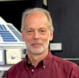 Jeffrey Robert Key合作论文数NESDIS, NOAA2
 Jeffrey L. Privette合作论文数NOAA National Climatic Data Center2Hirofumi Hashimoto合作论文数School of Medicine, University of Occupational and Environmental Health2
 Jyoteshwar Nagol合作论文数Department of Geography, University of Maryland2Nazmi E. Saleous合作论文数2
 Praveen Noojipady合作论文数Department of Geography, University of Maryland2
 Jeffrey T. Morisette合作论文数U.S. Geological Survey Fort Collins Science Center2
 Robert C Levy合作论文数Climate and Radiation Laboratory, NASA Goddard Space Flight Center2
 Martin Claverie合作论文数Department of Geographical Sciences, University of Maryland2RE Wolfe合作论文数1J Descloitres合作论文数1Yasmín Detrés合作论文数1Olga M. Ramos Gonzalez合作论文数1




