Accurate simulation of compound flooding in the coastal transition zone requires a fully coupled hydrologic-hydrodynamic modeling system to capture the complex interactions between inland and oceanic floodwaters. Despite recent advances in fully coupled 3D modeling frameworks, significant challenges persist in resolving flow through intricate river networks, especially where small channels are poorly represented due to limitations in digital elevation models (DEMs). This study addresses these challenges by enhancing the model meshing process and evaluating coupling strategies in the lower Mississippi River region, a representative coastal transition zone with a dense and complex river network. We improve a previously developed semi-automatic meshing approach by incorporating the National Hydrography Dataset to ensure clean delineation and connectivity of small channels where DEM uncertainties often cause artificial blockages. We also assess two strategies for integrating hydrologic model outputs into the hydrodynamic domain: (1) a conventional "hand-off" method that imposes freshwater streamflows at the land boundary combined with spatially varying precipitation, and (2) an alternative scheme that distributes hydrologic outputs at every resolved channel within the hydrodynamic mesh. Results show that the enhanced mesh, combined with updated topographic data, substantially reduces domain-wide bias and improves water-level skill at inland USGS stations. The alternative coupling scheme produces results comparable to the base method, providing an extensible framework for potential future development. By improving inland channel resolution and establishing a pathway for deeper coupling with hydrologic models, this work strengthens the scientific foundation and contributes to the operational readiness of compound flood forecasting.
The escalating frequency of extreme coastal events, exemplified by hurricanes and floods, underscores the necessity of robust monitoring and flood prediction tools. Given the limitations of observations, numerical models offer opportunities to address these gaps, yet their predictive efficiency is prone to uncertainties. Coastal models require several inputs, including bathymetry, which is a first-order forcing and an important boundary condition. However, bathymetric information is susceptible to inaccuracy due to the constraints of underwater topography measurement technologies; therefore, it can be a significant source of uncertainty in ocean models. Moreover, nearshore bathymetry is subject to frequent variability due to its highly dynamic seafloor morphology, especially during storm events. In this study, we investigate the sensitivity of a 3D tributary-estuary-ocean hydrodynamic model and its ability to forecast flood inundation under bathymetric uncertainty, focusing on Delaware Bay-a major estuarine system in the eastern US that Hurricane Irene profoundly impacted in August 2011. Bathymetry uncertainty is quantified based on NOAA's Category Zone of Confidence (CATZOC) and a random perturbation process that represents errors in the estimation of topobathy data based on vertical and horizontal length scales. Our results indicate that bathymetric errors can lead to model uncertainties of about 24% and 28% differences between original bathymetry and average ensemble conditions, respectively, for water level and currents predictions at locations of interest. Also, we observed standard deviations of 30 cm and 0.35 m/s for water level and currents in the perturbed conditions, which exceed acceptable error thresholds of NOAA's operational forecast models. Additionally, simulated currents showed more sensitivity in deeper regions, while water levels were more affected nearshore. These findings highlight the importance of accounting for input data uncertainty in marine operations and flood risk assessments, and support the development of resilient coastal planning strategies.
Simulating Total Water Level (TWL) at continental scale is inherently challenging and it is often desirable to correct model bias a posteriori. Here we present a simple yet effective bias correction method for NOAA’s STOFS-3D (Three-Dimensional Surge and Tide Operational Forecast System) forecasting system. The method seeks to dynamically correct the model bias, calculated from the results from the previous 2 days, by compensating it with an adjusted non-tidal elevation boundary condition. The adjustment is spatially uniform but varies over each forecast cycle. We demonstrate that the existing 3D model bias is largely attributable to the model’s exclusion of the large-scale steric effect, and therefore the method can be effectively used to incorporate this effect into the 3D model. Assessment at over 140 NOAA stations in US east and Gulf coasts show significant reductions in biases and root-mean-square errors for the non-tidal elevation and TWL, while having a small impact on tides and surges during extreme conditions.
Abstract The National Oceanic and Atmospheric Administration's (NOAA) Global Two‐Dimensional Surge and Tide Operational Forecast System (STOFS‐2D‐Global) provides global operational tidal, subtidal, and total water level forecast guidance with a 7.5‐day horizon. The system uses the ADvanced CIRCulation (ADCIRC) finite element model, with a large unstructured grid of approximately 12.7 million nodes and 24.9 million elements for STOFS‐2D‐Global version 2.1. Despite being one of the most accurate nondata assimilated global tide models, a difference has been observed between its simulated total water level and the observed one. To address this issue, we introduce NeurOCAST, a neural operator‐based deep learning model designed to correct biases in water level forecast guidance. The key strength of NeurOCAST is its ability to learn the underlying function of spatiotemporal outputs from a limited number of points and generalize it to gridded outputs at different resolutions. Our finding indicates that NeurOCAST improves water level accuracy by a significant reduction in bias at observational locations and times not included in the training data. NeurOCAST enhances forecast skill over the entire forecast horizon. To the best of our knowledge, this study represents the first application of a neural operator‐based model for improving oceanic forecast guidance using limited observational data. These advancements strengthen and support coastal resilience and safe navigation by providing more accurate prediction of water levels which in turn improve disaster preparedness and infrastructure planning and support informed decision‐making globally.
Despite great efforts towards automation and reproducibility, mesh generation remains a major “gray area” in coastal ocean modeling. This manuscript introduces OCSMesh, an open-source, parallelized Python framework for automated mesh generation. OCSMesh utilizes geometry and sizing function objects to define domain and resolution, primarily targeting SCHISM modeling system applications. Unlike traditional mesh generators that enforce element regularity and bathymetric smoothing, OCSMesh prioritizes Digital Elevation Model (DEM) fidelity, enabling the resolution of small-scale hydraulic features without element shape restrictions. We demonstrate OCSMesh’s applicability with two examples. In the first, we recreate a cross-scale mesh used by a SCHISM-based 3-dimensional operational forecast system. Results show that the OCSMesh-based model can reproduce the skill of the operational model while taking a fraction of the time needed for mesh development. The second example shows how the highly efficient OCSMesh mesh merging process can be used in a relocatable forecasting scenario. We show that within reasonable time (< 2-hours) we are able to not only create a high-resolution mesh for a large river basin, but also merge it into the coarser operational mesh. These applications demonstrate that OCSMesh can deliver realistic flood predictions, which are essential for timely flood hazard mitigation at cross-scale studies.
We present UPSurgeML, a cross-scale framework for probabilistic storm surge and tide forecasting driven by tropical cyclones (TCs), consisting of a small ensemble of unstructured-grid hydrodynamic model simulations augmented by a machine learning surrogate. A new methodology for perturbing TC isotach radii is developed for generating ensembles using an advanced asymmetric TC wind field model (GAHM). The skill of UPSurgeML and the effect of the GAHM wind fields is tested on a suite of fourteen U.S. landfalling hurricanes (2008–2024). We show that GAHM increases overall probabilistic skill assessment metrics across the board relative to the original Holland wind fields; with the largest gains for weaker broad storms such as Sandy (2012). UPSurgeML with GAHM forcing roughly matches the overall skill of the National Hurricane Center’s newest version of their probabilistic surge model (P-Surge), but there are notable differences across individual storms. We highlight that large-scale hydrodynamic model domains and TC wind fields are both needed for capturing the notable forerunner surge generated by Hurricanes Ike (2008) and Helene (2024). Lastly, we make several recommendations for future improvements based on the results of the study.
Abstract For decades, hurricane storm surge forecasting has been based on driving the hydrodynamics with reduced-order wind models, leveraging synthetic vortices that are generated from bulk storm parameters and distributed according to historical forecast errors. This strategy has the downside that the intricacies of the hurricane vortex and its far-field winds are lost. Here, we introduce a new methodology that leverages the development of high-fidelity meteorological products and high-resolution water level models, such as NOAA’s Surge and Tide Operational Forecast System 2D Global (STOFS-2D-Global), to generate probabilistic storm surge guidance (PSSG) at unprecedentedly high resolution. This is achieved by operating a global framework in a stochastic setting, driven by ensemble meteorological products. We explore this approach for Hurricane Ian (2022) in tandem with a nudging scheme that modifies core winds to be consistent with the National Hurricane Center’s peak wind intensity hindcast/forecast. We evaluate a range of meteorological hindcast and forecast products for Ian with and without nudging, all driving STOFS-2D-Global. It is shown that the accuracy of the projected storm surge in the Fort Myers region is highly sensitive to the forced winds, but that nudging allows the inherently muted (i.e., low bias) core wind products to perform well. Global Ensemble Forecast System (GEFS)-driven Ian forecasts with nudging are then implemented and statistical water levels are computed, with the standard deviation serving as a measure of confidence. Significance Statement Forecasting storm surge from hurricanes is a task complicated by uncertainty. This uncertainty stems primarily from meteorological forecasts. Producing probabilistic storm surge guidance (PSSG) rather than providing a single projection is a way to convey this uncertainty. Traditionally, idealized wind models of hurricanes, historical forecast errors, and relatively fast hydrodynamic solvers have been used to provide this guidance. Herein, we propose a new methodology that couples ensemble meteorological products with a high-fidelity finite-element-based hydrodynamics solver to produce detailed PSSG. We demonstrate this methodology for Hurricane Ian (2022). We show that this approach produces PSSG that reflects even small-scale coastal features.
Accurate and timely predictions from operational forecast systems are crucial for disaster response planning during extreme weather events. Many of these forecast systems utilize unstructured mesh representations to model seafloor topography and discretize the domain. The size of the bathymetric mesh can significantly impact the runtime performance of these systems. Mesh simplification is a technique used to reduce the number of elements composing a mesh while preserving desired characteristics, such as shape and topology. Reducing the overall size of the mesh can improve the performance of any subsequent simulations performed on the mesh. In this work, vertex removal and re-triangulation operations are used to simplify a bathymetric surface model. Differences in resulting vertical offset from the original mesh and a maximum triangle area constraint are used to identify candidate vertices for elimination. Identical two-dimensional (2D) depth-averaged barotropic tidal simulations are modelled on the original and each simplified mesh. Velocity direction, velocity magnitudes, and water levels are recorded at twelve sites in New York Harbor over time. It was demonstrated that the simplified mesh derived from using even the strictest parameters for the mesh simplification was able to reduce the overall mesh size by approximately 26.81
This paper presents an in-depth evaluation of a 3D unstructured grid model under various forcing sources, with a focus on the New York-New Jersey (NY-NJ) harbor. The model is first calibrated and evaluated through control runs, ensuring it accurately captures essential processes around the NY/NJ harbor. The sensitivity experiments highlight the significant roles and contributions of different forcing sources in coastal ocean conditions such as total water level, currents, salinity, and water temperature. Different tidal forcings, including FES2014, TPXO9 v1, and TPXO9 v5, show significant effects on tidal components, total water levels, currents, and water temperature, with minimal impact on salinity. Surface forcings from the HRRR, ERA5, and GFS demonstrate variable influences on water temperature predictions, while total water level, currents, and salinity are less sensitive to the different atmospheric forcing sources. Different open ocean conditions from CMEMS, HYCOM, and GRTOFS exhibited minor impacts on hydrodynamic variables in the inland rivers and estuaries but noticeably affected ocean surface currents and vertical structures of water temperature on the continental shelf. Different river discharges from USGS and NWM show high sensitivities of salinities and upstream water levels while shelf-scale ocean currents and vertical structures of water temperatures are similar across the different river discharges. The findings emphasize the necessity of selecting optimal forcing sources to minimize uncertainties and enhance predictive capabilities, supporting better decision-making in coastal management and hazard mitigation.
In this paper, for the first time, all five Great Lakes are simulated using a 3D baroclinic model using a single, seamless unstructured mesh without nesting, including adjacent flood plains and watershed inflows to better connect the hydrodynamic model to the hydrologic model. The hydraulic controls at Sault St Marie and Niagara Falls are simulated using an internal flow boundary approach with the observed flow. The model is shown to exhibit good skills for total water level (TWL) and temperature, with RMSE of 9.5 cm for TWL and similar to 1.6 degrees C for surface temperature and temperature profiles from a 60-day simulation. Sensitivity results reveal the importance of hydrologic forcing even for this short-term simulation. Results from a 210-day simulation indicate that the model is capable of capturing major lake-wide circulation patterns discussed in previous studies and providing further details in those patterns. The new model can potentially serve as a base to unify Great Lakes modeling while simultaneously providing flexibility for site specific studies in any areas of interest.
This study showcases a global, heterogeneously coupled total water level system wherein salinity and temperature outputs from a coarser-resolution (similar to ${\sim} $12 km) ocean general circulation model are used to calculate density-driven terms within a global, higher-resolution (similar to ${\sim} $2.5 km) depth-averaged total water level model. We demonstrate that the inclusion of baroclinic forcing in the barotropic model requires modification of the internal wave drag term to prevent excess degradation of tidal results compared to the barotropic model. By scaling the internal tide dissipation by an easy to calculate dissipation ratio, the resulting heterogeneously coupled model has complex root mean square errors (RMSE) of 2.27 cm in the deep ocean and 12.16 cm in shallow waters for the M2 ${\mathrm{M}}_{2}$ tidal constituent. While this represents a 10%-20% deterioration as compared to the barotropic model, the improvements in total water level prediction more than offset this degradation. Global median RMSE compared to observations of total water levels, 30-day sea levels, and non-tidal residuals improve by 1.86 (18.5%), 2.55 (42.5%), and 0.36 (5.3%) cm respectively. The drastic improvement in model performance highlights the importance of including density-driven effects within global hydrodynamic models and will help to improve the results of both hindcasts and forecasts in modeling extreme and nuisance flooding. With only an 11% increase in model run time compared to the fully barotropic total water level model, this approach paves the way for high resolution coastal water level and flood models to be used alongside climate models, improving operational forecasting of total water levels.
Coastal flood damage is primarily the result of extreme sea levels. Climate change is expected to drive an increase in these extremes. While proper estimation of changes in storm surges is essential to estimate changes in extreme sea levels, there remains low confidence in future trends of surge contribution to extreme sea levels. Alerting local populations of imminent extreme sea levels is also critical to protecting coastal populations. Both predicting and projecting extreme sea levels require reliable numerical prediction systems. The SurgeMIP (surge model intercomparison) community has been established to tackle such challenges. Efforts to intercompare storm surge prediction systems and coordinate the community 's prediction and projection efforts are introduced. An overview of past and recent advances in storm surge science such as physical processes to consider and the recent development of global forecasting systems are briefly introduced. Selected historical events and drivers behind fast increasing service and knowledge requirements for emergency response to adaptation considerations are also discussed. The community 's initial plans and recent progress are introduced. These include the establishment of an intercomparison project, the identification of research and development gaps, and the introduction of efforts to coordinate projections that span multiple climate scenarios.
Despite tremendous progress in algorithm development, computational efficiency and transition into operations over the past two decades, coastal modeling still lacks scientific rigor due to proliferation of many ‘gray’ areas related to various modeling choices made by modelers. In this paper, we propose some guiding principles for the modeling community to improve performance, and we also debunk commonly held myths that make the coastal modeling lack rigor. Using our own experience in developing seamless cross-scale unstructured-grid based models for the past two decades, we describe in unprecedented detail the end-to-end modeling process (i.e., from digital elevation models (DEMs) to mesh generation to post analysis), and demonstrate that defensible modeling is within reach for any end user by following three guiding principles: (1) Bathymetry is a first order forcing in coastal domains and thus should be respected in all aspects of modeling; (2) Oceanographic processes are driven across multiple spatial scales and so models should enable appropriate resolution as needed; and (3) Model assessment should focus on physical processes. Through qualitative and quantitative model assessments, we demonstrate the fundamental role played by bathymetry/topography as embedded in DEMs in making the results defensible, which is unfortunately glossed over in many modeling studies. Focusing on process-based assessment simplifies the calibration process. A major conclusion of this work is that model developers and operators should maximize the scientific rigor for in silico oceanography by avoiding some common pitfalls that rely on error compensation at the expense of representation of physical system processes. We present some best practice procedures for defensive and trustworthy numerical modeling.
In Alaska's coastal environment, accurate information of sea ice conditions is desired by operational forecasters, emergency managers, and responders. Complicated interactions among atmosphere, waves, ocean circulation, and sea ice collectively impact the ice conditions, intensity of storm surges, and flooding, making accurate predictions challenging. A collaborative work to build the Alaska Coastal Ocean Forecast System established an integrated storm surge, wave, and sea ice model system for the coasts of Alaska, where the verified model components are linked using the Earth System Modeling Framework and the National Unified Operational Prediction Capability. We present the verification of the sea ice model component based on the Los Alamos Sea Ice Model, version 6. The regional, high -resolution (3 km) configura- tion of the model was forced by operational atmospheric and ocean model outputs. Extensive numerical experiments were conducted from December 2018 to August 2020 to verify the model's capability to represent detailed nearshore and offshore sea ice behavior, including landfast ice, ice thickness, and evolution of air-ice drag coefficient. Comparisons of the hindcast simulations with the observations of ice extent presented the model's comparable performance with the Global Ocean Forecast System 3.1 (GOFS3.1). The model's skill in reproducing landfast ice area significantly outperformed GOFS3.1. Comparison of the modeled sea ice freeboard with the Ice, Cloud, and Land Elevation Satellite -2 product showed a mean bias of 24.6 cm. Daily 5 -day forecast simulations for October 2020-August 2021 presented the model's promising performance for future implementation in the coupled model system.
We demonstrate recent progress made in the simulation of total water level (TWL) at continental scale, using the coastal ocean of US East Coast/Gulf of Mexico coast as an example. A key difference between the continental-scale and small-scale modeling is that the former requires a more accurate vertical datum. Using a geoid-based datum (xGEOID20b), a satellite altimetry product, and a state-of-the-art 3D unstructured-grid model, we significantly improve the accuracy for TWL both near- and off-shore. The average root-mean-square error at all NOAA stations is 14 cm. The non-tidal signals are found to be sensitive to the representation of a large-scale current system near the boundary and extending the domain extent to accommodate this system improves these signals.
During tropical storms, precipitation and associated rainfall-runoff can lead to significant flooding, in both the upland and coastal areas. Flooding in coastal areas is compounded by the storm surge. Several hurricanes in recent history have exhibited the destructive force of compound flooding due to precipitation, rainfall-runoff, storm surge and waves. In previous work, various coupled modeling systems have been developed to model total water levels (defined as tides, waves, surge, and rainfall-runoff) for tropical storms. The existing coupled system utilizes a hydrologic model in the upland areas of the domain to capture the precipitation and rainfall-runoff associated with the storms; however, in the coastal areas the precipitation and rainfall-runoff is not captured. Herein a source/sink term is incorporated within the hydrodynamic model itself to capture precipitation and rainfall-runoff over the already inundated coastal areas. The new algorithm is verified for several idealized test cases, and then it is applied to Hurricane Irene. Validation indicates that the new methodology is comparable to the existing river flux forcing under most conditions and allows for the addition of streamflows due to overland runoff, as well as the actual precipitation itself.
 Edward P. Myers合作论文数38Ali Abdolali合作论文数19Andre J. Van der Westhuysen合作论文数12
 William James Pringle合作论文数Argonne Natl Lab, Environm Sci Div, Lemont, IL 60439 USA12
 H. Tuba Ozkan-Haller合作论文数College of Oceanic;Atmospheric Sciences;Oregon State University;College of Oceanic|Atmospheric Sciences, Oregon State University12
 Fei Ye合作论文数11Yinglong ZHANG (张应龙)合作论文数10
 Joannes Westerink合作论文数Department of Civil and Environmental Engineering and Earth Sciences, College of Engineering, University of Notre Dame10Y. Joseph Zhang合作论文数Virginia Institute of Marine Science, College of William and Mary9
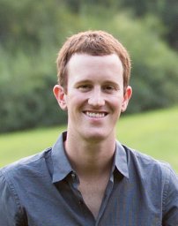 Gregory N Seroka合作论文数Coastal Ocean Obs. Lab., Rutgers Univ.;c;Coastal Ocean Obs. Lab., Rutgers Univ.9
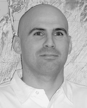 Shachak Peeri合作论文数9Serguei V. Vinogradov合作论文数8a j van der westhuysen合作论文数8T. Flowers合作论文数8
 Cigdem Akan合作论文数Taylor Engn Res Inst, Univ North Florida8Damrongsak Wirasaet合作论文数8Zaizhong Ma合作论文数8
 Maria Teresa Contreras合作论文数Dept Civil & Environm Engn & Earth Sci, Univ Notre Dame7
 Haocheng Yu合作论文数7Nicole Kurkowski合作论文数6Yuji Funakoshi合作论文数6
 Avichal Mehra合作论文数Environmental Modeling Center, NCEP;NWS6Hassan Mashriqui合作论文数5J. Calzada合作论文数5M. Karinna Nunez合作论文数4Kyung Min Park合作论文数Program Ocean Sci & Engn, Georgia Inst Technol4
 Liujuan Tang合作论文数4
 Linlin Cui (崔琳琳)合作论文数Marine Ecosystem and Environmental Laboratory, Shanghai Ocean University4
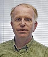 John G. W. Kelley合作论文数NOAA/NOS/CSDL4Alexander L. Kurapov合作论文数4
 Sergey V. Vinogradov合作论文数Atmospheric and Environmental Research, Inc.4Guoming Ling合作论文数3Christine M. Szpilka合作论文数3Zachary Burnett合作论文数3Zhengui Wang (王真贵)合作论文数Virginia Institute of Marine Science, College of William and Mary3
 Ayumi Fujisaki-Manome合作论文数Department of Climate and Space Sciences and Engineering, College of Engineering, University of Michigan-Ann Arbor3
 Zhuo Liu合作论文数3
 Seth Zippel合作论文数3
 Jim M. Thomson合作论文数Applied Physics Laboratory, Department of Civil & Environmental Engineering, College of Engineering, University of Washington3
 Clint N. Dawson合作论文数Department of Aerospace Engineering and Engineering Mechanics, Cockrell School of Engineering, The University of Texas, Austin3
 Roham Bakhtyar合作论文数Institut d'Ingénierie de l'Environnement', Ecole Polytechnique Fédérale de Lausanne3
 Jiabi Du合作论文数3
 Aron Roland合作论文数Inst Hydraul & Water Resources Engn, Tech Univ Darmstadt3
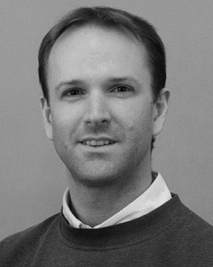 Gordon Farquharson合作论文数3Kendra M. Dresback合作论文数3
 Arun Chawla合作论文数Hofstra North Shore-LIJ School of Medicine3Neil D. Weston合作论文数2Henok Kefelegn合作论文数2Js Allen合作论文数2




