Wind energy has been growing steadily in the U.S. and worldwide in the past decades. As wind farms are projected to increase in size and number, however, concerns are rising about possible undesirable effects of wind turbines near the Earth's surface. The literature is highly divided about what these effects could be, including warming, cooling, both, or neither. Only one mechanism, however, has been widely accepted (but never tested) to explain how wind turbines affect the lower boundary layer, namely that turbulence generated in wind turbine wakes enhances vertical mixing near the ground. Wakes are plume-like volumes downwind of wind turbines that are characterised by lower wind speeds and higher turbulent kinetic energy (TKE) than the undisturbed upwind flow. The few observational campaigns that have measured changes in near-surface properties by wind turbines have not provided an answer with respect to vertical mixing near the ground. To fill this knowledge gap, the VERTEX (VERTical Enhanced miXing) measurement campaign was conducted in August-October 2016 near a large wind turbine in coastal Delaware, using 15 surface flux towers, a 50-m meteorological tower, a radiometer, and two scanning lidars. During VERTEX, lidar scans and a wake detection algorithm were used to detect wake events and identify which sites were affected by the wake of the wind turbine. TKE, momentum and heat fluxes near the ground were compared between the sites below the wake and those outside of it. Preliminary findings based on two case studies (30 August and 20 September 2016) suggest a lack of enhancement of vertical mixing near the ground.
The Niwot Ridge Subalpine Forest AmeriFlux site (US-NR1) has been measuring eddy-covariance ecosystem fluxes of carbon dioxide, heat, and water vapor since 1 November 1998. Throughout this 17-year period there have been changes to the instrumentation and improvements to the data acquisition system. Here, in Part 1 of this three-part series of papers, we describe the hardware and software used for data-collection and metadata documentation. We made changes to the data acquisition system that aimed to reduce the system complexity, increase redundancy, and be as independent as possible from any network outages. Changes to facilitate these improvements were (1) switching to a PC/104-based computer running the National Center for Atmospheric Research (NCAR) In-Situ Data Acquisition Software (NIDAS) that saves the high-frequency data locally and over the network, and (2) time-tagging individual 10 Hz serial data samples using network time protocol (NTP) coupled to a GPS-based clock, providing a network-independent, accurate time base. Since making these improvements almost 2 years ago, the successful capture of high-rate data has been better than 99.98 %. We also provide philosophical concepts that shaped our design of the data system and are applicable to many different types of environmental data collection.
The second Meteor Crater Experiment (METCRAX II) was conducted in October 2013 at Arizona's Meteor Crater. The experiment was designed to investigate nighttime downslope windstorm-type flows that form regularly above the inner southwest sidewall of the 1.2-km diameter crater as a southwesterly mesoscale katabatic flow cascades over the crater rim. The objective of METCRAX II is to determine the causes of these strong, intermittent, and turbulent inflows that bring warm-air intrusions into the southwest part of the crater. This article provides an overview of the scientific goals of the experiment; summarizes the measurements, the crater topography, and the synoptic meteorology of the study period; and presents initial analysis results.
The construction and deployment of a portable trace-gas measurement system (TGaMS) is described. The air-collection system (dubbed HYDRA) collects air samples from 18 different locations and was connected to either one or two LI-COR LI-7000 gas analyzers to measure CO2. An in situ "field calibration" method, that uses four calibration gases with an uncertainty on the order of +/- 0.1 mu mol mol(-1) relative to the WMO CO2 mole fraction scale, revealed CO2 output from the LI-7000 had a slightly nonlinear relationship relative to the CO2 concentration of the calibration gases. The sensitivity of the field-calibrated CO2 to different forms of the field-calibration equation is investigated. To evaluate TGaMS performance, CO2 from collocated inlets, portable gas cylinders, and nearby independent CO2 instruments are compared. Results are as follows: 1) CO2 measurements from HYDRA multiple inlets are feasible with a reproducibility of +/- 0.4 mu mol mol(-1) (based on the standard deviation of the CO2 difference between collocated inlets when HYDRA was operating with two LI-7000s); 2) CO2 differences among the various field-calibration equations were on the order of +/- 0.3 mu mol mol(-1); and 3) comparison of midday hourly CO2 measurements at 30 m AGL between TGaMS and an independent high-accuracy CO2 measurement system (within 300 m of TGaMS) had a median difference and standard deviation of 0.04 +/- 0.81 mu mol mol(-1) over two months.
Multiplate radiation shield errors are examined using the following techniques: 1) ray tracing analysis, 2) wind tunnel experiments, 3) numerical flow simulations, and 4) field testing. The authors' objectives are to develop guidelines for radiation shield and temperature sensor design, to build an improved shield, and to determine factors that influence radiational heating errors. Guidelines For reducing radiational hearing errors are given that are based on knowledge of the temperature sensor to be used, with the shield chosen to match the sensor design.A new class of shield called a part-rime aspirated multiplate radiation shield is introduced. This type of shield consists of a multiplate design usually operated in a passive manner but equipped with fan-forced aspiration capability to be used when necessary (e.g., low wind speed). A prototype shield reduced radiational heating errors from 2 degrees to 1.2 degrees C. In addition, nighttime low wind speed errors were reduced from 1.6 degrees to 0.3 degrees C. Existing passive shields may be modified to incorporate part-time aspiration, thus making them cost effective.
The Portable Automated Mesonet II(PAM II) system was developed by NCAR to provide surface mesoscale data for the research needs of the atmospheric science community. The PAM system has 60 remote stations with planned growth to 300. In such a distributed system, data communication is a vital subsystem and, since it dictates some key system constraints, deserves special attention. The NOAA/NESDIS satellite, GOES, is used to link the remote stations to the base stations. This provides very wide areal coverage but limits the data rate.Special attention was given to the design of the sensor subsystems to minimize the possibility for human error and to maintain the calibration in field conditions while using interchangeable modules. This was achieved by using a dedicated microprocessor in the psychrometer and the barometer. The microprocessor in the sensor modules controls the sensors, applies the individual calibration coefficients, and transmits the sensor data to the master data acquisition module.The master base station collects the data, archives them and generates graphic displays of real-time or archived data for system control and scientific analysis. The field base stations provide real-time data for the user in the field environment.
 Steven P. Oncley合作论文数6
 Gordon D. Maclean合作论文数4Anthony C. Delany合作论文数3
 Sean P. Burns合作论文数Department of Ecology and Evolutionary Biology, University of Colorado3Fred V. Brock合作论文数2
 Anja Martina Grudzielanek合作论文数2
 Russell Monson合作论文数Department of Ecology and Evolutionary Biology, University of Arizona;Laboratory of Tree Ring Research, University of Arizona2
 Rich Rotunno合作论文数Mesoscale and Microscale Meteorology Laboratory, National Center for Atmospheric Research2
 C. David Whiteman合作论文数Department of Atmospheric Sciences, College of Mines and Earth Sciences, University of Utah2Manuela Lehner合作论文数2Ronald Calhoun合作论文数2Roland Vogt合作论文数Institute of Meteorology, Climatology and Remote Sensing, University of Basel2
 Peter Blanken合作论文数Department of Geography, University of Colorado Boulder;Faculty of Hydrologic Sciences, University of Colorado Boulder2
 Bianca Adler合作论文数PSL;Cooperative Institute for Research in Environmental Sciences, NOAA;ESRL2Matthew E. Jeglum合作论文数2Steven Oncley合作论文数1K. P. Moran合作论文数1joel s schroter合作论文数1johannes ruppert合作论文数1R. G. Strauch合作论文数1Sj Richardson合作论文数1
 Jan Cermak合作论文数1
 Nihanth Wagmi Cherukuru合作论文数National Center for Atmospheric Research (NCAR), University Corporation for Atmospheric Research (UCAR)1
 Alexandra St.Pe合作论文数1Sebastian Hoch合作论文数1Sicheng Wu合作论文数1
 Joseph F. Brodie合作论文数Rutgers University1
 Ahmadreza Vasel-Be-Hagh合作论文数College of Earth, Ocean, and Environment, University of Delaware1
 Ruben Delgado合作论文数University of Maryland Baltimore County1
 Richard Anthes合作论文数University Corporation for Atmospheric Research1Jielun Sun合作论文数North West Research Associates1
 Dawn D Davis合作论文数1
 Donald H. Lenschow (Don Lenschow)合作论文数Mesoscale and Microscale Meteorology Laboratory, National Center for Atmospheric Research1Joost a Businger合作论文数1
 David Richter合作论文数Department of Civil and Environmental Engineering and Earth Sciences, University of Notre Dame1
 Christian Bernhofer合作论文数Institute of Hydrology and Meteorology, Technische Universität Dresden;Fakultät Umweltwissenschaften, Technische Universität Dresden1
 R. E. Shetter合作论文数1
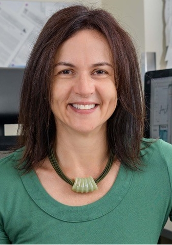 Cristina L. Archer合作论文数Center for Research in Wind, University of Delaware1Walter F. Dabberdt合作论文数1
 Erik T. Crosman合作论文数Department of Atmospheric Sciences, University of Utah1
 Petra Maria Klein合作论文数University of Utah, University of Nebraska at Kearney1
 Bertrand Carissimo合作论文数Teaching and Research Center in Atmospheric Environment (ENPC/EDF R&D) CEREA 6–8 avenue Blaise Pascal 77455 Champs-sur-Marne France 6–8 avenue Blaise Pascal 77455 Champs-sur-Marne France1
 William O. J. Brown合作论文数1George H. Saum合作论文数1
 G. B. Wright合作论文数School of the Built Environment, Heriot Watt University1
 Norbert Kalthoff合作论文数Institute of Meteorology and Climate Research, Karlsruhe Institute of Technology1Robert B. Mcbeth合作论文数1Michael J Falls合作论文数1




