One of the world’s largest “blue carbon” ecosystems, Louisiana’s tidal wetlands on the US Gulf of Mexico coast, is rapidly being lost. Louisiana’s strong legal, regulatory, and monitoring framework, developed for one of the world’s largest tidal wetland systems, provides an opportunity for a programmatic approach to blue carbon accreditation to support restoration of these ecologically and economically important tidal wetlands. Louisiana’s coastal wetlands span ∼1.4 million ha and accumulate 5.5–7.3 Tg yr−1 of blue carbon (organic carbon), ∼6%–8% of tidal marsh blue carbon accumulation globally. Louisiana has a favorable governance framework to advance blue carbon accreditation, due to centralized restoration planning, long term coastal monitoring, and strong legal and regulatory frameworks around carbon. Additional restoration efforts, planned through Louisiana’s Coastal Master Plan, over 50 years are projected to create, or avoid loss of, up to 81,000 ha of wetland. Current restoration funding, primarily from Deepwater Horizon oil spill settlements, will be fully committed by the early 2030s and additional funding sources are required. Existing accreditation methodologies have not been successfully applied to coastal Louisiana’s ecosystem restoration approaches or herbaceous tidal wetland types. Achieving financial viability for accreditation of these restoration and wetland types will require expanded application of existing blue carbon crediting methodologies. It will also require expanded approaches for predicting the future landscape without restoration, such as numerical modeling, to be validated. Additional methodologies (and/or standards) would have many common elements with those currently available but may be beneficial, depending on the goals and needs of both the state of Louisiana and potential purchasers of Louisiana tidal wetland carbon credits. This study identified twenty targeted needs that will address data and knowledge gaps to maximize financial viability of blue carbon accreditation for Louisiana’s tidal wetlands. Knowledge needs were identified in five categories: legislative and policy, accreditation methodologies and standards, soil carbon flux, methane flux, and lateral carbon flux. Due to the large spatial scale and diversity of tidal wetlands, it is expected that progress in coastal Louisiana has high potential to be generalized to similar wetland ecosystems across the northern Gulf of Mexico and globally.
Coastal Louisiana's ecosystems are threatened by anthropogenic factors exacerbated by climate change induced sea-level rise. The 2010 Deepwater Horizon oil spill resulted in injuries and deaths to coastal birds in Louisiana, and the ongoing loss of habitat has limited the potential for successful nesting of resident birds throughout the coast. Habitat loss is being addressed through increased large-scale ecosystem restoration as a result of settlement funds from the Deepwater Horizon oil spill. To further inform bird restoration in Louisiana, an avian restoration guidance document (Guidance for Coastal Ecosystem Restoration and Monitoring to Create or Improve Bird-Nesting Habitat, 2023) was developed to maximize restoration benefits for coastal breeding birds while also achieving broader habitat restoration objectives. The developed restoration guidance was co-produced by subject-matter experts and professionals, including avian experts, engineers, and coastal restoration project managers. The result of this cross-disciplinary effort was specific and targeted guidance that presents designable habitat features that are in the control of project engineers and are also important high-value bird nesting habitats (e.g., shoreline access, elevation heterogeneity and edge habitat). For the first time in Louisiana, defined nest-site characteristics and monitoring approaches are readily available to inform ecosystem restoration project implementation. The restoration document specifically emphasizes bird species that breed and nest in coastal habitats in Louisiana, and restoration managers can use these guidelines to explicitly incorporate bird nesting habitat features into coastal restoration planning, design, and implementation. In developing this guidance, many knowledge gaps and data needs were identified specific to engineering and project design, enabling the research community to frame research questions around specific coastal restoration questions. The co-production of science model applied here for avian resources is applicable to a wide range of other living marine resources that may benefit from large-scale ecosystem restoration and is an example of the benefits of working relationships, communications, and common goal setting.
Marsh terraces, constructed as a restoration and protection strategy, consist of a series of earthen berms in open water areas of the coastal wetland landscape and are being implemented across the Louisiana coast. To assess the efficacy of the marsh terraces as a nature-based solution, a small-scale, high-resolution hydrodynamic model was developed based on field sampling of vegetation and physical parameters (water level, waves, sediment, turbidity, and terrace elevation). This study tested common marsh terrace designs (e.g., chevron, linear, box, T-shape, etc.), ultimately selecting a preferred design based on the evaluation of factors such as vegetation, water depth, and sediment type on terrace stability and sediment retention under calm and storm conditions. The model results revealed that the 100 m box and the chevron designs exhibited greatest terrace stability and sediment trapping, particularly when installed perpendicular to prevailing wind and waves. The preferred terrace design was the box design due to its higher modeled resilience to wind and waves from multiple directions. Vegetation presence enhanced terrace resistance to erosion, with variations depending on vegetation type. Higher vegetation biomass, especially during the summer, contributed to the greatest stability of terraces. Greater water depth between terraces led to increased sediment retention, and terraces predominantly composed of organic-rich mud demonstrated greater stability than those with higher proportions of sand. Overall, vegetation had the greatest impact on sediment retention in the terrace field compared to water depth and sediment type. However, the potential habitat for submerged aquatic vegetation (SAV) was more influenced by water depth (i.e., 0.1 m < depth <1 m) than shear stress (<0.5 Pa). Even under storm conditions, shear stress rarely determined potential habitat for SAV, as shear stress remained relatively low within the terrace field. Potential SAV habitat was most abundant in shallow areas and increased where sediment stability was lowest (i.e., no vegetation and sand), primarily due to eroded sediment increasing the shallow area. While this model was developed using field data specific to Louisiana marshes, it can be adapted as a tool for terrace restoration project design and planning in most coastal wetlands.
Coastal Louisiana is currently experiencing high rates of wetland loss and large-scale ecosystem restoration is being implemented. One of the largest and most novel restoration projects is a controlled sediment diversion, proposed to rebuild and sustain wetlands by diverting sediment- and nutrient-rich water from the Mississippi River. However, the impact of this proposed sediment diversion on the nutrient budget of the receiving basin is largely unknown. A water quality model was developed to investigate the impact of the planned Mid-Barataria Sediment Diversion on the nutrient budget of the Barataria Basin (herein referred to as ‘the Basin’). The model results indicate that the planned diversion will increase TN and TP pools by about 38% and 17%, respectively, even with TN and TP loadings that increase by >300%. Water quality model results suggest that the increase of nutrients in the basin will be mitigated by increased advection transport (i.e., decreased residence time from ~170 days to ~40 days, leading to greater flushing) and increased removal via assimilation, denitrification, and settling within the Basin. Advection transport resulted in higher TN removal in the Basin than other processes, such as uptake or denitrification. Approximately 25% of the additional TN loading and 30% of the additional TP loading were processed within the Basin through the assimilation of phytoplankton and wetland vegetation, denitrification, and burial in the sediment/soils. These nutrient budgets help to better understand how the planned large-scale sediment diversion project may change the future ecological conditions within the estuaries of coastal Louisiana and near-shore northern Gulf of Mexico.
Submerged aquatic vegetation (SAV) are highly efficient at carbon sequestration and, despite their relatively small distribution globally, are recognized as a potentially valuable component of climate change mitigation. However, SAV mapping in tidal marshes presents a challenge due to optically complex constituents in the water. The emergence and advancement of deep learning-based techniques in the field of habitat mapping with remote sensing imagery provides an opportunity to address this challenge. In this study, an analytical framework was developed to quantify the carbon sequestration of SAV habitats in the Atchafalaya River Delta Estuary from field and remote sensing observations using deep convolutional neural network (DCNN) techniques. A U-Net-based model, Wetland-SAV Network, was trained to identify the SAV percent cover (high, medium, and low) as well as other estuarine habitat types from Landsat 8/9-OLI data. The areal extent of SAV was up to 8% of the total area (47,000 ha). The habitat areas and habitat-specific carbon fluxes were then used to quantify the net greenhouse gas (GHG) flux of the study area for with/without SAV scenarios in a carbon balance model. The total net GHG flux was in the range of −0.13 ± 0.06 to −0.86 ± 0.37 × 10⁵ tonne CO2e y−1 and increased up to 40% (−0.23 ± 0.10 to −0.90 ± 0.39 × 10⁵ tonne CO2e y−1) when SAV was accounted for within the calculation. At the hectare scale, the inclusion of SAV resulted in an increase of ~60% for the net GHG sink in shallow areas adjacent to the emergent marsh where SAV was abundant. This is the first attempt at remotely mapping SAV in coastal Louisiana as well as a first quantification of net GHG flux at the scale of hectares to thousands of hectares, accounting for SAV within these sub-tropical coastal delta marshes. Remote sensing and deep learning models have high potential for mapping and monitoring SAV in turbid sub-tropical coastal deltas as a component of the increasing accuracy of net GHG flux estimates at small (hectare) and large (coastal basin) scales.
Outcomes of landscape scale restoration and conservation can be maximized when planning is based upon quantitative and decision-relevant information. Existing tools to support data-driven planning are hindered by regionally inconsistent information and a need for advanced methods to analyze data of varying spatial resolution and coverage. We present a synthesis methodology for region-wide derived metrics to characterize natural resource value, ecosystem stress, and social vulnerability to inform implementation of conservation and restoration projects. Our three-part methodology was developed and tested for the Gulf of Mexico in support of the Southeast Conservation Blueprint that was created to advance the Southeast Conservation and Adaptation Strategy. The first step included integration of prioritized natural resource metrics alongside socio-ecological metrics to create a data layer of synthesized natural resource priority across the northern Gulf of Mexico. The second component was calculation of ecosystem stress indices based on ecologically relevant thresholds and a cumulative ecosystem stress layer, in addition to analyzing correlations between individual stressors and their relative importance. The final component was development of a social vulnerability (SoVI) index. Analysis of these metrics illustrate their ability to effectively capture variability at multiple scales in the Gulf of Mexico, including expected spatial correlation of stressors such as road density and non-point source pollution in populated areas and the dominance of sea-level rise as a future stressor along the coast. Significant composite components of social vulnerability for the northern Gulf of Mexico region were identified and include economic status, professional workforce, elderly population, population stability, migrant workforce, and rural population. To demonstrate the utility of the data synthesis approach, we used the developed data layers to evaluate proposed marsh creation projects in southern Louisiana. The synthesized data layers were capable of distinguishing differences at the scale of individual habitat restoration projects, and high-value projects could be aligned with the goals of key funding streams. This pilot application illustrates how restoration programs could use the methodology developed here to maximize benefits from conservation and restoration actions along the northern Gulf of Mexico or other regions globally.
Louisiana contains nearly 40% of estuarine herbaceous wetlands in the contiguous United States, supporting valuable ecosystem services and providing significant economic benefits to the state and the entire United States. However, coastal Louisiana is a hotspot for rapid land loss from factors including hurricanes, land use change, and high subsidence rates contributing to high relative sea‐level rise. The Coastal Protection and Restoration Authority (CPRA) was established after major hurricanes in 2005 to coordinate coastal restoration in Louisiana and develop the Louisiana Coastal Master Plan. The LA Coastal Master Plan uses numerical modeling of multiple scenarios to select a suite of restoration projects based on maximum land area created and flood reduction (as proxies for ecosystem value). Using potential value to aquatic, terrestrial, and social resources, our work compared habitat value of shallow open water areas to emergent wetland. While potential resource benefits varied by emergent wetland salinity type and emergent wetland versus water, they were similar, suggesting that restoration planning based primarily on wetland land area may not achieve the maximum possible ecosystem benefits. After nearly 20 years of integrated restoration planning in coastal Louisiana, a reassessment of restoration planning decision drivers may be beneficial to ensure maximum benefits from coastal restoration. As a result of the Deepwater Horizon oil spill, settlement funds will be a major support to coastal restoration in Louisiana for many years. Assessing potential habitat value to multiple natural and social resources in Louisiana has potential to maximize synergy with large northern Gulf of Mexico restoration programs.
This paper presents the results of a collaborative planning process to develop an integrated coastal restoration plan for Plaquemines Parish, Louisiana that recognizes the knowledge, experience, and priorities of residents and local stakeholders. To achieve this goal, the research team convened a broad group of stakeholders who live and work in Plaquemines Parish, including representatives of the seafood, navigation, and oil and gas industries, as well as residents, landowners, and those who are indigenous to the region, all of whom rely upon the ecosystem services provided by the wetlands, bays, and waterways for sustenance and wellbeing. Using a combination of local knowledge mapping and participatory modeling, the group worked with scientists to develop a restoration plan consisting of a suite of interlinked natural and nature-based solutions. The approach was intentionally interactive and iterative, creating a venue for open dialogue between residents, scientists, and resource users where no one source of knowledge was given primacy over another. Residents were able to contribute information regarding coastal restoration planning within their own communities, and a consensus plan for prioritizing restoration efforts in clusters was submitted for consideration as part of the State of Louisiana’s Coastal Master Plan process. Providing local stakeholders with direct access to scientists allowed their local knowledge to be translated into data products that could be more readily ingested into numerical models and other scientific planning tools.
Susan Lynn Williams (1951–2018) was an exceptional marine ecologist whose research focused broadly on the ecology of benthic nearshore environments dominated by seagrasses, seaweeds, and coral reefs. She took an empirical approach founded in techniques of physiological ecology. Susan was committed to applying her research results to ocean management through outreach to decision-makers and resource managers. Susan’s career included research throughout the USA in tropical, temperate, and polar regions, but she specialized in tropical marine ecology. Susan’s scholarship, leadership, and friendship touched many people, leading to this multi-authored paper. Susan’s scholarship was multi-faceted, and she excelled in scientific discovery, integration of scientific results, application of science for conservation, and teaching, especially as a mentor to undergraduate and graduate students and postdoctoral scholars. Susan served in a variety of leadership positions throughout her career. She embodied all facets of leadership; leading by example, listening to others, committing to the “long haul,” maintaining trust, and creating a platform for all to shine. Susan was an important role model for women in science. Susan was also a loyal friend, maintaining friendships for many decades. Susan loved cooking and entertaining with friends. This paper provides an overview of the accomplishments of Susan in the broad categories of scholarship, leadership, and friendship.
Coastal marshes are essential habitats for soil carbon accumulation and burial, which can influence the global carbon budget. Coastal Louisiana has extensive marsh habitats (fresh, intermediate, brackish, and saline) where soil cores were collected to a depth of 100 cm at 24 sites to assess long‐term carbon accumulation and burial rates. Select soil depth intervals were analyzed for bulk density, total carbon, and radionuclide ( 137 Cs and 210 Pb) dating. Marsh habitat maps (years 1949–2013) were also used to determine the most frequently occurring habitat at each field site. Over 5 decades, half of the sites transitioned between marsh habitats at least once. Saline marshes tended to have lower mean total carbon density (0.04 ± 0.002 g cm −3 ) and lower mean long‐term total carbon accumulation rates (211 ± 46 g TC m −2 yr −1 , n = 5, based on 210 Pb) compared to the other marsh habitats. Using marsh habitat specific accumulation rates and area, the total carbon burial rate for coastal Louisiana in year 2013 was estimated at 4.3 Tg TC yr −1 which accounts for about 5%–21% of the estimated tidal wetland burial rate globally. Historically, about 1.0 Tg TC yr −1 was lost due to reduced marsh area from 1949 to 2013. With no coastal restoration activity, the predicted wetland loss over the next 50 years could reduce carbon burial in coastal Louisiana to 2.1 Tg TC yr −1 , a reduction of about 50% from the year 2013 rate, with potential to significantly alter the global carbon budget.
The oil and gas industry has been a powerful driver of economic change in coastal Louisiana for the latter half of the 20th century and into the 21st. Yet, the overall impact of the industry on the economic well-being of host communities is varied, both spatially and temporally. While the majority of Louisiana’s oil and gas production now occurs offshore, processing the extracted product is an energy-intensive undertaking requiring an expansive network of land-based infrastructure. Despite the positive economic aspects of this development, there are also potential negatives posed to coastal ecosystems and to communities located adjacent to oil and gas infrastructure. This research utilizes a double exposure framework to explore the relationship between oil and gas infrastructure development, fish and shellfish habitat, and economic well-being in Louisiana’s coastal zone from 1950 to 2010. The approach followed four main steps: (1) Developing a hazardousness of place model to identify areas of magnified risk due to the combined hazards of multiple potential exposure sites related to the extraction and processing of crude oil and natural gas; (2) developing a model of ecological functioning to measure the ability of aquatic habitat to support key fish and shellfish species; (3) utilizing an integrated community economic well-being index to assess change on a decadal timescale; and (4) analyzing selected oil-dependent communities to illustrate how change processes occurring in different energy sectors result in differential outcomes. The results suggest that, for many communities, the dependence on the oil and gas industry has increased economic well-being but also increased sensitivity to natural and human-induced changes, including fluctuating economic conditions, environmental stress, coastal habitat destruction, and increasing social and economic pressures.
Multiple funding mechanisms support restoration across the northern Gulf of Mexico. To maximize environmental, societal, and financial benefits of these investments, best use of available science is needed to inform project prioritization and planning processes. Synthesizing available data across the northern Gulf of Mexico can provide information on potential threats to, and benefits from, projects or suites of projects. To achieve this, subject matter experts from Alabama, Florida, Louisiana, Mississippi and Texas were identified with recommendations from each of the RESTORE Act Centers of Excellence. These experts provided known sources of Gulf-wide data and recommended metrics that would be most informative, resulting in 40 threat, 19 habitat and 10 community primary data layers. Two tessellated geospatial hexagon grids were generated to provide uniform coverage that encompassed a 25-mile buffer of the Coastal Zone Management Act (CZMA) boundary at a spatial grid resolution of 100 km2 and 1 km2. The two resultant grid domains included all counties in the five Gulf states determined by the National Oceanic and Atmospheric Administration (NOAA) as contributing to coastal watersheds. The varying grid resolutions allowed for data to be spatially visualized both at a broad Gulf-wide scale on the 100 km2 grid as well as at a regional and project level scale on the 1 km2 grid. The data layers were synthesized into combined layers of potential stress, potential ecological benefits, and potential community benefits. These layers support broad scale prioritization for restoration efforts, based on likelihood of success and desired outcomes. The synthesized data were discussed in the context of the five goals and four priority criteria of the Gulf Coast Ecosystem Restoration Council’s (RESTORE Council) aim of using best available science (BAS) to guide future funding for restoration at large and small scales.
Louisiana’s coastal marshes are becoming increasingly fragmented due to sea level rise, subsidence, reduced sediment inflow from the Mississippi River, and saltwater intrusion. Many commercially and recreationally fished species rely on the marsh system as nursery habitat, and the resilience of species to further marsh loss and marsh fragmentation is uncertain. We examined the impacts of marsh fragmentation on the blue crab, Callinectes sapidus, a species supporting one of the largest fisheries in coastal Louisiana and which uses marsh edge as nursery habitat. Juvenile and adult abundances were quantified in multiple habitats (bare sediment, marsh edge, and submerged aquatic vegetation [SAV]) within an actively fragmenting coastal marsh. Adult blue crabs were sampled using crab pots, while juveniles were sampled using a throw trap. In general, blue crab density was unrelated to marsh fragmentation, but was instead related to local-scale patterns of habitat availability, including presence and type of vegetation. In tethering experiments to examine predation rates on juvenile blue crabs across habitats, predation rates were lowest in SAV compared with marsh edge or bare sediment. While direct effects of marsh fragmentation on local-scale patterns of blue crab abundance were not observed, marsh fragmentation will likely have indirect effects on blue crab populations through changes in habitat availability. Unless SAV expands into newly created open water areas, providing an alternative nursery habitat for blue crabs, continued marsh fragmentation and loss are expected to have negative impacts on blue crab populations and fisheries through a decrease in available nursery habitat.
The authors regret that we unknowingly used erroneous bulk density data in Figs. 4 and 6 (panels b,c,e) that affected results in Fig. 7.
Natural resources of coastal Louisiana support the economies of Louisiana and the whole of the United States. However, future conditions of coastal Louisiana are highly uncertain due to the dynamic processes of the Mississippi River delta, unpredictable storm events, subsidence, sea level rise, increasing temperatures, and extensive historic management actions that have altered natural coastal processes. To address these concerns, a centralized state agency was formed to coordinate coastal protection and restoration effort, the Coastal Protection and Restoration Authority (CPRA). This promoted knowledge centralization and supported informal adaptive management for restoration efforts, at that time mostly funded through the Coastal Wetlands Planning, Protection and Restoration Act (CWPPRA). Since the Deepwater Horizon (DWH) oil spill in 2010 and the subsequent settlement, the majority of restoration funding for the next 15 years will come through one of the DWH mechanisms; Natural Resource and Damage Assessment (NRDA), the RESTORE Council, or National Fish and Wildlife Foundation –Gulf Environmental Benefit Fund (NFWF-GEBF). This has greatly increased restoration effort and increased governance complexity associated with project funding, implementation, and reporting. As a result, there is enhanced impetus to formalize and unify adaptive management processes for coastal restoration in Louisiana. Through synthesis of input from local coastal managers, historical and current processes for project and programmatic implementation and adaptive management were summarized. Key gaps and needs to specifically increase implementation of adaptive management within the Louisiana coastal restoration community were identified and developed into eight tangible and specific recommendations. These were to streamline governance through increased coordination amongst implementing entities, develop a discoverable and practical lessons learned and decision database, coordinate ecosystem reporting, identify commonality of restoration goals, develop a common cross-agency adaptive management handbook for all personnel, improve communication (both in-reach and outreach), have a common repository and clearing house for numerical models used for restoration planning and assessment, and expand approaches for two-way stakeholder engagement throughout the restoration process. A common vision and maximizing synergies between entities can improve adaptive management implementation to maximize ecosystem and community benefits of restoration effort in coastal Louisiana. This work adds to current knowledge by providing specific strategies and recommendations, based upon extensive engagement with restoration practitioners from multiple state and federal agencies. Addressing these practitioner-identified gaps and needs will improve engagement in adaptive management in coastal Louisiana, a large geographic area with high restoration implementation within a complex governance framework.
Louisiana is undergoing rapid change from natural and anthropogenic forces, such as sea level rise, subsidence, and eutrophication. Sediment diversions on the lower Mississippi River are proposed as a large-scale restoration strategy to create new wetlands and sustain existing wetland areas in Barataria Basin, Louisiana. This will introduce a large volume of sediment and nutrient rich freshwater from the Mississippi River to the receiving basins. This will result in, at least, short term changes in light and nutrient dynamics and has potential to alter phytoplankton composition. In order to understand nitrogen dynamics in Barataria Basin due to large scale coastal restoration practices, the nitrogen budgets (including particulate and dissolved forms) were calculated from outputs of the Integrated Biophysical Model, which is based on the existing Delft3D model coupled with a water quality model (D-WAQ). Creating nitrogen budgets in estuarine systems allows for better understanding of the major sources, sinks, inputs and exports across the system, increasing understanding of the amount of nitrogen available to drive estuarine primary production. Quantification of nitrogen inputs, outputs and processes is essential because it is the limiting nutrient for most estuarine primary producers (e.g., phytoplankton and emergent macrophytes). Preliminary model results for the existing conditions suggest that the dissolved inorganic nitrogen in the estuarine waters is mainly derived from diffusional sediment fluxes and mineralization of particulate organic nitrogen. Most of the dissolved inorganic nitrogen was assimilated for phytoplankton growth. A relatively small portion of dissolved inorganic nitrogen was removed from the system through denitrification in the water column. More particulate organic nitrogen originated from emergent macrophytes than from phytoplankton primary production. These model results will help better understand how proposed sediment diversions on the lower Mississippi River may change the future ecological conditions of estuarine open water in coastal Louisiana.
Understanding changes in wave attenuation by emergent vegetation as wetlands degrade or accrete over time is crucial for incorporation of wetlands into holistic coastal risk management. Linked SLAMM and XBeach models were used to investigate potential future changes in wave attenuation over a 50-year period in a degrading, subtropical wetland and a prograding, temperate wetland. These contrasting systems also have differing management contexts and were contrasted to demonstrate how the linked models can provide management-relevant insights. Morphological development of wetlands for different scenarios of sea-level rise and accretion was simulated with SLAMM and then coupled with different vegetation characteristics to predict the influence on future wave attenuation using XBeach. The geomorphological context, subsidence, and accretion resulted in large predicted reductions in the extent of vegetated land (e.g., wetland) and changes in wave height reduction potential across the wetland. These were exacerbated by increases in sea-level from +0.217 m to +0.386 m over a 50-year period, especially at the lowest accretion rates in the degrading wetland. Mangrove vegetation increased wave attenuation within the degrading, subtropical, saline wetland, while grazing reduced wave attenuation in the temperate, prograding wetland. Coastal management decisions and actions, related to coastal vegetation type and structure, have the potential to change future wave attenuation at a spatial scale relevant to coastal protection planning. Therefore, a coastal management approach that includes disaster risk reduction, biodiversity, and climate change, can be informed by coastal modeling tools, such as those demonstrated here for two contrasting case studies.
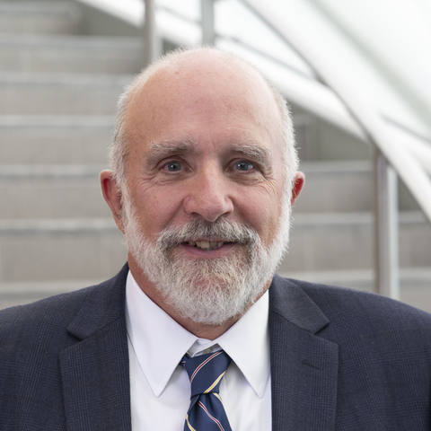 Bill Dennison合作论文数Center for Environmental Science, University of Maryland25
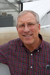 Robert J. Orth合作论文数Department of Biological Sciences, Virginia Institute of Marine Science10
 Michelle Waycott合作论文数School of Marine and Tropical Biology, James Cook University8
 Leland Moss合作论文数7
 Gary Kendrick合作论文数Oceans Institute, School of Biological Sciences, University of Western Australia7
 Melissa M. Baustian合作论文数Department of Oceanography and Coastal Sciences, Louisiana State University7
 Carey L. Perry合作论文数6
 Carlos M. Duarte合作论文数Biological and Environmental Science and Engineering Division, King Abdullah University of Science and Technology6
 Camille L. Stagg合作论文数Wetland & Aquat Res Ctr, US Geol Survey6Shawn L. Carter合作论文数5
 Kelly M. Darnell合作论文数Sch Ocean Sci & Engn, Univ Southern Mississippi5
 Benjamin Fertig合作论文数Berufsfachschule für den Rettungsdienst incentive MED5
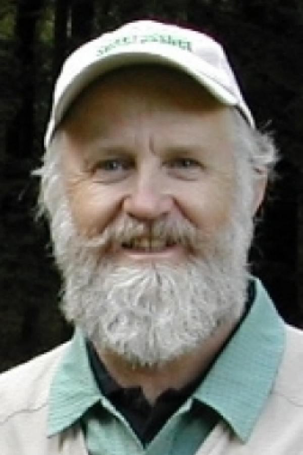 Frederick Short合作论文数Jackson Estuarine Laboratory, School of Marine Science and Ocean Engineering, University of New Hampshire;Department of Natural Resources and the Environment, College of Life Sciences and Agriculture, University of New Hampshire5
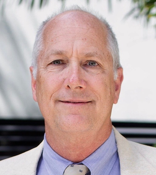 James W. Fourqurean合作论文数College of Arts, Sciences & Education, Florida International University;Institute of Environment Biological Sciences, Florida International University;Seagrass Ecosystems Research Lab, Florida International University;Department of Biological Sciences, Florida International University;Center for Coastal oceans Research, Florida International University5Hoon-Shin Jung合作论文数5
 Todd R. Lookingbill合作论文数Center for Environmental Science Appalachian Laboratory, University of Maryland5
 Harris Bienn合作论文数4Erin Kiskaddon合作论文数4Scott A. Hemmerling合作论文数Water Inst Gulf4
 Randall Hughes合作论文数College of Science, Northeastern University4Jane M. Hawkey合作论文数4W. Judson Kenworthy合作论文数4Suzanne Olyarnik合作论文数3Alyssa Dausman合作论文数3Cassie Gurbisz合作论文数3
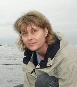 Susan Williams合作论文数Bodega Marine Laboratory, University of California at Davis3
 Kenneth L. Heck合作论文数Stokes School of Marine & Environmental Sciences, University of South Alabama3Courtney A. Schupp合作论文数3Brian Sturgis合作论文数3Lisa N. Florkowski合作论文数3W. Dennison合作论文数2Carl Zimmerman合作论文数2Adrian Jones合作论文数2Soupy Dalyander合作论文数2
 Christine DeMyers Curtis合作论文数Water Inst Gulf2
 kristin demarco合作论文数School of Renewable Natural Resources, Louisiana State University Agricultural Center2Jasper Dijkstra合作论文数2
 Hugh Govan合作论文数University of the South Pacific2
 Aaron Jenkins合作论文数School of Public Health, Faculty of Medicine and Health, The University of Sydney2
 Sean L Maxwell合作论文数AKD2Gibson, D.合作论文数2
 Bingqing Liu合作论文数2
 James Watson合作论文数School of the Environment, Faculty of Science, The University of Queensland;Centre for Biodiversity and Conservation Science, Faculty of Science, The University of Queensland;Centre for Marine Science, Faculty of Science, The University of Queensland2
 Brasher Michael G合作论文数2
 Michael R. Williams合作论文数2
 Marion Cambridge合作论文数Harbor Branch Foundation, Inc.2
 Tracey Saxby合作论文数2
 Eva Abal合作论文数2Laura Murray合作论文数2




