Wild insect pollinators contribute significantly to agricultural productivity, biodiversity, and ecosystem functioning. Wild pollinators are increasingly affected by multiple interacting stressors. Proactively identifying emerging risks and feasible mitigation strategies will be critical to ensuring the long-term stability of wild pollinators biodiversity and pollination services. We conducted the first continental scale horizon scan focused on wild pollinators in Europe. A structured Delphi-based approach was used to identify emerging issues that may have significant implications for wild pollinators over the coming decade. Ten priority issues were identified, including both potential risks and opportunities. For the first time in a pollinator-focused horizon scan, legislation was identified as a key opportunity, with the European Union Nature Restoration Regulation recognised for its potential to influence pollinator conservation through mandatory restoration and monitoring targets. In contrast, political developments such as the rise of populist parties and post-truth discourse may impede policy implementation. Several issues relating to pesticide use were also identified, including developments in RNA interference technologies and precision application methods, which may reduce non-target impacts if risks are appropriately assessed. These findings provide a foundation for further research and policy evaluation in support of pollinator conservation under changing environmental and political conditions.
The Natura 2000 (N2K) network of protected areas is one of the main tools for area-based conservation in the European Union (EU), yet its role in preserving plant biodiversity requires better understanding. We examined data kept in the European Vegetation Archive from over 1.2 million vegetation plots and obtained over 14.2 million plant species occurrences. To test the N2K network's representativeness of plant species gamma diversity, we compared the number and percentage of native and conservation priority species in- and outside the N2K network throughout the EU and for individual countries, biogeographical regions, and combinations thereof. We then determined whether N2K sites hosted more species than sites outside the network with the species-area relationship. Overall, almost 90% of the native vascular plant species occurred at least once in the N2K network. Yet, significant variation exists across countries and biogeographical regions-from 0% of species in the Boreal region of Lithuania, to 98% in the Alpine region of Croatia-indicating that local N2K sites are not equally representative of the regional gamma diversity. Nonetheless, the N2K network contains more species than land outside the network when area is taken into account. The planned expansion of the N2K network, as mandated by the European Biodiversity Strategy for 2030, should prioritize areas with currently underrepresented elements of the EU vascular flora.
Motivation Pollinators play a crucial role in maintaining Earth's terrestrial biodiversity. However, rapid human-induced environmental changes are compromising the long-term persistence of plant-pollinator interactions. Unfortunately, we lack robust, generalisable data capturing how plant-pollinator communities are structured across space and time. Here, we present the EuPPollNet (European Plant-Pollinator Networks) database, a fully open European-level database containing harmonised taxonomic data on plant-pollinator interactions referenced in both space and time, along with other ecological variables of interest. In addition, we evaluate the taxonomic and sampling coverage of EuPPollNet, and summarise key structural properties in plant-pollinator networks. We believe EuPPollNet will stimulate research to address data gaps in plant-pollinator interactions and guide future efforts in conservation planning. Main Types of Variables Included EuPPollNet contains 1,162,109 interactions between plants and pollinators from 1864 distinct networks, which belong to 52 different studies distributed across 23 European countries. Information about sampling methodology, habitat type, biogeographic region and additional taxonomic rank information (i.e. order, family, genus and species) is also provided. Spatial Location and Grain The database contains 1214 different sampling locations from 13 different natural and anthropogenic habitats that fall in 7 different biogeographic regions. All records are geo-referenced and presented in the World Geodetic System 1984 (WGS84). Time Period and Grain Species interaction data was collected between 2004 and 2021. Major Taxa and Level of Measurement The database contains interaction data at the species level for 94% of the records, including a total of 1411 plant and 2223 pollinator species. The database includes data on 6% of the European species of flowering plants, 34% of bees, 26% of butterflies and 33% of syrphid species at the European level. Software Format The database was built with R and is stored in ‘.rds’ and ‘.csv’ formats. Its construction is fully reproducible and can be accessed at: https://doi.org/10.5281/zenodo.14747448.
Protecting Farmland Pollinators is about identifying small actions that farmers can take that will allow biodiversity to coexist within a productive farming system. Farmers in Ireland recognise the importance of pollinators, but farmland has experienced wide-scale loss of wild pollinators over the last fifty years. By working closely with 40 farmers, management practices that benefit bees and hoverflies on Irish farmland were identified, and a whole farm pollinator scoring system was developed. Using a whole farm pollinator scorecard, farmers receive ‘pollinator points’ each year based on the amount and quality of pollinator friendly habitat maintained and/or created and, each year, farmers receive a results-based payment that relates to the points. Irish farms have great potential to improve both the quantity and quality of biodiversity friendly habitats without negatively impacting on farm productivity. Thirty-one farmers increased their score between year one and year three of the results-based payment and four farms more than tripled their score. The median whole farm pollinator score for the 40 farms increased from 25,696 in year one to 33,572 in year two (31% increase), to, 40,211 pollinator points in year three (56% increase). Each farm type (beef, dairy, mixed and arable) increased their median score over the three years and dairy and arable farms showed the largest increase. This project has helped farmers better understand and engage with nature on their land and has created a measurable system for improving habitats for biodiversity on farms that is accessible to all and has the potential to be rolled out on a wider scale.
Pollinators play a crucial role in ecosystems globally, ensuring the seed production of most flowering plants. They are threatened by global changes and knowledge of their distribution at the national and continental levels is needed to implement efficient conservation actions, but this knowledge is still fragmented and/or difficult to access. As a step forward, we provide an updated list of around 3000 European bee and hoverfly species, reflecting their current distributional status at the national level (in the form of present, absent, regionally extinct, possibly extinct or non‐native). This work was attainable by incorporating both published and unpublished data, as well as knowledge from a large set of taxonomists and ecologists in both groups. After providing the first National species lists for bees and hoverflies for many countries, we examine the current distributional patterns of these species and designate the countries with highest levels of species richness. We also show that many species are recorded in a single European country, highlighting the importance of articulating European and national conservation strategies. Finally, we discuss how the data provided here can be combined with future trait and Red List data to implement research that will further advance pollinator conservation.
Beneficial insects provide valuable services upon which we rely, including pollination. Pollinator conservation is a global priority, and a significant concern in Ireland, where over half of extant bee species have declined significantly in recent decades. As flower-visiting insects rely on flowering plants, one way to conserve and promote pollinator populations is to protect high-quality habitat. We analyzed the structure of insect-flower interactions from multiple habitat categories in a large database of interactions from Ireland. Our primary goals were to compare spatial and temporal variation in Irish network structures, compare Irish networks to published networks from other countries, and provide evidence-based recommendations for pollinator conservation in Ireland by identifying well-visited plant species that may promote high pollinator diversity, abundance, and functional complementarity. Habitat types within Ireland differed substantially: seminatural grasslands had the highest pollinator species richness and largest number of unique pollinator species, while intensively managed habitats exhibited negative asymmetry (more plant than pollinator species). This negative asymmetry is notable because most plant-pollinator networks exhibit a positive asymmetry. Within intensively managed habitats, agricultural and urban habitats differed. Urban habitats had the highest number of non-native plant species while agricultural habitats had the lowest pollinator species richness. We also found Irish networks varied across the growing season, where July had the highest plant and insect species richness. When comparing Irish networks to published networks from other countries, we found Irish networks had a higher ratio of plant species to pollinator species, and that this difference was most evident in agricultural habitats. This ratio means the typical network asymmetry (more pollinator than plant species) was flipped (more plant than pollinator species) in the Irish network. We conclude that conserving seminatural grasslands in Ireland will be an essential component of pollinator conservation and identify thirty-five plant species important for restoring seminatural habitats.
Macrophytes are an essential biological element of freshwater aquatic ecosystems and are well known to reflect prevailing ecological conditions in rivers. Their use as bioindicators of nutrient status in river systems is widespread yet their reliability is hotly debated. The aim of this investigation was to assess whether macrophytes are reliable indicators of nutrient levels or better applied as indicators of other non-nutrient environmental conditions. The importance of two water-column nutrients; nitrates (N) and orthophosphates (P) were assessed in terms of their influence on macrophyte species richness and diversity in relation to other non-nutrient environmental factors using 395 river plots from Ireland. Then, in this context, the efficiency of macrophytes to detect nutrient levels was assessed by selecting two macrophyte-based water quality assessment tools; the Mean Trophic Rank (MTR) and the Predictions And Classification System for river macrophytes (LEAFPACS2). Finally, the ability of phytosociological communities within these rivers to reflect trophic levels was examined using the same two water quality assessment tools. It was shown that water-column nutrients N and P have a minor influence on macrophyte richness and no significant influence on macrophyte diversity and that MTR and LEAFPACS2 were only weakly correlated with N and P levels. It was concluded that macrophytes are sensitive to environmental changes but respond to a combination of ecological factors rather than N or P alone. Therefore, this study suggests that macrophytes are not the most efficient taxon group to apply when assessing trophic changes in isolation of other non-nutrient factors.
Conservation initiatives carried out by informed, enthusiastic participants can be highly effective in conserving biodiversity, including the biodiversity of insect pollinators. It is important to understand how the public perceives insect pollinators, as it may have implications for the success of conservation initiatives and the initiation of protective policies. We used Ireland as a case study to determine how insect pollinators, pollination services, and pollinator decline are currently perceived by the public in an effort to understand the links between public knowledge and perceptions of pollinators, the implementation of insect pollinator conservation actions, and engagement with existing conservation initiatives. We designed a survey that was available to the Irish public for three months, distributed primarily through social media, and was taken by 613 participants. Findings indicate that people are aware of insect pollinator decline and of the main causes and are willing to participate in pollinator conservation, but that there are still some key gaps in the overall understanding of pollinators, their role, and their ecology. Most participants were able to identify charismatic pollinators, such as bumblebees and honeybees, and were aware of their importance to the pollination of crops and wildflowers. Fewer participants were able to identify other common pollinators, such as flies and solitary bees, and many were not aware of the importance of non-bee pollinators to pollination. While engagement with Ireland's national pollinator conservation initiative was linked with increased knowledge of Irish pollinators, less than 50 % of participants, particularly urban dwellers and those without post-secondary education, had heard of the initiative. To ensure a more inclusive approach to insect pollinator conservation, we recommend that future engagement measures highlight the importance of underrepresented non-bee insects to pollination services and target certain demographic groups that are currently not as actively engaged in pollinator conservation as others.
This paper synthesises a number of meaningful practices and transferable insights from sessions at the 2019 National Biodiversity Conference on engagement in biodiversity conservation.To achieve this, a diverse selection of contributors working with youth, the business and farming sectors, local communities, the general public and society at large, reflected on their research, practice and understandings using Dunford's (2019) triadic framework of engagement-the Pocket, Head and Heart.Across the range of social groups and scales involved, and different methodological approaches employed in each contributor's work to date, the paper finds that an overarching principle to successfully progressing all engagement work is the value of developing collaborative relationships among stakeholders in order to help identify and achieve shared conservation goals.It concludes that co-designed and appropriately resourced all-island, place-based or sectoral approaches, together with citizen science and public education, accessible to everyone from youth to retirees, offer effective practices for growing and strengthening collaborative relationships.Key to these practices is authentic and meaningful engagement across age groups, communities, sectors, institutions and public authorities, in order to achieve the ultimate shared goal of biodiversity conservation for this and future generations.
Insect pollinators are a key component of biodiversity; they also play a major role in the reproduction of many species of wild plants and crops. It is widely acknowledged that insect pollinators are threatened by many environmental pressures, mostly of anthropogenic nature. Their decline is a global phenomenon. A better understanding of their distribution can help their monitoring and ultimately facilitate conservation actions. Since we only have partial knowledge of where pollinator species occur, the possibility to predict suitable environmental conditions from scattered species records can facilitate not only species monitoring, but also the identification of areas potentially vulnerable to pollinators decline. This data paper contains the predicted distribution of 47 species of bumblebees across the 28 Member States of the European Union (EU-28). Amongst the wild pollinators, bumblebees are one of the major groups contributing to the production of many crop species, hence their decline in Europe, North America and Asia can potentially threaten food security. Predictions were derived from distribution models, using species records with a spatial resolution of 10 km accessed from a central repository. Predictions were based on records from 1991 to 2012 and on a series of spatial environmental predictors from three main thematic areas: land use and land cover, climate and topography. These distributions were used to estimate the value of pollination as an ecosystem service. In light of the recent European Pollinators Initiative, this paper provides valuable information for a better understanding of where wild pollinators occur and it should be extended to other pollinator species.
Aim: To construct a classification system for Irish aquatic river vegetation that is directly comparable to European aquatic vegetation classification units. Location: A total of 2,415 river vegetation plots with a wide geographic distribution across both the Republic and Northern Ireland. Methods: The plots were recorded from a range of river types from upland streams to wadeable lowland rivers. A total of 1,613 plots were classified using supervised K-means clustering through the programme JUICE. The Phi co-efficient for presence/absence data was used to measure fidelity of the vegetation communities. Results: The vegetation communities could be initially sub-divided in to four main categories: (1) bryophyte-dominated aquatic vegetation, (2) bryophyte-dominated marginal vegetation, (3) vascular plant-dominated aquatic vegetation and (4) vascular plant-dominated marginal/emergent vegetation. Within these four categories the vegetation was classified into seven classes, 18 alliances and 30 associations. Descriptions are given for each including variants and sub-associations if found at association level. Conclusions: There is a rich diversity of bryophyte communities within Irish rivers and they are an integral part of the river network, whereas there was less diversity among vascular plant communities. The distinction between some communities was not as sharp as expected for a variety of reasons discussed in this paper, nevertheless, a working classification system was constructed.
Classifying, mapping and describing habitats and vegetation is a bread-andbutter task for many people involved in ecological research or environmental management. It is thus perhaps surprising that Ireland lacked a standard scheme for this purpose until 2000 when A Guide to Habitats in Ireland (Fossitt 2000) was published by The Heritage Council. It was soon widely adopted by those working in the public and private sectors, being often referred to simply as ‘Fossitt’. It provides descriptions of natural, semi-natural and artificial habitats and is analogous to the Phase I habitat classification used in the UK. The accounts of terrestrial and freshwater habitats in this scheme draw in part on the numerous academic phytosociological studies conducted in Ireland over several decades, following the Braun-Blanquet approach widely used in continental Europe (see White and Doyle 1982). This approach conceives plant communities based on floristic composition sites (Phase II surveys in UK parlance). This requirement is reflected in the National Biodiversity Action Plan. Numerous theses and national surveys have produced detailed, separate classifications of specific habitats, but they vary considerably in methodology and the specificity of the categories. Although the British National Vegetation Classification (NVC) has been employed for some purposes in Northern
Aims: Although many phytosociological studies have provided detailed local and regional descriptions of coastal dune vegetation, a unified classification of this vegetation in Europe and the Mediterranean Basin has been missing. Our aim is to produce a formalized classification of this vegetation and to identify the main factors driving its plant species composition at a continental scale. LocationAtlantic and Baltic coasts of Europe, Mediterranean Basin and the Black Sea region. - Methods: We compiled a database of 30,759 plots of coastal vegetation, which were resampled to reduce unbalanced sampling effort, obtaining a data set of 11,769 plots. We classified these plots with TWINSPAN, interpreted the resulting clusters and used them for developing formal definitions of phytosociological alliances of coastal dune vegetation, which were included in an expert system for automatic vegetation classification. We related the alliances to climatic factors and described their biogeographic features and their position in the coastal vegetation zonation. We examined and visualized the floristic relationships among these alliances by means of DCA ordination. - Results: We defined 18 alliances of coastal dune vegetation, including the newly described Centaureo cuneifoliae-Verbascion pinnatifidi from the Aegean region. The main factors underlying the differentiation of these alliances were biogeographic and macroclimatic contrasts between the Atlantic-Baltic, Mediterranean and Black Sea regions, along with ecological differences between shifting and stable dunes. The main difference in species composition was between the Atlantic-Baltic and Mediterranean-Black Sea regions. Within the former region, the main difference was driven by the different ecological conditions between shifting and stable dunes, whereas within the latter, the main difference was biogeographic between the Mediterranean and the Black Sea. - Conclusions: The first formal classification of the European coastal dune vegetation was established, accompanied by an expert system containing the formal definitions of alliances, which can be applied to new data sets. The new classification system critically revised the previous concepts and integrated them into a consistent framework, which reflects the main gradients in species composition driven by biogeographic influences, macroclimate and the position of the sites in the coast-inland zonation of the dune systems. A revision of the class concept used in EuroVegChecklist is also proposed.
The study of river vegetation for the purposes of macrophyte community classification has often been neglected by vegetation scientists. There is little detail available on appropriate survey methods for classification of aquatic river communities and their suitability to the task in hand. There is great variation in river macrophyte surveying techniques within Ireland and abroad. Current methods relate mostly to water quality and status assessment; however, these methods are not always suitable for vegetation classification. We review survey methods utilised in European and Irish river vegetation studies. There is consensus on the optimum time of the year to survey and on the use of the most appropriate on-site recording techniques. The main challenges that need to be addressed are how best to select river survey sites and at what scale, then subsequently, selecting the most appropriate plot size within these sites, to capture existing vegetation community types accurately. Both issues are widely debated and little consensus exists. We discuss the practicalities of standardising survey procedures so that river vegetation studies can be compatible on a broad scale and suggest methods that will improve classification of river vegetation for the future. At least some standardisation in survey methodology would add to the quality and usability of future collected data, however, it is important that a level of flexibility remains so that different survey needs can be met. A thorough scientific assessment of techniques is not the purpose of this paper, but rather to present a proposed set of guidelines from lessons learnt while river macrophyte surveying and collating river vegetation data from different sources in to one central database, the Irish. River Macrophyte Database (RMD). Background information and summary statistics of the RMD are presented including limitations of the data in terms of classification and data quality.
Bumblebees in Europe have been in steady decline since the 1900s. This decline is expected to continue with climate change as the main driver. However, at the local scale, land use and land cover (LULC) change strongly affects the occurrence of bumblebees. At present, LULC change is rarely included in models of future distributions of species. This study's objective is to compare the roles of dynamic LULC change and climate change on the projected distribution patterns of 48 European bumblebee species for three change scenarios until 2100 at the scales of Europe, and Belgium, Netherlands and Luxembourg (BENELUX). We compared three types of models: (1) only climate covariates, (2) climate and static LULC covariates and (3) climate and dynamic LULC covariates. The climate and LULC change scenarios used in the models include, extreme growth applied strategy (GRAS), business as might be usual and sustainable European development goals. We analysed model performance, range gain/loss and the shift in range limits for all bumblebees. Overall, model performance improved with the introduction of LULC covariates. Dynamic models projected less range loss and gain than climate-only projections, and greater range loss and gain than static models. Overall, there is considerable variation in species responses and effects were most pronounced at the BENELUX scale. The majority of species were predicted to lose considerable range, particularly under the extreme growth scenario (GRAS; overall mean: 64% +/- 34). Model simulations project a number of local extinctions and considerable range loss at the BENELUX scale (overall mean: 56% +/- 39). Therefore, we recommend species-specific modelling to understand how LULC and climate interact in future modelling. The efficacy of dynamic LULC change should improve with higher thematic and spatial resolution. Nevertheless, current broad scale representations of change in major land use classes impact modelled future distribution patterns.
Aims: Phytosociological classification of fen vegetation (Scheuchzerio palustris-Caricetea fuscae class) differs among European countries. Here we propose a unified vegetation classification of European fens at the alliance level, provide unequivocal assignment rules for individual vegetation plots, identify diagnostic species of fen alliances, and map their distribution.Location: Europe, western Siberia and SE Greenland.Methods: 29 049 vegetation-plot records of fens were selected from databases using a list of specialist fen species. Formal definitions of alliances were created using the presence, absence and abundance of Cocktail-based species groups and indicator species. DCA visualized the similarities among the alliances in an ordination space. The ISOPAM classification algorithm was applied to regional subsets with homogeneous plot size to check whether the classification based on formal definitions matches the results of unsupervised classifications.Results: The following alliances were defined: Caricion viridulo-trinervis (sub-halophytic Atlantic dune-slack fens), Caricion davallianae (temperate calcareous fens), Caricion atrofusco-saxatilis (arcto-alpine calcareous fens), Stygio-Caricion limosae (boreal topogenic brown-moss fens), Sphagno warnstorfii-Tomentypnion nitentis (Sphagnum-brown-moss rich fens), Saxifrago-Tomentypnion (continental to boreo-continental nitrogen-limited brown-moss rich fens), Narthecion scardici (alpine fens with Balkan endemics), Caricion stantis (arctic brown-moss rich fens), Anagallido tenellae-Juncion bulbosi (Ibero-Atlantic moderately rich fens), Drepanocladion exannulati (arcto-boreal-alpine non-calcareous fens), Caricion fuscae (temperate moderately rich fens), Sphagno-Caricion canescentis (poor fens) and Scheuchzerion palustris (dystrophic hollows). The main variation in the species composition of European fens reflected site chemistry (pH, mineral richness) and sorted the plots from calcareous and extremely rich fens, through rich and moderately rich fens, to poor fens and dystrophic hollows. ISOPAM classified regional subsets according to this gradient, supporting the ecological meaningfulness of this classification concept on both the regional and continental scale. Geographic/macroclimatic variation was reflected in the second most important gradient.Conclusions: The pan-European classification of fen vegetation was proposed and supported by the data for the first time. Formal definitions developed here allow consistent and unequivocal assignment of individual vegetation plots to fen alliances at the continental scale.
Mitochondrial cytochrome oxidase I (COI) partial sequences are widely used in taxonomy for species identification. Increasingly, these sequence identities are combined with modelling approaches to delineate species. Yet the validity of species delineation based on such DNA 'barcodes' is rarely tested and may be called into question by phenomena such as ancestral polymorphisms in DNA sequences, phylogeographic divergence, mitochondrial introgression and hybridization, or distortion of mitochondrial inheritance through such factors as Wolbachia infection. The common and widespread European bumble bee Bombus lucorum s. lato contains three distinct mitochondrial DNA lineages that are assumed to represent three cryptic species, namely Bombus cryptarum, B. lucorum s. str. and B. magnus. To test whether nuclear gene pools of the three putative species were differentiated, we genotyped 304 sympatric members of the lucorum complex (54 B. cryptarum females, 168 B. lucorum s. str. females and 82 B. magnus females, as defined using mtDNA COI haplotypes) from 11 localities spread across the island of Ireland at seven nuclear microsatellite loci. Multilocus genotypes clustered into three discrete groups that largely corresponded to the three mtDNA lineages: B. cryptarum, B. lucorum s. str. and B. magnus. The good fit of mitochondrial haplotype to nuclear (microsatellite) genotypic data supports the view that these three bumble bee taxa are reproductively isolated species, as well as providing a vindication of species identity using so-called DNA barcodes.
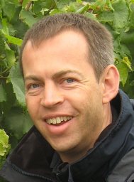 Mark Brown合作论文数Department of Zoology;Trinity College Dublin;Department of Zoology, Trinity College Dublin9
 Robert Paxton合作论文数Institute for Biology, Faculty of Natural Sciences, Martin-Luther-University Halle-Wittenberg9
 Zygmunt Kącki合作论文数8
 Tomás E. Murray合作论文数Teagasc, Crops Research Centre8
 Milan Chytrý合作论文数Department of Botany and Zoology, Faculty of Science, Masaryk University7
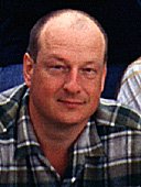 Pierre Rasmont合作论文数Université de Mons-Hainaut;Laboratoire de Zoologie;Laboratoire de Zoologie, Université de Mons-Hainaut7
 Stuart P M Roberts合作论文数Centre for Agri-Environmental Research, Reading University7
 Urban Silc合作论文数Institute of Biology, Scientific Research Centre of the Slovenian Academy of Sciences and Arts7
 Juho Paukkunen合作论文数6
 Denis Michez合作论文数Université de Mons-Hainaut;Laboratoire de Zoologie;Laboratoire de Zoologie, Université de Mons-Hainaut6John S. Rodwell合作论文数5Johann Neumayer合作论文数5
 Lynda Weekes合作论文数5Frode Ødegaard合作论文数5Cederberg Björn合作论文数5
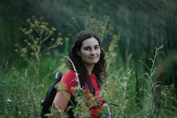 Landucci Flavia合作论文数Department of Chemistry, Biology and Biotechnology, University of Perugia;Department of Botany and Zoology, Masaryk University Brno;University of Perugia, Masaryk University Brno5
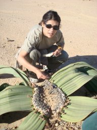 Idoia Biurrun合作论文数University of the Basque Country Department of Plant Biology and Ecology (Botany), Faculty of Sciences Ap. 644 E-48080 Bilbao Spain5
 Oliver Schweiger合作论文数5Henry Brisse合作论文数5
 Joop Schaminee合作论文数5
 Jakub Straka合作论文数Faculty of Science, Charles University in Prague5
 Florian Jansen合作论文数Dept. of Landscape Ecology, Ernst-Moritz-Arndt University5Ute Jandt合作论文数Martin-Luther-Univ. Halle-Wittenberg, Martin-Luther-Universität Halle-Wittenberg5
 Andraz Carni合作论文数4
 Janos Csiky合作论文数4
 Aulo Manino合作论文数4Els De Bie合作论文数4
 Byrne Andrew W合作论文数Veterinary Sciences Division, Agri-Food and Biosciences Institute4
 Jiménez-Alfaro Borja合作论文数4
 Jonathan Lenoir合作论文数Université de Picardie Jules Verne;Laboratoire Écologie et Dynamique Des, Centre National de La Recherche Scientifique4
 Tadeusz Pawlikowski合作论文数4
 Jane Stout合作论文数School of Biological Sciences, University of Southampton4
 Wolfgang Willner合作论文数4
 Zvjezdana Stancic合作论文数4
 Xavier Font合作论文数Surrey Business School, University of Surrey4Ilona Knollová合作论文数4
 Frédéric Francis合作论文数Université de Liège4
 Libor Dvorak合作论文数4
 M. Reemer合作论文数National Museum of Natural History;Museums of Scotland;National Museums Collection Centre;Museums of Scotland, National Museums Collection Centre4
 Emiliano Agrillo合作论文数3Koos Biesmeijer合作论文数Nat Biodivers Ctr, Leiden Univ3Tomáš Peterka合作论文数3
 Joachim Maes合作论文数Joint Research Centre, European Commission3Castro Leopoldo合作论文数3
 Chiara Polce合作论文数3
 Josef Settele合作论文数Department of Conservation Biology and Social-Ecological Systems, Helmholtz-Zentrum für Umweltforschung;Helmholtz-Centre for Environmental Research, Helmholtz-Zentrum für Umweltforschung3
 Jozef Sibik合作论文数Slovak Academy of Sciences Institute of Botany3
 Panayotis Dimopoulos合作论文数Department of Environmental and Natural Resources Management, University of Ioannina3Jesper Erenskjold Moeslund合作论文数Ecoinformatics & Biodiversity Group, Aarhus University3




