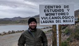
The Laguna del Maule (LdM) volcanic field, which surrounds the 54-km(2) lake of that name, covers similar to 500 km(2) of mountainous glaciated terrain with Quaternary lavas and tuffs that extend 40 km westward from the Argentine frontier and 30 km north-south from the R & iacute;o Campanario to Laguna Fea. Complementing recent investigations of postglacial volcanism and the ongoing geophysical unrest around the lake, we here review the longer eruptive history that spanned the entire Quaternary. The distributed rear-arc LdM volcanic field is contiguous with the Tatara-San Pedro stratovolcano complex on the volcanic front of the Quaternary Andean arc. The LdM field has had only a few large edifices, but we identified at least 140 separate vents, from which >350 km(3) of products have erupted since 1.5 Ma. Eruptive products of 14 (early and middle Pleistocene) stratocones and shields, and of similar to 125 monogenetic cones, domes, and lava flows, were mapped on foot, studied petrographically, and chemically analyzed. More than 80 Ar-40/Ar-39 and K-Ar ages have been determined to calibrate the Pleistocene eruptive sequence. An extensive welded ignimbrite erupted at 1.5 Ma and was followed by another at similar to 950 ka, producing a 12 x 8 km-wide caldera that underlies the north part of the lake basin and the ruggedly eroded highlands north of it. Outside the caldera, the southern two-thirds of the lake basin is a drainage network cut on Tertiary andesites and dacites. A ring of similar to 29 postglacial rhyolite and rhyodacite coulees and domes plus associated pyroclastic deposits that erupted from >30 separate vents (and together cover similar to 100 km(2)) encircles the lake. The large number of postglacial silicic vents around the lake basin, several comagmatic multi-vent compositional arrays, and scarcity of mafic enclaves in the rhyolites are features that suggest growth of a latest Pleistocene to Holocene magma reservoir beneath the LdM Basin. The Barrancas center on the divide southeast of the Basin has an additional 21 lavas from 15 vents and represents a second independent postglacial rhyolitic reservoir. About 21 postglacial mafic and intermediate eruptive units accompany the rhyolites around the margins of the LdM Basin. Ongoing work by Fierstein et al. (this volume) has brought the total number of postglacial vents recognized to more than 73 and has determined similar to 70 radiocarbon dates that bracket the abundant tephra deposits, thus providing a 17,000-year-long calibration of the postglacial eruptive sequence. In addition to the many postglacial silicic units, glacially eroded silicic lavas yield ages of 3.7, 2.5, 2.4, 2.0, 1.6, and 1.35 Ma, and 924, 880, 712, 695, 680, 460, 335, 240, 203, 114, 97, 83, and 25 ka, providing evidence of a prolonged history of explosive silicic eruptions from vents scattered throughout the volcanic field. Production of widely distributed rhyolites throughout the long history of the volcanic field demonstrates intensive crustal processing as well as the enduring potential for explosive eruptions. For the Quaternary LdM volcanic field, chemical analyses define an array continuous from 49% to 77.6% SiO2, medium-K toward its mafic end (1.5% K2O @ 55% SiO2) but high-K at its silicic end (4.5% K2O @ 75% SiO2). Quaternary eruptive units include 5 basalts, similar to 30 mafic andesites (52-57% SiO2), 33 andesites, 11 dacites (63-68% SiO2), 25 rhyodacites, similar to 27 rhyolites (>72% SiO2), and 6 ignimbrites (andesitic to rhyolitic). None of the basalts is primitive, and most of the mafic rocks display petrographic and/or chemical evidence for diverse crustal contributions (Hildreth et al., 2010).
The iconic volcanic center at Long Valley has released-820 km3 of rhyolite in at least 110 eruptions. From 2.2 Ma until 0.23 Ma, products were exclusively rhyolitic, and -700 km3 were high-silica rhyolite severely depleted in Sr, Ba, and Eu. The rhyolitic interval was preceded by an interval from 3.9 to 2.6 Ma with numerous basalt-andesite-dacite eruptions accompanied by no rhyolite at all. We have now mapped the circumcaldera products of this interval, defined 107 eruptive units, characterized them all chemically and petrographically, and dated many by 40Ar/39Ar. Here we display and describe them by sector around the caldera, interpret the nature of the transcrustal magma system that eventuated in the 35-km-wide Long Valley granite-rhyolite pluton, and analyze regional tectonic factors that did or did not contribute to siting the system. Nine Miocene (12-6 Ma) eruptive units close to Long Valley were followed by a Pliocene flare-up that released >300 mafic eruptions in a SW-NE swath 170 km long, centered across the later site of Long Valley. The basalts and their fractionates are intraplate alkalic products dominated by a continental lithosphere that had long been fluxed by Mesozoic subduction. Tertiary arc volcanism had not impinged on the area of Long Valley. Volumes estimated for the 107 Neogene precaldera eruptive units (only 40 of which exceeded 0.1 km3) total -27 km3 +/- 50%-only-3% of the subsequent volume of rhyolite erupted. Such a volume of high-silica rhyolite with ultra -low Sr and Eu is not a product of partial melting but requires as proximate parent a leucogranitic crystal mush that is itself the upper level of a long-lived plutonic reservoir that extends to the lower crust. The 27 km3 of Neogene magma that erupted was a small contingent of the mantle-derived basaltic flux needed to energize (and contribute its fractionated melt to) a 30-km-deep compositionally graded crustal column, which culminated in-10,000 km3 of granitoid mush from which 820 km3 of Quaternary high-silica rhyolitic melt escaped and erupted.Pliocene basaltic eruptions ceased at-2.6 Ma, probably because the basaltic flux intensified sufficiently to render the mushy upper crust impenetrable. The 2.6-2.2 Ma quiescent interval represented culmination of thermal activation of the plutonic column and refinement of its leucogranitic mushy upper layer, from which extreme melts escaped for the next 2 Myr. The Pliocene mafic swath crosses the Sierran rangefront fault zone coincident with a left-stepping extensional reentrant that also began developing at-3 Ma. Moreover, Long Valley overlies a dextral offset in the initial Sr-isotope 0.706 line, which may reflect the rifted or attenuated edge of Proterozoic crust and mantle lithosphere. Concatenation of these three influences may account for siting of intensified edge-focused magmatism that produced the great Quaternary pluton.
The leucogranitic crystal-mush pluton beneath the iconic Long Valley Caldera, California, USA, released >820 km3 of crystal-poor Pleistocene rhyolite, which was hosted by numerous Mesozoic granitic plutons, only a few of which had been dated until now. Reported here are U-Pb zircon ages, determined by sensitive high-resolution ion microprobe−reverse geometry (SHRIMP-RG), for 11 circumcaldera granitoids, all of them either Triassic or Cretaceous. Growth of the 35-km-wide Quaternary rhyolite-leucogranite plutonic reservoir was fostered by collocation of (1) a dense swath of late Pliocene basaltic vents, (2) a left-stepping extensional reentrant in the rangefront fault zone of the Sierra Nevada batholith, and (3) a sharp offset of the Proterozoic continental margin as represented by the Sr-isotope 0.706 line. We further consider whether the basement architecture of as many as 26 separate Triassic and Cretaceous plutons and intervening septa and pendants of Paleozoic metasedimentary rocks influenced siting of the Quaternary pluton and whether the ragged margin of Proterozoic lithosphere helped to focus asthenospheric edge upwelling that intensified crustal melting and intrusion in both the Triassic and the Quaternary.
Hildreth et al. (2021) analyzed a set of table mountains near the San Joaquin River that are capped by a 9.3 Ma trachyandesite lava flow and concluded that, since the deposition of the volcanic rocks, the table mountains have been tilted 1.07° due to uplift of the central Sierra Nevada. While Gabet (2014) suggested that, under a limited set of conditions, the size of fluvial gravels under the table mountains would support the hypothesis of postdepositional uplift, the authors claimed that their evidence is more definitive. In addition, the authors proposed that the central Sierra Nevada tilted as a rigid block. However, their analyses rely on inferences and assumptions that are not supported by field evidence.
Table S1: SHRIMP-RG Ion Microprobe Data: Individual 206Pb/238U Zircon Dates. Table S2: Chemical data for plutonic rocks near Long Valley. Figure S1: Compositions of 114 samples of Mesozoic plutonic rocks around Long Valley Caldera, almost exclusively the units distinguished by labels in Figure 4. Figure S2: Plot of K2O vs. SiO2 for all of our samples in Table S2.
In Mono Basin, California, USA, a near-circular ring fracture 12 km in diameter was proposed by R.W. Kistler in 1966 to have originated as the protoclastic margin of the Cretaceous Aeolian Buttes pluton, to have been reactivated in the middle Pleistocene, and to have influenced the arcuate trend of the chain of 30 young (62-0.7 ka) rhyolite domes called the Mono Craters. In view of the frequency and recency of explosive eruptions along the Mono chain, and because many geophysicists accepted the ring fracture model, we assembled evidence to test its plausibility. The shear zone interpreted as the margin of the Aeolian Buttes pluton by Kistler is 50-400 m wide but is exposed only along a 7-km-long set of four southwesterly outcrops that subtend only a 70 degrees sector of the proposed ring. The southeast end of the exposed shear zone is largely within the older June Lake pluton, and at its northwest end, the contact of the Aeolian Buttes pluton with a much older one crosses the shear zone obliquely. Conflicting attitudes of shear structures are hard to reconcile with intrusive protoclasis. Also inconsistent with the margin of the ovoid intrusion proposed by Kistler, unsheared salients of the pluton extend similar to 1 km north of its postulated circular outline at Williams Butte, where there is no fault or other structure to define the northern half of the hypothetical ring. The shear zone may represent regional Cretaceous transpression rather than the margin of a single intrusion. There is no evidence for the Aeolian Buttes pluton along the aqueduct tunnel beneath the Mono chain, nor is there evidence for a fault that could have influenced its vent pattern. The apparently arcuate chain actually consists of three linear segments that reflect Quaternary tectonic influence and not Cretaceous inheritance. A rhyolitic magma reservoir under the central segment of the Mono chain has erupted many times in the late Holocene and as recently as 700 years ago. The ring fracture idea, however, prompted several geophysical investigations that sought a much broader magma body, but none identified a low-density or low-velocity anomaly beneath the purported 12-km-wide ring, which we conclude does not exist.
Distilling my experience in having field mapped in detail the volcanic fields at Laguna del Maule and Long Valley and having worked out their time‐volume‐composition magmatic histories, I compare and contrast the postglacial rhyolites of the former with six multi‐vent eruptive sequences of rhyolite in California. Compilations and discussions are made of volcanic‐field areas and longevities, their compositions, vent distributions, individual batch and total volumes, eruptive episodicities, and tectonic influences. Growth of long‐lived pluton‐scale reservoirs of granitic crystal mush, from which the rhyolite melts separated, are interpreted in terms of conceptual models I published previously—(1) fundamentally basaltic transcrustal magmatism, 1981; (2) the deep‐crustal MASH zone model, 1988; and (3) the rhyolite‐melt crystal‐mush model, 2001. Inferences and speculations are advanced concerning processes and timescales of rhyolite‐melt separation from granitic mush and of prompt or long‐delayed subsequent eruption.
Table S1: Data for full topographic profile up Table Mountain and McKenzie Table Sections highlighted in red show significant erosion; Methodology for Meander-Tilt Analysis.
New mapping, geochemistry, and argon geochronology illuminate a brief, remarkably silicic episode set in a mafic segment of the Cascade arc. Middle Sister was constructed during a 35-k.y. episode in the late Pleistocene from mafic, intermediate, and silicic eruptions adjacent to the primarily rhyolitic South Sister. Eruptions in the Three Sisters volcanic cluster prior to 50 ka were exclusively mafic (<57 wt% SiO2), and several basaltic andesite lava flows can be traced to Middle Sister or a predecessor volcano (prior to 150 ka). Lava flows erupted 50-37 ka at Middle Sister and on its periphery were chemically diverse, with abundant basaltic andesite, a high-silica rhyolite flow, and an andesite produced from mixing of a rhyolite and mafic magma. Abundant rhyolite and rhyodacite erupted in this interval also at South Sister. Eruptive activity paused at Middle Sister 37-27 ka but continued at South Sister with large volumes of dacite and andesite lavas. Middle Sister erupted mafic, intermediate, and silicic lava flows 27-15 ka and then ceased to erupt. Calculated eruptive rates for the entire Three Sisters volcanic cluster quadrupled from similar to 0.2 to similar to 0.8 km(3)/k.y. between 50 and 15 ka, largely owing to the eruptions focused at Middle and South Sisters, and the cluster has now returned to its modest eruptive output, mainly away from the stratovolcanoes. Time-volume results for the volcanic cluster are compared to studies of other well-mapped, well-dated stratovolcanoes. Nearly all centers record similar wruptive-volume behavior with long histories of relatively constant output punctuated by short episodes of voluminous eruptions. In addition to the Three Sisters, two of these centers (Mt. Mazama, Crater Lake, Oregon, and Puyehue/Cordon Caule in the southern Andes) record significant compositional changes associated with the voluminous eruptive episodes.
The McGee Till is an early Pleistocene glacial diamict as thick as 50 m, preserved over an area of 1.65 km(2) on a relict low-relief Pliocene plateau that stands 900 m higher than mouths of its bounding canyons, on the rangefront of the Sierra Nevada. Although recognized 90 years ago as the oldest till in the Sierra, its age and relation to the next oldest Sierran till have remained uncertain, even controversial. This contribution seeks to clarify both. The McGee Till consists predominantly of grussy boulders and sandy granular matrix derived largely from a distinctive Cretaceous granodiorite that walls McGee Creek canyon 4-8 km to the south. The till rests directly upon two different basaltic units that yield 40Ar/39Ar ages of 2.8 and 2.6 Ma and show little or no evidence of preglacial erosion. The basalts preserve a minimum of 165-255 m of relief on steep slopes that existed around the plateau margins at the time of their eruption. McGee Creek consists of two segments a north-directed reach that confined the glacier that deposited the till and, now diverging at a right bend just upvalley from the till, a northeast-flowing reach that was incised later. The base of the McGee Till is at 3160 m elevation on the present-day rim of McGee Creek, 610 m above the bend. The base of the 130-ka Tahoe Till (MIS 6) is at 2550 m elevation directly downslope from the McGee Till and at 2300 mat the rangefront mouth of the canyon's northeast reach. The base of the 900-866 ka Sherwin Till (MIS 22) is at 2400 mat the nearby rangefront mouth of Rock Creek. As the canyons were cut to nearly modern depths before the Sherwin glaciation, the high perched McGee Till is probably older than 2 Ma and possibly close in age to the 2.6 Ma basalt it overlies. Growth in rangefront relief since about 3.0-2.5 Ma owes to normal slip on the Hilton Creek and Round Valley Faults east of McGee Mountain as well as to the 767-ka collapse of Long Valley caldera to its north. Published by Elsevier Ltd.
Geosphere, October 2018, v. 14, p. 2118-2139, doi:10.1130/GES01638.1, Supplemental Files. 1: 40Ar/39Ar tabulated data 2. Estimated eruptive volumes for all map units on the geologic map of the Three Sisters volcanic cluster (Hildreth et al., 2012). 3. Individual parts of Figure 6.
A sequence of late Holocene eruptions from the Ubehebe Crater cluster in Death Valley was short-lived, emplacing several phreatomagmatic and magmatic deposits. Seven craters form the main group, which erupted along a north-south alignment 1.5km long. At least five more make a 500-m east-west alignment west of the main crater group. One more is an isolated shallow crater ~400m south of that alignment. All erupted through Miocene fanglomerate and sandstone, which are now distributed as comminuted matrix and lithic clasts in all Ubehebe deposits. Stratigraphic evidence showing that all Ubehebe strata were emplaced within a short time interval includes: (1) deposits from the many Ubehebe vents make a multi-package sequence that conformably drapes paleo-basement topography with no erosive gullying between emplacement units; (2) several crater rims that formed early in the eruptive sequence are draped smoothly by subsequent deposits; and (3) tack-welded to agglutinated spatter and bombs that erupted at various times through the sequence remained hot enough to oxidize the overlying youngest emplacement package. In addition, all deposits sufficiently consolidated to be drilled yield reliable paleomagnetic directions, with site mean directions showing no evidence of geomagnetic secular variation. Chemical analyses of juvenile components representing every eruptive package yield a narrow range in major elements [SiO2 (48.65–50.11); MgO (4.98–6.23); K2O (2.24–2.39)] and trace elements [Rb (28–33); Sr (1513–1588); Zr (373–404)]. Despite lithologic similarities, individual fall units can be traced outward from vent by recording layer thicknesses, maximum scoria and lithic sizes, and juvenile clast textural variations. This permits reconstruction of the eruptive sequence, which produced a variety of eruptive styles. The largest and northernmost of the craters, Ubehebe Crater, is the youngest of the group. Its largely phreatomagmatic deposits drape all of the others, thicken in paleogullies and thin over several newly created crater rims. Evidence in-hand virtually requires that the Ubehebe cluster of craters erupted over a brief time interval, not protracted over centuries.
Accurate and precise ages of large silicic eruptions are critical to calibrating the geologic timescale and gauging the tempo of changes in climate, biologic evolution, and magmatic processes throughout Earth history. The conventional approach to dating these eruptive products using the 40Ar/39Ar method is to fuse dozens of individual feldspar crystals. However, dispersion of fusion dates is common and interpretation is complicated by increasingly precise data obtained via multicollector mass spectrometry. Incremental heating of 49 individual Bishop Tuff (BT) sanidine crystals produces 40Ar/39Ar dates with reduced dispersion, yet we find a 16-ky range of plateau dates that is not attributable to excess Ar. We interpret this dispersion to reflect cooling of the magma reservoir margins below ∼475 °C, accumulation of radiogenic Ar, and rapid preeruption remobilization. Accordingly, these data elucidate the recycling of subsolidus material into voluminous rhyolite magma reservoirs and the effect of preeruptive magmatic processes on the 40Ar/39Ar system. The youngest sanidine dates, likely the most representative of the BT eruption age, yield a weighted mean of 764.8 ± 0.3/0.6 ka (2σ analytical/full uncertainty) indicating eruption only ∼7 ky following the Matuyama-Brunhes magnetic polarity reversal. Single-crystal incremental heating provides leverage with which to interpret complex populations of 40Ar/39Ar sanidine and U-Pb zircon dates and a substantially improved capability to resolve the timing and causal relationship of events in the geologic record.
After the 767-ka caldera-forming eruption of 650 km(3) of rhyolite magma as the Bishop Tuff, 90-100 km(3) of similar rhyolite erupted in the west-central part of Long Valley caldera in as many as 40 batches spread over the 110,000-year interval from similar to 750 ka to similar to 640 ka. Centrally, this Early Rhyolite (ER) is as thick as 622 m, but it spread radially to cover much of the caldera floor, where half its area is now concealed by post-ER sediments and lavas. At least 75% of the ER is aphyric rhyolite tuff. Drillholes encountered similar to 22 (altered) ER lava flows intercalated in the pyroclastic pile, and another 11 units of (largely fresh) ER lava are exposed on the caldera's resurgent dome and at Lookout Mountain. Exposed units have been distinguished, mapped, studied petrographically and chemically, and radioisotopically dated; each is described in detail. Their phenocryst contents range from 0 to 2.5 wt%. All the phyric units have plagioclase, orthopyroxene, and ilmenite; most have biotite and rare tiny magnetite, and a few contain rare zircon. The compositional range of fresh obsidians is narrow-74.3-75.0% SiO2, 1.21-137% FeO*, and 5.12-5.26% K2O, but wider variations in Ti, Ba, Sr, and Zr permit distinction of individual units and eruptive groups. The limited chemical and petrographic variability shown by so many ER batches released episodically for similar to 110,000 years suggests a thermally buffered and well-stirred reservoir.The ER central area, where ER eruptions had taken place, was uplifted similar to 400 m to form a structural dome similar to 10 km in diameter. Most of the inflation is attributable to 10 sills of ER that intrude the Bishop Tuff beneath the uplift, but other processes potentially contributing to resurgence are also considered. As shown by erratics of Mesozoic rocks ice-rafted from the Sierra Nevada and dropped on ER lavas, much of the ER had erupted early enough and at low enough elevation to be inundated by the intracaldera lake and was only later lifted by the resurgence that also raised clusters of the erratics hundreds of meters higher than any shoreline. Most of the uplift was over by similar to 570 ka, but dome-crossing faults that exhibit normal throw of 10-30 m cut lavas as young as 175-125 ka. For most elements, chemical ranges of the ER lie within those of the zoned Bishop Tuff, which had erupted earlier from the same place. Only Ba, Zr, Hf, and Eu/Eu* extend to ranges outside those of the Bishop Tuff, nominally to less evolved compositions. Initial Sr-87/Sr-86 values of ER are likewise within the range of the Bishop Tuff, but ER ratios of Nd-143/Nd-144 and Pb-206/Pb-204 extend beyond those of the Bishop Tuff to values slightly more influenced by upper-crustal contributions. FeTi-oxide geothermometry yields 752 degrees-844 degrees C for ER, compared to 700 degrees-820 degrees C for the Bishop Tuff. ER fO(2) values are 0.5-1.0 log units more reduced than those of the T-fO(2) array of the Bishop Tuff. The postcaldera reduction may reflect reaction with graphite from the black lithics of Paleozoic graphitic metapelite so abundant in the Bishop Tuff. Much of the pumice emplaced during the later half of the Bishop Tuff eruption has 10-25 wt% phenocrysts, dominantly quartz and sanidine, but the 100 km(3) of ER has only 0-2.5 wt% and completely lacks quartz and sanidine. Postcaldera processes, including mixing, volatile ascent, and crystal resorption, as well as potential contaminants and magmatic inputs, are all considered. Published by Elsevier B.V.
 Judy Fierstein合作论文数61
 Brad S. Singer合作论文数Department of Geoscience, University of Wisconsin-Madison10Andrew T. Calvert合作论文数8Marvin A. Lanphere合作论文数8n k adams合作论文数6
 Bruce Houghton合作论文数Volcanology, Geochemistry, and Petrology Division, Department of Earth Sciences, School of Ocean and Earth Science and Technology, University of Hawaii at Manoa;National Disaster Preparedness Training Center, University of Hawaii at Manoa5
 J Eichelberger合作论文数Roy M. Huffington Department of Earth Sciences, Dedman College of Humanities & Sciences, Southern Methodist University5
 Gail Mahood合作论文数Department of Geological and Environmental Sciences, Stanford Doerr School of Sustainability, Stanford University5Cjn Wilson合作论文数4
 Steven B Shirey合作论文数Earth and Planets Laboratory, Carnegie Institution for Science4
 Clark M. Johnson合作论文数4
 Anita Grunder合作论文数Department of Geosciences, Oregon State University4Eric Champion合作论文数Université de Limoges4
 Brian Jicha合作论文数Department of Geoscience, University of Wisconsin-Madison4
 Alex N. Halliday合作论文数Earth Institute, Columbia Climate School, Columbia University4David F. Siems合作论文数4bruce f houghton合作论文数3Garret L. Hart合作论文数3estanislao godoy合作论文数3Juliet Ryan-Davis合作论文数US Geol Survey, Volcano Sci Ctr3
 Chris Hawkesworth合作论文数Cabot Institute for the Environment, School of Earth Sciences, University of Bristol3Brian L. Beard合作论文数DEPARTMENT OF GEOLOGY AND GEOPHYSICS;UNIVERSITY OF WISCONSIN-MADISON;DEPARTMENT OF GEOLOGY AND GEOPHYSICS, UNIVERSITY OF WISCONSIN-MADISON3
 R. L. Christiansen合作论文数3
 Mark K. Reagan合作论文数Department of Geoscience, University of Iowa3Jorge A Vazquez合作论文数Department of Earth and Planetary Sciences, Stanford University2
 nathan l andersen合作论文数university of wisconsin madison2
 Bruno Scaillet合作论文数French National Centre for Scientific Research2
 Fred Phillips合作论文数Department of Earth & Environmental Science, New Mexico Institute of Mining and Technology2
 Simon Turner合作论文数GEMOC ARC National Key Centre, Macquarie University2
 William Leeman合作论文数Department of Earth, Environmental and Planetary Sciences, Rice University2
 Charles Bacon合作论文数California Volcano Observatory, United States Geological Survey Western Region2
 Jeffrey Tepper合作论文数2Peter C. Wallmann合作论文数2
 David Pollard合作论文数Department of Earth and Planetary Sciences, Doerr School of Sustainability, Stanford University2
 Colin Wilson合作论文数School of Geography, Environment and Earth Sciences, Victoria University of Wellington2Basil Tikoff合作论文数Department of Geology and Geophysics;University of Wisconsin;Department of Geology and Geophysics, University of Wisconsin2Rowland W. Tabor合作论文数2Cynthia A. Gardner合作论文数2J.J. Papike合作论文数2Francisco Munizaga合作论文数2Ralph A. Haugerud合作论文数2P.E. Bruggman合作论文数2Kevin M. Scott合作论文数Department of Political Science;Texas Tech University;Department of Political Science, Texas Tech University2MA Clynne合作论文数1a t calvert合作论文数1B. R. Jicha合作论文数1
 Craig A. Miller合作论文数1Jr Oneil合作论文数1a j bartel合作论文数1




