Although object detection has been widely adopted in critical applications such as autonomous driving and security monitoring, its performance often deteriorates significantly under adverse weather conditions, including fog, rain, and snow. To address the challenges of object detection in foggy environments, this paper proposes the AFS-YOLO detection model. The proposed model improves detection accuracy and robustness without relying on additional dehazing preprocessing steps or external supervisory signals. Specifically, it incorporates an Adaptive Image Processing Module (AIPM) mechanism to better preserve image details, utilizes a Fog-Aware Adaptive Modulation (FAAM) module to dynamically optimize feature fusion, and introduces a Dynamic Shape-Context Intersection over Union (DSCIoU) loss function to enhance localization precision. Extensive experiments were conducted on two benchmark datasets—RTTS and Foggy-Cityscapes. The results demonstrate that AFS-YOLO achieves an overall mAP50 of 80.8% on RTTS and 56.4% on Foggy-Cityscapes, it demonstrates superior performance compared to the majority of existing methods for object detection in foggy conditions. Ablation studies further validate the effectiveness of each designed component in improving model performance. These findings comprehensively confirm the accuracy and robustness of AFS-YOLO in complex foggy scenarios.
As a critical component for ensuring flight safety, airborne weather radar is required to detect meteorological targets along the flight path in real time and provide pilots with timely weather warnings. However, the raw signals it receives are often heavily contaminated by ground clutter, which severely obscures true weather targets and readily leads to false alarms or missed detections. To address this and enhance detection performance, this article proposes a weather target detection scheme for vertical multichannel receiving radar system, consisting of two cascaded modules: a ground clutter suppression algorithm based on sparse iterative covariance matrix reconstruction (SICMR) and a multithreshold weather signal detector (MT-WSD). The SICMR algorithm exploits signal spatial sparsity to reconstruct the covariance matrix of weather and clutter signals in the spatial domain, achieving efficient clutter elimination. The MT-WSD extracts detection metrics from lagged autocorrelation and achieves weather/clutter identification and weather target detection through a multithreshold control-based detection method. Simulations and tests demonstrate that the SICMR algorithm outperforms traditional beamformers in ground clutter suppression, mitigates weather signal power loss, and exhibits faster convergence speed as well as superior robustness even with a limited number of snapshots. Meanwhile, the MT-WSD achieves higher detection accuracy and robustness than conventional weather signal detectors and remains effective for measured data processing.
Accurately estimating the motion parameters of ground maneuvering targets in airborne wide-swath multiple-input multiple-output synthetic aperture radar (MIMO-SAR) is challenging under low pulse repetition frequency and strong clutter. Rather than resampling the periodic nonuniform sampling (PNS) sequence for parameter estimation, the proposed method confines spectrum reconstruction to clutter preprocessing and exploits the restored PNS structure to efficiently estimate radial acceleration and radial velocity. First, the azimuth degrees of freedom of the MIMO-SAR are leveraged to construct equivalent dual-channel data, and conjugate-symmetric difference operators suppress clutter, improving the signal-to-clutter-plus-noise ratio while preserving the PNS structure. Then, a parallel differential-phase model with a common slope and group-dependent intercepts is formulated, and a group-coherent generalized likelihood ratio test estimator incorporating coherence-adaptive window selection is designed for robust estimation of radial acceleration. By treating radial velocity as a nuisance parameter through intragroup coherent integration and intergroup noncoherent combination, the original 2-D velocity-acceleration search is reduced to a 1-D acceleration search. Finally, after acceleration compensation, multidelay differential-phase observations derived from the PNS structure are combined to form closure-phase observations, yielding an ambiguous radial velocity estimate. The velocity ambiguity is resolved using reference-delay observations together with a coherence-weighted decision rule, and the final estimate is refined through a weighted least-squares fit to the residual phase. Simulation results show accuracy comparable to the generalized Radon-Fourier transform with substantially reduced computational complexity, demonstrating the effectiveness of the proposed algorithm.
In this work, an efficient wideband sparse array synthesis method is proposed, which implements beam-scanning and minimum element spacing control. Our strategy is to construct a spatio-temporal matrix (STM) by using parallel Farrow structured delay-lines (PFDs), and introduce the block sparsity within and across groups (block-SWAG) constraints for subfilter orders and element locations, ensuring optimized PFD-filter orders and sparse array layout. Considering mutual coupling between elements and engineering impracticability, the minimum element spacing control technique is introduced and the reweighted dual sparsity constraint FOCUSS algorithm (RWDS-FOCUSS) is used to solve nonconvex cost function. To further reduce the algorithm resolution complexity, the nonconvex issue of beam-scanning wideband array synthesis can be regarded as a series of convex-nonconvex optimization issues, and a fast joint sparse algorithm of the element location off-grid model is employed to obtain the sparse element locations and the complex-valued excitations. Given numerical examples show that the proposed method can efficiently design beam-scanning wideband sparse arrays with the filter order sparsity and array element sparsity improved by above 50% and 30%, respectively when compared with existing methods.
Transmission lines are a crutical component of an electrical grid, and ensuring their effective detection is of utmost importance. Small object detection in UAV-based inspections of transmission lines remains a challenging task due to extremely tiny object scales, complex backgrounds,frequent occlusions, and strict requirements for real-time deployment Existing methods often struggle to achieve an effective balance between detection accuracy and computational efficiency. To address these issues, this paper proposes a lightweight Multi-scale Fusion Attention Network (MFANet) that significantly improves detection performance while maintaining high efficiency. First, a Multi-Receptive Field Aggregation module (MRFA) is designed to adaptively construct hierarchical receptive fields using multi-scale depthwise separable convolutions(DWConv), enabling effective enhancement of fine -grained features with minimal computational overhead. Secondly, a Global-Context Fusion Module (GCFM) is developed to strengthen long-distance dependencies among features throutgh a lightweight multi-head self-attention mechanism, which improves semantic consistency and suppresses background interference. Finally, a Dual Attention Interaction Module (DAIM) is introduced to facilitate bidirectional interaction between shallow local features and deep global features, achieving complementary fusion and dynamic balancing of multi-scale information.. Extensive experiments conducted on three public UAV-based inspection datasets: VisDrone-DET2019, InsPLAD, and CPLID, the proposed method achieves improvements of 3.9%, 3.4%, and 7.7% in terms of APS over the suboptimal method MUK-Net respectively, demonstrate that MFANet consistently outperforms state-of-the-art methods in terms of detection accuracy while maintaining superior efficiency.
Ground moving target imaging using spaceborne multiple-input multiple-output synthetic aperture radar (MIMO SAR) requires both effective clutter suppression and accurate motion parameter estimation. To meet these needs, this letter integrates a multichannel clutter suppression interferometer (M-CSI) into the spaceborne MIMO SAR system. Drawing on the M-CSI's additional azimuth degrees of freedom, the integrated system creates two equivalent receiving channels to suppress stationary clutter, thereby improving the signal-to-clutter ratio (SCR) for moving targets. Since the satellite platform velocity far exceeds the ground targets' along-track velocity, the latter can be treated as negligible, making accurate radial velocity estimation the primary focus. However, the cancellation weight applied in the M-CSI can distort the spectrum of moving targets, complicating the radial velocity estimation. To address this issue, we propose a radial velocity estimation method that leverages prior knowledge about reconstruction filters for stationary targets to restore the moving target spectrum after cancellation. The restored spectrum enables accurate radial velocity estimation and, subsequently, target imaging and localization. Simulation results validate the effectiveness of the proposed method and demonstrate its capability for accurate radial velocity estimation.
At present, the construction of global low-orbit satellite constellations and the commercialization process of satellite internet are accelerating, and a satellite communication network with global coverage, ubiquitous interconnection and deep integration is taking shape at a fast pace. Starlink is a giant satellite internet constellation project proposed by SpaceX, the plan aims to provide high-speed and low-latency satellite internet services to global users by deploying tens of thousands of low-orbit satellites. Currently, it has become the satellite internet constellation with the largest number of satellites, the largest user base, the widest application scenarios, and the most advanced technical system in the world. Based on this, the technical system of the Starlink constellation is first analyzed, including constellation configuration and orbit design, satellite platform design, communication system design, and interference avoidance technology. Subsequently, based on the analysis, the severe challenges currently faced by Starlink are outlined, and the future development trends of Starlink are explored. Finally, the implications of Starlink for the construction of China's low-orbit satellite constellations are presented.
As a critical application of computational intelligence in remote sensing, deep learning-based synthetic aperture radar (SAR) image target recognition facilitates intelligent perception but typically relies on centralized training, where multi-source SAR data are uploaded to a single server, raising privacy and security concerns. Federated learning (FL) provides an emerging computational intelligence paradigm for SAR image target recognition, enabling cross-site collaboration while preserving local data privacy. However, FL confronts critical security risks, where malicious clients can exploit SAR's multiplicative speckle noise to conceal backdoor triggers, severely challenging the robustness of the computational intelligence model. To address this challenge, we propose NADAFD, a noise-aware and dynamically adaptive federated defense framework that integrates frequency-domain, spatial-domain, and client-behavior analyses to counter SAR-specific backdoor threats. Specifically, we introduce a frequency-domain collaborative inversion mechanism to expose cross-client spectral inconsistencies indicative of hidden backdoor triggers. We further design a noise-aware adversarial training strategy that embeds Γ-distributed speckle characteristics into mask-guided adversarial sample generation to enhance robustness against both backdoor attacks and SAR speckle noise. In addition, we present a dynamic health assessment module that tracks client update behaviors across training rounds and adaptively adjusts aggregation weights to mitigate evolving malicious contributions. Experiments on MSTAR and OpenSARShip datasets demonstrate that NADAFD achieves higher accuracy on clean test samples and a lower backdoor attack success rate on triggered inputs than existing federated backdoor defenses for SAR target recognition.
An avionic weather radar antenna should be able to operate in multiple modes to cope with the change in resolution and elevation coverage as an aircraft approaches a storm cell that could expand 10 km in elevation. To solve this problem, we propose the addition of four auxiliary antenna (AuxAnt) arrays based on the phased-MIMO antenna structure to the existing avionic weather radar for future field data collection missions. Two types of signals are employed: the Type I signal transmitted by AuxAnt 1 and 2 is designed based on a non-overlapping subarray configuration, with Subarray 1 and 2 dedicated to the transmission of long and short pulses, respectively, so that the near-range blind zone is mitigated. Leveraging the waveform design and beamforming flexibility provided by the phased-MIMO antenna, pulse compressions based on frequency modulation and phase-coding are employed for wide and narrow main beams, respectively. To suppress the range sidelobes, adaptive pulse compression is used at the receiver end in substitute of the conventional matched filter. In contrast, the Type II signal transmitted by AuxAnt 3 and 4 is designed based on the contextual information so that the transmitted beampatterns have specific sidelobe levels at certain directions for interference suppression. The advantages of the proposed signaling strategy are verified with a series of ingeniously devised experiments based on real weather data.
Multi-Input Multi-Output (MIMO) Synthetic Aperture Radar (SAR) offers the potential of preferable imaging performance in comparison with other forms of radar systems. However, to do so, one has to extract the signals corresponding to each transmit channel without suffering interferences from the other transmit channels, which constitutes a considerable challenge. One attractive alternative here is the use of orthogonal-waveform beamforming schemes which are becoming increasingly popular for addressing the echo separation issue involved in MIMO-SAR systems. When using such schemes, the Digital Beamforming (DBF) on reception in elevation should be implemented for wide-swath imaging. Generally, most current echo separation methods perform the DBF processing before azimuth focusing, causing the DBF performance to be very sensitive to Direction of Arrival (DOA) mismatch caused by topography variations. To alleviate such issues, we here propose an image post-processing echo separation strategy wherein the DBF is implemented after the Two-Dimensional (2-D) focusing. As a result, azimuth pulse extension effects are avoided and thereby reducing the sensitivity to the DOA errors caused by irregular topography variations. In the proposed technique, the well-known MUSIC estimator is exploited to acquire an estimate of the DOAs of the signal segments, with the number of the signal sources being determined using the characteristics of the eigenvalues. Using these estimates, refined signal steering vectors are used to form a Least-Square (LS) beamformer that has a distortionless signal response and deep nulls for the unwanted interference. Numerical simulations illustrate the robustness of the proposed technique in the presence of topographical variations, exemplifying the feasibility and potential in practical applications.
Federated learning (FL), owing to its distributed training paradigm and inherent privacy-preserving properties, has shown great potential in multisensor synthetic aperture radar (SAR) target recognition. However, heterogeneous data distributions across clients and hierarchical heterogeneity among sensors can induce local model drift. The existing FL methods mitigate the impact of data heterogeneity but assume uniform differences in client data heterogeneity and ignore the inherent multilevel data heterogeneity of SAR images. To address this limitation, we propose FedC-DAC, a clustered FL framework designed to explicitly capture and utilize heterogeneity at multiple levels. The method integrates Gaussian-mixture-model-guided soft grouping to reveal latent sensor similarities, introduces intracluster dynamic aggregation to enhance representation sharing while mitigating overfitting, and applies cross-cluster calibration to align feature distributions and reduce global inconsistency. Experimental results on representative SAR benchmark datasets show consistent gains over representative FL baselines in Accuracy, Kappa, and F1 under strong heterogeneity, and performance close to centralized training when distributions are near uniform. These results demonstrate improved robustness and generalization for distributed SAR recognition.
Recently, a multichannel radar forward-looking imaging method based on space-time reiterative super-resolution has been proposed to improve the cross-range resolution of airborne radar. In this imaging framework, constructing an accurate steering vector matrix is crucial to the imaging quality. As the beam dwell time increases, the imaging resolution improves. However, this is accompanied by the dual challenges of accurately constructing the time-domain steering vector and high computational complexity. To address the problems, an efficient space-time super-resolution (ST-SR) method based on the acceleration framework for moving platform multichannel radar is proposed. First, based on the forward-looking imaging model, motion parameters are accurately estimated directly from the data itself, thereby constructing a precise time-domain steering vector. Second, Doppler center compensation is performed on the echo of each dwell beam position. Leveraging the characteristic of an extremely narrow forward-looking Doppler spectrum, dimensionality reduction processing is performed on the data in the Doppler domain. Then, based on the low-rank property of the covariance matrix, rank reduction processing is applied, which significantly reduces the data dimensionality and computational complexity for forward-looking super-resolution imaging. Finally, a series of simulation experiments is designed to evaluate the performance of the proposed efficient imaging method, and the method is further validated via measured data processing. The imaging results show that this method can achieve lower computational complexity while maintaining imaging resolution and quality.
Airborne radar forward-looking imaging (FLI) is a crucial technique with applications in various fields. To enhance imaging performance, super-resolution (SR) methods from array signal processing are introduced, enabling high-resolution FLI. Among SR approaches, compressed sensing (CS) combined with array radar offers a promising approach. However, conventional CS reconstruction algorithms require prior knowledge of sparsity, which is often unavailable in practice. Although some algorithms, like the sparsity adaptive matching pursuit (SAMP), do not require sparsity, their performance can be hindered by ineffective stopping criteria. To address this, we propose a modified algorithm based on SAMP, named MSAMP. MSAMP employs a novel stopping criterion and a more suitable reconstruction process tailored for airborne radar FLI without requiring sparsity. Compared to some existing FLI algorithms, such as orthogonal matching pursuit (OMP) and iterative adaptive approach (IAA), MSAMP demonstrates low time complexity and competitive reconstruction performance.
To address the insufficient azimuth resolution in airborne forward-looking radar caused by the physical antenna aperture limitation and the negligible gradient of the Doppler frequency in the forward space, this paper proposes a single-channel deconvolution-based superresolution imaging algorithm within an iterative adaptive framework. By incorporating the minimum mean square error (MMSE) criterion into the iterative adaptive process, the ill-posed deconvolution problem is transformed into a well-posed optimization problem, enabling stable reconstruction of the target scattering coefficients. Furthermore, to mitigate the computational complexity of matrix inversion arising from the expanded sliding window in the stepped-scan mode, a dimensionality reduction strategy is proposed. This method samples and segments the original data into groups for independent processing, significantly reducing computational complexity while preserving superresolution performance. Simulations and measured data experiments demonstrate that the proposed algorithm effectively enhances the azimuth resolution of radar forward-looking imagery and offers high computational efficiency, confirming its effectiveness and feasibility.
Variations in dielectric constants among the internal layers of bridge structures often cause traditional inversion algorithms to produce only averaged values, thereby limiting their precision in heterogeneous media. In this study, embedded rebars are modelled as interfaces between dielectric layers, and an autofocus technique is employed to tomographically process echo signals from each rebar layer under a single-input multiple-output (SIMO) configuration. The dielectric constants of individual layers are then estimated using an inversion method based on the maximum target energy criterion. To address the errors caused by the incident angles of different array elements under SIMO near-field conditions, an approximate iterative (AIM) method is proposed: MAST is improved by combining the first-order Taylor approximation. This results in a nonlinear model that is iteratively solved to estimate the coordinates of refraction points. Simulation results show that the dielectric constant tomographic inversion accuracy of the proposed AIM algorithm is approximately 5.75% higher than that of the MAST method, thereby enhancing the corrosion detection of reinforcing bars.
In real beam image, there is a vast mismatch between the range and cross-range resolutions, arising from the inherent physical constraints of radar beamwidth. This paper addresses the resolution limitations in forward-looking imaging for array radar by proposing an innovative framework based on space-time superresolution method. we establish an optimized signal model, which takes the slow-time domain, coupling with the modulation of antenna pattern, into consideration to accurate reconstruct the echo profile. By combining signal model optimization with a multi-kernel deconvolution algorithm, this study significantly enhances the azimuth resolution of forward-looking imaging, providing a new technical pathway for radar imaging applications.
Forward-looking imaging radar can obtain images via a scanning antenna. However, such systems face a significant disparity between range and azimuth resolution due to fundamental physical constraints. While high range resolution is relatively easy to achieve, cross-range resolution is inherently limited by the radar antenna's beamwidth. Many superresolution algorithms, including those based on spatial superresolution spectral estimation and temporal deconvolution, have been developed to break through the limitation. In this article, we present an optimized space time superresolution framework to further improve the azimuth resolution of imaging through three key innovations. Initially, we refine the conventional space-time signal model for airborne forward-looking array radar by incorporating antenna pattern modulation effects into the slow-time domain signal reconstruction process. This enhanced model enables more precise echo profile characterization through the detailed analysis on pattern-weighted steering vector during beam dwell periods, as demonstrated through systematic numerical simulations. Building upon this optimized signal representation, we propose a multi-kernel deconvolution algorithm driven by a generalized iterative superresolution estimator. This adaptive processing architecture achieves superior performance through intelligent parameter selection across all range gates. Validation experiments involving both point-target and distributed scene simulations confirm the resolution enhancement of the proposed method over existing forward-looking imaging techniques.
 Daiyin Zhu (朱岱寅)合作论文数College of Electronic and Information Engineering, Nanjing University of Aeronautics and Astronautics84
 Mingwei Shen (沈明威)合作论文数College of Computer Science and Software Engineering, Hohai University36
 Xiaozhi Tang (汤晓智)合作论文数College of Food Science & Engineering of Nanjing University Of Finance & Economics19
 Weiwei Cheng (程威威)合作论文数College of Food Science and Technology, Zhejiang University of Technology17
 Guodong Jin (金国栋)合作论文数11
 Chengcheng Gao合作论文数11Linghan Meng合作论文数10
 Yu Wang合作论文数8Xiao Feng合作论文数8
 Zhenjiong Wang (汪振炯)合作论文数School of Food Sciences, Nanjing Xiaozhuang University8
 Yan Zhang (张岩)合作论文数河北省食品检验研究院7
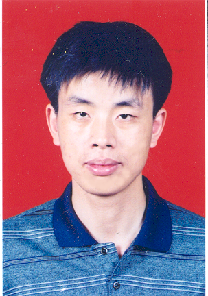 Yuming Zhou (周毓明)合作论文数Department of Computer Science and Technology, Nanjing University6
 Baowen Xu (徐宝文)合作论文数School of Computer Science, Nanjing University;Department of Computer Science and Technology, Nanjing University6
 Lin Chen (陈林)合作论文数Software Institute, Nanjing University6Yuling Yang (杨玉玲)合作论文数5
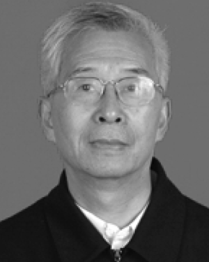 Zhaoda Zhu合作论文数5Lingyun Ren合作论文数4
 Qinghao Yu合作论文数4M. Shen合作论文数4
 Tianyue Shi合作论文数College of Electronic and Information Engineering, Nanjing University of Aeronautics&Astronautics, Nanjing, China4
 He Yan (闫贺)合作论文数College of Electronic and Information Engineering, Nanjing University of Aeronautics and Astronautics4
 Xinhua Mao (毛新华)合作论文数College of Electronic and Information Engineering, Nanjing University of Aeronautics and Astronautics4
 Ling Wang (汪玲)合作论文数College of Electronic and Information Engineering, Nanjing University of Aeronautics and Astronautics4
 Yudong Zhang (张煜东)合作论文数School of Informatics, University of Leicester4
 Yanhui Li (李言辉)合作论文数Software Institute, Nanjing University4Fangning Li合作论文数3
 Peiyao Wang合作论文数3Xiaoyu Wan (万晓玉)合作论文数3
 Jiming Lv合作论文数3Fanwang Meng合作论文数3SUN Weijie (孙伟杰)合作论文数3
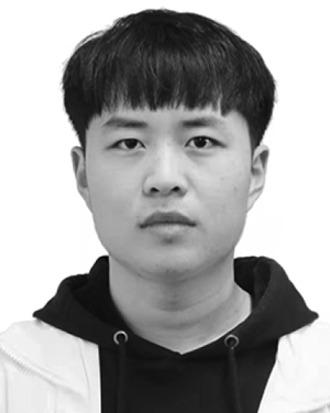 Xifeng Zhang合作论文数3
 Shilin Niu合作论文数3Meixia Fu合作论文数3Jia Yu合作论文数3Qin Wan (万琴)合作论文数3
 Xinchun Shen (沈新春)合作论文数College of Food Science & Engineering, Nanjing University of Finance and Economics3
 Andreas Jakobsson合作论文数Centre for Mathematical Sciences, Lund University;VoiceDiagnostic Sweden AB;Medotemic AB3Ruhui Xia合作论文数2Fei Ge合作论文数2Mingjie Liu合作论文数2Shengwei Zhang合作论文数2
 Yifu Chu合作论文数Dept Agr Food & Nutr Sci, Univ Alberta2ZHOU Wen-jing (周文静)合作论文数2Yaoyao Xu合作论文数2Xiangjun Xu合作论文数2Guan Wang合作论文数2




