The theoretical research and practice of sustainable development based on landsenses ecology are carried out through the overall framework mechanism of meliorization and process regulation. This kind of mechanism is denoted as hyperfeedback mechanism of meliorization towards sustainable development, or hyperfeedback for short. Based on the basic idea of landsenses ecology and meliorization approach, this paper expounds the hyperfeedback and related aspects, puts forward the concept and characteristics of hyperfeedback system, and illustrates a platform framework for the meliorization simulation and management of hyperfeedback system.
Eco-communities integrate construction and management with a comprehensive view of the environment and can be reflected through the aspects of 'harmony,' 'comfort,' 'conservation,' and 'intelligence.' In this study, relevant assessment indices were sorted and summarized to develop an eco-community evaluation system (ECES) based on basic principles of science, management, and operation. ECES assesses communities based on four parameters: outdoor environment, indoor environment, resource consumption, and operation and management. The main goal of ECES is to guide the sustainable development of eco-communities.
Urban cellular automata (CA) models are broadly used in quantitative analyses and predictions of urban land-use dynamics. However, most urban CA developed with neighborhood rules consider only a small neighborhood scope under a specific spatial resolution. Here, we quantify neighborhood effects in a relatively large cellular space and analyze their role in the performance of an urban land use model. The extracted neighborhood rules were integrated into a commonly used logistic regression urban CA model (Logistic-CA), resulting in a large neighborhood urban land use model (Logistic-LNCA). Land-use simulations with both models were evaluated with urban expansion data in Xiamen City, China. Simulations with the Logistic-LNCA model raised the accuracies of built-up land by 3.0%-3.9% in two simulation periods compared with the Logistic-CA model with a 3 x 3 kernel. Parameter sensitivity analysis indicated that there was an optimal large window size in cellular space and a corresponding optimal parameter configuration. (C) 2015 The Authors. Published by Elsevier Ltd. This is an open access article under the CC BY-NC-ND license (http://creativecommons.org/licenses/by-nc-nd/4.0/).
Traditional methods of urban planning mainly focus on urban land, population size and transport priorities, and fail to consider environmental quality and welfare. To build a suitable urban form for future residents, urban eco-planners should consider the various data and technologies available, especially a resident's sensitivity in their planning. Rational and scientific planning needs comprehensive analysis of urban ecosystems, including both natural and human factors. The new concept and theory, 'landsenses', can help urban planners to integrate human sensitivity into their blueprint. Excellent eco-planning should include all forms of human senses, that is sight, hearing, taste, smell and touch. Based on the framework of landsenses ecology, we tentatively made a landsenses ecological planning for the Xianghe Segment of China's Grand Canal (XSCGC), in which we addressed the importance and challenges to incorporate a resident's sensory information into the ecological planning process, to promote the use of mix-marching data and the Internet of Things.
The technology of Environmental Internet of Things (EIoT) has various advantages over conventional field data collection methods for better understanding of how nature reserves are protected and managed. This is mainly because EIoT systems can help collect a vast amount of real-time data, from which rich and dynamic information can be obtained for comprehensive analysis of spatial pattern and processes of key elements of nature resources, facilitating the sustainable management of nature reserves. However, there are practical considerations in the installation and maintenance of EIoT systems because of harsh environment and remote locations of many nature reserves. We did a preliminary EIoT experiment in Shangri-La County, Yunnan Province, China, based on which we proposed a technically simple solution for researchers to custom suitable EIoT instruments in nature reserves. We also put forward a few methods to calculate key parameters of power supply units and system availability. This EIoT system is configured for applications in nature reserves similar to that in Shangri-La County though further tests are necessary.
The global phenomenon of urbanization increases the importance of compact-city development. China’s rapid urban development has resulted in unprecedented urban population growth and built-up area expansion, but its effects on urban morphology and mobility are only partly understood. City compactness can be measured simply using urban spatial form or morphology: the more concentrated the built-up area, the more compact the city is. Here we show that 35 major cities in China are not compact in spatial form and that their compactness is not improving over time. Our results reveal close correlations between changes in urbanization rate and changes in city compactness as well as between city compactness and commuting time (CT), indicating that the high rate of urbanization without adequate planning has contributed to the poor compactness of Chinese cities, which has further increased CT. We suggest that continuing urban sprawl with low land use efficiency and low urban form compactness will make cities in China more congested and threaten China’s sustainable urbanization.
Simulation and quantitative analysis of urban land use change are effective ways to investigate urban form evolution. Cellular Automata CA has been used as a convenient and useful tool for simulating urban land use change. However, the key issue for CA models is the definition of the transition rules, and a number of statistical or artificial intelligence methods may be used to obtain the optimal rules. Neighborhood configuration is a basic component of transition rules, and is characterized by a distance decay effect. However, many CA models do not consider the neighbor decay effect in cellular space. This paper presents a neighbor decay cellular automata model based on particle swarm optimization PSO-NDCA. We used particle swarm optimization PSO to find transition rules and considered the decay effect of the cellular neighborhood. A negative power exponential function was used to compute the decay coefficient of the cellular neighborhood in the model. By calculating the cumulative differences between simulation results and the sample data, the PSO automatically searched for the optimal combination of parameters of the transition rules. Using Xiamen City as a case study, we simulated urban land use changes for the periods 1992–1997 and 2002–2007. Results showed that the PSO-NDCA model had a higher prediction accuracy for built-up land, and a higher overall accuracy and Kappa coefficient than the urban CA model based on particle swarm optimization. The study demonstrates that there exist optimal neighborhood decay coefficients in accordance with the regional characteristics of an area. Urban CA modelling should take into account the role of neighborhood decay.
There have been a growing number of environmental problems associated with the rapid development of cities. Common environmental monitoring methods are unable to meet the dynamic needs of urban environmental management. The emergence of Internet of Things (IoT) technology provides a new way to improve urban environment monitoring and management. The Environmental Internet of Things (EIoT) makes it possible to sense, acquire, process, and transfer environmental information over a large area in real time. In this paper, we present an integrated system for urban environment monitoring and management by referring to the EIoT concept. We developed and tested the system by monitoring water, soil, air, noise, and some other environmental factors on the campus of our research institute. The system can obtain real-time environmental information in situ and express and publish its outcomes in different formats. Moreover, the system is extendible for additional sensors and environmental factors, and to cover larger areas to achieve better urban environmental monitoring and management services for the construction of sustainable cities.
Villages in China have been greatly impacted by the countrywide urbanisation process, and many of them have undergone transformation in landscape structure and rapid changes in environment. However, environmental monitoring in urbanising villages, or town villages, cannot be fully realised by the existing environmental monitoring infrastructure and resources. We intended to apply Environmental Internet of Things (EIoT) technology to fulfill this task, beginning with the development of a Mobile Meteorological Monitor (3M) consisting of an ultrasonic weather station, an industrial tablet PC, a foldable mountain bicycle and a series of accessories. The initial application of 3M in environmental monitoring for a town village indicates that the monitoring capability could be expanded to carry out the monitoring of other environmental variables, such as water quality, air pollution and noise pollution. By simultaneously employing multiple 3M units, it is possible to generate a spatiotemporal framework of monitoring data for landscape-level environmental analysis and modelling. Such an approach is economically affordable and scientifically reliable. The application of EIoT as it matures over time will revolutionise future environmental monitoring and governance.
There is an increasing demand for improving spatial resolution of climate data. However, an increase in resolution does not necessarily mean an increase in realism and accuracy if local spatial features, such as elevational effects, cannot be considered in developing higher-resolution climate data. The Gradient plus Inverse Distance Squared (GIDS) is a broadly accepted elevation-dependent method for spatial interpolation of climate data but is relatively less effective in predicting climate variables in mountainous regions. We developed a new method called Clustering-Assisted Regression (CAR). Instead of using a fixed number of neighboring observed stations within a moving window, we repeated cluster analysis to derive a new subset of stations for each estimated site in CAR. We used both GIDS and CAR to estimate monthly mean temperature and monthly precipitation across mainland China based on observation data from 719 national meteorological stations. Both GIDS and CAR interpolation methods behaved reasonably well in developing 1 km resolution spatial data of monthly mean temperature and monthly precipitation at a national scale in mainland China. The accuracy of monthly mean temperature in summer was higher than in winter whereas that of monthly precipitation in winter was better than in summer. Overall comparisons indicate that CAR was slightly more accurate than GIDS, especially for predicting local climate patterns.
Abstract form only given. Environment quality of a community relates to the residents' health and standard of living significantly, and it also directly has effect on whole urban environment quality as a component of a city. With rapid urbanization in China, the monitoring of environment quality of a community, and further improve environment quality to optimize residents' living standard is becoming an important issue.
Forest fires threaten natural resources and human lives in many areas of the world. A rational assessment of forest fire risk is critical to reduce fire damage that threatens the sustainability of forest resources and their services. This is particularly true in Lijiang City, an important world heritage site. We assessed the grades of forest fire risk in Lijiang City based on the concept of a fire life cycle, using the probability of ignition in the pre-forest fire period, the capacity for detection and emergency rescue in the mid-forest fire period, and forest fire damage in the post-forest fire period. We used the analytical hierarchy process to analyse data on the ecology, economy, cultural resources, humanities and topography of Lijiang City, and geographic information systems (GIS) as a platform to integrate multi-source data. The results strongly agree with the records of reported forest fires between 2000 and 2011. This assessment method could be used in cities with large areas forestland that contains important resources and settlements, but without sufficient fire-fighting capacity to prevent and fight forest fires.
Copper (Cu)-doped polymethylmethacrylate (PMMA) composites were prepared by soapless emulsion polymerization. In this process, copper nanoparticles were modified by sodium oleate (SOA) and the surface property of Cu nanoparticles changed from hydrophilic to hydrophobic. The hydrophobic Cu nanoparticles could not only avoid the oxidation of Cu in air but also improve the compatibility between Cu nanoparticles and PMMA. The TEM micrographs revealed that Cu nanoparticles were encapsulated in PMMA polymer microspheres. In addition, the uniform Cu/PMMA composite microspheres could be synthesized in such a soapless emulsion polymerization process. It was worth mentioning that the friction property in oil was well improved when little nanocomposites were added into the base oil, which indicated that the composites can be widely used in lubricating oil. (C) 2011 Wiley Periodicals, Inc. J Appl Polym Sci 122:2837-2842, 2011
Improving the understanding of temporal and spatial behaviour of tourists is important for enhancing sustainable management of tourism. In recent years, with the emergence of photo-sharing Internet communities, many photographers have posted their photographs on the Internet and made them freely accessible. Generally attached to these shared photos is information about where and when the photos were taken, providing clues to establish the temporal and spatial distribution of the photographers. In this paper, we described a photography-based approach to analyse Chinese tourists' temporal–spatial behaviour identified from 1308 photos taken in the Old Town of Lijiang. We estimated tourists' temporal variation, length of stay, daily average number of tourists, individual movement traces and tourist hotspots. The results suggest that the photo-based methods have obvious advantages. We believe that this wealth of publicly available data sources with spatio-temporal information will provide a new perspective in analysing tourist flow distribution and tourist hotspots and will be helpful to plan tourism resources.
With the development of Lijiang City, many empty spaces have been exploited and the built-up land is becoming increasingly crowded. This has caused degradation of the urban environment. In this paper, we analyse the fractal dimension of built-up land in Lijiang City in an attempt to improve environmental quality. TM image data acquired in 2000 and 2006 were used to derive land-use data through a back-propagation neural network realized using Matlab software. Urban form was quantified with the box-counting method. The fractal dimension of built-up land increased from 1.73 in 2000 to 1.84 in 2006, meaning that the respective amounts of built-up land and green space have become disproportionate over time. To obtain a better balance between green areas and built-up land, the area–radius relationship method and the Smeed model were used to find the optimum range, within which increasing green areas will bring greater ecological benefits. This range was within a 2000-m radius of the entrance to the Old Town of Lijiang. Increasing green areas in this range is recommended to increase ecological benefits to the whole city, and the emphasis of planning studies in Lijiang City in future should be on the rational layout of built-up land within this range.
In the current information age, digital technology has become an essential part of urban civilisation. The digital city has been transformed from a novel concept to a practical and effective means of supporting urban planning and management. However, there are various definitions of a digital city and each has a unique significance. By comparing these digital city concepts, we examined common aspects of digital city definitions and propose an urban digital operating system (Urban DOS) that will be useful to improve life quality, socioeconomic functions and sustainable development in a city and its surrounding areas. The technical basis for the Urban DOS is the intersection between technology-oriented products (TOPs) and customised application products (CAPs). We then develop a procedure for designing a framework for a digital city based on Urban DOS with TOPs and CAPs. To explain such digital city concepts and applications, we demonstrate the initial development of Urban DOS for Lijiang City.
An aqueous synthesis approach has been developed for shape control of Bi nanostructures. Here, we demonstrate a work on the selective preparation of bismuth nanospheres and nanorods reduced by hydrazine hydrate in the presence of organic molecules as controlling agent. Bismuth nanotubes were also obtained by manipulating the reaction parameters in the system. On controlling the size and dispersibility of the project powders, Bi nanospheres with average diameter of 100nm, Bi nanorods with length of 50nm or 200nm, and Bi nanotubes with length of 100–200nm have been successfully synthesized. We also discussed the possible growth mechanisms of bismuth nanostructures by studying the influences of experimental parameters. The optical absorption spectra of the shape-controlled bismuth nanostructures show strong absorptions in the range of 200–400nm. These Bi nanostructures are expected to find potential applications in a variety of areas due to their optical characteristics.
We report here a simple approach to the synthesis of Cu2O/TiO2 core-shell nanocomposites with uniform octahedral structure in solution phase. First, fresh synthesized Cu2O octahedra were used as precursor, and butyl titanate (Ti(OBu)4) diluted by ethanol was preliminary hydrolyzed by the water adsorbed on the surface of Cu2O, so a very thin TiO2 condensed on the Cu2O surfaces. Then, when a mixture of water and ethanol was dropped into the reaction system, the Ti(OBu)4 would further hydrolyze and condense around the Cu2O to form TiO2, so octahedral Cu2O/TiO2 core-shell composites with uniform and compact TiO2 shells were obtained. This method is suitable for the formation of uniform integrated TiO2 shells and their thickness can be controlled by adjusting the ratio of water/ethanol (W/E). According to the surface photovoltage spectroscopy of the Cu2O/TiO2 composites, we think the material would have a potential application in photocatalysis and photoelectric transition.
Cobalt microspheres constructed by the assembly of nanoplatelets have been synthesized by a wet chemical reductive procedure at room temperature with the help of glycerin and citric acid and without additional surfactants. The size of the microspheres is about 2–5μm and that of the nanoplatelets assembled the microspheres is tens of nanometers in thickness. In this synthetic system, cobalt acetate was employed as Co source, sodium hydroxide was used to manipulate the pH value of the reaction system, and hydrazine hydrate was used as a reducing agent. A series of experiments were performed with different amounts of glycerin, from 0.5mL to 4mL, the results reveal that the formation of cobalt microspheres is assisted by glycerin. The shape, structure, and magnetic properties of the final products were investigated by XRD, SEM and VSM. This kind of Co nanostructures shows a ferromagnetic behavior at room temperature with enhanced coercivity, and has potential uses in magnetic recording devices and other related nanodevices. A possible mechanism for the formation of microspheres is proposed.
We report here a simple approach to the synthesis of Cu(2)O/SiO(2) core-shell nanocomposites in water solution. The Cu(2)O cores have a perfect octahedral structure with uniform size of about 200-300 nm. A compact SiO(2) shell 9 nm in thickness is located at the surfaces of Cu(2)O octahedra, and it is composed of fine SiO(2) nanoparticles. During the depositing of the SiO(2) particles, as we presumed, dynamic absorbing and disengaging of Na(+) at the interface of Cu(2)O octahedra and the solution made it possible for the formation of Cu-O-Si bonds between core and shell in the composites. The existence of Cu-O-Si bonds in our core-shell composite can be substantiated by peak changes at 1236 and 1080 cm(-1) in the FT-IR spectra. This is the reason why the SiO(2) shell is so compact and uniform. Moreover, these Cu(2)O/SiO(2) core-shell octahedra were further used as precursors, depending on a simple disproportionation reaction of Cu(2)O in acid, to easily achieve Cu/SiO(2) movable multicore-shell octahedral nanocomposites. In the final Cu/SiO(2) core-shell composite, the thin SiO(2) octahedral shell was held, inside of which formed several free Cu nanoparticles 50-80 nm in size. Studies on the Cu(2)O/SiO(2) core-shell octahedral composites and Cu/SiO(2) movable multicore-shell octahedral nanocomposites would be a good thing not only for fundamental research but also for applications.
 Guofan Shao (邵国凡)合作论文数Department of Forestry and Natural Resources, College of Agriculture, Purdue University8
 Lina Tang (唐立娜)合作论文数中国科学院城市环境研究所8
 Jingzhe Zhao (赵敬哲)合作论文数College of Chemistry and Chemical Engineering, Hunan University7
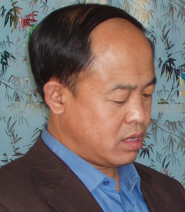 Zichen Wang (王子忱)合作论文数School of Chemistry, Jilin University6
 Shuanning Zheng (郑拴宁)合作论文数5
 Yanchao Zhu (朱燕超)合作论文数College of Chemistry, Jilin University5
 Jingzhu Zhao (赵景柱)合作论文数Institute of Urban Environment, Chinese Academy of Sciences4
 Rencai Dong (董仁才)合作论文数Research Center for Eco-Environmental Sciences, Chinese Academy of Sciences;University of Chinese Academy of Sciences4YunLing Li (李芸玲)合作论文数3
 Longyu Shi (石龙宇)合作论文数中国科学院城市环境研究所3Quanyi Qiu (邱全毅)合作论文数3Dingkai Chen合作论文数2Qiyuan Feng合作论文数2XiaoKun Ma (马晓坤)合作论文数2Shanshan Ma (马姗姗)合作论文数College of Instrumentation & Electrical Engineering, Jilin University2
 Haowei Wang (王豪伟)合作论文数Institute of Urban Environment, Chinese Academy of Sciences;University of Chinese Academy of Sciences2Cuiping Wang (王翠平)合作论文数集美大学港口与环境工程学院2
 Xu Zhao (赵旭)合作论文数College of Chemistry, Jilin University2
 Jiangfu Liao合作论文数2Ye Gao合作论文数2Zheng Xiancao合作论文数1SUN Xiao-ze合作论文数1Xinli Hao (郝新丽)合作论文数1
 Wu Di合作论文数1Huang Zhen合作论文数1
 Liu Xin (刘鑫 Liu Xin)合作论文数1Zhao Yang合作论文数1Shengnan Hou合作论文数1
 Yonglin Zhang合作论文数1Huina Wang合作论文数1
 Tong Xu合作论文数Chinese Acad Sci, Inst Urban Environm, Key Lab Urban Environm & Hlth, Xiamen 361021, Peoples R China1
 Xin Liu (刘欣)合作论文数中国科学院大学中国科学院烟台海岸带可持续发展研究所1Jonathan Vause合作论文数1
 Yi Wang (王一)合作论文数College of Instrumentation & Electrical Engineering, Jilin University1
 Yu Song合作论文数1
 Bing Zhou (周兵)合作论文数College of Chemistry, Jilin University1Li Qing合作论文数1
 Hao Zhang (张浩)合作论文数Department of Statistics, Purdue University1
 Yan Zhao (赵艳)合作论文数College of Chemistry and Chemical Engineering, Hunan University1
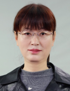 Yumei Tian (田玉美)合作论文数College of Chemistry, Jilin University1Linzhi Li合作论文数1
 Yupeng Guo (郭玉鹏)合作论文数College of Chemistry, Jilin University1
 Lishan Xiao合作论文数1Hari Bala合作论文数1
 Xuefei Tian (田雪飞)合作论文数The First Hospital of Hunan University of Chinese Medicine1Fang Sun合作论文数1
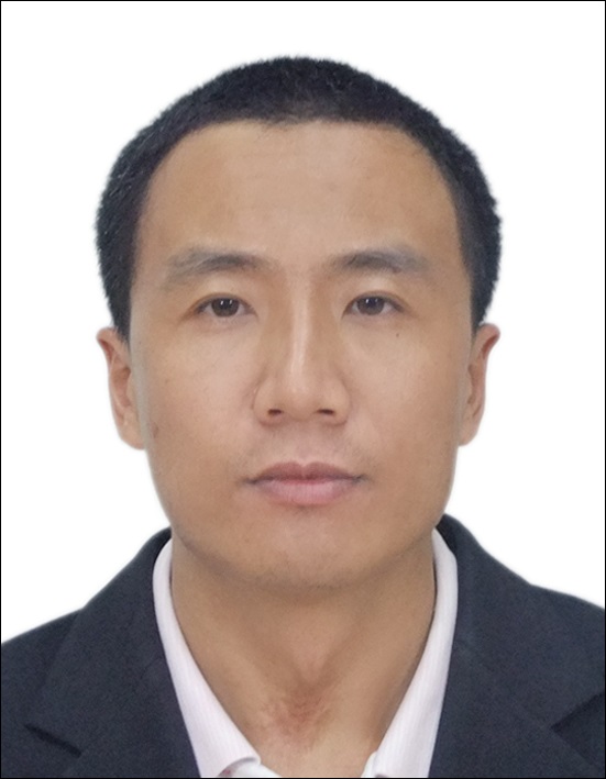 Gang Wu (吴刚)合作论文数School of Mathematical Sciences, University of Chinese Academy of Sciences1
 Chunming Li (李纯明)合作论文数School of Information and Communication Engineering, University of Electronic Science and Technology of China1




