In autonomous driving, relying solely on frame-based cameras can lead to inaccuracies caused by factors like long exposure times, high-speed motion, and challenging lighting conditions. To address these issues, we introduce a bio-inspired vision sensor known as the event camera. Unlike conventional cameras, event cameras capture sparse, asynchronous events that provide a complementary modality to mitigate these challenges. In this work, we propose an energy-aware imitation learning framework for steering prediction that leverages both events and frames. Specifically, we design an Energy-driven Cross-modality Fusion Module (ECFM) and an energy-aware decoder to produce reliable and safe predictions. Extensive experiments on two public real-world datasets, DDD20 and DRFuser, demonstrate that our method outperforms existing state-of-the-art (SOTA) approaches. The codes and trained models will be released upon acceptance.
Natural language provides an intuitive way to express spatial intent in geospatial applications. While existing localization methods often rely on dense point cloud maps or high-resolution imagery, OpenStreetMap (OSM) offers a compact and freely available map representation that encodes rich semantic and structural information, making it well suited for large-scale localization. However, text-to-OSM (T2O) localization remains largely unexplored. In this paper, we formulate the T2O global localization task, which aims to estimate accurate 2 degree-of-freedom (DoF) positions in urban environments from textual scene descriptions without relying on geometric observations or GNSS-based initial location. To support the proposed task, we introduce TOL, a large-scale benchmark spanning multiple continents and diverse urban environments. TOL contains approximately 121K textual queries paired with OSM map tiles and covers about 316 km of road trajectories across Boston, Karlsruhe, and Singapore. We further propose TOLoc, a coarse-to-fine localization framework that explicitly models the semantics of surrounding objects and their directional information. In the coarse stage, direction-aware features are extracted from both textual descriptions and OSM tiles to construct global descriptors, which are used to retrieve candidate locations for the query. In the fine stage, the query text and top-1 retrieved tile are jointly processed, where a dedicated alignment module fuses textual descriptor and local map features to regress the 2-DoF pose. Experimental results demonstrate that TOLoc achieves strong localization performance, outperforming the best existing method by 6.53
Understanding dynamic 3D scenes is crucial for extended reality (XR) and autonomous driving. Incorporating semantic information into 3D reconstruction enables holistic scene representations, unlocking immersive and interactive applications. To this end, we introduce TRASE, a novel tracking-free 4D segmentation method for dynamic scene understanding. TRASE learns a 4D segmentation feature field in a weakly-supervised manner, leveraging a soft-mined contrastive learning objective guided by SAM masks. The resulting feature space is semantically coherent and well-separated, and final object-level segmentation is obtained via unsupervised clustering. This enables fast editing, such as object removal, composition, and style transfer, by directly manipulating the scene's Gaussians. We evaluate TRASE on five dynamic benchmarks, demonstrating state-of-the-art segmentation performance from unseen viewpoints and its effectiveness across various interactive editing tasks. Our project page is available at: https://yunjinli.github.io/project-sadg/
LiDAR-based collaborative 3D perception in Vehicle-to-Everything (V2X) systems typically relies on fusing bird's-eye-view (BEV) features across agents. However, current BEV representations, typically extracted by LiDAR backbones trained from scratch, are geometry-dominated and lack general semantic priors, inherently limiting the efficacy of feature-level collaboration. Meanwhile, vision foundation models (VFMs) pretrained on large-scale image data have demonstrated strong capability in learning general-purpose and informative visual representations for 2D tasks, and have the potential to enhance agent-wise LiDAR BEV representations for collaboration. Despite this potential, adapting VFMs to LiDAR-based 3D detection remains challenging due to the substantial image-point cloud modality gap. To bridge this gap, we propose ViCo3D, a collaborative 3D object detection framework powered by VFMs. Specifically, ViCo3D adapts VFMs to LiDAR-based collaborative perception from three aspects: First, ViCo3D projects point clouds onto the BEV plane as three-channel images, enabling DINOv2 to extract BEV-space visual features from LiDAR inputs. Besides, to effectively integrate these DINOv2-derived features with LiDAR geometric features, ViCo3D introduces a multi-scale BEV fusion module within the single-agent encoder. In addition, ViCo3D adopts an ego-centric cross-agent fusion strategy to aggregate complementary information from multiple agents. Experiments on DAIR-V2X and V2XSet demonstrate that ViCo3D achieves state-of-the-art 3D detection performance. Remarkably, it delivers up to 1.8x greater collaborative gains than prior methods on DAIR-V2X. The code will be made public available for future investigation.
LiDAR-based place recognition is highly sensitive to rain, snow, and fog, where scattering and attenuation distort geometric structure and intensity. We tackle this problem with Conditional Latent Velocity Field (C-LaV) denoising, which restores weather-robust representations before retrieval. Single-sweep point clouds are projected into three-channel bird’s-eye-view (BEV) images and encoded with a frozen DINOv2-based BEV transformer to obtain a semantically anchored latent space shared across weather conditions. On this manifold, a conditional Flow Matching model learns a velocity field whose probability-flow ordinary differential equation (ODE) deterministically transports noisy latents toward their clear-weather counterparts. From the denoised manifold, a Sinkhorn Aggregation of Local Descriptors (SALAD) head produces compact global descriptors optimized with a truncated Smooth-AP loss. We also establish a unified adverse-weather benchmark with 3 m frame spacing and shared evaluation thresholds across KITTI, NCLT, and Boreas datasets. Under this protocol, C-LaV improves Recall@1 by \textbf{17.5\%} on NCLT snow and \textbf{21.5\%} on Boreas, achieving state-of-the-art weather robustness. Our dataset and code will be publicly available.
Airplanes are the most popular investigation objects as a dynamic and critical component in remote sensing images. Accurately identifying and monitoring airplane behaviors is crucial for effective air traffic management. However, existing methods for interpreting fine-grained airplanes in remote sensing data depend heavily on large annotated datasets, which are both time-consuming and prone to errors due to the detailed nature of labeling individual points. In this paper, we introduce Text2AIRS, a novel method that generates fine-grained and realistic Airplane Images in Remote Sensing from textual descriptions. Text2AIRS significantly simplifies the process of generating diverse aircraft types, requiring limited texts and allowing for extensive variability in the generated images. Specifically, Text2AIRS is the first to incorporate ground sample distance into the text-to-image stable diffusion model, both at the data and feature levels. Extensive experiments demonstrate our Text2AIRS surpasses the state-of-the-art by a large margin on the Fair1M benchmark dataset. Furthermore, utilizing the fine-grained airplane images generated by Text2AIRS, the existing SOTA object detector achieves 6.12% performance improvement, showing the practical impact of our approach.
Multimodal Large Language Models (MLLMs) achieve impressive performance once optimized on massive datasets. Such datasets often contain sensitive or copyrighted content, raising significant data privacy concerns. Regulatory frameworks mandating the 'right to be forgotten' drive the need for machine unlearning. This technique allows for the removal of target data without resource-consuming retraining. However, while well-studied for text, visual concept unlearning in MLLMs remains underexplored. A primary challenge is precisely removing a target visual concept without disrupting model performance on related entities. To address this, we introduce AUVIC, a novel visual concept unlearning framework for MLLMs. AUVIC applies adversarial perturbations to enable precise forgetting. This approach effectively isolates the target concept while avoiding unintended effects on similar entities. To evaluate our method, we construct VCUBench. It is the first benchmark designed to assess visual concept unlearning in group contexts. Experimental results demonstrate that AUVIC achieves state-of-the-art target forgetting rates while incurs minimal performance degradation on non-target concepts.
Aerial 6DoF localization typically relies on precise GNSS signals or radiometrically rich 3D reconstructions, limiting scalability and on-board deployment. We propose SemCityLoc, a semantic-geometric alignment system that reframes aerial pose estimation as structured surface registration between foundation-model-derived visual priors and standardized LoD-compliant 3D city models. Instead of matching sparse contours or dense texture, our method aligns semantic surfaces and monocular depth with lightweight semantic 3D building models, increasing pose discriminability in repetitive and occluded urban environments. To enable accurate evaluation, we introduce SemCityLockeD, the first real-world benchmark combining centimeter-accurate UAV poses with standardized LoD1–LoD3 semantic city models and challenging low-altitude imagery. Experiments demonstrate substantial improvements over existing map-based approaches, improving recall by up to 36
Achieving 360° coverage is critical for the visual perception systems of autonomous vehicles. Fisheye cameras offer a cost-effective solution by enabling full surround coverage with as few as two sensors. However, existing multi-view fisheye datasets are limited, and synthesizing rare corner cases typically requires computationally expensive 3D simulations, hindering the training. While generative models have achieved significant success in standard perspective imagery, their application to wide-angle distortion remains unexplored. In this work, we formally introduce the novel problem of multi-view fisheye image generation conditioned on volumetric semantic representations and present two distinct methods. We first propose SyntheOcc-FE, which adapts the SyntheOcc architecture to fisheye data. While effective, this method is constrained by the scarcity of fisheye datasets, which limits its generalization. To overcome these limitations, we propose our second method, MIVIFI (multi-view fisheye), which leverages cross-domain learning with Equirectangular Projections. By bridging the gap between dataset domains using KITTI-360 fisheye images alongside nuScenes multi-view standard images, our approach enables high-fidelity manipulation of scene content. This framework enables the structural modification of semantic occupancy inputs to introduce or eliminate specific actors and facilitates the rendering of diverse meteorological conditions and illumination scenarios absent in the limited fisheye datasets. Quantitative and qualitative experiments demonstrate that our methods achieve robust photorealistic multi-view fisheye image generation and highlight the specific advantages of our cross-domain strategy for handling data scarcity.
We tackle the problem of localizing 3D point cloud submaps using complex and diverse natural language descriptions, and present Text2Loc++, a novel neural network designed for effective cross-modal alignment between language and point clouds in a coarse-to-fine localization pipeline. To support benchmarking, we introduce a new city-scale dataset covering both color and non-color point clouds from diverse urban scenes, and organize location descriptions into three levels of linguistic complexity. In the global place recognition stage, Text2Loc++ combines a pretrained language model with a Hierarchical Transformer with Max Pooling (HTM) for sentence-level semantics, and employs an attention-based point cloud encoder for spatial understanding. We further propose Masked Instance Training (MIT) to filter out non-aligned objects and improve multimodal robustness. To enhance the embedding space, we introduce Modality-aware Contrastive Learning (MCL), incorporating cross-modal, submap-, text-, and instance-level losses. In the fine localization stage, we completely remove explicit text-instance matching and design a lightweight yet powerful framework based on Prototype-based Map Cloning (PMC) and a Cascaded Cross-Attention Transformer (CCAT). Extensive experiments on the KITTI360Pose dataset show that Text2Loc++ outperforms existing methods by up to 15%. In addition, the proposed model exhibits robust generalization when evaluated on the new dataset, effectively handling complex linguistic expressions and a wide variety of urban environments.
LiDAR-based 3D object detection is crucial for autonomous driving. However, due to the quality deterioration of LiDAR point clouds, it suffers from performance degradation in adverse weather conditions. Fusing LiDAR with the weatherrobust 4D radar sensor is expected to solve this problem; however, it faces challenges of significant differences in terms of data quality and the degree of degradation in adverse weather. To address these issues, we introduce L4DR, a weather-robust 3D object detection method that effectively achieves LiDAR and 4D Radar fusion. Our L4DR proposes Multi-Modal Encoding (MME) and Foreground-Aware Denoising (FAD) modules to reconcile sensor gaps, which is the first exploration of the complementarity of early fusion between LiDAR and 4D radar. Additionally, we design an Inter-Modal and IntraModal ({IM}2) parallel feature extraction backbone coupled with a Multi-Scale Gated Fusion (MSGF) module to counteract the varying degrees of sensor degradation under adverse weather conditions. Experimental evaluation on a VoD dataset with simulated fog proves that L4DR is more adaptable to changing weather conditions. It delivers a significant performance increase under different fog levels, improving the 3D mAP by up to 20.0% over the traditional LiDAR-only approach. Moreover, the results on the K-Radar dataset validate the consistent performance improvement of L4DR in realworld adverse weather conditions.
We tackle the problem of monocular 3D object detection across different sensors, environments, and camera setups. In this paper, we introduce a novel unsupervised domain adaptation approach, MonoCT, that generates highly accurate pseudo labels for self-supervision. Inspired by our observation that accurate depth estimation is critical to mitigating domain shifts, MonoCT introduces a novel Generalized Depth Enhancement (GDE) module with an ensemble concept to improve depth estimation accuracy. Moreover, we introduce a novel Pseudo Label Scoring (PLS) module by exploring inner-model consistency measurement and a Diversity Maximization (DM) strategy to further generate high-quality pseudo labels for self-training. Extensive experiments on six benchmarks show that MonoCT outperforms existing SOTA domain adaptation methods by large margins (~21% minimum for AP Mod.) and generalizes well to car, traffic camera and drone views.
Facade semantic segmentation is a long-standing challenge in photogrammetry and computer vision. Although the last decades have witnessed the influx of facade segmentation methods, there is a lack of comprehensive facade classes and data covering the architectural variability. In ZAHA, we introduce Level of Facade Generalization (LoFG), novel hierarchical facade classes designed based on international urban modeling standards, ensuring compatibility with real-world challenging classes and uniform methods' comparison. Realizing the LoFG, we present to date the largest semantic 3D facade segmentation dataset, providing 601 million annotated points at five and 15 classes of LoFG2 and LoFG3, respectively. Moreover, we analyze the performance of baseline semantic segmentation methods on our introduced LoFG classes and data, complementing it with a discussion on the unresolved challenges for facade segmentation. We firmly believe that ZAHA shall facilitate further development of 3D facade semantic segmentation methods, enabling robust segmentation indispensable in creating urban digital twins.
Semantic 3D city models are worldwide easy-accessible, providing accurate, object-oriented, and semantic-rich 3D priors. To date, their potential to mitigate the noise impact on radar object detection remains under-explored. In this paper, we first introduce a unique dataset, RadarCity, comprising 54K synchronized radar-image pairs and semantic 3D city models. Moreover, we propose a novel neural network, RADLER, leveraging the effectiveness of contrastive self-supervised learning (SSL) and semantic 3D city models to enhance radar object detection of pedestrians, cyclists, and cars. Specifically, we first obtain the robust radar features via a SSL network in the radar-image pretext task. We then use a simple yet effective feature fusion strategy to incorporate semantic-depth features from semantic 3D city models. Having prior 3D information as guidance, RADLER obtains more fine-grained details to enhance radar object detection. We extensively evaluate RADLER on the collected RadarCity dataset and demonstrate average improvements of 5.46 in mean avarage precision (mAP) and 3.51 previous radar object detection methods. We believe this work will foster further research on semantic-guided and map-supported radar object detection. Our project page is publicly available athttps://gpp-communication.github.io/RADLER .
Recent works on the global place recognition treat the task as a retrieval problem, where an off-the-shelf global descriptor is commonly designed in image-based and LiDAR-based modalities. However, it is non-trivial to perform accurate image-LiDAR global place recognition since extracting consistent and robust global descriptors from different domains (2D images and 3D point clouds) is challenging. To address this issue, we propose a novel Voxel-Cross-Pixel (VXP) approach, which establishes voxel and pixel correspondences in a self-supervised manner and brings them into a shared feature space. Specifically, VXP is trained in a two-stage manner that first explicitly exploits local feature correspondences and enforces similarity of global descriptors. Extensive experiments on the three benchmarks (Oxford RobotCar, ViViD++ and KITTI) demonstrate our method surpasses the state-of-the-art cross-modal retrieval by a large margin.
Dynamic scene rendering opens new avenues in autonomous driving by enabling closed-loop simulations with photorealistic data, which is crucial for validating end-to-end algorithms. However, the complex and highly dynamic nature of traffic environments presents significant challenges in accurately rendering these scenes. In this paper, we introduce a novel 4D Gaussian Splatting (4DGS) approach, which incorporates context and temporal deformation awareness to improve dynamic scene rendering. Specifically, we employ a 2D semantic segmentation foundation model to self-supervise the 4D semantic features of Gaussians, ensuring meaningful contextual embedding. Simultaneously, we track the temporal deformation of each Gaussian across adjacent frames. By aggregating and encoding both semantic and temporal deformation features, each Gaussian is equipped with cues for potential deformation compensation within 3D space, facilitating a more precise representation of dynamic scenes. Experimental results show that our method improves 4DGS's ability to capture fine details in dynamic scene rendering for autonomous driving and outperforms other self-supervised methods in 4D reconstruction and novel view synthesis. Furthermore, CoDa-4DGS deforms semantic features with each Gaussian, enabling broader applications.
We tackle the challenge of LiDAR-based place recognition, which traditionally depends on costly and time-consuming prior 3D maps. To overcome this, we first construct LiRSI-XA dataset, which encompasses approximately $110,000$ remote sensing submaps and $13,000$ LiDAR point cloud submaps captured in urban scenes, and propose a novel method, L2RSI, for cross-view LiDAR place recognition using high-resolution Remote Sensing Imagery. This approach enables large-scale localization capabilities at a reduced cost by leveraging readily available overhead images as map proxies. L2RSI addresses the dual challenges of cross-view and cross-modal place recognition by learning feature alignment between point cloud submaps and remote sensing submaps in the semantic domain. Additionally, we introduce a novel probability propagation method based on particle estimation to refine position predictions, effectively leveraging temporal and spatial information. This approach enables large-scale retrieval and cross-scene generalization without fine-tuning. Extensive experiments on LiRSI-XA demonstrate that, within a $100km^2$ retrieval range, L2RSI accurately localizes $83.27\%$ of point cloud submaps within a $30m$ radius for top-$1$ retrieved location. Our project page is publicly available at https://shizw695.github.io/L2RSI/.
Interactive articulated manipulation requires long-horizon, multi-step interactions with appliances while maintaining physical consistency. Existing vision-language and diffusion-based policies struggle to generalize across parts, instances, and categories. We first introduce ArtiBench, a five-level benchmark covering kitchen, storage, office, and tool environments. ArtiBench enables structured evaluation from cross-part and cross-instance variation to long-horizon multi-object tasks, revealing the core generalization challenges of articulated object manipulation. Building on this benchmark, we propose ArtiBrain, a modular framework that unifies high-level reasoning with adaptive low-level control. ArtiBrain uses a VLM-based Task Reasoner (GPT-4.1) to decompose and validate subgoals, and employs a Hybrid Controller that combines geometry-aware keyframe execution with affordance-guided diffusion for precise and interpretable manipulation. An Affordance Memory Bank continually accumulates successful execution episodes and propagates part-level actionable affordances to unseen articulated parts and configurations. Extensive experiments on ArtiBench show that our ArtiBrain significantly outperforms state-of-the-art multimodal and diffusion-based methods in robustness and generalization. Code and dataset will be released upon acceptance.
Localizing events in videos based on semantic queries is a pivotal task in video understanding research and user-oriented applications like video search. Yet, current research predominantly relies on natural language queries (NLQs), overlooking the potential of using multimodal queries (MQs) that incorporate images to flexibly represent semantic queries, particularly when it is difficult to express non-verbal or unfamiliar concepts in words. To bridge this gap, we introduce ICQ, a new benchmark designed for localizing events in videos with MQs, alongside an evaluation dataset ICQ-Highlight. To adapt and reevaluate existing video localization models for this new task, we propose 3 Multimodal Query Adaptation methods and a novel Surrogate Fine-Tuning strategy, serving as strong baseline methods. ICQ systematically benchmarks 12 state-of-the-art backbone models, spanning from specialized video localization models to Video Large Language Models. Our extensive experiments highlight the high potential of using MQs in real-world applications. We believe this is a first step toward video event localization with MQs 1.
Multimodal Large Language Models (MLLMs), built on powerful language backbones, have enabled Multimodal In-Context Learning (MICL)-adapting to new tasks from a few multimodal demonstrations consisting of images, questions, and answers. Despite showing noticeable improvement on standard vision-language datasets, current MLLMs struggle to leverage visual information in the demonstrations. Specifically, they tend to neglect visual cues and over-rely on textual patterns, leading to mere text imitation rather than genuine multimodal adaptation. This behavior makes MICL still unimodal and largely restricts its practical utility. More importantly, this limitation is often concealed by the improved performance on tasks that do not require understanding the visual context. As a result, how to effectively enhance MICL ability and reliably evaluate the MICL performance remains underexplored. To address these issues, we first introduce Dynamic Attention Reallocation (DARA), an efficient fine-tuning strategy that encourages models to attend to the visual context by rebalancing attention across visual and textual tokens. In addition, we present TrueMICL, an MICL-dedicated dataset with both support and test sets that explicitly requires the integration of multimodal information-particularly visual content-for correct task completion. Extensive experiments demonstrate the effectiveness of our holistic solution, showcasing substantial improvements in the true multimodal in-context learning capabilities. Code and datasets are available at https://chenxshuo.github.io/true-micl-colm .
 Daniel Cremers合作论文数Departments of Informatics and Mathematics, School of Computation, Information and Technology, Technical University of Munich23
 Cheng Wang (王程)合作论文数Department of Computer Science and Technology, Xiamen University;Institute of Artificial Intelligence, Xiamen University11
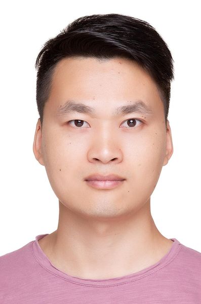 Hu Cao (曹虎)合作论文数School of Automation, Southeast University6
 Olaf. Wysocki合作论文数Technical University of Munich6
 João F. Henriques合作论文数Visual Geometry Group, University of Oxford5
 Chenglu Wen (温程璐)合作论文数Spatial Sensing & Computing Lab, School of Informatics, Xiamen University5
 Yu Zang (臧彧)合作论文数School of Informatics, Xiamen University5
 Volker Tresp合作论文数Institut für Informatik, Fakultät für Mathematik, Informatik und Statistik, Ludwig Maximilian University of Munich5
 Yusheng Xu (徐聿升)合作论文数College of Surveying and Geo-Informatics, Tongji University4
 Weiquan Liu (刘伟权)合作论文数Fujian Key Laboratory of Sensing and Computing for Smart Cities, School of Informatics, Xiamen University4
 Jun Li (李军)合作论文数School of Geospatial Artificial Intelligence, East China Normal University;Department of Geography, Geomatics and Environment, University of Toronto4
 Zifeng Ding合作论文数University of Cambridge;European Laboratory for Learning and Intelligent Systems;Eigent AI3
 Alois Knoll合作论文数3
 Mariia Gladkova合作论文数Technical University of Munich3
 Rui Wang (王锐)合作论文数Microsoft Mixed Reality & AI Lab3
 Jindong Gu合作论文数University of Oxford;Google DeepMind3
 Ming Cheng (程明)合作论文数Department of Computer Science and Technology, School of Informatics, Xiamen University3Letian Shi合作论文数2
 Ludwig Hoegner合作论文数2
 Xinyi Li合作论文数2Jonathan Li合作论文数2
 Qiangqiang Wu (吴強強)合作论文数Department of Computer Science, College of Computing, City University of Hong Kong2Jingpei Wu合作论文数2Magdalena Wysock合作论文数2
 Benedikt Schwab合作论文数Technical University of Munich2
 Xuesheng Bian合作论文数Xiamen Univ, Sch Informat, Fujian Key Lab Sensing & Comp Smart City, Xiamen 361005, Peoples R China2
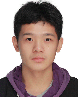 Baiqi Lai合作论文数Xiamen University,Fujian Key Laboratory of Sensing and Computing for Smart City, School of Informatics,Xiamen,China2
 Walter Zimmer合作论文数School of Computation, Information and Technology, Technische Universität München2
 Yudi Dai合作论文数Department of Computer Science, ETH Zurich;ETH AI Center, ETH Zurich2
 Guang Chen (陈广)合作论文数Robotics & Embodied AI Lab, School of Computer Science and Technology, Tongji University2
 Philip H. S. Torr合作论文数Department of Engineering Science, University of Oxford;St Catherine's College, University of Oxford;Orphic2
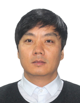 Bisheng Yang (杨必胜)合作论文数State Key Laboratory of Information Engineering in Surveying, Mapping and Remote Sensing, Wuhan University2
 Uwe Stilla合作论文数Aerospace and Geodesy Department, School of Engineering and Design, Technical University of Munich2
 Rui Song (宋锐)合作论文数State Key Laboratory of Integrated Services Networks, School of Telecommunications Engineering, Xidian University2
 Monika Sester合作论文数Institut für Kartographie Und Geoinformatik, Fakultät für Bauingenieurwesen Und Geodäsie, Leibniz Universität Hannover2
 Antoni B. Chan合作论文数Department of Computer Science, College of Engineering, City University of Hong Kong;Multimedia-software Engineering Research Centre, City University of Hong Kong2
 Yanyong Zhang (张燕咏)合作论文数Institute of Advanced Technology, University of Science and Technology of China;School of Computer Science and Technology, University of Science and Technology of China2
 Thomas H. Kolbe合作论文数School of Engineering and Design, Technische Universität München2Xuewei Cao合作论文数School of Artificial Intelligence and Data Science, University of Science and Technology of China;Suzhou Institute for Advanced Research, University of Science and Technology of China1Chenwei Liang合作论文数1Yunxiang Lu合作论文数1Wenjing Xu合作论文数1Xiaoran Zhang合作论文数1Dongyi Sun合作论文数1Jinlong Wang合作论文数1Ziyu Xu合作论文数1Jialu Ma合作论文数1




